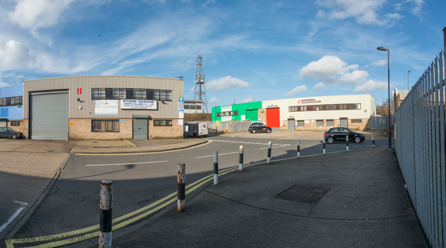
More from the Golden Mile continues from where my previous post on my walk on Sunday 7th January 1990, Curry’s, Firestone, A Fountain & Kluwer – 1990, ended. This is my final post on this walk.
Adini, 891, Great West Rd, Isleworth, Hounslow, 1990, 90-1g-12
Just to the west of Syon Lane on the Great West Road in Isleworth is this 1933 Art Deco factory by Wallis, Gilbert and Partners built for William Burnett Chemicals. This was the furthest west of the 1930s commercial buildings on the new road and past it are residential properties in the north of Isleworth and Osterley.
Adini, 891, Great West Rd, Isleworth, Hounslow, 1990, 90-1g-12
The building is I think still in use by fashion clothing firm Adini. In 2023 Hounslow Council turned down a planning application to develop the site retaining and restoring this locally listed Art Deco building but with two six storey blocks containing 51 flats on the site. The developers appealed and I am not sure of the current state of the proposal.
Softsel, 941, Great West Road, Brentford, Hounslow, 1990, 90-1h-65
I hadn’t finished with the ‘Golden Mile’ and turned around and walked east back into Brentford along the Great West Road. 941, the occupied by Softsel was another building by Wallis, Gilbert & Partners for cosmetics company Coty.
This building is now the private Syon Clinic.
Steps, 971, Great West Road, Brentford, Hounslow, 1990, 90-1h-66
Another grand set of steps led up to the factory of Leonard Williams Ltd, who made Packard cars here from 1929. Queensway in 1990 it now leads to DFS Brentford Sofa & Furniture Store, but only these steps remain of the previous building.
Pyrene Building, Westlink House, 981, Great West Road, Brentford, Hounslow, 1990, 90-1h-51
Built 1929-1930 by Wallis, Gilbert & Partners for Pyrene, makers of fire extinguishers it is Grade II listed. The main windows here had already been altered by 1990.
Pyrene Building, Westlink House, Great West Road, Brentford, Hounslow, 1990, 90-1h-44
This grand entrance and the gate posts are perhaps the most interesting feature of the building. The building now provides tailor-made office space for companies of all sizes.
Pyrene Building, Westlink House, Great West Road, Brentford, Hounslow, 1990, 90-1h-44
I still hadn’t quite finished with the Golden Mile, but my final pictures were a set of five pictures of the remarkable former Curry’s HQ at 991 Great West Road which featured in an earlier post – you can see them starting here on Flickr.
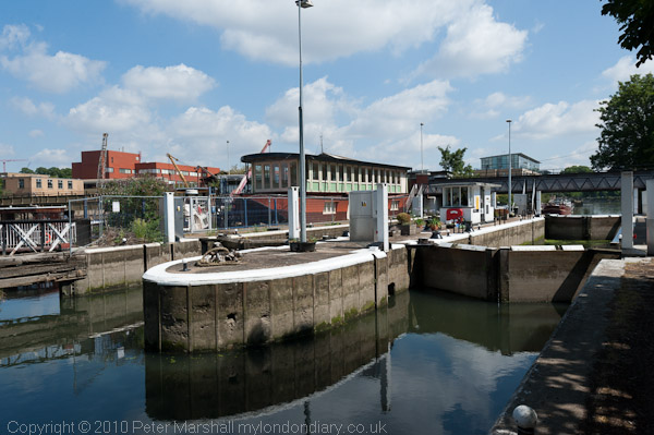
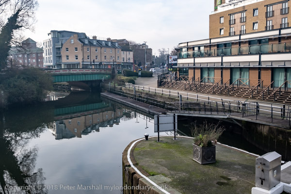
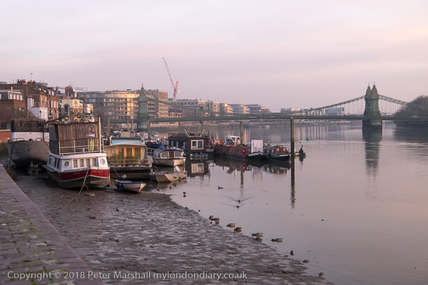
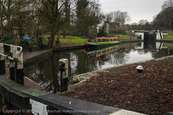
Grand Union Canal, Great West Rd, Brentford, Hounslow, 1990, 90-1h-34
I ended my walk by with a final picture looking south from the bridge which takes the Great West Road over the here combined River Brent and the Grand Union Canal before getting away from the noise and dust of the road and walking along the canal towpath to Brentford High Street where I could catch a bus to start my journey home.
Macleans Toothpaste, Great West Rd, Brentford, Hounslow, 1990, 90-1g-03
Toothpaste in my youth came as dentifrice, a usually pink powder or block in small tins, around 7 or 8 cm diameter and 2 cm tall, and Macleans had a patent aluminium tin. In my home we only changed to toothpaste in tubes at some time in the 1950s, but we could have been behind the times. And we used Gibbs Dentifrice, not Macleans.
Macleans was begun by a New Zealand born businessman, Alex C. Maclean in 1919, and moved into this splendid new factory on the Great West Road in 1932. The company was bought by Beechams in 1938 and later was swallowed up as a part of GlaxoSmithKline or GSK. You can still apparently get Macleans toothpaste though it bears little relationship to the orginal product and is now produced by Haleon
Macleans, Great West Rd, Brentford, Hounslow, 1990, 90-1g-04
The centenary of the Great West Road is celebrated in the book The Great West Road: A Centenary History by James Marshall, so far as I know not a relative of mine. “For two miles, from its junction with the North Circular Road and Chiswick High Road to Gillette Corner, a corridor of inter-war factory buildings emerged, a stylish celebration of art deco architecture.”
Macleans, Great West Rd, Brentford, Hounslow, 1990, 90-1g-61
Unfortunately many of the buildings have now gone, Trico and Macleans among them, although a few of the grander survive. I think I knew when I took these pictures two years before the business moved that these would shortly be demolished.
Trico, 980, Great West Rd, Brentford, Hounslow, 1990, 90-1g-51
The Trico Products Windscreen Wiper factory, No. 980, Great West Road, Brentford opened in 1928, three years after the new road was opened by George V in 2025 as the Brentford by-pass. Trico relocated to Pontypool, South Wales in 1992 and the building was demolished.
Certainly I took more pictures of these buildings than the others along this stretch of road, about three times as many as are in this post, though most of the rest are fairly similar to these.
Trico, 980, Great West Rd, Brentford, Hounslow, 1990, 90-1g-52
In the 1980s there was still little general appreciation of Art Deco or moderne buildings from the 1920s and 1930s and few had been give the protection afforded by listing. The most celebrated case of demolition was the Firestone Tyre Factory which had closed and been sold to Trafalgar House, a company run by Lord Victor Matthews and Nigel Broakes on 22nd August 1980.
A Department of the Environment inspector had the same week decided the building should be listed, but as it was the Bank Holiday weekend no civil servant was available to sign the emergency listing document. “On Saturday 23 August Lord Matthews ordered demolition men to destroy the main features of the facade – the ceramic tiles around the entrance, the white pillars, the pediment above and the bronze lamp standards.” And so one of the finest buildings on the stretch was destroyed.
Trico, 980, Great West Rd, Brentford, Hounslow, 1990, 90-1g-54
Victor Matthews, who as well as being Chairman of Trafalgar House was the proprietor of the Daily Express, had been made a Life Peer as Baron Matthews of Southgate a month before this despicable act of cultural vandalism.
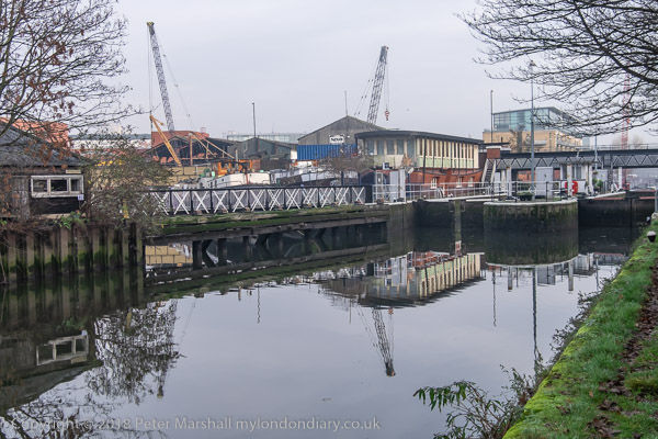
Grand Union Canal, Trico, Great West Rd, Brentford, Hounslow, 1990, 90-1g-56
The canal which had been so important in earlier Brentford history was irrelevant to the companies which now set up along the new road. They were entirely based around road transport and very much used their impressive frontages as advertisements for their businesses to those driving along the new highway.
Grand Union Canal, Trico, Great West Rd, Brentford, Hounslow, 1990, 90-1g-41
More from other buildings along the Great West Road in the next instalment.
Tamil Festival & Brentford Walk: On the morning of Sunday 8th August 2010 I photographed the annual Chariot Festival from the Tamil Hindu Temple in West Ealing and in the afternoon went for a walk in Brentford.
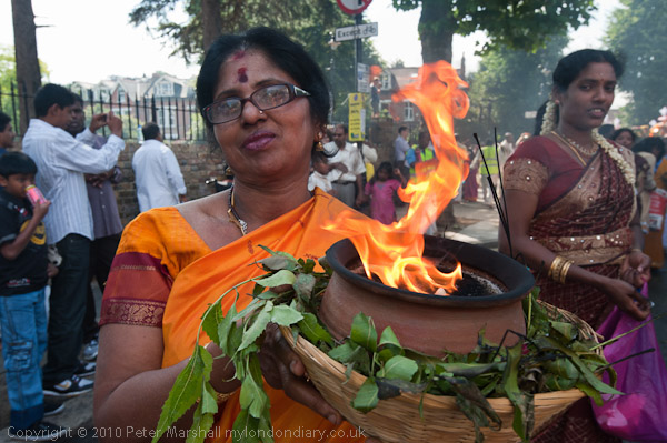
Tamil Chariot Festival in West Ealing
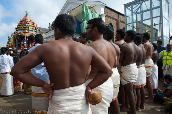
Men wait with coconuts outside the temple, ready to roll along the road
The annual Chariot Festival from the Tamil Shri Kanagathurkkai Amman (Hindu) Temple at a former chapel in West Ealing comes close to the end of their Mahotsavam festival which lasts for around four weeks each year.
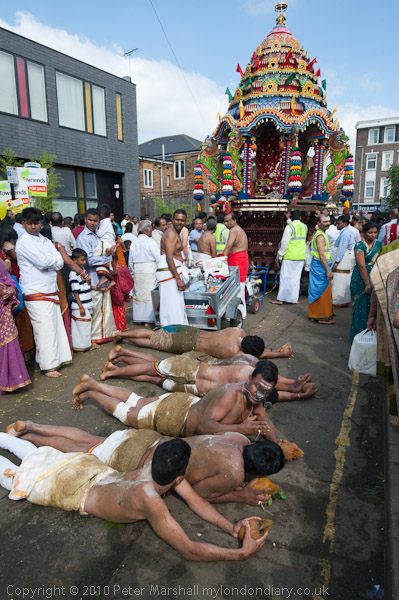
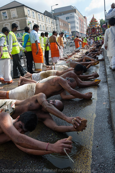
In it a represtentation of the Temple’s main goddess Amman (Tamil for Mother) and priests are dragged around the streets on a large chariot pulled by men and women on long ropes.
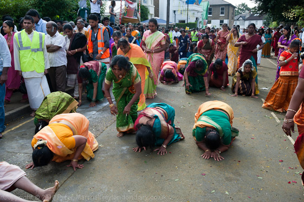
Behind them around 50 men naked from the waist up laid down on the street holding a coconut in front of them and rolled their bodies along the street for the half mile or so of the route. Men and women came and scattered Vibuthi (Holy Ash) on them. Following them were women who prostrated themselves to the ground every few steps.
From the Temple in Chapel Street the procession, led by a smaller chariot made its way along Uxbridge Road in the bus lane. People crowded around the chariot holding bowls of coconut and fruits (archanai thattu) as ritual offerings (puja) to be blessed by a temple priest.
To photograph the event I had – like those taking part – removed my shoes and my feet were soon soaked in coconut milk from the many cut open or smashed on the ground. Coconuts play an important role in many Hindu rituals and are a major product of the Tamil areas of India and Sri Lanka and many sacks of them were broken in the festival.
Further back in the procession were male dancers, some with elaborate tiered towers above their heads. Others had heavy wooden frames decorated with flowers and peacock feathers, representing the weight of the sins of the world that the gods have to carry; they had ropes attached to their backs by a handful of large hooks through their flesh. They turned and twisted violently as if to escape from the ropes, held by another man.
Women walked with flaming bowls of camphor which burns with a fairly cool flame and leaves no residue with others behind them carrying jugs on their heads.
The festival raises funds for various educational projects for children that the temple sponsors in northern Sri Lanka and other charitable projects in Sri Lanka devastated by the civil war and had sent more then £1.3 million in the previous ten years.
I left the festival, dried my feet as best I could, put on my socks and shoes and caught at bus to Brentford.
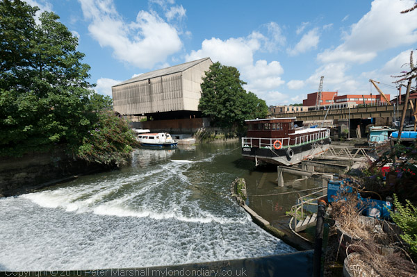
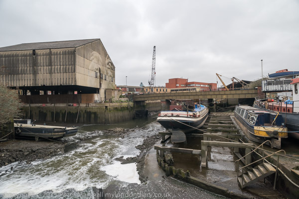
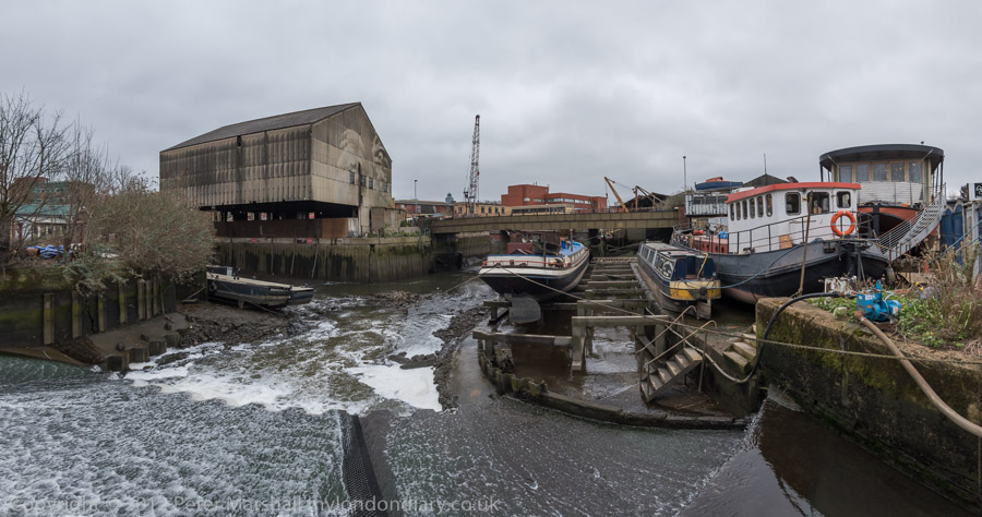
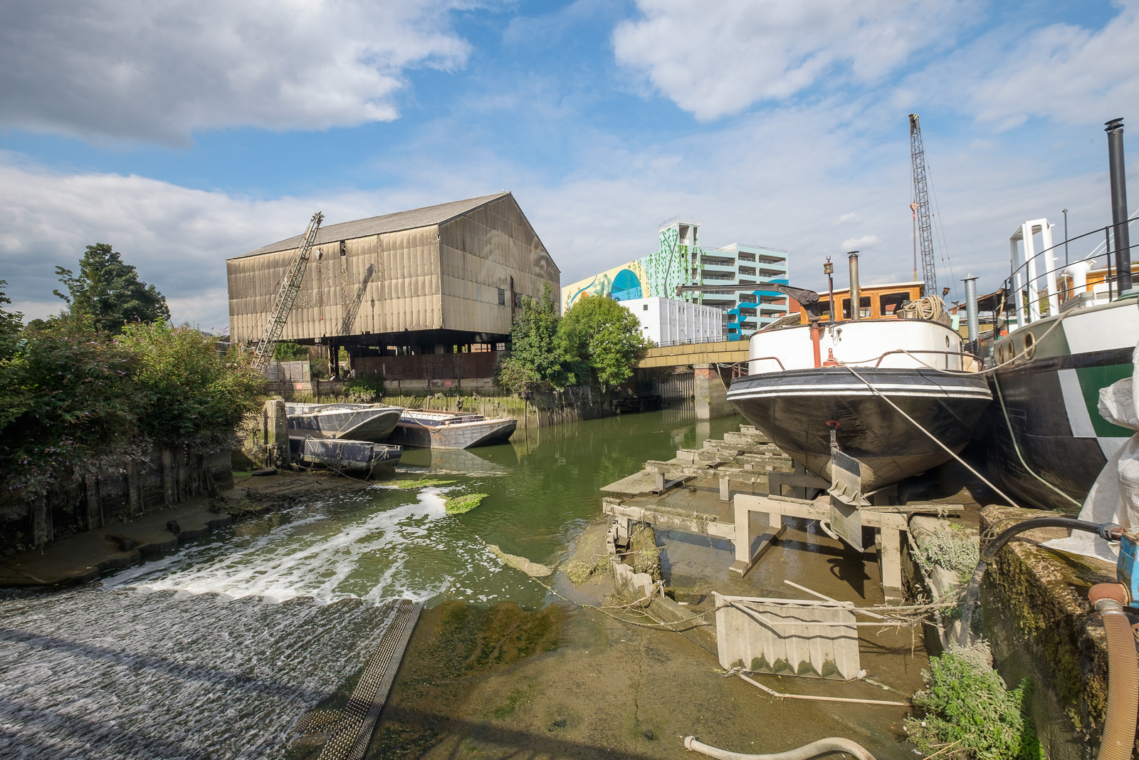
Overflow from the canal takes the River Brent to the Thames
When I was young and lived not far away Brentford was an important canal port, the junction of the Grand Union Canal (also here the River Brent) with the River Thames. The docks by the Thames were now a private housing estate and by 2010 almost all of the British Waterways sheds had gone, replaced by blocks of flats.
Past the recent moorings were the last remaining loading sheds
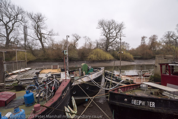
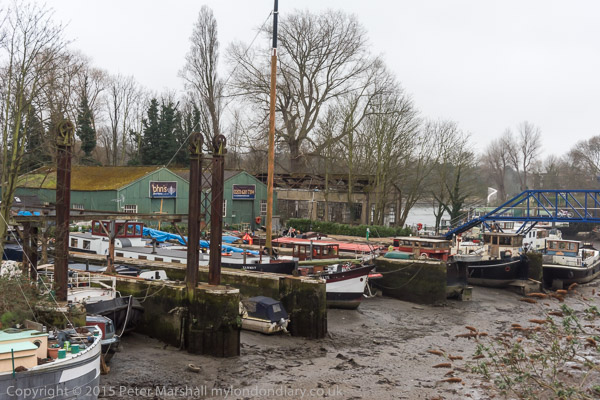
But the canal and the locks are still there, along with the small docks and some of the boat repair businesses. Little is visible from the High Street except where it goes over the canal, but despite extensive redevelopment in the 1990s – and more going on now – it remains an interesting area to walk around.
From the footbridge over the Brentford gauging locks
I’d photographed a little in the area back before much redevelopment took place, and more extensively in the 1990s. On line you can see some pictures from 2003 when some of the more recent development was starting. And I’ve returned a few times since this walk in 2010 and you can find more pictures if you search on My London Diary.
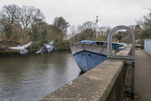
Thames Lock, connecting the canal system to the River Thames
As I noted in 2010, “Much of the walk that I took is now a part of the Thames Path, though it isn’t always well signposted, and some of the more interesting parts are a short detour away.”
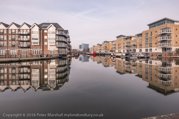
London’s Canal Walk: On Saturday 26th May 2007 I walked across London together with my wife and older son on canal towpaths from Mile End in the east to Old Oak Lane in the west, from where we made the short walk to Willesden Junction for a train towards home.
There is a great deal of new building next to the Regents canal
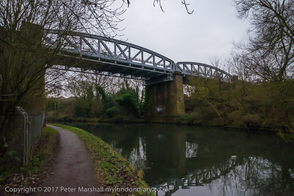
I’d walked and cycled along many shorter sections of these canals before, but this was the first time I’d done the whole roughly 12 miles in a single stretch. Most of the way we kept to the towpaths, but there are two tunnels around which we had to detour on roads, and a few places where walking along a road was more convenient than using the tow path, particularly around Little Venice.
The Hereford Union runs into the Regents Canal in Bethnal Green just beyone here
Probably the definitive book on English canals was written by a photographer, Eric de Maré, (1910 – 2002), one of a now largely forgotten generation of British photographers, and illustrated with many of his fine photographs, as well as some by others. He was one of the finest architectural photographers of the mid-20th century and also someone whose popular Penguin book ‘Photography’ published in 1957 introduced many of us to the history, techniques and aesthetics of the medium. Others since have looked better on the coffee table but have lacked his insight.
By Cambridge Heath Road, Empress Coaches and the gas holders
de Maré and his first wife lived on a canal boat for some years and travelled around 600 miles along them while writing and taking the pictures for the book ‘The Canals of England’ published by Architectural Press in 1950 which remains the definitive publication on our canals, though in some obvious ways outdated. The canals – which had played an important part in the war effort – had been nationalised under the National Transport Act on 1st January 1948 and part of the book is an impassioned plea for the UK’s transport policies to be revised to update the system and make fuller use of our great canal heritage.
But of course that didn’t happen, thanks to huge road transport lobby, and instead of canals similar to some in the continent we got motorways. The canals were encouraged to bring commercial traffic to an end, and with a few isolated examples most was finished by 1970 with the canals being given over to leisure use.
Not that de Maré was against leisure use and his work actively promoted this for many of England’s narrow and more rural canals as well as making an argument based on the commercial possibilities of schemes such as the ‘Cross or Four River Scheme’ proposed earlier by a 1906 Royal Commission for wide high volume commercial canals linking Bristol, Hull, Liverpool and London with the Midlands cities of Birmingham, Nottingham and Leicester.
The book came out in a second edition in 1987 and copies of both are available reasonably priced secondhand – my copy of the first edition with a handwritten dedication from de Maré was at some point marked by a bookseller’s pencil for 6d but I think I paid just a little more. I can find no individual website showing more than a small handful of his pictures – though you can see many by searching for his images online.
It’s still interesting to walk along by the canals in London, and easy to do in smaller sections – or to add a little at either end should you want to and perhaps walk from Limehouse to Southall or Brentford. I didn’t write much about the walk in 2007, but I’ll end with what I did write back then – with the usual corrections.
On Saturday I accompanied Linda and Sam on a walk along some of London’s canals, from Mile End on the Regent’s Canal and along that to join the Grand Union Paddington Branch at ‘Little Venice’, and west on that to Willesden Junction.
When I first walked along the Regents Canal I had to climb over gates and fences to access most of it. The towpath was closed to install high voltage lines below it, but even the parts that were still theoretically open were often hard to find and gates were often locked. The public were perhaps tolerated, but not encouraged to walk along them.
Now everybody walks along them and there are those heritage direction posts and information boards that I’ve rather come to hate. And from this weekend, you no longer even theoretically need a licence to cycle the paths – though mine is still in my wallet, several years since I was last asked to show it.
Now, as walkers, the constant cycle traffic on some sections has become a nuisance. And although most cyclists obey the rules, riding carefully, ringing bells and where necessary giving way, we did have to jump for safety as one group chased madly after each other, racing with total disregard for safety.
But for the rain – the occasional shower at first, later settling in to a dense fine constant downpour, it would have been a pleasant walk.
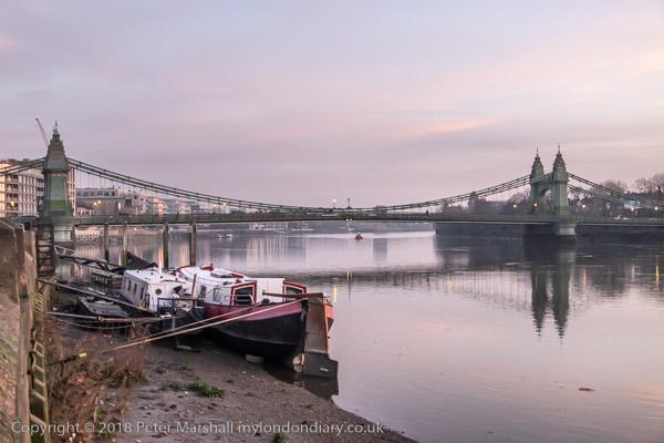
Brentford, Chiswick & Hammersmith: On Thursday 27th December 2018 we still had a lot of Christmas excess to walk off despite having made our normal Boxing Day walk the day before. But we had followed that with a second Christmas dinner.
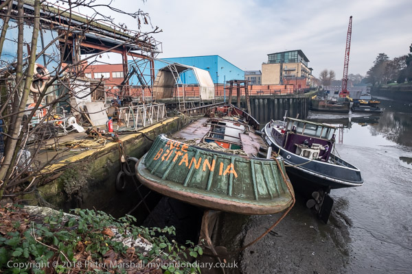
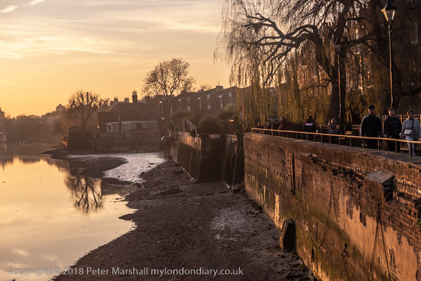
‘Rule Britannia’ on a boat moored below Thames Lock at Brentford
This is still one of my favourite walks in West London and includes various stretches I’ve often walked over the years in one direction or the other, usually during the times of year when days are short and we don’t want to spend much time in travelling. And during the time between Boxing Day and New Year, rail travel is often something of a lottery with much of the network being shut down for engineering work.
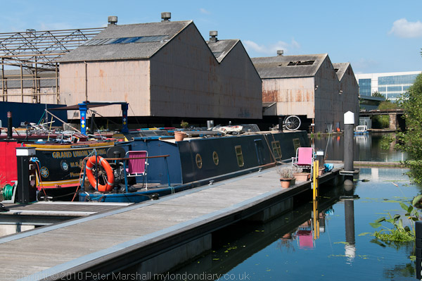
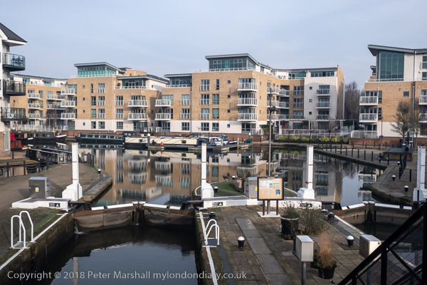
Brentford locks were gauging locks so that tolls could be charged based on the weight of goods in barges. The flats here on a site between the River Brent and the canal have replaced large dockside sheds.
Even our short journey to Brentford was affected in 2018 and the usual direct train service to Brentford – our slow route to Waterloo – was not running. But we could take a train to Twickenham and go the rest of the way on the top deck of a bus, always one of the most interesting ways to travel in London. And the bus did take us more conveniently close to where I wanted to start this walk, at the bridge which takes Brentford High Street over the Grand Union Canal.
The road over the canal used to be the main route from London to the west and southwest before the Great West Road opened in 1925, and the canal linked the Thames to Birmingham.
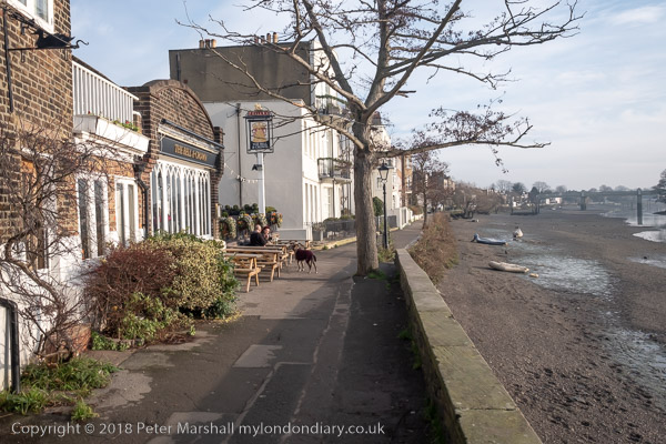
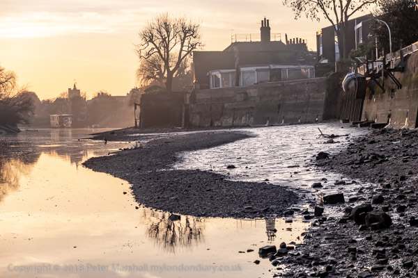
Brentford used to be a rather dirty downmarket industrial and commercial centre, with sheds and warehouses, factories, docks on the canal and where this enters the Thames, a thriving market, a large gas works and more. It has changed dramatically in the last 40 or so years with much of its river and canal sides now filled with luxury flats. Parts of the old Brentford remain but more and more is disappearing, including some things in these pictures I made in 2018. I’ve been there a few times since and it remains an interesting walk.
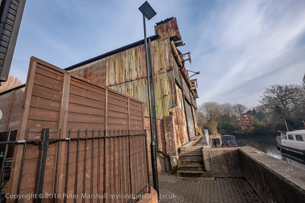
A narrow section of the towpath beside a derelict shed
More on My London Diary at Brentford to Hammersmith. Here I’ll simply post a few images with captions from some of the key places along our route apart from the picture at the top of the post they follow roughly in the order I took them, though we did quite a bit of wandering around in Brentford.
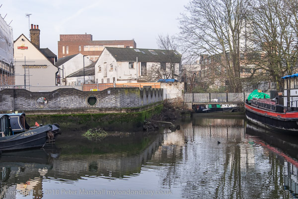
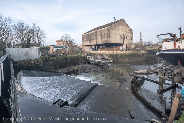
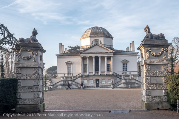
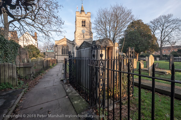
A small dock in the middle of BrentfordThe River Brent flows over the weir below the footbridge at centre left; at right, Thames Lock connects the canal to the tidal River Thames.The River Brent from the footbridge over the weir.Below Thames Lock the river comes back into the channel leading from the lock to the Thames.A working boatyard at Dock Road on the River BrentJohn’s Boat Works, Lot’s Ait with the bridge to it built in 2012Hounslow Council and boat owners fought a long battle over the moorings at the gasworks site, but these boats were simply abandoned after the council’s victory.Strand on the Green at low tide. It was warm enough to sit in the sun and eat our sandwichesWe walked through the gardens and out from the main gate to Chiswick HouseThe footpath to St Nicholas’s Church in ChiswickRiver Thames looking back to ChiswickRiver Thames and Hammersmith Bridge
In Hammersmith we took the District line to Richmond and then a train back home to tackle some of the leftovers from our Christmas lunch.
As a child I grew up in Middlesex, by then a rather truncated county on the north and west of London, though once it had included the cities of London and Westminster and many of London’s Metropolitan boroughs north of the Thames and west of the River Lea. Brentford, a couple of miles from where I was born, was the nearest thing the county had to a county town, though it had few if any of the normal attributes of one, with no town-hall or other public building.
Often on Bank Holidays our father would take us on a 237 bus from Hounslow to Kew Bridge Station, the route going through Brentford High Street where it was often held up as we gazed through the top deck windows at the sites. Under the railway bridge leading to Brentford Docks where we might see a steam hauled goods train, over the canal bridge where the locks and dock area were normally busy with barges,past the Beehive on the corner of Half Acre with its tower topped by a giant beehive and on through the noisy, smelly gas works to Kew Bridge.
We walked across Kew Bridge and then turned down the side of Kew Green to the gate of Kew Gardens, where a penny – an old penny, 240 to the pound led us into the extensive gardens where we could wander all day. This was before the days of garden centres and my father would always have a small pair of scissors in his pocket to take the odd cutting or pick up a seed or two on our walks.
Later, in the early and mid 1950’s I would ride my bicycle around much of Middlesex and Surrey – and that included Brentford, but I think it was only much later when I became a photographer that I really explored the area and found out what an important communication link it had been. Brentford is where the inland waterways system with the busy Grand Union Canal joined the River Thames, just a few miles upriver from the great Port of London.
In 1978 three of my photographs from Brentford were published in Creative Camera Collection: No. 5, a prestigious collection of contemporary photography published by Coo Press, the publishers of the monthly magazine Creative Camera and edited by Colin Osman and Peter Turner. It wasn’t the first time my work had been published but was great to be on the pages with some very well known photographers, including one who much later became a friend, John Benton-Harris.
Brentford has changed greatly since then, with much of the riverside now lined with expensive flats rather than commerce and industry. The gasworks site became a riverside park and an arts centre, where I took part in and helped organise a number of exhibitions. But there is still enough of the old Brentford untouched, though less each time I go there.
I first returned in the 1990s, when I was teaching a few miles down the road, bringing students to see shows there and to wander around the area taking pictures. Later I came back for walks on my own or with friends, such as this one on Saturday 26th March 2016 with my elder son. Brentford hadn’t been my first choice by railway engineering works that week end made travelling out further to the east of London impossible.
As well as making ‘normal’ pictures with lenses giving a horizontal angle of view of between 10 and 84 degrees (focal lengths 20 to 200mm) there were some pictures where I felt an even wider view was needed and I made some panoramss with a roughly 145 degree angle of view. The pictures above and below illustrate the difference.
We didn’t end our walk in Brentford, but continued on past Syon House to Isleworth where we ate our sandwiches in a relatively sheltered square before following the Duke of Northumberland’s River through Mogden Sewage Works to Kneller Park and then Whitton Station for the train home. You can see a much wider range of pictures online on My London Diary at these three links: Syon, Isleworth & Mogden Riverside Brentford Panoramas Riverside Brentford
Harlesden, Willesden, Mary Seacole & a Wassail: Sunday 2nd February 2014, ten years ago today was a pleasant winter day, not too cold and with some sunshine and light clouds, perfect for panoramas, so I went early to have a walk around the area before going on to photograph the wassail in Willesden Green.
Harlesden, Willesden & Mary Seacole
It was long ago on one of the dirtiest trains imaginable, windows think with dust so I could hardly see outside that I first came to Willesden Junction Station from Richmond on the North London Line which ran to the City and Broad Street Station. Upgraded to run to North Woolwich in the 80s with new rolling stock the line became a key way for me to travel to photograph around north London. Nowadays the line is part of London’s Overground, since 2016 run by Arriva Rail London, a part of Deutsche Bahn and rather cleaner, with trains running to Stratford.
Willesden Junction, which links with the Bakerloo line and another Overground service from Euston to Watford Junction is not in Willesden but in Harlesden and has platforms at two levels, and also has mainline trains rushing past without stopping. Apparently, according to Wikipedia, in earlier years it was was nicknamed “Bewildering Junction” or “The Wilderness” because it contained such a maze of entrances, passages and platforms and it is still rather like that.
If you can find it, a footpath leads over the mainline tracks next to the line from Richmond and Clapham Junction through an industrial wasteland and eventually to Hythe Road. Google Maps even dignifies it with a name, Salter Street Alleyway. Turning left at into Hythe Road takes you to Scrubs Lane, but going right can take you to the Grand Union Canal, with a bridge leading across to the tow path. I did both.
The blue sky with clouds was perfect weather for panoramas, and I took a number going back and forth a little in the area, across the Scrubs Lane bridge and back. At the corner of this bridge is a memorial garden to Mary Seacole (1805-81) who nursed many British soldiers in the Crimean War as well as working in her native Jamaica and Panama and Cuba, funding her medical work from the proceeds of her general store and boarding house in Jamaica. The garden, on the canal bank next to Mitre bridge, on Scrubs Lane, not far from where she was buried in St Mary’s Catholic cemetery, Kensal Green, was begun in 2003, shortly before the 2005 bi-centenary celebration of her birth.
The garden, now rather overshadowed by a new development, was a pleasant place to sit in the sun and eat my sandwiches before making my way to Willesden Green for the Wassail. Pictures from the walk start here on My London Diary and include more panoramas as well as other pictures.
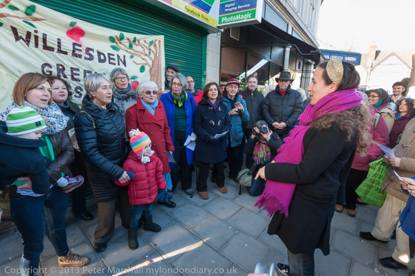
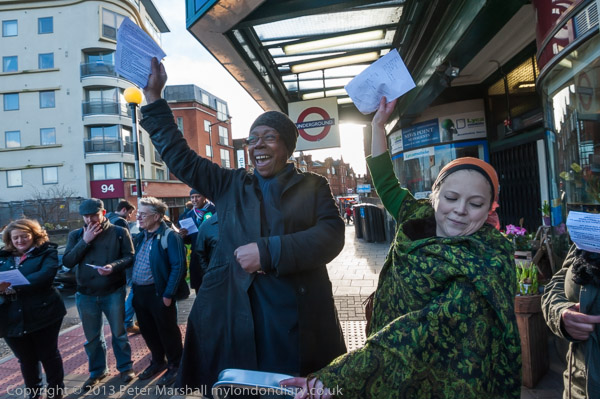
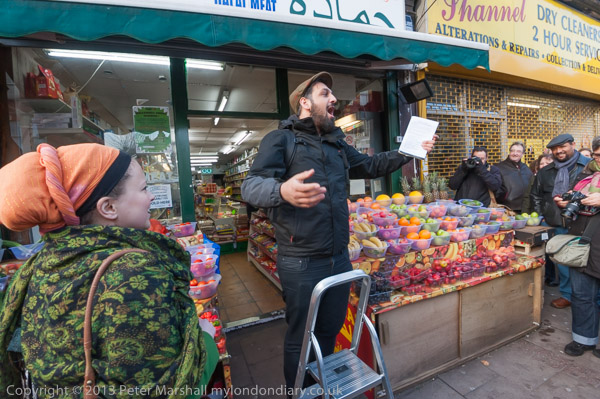
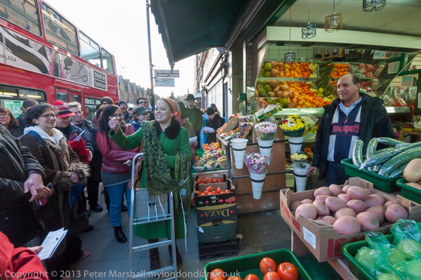
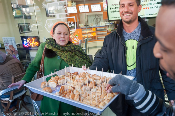
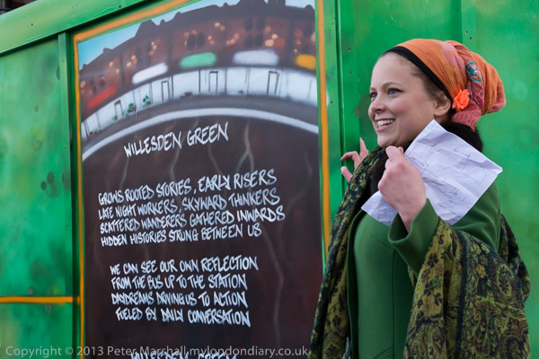
Willesden Wassail – Willesden Green
This was the fifth Urban Wassail in Willesden High Street organised by Rachel Rose Reid to celebrate local shopkeepers who give Willesden Green its character and help to create a vibrant community.
The wassail is described as a “small free festival run by and for people from Willesden Green” and also celebrates the work of all who live there and create the neighbourhood and brought together artists and volunteers from the area including James Mcdonald, Berakah Multi Faith Choir, Poetcurious, Errol Mcglashan and several others, with more performing later after the wassail.
The group met at Willesden Green Station, though unfortunately this was closed for engineering works on the day. Here there was a performance from ParkLife singers, a local community choir run as a not-for-profit co-operatvie and led by Charlotte Eaton, before Rachel Rose Reid introduced us to the first shopkeeper who told us a little abor her shop, Daisychain Florist, with all of the 70 or so people present repeating her words in Occupy ‘mike-check’ style.
Then everyone sang a Wassail Song, borrowed from the Carhampton Wassail, with the shop name in place of its “Old Apple Tree”. You can read this on My London Diary.
The same pattern was repeated at a number of shops along the High Stret including Hamada supermarket, Khan Halal Butchers, Pound.com, Corner Barber Shop, Red Pig, Fornetti, Mezzoroma and Buy Wise.
There were other stops on the route for poetry and songs, including one in the yard at the front of Sainsbury’s, one of relatively few chains in the area.
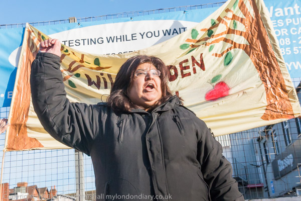
Here we were also told about the campaign to save the Queensbury Pub on Walm Lane from demolition, with a petition of over 4,000 signatures to Brent Council against the demolition of this ‘Asset of Community Value’ and its replacement by a 10 storey block of flats. The pub had been open since 1895 but was bought by developer Fairview New Homes (North London) Ltd in 2012. Brent turned down the development, but the developer, now called Redbourne (Queensbury) Ltd put forward new plans in 2018. Again these were refused by the council but the developer’s appeal succeeded. The pub vlosed in 2022-3 and was demolished in October 2023 to build 48 flats. The development is supposed to include a new pub.
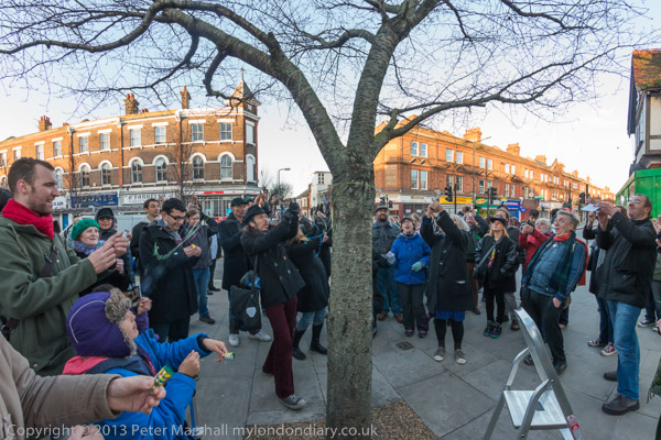
The Wassail ended with a number of poetry performances opposite the Willesden Green Library building site, after which we moved to the neighbouring cherry tree for a final wassail after which everyone let off the party poppers and decorated the tree with ribbons. It was slightly less noisy version of the traditional banging pans and firing guns in order to wake up the apple trees.
The wassailers then moved to the Bar Gallery in Queens Parade on the corner of Walm Lane, where refreshments were available and there were to be more performances. I went along but then realised it was time for me to start my journey home and left.
Six years ago on New Year’s Eve we walked with a couple of family members from Sudbury to Brentford. This year because of rail and health problems none of our family are staying with us and “South Western Railway services between 18 December and 8 January are subject to change and may not operate”, so if the weather is fine we will probably do a rather shorter walk from home.
The trip in 2016 to Sudbury Hill station was reasonably fast; a short train journey then a bus and a couple of short hops on the Piccadilly line got us there in a little under an hour and a half, and within a few minutes we were walking along suburban streets to Horsenden Wood, where we walked to the top of the hill.
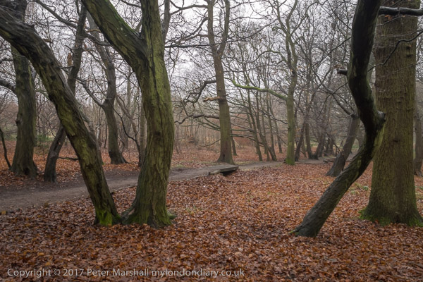
Unfortunately it was a dull and damp day, and we could only see the extensive views this part of the walk would have given us had the air been clear dully through the murk, but the path up through the wood was enhanced by the slight mist. We walked down the hill to cross the Grand Union Canal.
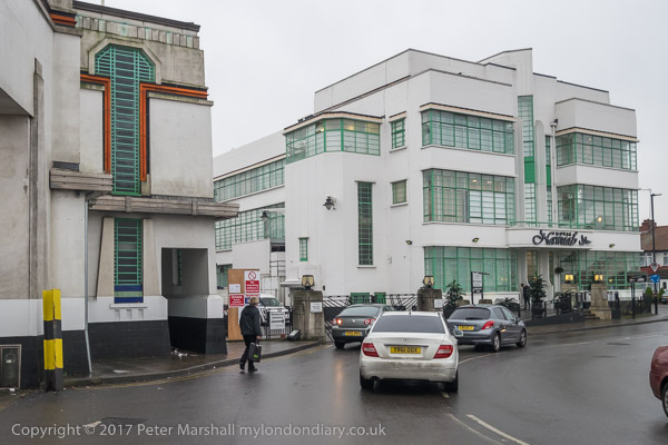
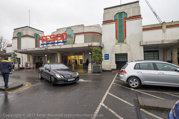
Soon we reached the highpoint of the walk for some of us, the 1930s trading estate leading to the Art Deco Tesco on Western Avenue, designed by Wallis, Gilbert and Partners and built in 1933 for Hoover, along with the 1930s moderne canteen, now an Asian restaurant. We chose the Tesco both for a tiny bit of shopping and the toilets, then walked west to the footbridge to cross the busy road.
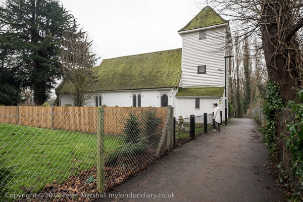
Almost immediately on the path the other side of Western Avenue we came to St Mary the Virgin Perivale, now used for concerts, with just an occasional service.
This Grade I listed redundant church dates in part from the 13th century and was the smallest church in Middlesex (outside London.) We explored its graveyard and sat down on a rather damp seat there to eat our sandwiches in what was either heavy drizzle or light rain.
The next section of the walk took us beside the River Brent, another of London’s minor rivers and like the rest of our walk going to Brentford, though we had to make some deviations to follow roads and footpaths. This was a relatively quiet and sometimes boring section of the walk, though its always good to walk beside the river, and there was a rather dumpy viaduct for a doomed railway, a council estate and a long foot path to a Cuckoo Lane where no cuckoos were to be heard except for our ludicrous imitations.
Things got more interesting again when we reached Hanworth Church, and early work of George Gilbert Scott who later called it ‘a mass of horrors’ and Brent Lodge Park, where I ignored the pleas of some of my cfo-walkers and led us firmly away from a tea-room – we were already and hour or so behind schedule if we were to finish the walk during daylight.
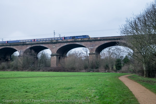
Brunel really knew how to build a viaduct, and here was the first major engineering work on the new Great Western Railway in 1836-7, with 8 semi-elliptical arches each of 70 ft span and rising 19 ft supported on hollow brick piers – the first time these were used in a railway viaduct. 886 ft long, the height to the parapet is 81 ft, and when built it was 30 ft wide to carry two broad gauge lines. Later it was widened to 55ft with a third pier added to each existing pair, and it could then take four standard gauge tracks, which were laid in 1892. We walked under this impressive structure beside the River Brent to the south side which is the earlier part and carries the arms of Lord Wharncliffe, chair of the committee that gave permission for the GWR.
We continued by the Brent to join the Grand Union Canal, another earlier great engineering acheivement along with the rest of the canal system, at the Hanwell flight of locks. Our route now ran along the towpath, so navigation was simple, all the way to the Great West Road.
There was still just enough light to take a few photographs, but my companions were flagging and our walk was getting slower and slower.
By the time we reached the road for the short walk to Brentford Station it was truly dark and they had slowed to a snails pace, and despite my urging them to catch the next train we arrived there to see it just departing, for once dead on time, though we were an hour and a minute later then planned. It had been a good walk but would have been better without the 29 minutes wait there for the next train.
You can see many more pictures from the walk on My London Diary at New Years Eve Walk.
My walk a few days ago in September 2022 began at Kew Bridge Station. I’d come half an hour before I was due to meet my two companions to take a short walk around one of the newer parts of the area before meeting them for a longer walk to Isleworth.
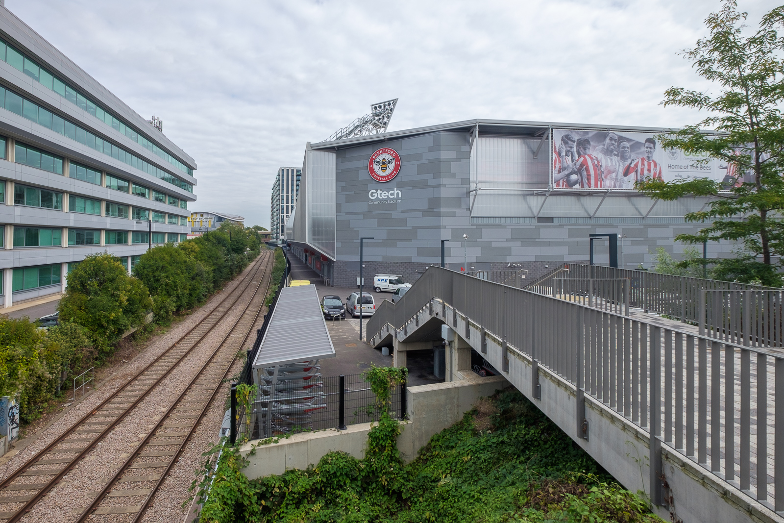
Lionel Road runs north of the railway up to meet the Great West Road. It used to be a rather run down area with railway sidings on one side and a few old commercial buildings and works to the north. The last time I’d walked down here on my way to Gunnersbury Park in 2018 the whole area had been a building site, but now is home to Brentford FC, currently doing pretty well in the Premier League.
Brentford was my local team when I was a kid, and several members of the award-winning under-11 team I played for at left back on went on to play for them at their old ground (and at Chelsea.) One of the other patrol leaders from my scout group stayed there until he retired, though I never met him after I hung up my woggle, but read his obit in the local rag.
Past there I came to the Great West Road, a 1930s dual carriageway with cycle tracks I sometimes used further west on my way home from school. In the 1980s or 90s I photographed most of the remaining Art Deco factories along it, though the bulldozers got to some first. Now it reminds me of J G Ballard’s novels, particularly ‘Crash’, set around the area we both lived in, with the elevated M4 above the older modern road.
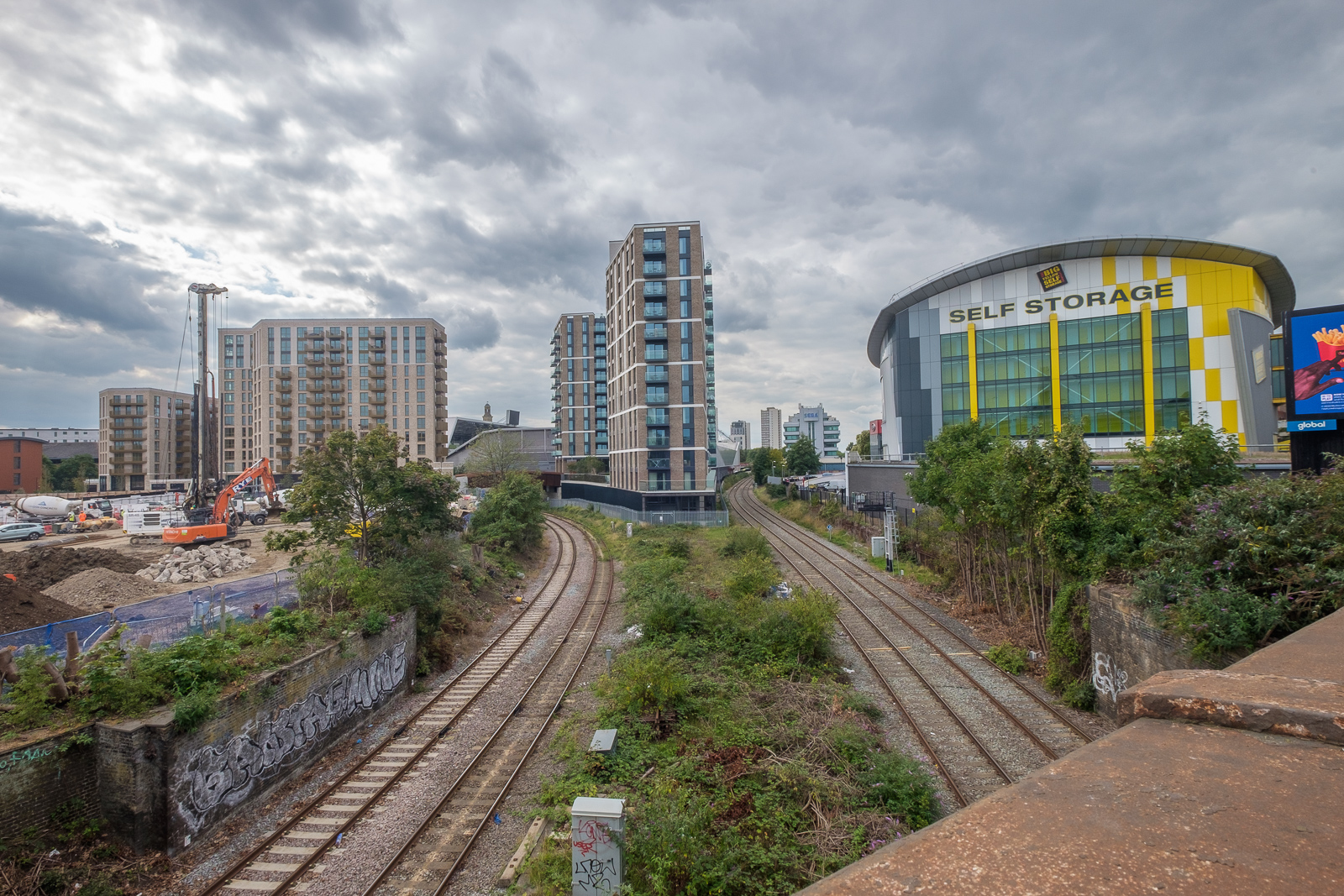
A new Brentford of tall blocks has sprouted here, though more land remains to be built on. A little-used rail line goes through it, the Kew Curve, with Brentford’s stadium replacing the sidings and cattle pens to its west, with new building on the east in what was Brentford Market. It moved to this site in 1893 after the Brentford Local Board had bought the 2 acre site from the Rothschild estate because market trading in the area around the Express Tavern immediately south of the station which had developed informally away from Brentford’s traditional market in Market Place had become a public nuisance. The site was extended in 1905 and then covered land now part of the Chiswick Roundabout. The market moved to the edge of Southall in 1974 as the new Western International Market and the Fountains Leisure Centre was built on part of the site, with the rest staying derelict for years.
My maternal grandfather, then a market gardener in Feltham, would drive his cart with produce to Brentford Market in the early years of the last century, past the house in Hounslow where my father, then a young boy, used to see him driving past. Around twenty years later when he became engaged to my mother he found out who he was.
I met my two colleagues and we walked together down by the west side of Kew Bridge to the Thames. To our right was where the Kew Bridge Ecovillage had squatted from June 2009 until May 2010, now occupied by 164 flats, a business centre, gym and pub.
The Hollows runs west between riverside moorings and recent blocks of luxury flats, eventually returning us to Brentford High St, and a park beside the river now called Watermans Park. This was the site of Brentford Gas Works which straddled the High Street here and was a great attraction when we took the bus through it in my childhood, usually on our way to Kew Gardens. Entrance then was only an old penny, and it was a cheap outing for families in the area. My father would have his scissors in his pocket and perhaps take the odd small cutting to grow in our garden. Rather cheaper than garden centres.
But if you were lucky as the bus drove slowly down the usually congested street, one of its Intermittent Vertical Retort would open sending a wall of red hot coke to the ground, quite an amazing site as we peered from the top deck. It almost made up for the smell.
A gas works had been set up here and began production in 1821, first supplying has for lighting the turnpike to Kensington, but later serving large areas around. Later other gas works were set up in Southall and then elsewhere as demand continued to rise. in 1926 the Brentford gas company became a part of the Gas Light and Coke Co which later became British Gas plc. Brentford Gas Woks closed in 1963 and the riverside buildings were demolished in 1965 though the large gasholder remained until 1988.
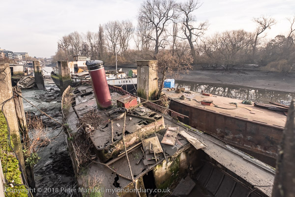
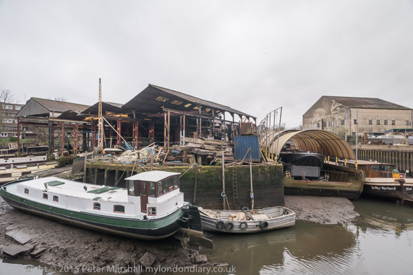
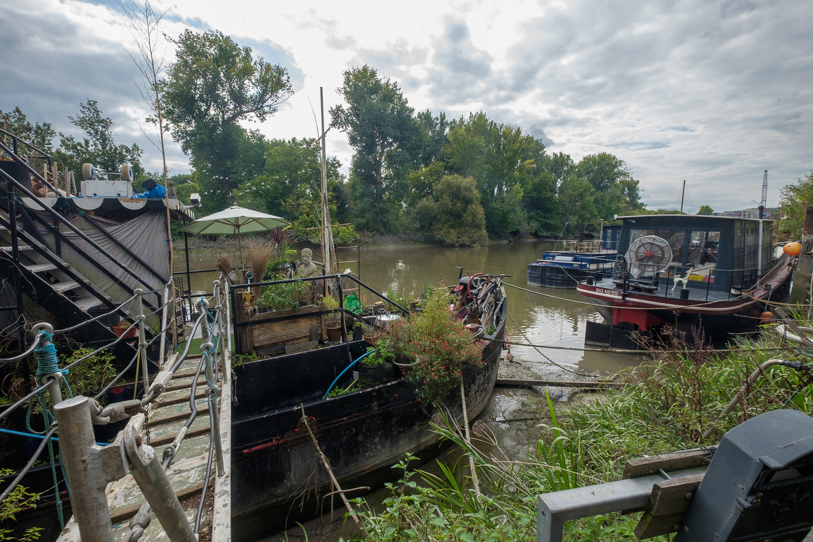
All than now remains of the gas works are some of the substantial posts of the gas works jetty, where colliers once brought in coal. There has been a long battle over the rights to moorings here between boat owners and Hounslow Council with boat owners claiming that the foreshore here belongs neither to the council nor to the PLA but to the Bishop of London, and refusing to abide by various eviction notices. Most have now moved but some derelict boats remain.
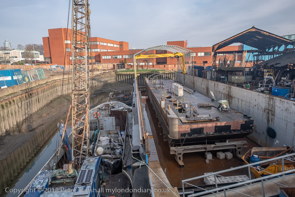
Brentford Ait runs along the centre of the river here. It was bought in the late 19th century by the Crown who planted trees on it to hide the gas works from visitors to Kew Gardens on the opposite bank. A few yard upstream is Lot’s Ait, where the Thames Steam Tug and Lighterage Company Ltd set up a boatyard in 1920 – most of the Thames lighters were built there. The boatyard closed in the 1970s, but was reopened in 2012 when a new footbridge was constructed to it.
As well as the park, the Watermans Arts Centre was also built on the gasworks site. We walked between it and the river, and continued on the riverside path, past the bridge to Lots Ait and recent blocks of flats. There are new moorings around here too.
A small spit of land leads from the bottom of Ferry Lane (more new flats) to an artwork by the riverside. I’m not quite sure what to make either of Liquidity or another similarly decorated column not far away, but it could provide a useful windbreak in bad weather. This was where once a ferry ran across to Kew Gardens.
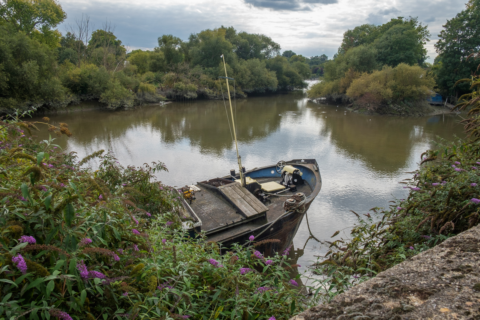
We followed the Thames Path around a small dock, on what was the site of the Thames Soap Works and then continued along the side of the River Brent which flows into the Thames here, continuing along this beside the winding river past another boatyard to Brentford High Street.
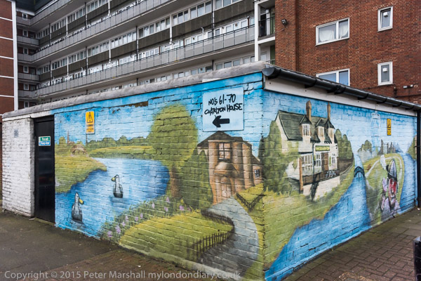
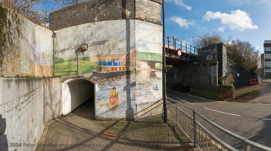
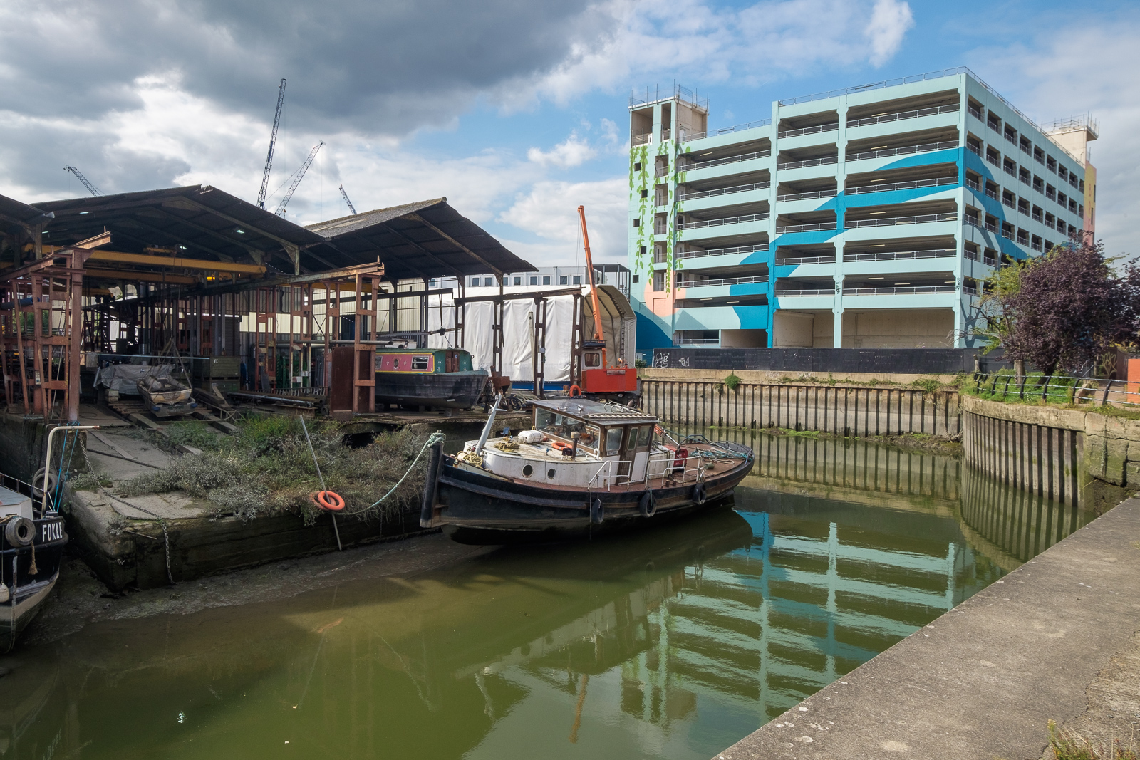
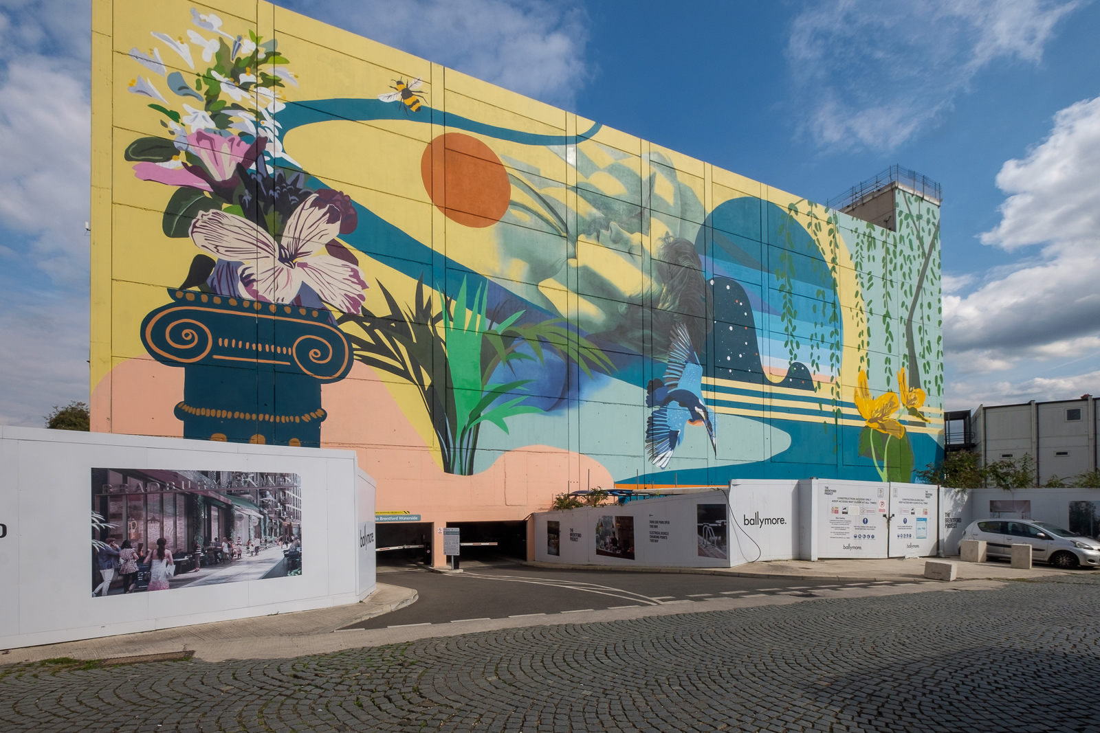
A few yards along we turned left down Dock Road to Thames Lock, past a huge mural and the other end of the boatyard, to Thames Lock, the southern end of the Grand Union Canal. Here we took the path beside the north side of the canal, leading across a bridge over the Brent to Johnson’s Island and Catherine Wheel Road.
The mural, on the side of a multi-story car park had included a giant kingfisher, and I’d joked saying this was the only kingfisher we’d see in Brentford. But as we walked across the bridge over the River Brent and stopped to take pictures, perched on the top of a post there was one, still only for a second before flying out of sight. By the time I’d raised my camera to my eye it was gone, though since I had and extreme wideangle lens it would hardly have been visible, just a few more colourful pixels.
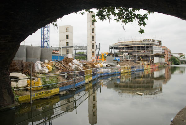
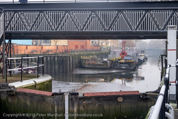
I’d planned to walk along Brent Way and rejoin the canal towpath, but the whole of this area is now a huge building site, and instead we walk along the High Street to the canal bridge. I couldn’t bring myself to walk down to the Gauging Lock preserved there, though I’ve done so several times before, but the changes to the area, now with a marina, flats and hotel made me feel too sad; we simply stood on the bridge and looked for a while before moving on.
Part 2 will continue the walk from here to its end in Isleworth. You can see more pictures from the walk in a Facebook album.
After Christmas – Brentford to Hammersmith was one of our more interesting walks in London to walk off our Christmas excesses in recent years. For once I’m not sticking religiously to my usual practice and this was three years AND one day ago, and the four of us set out on 27th December 2018.
Often in recent years we’ve gone away in the period after Christmas to visit one of our sons and his family in Derbyshire, with some great walks in the areas around where they have lived, and there are pictures from these on My London Diary, but in 2018 my other son and his wife were staying with us and came for this walk.
Public transport in the period between Christmas and New Year is at best restricted and rather unreliable, and 2018 was no exception and this always limits our starting point. Even for this relatively local walk what would have been just a short direct train meant taking the train to Twickenham and then catching a local bus to Brentford. And on our return trip again a bus took us back to Twickenham for the train home. It meant less time for walking and we had to abandon the idea of actually going inside Chiswick House in order to complete the relatively short walk of 5-6 miles before it got dark.
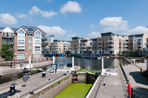
Brentford, and particularly the Grand Union Canal where we began our walk is now very different from how I remember it – and indeed since I first went back to photograph it in the 1970s. Commercial traffic on the Grand Union came more or less to an end in the early 1970s. What was once canal docks and wharves by the lock where boats were gauged and tolls charged the sheds have been replaced by rather uglier flats and a small marina.
Walking by the canal towards its junction with the River Thames there are areas which still look much as they did years ago, and some rather more derelict than they were then. This is a side of Brentford invisible from the High Street but with much of interest. Probably in the next few years this too will disappear as gentrification advances.
Shortly before the lock leading to the Thames, the River Brent which is here combined with the canal runs over a weir to make its own way to the main river. There are still working boatyards in the area around here, though a little downstream more new flats and a part of the Thames Path here was closed and a short diversion was necessary.
We continued along past new riverside flats and a new private footbridge to the recently revivied boatyard on Lot’s Ait to an area of open space which was a part of the old gas works site, then along the riverside path past more new flats to Kew Bridge and Strand on the Green. Here it was warm enough to sit in the sun and eat our sandwiches before leaving the river to walk to Chiswick House Gardens.
I’d planned to get here for lunch, perhaps spending an hour or so going around the house and then perhaps a drink in the cafe, but there was no time thanks to the rail problems, so we briefly visited the toilets before heading on to St Nicholas’s Church and Chiswick riverside.
From there it was a straight walk by the river to Hammersmith Bridge, arriving around sunset with some fine views along the river – and then the short walk to the bus station for the bus back to Twickenham and the train home. The two bus journeys made our travel take much longer, but you do get some interesting views from the top deck of a double-decker and the journey was intereresting at least until it got too dark to see much.