Tamil Festival & Brentford Walk: On the morning of Sunday 8th August 2010 I photographed the annual Chariot Festival from the Tamil Hindu Temple in West Ealing and in the afternoon went for a walk in Brentford.
Tamil Chariot Festival in West Ealing
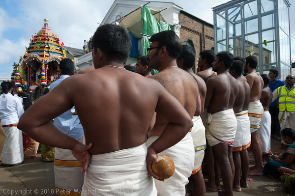
The annual Chariot Festival from the Tamil Shri Kanagathurkkai Amman (Hindu) Temple at a former chapel in West Ealing comes close to the end of their Mahotsavam festival which lasts for around four weeks each year.
In it a represtentation of the Temple’s main goddess Amman (Tamil for Mother) and priests are dragged around the streets on a large chariot pulled by men and women on long ropes.
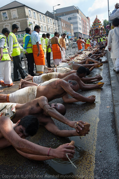
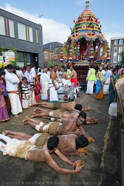
Behind them around 50 men naked from the waist up laid down on the street holding a coconut in front of them and rolled their bodies along the street for the half mile or so of the route. Men and women came and scattered Vibuthi (Holy Ash) on them. Following them were women who prostrated themselves to the ground every few steps.
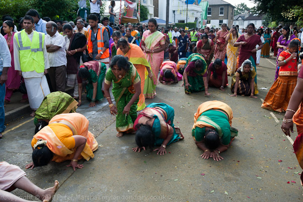
From the Temple in Chapel Street the procession, led by a smaller chariot made its way along Uxbridge Road in the bus lane. People crowded around the chariot holding bowls of coconut and fruits (archanai thattu) as ritual offerings (puja) to be blessed by a temple priest.

To photograph the event I had – like those taking part – removed my shoes and my feet were soon soaked in coconut milk from the many cut open or smashed on the ground. Coconuts play an important role in many Hindu rituals and are a major product of the Tamil areas of India and Sri Lanka and many sacks of them were broken in the festival.

Further back in the procession were male dancers, some with elaborate tiered towers above their heads. Others had heavy wooden frames decorated with flowers and peacock feathers, representing the weight of the sins of the world that the gods have to carry; they had ropes attached to their backs by a handful of large hooks through their flesh. They turned and twisted violently as if to escape from the ropes, held by another man.
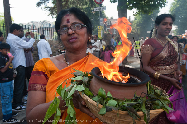
Women walked with flaming bowls of camphor which burns with a fairly cool flame and leaves no residue with others behind them carrying jugs on their heads.

The festival raises funds for various educational projects for children that the temple sponsors in northern Sri Lanka and other charitable projects in Sri Lanka devastated by the civil war and had sent more then £1.3 million in the previous ten years.

I left the festival, dried my feet as best I could, put on my socks and shoes and caught at bus to Brentford.
Many more pictures on My London Diary at Tamil Chariot Festival in Ealing.
Brentford
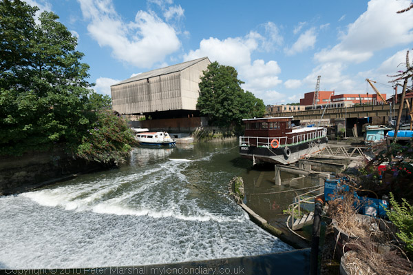
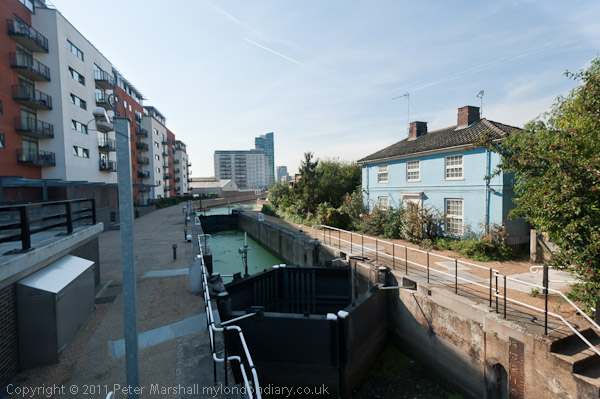
When I was young and lived not far away Brentford was an important canal port, the junction of the Grand Union Canal (also here the River Brent) with the River Thames. The docks by the Thames were now a private housing estate and by 2010 almost all of the British Waterways sheds had gone, replaced by blocks of flats.
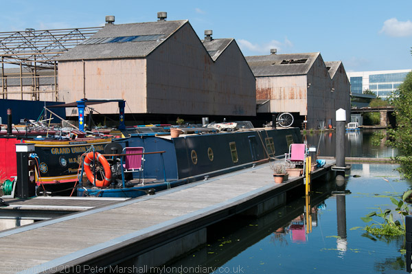
But the canal and the locks are still there, along with the small docks and some of the boat repair businesses. Little is visible from the High Street except where it goes over the canal, but despite extensive redevelopment in the 1990s – and more going on now – it remains an interesting area to walk around.
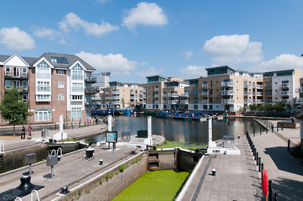
I’d photographed a little in the area back before much redevelopment took place, and more extensively in the 1990s. On line you can see some pictures from 2003 when some of the more recent development was starting. And I’ve returned a few times since this walk in 2010 and you can find more pictures if you search on My London Diary.
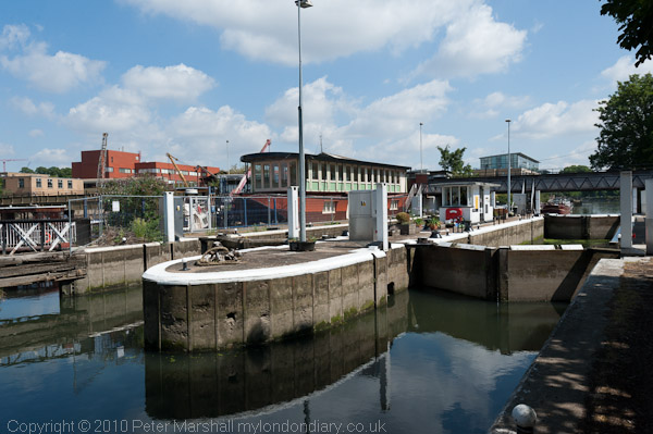
As I noted in 2010, “Much of the walk that I took is now a part of the Thames Path, though it isn’t always well signposted, and some of the more interesting parts are a short detour away.”
More pictures from my short walk around Brentford on My London Diary.
Flickr – Facebook – My London Diary – Hull Photos – Lea Valley – Paris
London’s Industrial Heritage – London Photos
All photographs on this page are copyright © Peter Marshall.
Contact me to buy prints or licence to reproduce.
