Clock House to Olympic Site – 2005

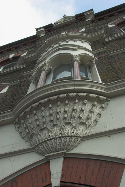
Clock House to Olympic Site: Thursday October 27 2005 was a fine late autumn day and I decided to go for a bike ride, putting my folding bike on a couple of trains to my start point, Clock House station. This is in south east London, halfway between Penge and Beckenham and just inside the London Borough of Bromley.

Big Party, Clockhouse

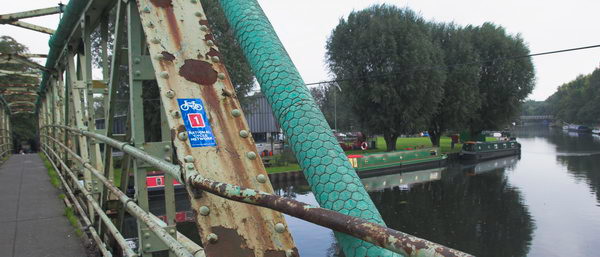
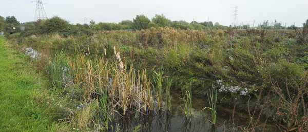
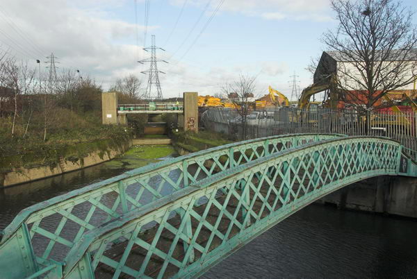
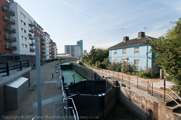
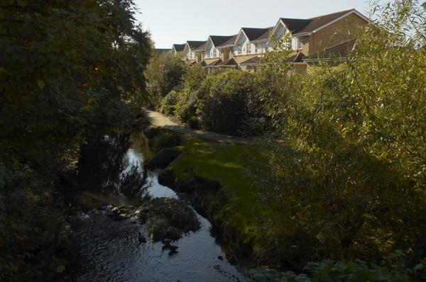
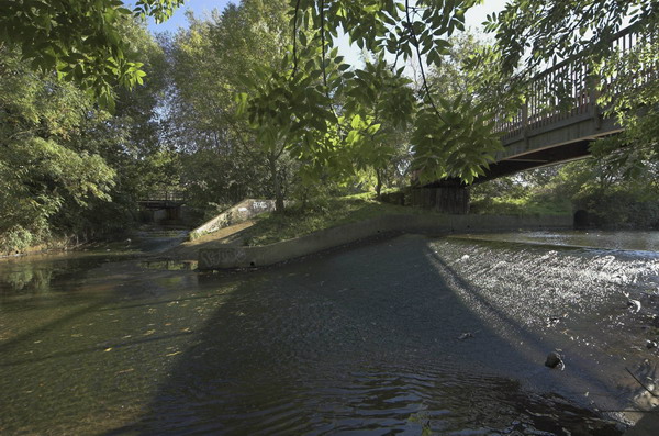
The Chaffinch Brook runs close by and joins with the River Beck to form the River Pool (aka Pool River) a mile or so north and a footpath going north from there is now part of a national cycle route. Parts of the Pool River which were once culverted have now been restored to an open stream, which will help prevent flooding downstream. The river’s main claim to fame is that four years after my ride then London Mayor Boris Johnson fell into it on an official visit to encourage volunteers who were cleaning the river up.

Big Pipes, New Beckenham

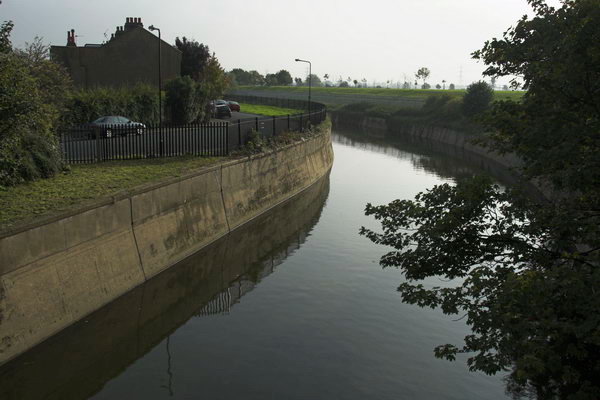
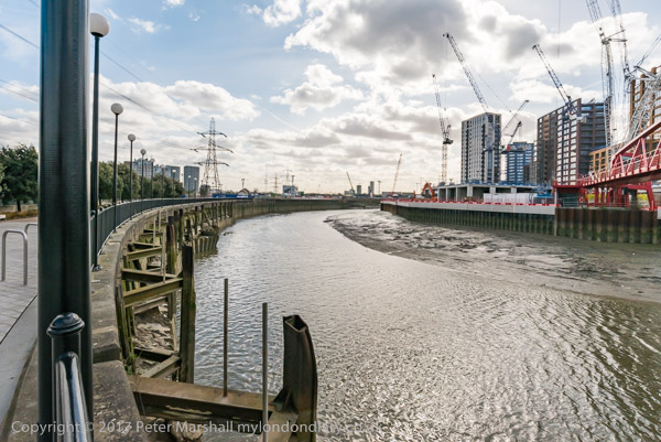
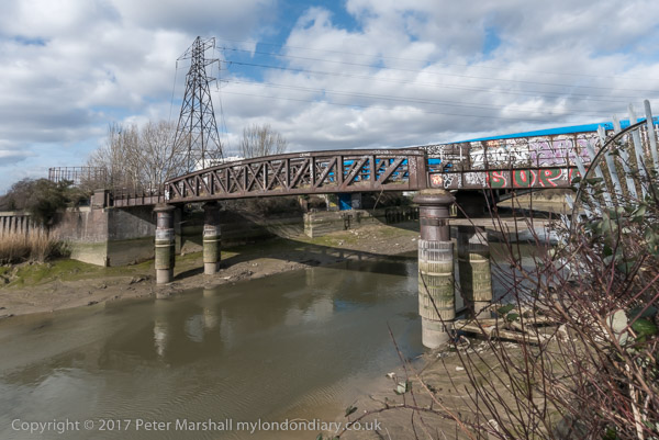
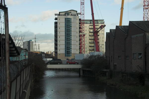
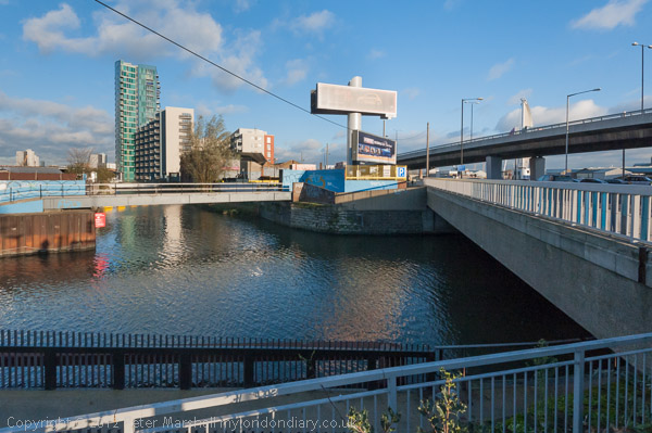
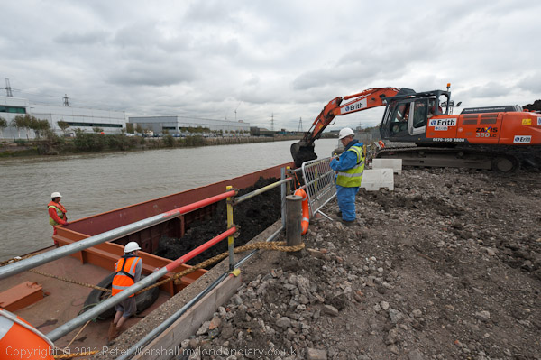
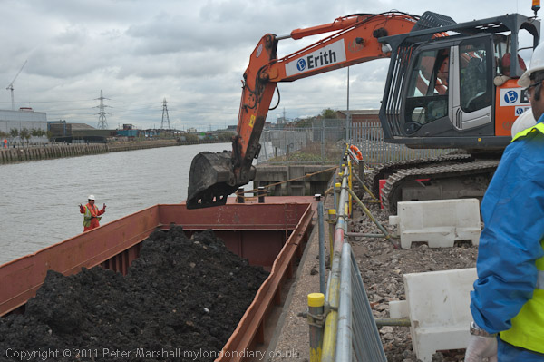
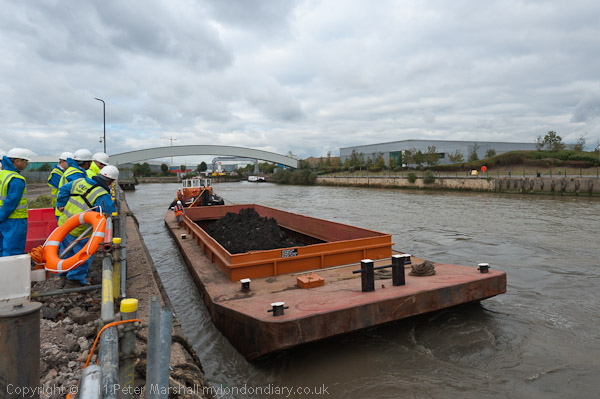
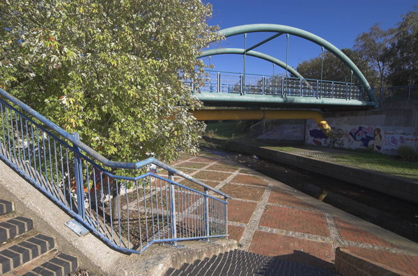
The Pool River is a tributary of the River Ravensborne and I had planned to continue along this as closely as I could to Deptford Creek where it joins the Thames. But I ran out of time, so took the Docklands Light Railway at Lewisham rather than Greenwich to cross the river to Canning Town.

Lower Sydenham

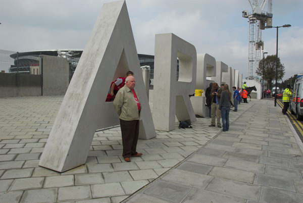
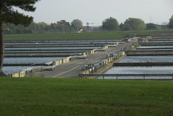
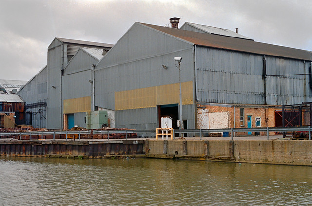
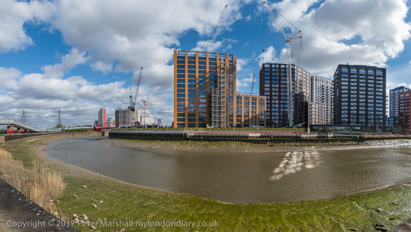
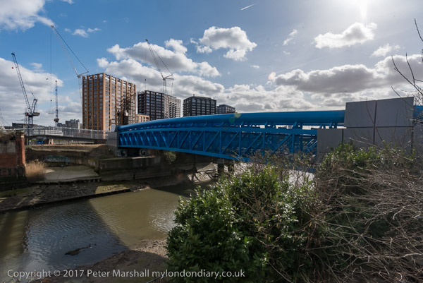
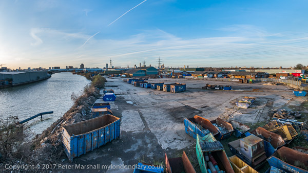
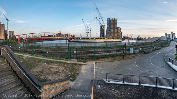
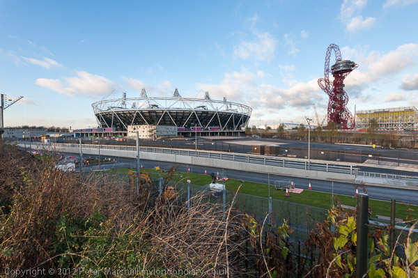
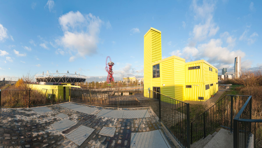
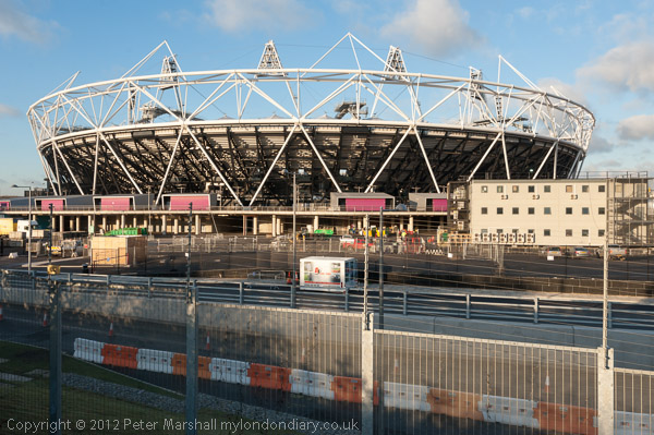
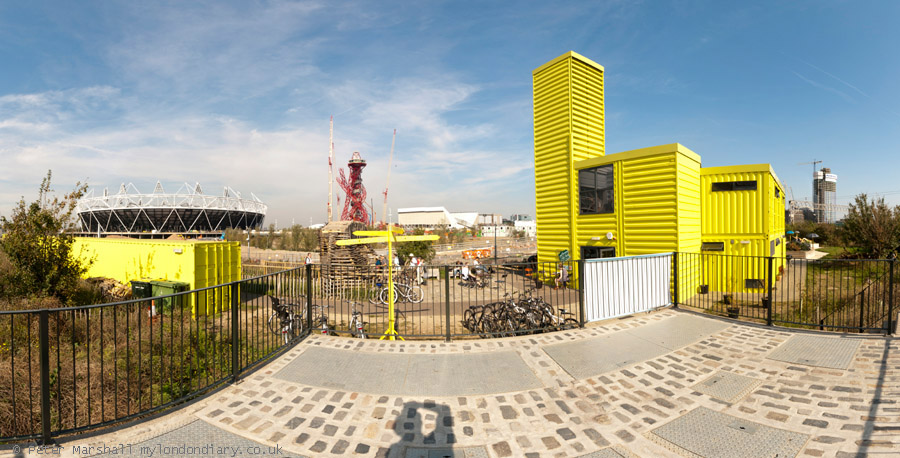
My ride then continued with a loop around Bow Creek and over the Lower Lea Crossing back through Canning Town and on to Stratford Marsh where work was then just beginning to turn this whole area into the Olympic site.

Bell Green

It wasn’t a long ride – probably around ten miles in all, perhaps a little longer with all the small diversions I took. All the pictures here were taken on this ride and there are more on My London Diary, along with the account below that I wrote back in 2005. As usual I’ve made a few small corrections.


Pool River and Ravensbourne (left) join

The Brompton folding bike is really an ideal form of transport for London, an essential tool for the urban photographer. It’s short wheelbase is great in slow-moving crowded traffic, and it can be folded in 15s to travel by tube, rail, taxi or even bus. [I’ve never put mine in a taxi.] The only problem is that they are highly prized by cycle thieves. [They are fairly expensive and slip easily into a car boot.]

Bridges over Bow Creek, River Lea, Canning Town, London

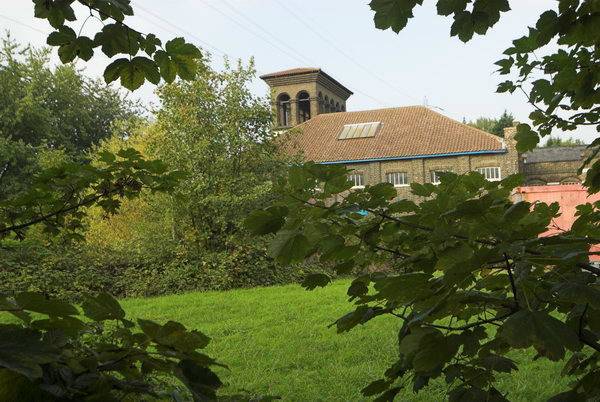
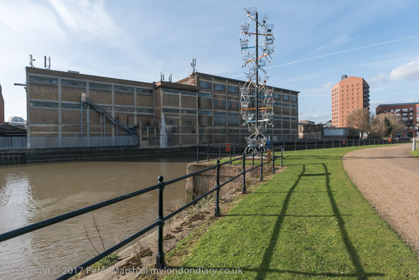
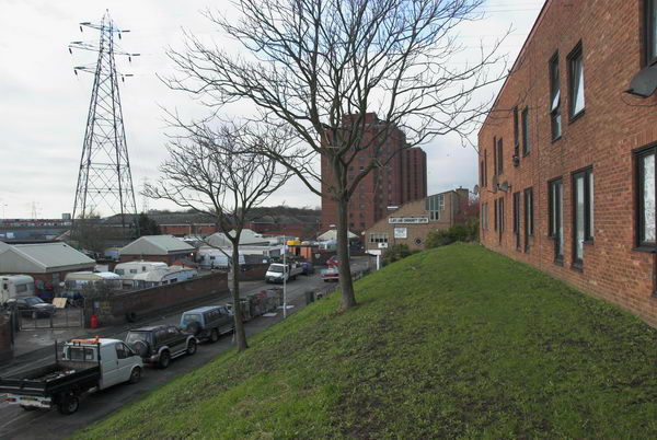
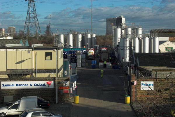
The weather forecast was for a fine summery day, so I took the opportunity to check up on a few things and fill in some little gaps, where I’d not quite managed to photograph things before. First I wanted to go along the footpath at Bell Green, next to Sainsbury’s, so I decided to make a slightly longer trip of it by starting at Clock House Station. There is a good, almost traffic-free route north from there along the Pool River, then the River Ravensbourne, at times surprisingly rural.

DLR viaduct over Bow Creek

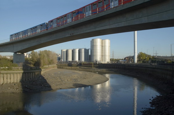
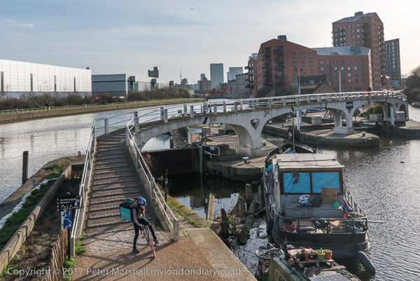
Taking photographs slows you down, as does stopping to sit in the sun and eat sandwiches, so at Lewisham I decided to get on the DLR with the bike to travel to Canning Town.

DLR extension, Millenium Dome and Canary Wharf from Silvertown Way.

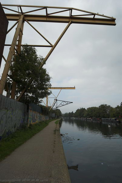
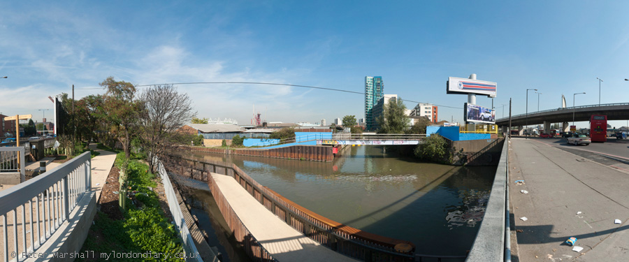
Perhaps one day the riverside walkway by Bow Creek from the station will open [it did, but only to go across a new bridge to City Island – the route south still comes to a dead end], but it seems unlikely to be in our lifetime. I went round the creek, over the Lower Lea Crossing and on to Silvertown Way to see how the new stretch of DLR was progressing. [It opened north of the river at the end of 2005.]

Car sales, Stratford Marsh

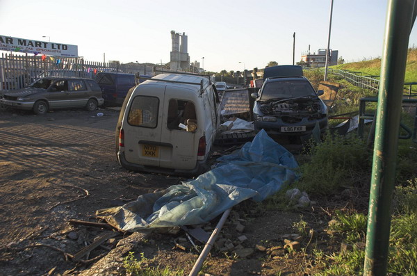
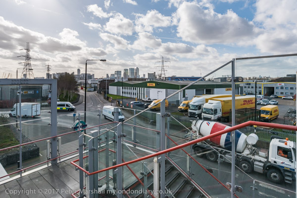
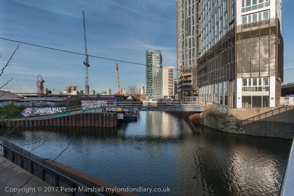
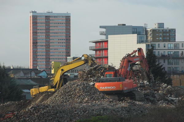
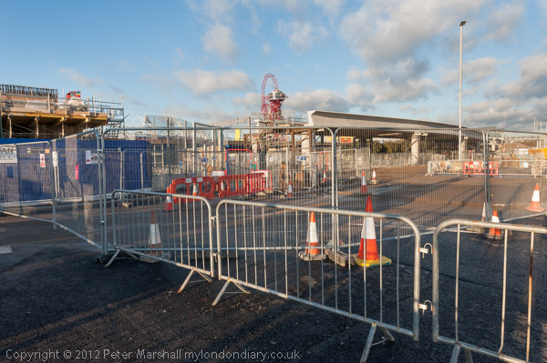
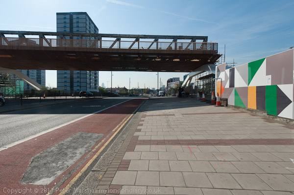
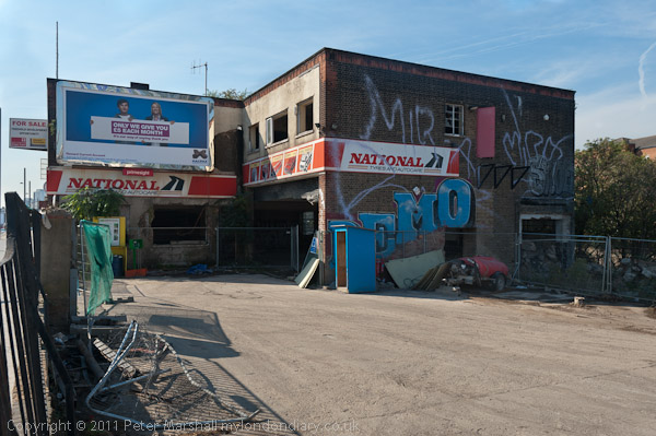
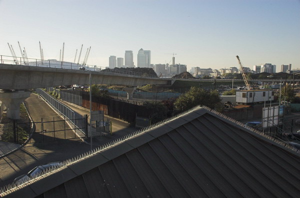
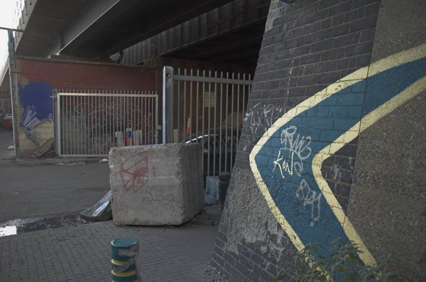
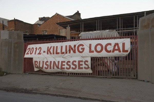
Then I cycled up to Stratford to take a look at Stratford Marsh again before work starts in earnest to demolish the existing businesses and create the Olympic waste. It was getting later and noticeably darker by the time I was there, although the day felt like summer, it gets dark rather earlier at the end of October.

The Greenway goes under the railway line on Stratford Marsh.

What really makes no sense at all is to put our clocks back to make it even darker still, as we were going to do in a couple of days time. If I were in charge, we’d move to the same time as France and the rest of our neighbours across the channel. I don’t like dark mornings, but it would be much better than having it get dark in the middle of the afternoon in winter. Orcadians or even Scots would be welcome to have their own time zone if they really must, but its about time they stopped imposing it on the rest of us. The sun set around 5.30, and next week that means it will be 4.30pm.

Twilight for Stratford Marsh

More pictures start here on My London Diary.


FlickrFacebookMy London DiaryHull PhotosLea ValleyParis
London’s Industrial HeritageLondon Photos

All photographs on this page are copyright © Peter Marshall.
Contact me to buy prints or licence to reproduce.


Land Mines and the Lea Valley – 2006

Land Mines and the Lea Valley: Fortunately these were two entirely separate events on October 14th 2006. The landmines were in Hyde Park in a display by Handicap International and after visiting this I took a walk across the Lea Valley from Holloway to Tottenham and Walthamstow where I was going to collect a set of my pictures which had been on show at Walthamstow Pumphouse Museum. Here is a slightly edited version of what I wrote in 2006 with a few of the pictures from the day – and a link to many more from the walk on My London Diary


Ban Landmines and Cluster Bombs

Handicap International, Hyde Park

Land Mines and the Lea Valley - 2006

Saturday in Hyde Park there were land mines. Fortunately they were mainly carefully marked as well as having been made harmless. For many people around the world they are daily hazard, the deadly and maiming residues of war.

Just as dangerous, if not more so, are cluster bombs. These are produced by the sophisticated weapons industries of many countries including Britain and America, and also used by our armies and air forces, dropped from aircraft or fired as artillery.

Land Mines and the Lea Valley - 2006

Each cluster bomb contains from a dozen to several hundred lethal bomblets, which are distributed over a wide area, intended to kill infantry or guerillas, but entirely indiscriminate in their action. Between 5-30% fail to explode on impact, usually getting buried in soil; those dropped over 30 years ago in Vietnam are still killing and maiming people, especially children, there. Almost 2,000,000 were scattered over Iraq in 2003-4.

Land Mines and the Lea Valley - 2006

I went to Hyde Park to sign the petition organised by Nobel peace prize-winning charity Handicap International to aim for a world-wide ban on these weapons.

Handicap International now has urgent appeals for Gaza, Ukraine and Sudan and invites you to join them in campaigning to “Fully implement the treaties banning landmines and cluster munitions without delay and encourage non-signatory states to sign their petition.”


Tottenham to Walthamstow

Land Mines and the Lea Valley - 2006
This stadium entrance had potential, but I couldn’t get myself into the right mood

After my brief visit to Hyde Park, I was on my way to Walthamstow to collect some of my pictures of the Lea Valley that had been on show at the Pump House Museum, and as it was a nice day, decided to walk the last few miles across the Lea Valley and take a few more pictures.

Land Mines and the Lea Valley - 2006
South Tottenham

I began my walk in Holloway, going post the Emirates Stadium and then across South Tottenham.

In King George V Park I found some graffiti artists at work, and took pictures of a few of the many murals, before heading down the Lea Navigation to Springfield and across to Walthamstow Marshes, a surprising area of open space so near to the centre of a major city.

Then I made my way between reservoir and waterworks to the Lea Flood Relief Channel and St James’s Park, surrounded with remarkably brooding lime trees.

There are many more pictures from the walk on My London Diary, but surprisingly I don’t appear to have taken a picture of the Walthamstow Pumphouse Museum on this occasion. I think I had stopped to take so many pictures on the way that I was in rather a hurry to collect my pictures which had been on show for Open Heritage Day there and get home.

More pictures from the walk on My London Diary


FlickrFacebookMy London DiaryHull PhotosLea ValleyParis
London’s Industrial HeritageLondon Photos

All photographs on this page are copyright © Peter Marshall.
Contact me to buy prints or licence to reproduce.


More Colour from 1994 in Enfield

More Colour from 1994 in Enfield: In More Ponders End, Enfield Wash, Palmers Green & Brimsdown 1994 I posted a set of pictures made in the first three months of the year. This post includes some more taken in March 1994 mainly along by the Lea Navigation in the London Borough of Enfield and ends with a couple taken in April or May.

My archives from back then are a little disorganised but I’ll try hard not to post any that I’ve previously posted, although a one here is from a site where I’ve previously posted a panoramic images.

Factory, Lea Navigation, Brimsdown, Enfield, 1994, 94-03-2-45

The Lea Valley was an important industrial area of London well into the 20th century and had been the source of some key inventions, including the start of the electronics industry. Some of the factories were along the river, perhaps originally on sites that had made use of its wharves, but now all reliant on road transport, with all of Brimsdown between the railway and the canal being huge industrial estates off Mollinson Avenue.

Factory, Lea Navigation, Brimsdown, Enfield, 1994, 94-03-2-21

Here the separation of industry from the canal was emphasized with a concrete fence, now rather decaying at the edge of the bank and tell fence topped with barbed wire at an angle to keep intruders from the canal out of the site.

I don’t remember exactly where at Brimsdown this factory was, but like the rest of the industry here it will since have been demolished, replaced by large distribution sheds, some set well back from the water and almost hidden by trees and bushes growing unfettered along the water’s edge.

Hairdressers, Brimsdown, Enfield, 1994, 94-03-2-42

There are houses and a few shops at Brimsdown on the other side of the railway line in what is perhaps part of Enfield Wash, which then included this hairdressers. The Sun’s March 1994 topless ‘Page 3 girl‘ in the calendar (also part reflected in the mirror at right) confirms the date of the picture.

Columbia Wharf, Ponders End, Enfield, 1994, 94-03-2-24

In a previous article I posted a panoramic view of Columbia Wharf looking down from the Lee Valley Road. Here from a little further East on that road with the navigation in the foreground you see the wharf and background the Ponders End Flour Mills, the gas holder and four tower blocks in Ponders End.

Much redevelopment has gone on in Ponders End and only one to those towers remains and there is no gas holder. But the shed at the wharf is still there and in use although Abbey Stainless Components Ltd are no longer there, nor is that large crane and the van boasting ‘NORTH LONDON’S CARRIER PIGEONS IN TRANSIT has long flown the coop.

Ponders End, Enfield, 1994, 94-05-1-53

A more pastoral panorama of Ponders End with Wright’s Flour Mills and the four towers in the background.

Hair Fashion, Ponders End, Enfield, 1994, 94-05-1-21

Lady Jayne remains a well known brand in the Ladies hair trade. I think this shop was probably in the High Street, much of which has now been redeveloped.

Tyre & Exhaust Centre, Ponders End, Enfield, 1994, 94-05-1-24
Tyre & Exhaust Centre, Ponders End, Enfield

Tyre Services Tyre & Exhaust Centre at 151 High Street on the corner with Stonehorse Road, a short ‘No Through Road’ off the High Street. This building was still there in 2022 but had became HiQ and then National Tyres and Autocare – a Halfords company and was by then permanently closed. I expect its days were numbered. Much of the area of the High Street around it was redeveloped around ten years ago.

More colour pictures from 1994 to follow in later posts.


FlickrFacebookMy London DiaryHull PhotosLea ValleyParis
London’s Industrial HeritageLondon Photos

All photographs on this page are copyright © Peter Marshall.
Contact me to buy prints or licence to reproduce.


Ponders End, Brimsdown, Enfield Wash & Waltham Cross – 1994

In March 1994 I spent some time photographing in the London Borough of Enfield, and going a little beyond its borders into Waltham Cross. Mostly I was taking black and white pictures – some of which you can see on Flickr in the album 1994 London Photos – but I did also take some in colour, including a few colour panormas.

Builders Mate, Builders Merchants, The Arena, Mollison Avenue, Brimsdown, Enfield, 1994,
Builders Mate, Builders Merchants, The Arena, Mollison Avenue, Brimsdown, Enfield, 1994, 94-03-3-53

Mollison Avenue in Brimsdown is a busy road running roughly parallel to and between a railway line and the Lea Navigation with the area between these crammed with industrial and commercial sites. Now much of it is occupied by delivery centres and I think there are rather more fences than in 1994.

This was a picture largely about shapes and as with many olds getting the colours to look natural is a problem – as you can see particulary in the foliage here.

Bridge, Pipe Bridge, Lea Navigation, Brimsdown, Enfield, 1994, 94-03-3-31

The colour is rather better in this image of a large pipe bridge, possibly carrying gas, over the navigation. The view here looks rather rural, but as usual there is a line of tall pilons.

Here I made use of the curvature from the swing-lens camera – as well as the obvious pipe there is a second interlocking curve with the bridge, the grass bank and the towpath.

Columbia Wharf, Ponders End, Enfield, 1994, 94-03-3-23

Columbia Wharf was now a wharf in name only, with lorries now delivering carpets. This is now a part of ‘Ponders End Waterfront’. I think this picture was taken from Wharf Road.

Launderette, Enfield Wash, Enfield, 1994, 94-03-1-63

Enfield Wash is close to Enfield Lock station which I used several times to walk around the area. I have a small suspicion that this launderette may really have been in an area that locals would call Enfield Lock, but I decided given the subject that Enfield Wash was more appropriate.

Launderette, Enfield Wash, Enfield, 1994, 94-03-1-64

I still can’t decide whether I preferred the landscape or portrait version of this launderette interior – taken through the window when it was closed.

Cross, Waltham Cross, Broxbourne,
Shops and Cross, Waltham Cross, Broxbourne, 1994, 94-03-1-61

From Enfield Lock Station a short walk took me to the Lee Navigation towpath which is also the Lea Valley Walk and a couple of kilometres north uder the M25 I was out of Greater London and in Waltham Cross. At right is the Eleanor Cross, one of twelve built to the orders of King Edward I to mark the overnight resting places of his wife Eleanor of Castile who died near Lincoln in 1290 as her body was en route to Westminster Abbey.

Much restored it now sits in the pedestrianised shopping centre, one of only 3 surviving Eleanor Crosses. The one in front of Charing Cross Station is a Victorian 1865 recreation.

More from Enfield in a later post.


FlickrFacebookMy London DiaryHull PhotosLea ValleyParis
London’s Industrial HeritageLondon Photos

All photographs on this page are copyright © Peter Marshall.
Contact me to buy prints or licence to reproduce.


Limehouse Basin and Limehouse Cut – 1990

Limehouse Basin and Limehouse Cut: More pictures from my walk around Limehouse on on 6th January 1990. The previous post from this walk is Ratcliff Highway and Limehouse Basin – 1990.

Former Limehouse Cut, Northey St, Narrow St, Limehouse, Tower Hamlets, 1990, 90-1a-24
Former Limehouse Cut, Northey St, Narrow St, Limehouse, Tower Hamlets, 1990

The Limehouse Cut is London’s oldest canal, opened in 1770 to provide an easier route from the Lea Navigation, an important river for transporting grain into London from the agricultural areas to north in Hertfordshire. Used from the Bronze age and later by Viking raiders, alterations had been made to improve navigation on the River Lee since at least 1190 and was later followed by various Acts of Parliament. The first river lock in England was built on it at Waltham Abbey in 1577, but it was only the the River Lee Navigation Act 1767 that really began its modernisation.

Former Limehouse Cut, Northey St, Narrow St, Limehouse, Tower Hamlets, 1990, 90-1a-41

Part of the work made under the 1767 Act when the navigation was surveyed John Smeaton was the suggestion to dig of the Limehouse Cut, allowing boats to avoid the treacherous and winding tidal lower reaches of Bow Creek on their way to the River Thames. The actual surveyor when the work began was his assistant Thomas Yeoman. It was a considerable short cut as it emerged into the river to the west of the long haul around the Isle of Dogs.

The original canal was narrow and had to be later widened and improved and it was only in the Victorian era that it was finally in something like its final state. The canal until 1968 entered directly into the Thames though Limehouse Lock in front of the row of small houses in these pictures, but it also had a basin, Limehouse Basin, at its southern end.

Limehouse Dock, Limehouse, Tower Hamlets, 1990, 90-1a-45
Limehouse Basin, Limehouse, Tower Hamlets, 1990, 90-1a-45

The first Limehouse Basin was at first simply a basin at the end of the Limehouse Cut, dug out by 1795. It had an island in it and on its bank was a a sawmill driven by a windmill, built a little earlier when sawmills were still widely thought to be illegal in England. It was attacked and the machinery destroyed by rioters – including hand-sawyers – in 1768. Restored the following year it closed around 35 years later. A lead mill opened on the island soon after and the company only ceased to exist in 1982. Victory Place is built on the site of this original Basin, and the old streets Island Row and Mill Place to its north are still there.

The Limehouse Cut was in 1854 linked to the Limehouse Basin of the Regent’s Canal which had opened in 1820 as the Limehouse Lock needed to be repaired. But this link was opposed by the boatmen from the Lee and Stort who fought a legal battle and in 1864 it was filled in and the site built on. It was not until over a hundred years later in 1968 that a new link – only 200 metres long – was made and Limehouse Lock finally closed.

Limehouse Cut, Limehouse, Tower Hamlets, 1990, 90-1a-32

The Limehouse Cut runs on a straight route through Poplar but curves around at its sourthern end. It was blocked here in 1990, probably in connection with the buildilng of the Limehouse Link tunnel between 1989 and 1993. But there was also work on the Cut around then, with the vertical guillotine gate on the north side of Britannia Bridge across the Commercial Road being removed.

Northey St, Limehouse, Tower Hamlets, 1990, 90-1a-32
Limehouse Cut, Limehouse, Tower Hamlets, 1990, 90-1a-32

Northey Street still has a bridge over the remains of the old route of the Limehouse Cut to Limehouse Lock, but all of the buildings including wharves and works on the banks of the Cut have now been replaced by modern development. The tower blocks beyond are on Oak Lane, and I think in the distance are cranes working on developments on the Isle of Dogs around Canary Wharf.

Northey St, Limehouse, Tower Hamlets, 1990, 90-1a-36

Another view of buildings on Northey Street in the 1990s.

Still more from Limehouse to come in later posts.


FlickrFacebookMy London DiaryHull PhotosLea ValleyParis
London’s Industrial HeritageLondon Photos

All photographs on this page are copyright © Peter Marshall.
Contact me to buy prints or licence to reproduce.


Canning Town, Cody Dock and Stratford – 2017

Canning Town, Cody Dock and Stratford: On Thursday 2nd March 2017 I made a rather convoluted walk along Bow Creek and the Lea Navigation, arranged around a meeting I had at Cody Dock. You couldn’t then – and can’t quite yet walk beside the river the whole way, but to get to the meeting I had to abandon a small part of the first stretch and catch the DLR, walking on from the meeting to Stratford High Street where I caught the DLR again to go back and complete the short part I’d had to miss out earlier.

Bow Creek & Canning Town

Canning Town, Cody Dock and Stratford - 2017

In this section of My London Diary I included pictures taken both at the start and at the end of my walk, which began at Canning Town Station.

Canning Town, Cody Dock and Stratford - 2017

The riverside walkway at Canning Town is open after many years and can take you to the bridge to London City Island.

Canning Town, Cody Dock and Stratford - 2017

People were living in some of the blocks on the “Island” but there was still a lot of work continuing in this area which Bow Creek loops around on three sides. Another bridge was built across the DLR tracks to allow people from South Bromley in Tower Hamlets a pedestrian route to the riverside path and Canning Town station. Open for a short time it closed well before the station entrance became open, and a gate on it was firmly locked when I tried to cross it.

Canning Town, Cody Dock and Stratford - 2017

This meant I had to make a lengthy detour walking around the Ecology park to get to the Blue Bridge which took me to the East India Dock Road.

Canning Town, Cody Dock and Stratford - 2017

This meant I had to hurry back to Canning Town Station to get the DLR to Star Lane for my meeting at Cody Dock and couldn’t then walk along the north side of the road to take more pictures.

Cody Dock

I made a few pictures on my walk from Star Lane to Cody Dock, and then rather more after my meeting, at first in the dock itself,

and then on the riverside path, thankfully renamed from ‘Fatwalk’ to ‘Leawalk’ and a part of ‘The Line’ sculpture trail.

Leawalk to Bow Locks

I paused briefly to photograph a sculpture made from shopping trolleys in a mock DNA double helix.

My next stop was to photograph the The Imperial Gas Light and Coke Co’s 1872-8 Bromley-by-Bow gasholders and the war memorials – originally at Beckton – with an eternal flame next to a monument to company workers killed in both World Wars.

Steps leading down from Twelvetrees Bridge at Bow Locks took me down to the towpath beside the Lea Navigation.

Bow Locks

Three Mills & Stratford

Three Mills is a tide mill dating from 1776 (though on the site of earlier tide mills mentioned in the Domesday Book) on the Three Mills Wall River. It is the largest tide mill in the UK and the largest surviving in Europe.

Another sculpture on The Line, unveiled on the centenary on Three Mills Green and moved to this position on Short Wall is by Alec Peever and commemorates three men who died in 1901 They died going to the aid of a fourth who had been overcome by the lack of oxygen at the bottom of a well they were investigating.

I walked on to Stratford High Street, turning west to go to Bow Bridge and the Lea Navigation before going back beside St Thomas’s Creek and along Stratford High Street to the DLR Stratford High Street Station for the train to Canning Town.

More from Bow Creek

It was beginning to get a little dark as I came out from the station to photograph from the north side of East India Dock Rd.

This was still an industrial area although a large area seemed now to be unused. I thought it would probably not be long before this area too was covered in flats as I walked back to the station.

You can see many more pictures and read more about the walk in my four posts on My London Diary:
Three Mills & Stratford
Leawalk to Bow Locks
Cody Dock
Bow Creek Canning Town


FlickrFacebookMy London DiaryHull PhotosLea ValleyParis
London’s Industrial HeritageLondon Photos

All photographs on this page are copyright © Peter Marshall.
Contact me to buy prints or licence to reproduce.


Around the Olympic Site – January 2007

Around the Olympic Site: Thursday 4th January, 2007 looked like being a pleasant enough day for a bike ride around the area where preparations were getting into full swing for the London 2012 Olympics to see how things were going in the area. So I wrapped up warm and put my folding bike on the train to make my way to Stratford.

Around the Olympic Site
Clays Lane travellers site, Park Village and Clays Lane estate

Most of the central area of the site was already closed off to the public, but I was able to cycle to various parts of the perimeter and take photographs, though I was disappointed to find large areas where nothing was yet taking place already fenced off. From Stratford I went around in an anti-clockwise direction and on My London Diary you can read a fairly long piece about where I went and my opinions about what was happening.

Around the Olympic Site
Eastway Cycle Circuit now fenced off

It was becoming more and more clear that many of those who lived and worked in and around the area were being very shabbily treated, with nothing being allowed to stand in the way of the Olympic juggernaut. People were being lied to, promises being made and then abandoned.

Around the Olympic Site
Bully Fen Wood is Community Woodland no more

Probably the worst case of this was with the 430 residents of the Clays Lane Housing Co-Operative who were first promised they would be rehoused in conditions “as good as, if not better than” their present estate but were later told “at least as good as in so far as is reasonably practicable.”

Around the Olympic Site
Everything on Waterden Road was later demolished

The tenants there had already suffered from their cooperative estate with its strong community being transferred against their wishes to Peabody Housing following an adverse Housing Corporation inquiry, losing their mutual status. After their eviction under the Olympic Compulsory Purchase Order (CPO) they were dispersed and many found they were having to pay much higher rents and living in worse conditions in places that lacked any of the feeling of community of Clays Lane.

Carpenters Lock and part of the closed area

I’d hoped to visit the Eastway Cycle Circuit and the Bully Fen nature Reserve, but both were fenced off, as were some of the footpaths I had hoped to cycle down, resulting in some fairly lengthy detours. Some of the closures claimed to be “temporary” – but some were still closed ten years later.

Samuel Banner, inventor of white spirit, founded the company in 1860. It relocated to Teeside

I commented “Parliament smooths the way for the Olympic Delivery Authority at the expense of people and environment, enabling them to slough off the inconvenience of democracy and justice. The situation for some of the local people – particularly those living in Clays Lane – can only be described as Kafkaesque.”

Huge areas were being flattened

I rode down Marshgate Lane and went onto the Greenway and then returned and went on to Hackney Wick, pausing to eat my sandwich lunch in a sheltered suntrap by the lock on the Hertford Union Canal before riding on the Greenway, turning back where this was blocked and coming back to the Lea Navigation towpath and on to Stratford High Street.

Bridge over Pudding Mill River to Marshgate Lane, Stratford Marsh.

From here I was able to go along a short length of footpath next to the Waterworks River before returning to the Greenway on the other side of the High Street, past some more areas covered by the CPO.

Bow Back River. Both sides in the foreground are part of the CPO area

By now the light was beginning to fade, but I rode on to Canning Town and took a brief look (and some rather dark pictures) of the Pura foods site then being demolished before riding over the Lower Lea Crossing to the station for the Jubilee Line back to Waterloo.

Parts of Pura Food had yet to be demolished.

Many more pictures begin a short scroll down the January 2007 page of My London Diary.


FlickrFacebookMy London DiaryHull PhotosLea ValleyParis
London’s Industrial HeritageLondon Photos

All photographs on this page are copyright © Peter Marshall.
Contact me to buy prints or licence to reproduce.


Olympic Site & Budget Cuts – 2012

Olympic Site & Budget Cuts: Wednesday 5th December 2012 was a cold day in London, with the temperature just three or four degrees above freezing during the day, but there was plenty of blue sky with a few clouds and it seemed ideal weather to wrap up and go and see what progress had been made in restoring the Olympic site, still largely off-limits some months after the end of the games. And later in the early evening I returned to Westminster for a protest against the cuts which had been announced by Chancellor of the Exchequer George Osborne in his autumn budget statement.


Olympic Area Slightly Open – Stratford Marsh

Olympic Site & Budget Cuts - 2012

Much of the area around the Olympic site had been closed to the public in May, including the Greenway, the elevated footpath on top of the Northern Outfall Sewer which runs close to the Olympic stadium, but this was now re-opened in part.

Olympic Site & Budget Cuts - 2012

The section between Stratford High Street and the main railway lines which run from Liverpool Street station to Stratford and on further east was however still closed and would remain closed for years as work was now taking place for Crossrail – opened as the Elizabeth Line in 2022.

Olympic Site & Budget Cuts - 2012

I started my walk in the early afternoon around the Bow flyover where the Bow Back rivers were still closed to traffic with a yellow floating barrier, but the footpath along the Lea Navigation had been re-opened. One improvement made presumably for the Olympics was a pathway and footbridge taking walkers under the busy road junction and across the canal.

Olympic Site & Budget Cuts - 2012

Finding the new entrance to the Greenway meant walking between fences on the Crossrail site down Pudding Mill Lane, and probably I would have abandoned the route had it not been for signs put up by the View Tube café – though when I finally reached this I found I was the only person to have done so and the cafe was deserted.

Olympic Site & Budget Cuts - 2012

There were still fences everywhere as you can see from my photographs but I was able to walk along the Greenway to Hackney Wick and then along the towpath beside the navigation. But the footpath beside the Old River Lea was still blocked off.

By then the light was beginning to fade and the Olympic stadium was gaining a golden glow. I walked a little further along the towpath and photographed the Eton boathouse as the sun was setting setting before crossing the canal and making my way to Hackney Wick station.

Many more pictures, both normal and panoramic views on My London Diary:
Olympic Area Slightly Open.


Osborne’s Budget Cuts – Strand to Whitehall

Several hundred students, trade unionists, socialists and others marched with UCU London Region down the Strand and into Whitehall shouting slogans against public service cuts, the rich, David Cameron and George Osborne in particular.

Opposite Downing Street they joined with others already protesting there including CND and Stop the War who were calling for the government to stop wasting money on the war in Afghanistan and vanity projects supporting the arms industry such as Trident and its planned replacement.

The Afghanistan war — which everyone knows is futile and lost — is costing around £6 billion a year. The yearly maintenance costs for Trident are £2.2 billion a year. The cost of renewing the Trident system — which this government is committed to do — would cost up to £130 billion. Two aircraft carriers are being built at a cost of £7 billion. Then there’s the £15 billion to be spent buying 150 F-35 jets from the US, each of which will cost £85 million plus an extra £16 million for the engine.”

The rally began shortly after the marchers arrived. By now it was only just above freezing and speakers were asked to keep their contributions short because of the temperature.

Among the speakers were John McDonnell MP, Kate Hudson of CND, author Owen Jones, Andy Greene of DPAC, Green Party leader Natalie Bennett and others including a nurse from Lewisham Hospital threatened with closures, from the NUT, UK Uncut and other trade unionists.

Kate Hudson CND and Romaine Phoenix Coalition of Resistance/Green Party

Many of the speakers called on trade unions to take effective action against the cuts. calling for union leaders to stop simply speaking against them and take the lead from their members and start organising strike action. But of course few did and the cuts continued unabated.

More at Osborne’s Budget Cuts.


FlickrFacebookMy London DiaryHull PhotosLea ValleyParis
London’s Industrial HeritageLondon Photos

All photographs on this page are copyright © Peter Marshall.
Contact me to buy prints or licence to reproduce.


Barging on Bow Creek – 2011

Barging on Bow Creek: On Wednesday 12 October 2011 I was pleased to get paid to go back to Bow Creek and take photographs of a working barge on Bow Creek in Poplar.

Barging on Bow Creek - 2011

Bow Creek is the lower part of the River Lea, between Bow Locks and the River Thames. Bow Locks mark the southern end of the Lea Navigation and since London’s oldest canal, the Limehouse Cut opened in 1770, most canal traffic took advantage of this to take a more direct route to the Thames and avoid the dangerous and meandering tidal Bow Creek.

Barging on Bow Creek - 2011

The River Lea remains tidal some miles above Bow Lock, but this tidal section is separate from the navigation, although there are various channels and locks such as City Mill Lock and Carpenters Lock on the Olympic site which link the two.

Barging on Bow Creek - 2011

Bow Creek continued to be used for navigation, including for bring coal to West Ham Power Station and the huge Imperial Gas Light & Coke Company gas works at Bromley-by-Bow.

Barging on Bow Creek - 2011

But the gas works closed in 1976 although its gasholders remain – they were still in use for gas storage until 2010. (I went inside the site to photograph them in 2022.) Planning permission has now been granted for 2,200 new homes on the site, retaining the seven gasholders. The gas works dock is now Cody Dock, a creative and community hub with moorings and a short walk from the DLR at Star Lane, hosting many intersting events.

West Ham Power Station ended production in 1983 and was then demolished to build a business park. In the lower sections of Bow Creek there were still a number of timber yards and a ship repair business still using the creek at least in the 1980s, but I think all all commercial traffic has now ended.

Much was made during the construction of the Olympic site of the use of barges to carry waste away from the area, and a new lock was built at great expense on the Prescott Channel at Three Mills Green, but I think barges were only used for PR photographs and the huge majority of waste was taken out by lorries.

So I was pleased to hear that “the people cleaning up the gas works site at Poplar … were using barges to carry out the highly toxic soil from the site* and “… “was delighted to be given a commission to go and photograph the barging.”

This is what a rubbish recycling plant looks like

On My London Diary I write more about my relationship with the River Lea which had begun in 1981 when “I heard a story on the radio that commercial barge traffic was about to come to an end on the Lea Navigation, and decided to travel across London to record its last days.” From then I carried out a major project on the river, but was disappointed to have a funding application turned down.

I returned to the River around ten years later and again in the early 2000s, with more frequent visits after the Olympic bid was successful – although access to the main site was soon impossible. In 2010 I published Before the Olympics, ISBN: 978-1-909363-00-7 with over 200 pictures from the source to the Thames.

The My London Diary post also describes my experience on the visit – how I had to dress up to take the pictures – and that although I’d been promised I would have half an hour to take photographs it actually ended up as 11 minutes.

After taking the pictures – both for the project PR and myself – I had the rest of the day to take a walk along Bow Creek again and made my way to the Thames on the Greenwich meridian, where I found “a new marker installed in the Virginia Quay estate next to West India Docks station, built since I carried out my ‘Meridian Project‘ in the 1990s and made an unsuccessful bid to create a’Meridian Walk’ to mark the new millennium.” Now there is a sculpture trail, The Line, which in part follows Bow Creek – and includes work at Cody Dock.

All pictures in this post are from Wednesday 12 October 2011. There are many more pictures from my walk as well as the barging at Barging on Bow Creek


FlickrFacebookMy London DiaryHull PhotosLea ValleyParis
London’s Industrial HeritageLondon Photos

All photographs on this page are copyright © Peter Marshall.
Contact me to buy prints or licence to reproduce.


Lea Navigation & Olympic Site

Lea Navigation & Olympic Site: Saturday 1 October 2011 was a fine day and I decided to go early to Stratford and take a photographic walk around Bow & Stratford Marsh, before a meeting at the View Tube on the Greenway overlooking the Olympic site.

Lea Navigation & Olympic Site

I took the Jubilee Line to Stratford and then walked over the footbridge leading to the Carpenters Estate and then on to Stratford High Street. A great deal of new building was taking place there, including a new bridge to carry the Olympic crowds across the busy road on a route from West Ham station along the Greenway. The bridge was demolished shortly after the games ended.

Lea Navigation & Olympic Site

This section of the Greenway – the path on top of Bazalgette’s Northern Outfall Sewer rebranded in the 1990s – was closed off by fences and I kept on walking down the High Street. A few yards along was one of the few remaining commercial sites, though by then derelict and for sale. It was demolished and the site flattened for the Games, though it was only five years later than penthouses on the new block here were offered for sale.

Lea Navigation & Olympic Site

A few yards off the High Street was City Mill Lock, now behind a row of flats. I continued on to the Lea Navigation. The industrial sites on the High Street had now been cleared and there were now huge advertising structures.

Lea Navigation & Olympic Site

I had come mainly with the intention of making panoramic images, but these don’t display well on this blog, but you can see them larger on My London Diary. A footway now carries the towpath under the Bow Flyover and the High Street and then across the canal where the towpath continues on the opposite bank.

I made far too many pictures around this part of the canal before I could drag myself away, although the sky was not at its best for panoramic images and I would have prefered more distinct clouds rather than the large areas of blue. Only the first section of Cook’s Road was still open, but I could walk along beside St Thomas’s Creek to Marshgate Lane and then make my way to the bright yellow View Tube.

Here I was one of five photographers taking part in what was billed as a ‘Salon de Refuse Olympique‘, showing our artistic responses to the area. It was interesting to see the very different work that the five of us presented. You can read more about this in a post published here two days after the event in 2011, Northern Outfall Sewer 1990, 2005, 2010… which includes the three pictures I contributed for a forthcoming book as well as a lengthy text based on my presentation.

The Olympics have certainly changed this area, and the changes which were showing back in 2011 have continued. Many more pictures – both panoramic and normal aspect ration – in my post on My London Diary at Lea Navigation & Olympic Site.


FlickrFacebookMy London DiaryHull PhotosLea ValleyParis
London’s Industrial HeritageLondon Photos

All photographs on this page are copyright © Peter Marshall.
Contact me to buy prints or licence to reproduce.