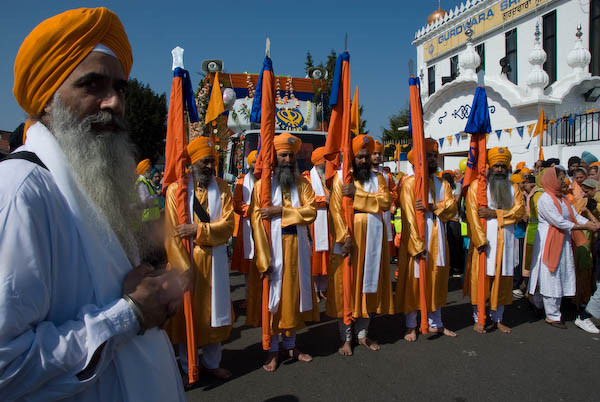
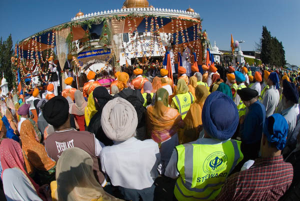
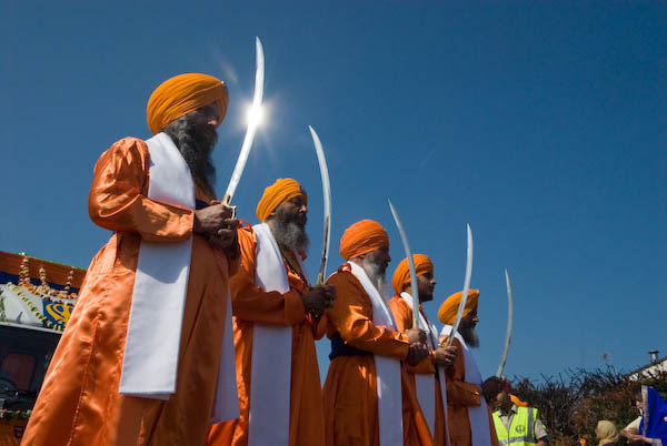
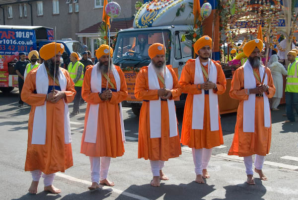
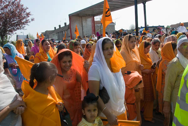
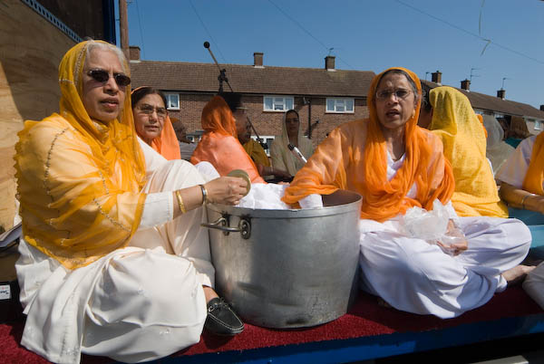
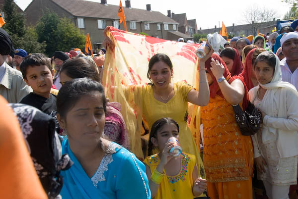
Vaisakhi Procession, Slough: On Sunday 15 April, 2007 I decided at the last minute to rush to Slough, picked up my rumāl and arrived just in time to photograph the Vaisakhi Procession as it left the Gurdwara. Two years later in 2009 I returned and was able to cover it more thoroughly and you can see the results on My London Diary – but in this post I’ll stay with the pictures and text from 2007. As usual I’ve made the text easier to read, correcting the capitalisation and typos etc.
Vaisakhi in Slough
Slough, Berkshire
I’d hoped to relax a bit on Sunday, have a day off from working with a camera, catch up with things. But Linda heard something on the radio about Vaisakhi in Slough, so I looked on the web, found the procession started at 10.30 and jumped on my ancient bike.
By then it was 10.15am, and according to the AA, the 9.5 miles should have taken me 27 minutes by car (and you could probably add a bit for parking etc onto that.)
So 40 minutes wasn’t too bad going, and I arrived just before the procession started to move off, just before 11.00am.
By the time I left two hours later, the procession carrying the Sikh holy scriptures and led as always by Khalsa carrying flags and swords was just around the corner a couple of hundred yards away in Shaggy Calf Lane (though it had taken a rather longer route than me to get there.) And as well as photographing the event and many of those taking part, I’d also had a very enjoyable free lunch.
I made my way home rather more slowly. One of the great advantages of travelling by bike is that you can stop exactly where you like to take photos.
As well as a few buildings in Slough, and what remains of a landmark garage at the west end of the Colnbrook Bypass (now sold and doubtless to be redeveloped) I spent some time in Horton, which in my youth really was a country village, and still retains some of that feeling, before returning to Staines via Wraysbury.
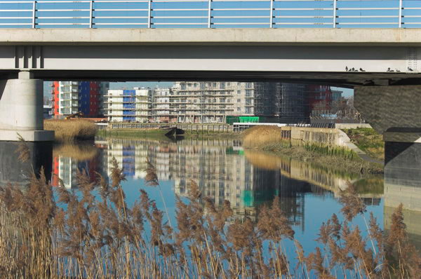
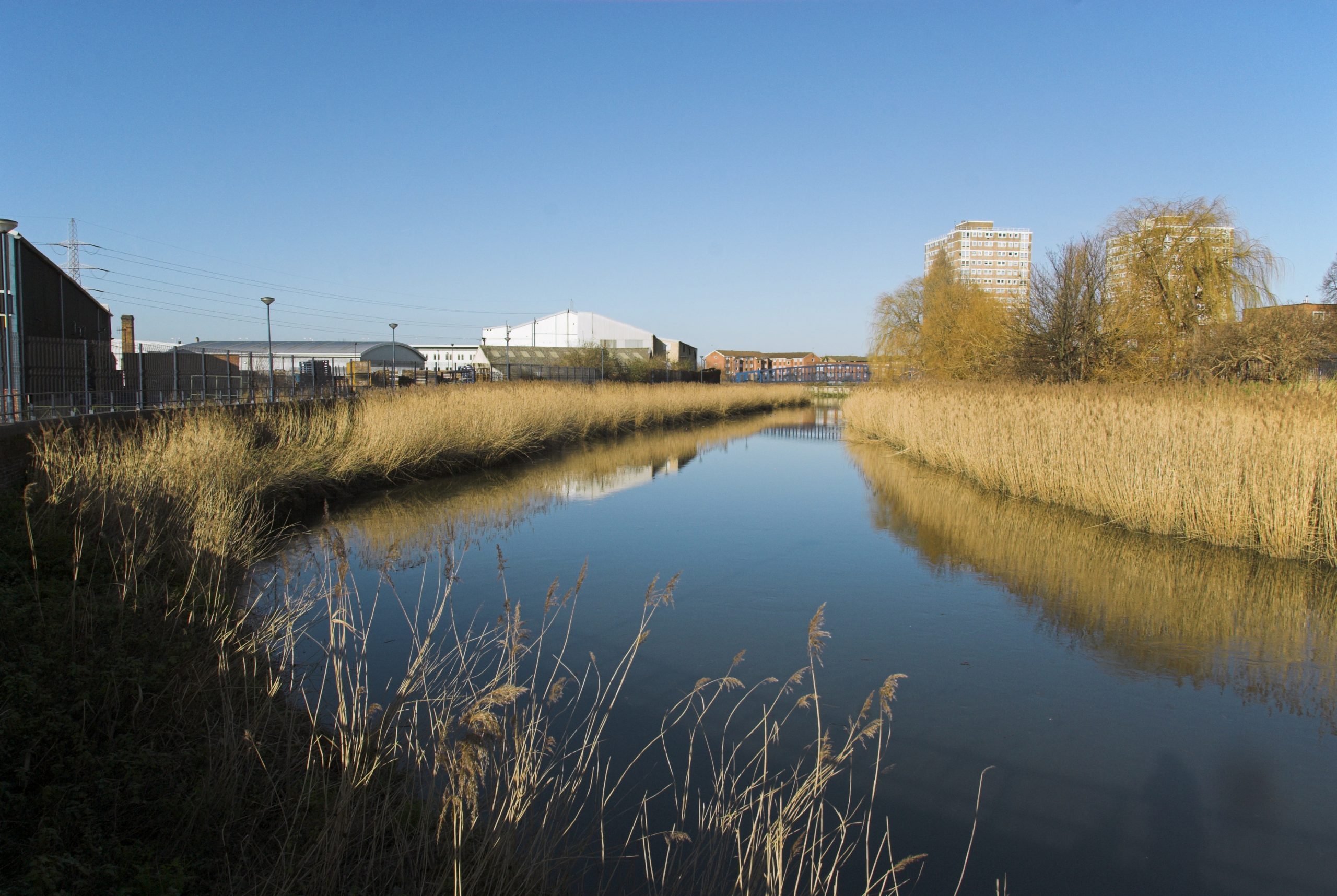
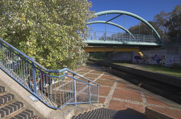
Barking and the River Roding: Another post from what now seems to me a distant past, Saturday 3rd February 2007, when I took my Brompton folding bike across London on three trains to Barking. Easy as it is to ride, I think I would find lugging it up and down all the stairs to change trains and enter and exit stations rather too tiring now, 19 years later. There are some very much lighter titanium models now than my ageing steel bike – but at an eye-watering cost. And as well as the bike my camera gear probably put the total weight I was carrying up to more than 20kg.
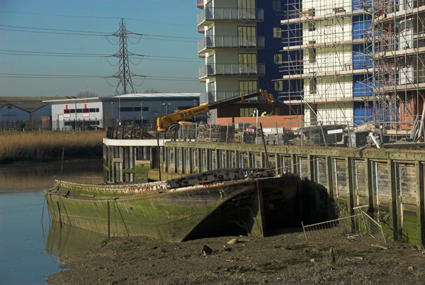
Barking riverside from Hand Trough Creek
So this is a ride I’m unlikely to repeat, though I’ve often thought of doing so – but perhaps on foot. And although I describe this as a ride, much of it was a walk pushing the bike, not a good off-road bike and impossible on muddy paths. Fortunately it was mainly dry in February 2007 though some paths were quite overgrown.
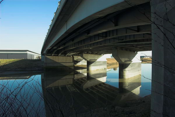
A13 Alfred’s Way crosses the River Roding
As usual I’ve put the account into normal case to make it more readable, corrected the odd typo and made a few comments on things that have changed and have given a link to more pictures on My London Diary than on this page.
This car park in Jenkins Lane was a possible site for relocated Clay’s Lane travellers
Barking and the River Roding
Barking, Ilford & Redbridge
I had taken the train to Barking
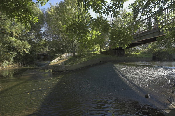
The River Roding runs into the River Thames at Barking Creek. I’d hoped to be able to ride alongside it to the Thames, but although the London Borough of Newham had spent a small fortune on getting ARUP to produce 2.4km of riverside path in 2001-2, it still wasn’t opened for public use. The large and expensive gates at its northern end remain locked. [The path leading to the Beckton Creekside Nature Reserve has apparently since been opened and there a plans for it to go on and no longer be a dead end. But I had to change my plans and instead go north by the Roding.]
River Roding in Barking
I don’t know what it is about Newham and footpaths. At Canning Town, the exit from the station to the riverside path remains firmly closed after the riverside walk was completed some years back, with the end of the bridge over the DLR coming from Tower Hamlets also being fenced off. [Now open, but the path still a dead end in both directions, though there is a new bridge to take you across Bow Creek and so further on.]
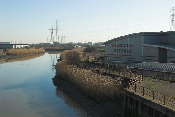
River Roding, riverside path and Showcase Cinemas
This would be the end of The Roding Valley Way, started in 1996, but still largely non-existent, leading to the as yet unbuilt Thames Gateway Bridge and the dream of a park across the river. Don’t hold your breath.
River Roding, Barking
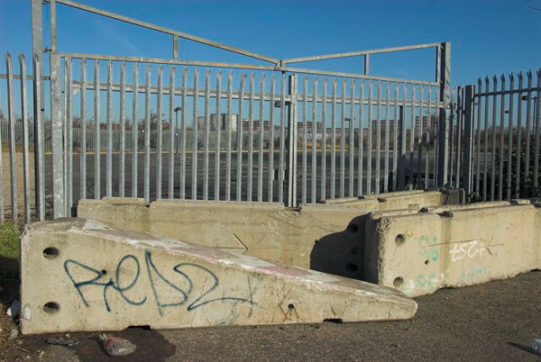
I’d gone to Barking partly to have a look at the Jenkins Lane Car Park underneath the A13 flyover being offered by the London 2012 Olympics developers to relocate travellers from the Clays Lane site. It’s in a kind of wasteland adjoining the Roding, handy for the council yard at the end of the lane, the cinema complex, the sewage works and the new refuse transfer station, and not far from the East Beckton megastores. Just down the road there is still the Horse Sanctuary, a home for neglected old horses. [I think this may have gone.]
A13 Flyover over River Roding
It is just possible to force your way along the riverside path north from the Hollywood Bowl and Showcase Cinema, but on a bicycle it’s easier to follow Jenkins Lane under the A13 and then take the new path to the riverside walk and Cuckold’s Point, and its viewing area, with some convenient seats where I sat in the February sun and ate my sandwiches. Unfortunately the path ends at the head of Hand Trough Creek a couple of hundred yards further on, with a long detour under, beside and over the North Circular to reach Highbridge Road and the town dock.
From there you can walk along the river in Tesco’s car park and on from there all the way to the railway line, although it gets rather overgrown. Today I left the path and went through Little Ilford, meeting the river again at the side of the City Of London Cemetery, then going off through Wanstead Park and the Redbridge Roundabout.
From the Redbridge Roundabout going north is another finished section of the Roding Valley Way, although I only followed it as far as the bridge across to Roding Lane South, where I turned south and rode back to Ilford and the trains home.
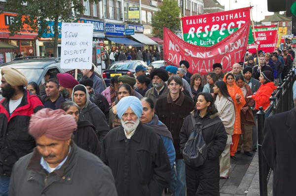
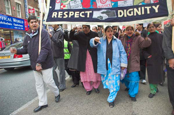
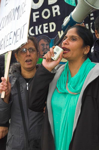
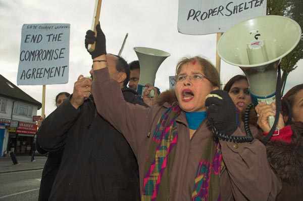
Gate Gourmet & a Bike Ride: On Sunday December 4th 2005 I got on my bike and rode the roughly 1l miles to Southall, where I locked up my bike (not the Brompton, but an old CinellI racer I’d got many years ago for my 13th birthday) and photographed a protest by workers sacked from their jobs at Heathrow airport catering firm Gate Gourmet.
There is an excellent article on the Striking Women website which gives the background to the dispute and explains why 56 women workers of South Asian origin felt betrayed by the agreement reached by the TGWU over the dispute and refused the compensation offered of between £5000 and £8000 – and refused to leave quietly – though most of the workers took the money rather than fight for justice.
The workers and their shop stewards received little support from the official trade union movement in their fight for justice and the TGWU hardship fund ended its support in January 2006, and the TGWU (by then part of UNITE) cease all support in 2009. Around a dozen of the workers – mainly those who were for various reasons not at work when Gate Gourmet locked the workers out – eventually won claims for unfair dismissal.
The dispute made very clear the extent to which union powers had been emasculated by a succession of Acts passed under Thatcher – the Employment Act 1980, Employment Act 1982, Trade Union Act 1984, Trade Union Art 1990, Employment Act 1988, Employment Act 1990. John Major continued with the Trade Union Reform and Employment Rights Act 1993 and then Blair and New Labour took over the job.
But even given all this, the TGWU ended up caving in to the employers and giving them everything they wanted in the settlement it made.
Below (with minor corrections) is the post I wrote back in 2005.
Gate Gourmet – the Struggle Continues
Southall, December 4, 2005
Gate Gourmet was split off from British Airways in 1997 to cut costs by out-sourcing their catering. It was sold to US company Texas Pacific in 2002, and they also decided to cut costs. This seems to have meant increasing workload, bringing in more managers (why?) and replacing skilled and experienced staff by unskilled workers. They went into a dispute with the TGWU (Heathrow’s major union) over layoffs and worsening conditions, then on 10 August 2005, took on 120 temporary workers.
Their aim was to provoke an unofficial walkout, which would allow them to sack the workers. The workers held a union meeting in the canteen and were told by management that if they were not back at work in 3 minutes they were all sacked. It is claimed that management had locked the doors just to make sure they didn’t return. The workers were then forcibly evicted from the premises by the private security guards the management just happened to have standing around waiting.
Britain’s anti-union laws (thanks to Mrs Thatcher) stack the odds against workers, allowing unscrupulous management to get away with most things short of murder if they put their minds to it.
The TGWU were hamstrung by a High Court injunction, which prevented them from doing much to help the workers. The only thing that helped them was illegal action by their former colleagues at BA, said to have cost that company £40 million. So eventually BA forced Gate Gourmet to come to some kind of compromise with the TGWU, but this has failed to satisfy most of the workers, who wanted their jobs back and decent working conditions. So, although all the papers reported it as over, the action still continues. When my wife flew BA from Heathrow a few days ago, she got a voucher to get sandwiches in the departure lounge rather than in-flight catering.
This is a dispute that highlights the need for proper trade union laws that give workers and unions a fair deal. It shows how union weakness has allowed the Labour Party to renege on the promises it made in opposition and to turn its back on its traditions of fair play. BA has also emerged as pretty short-sighted in its decision to out-source its catering, much as we have found out-sourcing to be a mistake over key services in hospitals and schools.
After the protest I was relieved to find my bike still in one piece where I had locked it and rode home. On my way to Southall I had time to spare and stopped to take a few pictures -and just a few more on my way home. Here is what I wrote in 2005.
I took my usual route to Southall on a push-bike – it takes me around 45 minutes if I don’t stop. but I nearly always do stop at least once to take some pictures. So here are a few pictures from around Heathrow, including a farm. Heathrow swallowed up some of the most productive arable land in the country including a number of fine orchards, but there are still a few farmed areas around its edges – cutting down the dangers of a crash, although some of the most used approaches come in low over many homes.
It was never a suitable site for a major airport, but the chances of any government biting the bullet and closing it down seem low. We should have been running it down for years, but instead have built 2 new terminals (both of which the airport authority said they would never need) and further disastrous development looks likely.
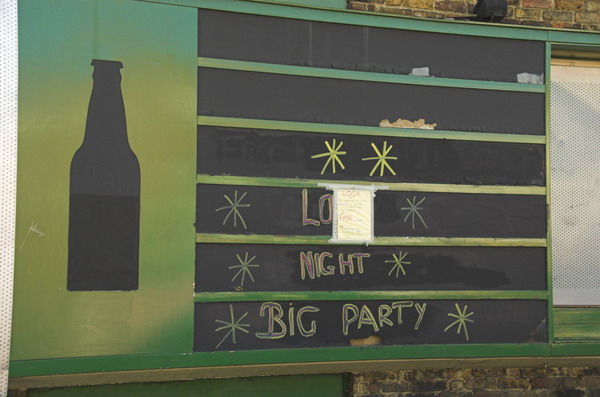
Clock House to Olympic Site: Thursday October 27 2005 was a fine late autumn day and I decided to go for a bike ride, putting my folding bike on a couple of trains to my start point, Clock House station. This is in south east London, halfway between Penge and Beckenham and just inside the London Borough of Bromley.
Big Party, Clockhouse
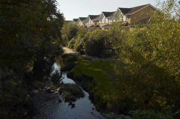
The Chaffinch Brook runs close by and joins with the River Beck to form the River Pool (aka Pool River) a mile or so north and a footpath going north from there is now part of a national cycle route. Parts of the Pool River which were once culverted have now been restored to an open stream, which will help prevent flooding downstream. The river’s main claim to fame is that four years after my ride then London Mayor Boris Johnson fell into it on an official visit to encourage volunteers who were cleaning the river up.
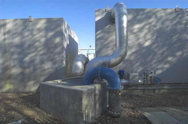
Big Pipes, New Beckenham
The Pool River is a tributary of the River Ravensborne and I had planned to continue along this as closely as I could to Deptford Creek where it joins the Thames. But I ran out of time, so took the Docklands Light Railway at Lewisham rather than Greenwich to cross the river to Canning Town.
Lower Sydenham
My ride then continued with a loop around Bow Creek and over the Lower Lea Crossing back through Canning Town and on to Stratford Marsh where work was then just beginning to turn this whole area into the Olympic site.
Bell Green
It wasn’t a long ride – probably around ten miles in all, perhaps a little longer with all the small diversions I took. All the pictures here were taken on this ride and there are more on My London Diary, along with the account below that I wrote back in 2005. As usual I’ve made a few small corrections.
Pool River and Ravensbourne (left) join
The Brompton folding bike is really an ideal form of transport for London, an essential tool for the urban photographer. It’s short wheelbase is great in slow-moving crowded traffic, and it can be folded in 15s to travel by tube, rail, taxi or even bus. [I’ve never put mine in a taxi.] The only problem is that they are highly prized by cycle thieves. [They are fairly expensive and slip easily into a car boot.]
Bridges over Bow Creek, River Lea, Canning Town, London
The weather forecast was for a fine summery day, so I took the opportunity to check up on a few things and fill in some little gaps, where I’d not quite managed to photograph things before. First I wanted to go along the footpath at Bell Green, next to Sainsbury’s, so I decided to make a slightly longer trip of it by starting at Clock House Station. There is a good, almost traffic-free route north from there along the Pool River, then the River Ravensbourne, at times surprisingly rural.
DLR viaduct over Bow Creek
Taking photographs slows you down, as does stopping to sit in the sun and eat sandwiches, so at Lewisham I decided to get on the DLR with the bike to travel to Canning Town.
DLR extension, Millenium Dome and Canary Wharf from Silvertown Way.
Perhaps one day the riverside walkway by Bow Creek from the station will open [it did, but only to go across a new bridge to City Island – the route south still comes to a dead end], but it seems unlikely to be in our lifetime. I went round the creek, over the Lower Lea Crossing and on to Silvertown Way to see how the new stretch of DLR was progressing. [It opened north of the river at the end of 2005.]
Car sales, Stratford Marsh
Then I cycled up to Stratford to take a look at Stratford Marsh again before work starts in earnest to demolish the existing businesses and create the Olympic waste. It was getting later and noticeably darker by the time I was there, although the day felt like summer, it gets dark rather earlier at the end of October.
The Greenway goes under the railway line on Stratford Marsh.
What really makes no sense at all is to put our clocks back to make it even darker still, as we were going to do in a couple of days time. If I were in charge, we’d move to the same time as France and the rest of our neighbours across the channel. I don’t like dark mornings, but it would be much better than having it get dark in the middle of the afternoon in winter. Orcadians or even Scots would be welcome to have their own time zone if they really must, but its about time they stopped imposing it on the rest of us. The sun set around 5.30, and next week that means it will be 4.30pm.
Last Saturday I photographed a couple of protests, went to a disappointing photographic exhibition, took a snap of the Red Arrows and found myself with time to spare to go and photograph the 2025 London World Naked Bike Ride at its start and then later on my way to my last protest of the day.
London, UK. 14 June 2025
The first year I photographed this event was in 2006 and I came back to it in almost every year until 2014, then again rather briefly in 2019. Here I’ll post some of what I wrote about it on that first occasion and then my comments on returning to photograph it in 2019, and end with my thoughts about the 2025 ride. All the pictures in this post are from Saturday 14th June 2025.
London, UK. 14 June 2025
Unfortunately Facebook’s “community standards” prevent me from publishing an album of my pictures there, but you can find a selection of images on my Alamy portfolio pages. Though you may have to search or browse a few pages to find them after I upload more work.
2006
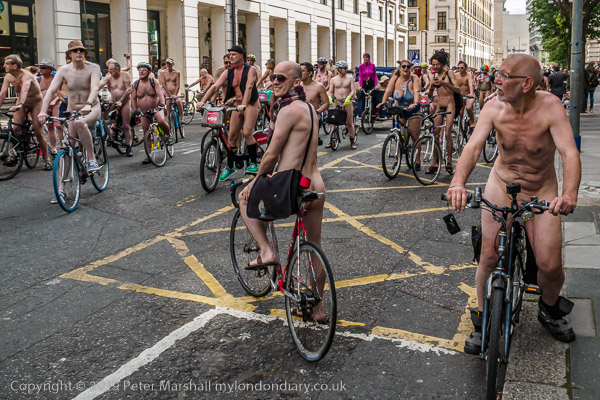
People in over 50 cities around the world were taking place in the World Naked Bike Ride as a protest against oil dependency and car culture. In London. over 600 cyclists, along with a few rollerskaters, rollerbladers and others took part.
London, UK. 14 June 2025
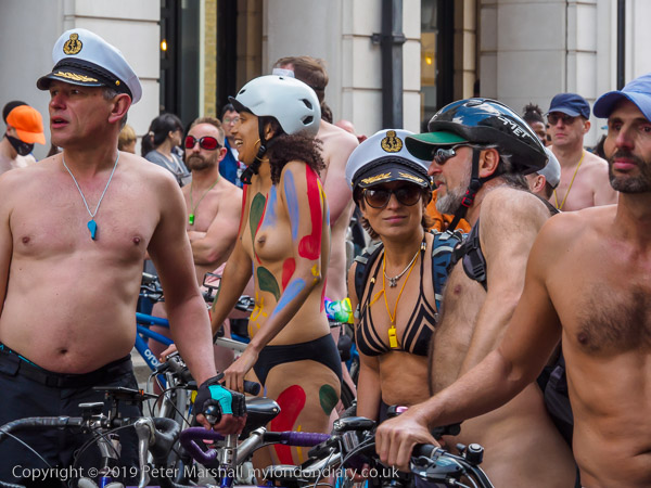
As a change, I congratulate the Met police for allowing the event (unlike the Brighton cops.) Police cyclists – looking rather over-dressed in their usual uniform – led the event in its ride around some of the busiest streets in central London, and kept riders safe from traffic. Most of them seemed to be amused by the event.
London, UK. 14 June 2025
So too were the crowds in central London. Many obviously found it hard to believe the evidence of their eyes, but all I saw seemed amused and none offended. Riders handed out a leaflet explaining the purpose of the event and advising “if you don’t wish to see nudity, please avert your gaze – we’ll soon be out of sight,” but I didn’t see anyone following this advice. Indeed it looked like the event should attract even more tourists to the city.
London, UK. 14 June 2025
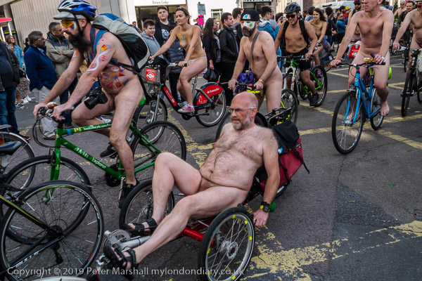
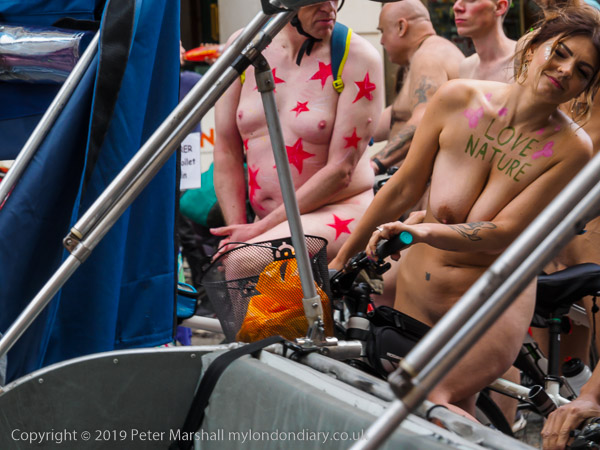
I don’t have a great problem with nudity. I was brought up told we were created in the image of our maker, so feel it would be blasphemous to object about the display of the naked body, although generally we may find it more prudent to keep it covered, especially in our climate. As my pictures show, not all those taking part rode entirely naked: the invitation was to ride “as bare as you dare!”
London, UK. 14 June 2025
Photographing an event like this could be awkward, but I recognised many of those taking part and they knew me. There were a few conditions, but only one person out of the several hundred made it clear she didn’t want me to take a picture, and of course I didn’t.
London, UK. 14 June 2025
It was an afternoon when it was more comfortable to be without clothes than in them (so long as you had plenty of sun-screen) and it certainly made an interesting spectacle. I had chosen not to ride a bike, and just pretended to be one as I ran up Piccadilly fully dressed with the mass of cyclists. By the time we got to the top of Haymarket I was pretty much whacked, and continued by tube to Waterloo to meet the ride as it came up York Road and get a different viewpoint.
London, UK. 14 June 2025
2019
I’ve never been too impressed by the protest side of this. It’s more a fun ride for people who want to ride around London with no or very few clothes on. For those of us watching on the streets it is certainly unusual and entertaining, and I think very few could be seriously upset by it. The normal response seems to be a lot of pointing and laughing.
London, UK. 14 June 2025
Perhaps if it were more of a protest there would be more women taking part. This year the imbalance seemed even greater than previously, with perhaps 10 or 20 men for every one woman, though I didn’t try to make an accurate count. My pictures do tend to concentrate more on the women than the men for various reasons. To state the obvious, these pictures involve nudity. Please do not click on the link if you may be offended or if you are in a place where others may be offended.
2025
This year there were even fewer women on the ride which now seems to be dominated by male nudists, with some coming from the continent to take part. It has become an event very much more about “body positivity” than a protest about car culture and cycle safety. And it illustrated the huge anatomical variation of male members of our species.
London, UK. 14 June 2025
A mere handful rode with political messages written on their bodies and even fewer with flags or posters on their bikes. There was little of the creative face and body paint and fancy dress which had enlivened earlier years. It’s an event that has lost much of its interest for me and is far more drab than my pictures, which concentrate on the things that still interest me. Perhaps this is an event which has outlived its times.
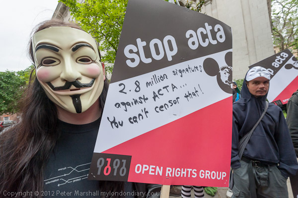
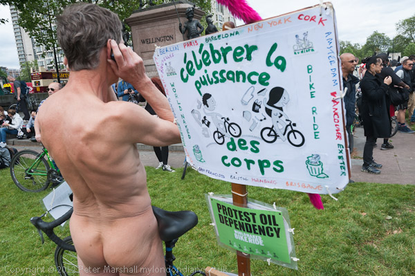
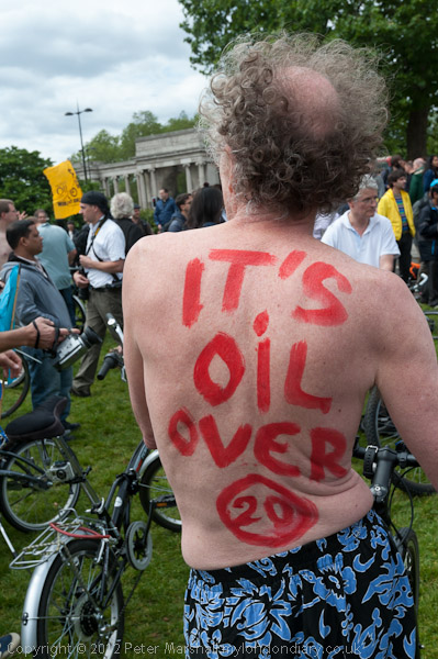
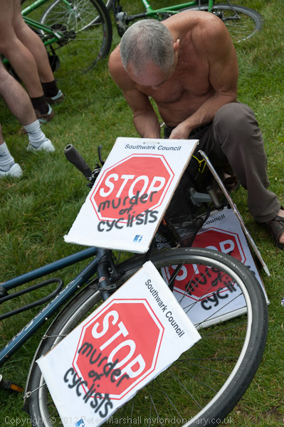
Intellectual Property, Naked Cyclists: On Saturday 9th June 2012 after a rally against the Anti-Counterfeiting Trade Agreement outside Europe House in Smith Square I went to Hyde Park Corner where cyclists were preparing for the London World Naked Bike Ride, an environmental protest against a society based on oil and the domination by cars.
Rally Against ACTA
Current debates on intellectual property in 2025 are mainly concerned with protecting the rights of individual creators from being used without permission or compensation by companies developing AI which could then use the data taken to create new works which would mimic their work, essentially producing counterfeit works.
Back in 2012 the protests were against ACTA, the Anti-Counterfeiting Trade Agreement put together in secret talks between the USA, Europe, Japan and some other major governments to protect the copyrights, trademarks and patents held by major multinational companies.
Wikileaks had released the secrets of these talks, deliberately set up in private to exclude the views of civil society and developing countries. They proposed putting draconian powers in the hands of major corporations without the need for allegations of abuse to be properly tested.
Now in 2025 the government is attempting to put into law an act which would legitimise the production of ‘fakes’ by the major AI companies, though the fight against this is being carried on largely in the House of Lords rather than on the streets or on the web. As usual laws are largely about protecting and advancing the interests of the rich and powerful – whose donations and lobbying keep our legislators on side.
As well as preventing much sharing of material on the web – some legitimately – ACTA would also disrupt much-needed generic medicines to majority world countries, where indiscriminate raids had already disrupted some legitimate supplies. And many musicians and other content creators feared it would be used by the major corporations to prevent or inhibit their ability to profit through distributing their own work via the Internet.
On 4th July 2012, 478 MEPs in the European Parliament voted against ACTA, 39 in favour, and 165 abstained, meaning the agreement did not enter into force in the EU.
More about the protest and about ACTA, along with more pictures on My London Diary at Rally Against ACTA.
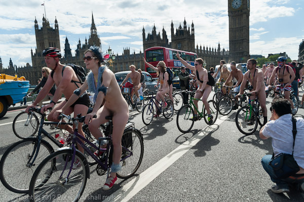
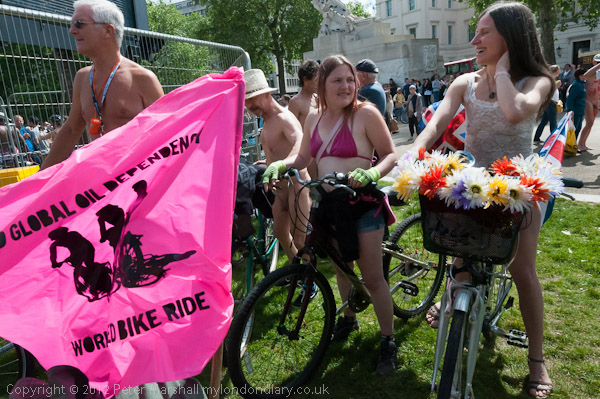
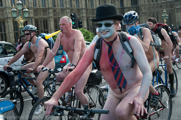
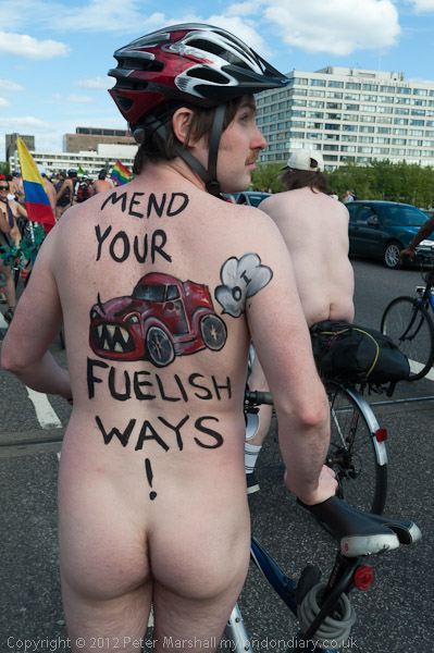
Naked Cyclists Ride Against Oil
Around a thousand cyclists in various states of undress, some wearing nothing but shoes, took part in the World Naked Bike Ride, an annual environmental protest touring central London, much to the astonishment of many tourists. Shoes are required, but otherwise the dress code is “as bare as you dare.”
People gathered at Hyde Park Corner for the start of the ride
Public nudity is not illegal in Britain and the ride seems to cause a great deal of hilarity from some onlookers but little or no offence. Most of those on the pavements were tourists and eagerly taking photographs of the event.
Although there had been many earlier naked bike rides organised as naturist or political demonstrations, the first World Naked Bike Rides were organised in 2004 and now take place in many cities around the world. The rides are a protest against dependence on oil and other forms of non-renewable energy and “expose the unique dangers faced by cyclists and pedestrians” in modern cities.
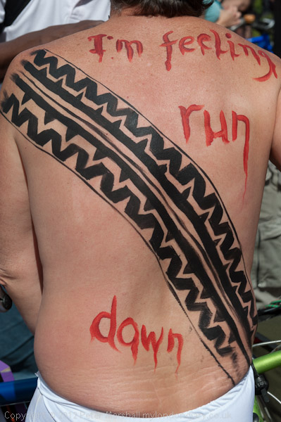
In 2012 there did seem to be a rather clearer environmental message than in some other years, and my pictures here – and in the many more on My London Diary concentrate on this rather than the nudity, and on the many with body paint, sometimes solely for decoration but often expressing an environmental message, contributing to the purpose of the ride to “deliver a vision of a cleaner, safer, body-positive world.”
Back in 2012 there were similar rides in 20 countries around the world ands well as others in Brighton, Bristol, Cardiff, Exeter, Glasgow, Manchester, Portsmouth, Southampton and York.
After photographing the riders on the grass at Hyde Park corner I set off with them on foot, rather dangerously as other traffic was still driving around the busy roundabout and along Piccadilly. But I soon got out of breath and had to rest.
Later I took the tube to Westminster and met the cyclists again coming down Whitehall, going with them across Westminster Bridge. I left them to go to Waterloo Station on their way to the City and then back trough Holborn to Buckingham Palace and Hyde Park Corner.
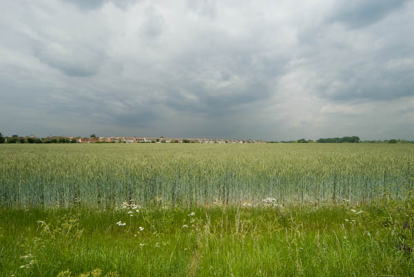
Thames Gateway – Essex: I didn’t write much about my bike ride in south Essex on 24th May 2007, though the pictures on My London Diary tell the story of my route. I began at Rainham on the edge of Greater London in the London Borough of Havering.
It wasn’t a linear ride but one where I went back and forth rather extensively exploring some of the areas.
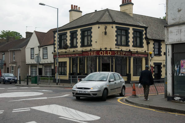
Next came the village of Aveley, where the Old Ship has a pub interior “of Outstanding National Importance” but I didn’t go inside.
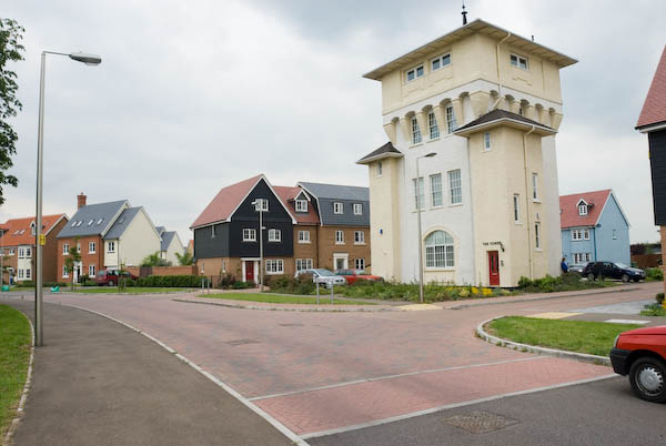
I photographed the Mar Dyke at North Stifford along with a number of houses, some thatched and cycled around the Stifford Green estate on site of Stepney Boys Home built around ‘The Tower’. This had been an approved school and then a community home until it closed in 1994.
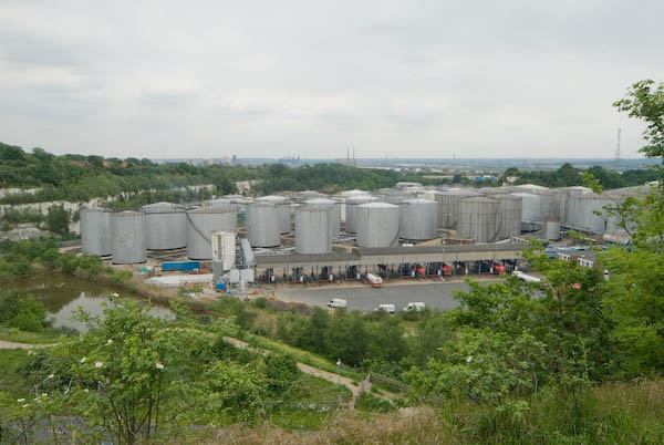
Next came Chafford Hundred, an area where chalk was extensively quarried from 1874 until the last quarry closeed in 1976. In 1986 a proposal by Blue Circle Industries, West Thurrock Estates and Tunnel Holdings to build 5,000 homes on derelict land was approved and the first were completed in 1989.
Parts of the area were still in industrial use in 2007 and there is a nature park with extensive lakes and ditches.
Lion Gorge, Chafford Hundred
From there I cycled a little deeper into Grays before going to Orsett Fen and Orsett and Horndon on the Hill which has a rather fine old pub I also didn’t go inside. Cycling and beer really don’t mix well with modern traffic.
There are more impressive ancient buildings, a reminder of the wealth that once came from the wool trade.
I made my way via Bulphan towards Upminster where I could use my railcard to start my journey home.
Here is the short text I wrote back in 2007 – with the usual corrections. The cost of the ticket I bought then is now £15.30 – an increase of around 9% above inflation – another of the costs of privatisation.
Thursday I bought an expensive ticket – just up from £6.60 to £7.90 – for a one-day railcard for Greater London from Staines, and put my folding bike aboard the train, changing to reach Rainham, Essex, (L B Havering) on the furthest edge of London from where I live.
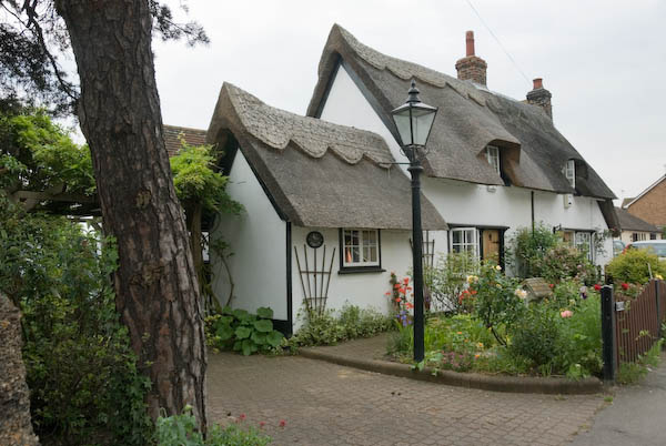
Don’t let anyone tell you Essex is flat. O boring. Over a few hundred yards you can move from idyllic thatched cottages to post-industrial dereliction; from dramatic man-made scenery with lakes and chalk gorges to densely packed modern housing estates. From farms owned by city millionaires to council tower blocks.
Most of my winding route took me through Thurrock, one of the major growth sites of the Thames Gateway area.
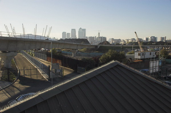
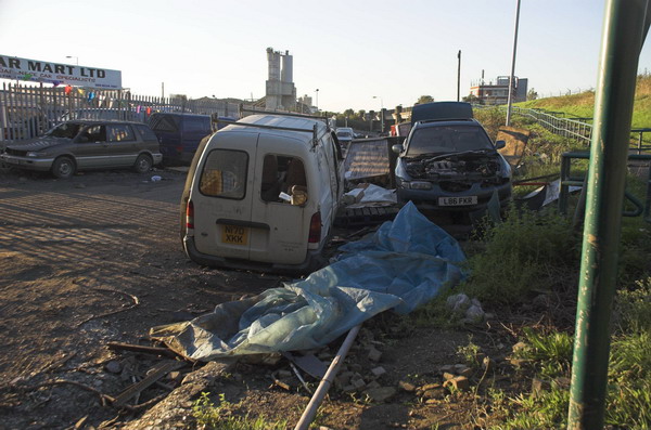
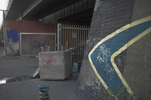
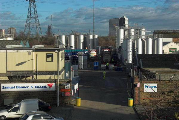
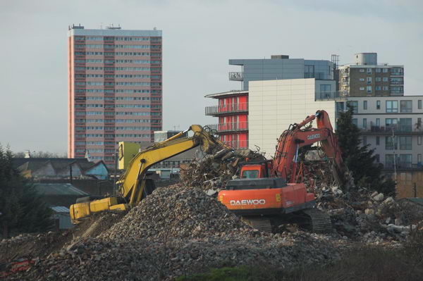
Around the Olympic Site: Thursday 4th January, 2007 looked like being a pleasant enough day for a bike ride around the area where preparations were getting into full swing for the London 2012 Olympics to see how things were going in the area. So I wrapped up warm and put my folding bike on the train to make my way to Stratford.
Clays Lane travellers site, Park Village and Clays Lane estate
Most of the central area of the site was already closed off to the public, but I was able to cycle to various parts of the perimeter and take photographs, though I was disappointed to find large areas where nothing was yet taking place already fenced off. From Stratford I went around in an anti-clockwise direction and on My London Diary you can read a fairly long piece about where I went and my opinions about what was happening.
Eastway Cycle Circuit now fenced off
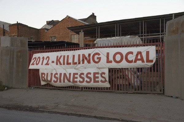
It was becoming more and more clear that many of those who lived and worked in and around the area were being very shabbily treated, with nothing being allowed to stand in the way of the Olympic juggernaut. People were being lied to, promises being made and then abandoned.
Bully Fen Wood is Community Woodland no more
Probably the worst case of this was with the 430 residents of the Clays Lane Housing Co-Operative who were first promised they would be rehoused in conditions “as good as, if not better than” their present estate but were later told “at least as good as in so far as is reasonably practicable.”
Everything on Waterden Road was later demolished
The tenants there had already suffered from their cooperative estate with its strong community being transferred against their wishes to Peabody Housing following an adverse Housing Corporation inquiry, losing their mutual status. After their eviction under the Olympic Compulsory Purchase Order (CPO) they were dispersed and many found they were having to pay much higher rents and living in worse conditions in places that lacked any of the feeling of community of Clays Lane.
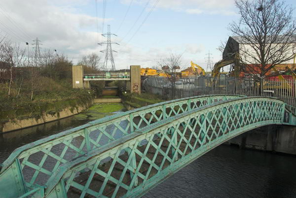
Carpenters Lock and part of the closed area
I’d hoped to visit the Eastway Cycle Circuit and the Bully Fen nature Reserve, but both were fenced off, as were some of the footpaths I had hoped to cycle down, resulting in some fairly lengthy detours. Some of the closures claimed to be “temporary” – but some were still closed ten years later.
Samuel Banner, inventor of white spirit, founded the company in 1860. It relocated to Teeside
I commented “Parliament smooths the way for the Olympic Delivery Authority at the expense of people and environment, enabling them to slough off the inconvenience of democracy and justice. The situation for some of the local people – particularly those living in Clays Lane – can only be described as Kafkaesque.”
Huge areas were being flattened
I rode down Marshgate Lane and went onto the Greenway and then returned and went on to Hackney Wick, pausing to eat my sandwich lunch in a sheltered suntrap by the lock on the Hertford Union Canal before riding on the Greenway, turning back where this was blocked and coming back to the Lea Navigation towpath and on to Stratford High Street.
Bridge over Pudding Mill River to Marshgate Lane, Stratford Marsh.
From here I was able to go along a short length of footpath next to the Waterworks River before returning to the Greenway on the other side of the High Street, past some more areas covered by the CPO.
Bow Back River. Both sides in the foreground are part of the CPO area
By now the light was beginning to fade, but I rode on to Canning Town and took a brief look (and some rather dark pictures) of the Pura foods site then being demolished before riding over the Lower Lea Crossing to the station for the Jubilee Line back to Waterloo.
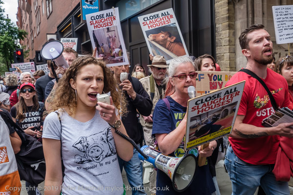
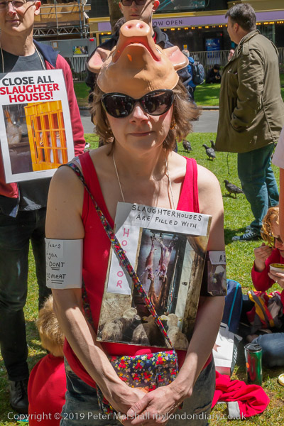
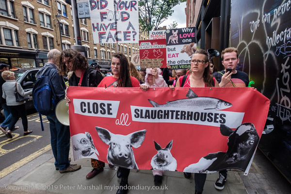
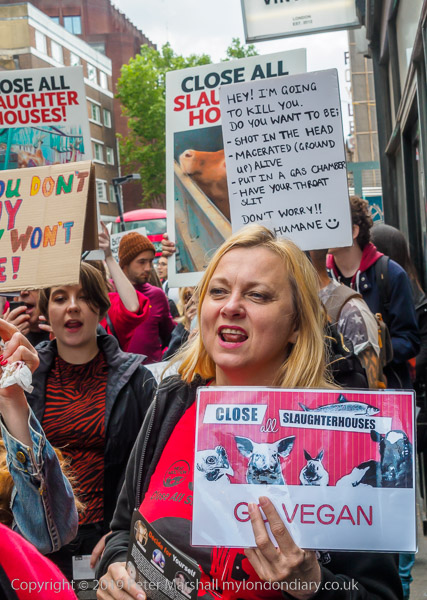
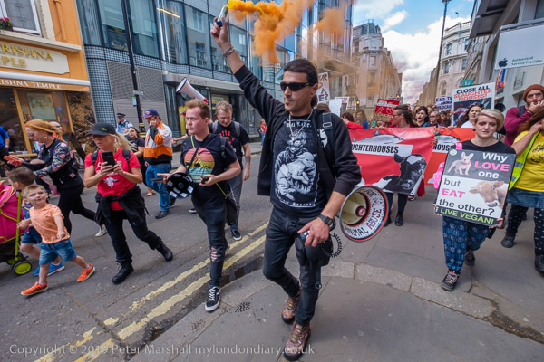
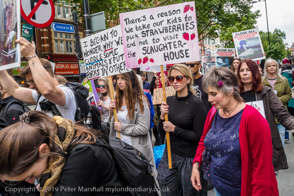
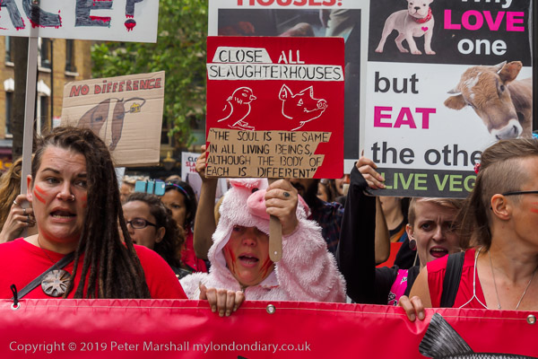
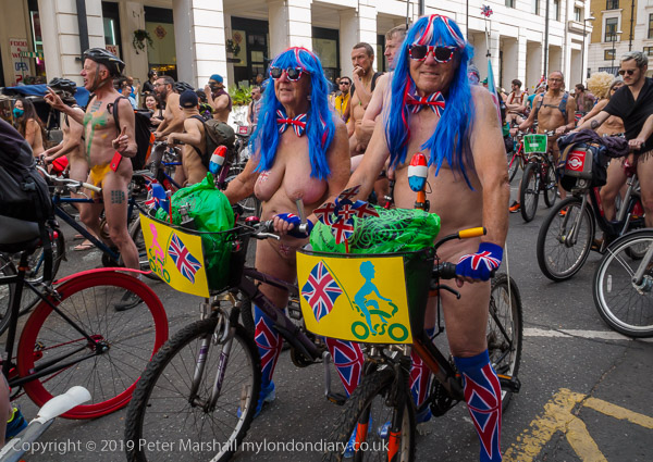
Slaughterhouses & Naked Cyclists: Five years ago today on Saturday 8th June 2019 I photographed a march by vegans through the West End, leaving them at their rally in Soho Square and photographing people taking part in the London World Naked Bike Ride on my way back to Waterloo Station.
Close all Slaughterhouses
Vegans were marching in London calling for an end to the breeding, fishing and slaughter of animals.
I’m not a vegan, and as my comments on My London Diary make clear I do not find some of the arguments that they make so forcefully to be well-founded or convincing.
As I state there, “Of course I’m against cruel farming practices, and much is wrong in various ways about some modern farming, but keeping animals and killing them for food or milking them can be done in a decent and humane way and one that has an important contribution to our environment.“
But I am an unrepentant what they call ‘speciesist’, believing that although other animals share many of our characteristics they are not as these vegans were chanting “just like us” and that our species is in important respects different.
But vegans are a good thing in that a plant-based diet certainly does make lower demands on the environment, and I’m happy to eat vegetarian food several days a week, though not to be either a vegetarian or a vegan.
Given the way things are going with a failure of societies around the world to respond adequately to the increasing climate chaos it seems quite likely that our species will become extinct. And the farmed animals which appear on many of the posters carried in this and other vegan protests will also die out. They are the product of centuries and more of breeding by us and most could not survive in the wild. Farm animals rely on farmers as much as farmers do on their animals.
But there is certainly no doubting the sincerity, anger and dedication of these vegan protesters and this is reflected in the many posters and placards and the anger of their protests which I think comes through in my pictures. I just wish more of them would show the same support for protests over human rights abuses too.
The World Naked Bike Ride says it is a global protest movement with rides in cities around the world, raising awareness of issues such as safety of cyclists on the road, reducing oil dependence and saving the planet. They say “Let’s make the planet great again!”
And although for some it clearly is a protest, for many I think it is, as I wrote “more a fun ride for people who want to ride around London with no or very few clothes on.” And I can see nothing wrong with that as “For those of us watching on the streets it is certainly unusual and entertaining, and I think very few could be seriously upset by it. The normal response seems to be a lot of pointing and laughing.”
There were around a thousand cyclists “in various states of undress, some with face or body paint or slogans on their bodies” in the ride, having started from several places some miles away who converged on the South Bank to ride together past St Paul’s Cathedral and then to Buckingham Palace before finishing the ride at Hyde Park Corner.
The great majority of the riders were men. My pictures concentrate on those people who stood out because of their body paint or slogans which included a considerably larger percentage of the women taking part – and I think most of the men who had these were taking part with their female partners.
The WNBR dress code is ‘as bare as you dare‘ although footwear is obligatory for safety reasons. I don’t have a problem with nudity, but am aware when photographing this event that many publications would not use more revealing images, and try and ensure that at least some pictures have strategically placed handlebars or other objects. But my pictures of the WNBR from earlier years did get complaints from some American educators who blocked my site from their students. And on the front page for June 2019 I includeD the warning “These pictures involve nudity. Please do not click on the link if you may be offended or if you are in a place where others may be offended.”
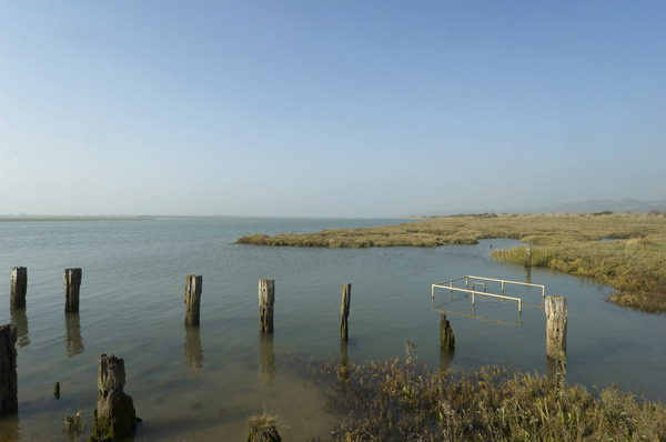
Thames Estuary – Benfleet, Leigh and Canvey. I’ve photographed the Thames east of London on many occasions and found much of interest, but I’ve relatively seldom ventured right out to the real Thames Estaury, though there is no real consensus where that begins as the Wikipedia entry discuses. For some purposes it includes virtually all of the river in London, the tidal Thames which begins at Teddington, and extends all the way east, at least to the Isle of Grain.
In my own own working definition I think of the estuary as meaning the river to the east of Greater London, the shores of Essex and Kent, perhaps as far as Southend to the north and Grain on the south. But by any definition this day of cycling out from Benfleet in Essex was definitely around the estuary.
Back in May 2023 I published here a piece here on the exhibition Estuary held ten years earlier to celebrate the 10th anniversary of the Museum of London Docklands in 2013 when I was delighted the show included ten of my panoramas along with work by eleven artists, some of them rather well-known. But none of the pictures in the Museum collection were taken on this ride, where I made only a few panoramas, none of which are yet on-line.
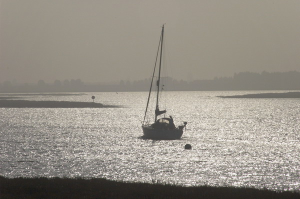
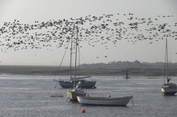
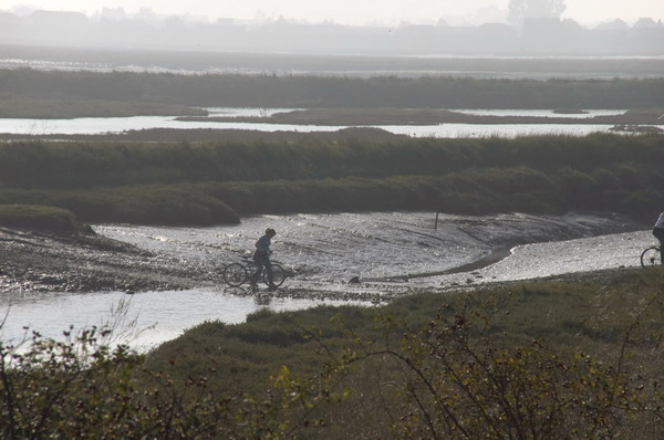
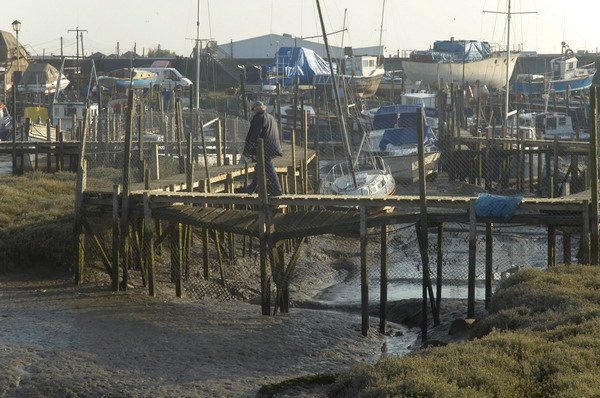
On Saturday 15 October 2005 I took my Brompton on the train to London, then on the tube to West Ham where I changed to a train to Benfleet station in South Benfleet. The road leads down from here towards Canvey Island, but a track leads off to the east just before the bridge running alongside Benfleet Creek. The public footpath I could cycle along leads all the way beside the Creek and then between Hadleigh Marshes and Two Tree Island and on to a bridge over the railway close to Leigh-on-Sea Station.
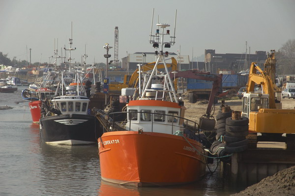
From there I had to cycle along the road, rather less pleasant as there was quite a lot of traffic and even in October quite a few people who had come to enjoy the seaside. Leigh has pubs, tea rooms, fishing boats and more, but I’d soon had enough and turned around to ride back.
This time I took the road and bridge across to Two Tree Island. There is a crossing to the island you can take at low water but I didn’t take my bike across although I saw others doing so. There are rather more than two trees, but only one road, though with several car parks and it ends at a jetty where I could look across Hadleigh Ray to Canvey Island but go no further.
I turned around, cycled back over the bridge and along the footpath back to the bridge to Canvey Island which I then spent some time exploring and photographing. I think I had last been here in 1982 did recognise some of the places I’d photographed back then, but also found quite a lot more to photograph. I don’t think any of those earlier images are on-line as by the time I scanned them the images had deteriorated badly.
Too soon it was time to get back on my Brompton again and ride back to Benfleet for the train back to London.