Gasholders, Goods Way and Midland Road: Continuing with pictures from my walk on Sunday 18th February 1990 – the first post on this was Between Kings Cross & St Pancras – 1990.
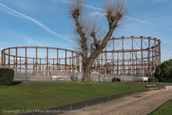
Gas Holders, Goods Way, Kings Cross, Camden, 1990, 90-2d-16
I photographed the gasholders here on various occasions and from various places, both in black and white and in colour. The Pancras Gasworks and those at Shoredittch were the first gas works of the Imperial Gas Light Company (later the Imperial Gas Light and Coke Co) were built in 1822 on Battlebridge Road beside the Regent’s Canal. In the 1860s it was still the largest gas works in Britain if not the world, but soon it was eclipsed by others.
Although the gas works closed in 1904 and was dismantled three years later, the gasholders continued in us for gas storage for gas from the company’s vast Beckton gasworks and were only finally decommissioned around 2000 well after town gas had been replaced by natural gas.
These three gasholders were originally built in 1879, replacing an earlier triplet from the 1860s designed by engineer John Clark. He had them built as ‘telescopic’ holders with two interlocking sections or ‘lifts’ around the outside of the ‘bell’ which could rise up inside the guide frames to increase the capacity.
As the Grade II listing text states this involved “replacing the guide frames in their entirety by the contractors Westwood and Wright under the direction of John Clark. The columns of the new guide frames observed classical rules so that the lowest tier was in the Tuscan order, the middle in the Doric and the topmost in a simplified version of Corinthian.”
These small industrial workshops were also demolished in the redevelopment of the area for the building of St Pancras International.
Water Point, St Pancras Station, Goods Way, Somers Town, Camden, 1990, 90-2e-01
This Grade II listed water point is close to the new location of the gasholder frames and also the redeveloped coal drops on the north side of the canal. Built around 1870 for the Midland Railway it was probably designed by Sir George Gilbert Scott’s architects office.
Like the gasholders its original location was in the way of St Pancras International and was moved around 2001 to its new location on Camley St, some 700 yards to the north. When built it was condemned by some architectural critics for being an inappropriate use of Gothic for a functional building, but it well matched the station and hotel.
Together with the Granary building and others in the area according to Historic England it forms “an evocative ensemble of former industrial buildings of considerable urban landscape value.” Having a theme park like this is certainly better than losing these structures completely but it isn’t any real replacement for the original.
Poplar, Bow, Leyton, North Woolwich & Silvertown: These pictures come from a number of visits to areas of London working on several different projects and are my final selection of colour panoramas made in 1995. There are a few more colour images, including some panoramas I made in 1995 in the images in the Flickr album as well as many I have not digitised; some very similar to those online, others that I now find of less interest. Some of these were taken as a part of my project on the Greenwich Meridian in London – you can see a set of 16 images from this on the urban landscape web site.
Bow Locks, River Lea, Bow Creek, Bow, Tower Hamlets, 1995, 95p4-752
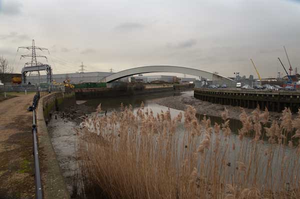
Bow Locks separate the tidal River Lea from the Lea Navigation and the Limehouse Cut which offers an alternative route to the Thames to avoid the winding and dangerous Bow Creek. First built in 1850 they were remodelled in 1930. At the highest Spring tides water from Bow Creek would overtop the locks and raise the level of the canals here – the locks were modified in 2000 to stop this and avoid the silting it caused.
London Galvanizers, Leven Rd, Poplar, Tower Hamlets, 95p4-743
The Poplar Gas Coompany built a local gas works here in the 1820s at the request of the Poplar Vestry after ratepayers lobbied them to provide gas street lighting. The site was cleared in 2011 and I was commissioned to photograph the removal of toxic earth from the site using barges on Bow Creek. Something around an eigth of the material was removed in this way, tides making the removal of more difficult. The original gasholders had to be built to special safety standards because of their proximity to the West India Dock wall. The last of the gasholders was removed in 2017.
London Galvanizers had modernised their galvanizing plant here in 1983-5 and were one of the most important jobbing galvanizers in London and the Home Counties.
This street corner is close to the Meridian and I had stood here for some time outside the Chinese restaurant which was having some joinery work done. I liked the contrast between its orange paint and the blue on the opposite corner and the warm brown of the Birkbeck Tavern at right. I think I had made at least one exposure when a young girl in a red coat on roller skates came to see what I was doing – and I made this exposure as a red car come around, filling an otherwise rather empty grey space.
The Meridian also passes through this cemetery and I chose a viewpoint which included the cemetery chapel with a fine group of monuments in the foreground, I think all for people of Italian origin.
Stratford Station, Great Eastern Rd, Stratford, Newham,1995, 95p4-963
I’m unsure what this railway building to the east of the station was, perhaps a 1930s signal box. Parts of this area have now been redeveloped, and this has been behind fences for more than ten years and could stil be there, as least in part.
King George V Dock, Woolwich Manor Way, North Woolwich, Newham, 1995, 95p9-171
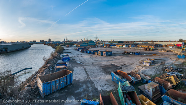
Finally four pictures from a walk along Woolwich Manor Way, this taken looking westwards along the south side of the King George V Dock. You can see the bridge over the dock entrance at right and the City Airport terminal and Canary Wharf at the end of the dock.
Royal Albert Dock Basin, Woolwich Manor Way, North Woolwich, Newham, 1995, 95p9-161
At left is the old swing bridge that took the road over the dock entrance from the basin. To its right is the elevated DLR and the pumping station at the centre of the Gallions roundabout. Further on only two buildings were standing along the side of the Basin, the Gallions Hotel and the Royal Docks Pumping Station.
Containers, Woolwich Manor Way, North Woolwich, Newham, 1995, 95p9-162
Land to the south of the Royal Albert Dock Basin just east of Woolwich Manor Way.
King George V Lock, Woolwich Manor Way, North Woolwich, Newham, 1995, 95p9-153
This swing bridge across the dock entrance is still there.
Royal Victoria Dock, Silvertown, Newham, 1995, 95p11-262
This was taken from Silvertown Way, looking across the Royal Victoria Dock. There are still cranes along the dockside here but the foreground now has flats. The Millenium Mills are still there, but there is nothing in the picture where the Excel Centre now stands and none of the other new developments on the north side of the dock. The council flats at the right have been demolished.
You can see these and some other colour pictures I took in 1995 at 1995 London Colour.
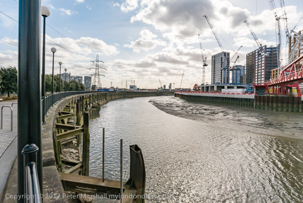
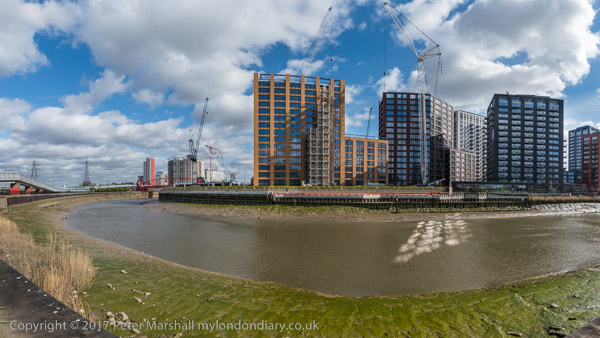
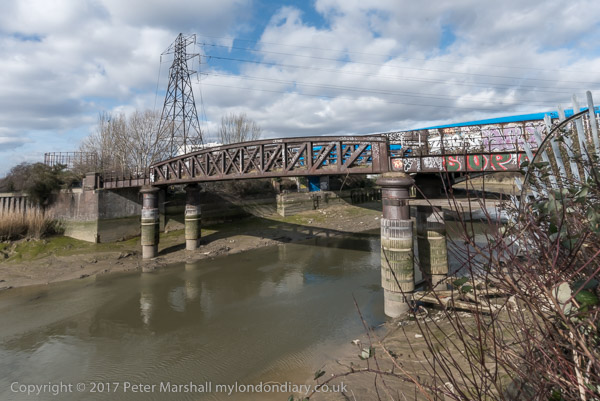
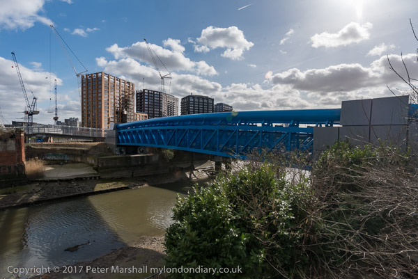
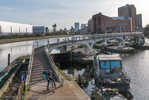
Canning Town, Cody Dock and Stratford: On Thursday 2nd March 2017 I made a rather convoluted walk along Bow Creek and the Lea Navigation, arranged around a meeting I had at Cody Dock. You couldn’t then – and can’t quite yet walk beside the river the whole way, but to get to the meeting I had to abandon a small part of the first stretch and catch the DLR, walking on from the meeting to Stratford High Street where I caught the DLR again to go back and complete the short part I’d had to miss out earlier.
In this section of My London Diary I included pictures taken both at the start and at the end of my walk, which began at Canning Town Station.
The riverside walkway at Canning Town is open after many years and can take you to the bridge to London City Island.
People were living in some of the blocks on the “Island” but there was still a lot of work continuing in this area which Bow Creek loops around on three sides. Another bridge was built across the DLR tracks to allow people from South Bromley in Tower Hamlets a pedestrian route to the riverside path and Canning Town station. Open for a short time it closed well before the station entrance became open, and a gate on it was firmly locked when I tried to cross it.
This meant I had to make a lengthy detour walking around the Ecology park to get to the Blue Bridge which took me to the East India Dock Road.
This meant I had to hurry back to Canning Town Station to get the DLR to Star Lane for my meeting at Cody Dock and couldn’t then walk along the north side of the road to take more pictures.
I paused briefly to photograph a sculpture made from shopping trolleys in a mock DNA double helix.
My next stop was to photograph the The Imperial Gas Light and Coke Co’s 1872-8 Bromley-by-Bow gasholders and the war memorials – originally at Beckton – with an eternal flame next to a monument to company workers killed in both World Wars.
Steps leading down from Twelvetrees Bridge at Bow Locks took me down to the towpath beside the Lea Navigation.
Three Mills is a tide mill dating from 1776 (though on the site of earlier tide mills mentioned in the Domesday Book) on the Three Mills Wall River. It is the largest tide mill in the UK and the largest surviving in Europe.
Another sculpture on The Line, unveiled on the centenary on Three Mills Green and moved to this position on Short Wall is by Alec Peever and commemorates three men who died in 1901 They died going to the aid of a fourth who had been overcome by the lack of oxygen at the bottom of a well they were investigating.
I walked on to Stratford High Street, turning west to go to Bow Bridge and the Lea Navigation before going back beside St Thomas’s Creek and along Stratford High Street to the DLR Stratford High Street Station for the train to Canning Town.
More from Bow Creek
It was beginning to get a little dark as I came out from the station to photograph from the north side of East India Dock Rd.
This was still an industrial area although a large area seemed now to be unused. I thought it would probably not be long before this area too was covered in flats as I walked back to the station.
It’s perhaps misleading to call this a ride, since I spent most of the day on Wednesday 3rd February 2010 actually off my bike, parking it neatly to take photographs. Although a bicycle has been my main personal transport now for over 70 years (when I’m not using public transport or walking) I’m not really a cyclist. Or at least just a pragmatic cyclist, using a bike just to get from A to B (and on this day to C,D and most of the letters of the alphabet.)
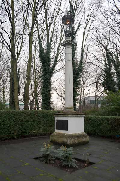
Memorial to firewatchers of Stepney Gas Works
And just very occasionally for a bit of exercise. I have used exercise bikes and always thought why bother when you could use the real thing, though I suppose when its pouring with rain or below zero there might be some point in them. And though one wouldn’t help me to take photographs I would be less likely to be killed by careless or dangerous drivers.
Bromley-by-Bow gasholders, Twelvetrees Bridge
Back at the end of 2002 I bought myself a Brompton folding bike, and a year or three later when I was undergoing a Q & A interview for an amateur photography magazine it became my answer to ‘What is your most useful photographic accessory’. It had replaced the answer to a similar question from another such magazine which was ‘a good pair of shoes’.
Eternal flame, West Ham Memorial Gardens
Once you have practised a few times the Brompton folds (and unfolds) in a few seconds into a fairly compact package, which has the advantage you can take it at any time onto our trains and underground system. It’s too heavy for me to comfortably carry any distance, but I added the tiny wheels which mean you can pull it rather like a suitcase, only actually lifting it when necessary. And I bought the bag which fits on in front of the handlebars which was about the right size for my camera gear and essentials like a bottle of water or a flask of coffee and sandwiches.
The end of the ‘Fatwalk’
I can’t know remember exactly how I got to the start of my ride, though I think I probably rode from Waterloo to Fenchurch Street for a train to Limehouse station, crossing the Thames on Southwark Bridge. But from there on the pictures make my route fairly clear.
Bow Creek and Bow Locks
I cycled roughly along the Regents Canal up to the former Stepney Gas Works site north of Ben Johnson Road. There had been a fight to save more elements of the former gas works including gas holders which were some of the oldest surviving in the world; although some were said by English Heritage to be of national importance an attempt to get one of them listed failed. Eventually the area was redeveloped by Bellway Homes with only token ‘public art’ residues of the works.
From there I headed east to the bridge at Twelvetrees Crescent across Bow Creek and the Lea Navigation to visit another gas works site, the West Ham Memorial Gardens where war memorials, a permanent flame and a statue of Sir Corbett Woodhall are in a small wooded area close to the remarkable group of gas holders for the former Bromley-by-Bow Gas Works.
Three Mills
From there I went down to the recently opened path beside Bow Creek, part of a planned riverside walk which had been landed with the ridiculous name of The Fatwalk. As I commented then, most of the walk, meant to lead from Three Mills all the way to the Thames was still closed (and is still closed 13 years later) and by the time they were open the “nincompoop who thought that ‘The Fatwalk’ was a good name for this route will probably have retired or died or moved to another job for which he (or she) is equally incapable and common sense will prevail as we walk or cycle along the Bow Creek Trail.”
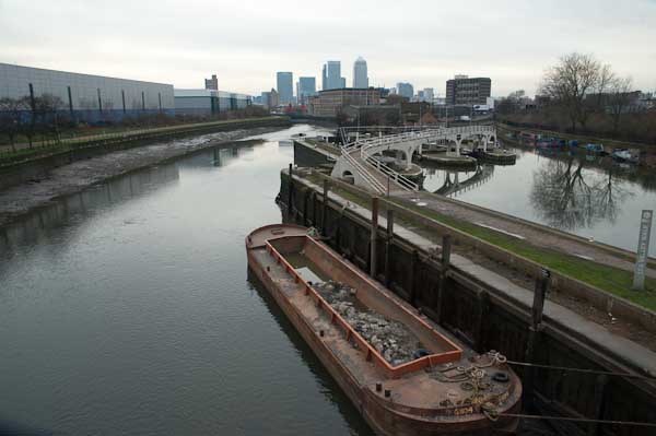
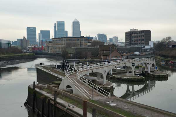
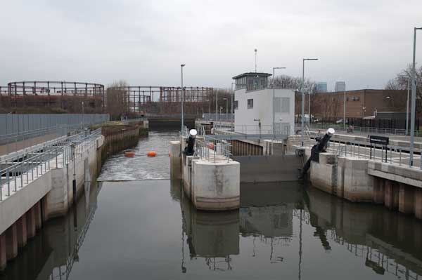
New Lock, Prescott Channel
The walk still only goes as far south as Cody Dock, now a thriving community resource and hub with events and exhibitions and worth a visit, but in 2010 still undeveloped. The silly name has gone and this path is now also a part of London’s sculpture trail, The Line, making its way from the Greenwich Peninsula to Stratford.
Three Mills Wall River
At the end of the Fatwalk, I had to turn around and go back to the Twelvetrees Crescent bridge, where I once again photographed the locks from the Lea Navigation to Bow Creek. Now there are new steps leading down from this bridge to the towpath, but then I had to go across and join the fast-moving traffic on the Blackwall Tunnel Northern Approach to make my way to Three Mills.
Stratford High St
Three Mills is home to one of Newhams only four Grade I listed buildings and the House Mill, a tide mill, was built in 1776, though there had been tide mills here at least since the Domesday book.
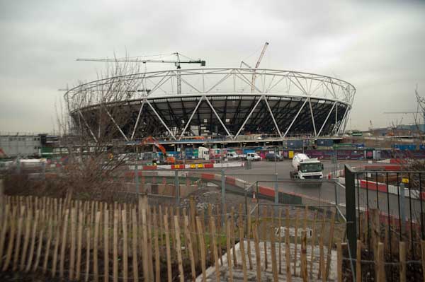
Olympic stadium
The film studios here were converted from a gin factory where Chaim Weizmann developed a new biochemical process to produce acetone needed for explosive production in the First World War – which led to the Balfour Declaration and later to Weizmann becoming the first president of Israel.
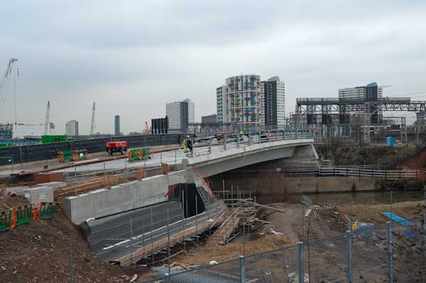
Bridge over City Mill River
Past the studios I visited the new lock on the Prescott Channel, opened in 2009. Supposedly this was to be used by barges to carry away waste and bring in material for the development of the Olympic site instead of lorries, but was in practice only used for photo-opportunities. The Prescott Channel was built in the 1930s, part of a large flood relief programme, that was also largely to provide jobs at the height of the depression.
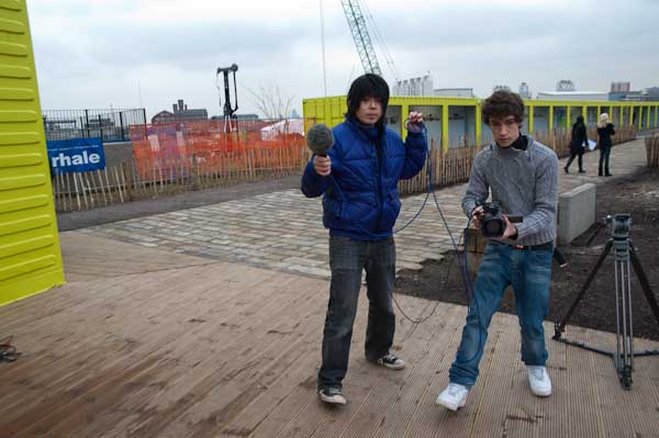
I get interviewed for a student film
Finally I cycled up to the Olympic site, a building site with little or no public access, but parts of the ‘Greenway’ – the path on the Northern Sewage Outfall – were still open and gave extensive views. The reason I was in London on this particular day, when the weather wasn’t at its best was to be interviewed and filmed by a group of students at the View tube on the Greenway. I can’t remember ever seeing the video. After the interview I made my way to Stratford to fold the Brompton and start my journey home on the Jubilee Line.
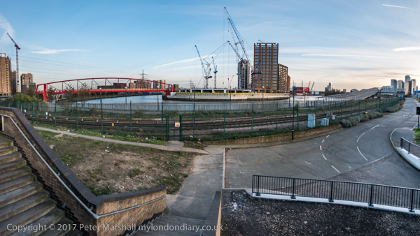
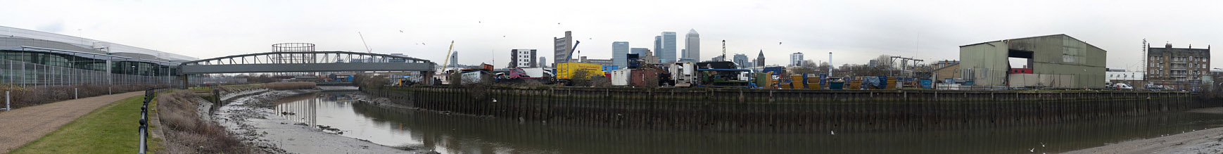
Bow Creek – right click to open at a viewable size in a new tab
As well as taking single images I also produced a number of panoramas, taking a series of pictures from the same position to be stitched together. These include some 360 degree views, produced by software from 6 or 8 individual images. The pictures were taken on a Nikon D700 and are each 12Mp, but the combined files are huge. It isn’t easy to display these on the web, and they fit even less well on this blog. I’ll post one here on a rather smaller scale and invite you to double click on it to see it larger, though still much reduced. You can find more online here.
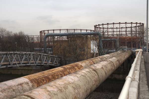
Bromley-by-Bow Gasholders: A week ago on Monday 28th March I was invited to go with a team from Cody Dock on a site visit to the gasholders which are a prominent feature of the local landscape, seen by many thousands every day from the Underground and National Rail lines as they travel in and out of London as well as local residents and walkers along the Lower Lea and Bow Creek, including those following The Line sculpture trail. We were there invited to study the heritage, history and ecology of the Bromley-by-Bow Gasworks site which has just been sold by its future developers.
The seven gas holders, all to a similar design were built between 1872 and 1882 and are all Grade II listed. Nine were built on the site but two are no longer there, the base of one now forming a large circular lake in the site. Holder No 1 was given an extra upper tier in steel in 1925-7 to more than double its capacity. All were taken out of use in the 1980s.
The real value of the site is not in the individual holders although these were some of the “most aesthetically distinguished and finely detailed gasholders ever built” (according to the listing text) but in the ensemble, thought to be “the largest group of Victorian gasholders known to remain in the world, which is testament to the scale of Britain’s pioneering gas industry and its contribution to the Industrial Revolution.” It is a heritage site not just of national importance but of world importance.
Given their importance the group, together with the adjoining memorial garden with its Grade II listed memorial lamp and statue of Sir Corbett Woodall surely deserves both Grade I listing and preservation, and the former gas works offices could form a heritage centre for the area. The offices were for some time a gas museum.
The circular pond is the base of a former gasholder
Just across the Channelsea river from the site is the Grade I listed Three Mills and a little to the south the former gas works Dock at Cody Dock, now a thriving creative and community hub, the sites linked by a riverside path which currently stops at Cody Dock but which should long ago have been opened as planned to lead to the Thames at Trinity Buoy Wharf, passing on the way the Bow Creek Ecology Park. Many sites along here played an important part in Britain and the world’s industrial history, but unfortunately little evidence remains, making it essential to preserve what does.
We were shown around the site in the morning by two of those responsible for planning the development who expressed their wish for the development to retain these elements which make the site unique and to open them up to the public, but good intentions are not enough, particularly for company accountants.
Given what has happened at other sites greater protection is required to make sure that any development in the area leaves the gasholders intact and preserves their landscape value, in particular the views of the ensemble from the railway and Underground lines, from Three Mills and the riverside footpaths by the Channelsea River and River Lea and the navigation. We do need more housing, or at least more social housing rather than luxury flats many of which remain largely unoccupied as investments, but we also need to preserve important monuments such as these which record and could celebrate our history.
Many more pictures from the day, mainly inside the holder site in my album Bromley-by-Bow Gas Holders. You can click on any of the images above to see a larger version in the album – and browse from there. Most of the images have an horizontal angle of view of approximately 145 degrees. There are more pictures of the area in various posts on My London Diary including Bow and The Fatwalk, Bromley-by-Bow to Star Lane and Gasworks Dock Revived.
Bow Common Lane, Bow Common, Tower Hamlets, 1988 88-7r-35
Although this image is labelled as being on Cantrell Road in my very skeletal notes written small in black ink on the contact sheet, it is actually still there next to the railway on the west side of the gasworks site in Bow Common Lane.
This fairly substantial house is on the edge of the gas works site mentioned in the previous post and I wondered if it might have been a part of this development, perhaps a manager’s house. The gasholder was removed in 2016-7
Bow Common, Tower Hamlets, 1988 88-7r-21
I’m fairly sure that Turnbull & Son Builders were not on Cantrell Road as my notes suggest, but certainly somewhere in Bow Common, possibly on Bow Common Lane, Devons Road or St Paul’s Way which were on my route. Little of the older industry in the area now remains.
Bow Common, Tower Hamlets, 1988 88-7r-23
Again there is a frustrating lack of information on the contact sheet, possibly because I was lost. So I’m unsure of the location of this detached Victorian house, but I think it may have been on Turners Road which I went down on my way to Clemence St.
Finally a location I can be sure of, as the block in the background has two signs on it. ‘No Ball Games’ is on not helpful, but over the entrance way just above the thighs of what looks to me a naked rudimentary female figure I can read ‘Gatwick House’.
Although Trevor Tennant (1900-80) entitled this ‘play sculpture’ Gulliver it still looks female to me. It is described in The Buildings of England London: East as “in Festival of Britain Spirit”, though it looks vaguely Henry Moore to me. Tennant in taught at various art colleges including Camberwell School of Art (1930-4). The sculpture commissioned by the LCC for the Locksley Estatew was probably installed when the block was built in 1954-6 and by the time I photographed it was deteriorating – perhaps due to some rather more robust physical play than anticipated. It was originally at the centre of a large sandpit with the base buried in the sand. I suspect the sand was removed after being too often used as a toilet for dogs, a common fate with sandpits in public places.
A gloomy building by a gloomy canal, close to St Anne’s Church which towers above the tree at right. This building at the rear of a ‘dangerous structure’ on Commercial Road opposite the church is still standing, though the lower structures to the right have been demolished. I think this is 777 Commercial Road, a former sail loft, part of the Grade II listed run of buildings here. According to the listing, 777 dates from 1893-4 and was designed by Marshall & Bradley and built by J.H. Johnson for Caird and Rayner. The site is now ‘Sailmakers’ a mixed-use development which will retain the building frontage.
The Flood barrier on the Limehouse Cut presumably became redundant after the building of the Thames Barrier. On the other side of Commercial Road you can see both St Anne’s Church over a billboard and Limehouse Town Hall.
The Empire Memorial Sailors’ Hostel, now called The Mission Building, was built in 1924 to house some of the many sailors in the city needing lodgings. Money to fund it came from an appeal organised largely by women from across the British Empire to save these men who might otherwise have spent the night and their earnings in the company of the oldest profession. They appealed for the funds to build it as a memorial to the 12,000 merchant seamen who were killed in the Great War.
The Grade II listed building originally had 205 single rooms (cabins) and appears to have been designed to the demands of a committee whose members advocated differing styles. It was enlarged in 1932 along Salmon Lane to meet the huge demand, but as the docks closed became a hostel for the homeless. It closed in 1985, presumably not because of any lack of homeless people but because of the cost of housing them, and in 1994 was sold off to a developer who converted it to a gated and portered residential development.
4-12 West India Dock Road, Limehouse, Tower Hamlets, 1988 88-7r-14
A little of the old West India Dock Road, this row of shops is now long gone. The large Grade II listed building at right is still there, built as the Passmore Edwards Sailors Palace, the Headquarters of the British And Foreigh Sailors Society in 1901, with a grand frontage including a crowned Britannia holding on each shoulder a strangely morphed galleon and child. The side view here is rather more utilitarian.
Sail Makers, Ships Chandlers, 11, West India Dock Rd, Limehouse, Tower Hamlets, 1988 88-7r-16
A sign over the door for Pastel Print shows its use in 1988, when local demand for sails, candles and other marine equipment has shrunk to zero. A plaque near the apex of the facade states ‘ERECTED AD.1860’. I think it has now been made into flats and offices retaining the facade.
The next part of my walk, going back into Bow and on towards Bromley-by-Bow will continue in a later post.
Clicking on any of the pictures will take you to a larger version in my album 1988 London Photos from where you can browse the album.
Railway Bridge, River Thames, Battersea Power Station, Grosvenor Rd, Pimlico, Westminster, 1988 88-5f-62
These seven pictures all come from the same film I took at the end of a fairly long day’s walk around Chelsea on Sunday 8th May 1988 which had taken me down to the Thames on Grosvenor Road. I spent some time wandering around on the road and also where it was possible to get onto the riverbank, though most was fenced off.
Railway Bridge, River Thames, Battersea Power Station, Grosvenor Rd, Pimlico, Westminster, 19888 8-5f-64
The views today are rather different, although the railway bridge carrying the main line to and from Victoria is still much the same. In the pictures you can see some work being carried on in Battersea Power Station, but now new flats hide most of the building apart from the chimneys from here, and the gas works have completely gone.
Railway Bridge, River Thames, Battersea Power Station, Grosvenor Rd, Pimlico, Westminster, 1988 88-5f-51
You may still see lighters moored in the river here, but I think this rather odd structure close to the mouth of the vestigial Grosvenor Canal here has gone. I wasn’t absolutely sure why there was this wooden platform with what looked to me like small dog-kennels on it, but perhaps as the rope shows they were simply for mooring barges waiting to use the canal. Technically I think this is a dolphin, as the picture below shows.
Chelsea Bridge, River Thames,Grosvenor Rd, Westminster, 1988 88-5f-52
The first bridge here was built in 1858 when Chelsea Embankment was being built and was a suspension bridge intended to give the large population of Pimlico access to the new Battersea Park – if they could afford the toll – though it was made free on Sundays. It was then called Victoria Bridge, named like the station after the Queen. It became even less popular after Albert Bridge was built at the other end of the park in 1873. It was bought by the Metropolitan Board of Works in 1877 and they abolished the tolls in 1979. It was a narrow bridge and found to be structurally unsound, so fearing it might embarass the Queen if it collapsed they renamed it Chelsea Bridge. It didn’t collapse and apparently took several years to demolish when they decided to replace it with the current bridge which opened in 1937.
As the picture shows, the main cables are attached to the end of the bridge rather than on solid ground on the banks, and it was the first such ‘self-anchored’ suspension bridge in Britain. The LCC couldn’t afford to fund the entire cost and the Ministry of Transport only agreed to stand 60% oof the cost on the condition that all the materials used came from the British Empire.
When Billy Strayhorn named his most famous composition ‘Chelsea Bridge’ it was not this structure that he had in mind, but something more ethereal, probably Whistler’s Nocturne: Blue and Gold – Old Battersea Bridge.
Grosvenor Canal, entrance, River Thames, Pimlico, Westminster, 1988 88-5f-53
I wrote at some length in a previous post about the Grosvenor Canal, London’s last working canal, still in use when I took this picture. You can see part of one of the barges still in use to carry Westminster’s rubbish downriver through the bridge.
Chelsea Bridge, River Thames, Battersea Power Station, Chelsea Embankment, Kensington & Chelsea, 1988 88-5f-43
The pictures here (and on Flickr) are from around 20 exposures I made on this small area of riverside, though many of the others are very similar. There were very few boats around moving on the river at the time.
Pagoda, Battersea Park, River Thames, Chelsea Embankment, Kensington & Chelsea, 1988 88-5f-34
I walked upriver along Chelsea Embankment on my way to catch a bus across Battersea Bridge to take me to Clapham Junction for the train home. On my way I took a few pictures of the impressive late-Victorian houses – which haven’t made it to my Flickr album – and four pictures across the river of the Battersea Park Peace Pagoda, this one of which has. I’m not sure about the framing and I think it would perhaps be better in a square format but I felt it had a suitably Japanese feel to it.
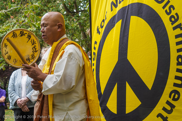
Reverend Gyoro Nagase at Hiroshima Day, Tavistock Square, 2019
After the destruction of Hiroshima and Nagasaki by US atom bombs in August 1945, Nichidatsu Fuji who had in 1917 founded the Japanese Buddhist movement, Nipponzan Myohoji, in 1947 decided they would set up Peace Pagodas around the world to promote peace and non-violence. The first opened in Japan in 1954 and the London Peace Pagoda was built by Nipponzan Myohoji monks and opened in 1985, shortly after Nichidatsu Fuji died aged 100. Since 1978 it has been looked after by Reverend Gyoro Nagase who I have met and photographed at many events calling for peace. There are also Peace Pagodas in Milton Keynes and Birmingham among over 80 around the world.
Click on any of the black and white images to go to a larger version in my album 1988 London Photos from where you can browse to other images.
All photographs on this and my other sites, unless otherwise stated, are taken by and copyright of Peter Marshall, and are available for reproduction or can be bought as prints.
Back in the 1980s it wasn’t possible to walk beside Bow Creek from Bow Locks south to the East India Dock road, as the banks were occupied by various industrial and commercial sites, including two gas works and West Ham power station. And although there have been plans by the councils for many years, even today you can only walk down on the Newham bank as far as Cody Dock, on a path opened to the public some years ago with the ridiculous name of the Fatwalk, but since renamed. There is a tantalising walkway visible continuing past the dock along the former power station bank, but this is still closed to the public.
While this was a limitation, it was also an opportunity to explore the two areas where roads ran close (or not too close) to Bow Creek to both the east in West Ham and west in Bromley and Poplar, and I was rewarded by some images I found interesting, though parts of my walks were along fume laden streets with heavy traffic.
Tweed House, a tall block of council flats on the Blackwall Tunnel Approach Road next to the Limehouse Cut enabled me to take some pictures which I more recently stitched together to create two panoramas of the area – the individual pictures are also in the Flickr album. Click to see the larger versions on Flickr.
From various places both on to the east and west of Bow Creek I found rather satisfyingly bleak views of the distant power station, including one with a young mother with a small baby in a pram.
Others were emptier still, like this
or more minimal and just occasionally rather threatening; some streets around here featured in crime films and TV dramas of the era, gangster London.
But there was also a little chance for fun, with a cafeteria with two giant cooling towers to take away the cooking fumes and the unlikely name of Oasis.
Poplar Gas Works was on a rather smaller scale to Bromley-by-Bow, but its gas holders still dominated the working class housing around it. Two young girls playing on the grass came to see what I was doing and insisted on being photographed, though I perhaps should have stepped back a foot or two to avoid cropping their feet to get the gasholder in the frame.
At East India Dock Road I was able to return to Bow Creek – and things got even more interesting (and although very different they still are) as I hope to show you in the next installment of my work from the Flick album River Lea – Lea Navigation – 1981-92 – the pictures above are all on Page 4.
Clicking on any of the images above should take you to a larger version on Flickr, and you can also go on to explore the album from there.
All photographs on this and my other sites, unless otherwise stated, are taken by and copyright of Peter Marshall, and are available for reproduction or can be bought as prints.
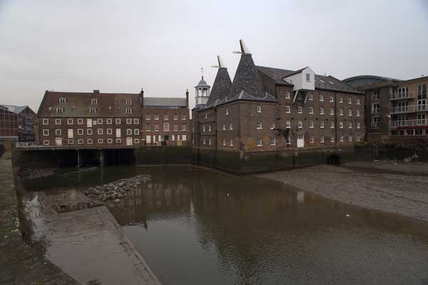
Three Mills Lane which runs from Hancock Road, a short walk from Bromley by Bow Underground station takes you across the Lea Navigation and Bow Creek to a remarkable ensemble of four of Newham’s listed buildings, including the Grade I listed House Mill from 1776, the early 19th century offices and the 1817 Clock Mill, with its 1753 Clock Tower. The fourth is easy to miss, as it is the stone setts and flagstones under your feet, dating back to the 19th century.
Together they make a splendid early industrial landscape, though now a little hemmed in by rather more recent flats. When I photographed there in the 1980s and 1990s, the area around was full of largely 20th century industrial sites, mainly along the navigation, and a little still remains, particularly an impressive set of gas holders (seven Grade II listings) on the southern side of the Channelsea River at the former Bromley-by-Bow gas works (which also has listings for its bridge across the canal and Bow Creek as well as its war memorial and statue of Sir Corbet Woodhall.)
Three Mills Wall River
In more normal times the House Mill, which was saved from demolition in the 1970s and has been partially restored offers reasonably priced guided tours on Sundays from May to October and at some other times as well as hosting various events. The mill is a tide mill, and is on a site recorded in the Domesday Book, with foundations dating back to the end of the 14th century. It was able to generate power for 7-8 hours a day, though the output varied with the monthly changes in tides. Together with the Clock Mill it would grind an average of 125 tons of grain a week.
The towpath running south from Three Mills is on a narrow strip with the navigation on the west and Bow Creek to the west, and it leads down under railway bridges to Twelvetrees Crescent (where recent stairs now allow you to go on to the bridge and continue your walk beside Bow Creek) and under the bridge to Bow Locks where you can continue along the Limehouse Cut.
You won’t see the empty lighters on the navigation that were there when I walked along here in 1983, not long after commercial traffic ended. The large pipe across in front of the bridge would have carried gas from the Bromley gas works across to deliver gas to London west of the works. The listed bridge dates from 1872. Under it you can see the bridge which takes the path across Bow Locks and on to Gillender St or to the towpath beside the Limehouse Cut.
More on page 4 of River Lea – Lea Navigation. Click any of the images above to go to larger versions on my Flickr site.
All photographs on this and my other sites, unless otherwise stated, are taken by and copyright of Peter Marshall, and are available for reproduction or can be bought as prints.
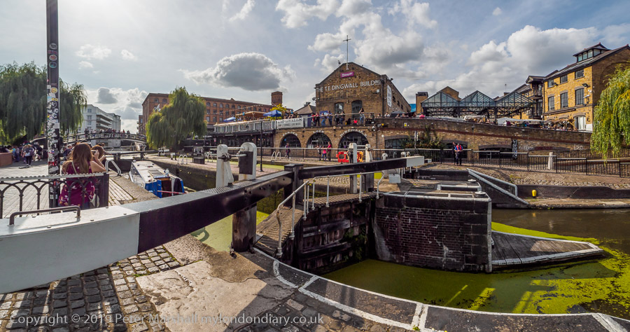
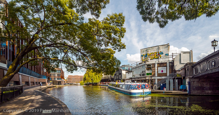
200 years ago the Regent’s Canal was opened. In some respects it was like HS2 today, cutting travel times, though for goods, providing a more direct link between London’s Docks and the canal system which served Birmingham and much of the rest of England. Perhaps more importantly it brought coal and building materials into the centre of London at City Road Basin, and other basins and Samuel Plimsoll’s (remembered for his line) coal drops north of King’s Cross.
And like HS2 it came in late (though at the moment it is still doubtful if HS2 will come in at all, and it certainly will never deliver what was promised.)
The canal was first proposed in 1802, but only got Parliamentary approval in 1812, after it had been adopted by the Prince Regent (later George IV) and John Nash as a part of their scheme for redeveloping Regent’s Park.
Like HS2, the canal had its controversies and problems. In 1815 Thomas Homer, who had first proposed the canal and remained in charge with Nash although neither knew anything about building canals, was found to have stolen company funds and was sentenced to transportation (though it appears the sentence was never carried out.) The first length of the canal, from Little Venice to Camden was completed and opened on the birthday of the Prince Regent in August 1816, but there wasn’t enough money to complete the rest.
The government came to the rescue with the Poor Employment Act of 1817, designed to give work to those unemployed after the end of the war against Napoleon, which provided cheap labour so the scheme could continue.
There were technical problems too, particularly with at Hampstead Road, where a hydro-pneumatic boat lift had been built to an innovative design by William Congreve (better known for his military rockets.) Designed to save water, as the canal had problems with water supply, although the design worked when first installed it quickly broke down when handed over to the canal company, possibly because the materials then available for pneumatic seals were not up to prolonged use. There was a lengthy and acrimonious dispute between the inventor and the canal company, who eventually replaced the lift with a two chamber conventional lock as used elsewhere on the canal.
Also like HS2, there were huge cost increases. The canal eventually cost £772,000 which was twice the original estimate.
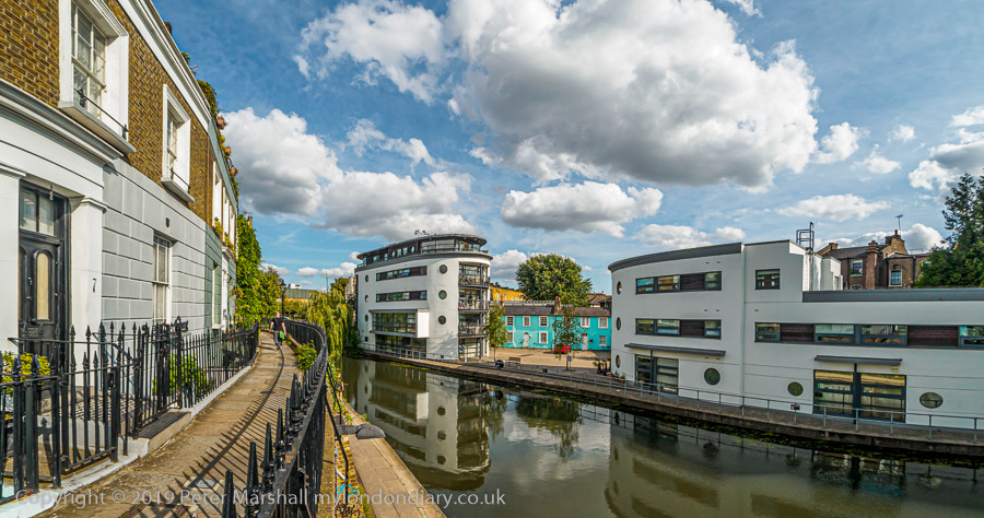
I’d begun my walk at Camden Road station, walking from there through the Maiden Lane estate and new developments to York Way where I met a colleague with whom I will be having an exhibition in March 2020. My contribution to the joint show will be a set of around a dozen pictures commemorating the canal anniversary. We made our way together along the towpath to Kentish Town Rd, with several stops where she sat down to sketch and I wandered around making photographs. After leaving her I walked on to Cumberland Basin before returning to Camden Road station.
All photographs on this and my other sites, unless otherwise stated, are taken by and copyright of Peter Marshall, and are available for reproduction or can be bought as prints.
There are no adverts on this site and it receives no sponsorship, and I like to keep it that way. But it does take a considerable amount of my time and thought, and if you enjoy reading it, please share on social media. And small donations via Paypal – perhaps the cost of a beer – would be appreciated.