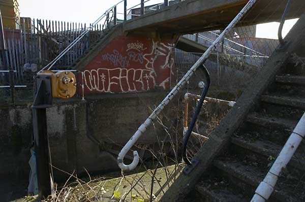
Posts Tagged ‘Channelsea River’

Before the Olympics – A walk in 2005

Monday, January 23rd, 2023

I published this post seventeen years ago on My London Diary, following an organised walk around the Olympic Site by locals while London was making its unfortunately successful bid to host the 2012 games. I’ve corrected the capitalisation but otherwise it remains as written. Going around the area some ten years after the games there is nothing I would want to change in the piece, though the legacy has turned out even worse than we feared back then, with so many broken promises.


Olympic site? – Stratford and Temple Mills, 23 Jan, 2005

Before the Olympics
Carpenters Road lock, Old River Lea, London

I first got to know the lower Lea (or Lee) valley around twenty-five years ago, when many of the traditional industries, many based around the Lea Navigation, had or were just ending. Parts of it were almost a dark continent, with the Bow Back Rivers machete country. Secateurs became an essential photo accessory, and together with a heavy duty tripod swung with abandon hacked a path alongside streams overgrown with bramble, nettles and bushes.

Before the Olympics
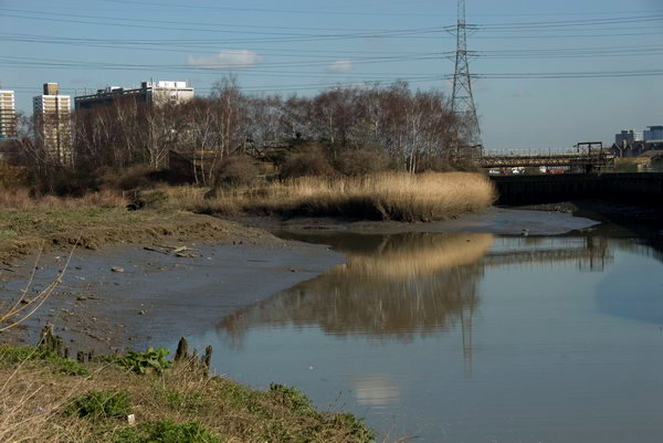
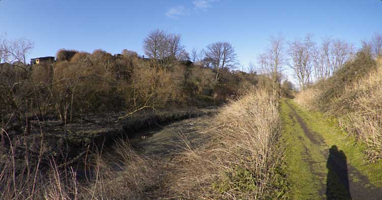
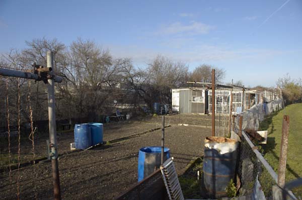
Channelsea River, allotments and path near Eastway Cycle Circuit

Since then, things have changed, with proper paths, nature trails, signposts and more, although it remains an area of relative peace and quiet. All this could soon change. You can hardly move in or around London without the almost continuous reminder of the 2012 Olympic bid. Large sums are being spent to convince us it is a good thing, despite concurrent claims that over 70% of Londoners already support it.

Before the Olympics
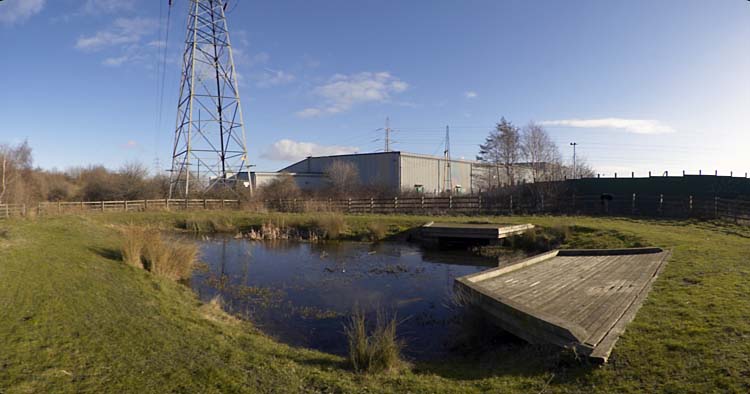
Bully Point Nature Reserve, Stratford

For this particular area of London it will mean dramatic changes, and whatever the good intentions of the developers (and I’ve read them) these will probably be environmentally disastrous. Development on this scale almost always is. Even the proponents acknowledge short-term problems, while local environmentalists point out the massaging and misrepresentation in parts of their planning, as well as the failure to ensure a proper post-games future for the area. While some of the proposals make sense for the area, the short-term priorities of the games will result in many that do not.

Before the Olympics
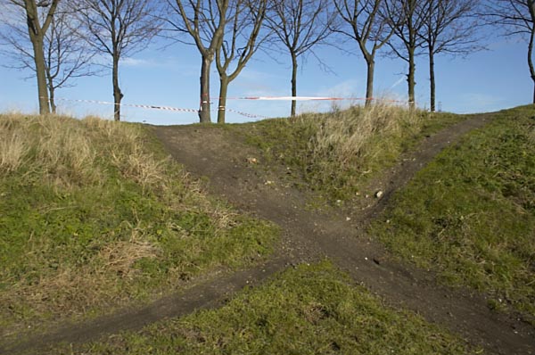
Off-road tracks at Eastway Cycle Circuit, Temple Mills

I’m not against the Olympics as such; in some ways they could be a good thing for the country, although the whole movement has been allowed to get seriously out of hand. I’m cynical enough to know that much of the enthusiasm for London 2012 comes from companies who are already making serious money from the promotion and will make even more should they happen, and realistic enough to know that any local opposition to them can only enforce very minor changes to their impact. Such local views are likely to carry far more weight on developments in the area should the London bid fail.

Allotments on ridge between Old River Lea and Channelsea River, Stratford.

Sunday I cycled from Stratford to Temple Mills to join a walk around the northern part of the site, organised by No To London 2012, a coalition of East London community groups and social justice campaigners. A group of just over twenty of us spent an enjoyable couple of hours looking at the area and the impact the Olympic developments would have. it was an opportunity that IOC delegates are not likely to have, with their view of these particular areas expected to be with a pair of binoculars from a distant tower block.

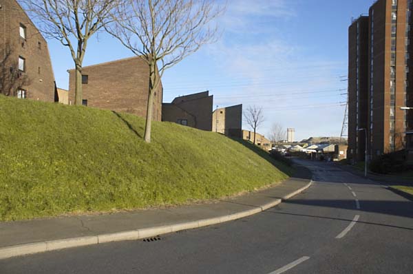
Clays Lane estate, Stratford

We stood first of all on a part of Hackney Marshes, watching the local footballers play on an area marked for a vast coach park, wondering how long it would take for it to be returned to recreational use, before making our way south across the A12 to the Eastway Cycle Circuit, now a well-used recreational area which will also be dramatically changed, becoming in the long term part of a larger Velopark, and on to the recently established Bully Point Nature Reserve at the southwest of the site between the Channelsea River and the River Lea, a viewpoint over the major land-forming currently taking place as a part of the Channel Tunnel Rail Link works and the future development of Stratford City.

Wick Field on edge of Hackney Marsh

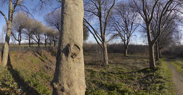
Returning to Eastway, we climbed over a barrier onto Arena Field. Until a few years back this was a cricket ground, but travellers occupied it and the pavilion was burnt down. It was then used as a landfill site, raising the overall ground level around twenty feet. On the other side of Eastway we walked through Wick Field, site of massive tree-planting by Hackney. The new path we walked through, designed and made by one of those on the walk, was pleasant if muddy.

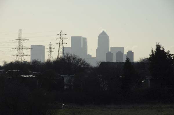
Canary Wharf towers from Eastway Cycle Circuit

At the end of the walk I went back to the bench in Wick Field, in the centre of a fine row of plane trees running parallel to the Lea Navigation and sat down to eat my lunch. In front of me a grassy fire-break path stretched into the distance, marred only slightly by dimly seen lorries at its end on the elevated roadway. As I sat there, the unmistakable low-slung red-brown shape of a fox strode slowly across the path a hundred yards away.

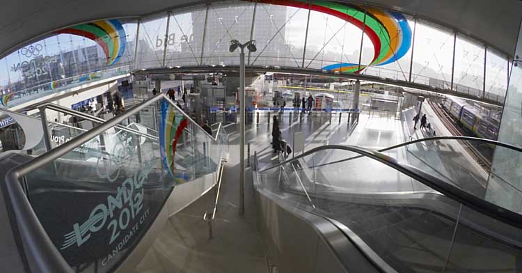
London 2012 Olympic advertising at Stratford Station

I made my way back to Stratford by Leyton, returning to look at some of my memories – St Josephs Cemetery and the nearby crossroads on Langthorne Road, the stump of Claremont Road and then a few pictures around the centre of Stratford itself.


You can see more pictures from the walk and my cycle rides from and to Stratford Station before and after the walk http://mylondondiary.co.uk/2005/01/jan3.htm with the original posting. All pictures were made with a Nikon D70, with some of the panoramas stitched together from several images.

You can see these and more pictures from the area on my Lea Valley web site, Some are also in my book Before The Olympics, first published in 2010, ISBN: 978-1-909363-00-7 still available from Blurb both as an expensive paperback or as a PDF.


Bromley-by-Bow Gasholders

Tuesday, April 5th, 2022

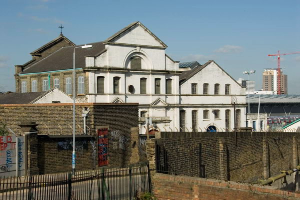
Bromley-by-Bow Gasholders: A week ago on Monday 28th March I was invited to go with a team from Cody Dock on a site visit to the gasholders which are a prominent feature of the local landscape, seen by many thousands every day from the Underground and National Rail lines as they travel in and out of London as well as local residents and walkers along the Lower Lea and Bow Creek, including those following The Line sculpture trail. We were there invited to study the heritage, history and ecology of the Bromley-by-Bow Gasworks site which has just been sold by its future developers.

Bromley-by-Bow Gas Holder Site Visit

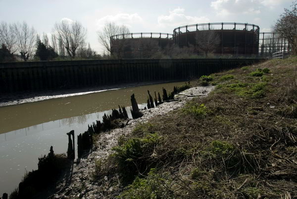
The seven gas holders, all to a similar design were built between 1872 and 1882 and are all Grade II listed. Nine were built on the site but two are no longer there, the base of one now forming a large circular lake in the site. Holder No 1 was given an extra upper tier in steel in 1925-7 to more than double its capacity. All were taken out of use in the 1980s.

Bromley-by-Bow Gas Holder Site Visit

The real value of the site is not in the individual holders although these were some of the “most aesthetically distinguished and finely detailed gasholders ever built” (according to the listing text) but in the ensemble, thought to be “the largest group of Victorian gasholders known to remain in the world, which is testament to the scale of Britain’s pioneering gas industry and its contribution to the Industrial Revolution.” It is a heritage site not just of national importance but of world importance.

Bromley-by-Bow Gas Holder Site Visit

Given their importance the group, together with the adjoining memorial garden with its Grade II listed memorial lamp and statue of Sir Corbett Woodall surely deserves both Grade I listing and preservation, and the former gas works offices could form a heritage centre for the area. The offices were for some time a gas museum.

Bromley-by-Bow Gas Holder Site Visit
The circular pond is the base of a former gasholder

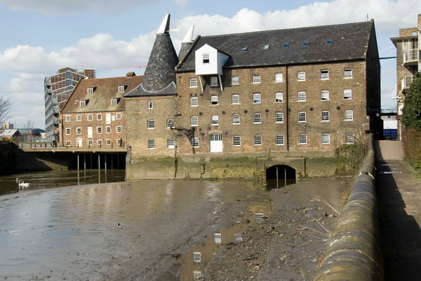
Just across the Channelsea river from the site is the Grade I listed Three Mills and a little to the south the former gas works Dock at Cody Dock, now a thriving creative and community hub, the sites linked by a riverside path which currently stops at Cody Dock but which should long ago have been opened as planned to lead to the Thames at Trinity Buoy Wharf, passing on the way the Bow Creek Ecology Park. Many sites along here played an important part in Britain and the world’s industrial history, but unfortunately little evidence remains, making it essential to preserve what does.

Bromley-by-Bow Gas Holder Site Visit

We were shown around the site in the morning by two of those responsible for planning the development who expressed their wish for the development to retain these elements which make the site unique and to open them up to the public, but good intentions are not enough, particularly for company accountants.

Bromley-by-Bow Gas Holder Site Visit

Given what has happened at other sites greater protection is required to make sure that any development in the area leaves the gasholders intact and preserves their landscape value, in particular the views of the ensemble from the railway and Underground lines, from Three Mills and the riverside footpaths by the Channelsea River and River Lea and the navigation. We do need more housing, or at least more social housing rather than luxury flats many of which remain largely unoccupied as investments, but we also need to preserve important monuments such as these which record and could celebrate our history.

Many more pictures from the day, mainly inside the holder site in my album Bromley-by-Bow Gas Holders. You can click on any of the images above to see a larger version in the album – and browse from there. Most of the images have an horizontal angle of view of approximately 145 degrees. There are more pictures of the area in various posts on My London Diary including Bow and The Fatwalk, Bromley-by-Bow to Star Lane and Gasworks Dock Revived.


Sewage & Sulphuric Acid

Thursday, January 21st, 2021

Channelsea River, Northern Outfall Sewer, Greenway, Stratford, Newham, 1983 36p-53_2400

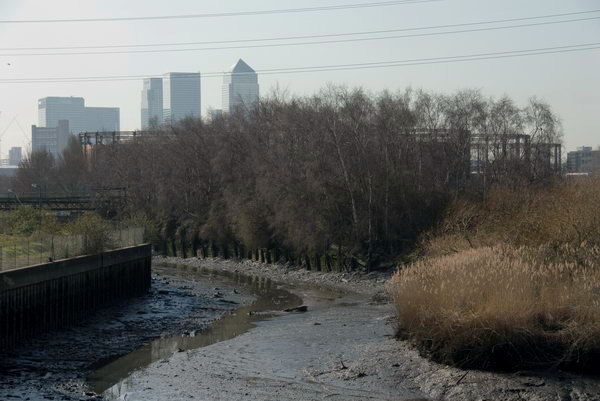
The Channelsea River used to be a fairly important stream of the River Lea as it made its way down to Bow Creek, and the size of the bridge which carries the Northern Outfall Sewer over it close to Abbey Mills Pumping Station reflects this. Now in the few places that it remains visible it is little more than a ditch, and I couldn’t see any water flowing from it, and the Channelsea here is simply a tidal creek, often now called Abbey Creek.

Sewage storm outfall,  Channelsea River, West Ham, 1982 32g-63_2400

Except for this row of openings. When heavy rain falls on London, it pours from the streets into the sewers, augmenting considerably their normal load of sewage. When the system was established in the Victorian era the flows were considerably smaller, but London has grown, with more people, more houses, more streets and more paved, concreted and tarmaced areas to rapidly drain away the water that might have once largely soaked into soil. The excess water (and not just water) has to go somewhere, and that somewhere is here on the Channelsea River.

Sewage storm outfall,  Channelsea River, West Ham, 1982 32g-61_2400

Which certainly accounts for the lushness of the growth around the banks of the stream and on Channelsea Island and which was noticeable (along sometimes with a noticeable odour) as I walked along the path past the rather large pipe on the bank. To the right of the picture you can see a part of the pumping station, which back then was fairly well hidden behind vegetation as you walked along the ‘Greenway’ – you get a much better view now. And at the left are the Bromley-by-Bow gasholders, still present while many others in London have disappeared.

Channelsea River, Stratford, Newham, 1983 36p-61_2400

Looking across the Channelsea from beside that giant pipe showed an industrial landscape, now all gone. Channelsea House, the large six-storey 1960’s office block at right of the top picture, is now flats. But beyond it used to be large factories, including those making sulphuric acid, where there is now mainly empty space, with a small area now the London Markaz (Masjid-e-Ilyas), one of the biggest purpose-built mosques in London with space for 6,000 male worshippers.

Works, Channelsea River, West Ham, 1982 32g-51_2400

These works stretched some way along the bank of the river and between it and the railway lines to the south, as you can see in the picture below, taken looking up the creek with Channelsea House at its left.

Chemical Works, Channelsea River, West Ham, 1982 32g-52p_2400

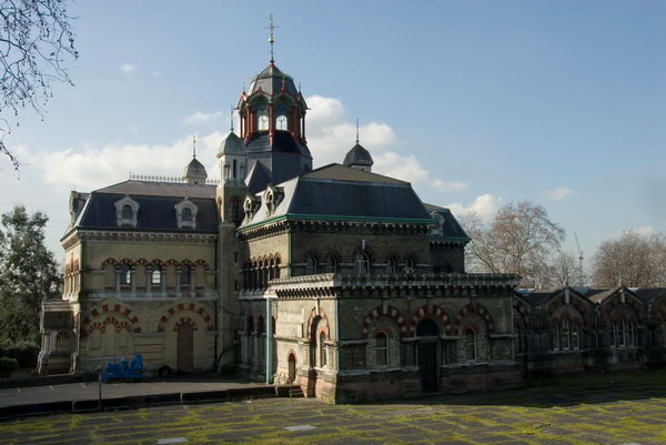
Immediately north of the bridge over the Channelsea River is the West Ham Sewage Pumping Station built in 1897 by West Ham Corporation to raise their sewage into the Northern Outfall Sewer. Previously they had released it into the creek. This contained three steam pumping engines which were decommissioned in 1972.

Abbey Rd, Stratford, Newham, 1983 36p-42_2400

I didn’t photograph Abbey Mills on my walks along the Northern Outfall as it was hidden or largely so by the vegetation along the edge of the embankment, since largely cleared. But also a part of Bazalgette’s work were a row of houses on Abbey Lane built in 1865 for the workers at the pumping station, with steps at one end leading up to the path along the top of the Outfall.

Northern  Outfall Sewer, Abbey Lane, Stratford, 1983 33x-55_2400

Clicking on any of the pictures will take you to a larger version on Flickr from where you can explore other pictures in the album.


All photographs on this and my other sites, unless otherwise stated, are taken by and copyright of Peter Marshall, and are available for reproduction or can be bought as prints.


Stratford Marsh: Sewage and Rivers

Thursday, January 7th, 2021

Northern Outfall Sewer, Lea Navigation, Stratford Marsh, Newham, 1983 36o-24_2400
Two pipes and behind them the Northern Outfall Sewer

Part of Bazalgette’s great plan for freeing the Thames in central London from being a huge open sewer was to build large sewage pipelines to sewage works to the east of London. North of the river, the Northern Outfall Sewer, built in 1960-65, channels sewage from high level sewers serving North London and those from Central London to run under an embankment from Wick Road, across the Lea Navigation at Old Ford and past Stratford’s ‘Cathedral of Sewage’ at Abbey Mills which pumps up sewage from lower level sewers serving West London to join it and flow together to the sewage works at Beckton, the effluent from which is discharged into the Thames. Above the large pipes is a path for pedestrians and cyclists, rebranded at great expense as ‘The Greenway’ in the early 1990s.

Lea Navigation, Stratford Marsh, Newham, 1983 36o-34_2400
These two pipes close to the Greenway are perhaps for gas.

It provides a useful traffic-free route across Newham, but access to it is often poor, particularly for cyclists and for the past 15 or so years has been blighted by closures of various sections, particularly in Stratford Marsh for the 2012 Olympics and Crossrail construction as well as sewer maintainance. It should be open again now and is an interesting walk, though the slightly sweet sickly smell may put some off.

Towards Bow, from Northern Outfall Sewer, Stratford Marsh, Newham, 1983 33x-14_2400
Stratford Marsh and Bow, 1983
Lea Navigation from Northern Outfall Sewer, Stratford Marsh, Stratford, Newham, 1990 90-9h56_2400
The sewer path provides an elevated viewpoint. Lee Navigation and Bow 1990

Stratford Marsh north of the Northern Outfall was bounded by water. The Old River Lea ran from Carpernters Road through Carpenter’s Lock to join the Lea Navigation just south of Old Ford Lock and immediately north of the outfall. Along its east side was the Waterworks River (carrying most of the flow from the Lea and passing under the sewer close to Stratford High St, which it flowed under close to City Mill Lock. Running West from the other end of the lock was St Thomas’s Creek joining to the Navigation at Bow Bridge, and north the City Mill River linking to the Old River Lea.

City Mill River, Stratford Marsh, Newham, 1983 35p-24_2400
A rare boat makes its way around the Bow Back Rivers. City Mill River, 1983

Until the closure for the Olympics it was possible for boats to navigate around the area, leaving the navigation just above Bow Bridge on St Thomas’s Creek, going north up the City Mill River, then west along the Old River Lea back to the navigation, all these rivers being at the same level. In quite a few days of walking around the area I only saw two boats making the trip.

Signal Box, Stratford Station, Stratford, Newham, 1983 35p-65_2400
Channelsea River at Stratford Station, 1983

Another smaller channel, the Pudding Mill River, ran a little to the west of this down from the Old River Lea, disappearing under the railway lines which cut through Stratford Marsh (a couple of pictures in a later post.) This river I think disappeared completely under the stadium in the Olympic makeover; while all around them was changed (including the soil, much imported from elsewhere) the other watercourses in this area emerged largely unscathed though there were changes south of the High St, and I think the Channelsea River was possibly further marginalised.

Channelsea River, Jupp Rd, Stratford, Newham, 1983 35p-62_2400
Channelsea River, Jupp Rd, Stratford, 1983

Eastway & Stratford

Monday, January 4th, 2021
Eastway Cycle Circuit, Stratford, Newham, 1983 36n-54_2400
Eastway Cycle Circuit, 1983

I hadn’t taken my bike when I visited the Eastway Cycle Circuit in 1983, so I was walking around the area and keeping out of the way of the few cyclists who were using the track. It was built on a landfill site in 1975, the first purpose-built road cycling venue in the UK, with a one mile circuit used for road racing and time trials, around which many well-known cyclists including the legendary Eddy Merckx raced, and later hosted this country’s largest weekly mountainbike cross-country race series.

Eastway Cycle Circuit, Stratford, Newham, 1983 36n-01_2400
Eastway Cycle Circuit, 1983

The last race took place here on October 21, 2006, with part of the site being used to build the Olympic village. There were a number of protests by cyclists about the closure and what many saw as an inadequate replacement a short distance away in the Olympic park next to the A12. the Lea Valley VeloPark, particularly after its size was reduced from the originally promised 34 hectares to a mere 10.

Eastway Cycle Circuit, Stratford, Newham, 1983 36n-62_2400
Eastway Cycle Circuit, 1983

Running along the west side of the cycle circuit was the Channelsea River, once a major stream of the River Lea going close to the centre of Stratford, but now reduced to a minor ditch. The pattern of waterways in the area is hard to understand with a number of natural and man-made streams, some possibly built to power medieval mills but I think much of its flow was probably diverted into the Waterworks River perhaps around 1745 when the West Ham Waterworks Company opened its works. More changes were made in an extensive programme of flood prevention in the 1920s and 30s, and it was probably then that the Channelsea was severely reduced in status.

Eastway Cycle Circuit, Stratford, Newham, 1983 36n-63_2400
Eastway Cycle Circuit, 1983
36n-64_2400
Eastway Cycle Circuit, 1983
Channelsea River, Eastway Cycle Circuit, Stratford, Newham, 1983 36n-65_2400
Eastway Cycle Circuit, 1983
Freightliner Terminal, Cold Stores, Stratford, Newham, 1983  36n-52_2400
Freightliner Terminal, Cold Stores, Stratford, Newham, 1983

Stratford expanded greatly as a railway town, and much of the area to the north of its centre between Carpenters Road and Leyton Road, south of where the Cycle Circuit was built was covered by an incredible mesh of tracks, engine sheds and railway works by the start of the twentieth century. Most of this had gone by the time I took these pictures, replaced in part by cold stores and a Freightliner Terminal. Now there is a rather bleak Olympic Park and a vast shopping centre along with new housing, and also a new high-speed rail line.

Cold Stores, Stratford, Newham, 1983  36n-53_2400
Cold Stores, Stratford, Newham, 1983 36n-53_2400
Stratford Station, Stratford, Newham, 1983 35r-15 (2)_2400
Stratford Station, Stratford, Newham, 1983

Stratford Station could still show an impressive amount of railway. Since 1983 it has also added new lines, with the DLR from Poplar terminating here and the Jubilee Line opening at the end of the last century. The old North London service which I used to travel here from Richmond to take these pictures has now been rebranded as a part of the London Overground and terminates here, with its parts of its track south of Stratford now a part of the DLR to Canning Town and beyond.

Clicking on any of the pictures in this post will take you to a larger version in my Flickr album River Lea – Lea Navigation 1981-1992.


All photographs on this and my other sites, unless otherwise stated, are taken by and copyright of Peter Marshall, and are available for reproduction or can be bought as prints.