Posts Tagged ‘factories’

An Olympic Bike Ride

Tuesday, January 4th, 2022

Businesses later demolished at the heart of the site for London’s 2012 Olympics

An Olympic Bike Ride: At the end of 2002 I finally bought a Brompton, a rather expensive folding bicycle which then cost me around £600. Perhaps not a lot for a new bike then and certainly not now, but rather more than the £13-7s6d or so the other bike I was still riding had cost in 1958.

Clays Lane Housing Co-operative – demolished for the Olympics

I’d been thinking about it for years, and it would certainly have been very useful for the work that I’d been doing around outer London in the previous decade, but I’ve only used it infrequently for my photography.

Eastway Cycle Circuit – lost to the Olympics

Though it’s a great way to get to places, taking it by train or underground and riding from a convenient station, Bromptons are a powerful magnet for bike thieves, so easy to put in a car boot or van, and selling at a relatively high price. It isn’t safe to lock them anywhere in public view when even the best cycle lock can only detain the well-equipped thief for around 30 seconds.

Bully Fen Wood – Community Woodland lost to the Olympics

So rather than using it for my general photography – mainly of protests and other events – I’ve used it for cycle rides on which I’ve taken photographs, both around where I live – it’s easier to jump on and off than my full-size bike – and in and around London.

Factory on Waterden Road – demolished for the Olympics

Thursday 4th January 2007 was a nice winter’s day, not too cold and blue skies with just a few clouds, and I went with the Brompton to Waterloo and then on the Jubilee Line to Stratford. Preparations had begun for the 2012 London Olympics and I wanted to see and photograph what I could of the changes that were taking place.

The footbridge has been kept in the new Olympic Park

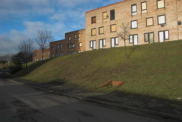
My account of the day on My London Diary begins with my tongue-in-cheek suggestion that it would have been much preferable on environmental ground to shut down Heathrow and use that as the Olympic site, but goes on to describe a conversation I had with one of the residents at Clays Lane, then about to be demolished (spelling etc corrected.)

‘he talked of living in a fascist state, with lack of consultation and individual powerlessness, and of the games as having always had a militaristic overtone. hardly surprising there is little support for the games here, as initial promises that people from the Clays Lane Housing Co-operative would be rehoused in conditions “as good as, if not better than” their present estate were soon changed to “at least as good as in so far as is reasonably practicable.”‘

My London Diary

Work on the site seen from the Greenway

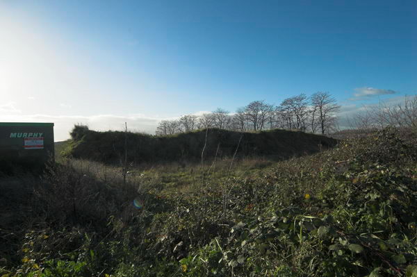
From Clays Lane I moved to the Eastway Cycle Track, already closed and fenced off – I decided against going through a gap in the fence to ride around it. The Community Woodland at Bully Fen Wood was also already closed. and I cycled on around the roads at the north of the site to Hackney Wick.

Pudding Mill River and Marshgate Lane – all now gone

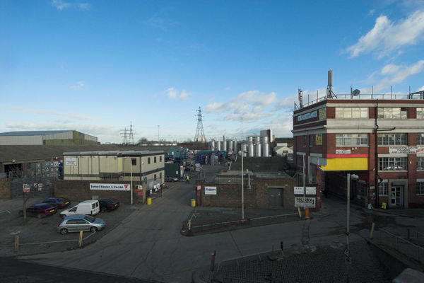
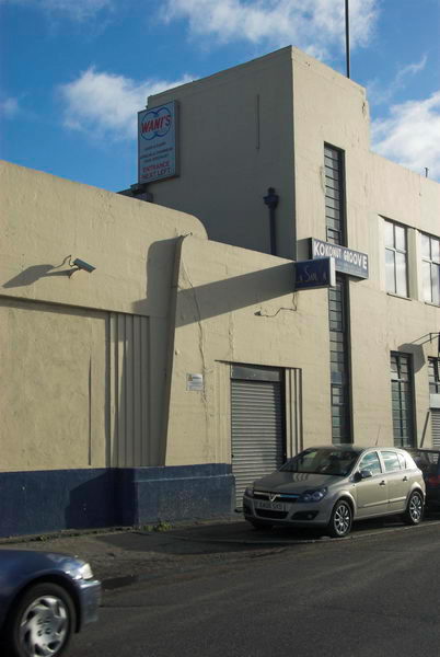
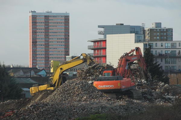
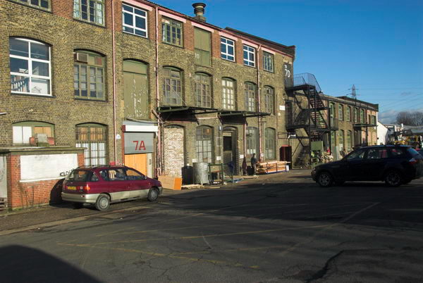
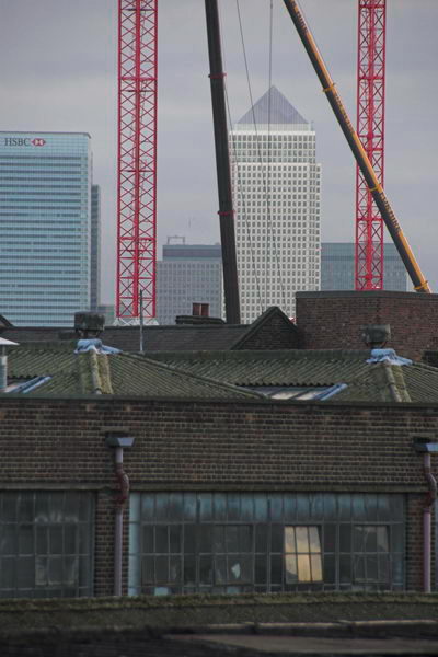
Along Waterden Road I photographed some of the other industrial sites that were to be lost to the games, then turned along Carpenters Road and into Marshgate Lane, all soon to be fenced off and everthing on them destroyed. After taking pictures around Marshgate Lane I went back and into Hackney Wick, photographing the Kings Yard workshops on Carpenters Road soon to be demolished on my way.

Kings Yard – demolished for the Olympics

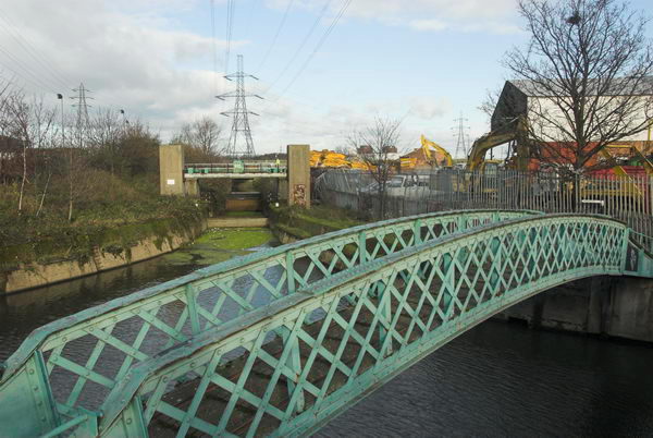
Hackney Wick to the west of the Lea Navigation is largely outside the Olympic compulsory purchase area, but some large areas of industry were scheduled for demolition and I took more pictures. I found the towpath here beside the navigation still open and rode down it to Stratford High Street, where more industry to the north of the road is also going.

Canary Wharf from Stratford Marsh

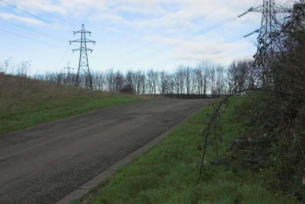
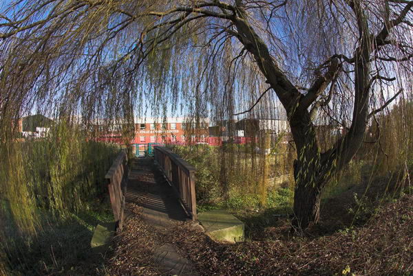
I spent some time going up the roads and paths here going from the High Street into Stratford Marsh which were still open, then went east along the top of the outfall sewer past areas also covered by the Olympic CPO.

St Thomas Creek, Bow Back Rivers – factories at left and right to be demolished

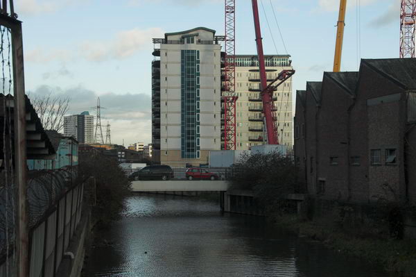
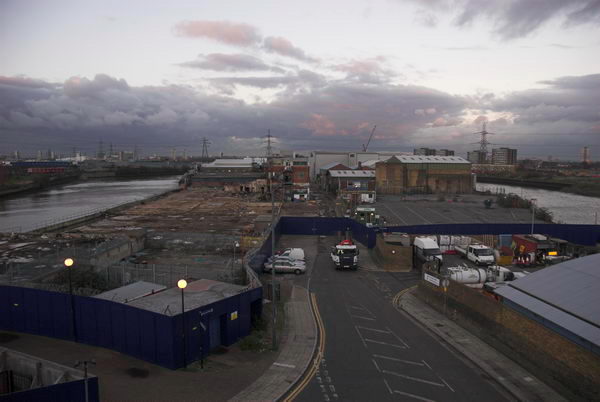
There was still a little light and I came down from the ‘Greenway’ and cycled down to Bow Creek from West Ham, going down the path on the west side of the creek to the Lower Lea Crossing. I wanted a picture showing the Pura Foods site then being demolished, but also made a number of other twilight pictures from this elevated viewpoint, and also some from the Silvertown Way viaduct as I made my way to Canning Town Station for the train home.

Pura Foods being demolished for London City Island development

Many more pictures from this ride on My London Diary, starting a little way down the January 2007 page.


Sewage & Sulphuric Acid

Thursday, January 21st, 2021

Channelsea River, Northern Outfall Sewer, Greenway, Stratford, Newham, 1983 36p-53_2400

The Channelsea River used to be a fairly important stream of the River Lea as it made its way down to Bow Creek, and the size of the bridge which carries the Northern Outfall Sewer over it close to Abbey Mills Pumping Station reflects this. Now in the few places that it remains visible it is little more than a ditch, and I couldn’t see any water flowing from it, and the Channelsea here is simply a tidal creek, often now called Abbey Creek.

Sewage storm outfall,  Channelsea River, West Ham, 1982 32g-63_2400

Except for this row of openings. When heavy rain falls on London, it pours from the streets into the sewers, augmenting considerably their normal load of sewage. When the system was established in the Victorian era the flows were considerably smaller, but London has grown, with more people, more houses, more streets and more paved, concreted and tarmaced areas to rapidly drain away the water that might have once largely soaked into soil. The excess water (and not just water) has to go somewhere, and that somewhere is here on the Channelsea River.

Sewage storm outfall,  Channelsea River, West Ham, 1982 32g-61_2400

Which certainly accounts for the lushness of the growth around the banks of the stream and on Channelsea Island and which was noticeable (along sometimes with a noticeable odour) as I walked along the path past the rather large pipe on the bank. To the right of the picture you can see a part of the pumping station, which back then was fairly well hidden behind vegetation as you walked along the ‘Greenway’ – you get a much better view now. And at the left are the Bromley-by-Bow gasholders, still present while many others in London have disappeared.

Channelsea River, Stratford, Newham, 1983 36p-61_2400

Looking across the Channelsea from beside that giant pipe showed an industrial landscape, now all gone. Channelsea House, the large six-storey 1960’s office block at right of the top picture, is now flats. But beyond it used to be large factories, including those making sulphuric acid, where there is now mainly empty space, with a small area now the London Markaz (Masjid-e-Ilyas), one of the biggest purpose-built mosques in London with space for 6,000 male worshippers.

Works, Channelsea River, West Ham, 1982 32g-51_2400

These works stretched some way along the bank of the river and between it and the railway lines to the south, as you can see in the picture below, taken looking up the creek with Channelsea House at its left.

Chemical Works, Channelsea River, West Ham, 1982 32g-52p_2400

Immediately north of the bridge over the Channelsea River is the West Ham Sewage Pumping Station built in 1897 by West Ham Corporation to raise their sewage into the Northern Outfall Sewer. Previously they had released it into the creek. This contained three steam pumping engines which were decommissioned in 1972.

Abbey Rd, Stratford, Newham, 1983 36p-42_2400

I didn’t photograph Abbey Mills on my walks along the Northern Outfall as it was hidden or largely so by the vegetation along the edge of the embankment, since largely cleared. But also a part of Bazalgette’s work were a row of houses on Abbey Lane built in 1865 for the workers at the pumping station, with steps at one end leading up to the path along the top of the Outfall.

Northern  Outfall Sewer, Abbey Lane, Stratford, 1983 33x-55_2400

Clicking on any of the pictures will take you to a larger version on Flickr from where you can explore other pictures in the album.


All photographs on this and my other sites, unless otherwise stated, are taken by and copyright of Peter Marshall, and are available for reproduction or can be bought as prints.


Stratford Marsh & Carpenter’s Road

Tuesday, January 12th, 2021

Pudding Mill River and Railway, Stratford Marsh, Stratford, Newham, 1990 90-9h66_2400
Pudding Mill River, Stratford Marsh, 1990

Continuing with pictures from my walks in the 1980s and early 1990s around the area destroyed for the London 2012 Olympics on Stratford Marsh. Although there was then considerable industry of various kinds across the area, many of the factories had closed, and some were derelict, partly as a result of Thatcher’s de-industrialisation policies, but also because of competition from more efficient industry abroad as well as from lower wage economies.

Pauls Cafe, Stratford Marsh, Stratford, Newham, 1990 90-9h63_2400
Paul’s Cafe served the many workers in the area

A few of the empty properties and sites were occupied by smaller local businesses such as car breakers and repair shops, and a few were transformed into artists studios – and I remember going to a great party in one of them off Marshgate Lane, though missing most such events as I lived thirty miles away on the other side of London.

City Mill River, Stratford Marsh, Newham, 1983 33x-34_2400
This path beside the City Mill River was well trodden during the fishing season. 1983

This was clearly a liminal area, on the edge of London and in some respects on the edge of society, even though it was surrounded on all sides by the city which now sprawls out much further east. In it there were also areas of wilderness, with paths beside the various streams of the River Lea across the area often overgrown and some largish areas of now disused land.

Caravan, Marshgate Lane, Stratford Marsh, Newham, 1982 32w-45_2400
Behind the caravan was the Queen Mary College nuclear engineering dept building. 1982

One large building next to the Pudding Mill River was the nuclear engineering department of Queen Mary College, which in 1966 had the first nuclear reactor of any UK university. This very small reactor was decommissioned about the time I made the picture which shows it behind a caravan and lorries parked beside the road.

Jerome Engineering Ltd, Johnson-Progress Ltd, Carpenters Rd, Stratford, Newham, 1983 92-8e23_2400
Jerome Engineering Ltd, Johnson-Progress Ltd, Carpenters Rd, Stratford, Newham, 1983

Although there was clearly considerable industry in the area, quite a few of the properties were empty. You can find more pictures from Carpenters Rd on page 3 of the Flickr album River Lea- Lea Navigation.

Asteroid Ltd, Carpenters Rd, Stratford, Newham, 1983 92-8e62_2400
Asteroid Ltd, Carpenters Rd, Stratford, Newham, 1983
Carpenters Rd, Stratford, Newham, 1983 35p-53_2400
Carpenters Rd, Stratford, Newham, 1983
Carpenters Rd, Stratford, Newham, 1983 35q-26_2400
Carpenters Rd, Stratford, Newham, 1983

The area now is unrecognisable – part of the largely still rather arid space of the new park. And although Carpenters Road still runs through the area, its sides are bare and bleak apart from the Aquatics Centre.


All photographs on this and my other sites, unless otherwise stated, are taken by and copyright of Peter Marshall, and are available for reproduction or can be bought as prints.


Ponders End & Edmonton

Monday, December 7th, 2020

Lea Navigation, Brimsdown, Ponders End, 1983 34m-22_2400

I’m not sure why the name Ponders End so appeals to me. It has a rather down to earth quality (or perhaps down to water) which is apparently reflected in its etymology, stretching back over 600 years to the Ponder family, with a John Ponder being recorded as far back as 1373. He or his family apparently got their name because they kept or lived by a fishpond or mill pond on the River Lea. Ponders End was their end of Edmonton.

Lea Navigation, Ponders End, 1983 34m-23_2400

The River Lea was important for the movement of people and goods from the earliest times and was improved for navigation at various times in the middle ages; later the first modern gated lock on a river was built at Waltham Abbey in 1577 and the basis of the current Lea Navigation – including the Limehouse Cut – were laid in the 1770s, though there were further improvements well into the 20th century. You can read more on Wikipedia. In recent convention the spelling Lea is used for the river and natural features, and Lee for those man-made features such as the navigation but I tend to use Lea for both.

Lea Navigation, Ponders End, 1983 34m-24_2400

Because of its good transport links to London, industry began to arrive here in the 19th century, with wharves along the canal. Later with the growth of motorised transport development became centred along the Great Cambridge Road, the A10, a short distance to the west, particularly after its improvement in the 1930s. When I took these pictures back in 1983 the area was full of factories, but many were derelict, their demise accelerated by Thatcher’s national flight from manufacturing – something which was at the centre of my recording of out post-industrial landscape

Lea Navigation, Brimsdown, Ponders End, 1983 34m-32_2400

The area had turned its back on the canal where all commercial traffic had ceased a couple of years earlier, but many of the structures were still present. Now almost all have been replaced by warehousing and some residential development. In later years I photographed around the little that remained, including Wright’s Flour Mill, parts of which date from the 18th century.

Lea Navigation, Brimsdown, Ponders End, 1983 34m-36_2400

Back in 1983, there was no GPS and it was hard to determine the exact location of the pictures I took as I walked beside the navigation, and I made few records that would help. In a few pictures it is possible to see features which still exist, particularly the tall blocks of council flats close to Ponders End station.

Thorn Lighting, Edmonton, 1983 37e-34_2400

The last two pictures are of one of Edmonton’s best known and largest industries, Thorn Lighting. Julius Thorn opened his Atlas Lamp Works Ltd in Edmonton in 1932, and later at the start of the war a second factory in Tottenham. The company is now part of the Austrian company Zumtobel. I think that these two pictures are part of their Angel Road site. The main production moved from here to Merthyr Tydfil soon after the Second Wolrd War, but speciality lamps were produced here until around the late 1960s.

Thorn Lighting, Edmonton, 1983 37e-35_2400

More pictures in River Lea – Lea Navigation 1981-1992 on Flickr. Click on any of the pictures above to go to a larger version in that album, where you can also comment on the pictures.


All photographs on this and my other sites, unless otherwise stated, are taken by and copyright of Peter Marshall, and are available for reproduction or can be bought as prints.