Big Brew, Childrens’ Carnival & London Bridge – 2009

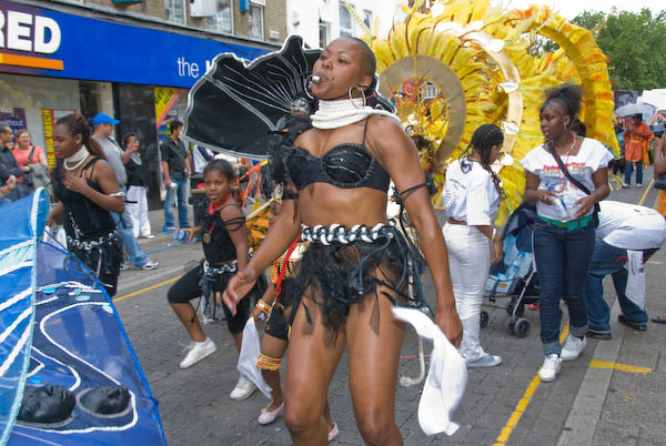
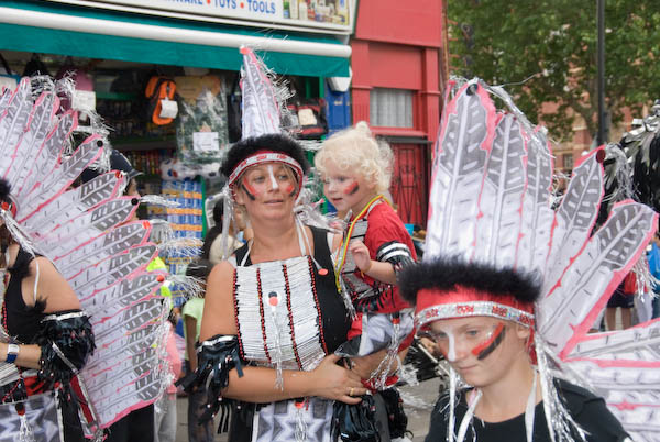
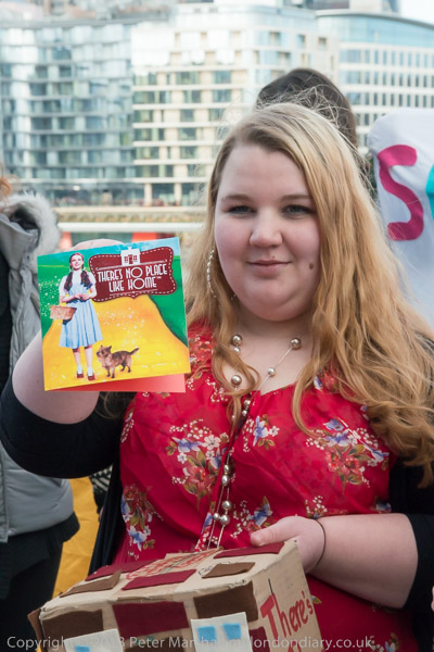
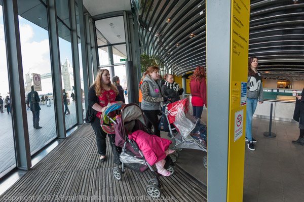
Big Brew, Childrens’ Carnival & London Bridge: On Saturday July 11th 2009 I’d been commissioned to photograph a bishop at fair trade events in Finchley, then rushed to Newham for a children’s carnival procession. Gettingg back to London Bridge for its 800th birthday celebration was made difficult by the planned closure of both District and Jubilee lines and I only made it minutes before the event ended.


Big Brew

Finchley and Edgware

Big Brew, Childrens' Carnival & London Bridge - 2009

The Diocese of London had organised a day of ‘Big Brew’ events at Anglican churches across Greater London promoting fairly traded goods, particularly tea and coffee. Fair Trade is a movement and system that ensures the farmers and other workers get a fair return for their work, safe working conditions and ensures that money from their products gets invested into their local communities for healthcare, education and other development opportunities. Both I and my wife had been active supporters of the movement since our student days, long before the Fairtrade certification mark was first introduced in 1988.

Big Brew, Childrens' Carnival & London Bridge - 2009

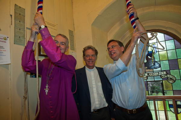
I had been persuaded to photograph two events organised by the parish churches in Finchley and Edgware which the Bishop of Edmonton, the Right Revd Peter Wheatley, a strong supporter of the fair trade movement would be attending.

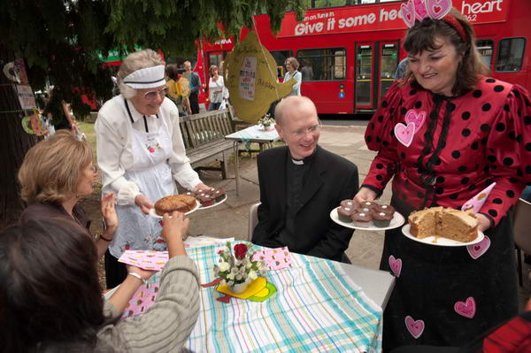
St Mary’s Finchley had tables and chairs on the pavement with tea, coffee and a large assortment of delicious looking cakes. As well as the bishop, Barnet Mayor Councillor Brian Coleman and the leader of the opposition were there too.

Big Brew, Childrens' Carnival & London Bridge - 2009

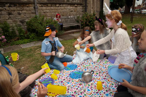
But for me the main attraction were the waitresses in caps and aprons and the ‘Mad Hatter’s Tea Party’ performed by children from the Church’s drama group.

Big Brew, Childrens' Carnival & London Bridge - 2009

Things were a little quieter at St Margaret’s Edgware, where I went on with the Bishop. We met the local MP Gareth Thomas and were offered the chance of ringing the church bells. Or at least they posed for a photograph pretending to ring them. It was very dark and needed a tricky bit of flash.

More pictures on My London Diary: Big Brew


Newham Childrens’ Carnival Procession

East Ham

Big Brew, Childrens' Carnival & London Bridge - 2009

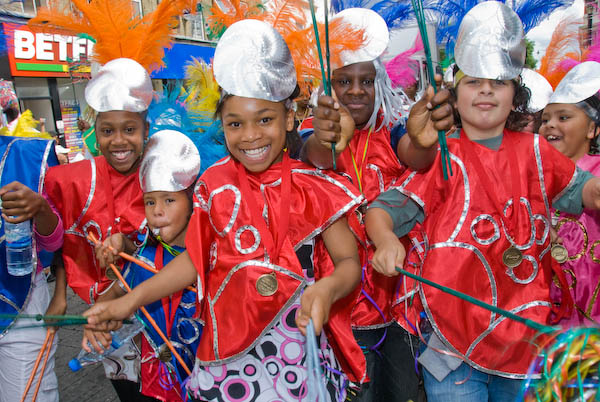
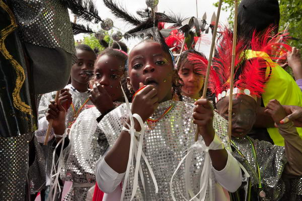
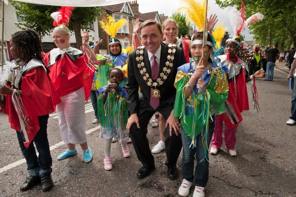
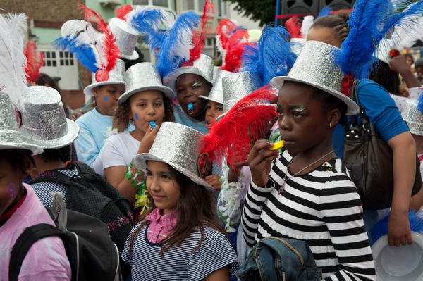
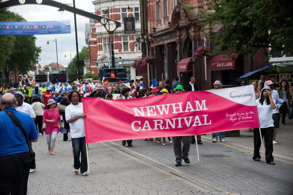
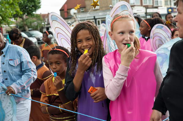
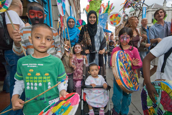
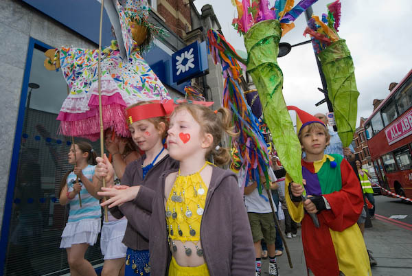
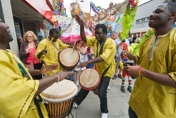
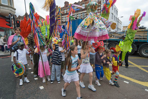
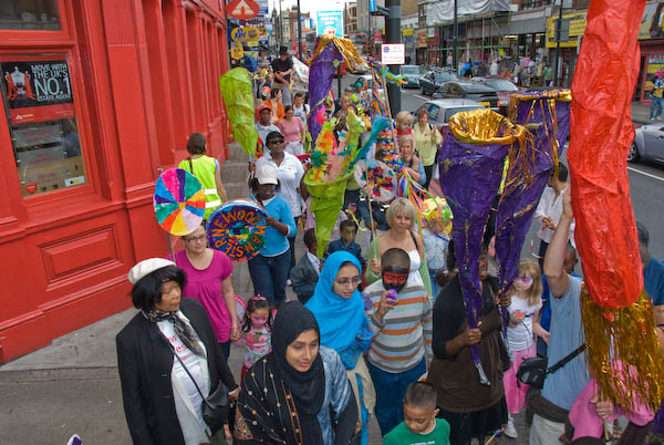
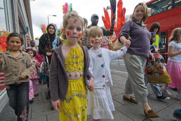
Newham Carnival seemed rather smaller than when I photographed it in 2007, but it was still a lively procession, with lots of kids having fun. The Mayor, Sir Robin Wales, came and joined in, though I found his performance rather embarrassing.

Big Brew, Childrens' Carnival & London Bridge - 2009
I suppose its a point in his favour that he doesn’t mind making a fool of himself

Keir Hardie was the country’s first Labour MP, elected in West Ham South in 1892. The County Borough of West Ham, now a part of Newham, elected England’s first Labour-controlled council in 1898. And in 2009 every one of its 60 councillors was Labour. Robin Wales became council leader in 1995 and became its elected mayor in 2002. In 2018 he was de-selected as Labour’s mayoral candidate following a bitter dispute inside Newham Labour party and is now a leading member of Reform UK.

Wales seemed very much to regard Newham as a personal fiefdom and used events such as this very much as PR opportunities.

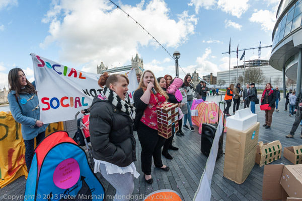
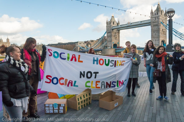
In the Wikipedia article you can read a little – in a very bland fashion about some of the controversies of his reign as local dictator. Under his leadership Newham gained large amounts of high cost private developments but failed to deal with the incredible housing problem in the area – telling people if they couldn’t afford to live in Newham they should move. As his critics said, we want social housing not social cleansing.

I walked some way with the carnival procession, but then took a bus, which was held up even more than usual by the traffic congestion the procession created. Normally I would have taken the District line, but this was closed for engineering work. And at Canning Town, rather than the Jubilee line (also closed) I had to use the much slower Docklands Light Railway, so I arrived rather late for my next event.

Newham Childrens’ Carnival Procession


London Bridge – 800

London Bridge

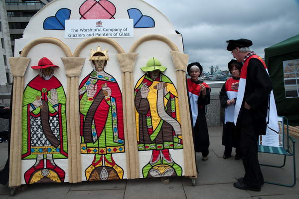
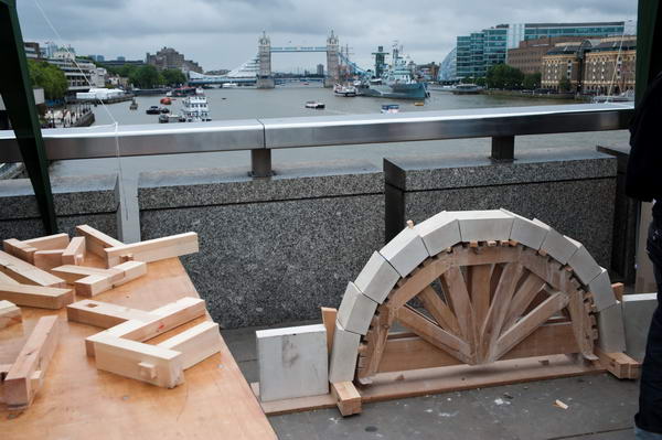
One of a number of guild displays on the modern London Bridge, 30 metres upstream from the old bridge

The Romans had built bridges across the Thames but these wooden structures did not survive. As I wrote (with minor corrections) in 2009:

“It was Peter de Colechurch who decided a stone bridge would be a better bet well over a thousand years after the first bridge, and started building one in 1176. It was a lengthy job, and was only finished 33 years later, and it was also very expensive.

To get back the cost houses were built on the bridge (as well as a chapel in the middle) and it soon became a thriving medieval shopping centre. There was actually very little space left for traffic to get across it, traffic moving in both directions on a 12 foot wide roadway (and in 1722 we got our first Highway Code, with the Lord Mayor laying down that carts coming from Southwark should stick to the west side, and those going south from the City drive on the east.)

This was part of the roadway across the 1209 London Bridge

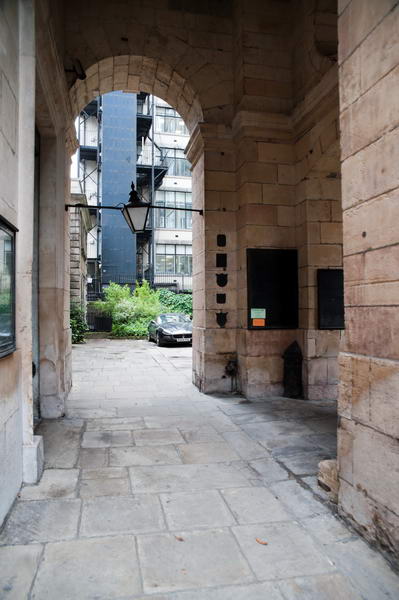
You can get a good idea of its width from going to the church of St Magnus the Martyr, as its entrance porch is the only remaining part of the bridge, and if the church is open you can go inside and view (sometimes through a rather thick haze of incense) a large model of the whole bridge.

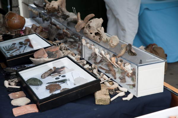
Found in the Thames

That bridge – with pretty well constant repairs and several major disasters – lasted until 1831 when a new bridge designed by John Rennie opened for business, around 100 ft upstream… The current bridge opened in 1971″

London Bridge – 800


FlickrFacebookMy London DiaryHull PhotosLea ValleyParis
London’s Industrial HeritageLondon Photos

All photographs on this page are copyright © Peter Marshall.
Contact me to buy prints or licence to reproduce.
Focus E15 Occupy Police Station – 2016

East Ham. Sunday 10th July 2016

Housing Activists Focus E15 get their name from a hostel for young single mothers in Stratford, in the London postcode area E15. In September 2013 they were given notice of eviction from the hostel by by East Thames Housing Association after Newham Labour Council cut the funding. They were told they would have to move to private rented accommodation scattered around distant low-rent areas of the country if they wanted to be rehoused.

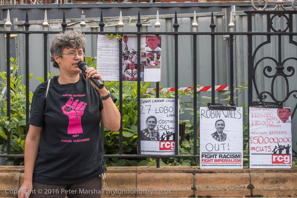
Focus E15 protesters set up on Barking Rd, outside Newham Town Hall, with posters on its fence about Newham Mayor Robin Wales.

Instead they decided to stick together and fight to remain in London where they had families, friends and support networks. Their campaign, supported by friends and family members as well as some members of the Revolutionary Communist Group, involving various direct actions including a party in the housing association offices, large marches, an occupation of Newham Council’s housing office, and of long-term empty council flats on a Stratford estate gained a great deal of local and national publicity. I was pleased to have photographed some of these events and you can find more about them on My London Dairy.

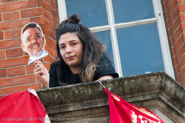
Jasmin Stone holds up a RCG poster – ‘Newham residents suffer £50million cuts. Robin Wales gets £100,000 + £80,000 expenses’

It was a successful campaign, but the group did not stop there, but widened into a much wider ‘Housing For All’ campaign, linking with other housing activists around the country and pushing housing for ordinary people higher up the national agenda.

Focus E15 move towards the former police station

They continue to fight Newham Council to meet their obligations towards local people, still in 2026 going to oppose evictions in the area, still accompanying people to support them at the housing office and still holding a weekly Saturday protest and advice stall on the pavement in the centre of Stratford on Stratford Broadway and an open meeting every Saturday afternoon in a former corner shop, Sylvia’s Corner.

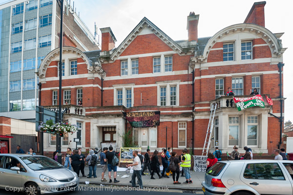
Some of the protesters had used ladders to climb onto the balconies and hang banners

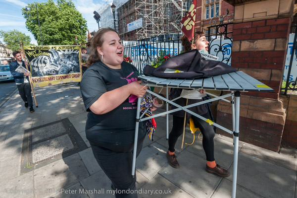
Their campaign brought them into conflict with Newham’s then Mayor, the abrasive Robin Wales, which at times became highly personal, with the mayor attacking them when they protested against him and his policies. The council’s actions against the group included the ludicrous ‘arrest’ of a table at their stall, arrests of Jasmin Stone, physical assaults and various attempts at intimidation.

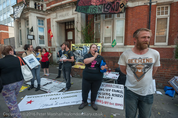
The protest took place on the second day of the annual Newham Show, a PR exercise for the Mayor. For the previous two years the group had been physically prevented from handing out leaflets at the show, so in 2016 they set up a stall on the main Barking Road a short distance from the show to hand out their housing information leaflets to the crowds making their way to it.

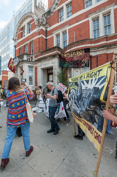
The Grade II listed former East Ham police station on the corner of High Street South, opposite Newham Town Hall had closed two years earlier and was then empty. [The Met sold it in 2018 for £3.4million.] After a few speeches and handing out leaflets for around an hour on Barking Road, the protesters picked everything up and walked the few yards to the police station where some had already used a ladder to climb onto the two balconies and hang banners.

A protester holds a ‘Robin Wales’ selfie-stick

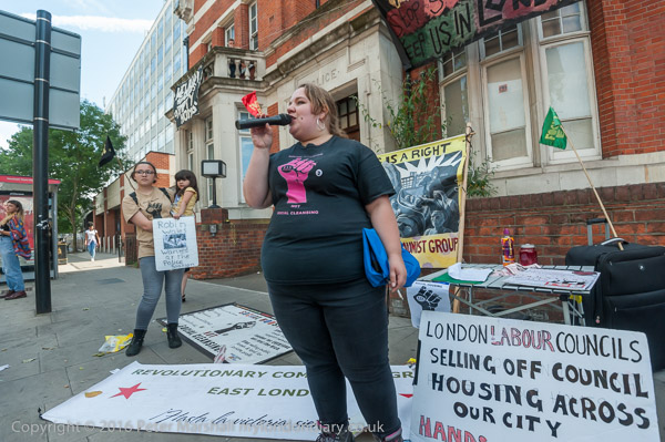
The protest continued there, with more speeches. One woman on her way to the show stopped and spoke on the open mike and demonstrated how she thought people should kick Mayor Wales out of Newham – and in 2018, at least partly as a result of demonstrations like these, the Labour Party managed to do so, despite what had seemed his iron hold on the party machine.

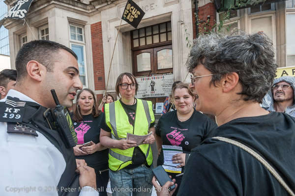
Other housing activists came to speak and the rally continued. A police car stopped and the officers came to talk with the protesters. They claimed to be worried that the balconies could be dangerous – but they look pretty solid and sound to me and the protesters and the rally continued.


FlickrFacebookMy London DiaryHull PhotosLea ValleyParis
London’s Industrial HeritageLondon Photos

All photographs on this page are copyright © Peter Marshall.
Contact me to buy prints or licence to reproduce.

Canning Town Walk (2007): 9

9 Thames Barrier Park

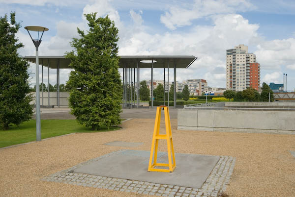
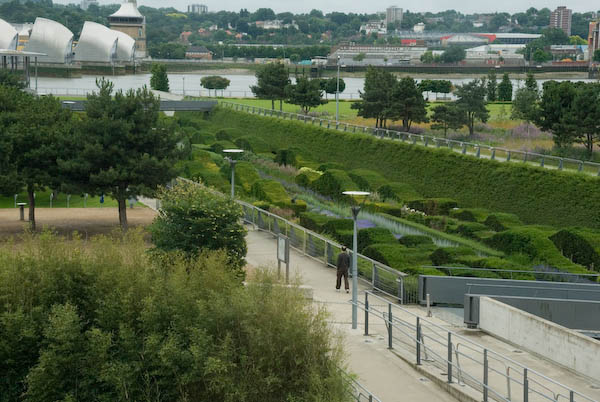
The children’s fun area is a nice idea, [32 computer controlled fountains] but this works better at Parc Citroen in Paris, and hasn’t stood up to British weather or use. We just don’t have the same level of upkeep in Newham as does the City of Paris. Competitions such as was carried out for this are a good idea, but only if the judges think rather more about what the result will look like in ten years time rather than on the sketches. It is also unfortunately not possible to enter the Green Dock at the ground level at the north end and walk through it (there is still an entry at the south end.)

[The park is managed by the Greater London Authority and was built on one of the most polluted sites in the country, the former PR Chemicals factory, which took years to decontaminate.]

The sides of the dock were lined by a metal fence with lower wires, which have currently been removed. In their place the fence is lined by normal street safety barriers, tied together with plastic bags. Although it may be effective, it is visually unacceptable and hopefully the fences are to be repaired and these removed.

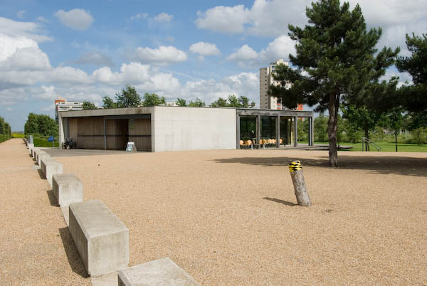
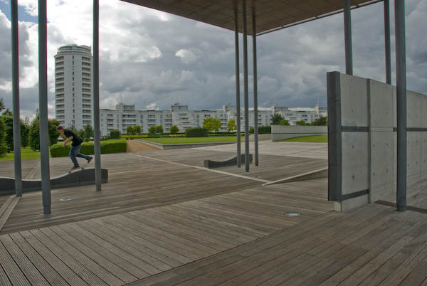
The two buildings in the park have a Japanese feel. One usefully houses toilets and a café, while the other was erected by Newham in memory of the victims of war. Its undulating seating was intended to carry on the wave theme of the Green Dock, but is perhaps of more interest to skateboarders than for comfort.

Walk along the edge of the ‘Green Dock’ to the riverside.

The park gives an excellent view of the Thames Barrier. Silvertown was one of the areas to be flooded in 1953, though rather less disastrously than Canvey, although some 1130 homes here were flooded. It took until 1982 for the Thames Barrier to be completed. Estimates of how much longer it will remain effective with the sea level rise due to global warming vary widely, but certainly at the moment it is getting used rather more often than was envisaged.

Walk back along the other edge of the Green Dock to the cafe and/or the station.


It’s some years since I’ve been back to the park, and it would be interesting to see how it has changed over the years. Perhaps I’ll find time this summer.

This walk will continue in a later post with Part 10: Riverside which mainly looks at views from the DLR.

You can read the whole document as I published it in 2007 beginning here and see more pictures I took in 2007 on My London Diary at Canning Town, Victoria Dock, Silvertown West.


FlickrFacebookMy London DiaryHull PhotosLea ValleyParis
London’s Industrial HeritageLondon Photos

All photographs on this page are copyright © Peter Marshall.
Contact me to buy prints or licence to reproduce.

Focus E15 Mums at City Hall

More London

Focus E15 Mums at City Hall
Focus E15 Mums make some noise at City Hall

I’d first met the young mothers facing eviction from the Focus E15 hostel in Stratford around a month earlier when I had gone with them into the offices of East Thames Housing Association to occupy the show flat there and hold a party in protest against the threat of being evicted from their nearby hostel because Newham Council had decided to cut its funding.

Focus E15 Mums at City Hall

Newham Council seemed clearly to be failing these mothers and children and were trying to move them away from Newham into private rented accommodation, sometimes hundreds of miles away from their friends, families, colleges, nurseries and support networks in Newham in order to evade their responsibility for them.

Focus E15 Mums at City Hall

Clearly the council, then led by Newham Mayor Robin Wales, had not expected these young women to put up much if any fight against this unjust treatment, but the Focus E15 women were determined not to move away from London. Their continued protests, always powerful and colourful attracted media coverage and made their case into a national scandal, and they revealed the serious mismanagement of the council.

Focus E15 Mums at City Hall
‘Boris Build More Homes’

Stratford was at the centre of a housing boom, particularly around the former 2012 Olympic site but this was largely for private sale, which many flats being bought up by investors, many from abroad wanting to cash in on London’s housing price boom, despite Newham having the highest waiting list for social housing in London.

Focus E15 Mums at City Hall

Focus E15 and others pointed to the Carpenters Estate, a well-designed and highly popular council estate in a highly desirable location next to Stratford Station and the Olympic site where there were large numbers of empty flats and houses – some having been left empty for 10 years. Rather than seeing this as successful housing for the people of the borough, the council had regarded it as an asset to be sold off.

Focus E15 Mums at City Hall

In February 2014 the mothers and children were still all living in the Focus E15 Mother and Baby Unit despite having been served eviction orders the previous October – East Thames had promised they would not be forced out until they had alternative accomodation. And they hired an open-top bus to bring themselves to City Hall.

Green Party GLA member Jenny Jones visited the protest

City Hall has now moved out to the Royal Docks, but in 2014 was in an unusually shaped Norman Foster building on Queens Walk next to the Thames on the privately More London office development owned by the Kuwaiti sovereign wealth fund (Ken Livingstone called it a ‘glass testicle’.) And although Focus E15 were allowed to protest by the security there, they were told they must not hand out leaflets. And no one at City Hall was prepared to accept the card the mothers signed for Boris Johnson.

The card for Boris

Their protests did result in them being rehoused in London, but the women didn’t stop there, developing into a ‘Housing For All’ protest, including an occupation of empty flats on the Carpenters Estate which achieved national news coverage. Locally they fought for others, going with them into Newham’s housing office and demanding the council meet its legal requirements and also stopping evictions.

They set up a housing advice and support stall every Saturday on Stratford Broadway and more. I’m sure that it was due to their activities that eventually the local Labour party turned against Robin Wales, getting rid of him.

Assistant director of the affordable homes programme in London, Jamie Ratcliff came to meet the E15 Mums

Their Focus E15 campaign, still continuing and still demanding ‘social housing, not social cleansing!’ became the most effective housing campaign in the country. I’m pleased to have been able to give them some support.

The mothers take their card for Boris into City Hall, but staff refused to accept it

The pictures on this post are all from Friday 21st February 2014 and there are more together with the text I wrote in 2014 at Focus E15 Mums at City Hall.


FlickrFacebookMy London DiaryHull PhotosLea ValleyParis
London’s Industrial HeritageLondon Photos

All photographs on this page are copyright © Peter Marshall.
Contact me to buy prints or licence to reproduce.

1994 London Colour – City, Limehouse & Canning Town

1994 London Colour – City, Limehouse & Canning Town: More of my colour pictures made in July or the start of August 1994, in the City of London, Limehouse and at the Royal Victoria Dock in Canning Town.

Red Chairs, London, 1994, 94-722-51

I can no longer remember where I saw this circle of chairs, left after a celebration of some kind. Reflected in the background I can see myself looking in, probably from one of the highwalks in the City, with a whole range of buildings behind me, none of which I can immediately recognise. I am standing in sunlight, which shines on the foreground chairs, but the back of the room is in fluorescent lighting, giving it an unnatural blued-green tint. A single empty glass on the decorated table and a stubbed out cigarette on the floor remain from the earlier gathering.

Fleet Place, City, 1994, 94-722-26

Fleet Place is immediately east of City Thameslink Station and this is one of London’s private pedestrian areas – like Broadgate and Canary Wharf – where various activities, including photography are not permitted.

Fleet Place, City, 1994, 94-723-61

I took a few pictures in Fleet Place on several occasions but was usually then approached by the private security men and told that photography was not allowed. But I generally work fairly quickly, though using the panoramic camera is rather slower than a normal camera as it needs careful levelling. But usually by the time I was told I could not take photographs I had already done so and was happy to leave the premises. But I think I took this in rather a hurry and underexposed it – perhaps seeing the man approaching.

Demolition, Tower Block, Limehouse, Tower Hamlets, 1994, 94-803-43

A skeleton around the spine of a tower block in Limehouse, with the wall paper and paint of the flats that were once attached.

Car Sales, Royal Navy, pub, Salmon Lane, Limehouse, Tower Hamlets, 1994, 94-803-44
Car Sales, Royal Navy, pub, 53 Salmon Lane, Limehouse, Tower Hamlets, 1994, 94-803-44

Car sales and the typical bunting around them on the corner of Condor Street aand Salmon Lane. The Royal Navy pub at 53 Salmon Lane was open by 1856 but closed permanently in 1999 and was converted into flats four years later.

Tidal Basin Pumping Station, Tidal Basin Rd, Canning Town, Newham, 1994, 94-803-51

The Tidal Basin Pumping Station designed by Richard Rogers and built in 1998 is one of the three pumping stations that prevent the former marshy areas to the north of the Royal Docks from flooding, pumping out surface water into the Thames, allowing their redevelopment by the LDDC. It was built in a colourful post-modern fashion in a deliberate attempt to provide a colourful accent in the area.

Warehouses, Royal Victoria Dock, Canning Town, Newham, 1994, 94-723-25

The part of the dock in the left foreground has now been built over, but six cranes remain on the dockside.

Royal Victoria Dock, Canning Town, Newham , 1994, 94-803-61
Royal Victoria Dock, Canning Town, Newham, 1994, 94-803-61

Spillers Millenium Mills were “designed and built by millers William Vernon & Sons of West Float, Birkenhead in 1905” and were the last of the large mills built on the dock, following those of the Cooperative Wholesale Society and Joseph Rank. All the mills were damaged by the 1917 Silvertown explosion. Spillers took over the mill in 1920 and rebuilt it “as a 10-storey concrete art deco building in 1933.” Badly damaged by bombing it was again rebuilt after the war, reopening in 1953. The dock closed in 1981, and the other buildings in the picture have since been demolished.


FlickrFacebookMy London DiaryHull PhotosLea ValleyParis
London’s Industrial HeritageLondon Photos

All photographs on this page are copyright © Peter Marshall.
Contact me to buy prints or licence to reproduce.


Regents Park & Beckton Alp – 2008

Regents Park & Beckton Alp – 2008: On Wednesday 30 January 2008 I took two walks in London. The first took me to Regents Park around noon, but I can remember nothing about it – all I have are the pictures that I took with their EXIF time stamps. But I was soon the Tube and the DLR, taking some pictures on my way to Beckton, a visit I wrote about on My London Diary and I’ll reproduce that account below. But first some pictures from Regents Park.


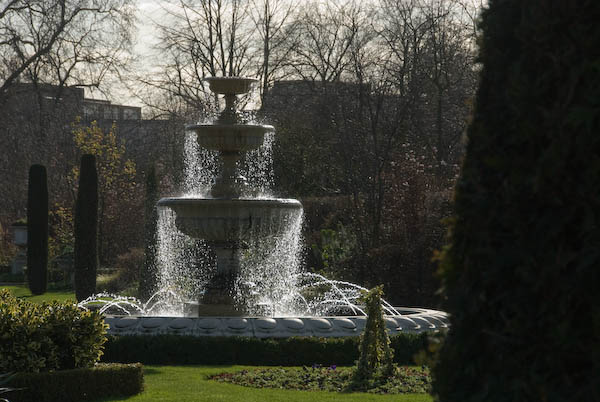
Regents Park, Park Square & Park Crescent

The gardens in Park Square are private, but it isn’t far to go to walk in Regents Park.

More pictures at Regents Park, Park Square & Park Crescent.


Beckton Alp and DLR Beckton Branch

Beckton, Newham

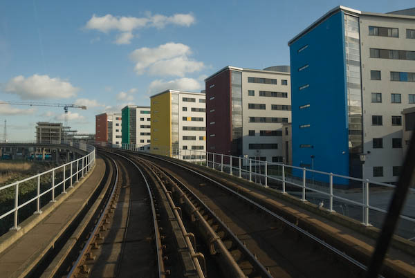
East London University from the DLR

So on Jan 30 as it was a rather nice day I took a walk in the alps, or rather the singular alp that London has on offer, at Beckton. Theoretically there are two, but the other is more of a pimple, while the northern alp is 36 metres high.

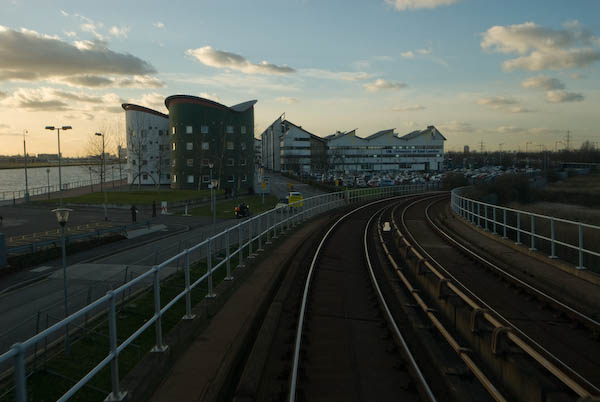
A strikingly decorated shed at Gallions Reach

The gasworks started by Simon Adam Beck on agricultural land in 1868 became the largest in Europe, but closed down in 1967. The LDDC bulldozed all of the rubbish from the site into the two mounds, put a 2m capping, mainly of clay on top, and the larger one became a dry ski slope in 1989.

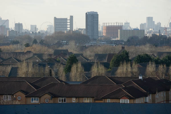
The London Eye is one of many London buildings easily seen from the slopes of the Beckton Alp

Despite the odd landslide the ski slope continued in use until 2001, and there were then plans for a ‘Snowdome’ with real snow on the site. But the developer went bust, leaving the site in a dangerous condition with some exposed waste – which includes various nasty chemicals – acids, volatile hydrocarbons – including carcinogens such as benzene, cyanides.

From the Beckton Alp, looking roughly east with the flood barrier on Barking Creek at left of picture. The gasholders are from the old Beckton works

Meanwhile the LDDC had faded away, having done its job of diverting large amounts of public wealth into private pockets, and had handed its problems to the local authority – in this instance, Newham, although the ski slope area is owned by Cresney who have had various ideas, including a possible hotel development on part of the site. It was also one of the shortlisted sites for a large scale artwork in the Channel 4 Big Art project to be shown in April 2008. [Antony Gormley’s plan for the site was never realised.]

The retail park, with East Beckton and the University of East London

Although there is still access to the public open space around the alp, the ski slope site and the top of the alp is surrounded by a large fence. However there was a rather convenient hole in this, and since there was no notice telling me to keep out – and a very well-worn path on the other side I went through it.

I carefully made my way to the summit to enjoy the views, before continuing my walk along the northern outfall sewer and then down along various paths through East Beckton to Manor Way and the Gallions Roundabout, where I took my life into my hands to dash across Royal Docks Way to the DLR station

[You can read more detail about the Beckton Alp in a 2023 post ‘What’s in the Beckton Alp‘ on the Reimagining Waste Landscapes site.]

More pictures on My London Diary at Beckton Alp and DLR.


FlickrFacebookMy London DiaryHull PhotosLea ValleyParis
London’s Industrial HeritageLondon Photos

All photographs on this page are copyright © Peter Marshall.
Contact me to buy prints or licence to reproduce.


DLR – Bow Creek and Poplar Panoramas 1994

Bow Creek and Poplar Panoramas: It was before Christmas that I posted the previous set of panoramic images I made in July 1994 along the DLR between Poplar and Beckton, DLR – Connaught Rd & Bow Creek 1994. Here is the final set I made then.

Bow Creek, Wharfside Rd, Canning Town, Tower Hamlets, Newham, 1994, 94-720-11

Another picture taken from the East India Dock Road, looking down at Wharfside Road and the sawmills with their address on Barking Road. The road layouts here have changed with the building of Newham Way flyover and I think Barking Road which earlier began at the ‘Iron Bridge’ over Bow Creek now only starts at the roundabout about 250 yards or so to the east.

As the noticeboard states the entrance to the site is from Wharfside Road on the opposite side of the road, and any driver unfortunate to read the sign would be faced with a long detour to reach it.

M&J Reuben Ltd was founded in 1895 and seems to have moved from the area in 2004 when the then managing director David Reuben retired. London Sawmills Ltd also had timber sheds at Hercules Wharf in Orchard Place closer to the mouth of Bow Creek.

Bow Creek appears on both sides of this roughly 130 degree view, upstream at right, flowing under the bridges and in a long loop and coming up at the left past Pura Foods where London City Island now is, before turning round the other side of Pura foods to flow down to the Thames.

Bow Creek, East India Dock Rd, Canning Town, Tower Hamlets, Newham, 1994, 94-720-12

Moving a few yards to the west along East India Dock Road I made this picture standing on the bridge. The Iron Bridge, built in 1810, was the first road bridge to use cast-iron columns and made a new lower route across Bow Creek. It has now been replaced and the current bridge is concrete.

On the left of the river is Essex Wharf, with the sawmills out of picture to the left. The first bridge on the river, a pipe bridge for a large gas pipe, was demolished soon after, but its brick piers remain. The second bridge is now the ‘Blue Bridge’ though in my picture it is grey. A third, a disused single track rail bridge, is hidden by those in front.

Construction work, South Bromley, Tower Hamlets, 1994, 94-721-62

A little further on but I think still on or close to the East India Dock Road I made this picture looking across a construction site, the DLR, Bow Creek and Pura Foods. I think that the tunnel which connects East India Dock Road to Aspen Way is under the site here.

Aspen Way, East India DLR, South Bromley, Tower Hamlets, 1994, 94-720-51

East India Dock Station on Aspen Way, looking west. At left is the Telehouse South and the Blackwall Tunnel ventilation shafts. Then along the horizon some 1930s council flats and buildings aroudn Canary Wharf including the tower. On the other side of the DLR viaduct is the Grade II listed former hydraulic pumping station in Naval Row and over the dock wall the ugly 1990s buildings on the former East India Dock.

DLR, Poplar, Tower Hamlets, 1994, 94-721-11

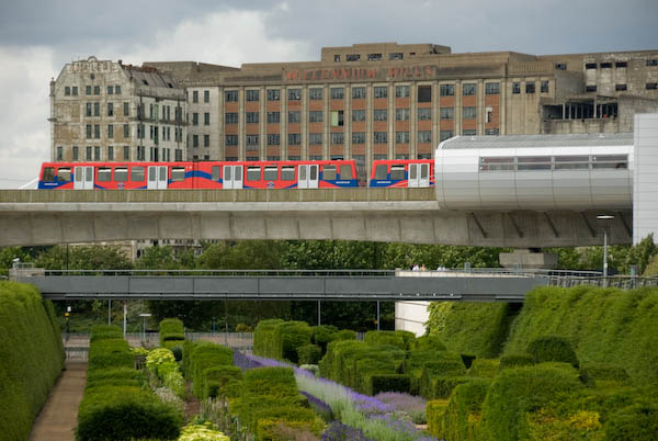
Finally a view through the rear window of a DLR train on its way from Poplar to Canary Wharf. Poplar Station can just be seen under the long footbridge across the DLR and the Wes India Dock Road. At left is the DLR line towards Tower Gateway.

The next post in this series of my colour pictures will feature pictures made in July 1994 here and elsewhere using a normal camera.


FlickrFacebookMy London DiaryHull PhotosLea ValleyParis
London’s Industrial HeritageLondon Photos

All photographs on this page are copyright © Peter Marshall.
Contact me to buy prints or licence to reproduce.


DLR – Connaught Rd & Bow Creek 1994

DLR – Connaught Rd & Bow Creek 1994. Continuing my panoramic images made along the path of the DLR in July 1994.

DLR, near Connaught Bridge, Custom House, Newham, 1994, 94-721-33
DLR, Connaught Rd, Custom House, Newham, 1994, 94-721-33

The road layout in this area has changed completely since 1994, but you can see at right the DLR Beckton branch going over the concrete lead-up to the Connaught Bridge. I think GATE 30 at extreme left is to the Excel site and the Connaught Tavern is hidden by the trees in the centre of the picture – and so this road was the old Connaught Road which led to the old swing bridge. I think where I was standing is now the middle of a hotel car park.

Bridges, Bow Creek, East India Dock Rd, East India, Tower Hamlets, Newham, 1994, 94-719-61

I moved around a mile and a half west and four stops along the DLR line to Canning Town and one of my favourite areas around Bow Creek, which here does two more or less 180 degree turns before flowing into the Thames. These two ‘bridges’ are a few yards south of East India Dock Road and I think both were built as pipe bridges to carry gas across the river.

Only the brick end supports of first remain on each bank. The metal bridge in the centre of the image is also a footbridge, now painted blue and leading across the river to the ecology park. Just beyond it, almost completely hidden is a third bridge, a long disused rail bridge. At left are the sheds of a timber yard.

DLR, Bow Creek, Wharfside Rd, Canning Town, Tower Hamlets, Newham, 1994, 94-719-52

Further East on the East India Dock Road I made this panorama with a sawmill in Wharfdale Road. Beyond that road is a train on the DLR line, and over the top of this you can see the Pura Foods factory on the site where London City Island now is.

DLR, Bow Creek, Wharfside Rd, Canning Town, Tower Hamlets, Newham, 1994, 94-720-31

A few yards further east on East India Dock Road gave this view of Bow Creek, curving 180 degrees around Pura Foods. Locals were pleased to see this London City Island factory go as you could smell it across much of Canning Town.

DLR, Bow Creek, Wharfside Rd, Canning Town, Tower Hamlets, Newham, 1994, 94-720-32

And a similar view but including a DLR train.

DLR, Bow Creek, Wharfside Rd, Canning Town, Tower Hamlets, Newham, 1994, 94-720-23

A few yards away I used a crane to frame the image of Pura Foods on its not quite island site. At right of the picture is a bridge across the DLR leading to a riverside walk to Canning Town Station. Although I managed to walk across Reuben’s Bridge several times, it has been mainly locked for the last thirty years, despite being a useful short cut to the riverside station entrance.

Apparently it was closed because people were throwing stones from it onto the DLR, and more recently in 2019 a survey determined that it is non-compliant with current Health & Safety Legislation, Building Regulations, British Standards and associated supplementary guidance.

The initial plans were for the riverside walkway to lead all the way to Trinity Buoy Wharf at the mouth of Bow Creek – and a competition was held and awarded for a new footbridge to enable this – but then the plans were dropped. Until a new bridge was built for London City Island the riverside entrance to Canning Town station only led to two dead ends.

More to come.


FlickrFacebookMy London DiaryHull PhotosLea ValleyParis
London’s Industrial HeritageLondon Photos

All photographs on this page are copyright © Peter Marshall.
Contact me to buy prints or licence to reproduce.


Panoramas Around Albert & Victoria Docks – 1994

Panoramas Around Albert & Victoria Docks: More panoramas I made in July 1994 on and around the Beckton Extension of the DLR, getting off the train at each stop, taking a walk around and making a few pictures before boarding the train again

DLR, Roundabout, Royal Albert Way, West Beckton, Newham, 1994, 94-718-33

One of the few pictures I made with a deliberate tilt of the camera in order to get the whole circle of the roundabout in the image. As you can see this results in a curved horizon.

DLR, Albert Dock, West Beckton, Newham, 1994, 94-719-11

The DLR stations on the elevated line often provided a useful viewpoint. Along the horizon here at left you can see the church at Silvertown, then the Silvertown Flyover. Around the centre are the mills on Royal Victoria Dock, then the more distant Canary Wharf and past that the Grade II listed 1881 Connaught Tavern. At right is the Compressor House, built in 1914 as a cold store for the dock.

DLR, Albert Dock, West Beckton, Newham, 1994, 94-721-22

A view through the front window of a DLR train which shows the Compressor House next to the Royal Albert Dock Station and the long stretch of the Royal Albert Dock. At the left are the houses of West Beckton. At right is London City Airport with a couple of planes.

DLR, Connaught Crossing,  Custom House, Newham, 1994, 94-721-42
DLR, Connaught Crossing, Custom House, Newham, 1994, 94-721-42

A view from the side of the train as it goes across Connaught Road looking over the recently built cable stayed swing bridge with reinforced concrete approach viaducts, opened around 1990. It replaced an earlier swing bridge built in 1904 to carry both the road and the North Woolwich Railway across the Connaught Passage between the Royal Victoria and Royal Albert Docks. The small octagonal building to the left of the bridge pumps water from the Connaught Tunnel, originally by hydraulic pumps but now by electric pumps. This was replaced by a larger circular structure when the tunnel was rebuilt for the Crossrail.

DLR, Victoria Dock Rd, Canning Town, Newham, 1994, 94-718-53

The DLR line runs beside Victoria Dock Road and this picture was made from Custom House Station and shows the junction with Freemasons Rd. Further along Victoria Dock Road you can see The Missions to Seaman Institute, Flying Angel House, built in red-brick Art Deco style in 1936. It closed in 1973 and after being used for some time as a college was converted into flats.

Royal Victoria Dock, Canning Town, Newham, 1994, 94-718-41

The western end of Royal Victoria Dock which closed in 1981. This picture was taken roughlky from where the cable car ride now has its northern terminal. The dockside sheds have been replaced by tall waterside blocks – around 17 storeys. There are still some of the old cranes on the quayside.

More panoramas from 1994 to follow.


FlickrFacebookMy London DiaryHull PhotosLea ValleyParis
London’s Industrial HeritageLondon Photos

All photographs on this page are copyright © Peter Marshall.
Contact me to buy prints or licence to reproduce.


More From Beckton, Cyprus and Silvertown – 1994

I spent a long day in July 1994 travelling up and down the recently opened Beckton Extension, taking some pictures from the trains but also getting off at every station and explouring the area around the stations, sometimes at some length. The previous set of pictures, DLR – Beckton Extension – 1994, began from around the end of the line at Beckton, and these images start with those from a walk from the next station along, Gallions Reach.

In the 2000s there was a plan to extend the DLR from here to Dagenham Dock, but these were cancelled in 2008; now plans have been approved for an extension to a Beckton Riverside station and on under the Thames to Thamesmead.

DLR, Roundabout, Woolwich Manor Way, Cyprus, Newham, 1994, 94-716-13
DLR, Gallions Roundabout, Woolwich Manor Way, Cyprus, Newham, 1994, 94-716-13

From the Gallions roundabout you can go north and south along Woolwich Manor Way or take the more recent roads, Royal Albert Way, Royal Docks Road and Atlantis Avenue. My picture was made from Woolwich Manor Way looking roughly north. In the centre of the roundabout is a pumping station, which I think is a 16-sided building, though I always lose count. On top in its centre is a small 8 sided pimple. Locally listed, it was built for Thames Water in 1974.
Ruins, Beckton Gas Works, Beckton, Newham, 1994, 94-717-61

Beckton Gas Works were built on the East Ham Levels from 1868-1870 by the Gas Light and Coke Company which had been founded in 1812 by Frederick Albert Winsor and was not only the UK’s first gas company but the first public gas company in the world. It was for some years the largest gas works in Europe and until 1969 produced gas for industry and homes across much of East London.

The site was named Beckton after then company chairman Simon Adams Beck and covered a huge of 550 acres. As well as giving room for the huge works, its site on the Thames well to the east of London meant that larger colliers could bring coal to it than to the gas works closer to the city.

As well as town gas, the site also contained the Beckton Product Works which became the largest UK manufacture of tar and ammonia by-products. Beckton was a huge local employer, providing jobs for as many as 10,000 men.

For many years after it closure the site remained derelict and was used in a number of films, most notably Stanley Kubrick’s Vietnam War film ‘Full Metal Jacket’. Back in 1994 there was little left on the site which is now largely a retail park.

I’d taken a few pictures in the area in black and white and colour ten years earlier when more of the works where still there – such as this one:

Beckton Gas Works, Beckton, Newham, 1984 81-NorthWoolwich-008
Beckton Gas Works, Beckton, Newham, 1984

[If you open the image you can browse a few more on Flickr.]

Royal Docks Rd, Galions Reach, Newham, 1994, 94-717-52
Atlantis Avenue, Gallions Reach, Newham, 1994, 94-717-52

A view made from underneath Gallions Reach Station looking roughly north-east towards the former gas works site.

DLR, Approaching Woolwich Manor Way, Cyprus, Newham, 1994, 94-717-43
View from Gallions Reach DLR, Station, Atlantis Avenue, Gallions Reach, Newham, 1994, 94-717-43

I went up to the station platform and made this picture as I waited for a train to arrive. At right you can see the Thames Water pumping station in the middle of the Gallions roundabout. On the left others waiting on the platform can be seen in a mirror. Beyond that is the Royal Albert Dock and in the distance the hills on the other side of the Thames. In the sky is a plane shortly after take-off from London City Airport.

DLR Station, Beckton Park, Beckton, Newham, 1994, 94-717-31
Beckton Park Station, DLR, Beckton, Newham, 1994, 94-717-31

I can’t remember if I got off the train first at Cyprus station or continued directly to the next stop, Beckton Park. The two stations are fairly similar and both are in the centre of roundabouts in the Royal Albert Way, built for the LDDC and opened in 1990.

DLR, Royal Albert Dock, West Beckton, Newham, 1994, 94-717-11

I got back on a train to go to the next stop on the line, Royal Albert, where I took a walk around the area beside Royal Albert Dock dock, making this picture from its west end looking east down the dock. In the distance is a DLR train approaching and to the left is the road leading the the Connaught Bridge. I think the brick structure at left of picture is a ventilator for the railway tunnel below.

Connaught Bridge, Royal Albert Dock, West Beckton, Newham, 1994, 94-717-12
Connaught Bridge, Royal Albert Dock, Silvertown, Newham, 1994, 94-717-12

I made this from a temporary footpath across the channel between the Royal Victoria and Royal Albert Docks a few yards to the west of the Connaught Bridge. Under the bridge is the full 1.75 miles of the Royal Albert Dock, built in 1875-80 and opened by the Duke of Connaught. The dock finally closed to commercial traffic in 1981.

In 1984 I got permission to go onto the site and photograph the remaining buildings – virtually all now demolished. They had no great architectural value but were an important part of London’s history. You can see some of the black and white pictures I took in the book The Deserted Royals – there is a good preview with over 40 pictures on the website and the PDF version is reasonably priced – and rather more, including colour work on Flickr – in the two albums 1984 London Photographs and 1984 Docklands Colour.

More Docklands colour from 1994 in my next post in this series.


FlickrFacebookMy London DiaryHull PhotosLea ValleyParis
London’s Industrial HeritageLondon Photos

All photographs on this page are copyright © Peter Marshall.
Contact me to buy prints or licence to reproduce.