Charlton and Maryon Park – 1990

Charlton and Maryon Park is the final part of my walk on Saturday 20th January 1990 which began with Westcombe Park and Blackheath 1990

Springfield Grove estate, Charlton Rd, Charlton, Greenwich, 1990, 90-1j-62

This estate was built on what had earlier been the site of the late 17th Century Springfield House, which was demolished just before the Second World War – the LCC had bought Stonefield Farm in 1927 for the Thornhill Estate. During the war there was a pig farm on the site. Springfield House took its name from a spring here which ran down in a valley here when the house was built. and though it is sometimes described as a wooded combe (dry valley) construction of the estate was held up in 1949 by the spring having to be stemmed and the ten blocks date from 1951-2.

The blocks were named with associations to previous Lords of the Manor of Charlton “Bayeaux – Bishop Odo of Bayeaux ; Downe & Ducie – Sir Wm.Ducie created Vise.Downe ; Erskine – Sir John Erskine Games – Wm.Langhorn Games ; Langhorne – Sir Wm.Langhorn, Mar – Earl of Mar (Sir J.Erskine) ; Priory – Priory of Bermondsey and Wilson – Sir Thos. Wilson 6th Bt. who married into the Maryon family, owners of the Manor & Estates.

These ten brick LCC point blocks in the Sparingfield Grove Estate (also known as Thornill Estate which it adjoined) were built around 1950, and the view between the towers here is described in the conservation area document as the most dramatic of the “number of good panoramic vistas” from the escarpment here, with a view towards the Thames and central London. The estate was built by the LCC but was transferred to the London Borough of Greenwich when that was set up and then in 1999 to a housing association. In 2012 the blocks were clad hiding the brickwork, which although I think is aesthetically poorer will have been much appreciated by residents for increasing their comfort.

I walked along here, but perhaps the best way to appreciate the views is from the upper deck of a bus going along Charlton Road or Charlton Church Lane.

War Memorial, Drinking Fountain, Public Toilets, Charlton House, Charlton Church Lane, The Village, Charlton, Greenwich, 1990, 90-1j-54

The triangle in the middle of the junction between Charlton Church Lane and The Village would, apart from the traffic be a pleasant place to sit and there is now a seat between the war memorial and the drinking fountain, though I think you need to bring your own drink. Most of our old drinking fountains have been disconnected for hygienic reasons, though London does now have some new ones. At least in winter you can see a wide variety of architecture, though trees tend to block some views for the rest of the year.

The cattle trough which replaced the old village stocks must I think have been just out of my picture on the left and like the drinking fountain was erected to commemorate the coronation of King Edward VII in 1902, together costing £247 donated by local residents and Sir Spencer Maryon Wilson, 11th Bart – who gets his name on the side of the trough. The fountain was damaged in 1980 when a driver without tax or licence drove into it; Greenwich Council decided they could not afford the £3,000 needed to repair it, but local residents again reached into their pockets.

Charlton House, The Village, Charlton, Greenwich, 1990, 90-1j-66

Charlton House is said to be the “finest Jacobean mansion in all London”, designed by architect John Thorpe, said to have been the inventor of “humble and now-ubiquitous corridor” which allowed independent entrance to the various rooms of a grand house – previously each room had led through doors to the next in what was know an an enfilade.

The house was first opened to the public in 1909 with the one shilling (5p) entry fee going to provide free lunches for the children of Deptford. Now in public ownership for 100 years it is one of the few things that cost less than then, with house and grounds free to the public.

The large classical arch was once the entrance to the grounds but is now isolate, all on its own in a large area of grass.

Charlton House, Charlton, Greenwich, 1990, 90-1j-55

Part of the house was badly damaged by wartime bombing in 1944 but has been carefully restored, and perhaps the only visible sign is a slightly lighter colour to the bricks used – and apparently the sundial between the first and second floor windows was fitted upside down.

Charlton House, Charlton, Greenwich, 1990, 1990, 90-1j-56
Charlton House, Charlton, Greenwich, 1990, 1990, 90-1j-42

The house was built by the crown for Prince Henry, the son of James I, and older brother of the future Charles I and his then tutor, Sir Adam Newton who was Dean of Durham, though hardly convenient for him as the 260 mile commute would then have taken several days. But I imagine he could claim his salary while working from home despite there being no internet connection.

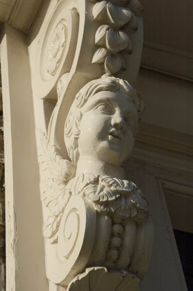
The house has a grandly decorated doorway.

Roman Stone, Acorn, Charlton House, Charlton, Greenwich, 1990, 1990, 90-1j-45

Charlton was of course long famous for its Horn Fair, held not at Charlton House on the top of the hill but at Cuckold’s Point on the River Thames. It was described by Daniel Defoe as a “yearly collected rabble of mad-people” which “ought to be suppressed, and indeed in a civiliz’d well govern’d nation, it may well be said to be unsufferable” and at which “the women are especially impudent for that day; as if it was a day that justify’d the giving themselves a loose to all manner of indecency and immodesty, without any reproach“.

And in 1872 it was suppressed but a considerably “tamer version of the fair was re-established in 1973 in the grounds of Charlton House“. I went at least once and was disappointed, particularly by the lack of female impudence.

The ‘Roman Stone’ is not of course Roman, but an artificial stone probably bound together with Portland Cement (invented by Joseph Aspdin in 1824) much used for garden ornaments in the Victorian era and beyond. These materials can be moulded using sand moulds.

Woodland Terrace, from Maryon Park, Charlton, Greenwich, 1990, 90-1j-25

Woodland Terrace is in what was a large wooded area known as Hanging Woods which hung on the side of the slopes rising from the River Thames here. The main Dover Road runs through these woods and Shooters Hill was a popular haunt for highwaymen, though less popular for travellers. Hanging Woods was a wild wooded area good for the gentlemen of the highway to hang out and evade pursuit.

Maryon Park, Charlton, Greenwich, 1990, 90-1j-11

Maryon Park is a former quarry, part of Charlton sandpits on the edge of Hanging Wood, which the Maryon-Wilson family gave to the LCC in 1891. The sandpits were dug in the 18th and 19th centuries for sand in the local foundries and for making glass, and there were also chalk pits nearer to the river. One of the four pits, Charlton Station Pit is now The Valley, home to Charlton Athletic Football Club, and another, Gilbert’s Pit, is part of a nature reserve. The East Pit is Maryon Park, along with an un-quarried ridge on its west side.

Maryon Park, Charlton, Greenwich, 1990, 90-1j-15

On the Charlton Parks Reminiscence Project you can read a great deal about the history of the park which was opened in 1890. Serpentine fenced paths lead down from Woodland Terrace to the floor of the park below. The park’s moment of fame came in 1966 with the filming there in Michelangelo Antonioni’s ‘Blow Up‘ featuring David Hemmings, and Vanessa Redgrave. A YouTube video ‘Blow Up Revisited‘ intercuts scenes from the film with those taken in the same areas of the park in 2010.

I’d photographed the park in 1985 and in 1990 only too a few pictures of some of the fences before rushing to the station to catch a train towards home.


FlickrFacebookMy London DiaryHull PhotosLea ValleyParis
London’s Industrial HeritageLondon Photos

All photographs on this page are copyright © Peter Marshall.
Contact me to buy prints or licence to reproduce.


Around Shooters Hill Road – 1990

Around Shooters Hill Road: Continuing my walk on Saturday 20th January 1990 which began with the previous post, Westcombe Park and Blackheath 1990.

Heath House, Vanbrugh Terrace, 1, Shooters Hill Rd, Greenwich, 1990, 90-1i-34
Heath House, 1 Shooters Hill Rd, Greenwich, 1990, 90-1i-34

This is an area full of mostly large houses, and this, at 1B Shooters Hill on the corner of Vanbrugh Terrace – the A2 ancient main road Watling Street from London to Dover via Canterbury – is one of the larger and is extended by the substantial conservatory.

According to its Grade II listing it was “built by Benjamin Cooke the cooper and shipowner of Dock Head, Bermondsey, about 1850” though the glazed conservatory was a later extension.

House, 19, Shooters Hill Rd, Greenwich, 1990, 90-1i-21

One of a long line of large houses on the north of Shooters Hill Road Grade II listed as 7-33 Shooters Hill Road. The listing is rather vague about dates, stating “2nd quarter of C19” and is mainly about the relatively minor differences between the pairs of houses mentioning the extra windows of 19 and its pair 21 at each side of the tympanum – probably why I chose this pair as one of two I photographed (the other not online.)

Houses, Stratheden Rd, Greenwich, 1990, 90-1i-24

I turned northeast from Shooters Hill up Stratheden Road, to photograph this impressive row of late Victorian large semi-detached houses leading up to St John the Evangelist Church. Two of the blocks at 15-17 have been joined with a new central entrance as Bardon Lodge.

St John the Evangelist Blackheath was designed by Arthur Ashpitel (1807–1869) in a largely Perpendicular style and was completed in 1853. It was built as a landmark to be seen from the west as the centre of the Vanbrugh Park development and is Grade II listed.

House, St John's Park, Greenwich, 1990, 90-1i-26
House, St John’s Park, Greenwich, 1990, 90-1i-26

This house immediately to the south of St John’s Church in St John’s Park was then surrounded by far more overgrown vegetation than now. There are two similar detached houses here and this is No 32. I saw it as a villa in some Gothic mystery – and may have deliberately chosen the viewpoint to exaggerate this.

These two detached villas are both locally listed and were built in 1873.

House, Shooters Hill, Charlton, Greenwich, 1990, 90-1i-11
House, Vanbrugh Park, Shooters Hill, Greenwich, 1990, 90-1i-11

I’m rather surprised I didn’t photograph the rather fine pub on the corner as I turned from Stratheden Road into Vanbrugh Park, but my next frame was of these three storey houses at 30 and 31 Vanbrugh Park – there is another pair to their left.

I think these are probably late Victorian, built after many of the others in this street.

House, 90, Shooters Hill Rd, Charlton, Greenwich, 1990, 90-1i-14

Originally this was a semi-detached house, but the left half was lost with the construction of the ‘Sun in the Sands’ roundabout to take Shooters Hill Road over the the Rochester Way Relief Road which opened in 1988.

More pictures from Charlton in a later post.


FlickrFacebookMy London DiaryHull PhotosLea ValleyParis
London’s Industrial HeritageLondon Photos

All photographs on this page are copyright © Peter Marshall.
Contact me to buy prints or licence to reproduce.


More Colour From New Charlton – 1995

More Colour From New Charlton: I think all of these pictures were taken in May 1995, the panoramic examples being made using a swing lens panoramic camera, probably the Horizon 202 from the Krasnogorsky Mechanicheskiy Zavod (KMZ) factory in Krasnogorsk near Moscow. This uses clockwork to rotate a 28mm f2.8 lens around a little over 120 degrees, keeping the lens to film distance constant by having the film in a curve around the axis of rotation. The camera made negatives 58mm long and 24mm tall on normal 35mm film, giving around 20 exposures from a normal ’36 exposure’ cassette.

Willoughby Way, New Charlton, Greenwich, 1995, 95p5-671

The film was exposed though a rotating slit behind the lens and different shutter speeds were obtained by altering the slit width. There were only two rotation speeds and for the faster speeds – 1/60 s, 1/125 s, and 1/250 s – the rotation took around a thirtieth of a second, enabling me to use the camera without a tripod.

Thames Path, Lombard Wall, New Charlton, Greenwich, 1995, 95p5-662

The lens focus was fixed and I think I usually worked at f8 which meant everything from a few metres away to infinity was sharp. The camera had a spirit level as by keeping the camera level vertical lines were rendered straight in the image. Horizontal lines away from the centre of the image become curved as you can see in some of these images, and care in composition was needed to stop these effects dominating the pictures.

Mudlarks Way, New Charlton, Greenwich, 1995, 95p7-161

The image quality was much the same as that from my several times more expensive Japanese Widelux f8 swing lens camera, but the Horizon had a useable viewfinder and was easier to use handheld. Though I think for most of my walks back in 1995 I was still carrying a rather large, heavy and solid Manfrotto tripod. I liked it because it could hold the camera absolutely steady at my eye level – and unless there was good reason not to do so I always preferred to view from that height.

Andrews Sykes,  New Charlton, Greenwich, 1995, 95c5-832
Andrews Sykes, New Charlton, Greenwich, 1995, 95c5-832

But I was also photographing with more conventional cameras, and usually had two Olympus OM4 bodies, one with black and white and the other with colour negative film. Although I had a fairly full range of lenses, the great majority of the pictures were made using an Olympus 35mm shift lens.

Bugsby's Way, New Charlton, Greenwich, 1995, 95-5o-66, 1995, 95c5-825
Bugsby’s Way, New Charlton, Greenwich, 1995, 95-5o-66, 1995, 95c5-825

In particular this allowed me to place the horizon in the images below or above the centre of the frame without tilting the camera which would have resulted in converging or diverging verticals. As well as shifting the optical elements up and down the lens mount allowed the lens to move to either side which also gave more control over framing.

Works, Mudlarks Way, New Charlton, Greenwich, 1995, 95c5-823

This area beside the Thames was then almost entirely industrial with aggregate wharves and some commercial premises. On other occasions I took more pictures along the riverside path which in the following year became a part of the Thames Path.


FlickrFacebookMy London DiaryHull PhotosLea ValleyParis
London’s Industrial HeritageLondon Photos

All photographs on this page are copyright © Peter Marshall.
Contact me to buy prints or licence to reproduce.


Rathmore Benches & Greyladies – New Charlton 1995

Rathmore Benches & Greyladies – New Charlton 1995: You can still see these mosaic decorated concrete benches on Troughton Rd and around the corner in Rathmore Rd. A short walk from Charlton Station, the building they are outside has for some years been the New Covenant Church Charlton.

Rathmore Community Centre & Rathmore Benches (Former Good Shepherd Mission Hall), 61a, Troughton Road, New Charlton, Greenwich, 1995, 95c5-714

The mosaic covered benches were installed here together with a mural on the walls behind in 1980. By 1995 the mural had been painted over but the benches remained, still in fairly good condition.

Rathmore Community Centre & Rathmore Benches (Former Good Shepherd Mission Hall), 61a, Troughton Road, New Charlton, Greenwich, 1995, 95c5-713

The benches were created as a part of a ‘Past, Present and Future of Charlton‘ project with the help of adults and children from the community centre by Greenwich Mural Workshop, who got funding to restore them in 2019 as they had suffered from wear and tear and some vandalism.

Rathmore Community Centre & Rathmore Benches (Former Good Shepherd Mission Hall), 61a, Troughton Road, New Charlton, Greenwich, 1995, 95c5-835

On the For Walls With Tongues web site of Greenwich Mural Workshop you can see pictures of the missing mural as well as the benches and learn more about their creation.

Rathmore Community Centre & Rathmore Benches (Former Good Shepherd Mission Hall), 61a, Troughton Road, New Charlton, Greenwich, 1995, 95c5-834

The centre had been built as the Good Shepherd Mission Hall and the Greenwich Local Heritage List states it is a 200-seater mission hall built 1900 to designs of architect J Rowland and was developed from Holy Trinity Mission run by Greyladies College.

Rathmore Community Centre & Rathmore Benches (Former Good Shepherd Mission Hall), 61a, Troughton Road, New Charlton, Greenwich, 1995, 95c5-833

Greyladies College for Women Workers was based in Dartmouth Row , in “a delightful country house, once the mansion of Lord Dartmouth, and stands on the breezy heights of Blackheath, in the midst of its own beautiful grounds, and with far-stretching views over the surrounding country to the Crystal Palace.

The great aim of the Greyladies’ College is to bring together lonely women working in isolation without a definite plan, and also women who are possibly daughters in a large family and find it difficult to separate themselves from social distraction in order to follow religious and philanthropic work.

The Greyladies worked in 22 parishes in South London “helping in the work of the Church of England under the incumbents of the diocese.” The description of them in Volume 1 of Every Woman’s Encylclopaedia published in 1910-12 is fascinatingly and charmingly dated.

More from Charlton to follow.


FlickrFacebookMy London DiaryHull PhotosLea ValleyParis
London’s Industrial HeritageLondon Photos

All photographs on this page are copyright © Peter Marshall.
Contact me to buy prints or licence to reproduce.


Deptford & Greenwich – 2005

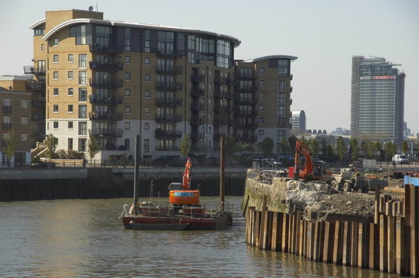
Deptford & Greenwich: Some pictures from two bike rides in April 2005, the second cut rather short by a puncture, around one of my favourite areas of London, mainly along the southern bank of the River Thames. The area has changed fairly dramatically in recent years with new blocks of riverside flats replacing riverside industry, much of which had already ceased work by 2005. I first photographed here around 1980 and it still now makes an interesting walk (or ride) and I’ve done most or all of it a few times since 2005.

Deptford & Greenwich - 2005
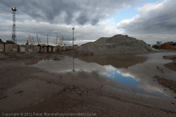
River Thames and Drydock, North Greenwich.

As usual I’ll post a slightly amended version of what I wrote at the time on My London Diary together with links to that site which has some more pictures. But I didn’t write anything about the actual pictures except the captions.

Deptford & Greenwich - 2005
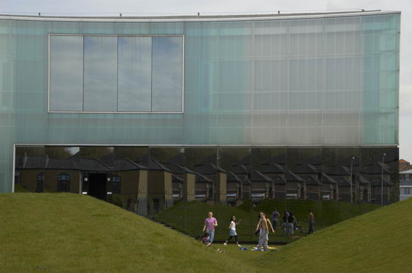
Reflection of the Laban building in Deptford Creek, London.

It was a fine sunny day on Thursday 21 April 2005 and I put my Brompton folding bike on the train to Waterloo, then cycled east from there to Deptford and Geenwich, taking another trip along one of my favourite riverside paths around the Greenwich Peninsula.

Deptford & Greenwich - 2005
Trinity Square, Southwark, London SE1. Church is now a rehearsal studio

North Greenwich is still interesting, although the area by the Dome is now rather bleak. Time went surprisingly quickly, and I had only got just past the Dome when it was time to make my way back.

Deptford & Greenwich - 2005
Dry Dock, North Greenwich, London.

Just over a week later I tried to take up the ride from where I left off, but only made it as far as the footbridge over Deptford Creek, when I heard a loud bang as my rear tyre punctured. I should have stopped, mended the puncture and gone on, but I couldn’t face it.

Deptford & Greenwich - 2005
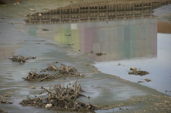
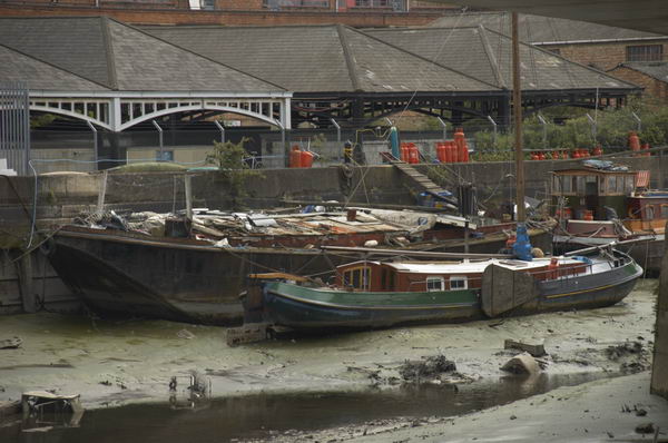
Deptford Creek close to its junction with RIver Thames, Deptford, London.

I wheeled the bike to Greenwich station, got on the train and came home. One of my few gripes about the Brompton is that mending punctures is a bit of a pain; the small tyres are hard to take off and even harder to replace, and if you want to take the rear wheel off, it is a rather tricky business that I’ve yet to master. I have tyres with kevlar inserts that are supposed to be puncture-resistant, but they don’t seem very effective.

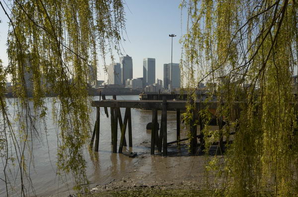
Canary Wharf and River Thames from North Greenwich, London

After I’d arrived home and had a cup of coffee, the puncture turned out to be a straightforward job.

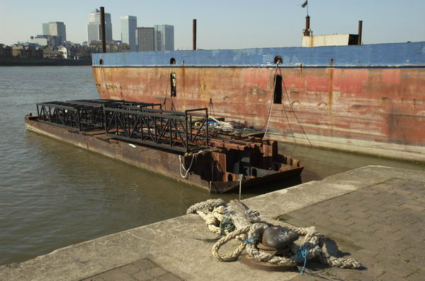
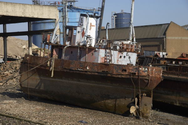
Ship breaker’s yard, North Greenwich, London, April 2005
Doorway, Albury St, Deptford,
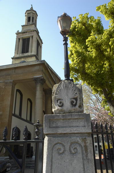
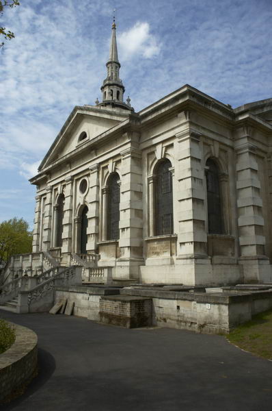
St Pauls, Deptford, London built by Thomas Archer in 1713
Laban dance centre
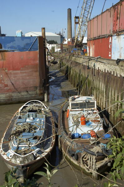
Deptford Creek

More pictures on My London Diary
From April 21st 2005
From April 29th 2005


FlickrFacebookMy London DiaryHull PhotosLea ValleyParis
London’s Industrial HeritageLondon Photos

All photographs on this page are copyright © Peter Marshall.
Contact me to buy prints or licence to reproduce.


New Charlton in Colour – 1995

New Charlton in Colour – 1995. New Charlton has now been given the new and more descriptive name of Charlton Riverside and is the area between the River Thames and the main road from Greenwich to Woolwich, Woolwich Road. The major feature of the area other than the river is the Thames Barrier, but although I photographed this in black and white it does not appear in my selection of colour pictures. I had photographed it in black and white and colour on several occasions since 1984 from both sides of the river and so felt no need to visit it again in 1995.

Eastmoor St, New Charlton, Greenwich, 1995, 95c5-743

I did find a very different barrier on Eastmoor Street, with this monumental slab apparently cut out to leave a gateway through this reflective red wall. Whatever its original purpose – I think perhaps an art work – it seemed to have served for target practice probably for bricks thrown by local youths.

Classic Car Restorations, New Charlton, Greenwich, 1995, 95c5-733

And I did photograph Thames Barrier Classic Car Restoration with its texts and pictures of cars on its wall.

Carpet Kingdom, New Charlton, Greenwich, 1995, 95c5-732

The redevelopment of the area had begun when the Thames Barrier was opened, but much was still industrial or derelict but large parts are now occupied by large retail units. Carpet Kingdom was one of the first to open, though I don’t remember exactly where. There is now a rather larger Carpet Giant in the area,

Mural, Floyd Rd, Charlton, Greenwich, 1995, 95c5-726
Mural, Floyd Road, Charlton, Greenwich, 1995, 95c5-726

You can still see this giant mural, details from which are in my two pictures. It was painted on the wall of this house in 1976 by the Greenwich Mural Workshop in 1976 and has now faded considerably.

Mural, New Charlton, Greenwich, 1995, 95c5-725
Mural, Charlton, Greenwich, 1995, 95c5-725

Just south of the railway line close to Charlton’s ground at The Valley and so in Charlton rather than New Chalton, I had glimpsed it in my journeys past on the train and so went to photograph it.

Annette, Hair Stylist, Valley Grove, Charlton, Greenwich, 1995, 95c5-724

Annette Hair Styling was just around the corner from the mural in Valley Grove, so also in Charlton rather than New Charlton.

More colour from Charlton in a later post


FlickrFacebookMy London DiaryHull PhotosLea ValleyParis
London’s Industrial HeritageLondon Photos

All photographs on this page are copyright © Peter Marshall.
Contact me to buy prints or licence to reproduce.


Woolwich to New Charlton Panoramas – 1995

Woolwich to New Charlton Panoramas: Continuing my occasional series of colour images from 1995 – I think this is the eleventh post – with some colour panoramas made in May 1995 on a walk from Woolwich to New Charlton.

River Thames, Church Hill, Woolwich, Greenwich, 1995, 95p5-342

My walk had begun when I got off the train at Woolwich Arsenal on my way back from Dartford on May 7th and I think these pictures were made that afternoon as I walked from there to another station keeping close to the River Thames. But I did but return to Woolwich the following Sunday, May 14th and some of these pictures could have been made then.

A path leads up from the roundabout at the start of Woolwich Church Street to Church Hill and St Mary Magdalene Church, built on a spur of high ground leading out towards the river. Originally this ground went rather closer to the Thames, but much of it was quarried for sand though the digging had to stop at the church. Although the present church dates only from 1727-39 there had been a church on this site since the 9th century if not earlier and it was probably a much earlier site of settlement.

The road in front of the church, Church Hill, gives a splendid panoramic view of the Thames. In 1995 you could still see the remains of Woolwich’s riverside industry, but by the time I photographed here again in 2000 all had gone and the area was empty and derilect. Now it is filled with four tall blocks of flats and some other housing.

Former Woolwich Dockyard Dry Docks, Europe Rd, Woolwich, Greenwich, 1995, 95p5-343

Woolwich Dockyard was the Navy’s most important dockyard for many years and ships were built here from 1512 to the Victorian era. By then it had become too small for the new ships and the Royal Dockyard closed in 1869. Parts remained in industrial use and a large area was bought by Greenwich Council in the 1960s where they built the Woolwich Dockyard Estate in the 1970s – part at the left of this picture. I think this is the Grade II listed Graving Dock.

Ernest Bevin, Ferry Boat, River Thames, Woolwich, Greenwich, 1995, 95p5-332

Taken on the Woolwich Dockyard Estate this shows one of the old dry docks and at a mooring in the Thames the Woolwich Ferry Ernest Bevin. You can just see part of the south ferry terminal in the centre of the image.

The ferry across the Thames became a free ferry run by the LCC in 1889 – two days after they had replaced the Metropolitan Board of Works who had organised and funded it. A number of public bridges had been built to make crossing the river in West London easy and free and it had been decided that there must also be a free crossing in East London. The Ernest Bevin was one of three ferries in the third generation of ships which came into operation in 1963 and it was replaced in 2019. All have been named after local figues and Bevin was elected as MP for Woolwich East in 1950.

Flats, Frances St, Woolwich, Greenwich, 1995, 95p5-462

These point blocks, close to Woolwich Dockyard Station were built for Greenwich Council are St Mary’s Towers, one of the more successful housing schemes of the late 50s and early 60s, opened by Princess Margaret in 1961. They remain now still in good condition and popular.

River Thames, Woolwich, Greenwich, 1995, 95p5-472

Back to the River Thames and another cleared area of the former Dockyard with a view across the river to Tate & Lyle’s Silvertown works.

River Thames, Warspite Rd, Woolwich, Greenwich, 1995, 95p5-433

Another former dockyard area still in industrial use. I think this is Thameside Wharf on Harrington Way. Some of the buildings here were once part of the Siemens Brothers Telegraph Works factory established in 1863 and became Thameside studios for artists around 1990.

Bugsby's Way, New Charlton, Greenwich, 1995, 95p5-521
Bugsby’s Way, New Charlton, Greenwich, 1995, 95p5-521

Bugsby’s Way took its name from this part of the River Thames known from around 1830 as Bugsby’s Hole or Bugsby’s Reach which probably got its name from this once “marshy area to the south of Blackwall Point where executed criminals were formerly hung in chains.” As E.W.Green suggested in 1948, ‘bug‘ was the old British (ancient Welsh) word for ‘spook’ or ghost, and what could be a better place to meet with ghouls. Bugsby’s Way was built across this marshy area by the London Borough of Greenwich in 1984.

Beatle Line Ltd, Bugsby's Way, New Charlton, Greenwich, 1995, 95p5-511
Beatle Line Ltd, Bugsby’s Way, New Charlton, Greenwich, 1995, 95p5-511

Another picture from Bugsby’s Way. The Beatle Line perhaps got its name from the later meaning of ‘bug’, perhaps from a different Anglo-Saxon root, at first simply meaning beatle, though later coming into popular use for a wider range of species – including the famous moth found by Grace Hopper and colleagues in the Mark II computer at Harvard University in 1947.

More pictures from Charlton in a later post.


FlickrFacebookMy London DiaryHull PhotosLea ValleyParis
London’s Industrial HeritageLondon Photos

All photographs on this page are copyright © Peter Marshall.
Contact me to buy prints or licence to reproduce.


Lewisham Hospital, Greenwich Peninsula, Syria & Mali – 2013

Lewisham Hospital, Greenwich Peninsula, Syria & Mali: As often when I had a long break between two events I took the opportunity to take an extensive walk in one of my favourite areas of London and on Friday 15th February I went to the Thames Path at Greenwich after a lunchtime protest at Lewisham Hospital. Then I went to Whitehall for a small protest against Western military intervention in Mali and Syria and a possible attack on Iran.

Lewisham Hospital, Greenwich Peninsula, Syria & Mali

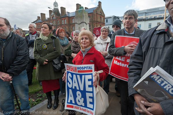
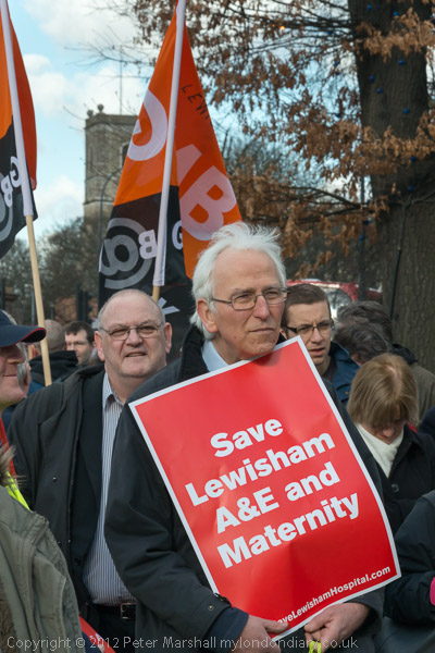
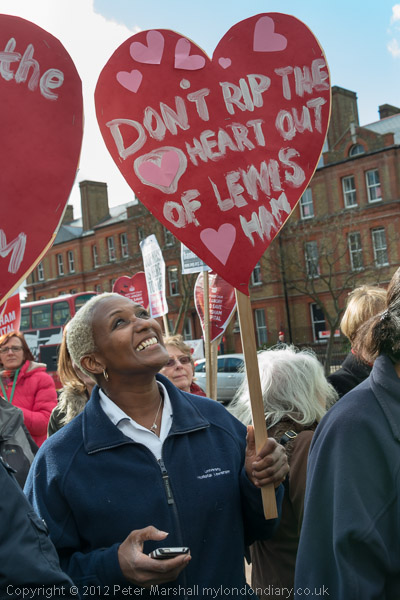
Fight to Save Lewisham Hospital Continues

Lewisham Hospital, Greenwich Peninsula, Syria & Mali

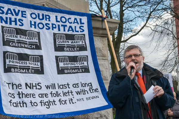
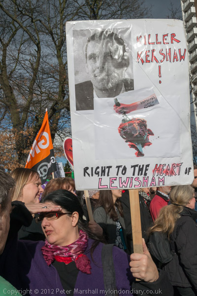
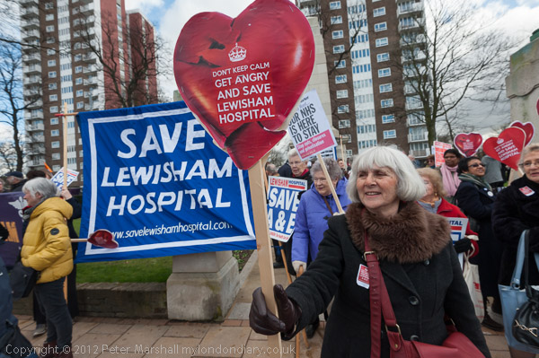
A lunchtime rally at the war memorial opposite the Hospital made clear that the fight by the entire local community to save services at their hospital was continuing.

Lewisham Hospital, Greenwich Peninsula, Syria & Mali

As well as a legal challenge there were to be further mass demonstrations including a ‘Born in Lewisham Hospital’ protest the following month.

Lewisham Hospital, Greenwich Peninsula, Syria & Mali
Lewisham Mayor Sir Steve Bullock

People in the area and all concerned with the future of the NHS were appalled by Jeremy Hunt’s decision to accept to the proposals for closure, which are medically unsound and would lead to more patients dying, but they would result in a huge waste of public funds.

The financial problem that led to the proposal was caused not by Lewisham but by a disastrous PFI (private finance initiative) agreement to build a hospital a few miles away.

As I wroteL “Lewisham is a successful and financially sound hospital which has received sensible public investment to provide up to date services, and the services that will be cut there will have to be set up again and provided elsewhere by other hospitals. Closing Lewisham will not only incur high costs, but will result in the waste of the previous investment in its facilities.”

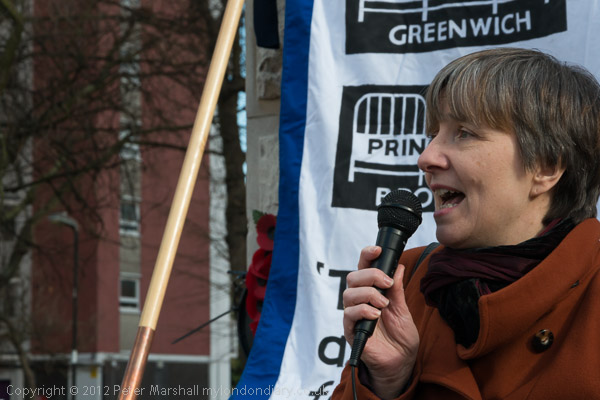
Louise Irvine, the Chair of Save Lewisham Hospital Campaign

In making his decision Hunt deliberately set out to mislead the public by describing the replacement of A&E as only a small reduction in A&E services. The proposed urgent care centre could only deal with around 30% of the cases currently being covered. Similar the replacement of the current maternity service by a midwife only unit could only deal with around 10% of current births – and life-threatening transfers would be necessary if complications rose in these.

You can read a fuller account of the protest and more pictures at Fight to Save Lewisham Hospital Continues.


Thames Path – North Greenwich – Greenwich

I took a bus to North Greenwich and tried to walk along the Thames Path, parts of which had reopened after a long closure. It was a warm day for February and started off sunny, though later the weather changed giving some dramatic skies.

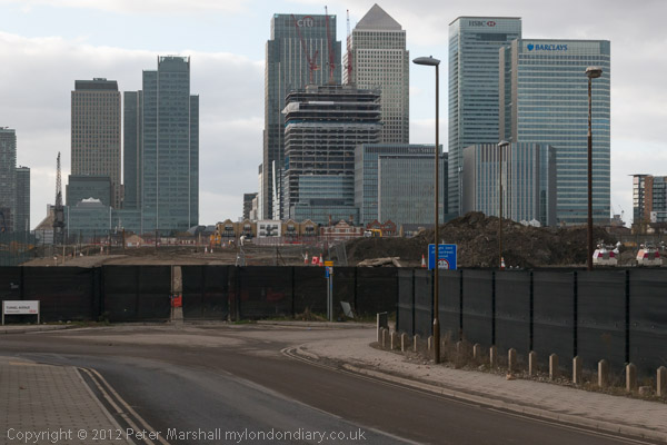
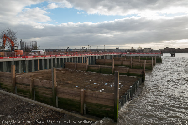
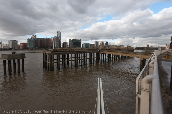
The path from Delta Wharf and north to Drawdock Road was still vlosed but beyond that in both directions the path was open. I’m not sure what all the work taking place was about, but in part it was to provide a new section of the path, and to put in new breakwaters. Some time later of course there will be new riverside flats here, but for the moment these were being built closer to Greenwich.

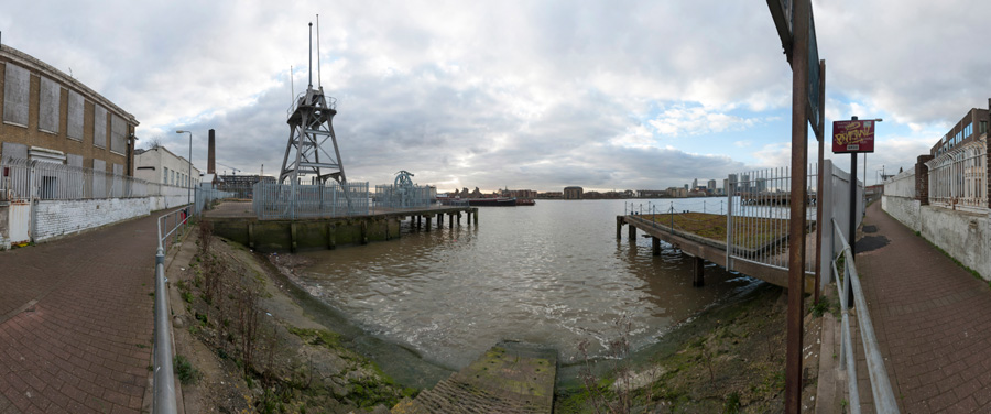
One fairly recent addition to the path was the Greenwich meridian marker at the bottom centre of this picture, the line going along in the gap between two metal beams and pointing north across the river.

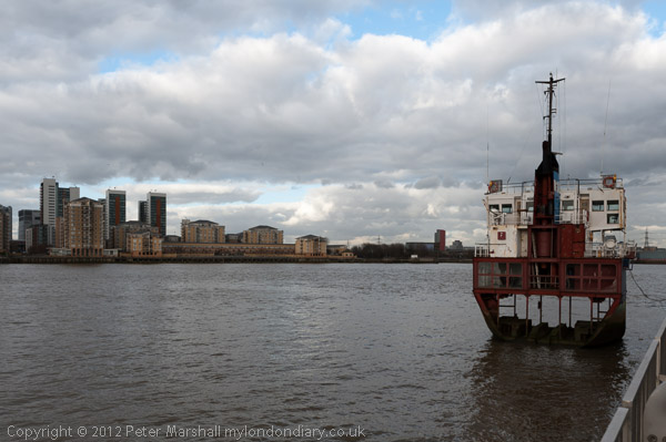
And a little further to the east is the sculpture A Slice of Reality by Richard Wilson. In the following year this was to become part of London’s first public art walk, The Line. It is a 30ft slice of the former sand dredger Arco Trent – Google’s AI gets it badly wrong by describing it as “an eighth-scale replica“. As the name suggests it is a slice of the actual ship.

As I turned back and walked towards Greenwich there were some dramatic skies and lighting, but also some slightly boring road walking where the path was diverted away from the river.

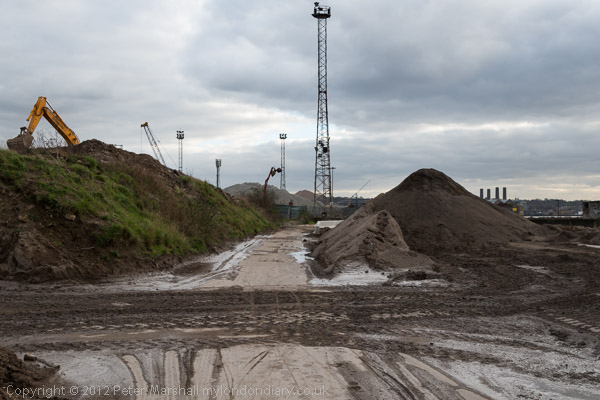
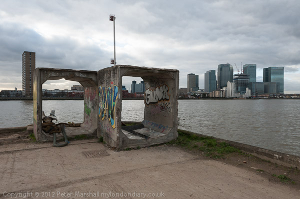
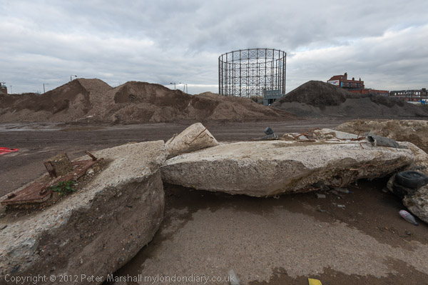
Soon I was able to return to the riverside path and walk through the surreal landscape of an aggregate wharf.

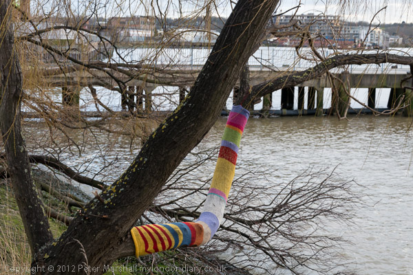
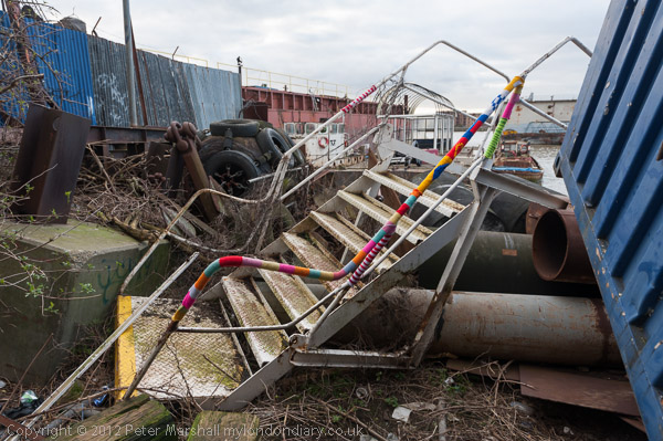
The final section of the walk on my way into Greenwich had been targeted by guerilla knitters.

I was getting short of time, and could only stop to make one panorama although the weather was perfect for it.

This view shows the riverside path at left going south at the left and north at the right – a view of over 180 degrees. The shoreline here highly curved was in reality straight. I think the image digitally combines half a dozen overlapping frames.

By then I was having to hurry to catch the train back into central London – and the light was falling.

Many more pictures from this walk at Thames Path Greenwich Partly Open.


Stop Western Intervention in Syria & Mali – Downing St

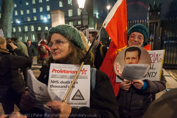
This protest had been called by Stop the War on the 10th anniversary of the march by 2 million against the Iraq war in 2003, the largest protest march ever seen in the UK (and with many others around the world also marching.)

On this occasion they were calling for a stop to Western intervention in Mali and Syria and against the possible attack on Iran but the numbers taking part were very much smaller, with only around a hundred turning up.

Among them were supporters of Syria’s President Assad and Stop the War had lost a great deal of support by opposing the help being given to groups against his regime, with many on the left calling for an end to his regime.

Stop Western Intervention in Syria & Mali


FlickrFacebookMy London DiaryHull PhotosLea ValleyParis
London’s Industrial HeritageLondon Photos

All photographs on this page are copyright © Peter Marshall.
Contact me to buy prints or licence to reproduce.


More Around the Meridian – 1995 Colour – Part 3

More around the Meridian – It’s seldom possible to actually walk for more than a few yards actually on the Greenwich Meridian in London and while planning my Meridian Walk I often wandered around considerably, having to make detours and also looking for the more interesting routes. So not all these images are exactly on the Meridian, but most were taken within a short distance from it.

Greenway, Abbey Lane, Abbey Rd, Stratford, Newham, 1995, 95p4-1151

When I began this project the Meridian was not marked on the Ordnance Survey or Street maps, and one of may first tasks was to get a ruler and pencil it on to them. In 1999 it was added to the OS maps of the area, but does not seem to be on the latest versions. In 1995 there were no smart phones with online maps and GPS which would have made things so much easier.

Greenway, Abbey Lane, Abbey Rd, Stratford, Newham, 1995, 95p4-1152

The Greenway was the recently rebranded path above the Northern Outfall Sewer which rans across East London from Hackney Wick to the sewage treatment plant at Beckton, going under the road here close the the bridge over Abbey Creek on the Channelsea River, where Abbey Lane becomes Abbey Road. You can see the bridge at the left of the picture.

Greenway, Channelsea River,  Stratford, Newham, 1995, 95p4-1153
Greenway, Channelsea River, Stratford, Newham, 1995, 95p4-1153

The Greenway is a great traffic-free cycle route for pedestrians and cyclists, running straight and level and this picture gives some evidence of that.

Channelsea River, Long Wall, Stratford, Newham, 1995, 95p4-1111

I’m not sure what this pipe was for, perhaps for taking gas across the river. Not far away on the other side of this tidal creek was one of the largest gas works in London – and you can still see its listed gasholders, though the view is likely to change soon with the site being redeveloped.

But behind me when I made this picture was the Abbey Mills sewage pumping station and on the edge of the creek below were the storm outfalls where sewage would be released after heavy rains. With the changing tides it would flow downstream a little and then could be taken miles upriver along the Prescott channel and the River Lea.

Gasholders, Leven Rd, Poplar, Tower Hamlets, 1995, 95p4-1332
Flats, East India Dock Rd, South Bromley, Tower Hamlets, 1995, 95p4-1321

I think the Meridian went through the centre of the taller gas holder at Poplar Gas works.

Flats, East India Dock Rd, South Bromley, Tower Hamlets, 1995, 95p4-1321

Another view with the gasholders in the background.

Clove Crescent, East India, DLR, South Bromley, Tower Hamlets, 1995, 95p4-1273

My pencilled line for the Meridian shows it going through both the water in the dock and the brick building at left which was the former Blackwall Power Station in both of these pictures.

Clove Crescent, East India DLR, South Bromley, Tower Hamlets, 1995, 95p4-1263

South of the East India Docks the line crosses the River Thames above and between the two bores of the Blackwall Tunnel, closer to the original western tunnel now used by northbound traffic. I couldn’t take photographs in the tunnel – though it was possible for those on foot to take a bus across, but these would have been rather boring in any case.

Blackwall Tunnel Entrance, Greenwich, 1995, 95p4-1672

This picture shows the southern entrance to the tunnel with its 1897 Grade II listed gatehouse by the London County Council’s Superintending Architect Thomas Blashill. In front of it a less ornate red and white striped arch with heigh and weight restriction signs and hangers to hit any overtall vehicles and hopefully prevent damage to the gatehouse.

Dorringtons, Blackwall Tunnel Southern Approach, Greenwich, 1995, 95p4-1551

One picture not I think actually on the Meridian but not far from it, taken from the long footbridge over the Blackwall Tunnel Southern Approach.

Riverside Path, Greenwich, 1995, 95p4-1762

My path continued south along the riverside path, with the Meridian going into the River Thames on the extreme left of this picture.

Riverside Path, Greenwich, 1995, 95p4-1742

I kept to the land continuing along a path I’ve walked many times and making a few more pictures.

Riverside Path, Greenwich, 1995, 95p4-1743

Like much of London’s riverside almost all of the industry has now gone, but some relics remain, though most of this part of my route is now lined by rather boring flats.

I rejoined the Meridian where it made landfall in Greenwich – where I made some of the pictures at the end of my earlier post.

More colour work from 1995 including some more panoramas in a later post.


FlickrFacebookMy London DiaryHull PhotosLea ValleyParis
London’s Industrial HeritageLondon Photos

All photographs on this page are copyright © Peter Marshall.
Contact me to buy prints or licence to reproduce.


1995 Colour – Part 2 – Greenwich Meridian

1995 Colour – Greenwich Meridian: The second of a series of posts on my colour work, mainly in London, from 1995, 35 years ago and when I’d been working extensively with colour negative film for ten years, though still continuing to work with black and white.

Obelisk, Trig Point, Pole Hill, Chingford, Waltham Forest, 1995, 95p03-841

In 1992 I began making colour panoramas using a Japanese Widelux F8 swing lens panoramic camera – and later I used a Russian Horizon which gave similar results. Both worked with normal 35mm film but produced negatives that were a little under 60mm wide rather than the 36mm of normal cameras. Both use clockwork to swing the taking lens around a third of a circle exposing the film through a narrow slit behind the lens. The film was held in a curved path – again around a third of a circle – with the lens at the centre of the circle so that the lens to film distance remained constant.

Peacham Hall, King's Head Hill, Woodberry Way, Chingford, Waltham Forest, 1995, 95p03-411
Peacham Hall, King’s Head Hill, Woodberry Way, Chingford, Waltham Forest, 1995, 95p03-411

This arrangement avoided the change in distance from the lens to film that gives some stretching of the subject towards the edges of the frame – and begins to become very noticeable in ultra-wide lenses, particularly wider than around 18mm focal length on a 35mm camera.

95p03-552-Edit
Level Crossing, Highams Park, Waltham Forest, 95p03-552

Using the curved film plane avoids this distortion and enables a much wider field of view, while using a fairly moderate focal length – the Widelux has a 26mm f2.8 lens and gives negatives 24x56mm with a horizontal angle of view of 123 degrees.

Bridges, North Circular, Hale End Rd, Hale End, Waltham Forest, 1995, 95p03-463

But there is a downside. Creating the image in this way gives a curvature to objects which is unlike our normal vision which is particularly noticeable on any straight lines, though lines parallel to the axis the lens rotates around remain straight – so if you hold the camera level, verticals will remain straight. But other lines become curved with the effect increasing away from the image centre, giving what is often called a “cigar effect“.

Raglan Rd, Lea Bridge Rd, Whipps Cross, Waltham Forest, 1995, 95p4-373

This is a constraint which makes composition far more difficult using a swing lens camera, and was not helped by a rather poor viewfinder on the Widelux. Usually for landscape work I tried to visualise the effect of the curvature and chose a suitable camera position, levelled the camera on a heavy Manfrotto tripod using the spirit level on the camera top plate, lining the camera up using two arrows on the top plate to show the extent of the view (more accurately than the viewfinder) and then pressing the cable release to make the picture.

Stratford Bus Station, Great Eastern Rd, Stratford,, 1995, 95p4-922
Stratford Bus Station, Great Eastern Rd, Stratford, Newham, 1995, 95p4-922

For photographing events and some creative effects this is a camera you can use handheld, but you have to remember that even when using its fastest speed of 1/250 second the camera actually takes quite a lot longer to scan around the curved film.

Crowley's Wharf, River Thames, Greenwich, 1995, 95p4-672
Crowley’s Wharf, River Thames, Greenwich, 1995, 95p4-672

These pictures are from a project I began in 1995 with the approaching Millennium in mind. It seemed to me to make sense to carry out a project based on the Greenwich Meridian.

Greenwich Boating Pond, Park Vista, Greenwich, 1995, 95p4-1431

So I set about walking the Meridian, photographing it at various points in London and used some of these pictures in an attempt to get public funding for a Meridian Walk with some markers in pavements and a web site and publication. Panoramic images seemed a very appropriate format for illustrating the line.

Greenwich Meridian, Royal Observatory, Greenwich, 1995, 95p4-1242

Unfortunately my grant application as usual was unsuccessful, but I did go on to take some more photographs. In 2009 others produced a Greenwich Meridian Long Distance Path covering all of the Meridian in England from Peacehaven to Sand La Mere which of course goes through London and we also have The Line Sculpture Trail. Quite a few more Meridian markers were also added in London since I made this walk.

Many more panoramas from my Meridian project and other colour images from 1995 in the album 1995 London Colour.


FlickrFacebookMy London DiaryHull PhotosLea ValleyParis
London’s Industrial HeritageLondon Photos

All photographs on this page are copyright © Peter Marshall.
Contact me to buy prints or licence to reproduce.