Yet More Wandle – 1990

Yet More Wandle: Continuing my walk on Sunday 4th March 1990 had begun at Clapham Junction in Battersea with St John’s Road & East Hill, Battersea – 1990 and the previous post to this was A Wandle Wander – 1990:

River Wandle, The Causeway, Wandsworth, 1990, 90-3b-25

I found it hard to drag myself away from this spot on the path beside the River Wandle where the previous post had ended and took several more pictures before moving on, including this one.

Tyres, River Wandle, The Causeway, Wandsworth, 1990, 90-3c-53

I didn’t move far, just a few yards further on before taking the picture above, which shows the same heap of tyres and the same covered pipe bridge – but from the other side. I think most of these pipe bridges date from the time the east side of the Wandle was occupied by the gas works.

River Wandle, The Causeway, Wandsworth, 1990, 90-3c-65

Much of the former gasworks site was then occupied by the concrete plant I wandered back and forth for some time taking pictures and cannot now remember the exact locations as the area has changed so much. This area is now a huge building site with a tall residential tower now going up.

River Wandle, The Causeway, Wandsworth, 1990, 90-3c-54

This is where the River Wandle and Bell Lane Creek rejoin, running to the right of this picture into the Thames just a few yards away. The tide was low and you can see there is little or no water running out from the Wandle with all the flow all going down Bell Lane Creek. The Shell Oil Terminal Site was in Osiers Road and this and adjoining sites have now been redeveloped with blocks of flats of various heights, the tallest around 15 storey. One gain from this is that there is now a walkway by the Wandle leading to the Thames; the previous diversion was not without interest – but had an overpowering strong smell of oil.

River Wandle, The Causeway, Wandsworth, 1990, 90-3c-55

Here I think I was looking roughly south I think over or through a fence at the north edge of the cement works where there is a cement lorry. I think this may be part of the works, possibly a water intake or perhaps a settling tank for water used for hosing down the lorries and plant, but that is simply guesswork. But as often with my pictures I did record a six-figure map reference – 257752.

River Wandle, The Causeway, Wandsworth, 1990, 90-3c-56

Also taken from The Causeway a few feet west from the previous image you can see the gasholder in the background – and at right the railway viaduct.

Finally I dragged myself away from the Wandle and made my way west to Point Pleasant where my next post on this walk will begin, coming back to those oil storage tanks beside the Wandle.


FlickrFacebookMy London DiaryHull PhotosLea ValleyParis
London’s Industrial HeritageLondon Photos

All photographs on this page are copyright © Peter Marshall.
Contact me to buy prints or licence to reproduce.


A Wandle Wander – 1990

A Wandle Wander – 1990: Continuing my walk on Sunday 4th March 1990 had begun at Clapham Junction in Battersea with St John’s Road & East Hill, Battersea – 1990 and the post before this was Court, Citadel, Gas & Brewery – 1990

River Wandle, Armoury Way, Wandsworth, 1990, 90-3b-34

The area between Armoury Way and the River Thames was and still is very much an industrial one. I think most of the pictures in this post, probably including this one were taken from The Causeway, a street that leads from the junction between Armoury Way and Dormay Street, running beside the west bank of the River Wandle. A dead end for vehicles you can walk along it to reach a footpath which leads to the path beside the Thames towards Putney – or if you turn east, to Smugglers Way. Here across the Wandle you can see a cement plant and cement lorries.

Bell Lane Creek, The Causeway, Wandsworth, 1990, 90-3c-42

Bell Lane Creek is the western of two mouths of the River Wandle and I think part of its original course though it was described as ‘a marshy area’ and might have had more channels. It was improved by the addition of a half lock from the Thames in the 1970s and apparently remains navigable from the River Thames an hour or two each side of high tide, though only as far as where I was standing to take this picture, next to a weir. The sluice gates here – which I photographed on another visit – have a bell on them inscribed ‘I AM RUNG BY THE TIDES’. The area to the right of the creek is Causeway Island.

To the left had once been the Wandsworth Royal Laundry and the creek had also extended further west to several wharves.

River Wandle, Railway Bridge, The Causeway, Wandsworth, 1990, 90-3b-35

Looking south up the Wandle under the railway bridge which carries the line from Reading and Windsor to Waterloo. Above it as left is the giant Wandsworth gasholder.

Railway Bridge, The Causeway, Wandsworth, 1990, 90-3c-51

The Staines and Windsor line is on a viaduct here, with three bridges. As well as one over Bell Lane Creek and this one, a few yards to the east is one built to carry the lines over the Wandsworth Cut – later called McMurray’s Canal – there is a very clear map from 1891 here.

This quarter-mile long canal was built in 1802 to link the Surrey Iron Railway to the Thames and had an entrance lock from the river a few yards east of the Wandle where the Wandsworth Solid Waste Transfer Station now is. The horsedrawn Surrey Iron Railway, the first public railway ceased operation in 1846 and the canal was sold to the owners of a nearby flour mill.

The mill was later owned by William McMurray who made paper from esparto grass brought from farms owned by his family in Spain and North Africa – and from the docks by barge to his Royal Paper Mills in Wandsworth. After a fire bankrupted the company, the canal was sold to the Wandsworth and District Gas Company in 1910. In the 1930s they filled it in and built over its route.

River Wandle, The Causeway, Wandsworth, 1990, 90-3b-23

A rather confusing array of bridges and pipe bridges across the Wandle just to the north of the railway bridge. At right past the parked concrete lorries is the Wandsworth Solid Waste Transfer Station.

Footpath, River Wandle, The Causeway, Wandsworth, 1990, 90-3c-63

A narrow footpath leads to the section of The Causeway at the west end of Smugglers Way. aAt right is the Waste Transfer Station and just getting into the picture at left a little of a large electrical substation.

River Wandle, The Causeway, Wandsworth, 1990, 90-3c-64

And from exactly the same position looking across the Wandle. I had probably intended to produce a panoramic image from these two exposures.

River Wandle, The Causeway, Wandsworth, 1990, 90-3b-26

And I too a third picture moving closer to the river at the same location.

I found this a fascinating area and continued to take pictures for some time – and will share a few more in a later post.


FlickrFacebookMy London DiaryHull PhotosLea ValleyParis
London’s Industrial HeritageLondon Photos

All photographs on this page are copyright © Peter Marshall.
Contact me to buy prints or licence to reproduce.


Court, Citadel, Gas & Brewery – 1990

Court, Citadel, Gas & Brewery continues the occasional series on my walk on Sunday 4th March 1990 had begun at Clapham Junction in Battersea with St John’s Road & East Hill, Battersea – 1990. The previous post, Quakers, Beer, a Palace and the Wandle – 1990 had ended with me at the north end of Garratt Lane in the centre of Wandsworth.

Courthouse Community Centre, Garratt Lane, Wandsworth, 1990, 90-3b-42
Courthouse Community Centre, 11, Garratt Lane, Wandsworth, 1990, 90-3b-42

This was built in 1858 apparently as one of the first courts under the 1846 County Courts Act and is Grade II listed.

It was alleged to be near-derelict in the 1970s when it was first Grade II listed and was handed over to Wandsworth Council, becoming a community centre for the Arndale Estate. Then it became the Wandsworth Museum but that was closed in 2008 to turn it into Wandworth Library. The museum was moved West Hill Library then closed in 2015. In 2014 the council decided to move the library and to sell or let the building . I think it is now offices.

Salvation Army Citadel, Ram St, Wandsworth, 1990, 90-3b-43

I crossed Wandsworth High Street and walked up Ram Street. stopping to take this view of the Salvation Army Citadel, built in 1907, but now replaced in 2008 by a more modern building. Doubtless a much more functional building its rounded lines have nothing of the military features of the old with its castellated tower.

The Wandsworth Gas Company gasholder is no longer visible. Gasholders such as this were still in use for storage and to regulate gas pressure for some years after the changeover to natural gas and the closure of our gas works. Once a common feature of our townscapes, most have now gone, with just a few of the guide frames of particular interest being listed and saved, some converted to contain flats.

I think this one was dismantled around 15 years ago, but at least until recently its base could be seen from the railway line to the north.

Gas Holder, Swandon Way, Wandsworth, 1990, 90-3a-54

A closer view of the gasholder which clearly shows the three sections which would be lifted up inside each other by the gas as more gas was pumped into the holder (and were known as lifts.) The first ‘telescopic’ gasholder was invented in 1824. This example was built in 1972 and was said to be the largest of its type in the UK. Gas was stored at only a little above atmospheric pressure

Gas Holder, Houses, Barchard St, Ram St, Wandsworth, 1990, 90-3b-44

Controversial plans were approved by Wandsworth council for the redevelopment of the gas works site to include a 29 storey tower – rather taller than the old gasholder. I think that the massive concrete base which held the water to seal the bottom of the gas holder is to be retained to save the huge environmental cost of its removal.

I rather liked the way the old gasholders – here and elsewhere – contributed to the townscape, and they were certainly local landmarks. But the Wandsworth Society and other objectors are correct to point out the main tower block of the development with a height of 29 storeys, “is quite ‘out of context’ next to the River Wandle. The site of the tower cannot be considered to be a ‘town centre’ site nor is it close to a ‘cluster’ of buildings of a similar nature. The application cannot be considered to ‘make a positive contribution to local character and context’“.

Gas Holder, Armoury Way, Wandsworth, 1990, 90-3b-31

A final picture of the gas holder.

Ram Brewery, River Wandle, Wandsworth High St, Wandsworth, 1990, 90-3c-12

The rest of the area north of the town centre has also seen massive redevelopment, though at least the major historic elements of the Ram Brewery have been retained – and now contain the Sambrook Brewery.

Here you can see one of the more modern parts of the brewery, which looked more like a chemical plant than how I imagine real beer being made.

The area is now covered by large bocks of around 4-7 storeys and I think the only thing visible in this image that remains is the brewery chimney. There is now a walk alongside the Wandle, but little of interest to see from it.

Ram Brewery, River Wandle, Wandsworth High St, Wandsworth, 1990, 90-3c-15

Young’s beers are now brewed by Carlsberg Marston’s Brewing Company in Bedford, though they have re-branded them to include London in their names.

River Wandle, Armoury Way, Wandsworth, 1990, 90-3b-32

More from around the Wandle in a later post.


FlickrFacebookMy London DiaryHull PhotosLea ValleyParis
London’s Industrial HeritageLondon Photos

All photographs on this page are copyright © Peter Marshall.
Contact me to buy prints or licence to reproduce.


1995 Colour Part 4 – Around Dartford

1995 Colour Part 4 – Around Dartford: More of my panoramic images. These were taken in and around Dartford in Kent in March 1995 on a walk which took me from the centre of the town and along by the River Thames to an area close to the QEII Dartford Bridge. All these were taken on Sunday 19th March 1995. Dartford is a part of the Thames Gateway area around the Thames Estuary.

Dartford

Gasholder, Hythe St, Victoria Rd, Dartford, 1995, 95p03-531

I walked up Hythe Street and then turned right to a path that led me to a bridge across Dartford Creek.

Bridge, Dartford Creek, Nelsons Row, Dartford, 1995, 95p03-533

Dartford Creek is the tidal creek of the River Darent and was once important navigable creek to wharves in the centre of Dartford. Work has now been going on for years to restore the half-lock and make the creek navigable again. I made more panoramic images along the footpath beside the creek later in the year, but on my first visit was keen to get to the River Thames and left the Creek to walk up Joyce Green Lane and Marsh Street to the River Thames.

Littlebrook

Littlebrook Power Station, Dartford Bridge, QEII Bridge, River Thames, Dartford, 1995, 95p03-612

The first power station at Littlebrook was coal fired and opened in 1939 and was joined by a second in 1949 and a third in the 1950s with the final station Littlebrook D shown here opening in the 1980s. The earlier stations had been converted to burn oil by 1958 and were all decommisioned by 1981 when the final station began to be put into use. This continued to produce power until 2015 and was finally demolished in 2019. You can read much more detail on Wikipedia.

River Thames, Dartford Bridge, QEII Bridge, Dartford, 1995, 95p03-631

Google’s map now shows Littlebrook Beach as a ‘tourist attraction’ but I’m fairly sure I was the only person there on the day I made this picture.

Jetty, Littlebrook Power Station, Dartford Bridge, QEII Bridge, River Thames, Dartford, 1995, 95p03-643
Littlebrook Jetty, Dartford Bridge, QEII Bridge, River Thames, Dartford,  1995, 95p03-661
Littlebrook Jetty, Dartford Bridge, QEII Bridge, River Thames, Dartford, 1995, 95p03-661
National Power, River Thames, Dartford, 1995, 95p03-663

Crossways

As I walked along the path beside the river taking these and rather more black and white images I kept looking for a gate or gap in the fence betweent the riverside path and Crossways I could go through, but there was none. It was only when I got to Stone Marshes that I was able to leave the river and then walk along St Mary’s Road and into Crossways Business Park.

Warehouse, Crossways Business Park, Crossways, Dartford, 1995, 95p03-873

The area has been considerably expanded now, with a new major road to Greenhithe as well as new housing and commercial development.

Lake, Crossways Business Park, Crossways, Dartford, 1995, 95p03-733

The lake now has much new development around it, including a pub, The Wharf on Galleon Boulevard, close to where I made these pictures

Lake, Crossways Business Park, Crossways, Dartford, 1995, 95p03-721
Lake, Crossways Business Park, Crossways, Dartford, 1995, 95p03-723

I walked back into Dartford taking quite a few more black and white images but no more panoramas. The black and white pictures from this walk start here.


FlickrFacebookMy London DiaryHull PhotosLea ValleyParis
London’s Industrial HeritageLondon Photos

All photographs on this page are copyright © Peter Marshall.
Contact me to buy prints or licence to reproduce.


Greenwich Walk – 2018

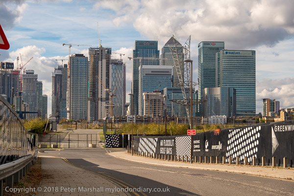
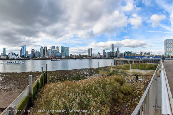
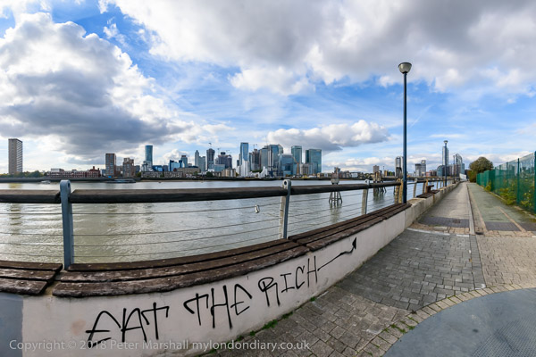
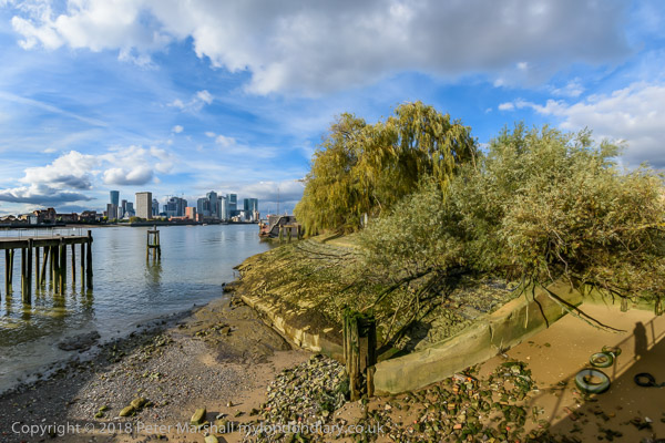
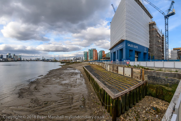
Greenwich Walk: On Thursday 18th October 2018 I walked with two or three other photographers from North Greenwich Station to the centre of Greenwich and made the pictures in this post. You can see many more of them in a post on My London Diary, Greenwich Walk.

Greenwich Walk

Recently on >Re:PHOTO I’ve published a series of posts about my walks in London back in the 1980s, along with some of the pictures I took then which are now in my albums on Flickr. The most recent walk I’ve featured has been in Brixton and Stockwell and began with Stockwell Park, Bus Garage, Tower and Mason, and I’ve still to finish the posts on this, and will do so shortly.

Greenwich Walk

But I’ve continued to walk around London, if less frequently than before in recent years. My walks now are rather shorter in length and duration and are mostly together with a few friends, other photographers who sometimes lure me into pubs on the way (I’m easily tempted.) And we almost always end up with a meal together in one.

Greenwich Walk

Photographically things are rather different too. I don’t even always take any photographs and am no longer working on the kind of extended projects which I had back in those earlier days, recording the fabric of the city and in particular those areas undergoing substantial change – such as the whole of London’s docklands.

Greenwich Walk

Back in the 80s and 90s I always worked with at least two cameras, one with black and white film and the other with colour. So far I’ve included very little of the colour work in those posts here, in part because I was working on a different project with the colour. You can see more of the colour work in the online project initially put together as a dummy for an as yet unpublished book in the early 1990s, ‘Café Ideal, Cool Blondes & Paradise‘.

More recently several web sites have published features using mainly these colour pictures from my Flickr albums sometimes along with some of the black and white. The most recent of these is on Flashbak, ‘34 Photos From A Walk Around Tooting, South London In 1990‘. It puts together images from several visits to the area and includes a few black and white images of people on the streets, In the introduction Paul Sorene comments “What we love about Peter’s pictures is that he shows us the everyday things we saw but didn’t much notice. Now that we get to look again, things looks strangely familiar.” I think this is about the 12th set of my pictures on that site.

But now I only take one camera on my walks, and always work in colour as the camera is digital. I could easily switch the images to black and white, but have only done so extremely rarely.

The other large change for me is the ease with which I can now make panoramic views, no longer needing to carry a separate camera for these, just the right lens. Many of the images from my walk on Thursday 18th October 2018 are panoramic with a horizontal angle of view of around 145 degrees even though they have a ‘normal’ aspect ratio of 3:2 as they also have a large vertical angle of view. Just a few are cropped to a more panoramic format.

Finally, here is the paragraph I wrote about the area in 2018:

I first walked along here back in 1980, and have done so a number of times since, though in recent years much of the riverside path has been closed as the old wharves are being replaced by luxury flats. It is still an interesting walk, though it has lost virtually all of the industrial interest it once had. A River Thames that is rapidly becoming lined by new and largely characterless buildings is at times a sad state, but there still remain some liminal landscapes and surprising vistas.

Greenwich Walk on My London Diary

Buildings, Dancers, Gym and a Bison

This is the final part of my walk around King’s Cross after the walk led by the Greater London Industrial Archeology Society finished on Saturday 8th April 1989. The previous post was Goods Way, Gasholders & St Pancras.

Stanley Buildings, Stanley Passage, Cheney Rd, King's Cross, Camden, 1989 89-4h-61
Stanley Buildings, Stanley Passage, Cheney Rd, King’s Cross, Camden, 1989 89-4h-61

I was clearly in no hurry to get home and spent some time wandering around the area taking pictures. In this post they are in the order that I made them, along with some others, mainly near duplicates, but I haven’t kept to this in posting them to the album.

This block of flats was built 1864-5 by the Improved Industrial Dwellings Company, architect Matthew Allen. They were grade II listed five years after I made this picture and have been retained in the fairly comprehensive development around them, being incorporated after considerable rebuilding around 2014 into a modern office development.

The listing text decribes them as part of a group with the “King’s Cross Gasholders, Goods Way and Barlow’s great shed to St Pancras Station, Euston Road” and “in addition an important part of a dramatic Victorian industrial landscape.” Unfortunately this is no longer the case, and it is now simply an addendum to a modern development.

Gasholder, Cheney Rd, Battlebridge Rd, King's Cross, Camden, 1989 89-4h-62
Gasholder, Cheney Rd, Battlebridge Rd, King’s Cross, Camden, 1989 89-4h-62

Here and in the next picture we see a landscape and portrait view of a nearby part of that “dramatic Victorian industrial landscape”, now gone and replaced by modern blocks

89-4h-64-Edit_2400
Gasholder, Cheney Rd, Battlebridge Rd, King’s Cross, Camden, 1989 89-4h-64-Edit_2400

I made the landscape format view first, but then decided that it was probably better to include the top of the gasholder.

German Gymnasium, Cheney Rd, King's Cross, Camden, 1989 89-4h-65
German Gymnasium, Cheney Rd, King’s Cross, Camden, 1989 89-4h-65

The German Gymnasium on the south side of Clarence Passage was also built in 1964-5, paid for by the German Gymnastics Society and London’s German community and it had its front entrance on Pancras Road. It was one of the first venues used by the National Olympian Association for its first games in 1866.

Dancers, Mural, Stanley Buildings, Pancras Rd, King's Cross, Camden, 1989 89-4h-56
Dancers, Mural, Stanley Buildings, Pancras Rd, King’s Cross, Camden, 1989 89-4h-56

My favourite mural in London, on the side of this block of flats. I don’t know when this disappeared. The ‘preserved’ building has a huge featureless brick wall facing Pancras Road which could do with something like this to liven it up.

German Gymnasium, Cheney Rd, King's Cross, Camden, 1989 89-4h-42
German Gymnasium, Cheney Rd, King’s Cross, Camden, 1989 89-4h-42

Although this building was Grade II listed in 1976, part of its western end was demolished for the construction of St Pancras International, with a new end wall being built in matching fashion. The building is now in use as a restaurant and bar.

Culross Buildings, Kings Cross Station, King's Cross, Camden, 1989 89-4h-43
Culross Buildings, Kings Cross Station, King’s Cross, Camden, 1989 89-4h-43

I had wandered here to the side of the Motorail terminal at King Cross, where you used to be able to drive your car onto a train and sleep in a bunk bed all the way to Edinburgh or Aberdeen. This was the first such service, I think dating from the 1950s by British Rail, who set it up as Car Sleeper Limited, but it was soon joined by a network of similar services serving other stations and distant destinations, with London terminals at Olympia, Paddington and Euston.

As the motorway network grew, demand for motorail decreased, and I think the service from Kings Cross ended around the time I made this picture.

Culross Buildings, Kings Cross Station, King's Cross, Camden, 1989 89-4h-44
Culross Buildings, Kings Cross Station, King’s Cross, Camden, 1989 89-4h-44

Another image from somewhere around the north of King’s Cross Station where I had wandered.

Great Northern Hotel, Pancras Rd, King's Cross, Camden, 1989 89-4h-45
Great Northern Hotel, Pancras Rd, King’s Cross, Camden, 1989 89-4h-45

Back on Pancras Rd I walked to the eastern side of the Great Northern Hotel facing King’s Cross Station to take this picture of the main facade. The area in front of the hotel is now covered by the extended station building from 2008. The building was a part of Lewis Cubitt’s plans for the station, built in 1854 and Grade II listed in 1984. The slightly less impressive convex rear of the building is still fully visible on Pancras Rd.

Ox, Pancras Rd, King's Cross, Camden, 1989 89-4h-46
Ox, Pancras Rd, King’s Cross, Camden, 1989 89-4h-46

This rather threadbare beast was for some years a feature of Pancras Road, and although I’ve called it an Ox I think it was really a Bison. I think it was there simply to draw attention to the shop behind, or perhaps just to make it easier to find. Perhaps someone will be able to post more about it in a comment?

A short distance down the road was the Underground entrance at which my walk ended and my journey home began.

The first post on this walk was Kings Cross, St George’s Gardens & More

Solstice 2006

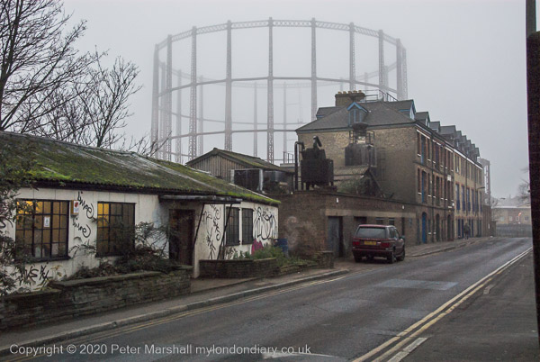
Today, 21 December 2020 is the Winter Solstice, when in London we have only 7 hours 49 minutes and 41 seconds (or 42 seconds) between sunrise at 8.03 am and sunset at 15.53 pm. It’s a depressing time of year for photographers who work outdoors, though we have now passed the earliest sunset which was on 12 December at 15.51pm. Sunrise continues to get later until almost the end of the month, but at 8.06am I’m usually still eating my breakfast rather than wanting to take pictures.

I had forgotten when I began this piece what it was that dragged me away from the fireside and out to take pictures on 21st December 2006, but I had been working on a set of pictures for the book by Cathy Ross, ‘The Romance of Bethnal Green‘. As my text below makes clear, although most of my pictures which feature in it (and I get a credit on the cover and title page) are from the 1980s and 90s, I think she had wanted a picture of the frieze on the Bethnal Green Museum (a double page black and white spread on p36-7) and I had gone up to take this, but I also took a short walk around the area and made a few more pictures.

You can see some of these in My London Diary, beginning towards the bottom of the page for December 2006 under the title Bethnal Green Solstice. In the colum to the left is the following text:

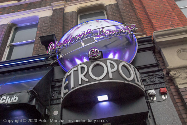
thursday was a cold dark day, the mercury hanging on zero and grey in the air, a fog which never quite cleared. i needed just one more picture for the project on bethnal green and emerged from the underground half an bour before the shortest day of the year officially turned to night. having done what i had to do, i kept walking as it got darker still, and more lights came on.

My London Diary then was a rather more tentative and arty production , even less polished than in later years, and I then eschewed capitalisation, writing in a rather less formal style.

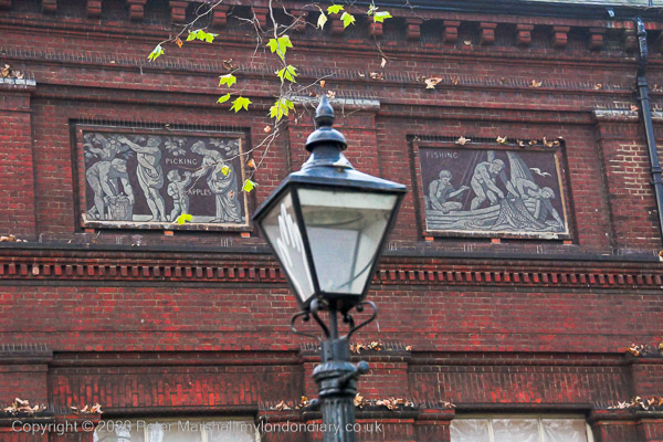
There are 13 panels along the side of the museum facing the park, each depicting a rural pasttime, and I photographed thoroughly in the dying light in various combinations and some singly. I was working by then with a Nikon D200, with a much improved viewfinder over the D100 I’d started with and which gave 10Mp files. Later when I got home I chose the image above – with ‘Picking Apples’ and ‘Fishing’ – and converted it to black and white for publication, cropping it slightly at the right to fit the double page.

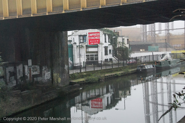
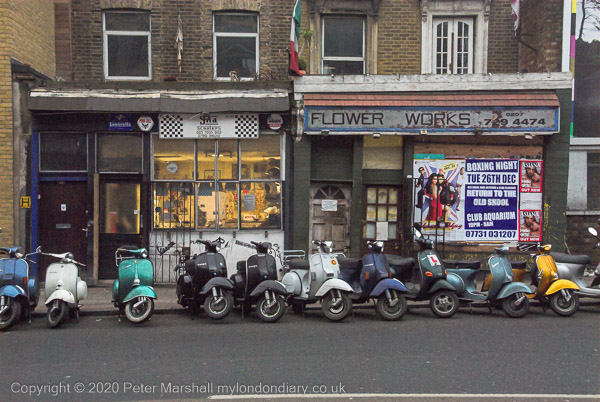
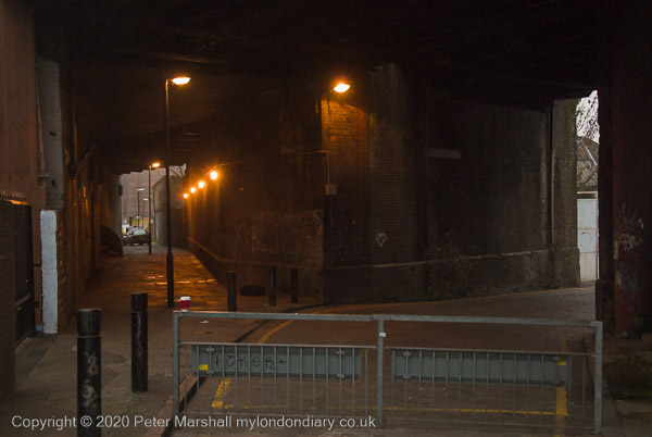
Having taken the necessary image, I walked north up Cambridge Heath Road to the canal, taking a few pictures as I went and on my way back, including a couple more of the museum. The light had been dim when I was photographing the frieze, but it was now definitely dark, with most of the lighting coming from the street lights. I was soon back on the train having spent around an hour on the streets taking pictures.

These pictures were all made at ISO 800, though on at least one the shutter speed was only 1/13s. Even at this relatively low speed some have a high degree of noise. They may have been underexposed but I think that comparing them to pictures taken with the D750 or D810 shows the great advance in sensor quality over the past decade or so. And I suspect re-editing the files in Lightroom now would show the improvements made in software too. The noise isn’t (at least to me) objectionable, any more than the grain in a black and white film image would be, but it is noticeable.

More in Bethnal Green Solstice.


All photographs on this and my other sites, unless otherwise stated, are taken by and copyright of Peter Marshall, and are available for reproduction or can be bought as prints.