DLR – Beckton Extension: One of the earliest projects I had used a panoramic camera on was the building of the Docklands Light Railway Beckton extension which had been a part of a transport show at the Museum of London in 1992. I had made these pictures on black and white film – you can view these along with many other pictures in my Flickr album ‘1992 London Photos‘
So when the Beckton branch from Poplar opened at the end of March 1994 I made a note to myself to return there and make more panoramas along the completed route, but this time working in colour. But I was busy with other things and it was only in July 1994 that I finally managed to go and take some new pictures.
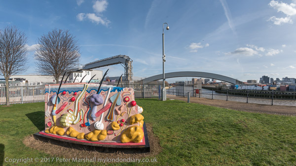
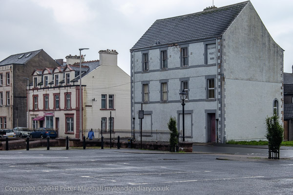
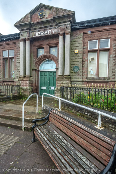
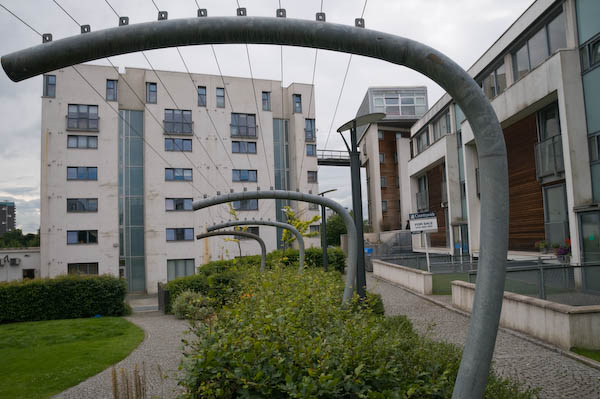
Station Entrance, DLR, Beckton, Newham, 1994, 94-715-13
I began by taking a DLR train to the end of the line, Beckton Station, and then walked out to make a few pictures in the area surrounding the station.
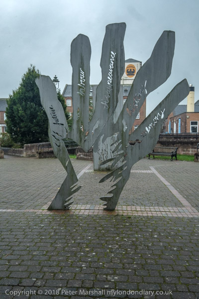
Horses, sculpture, Brian Yale, Beckton Bus Station, Woolwich Manor Way, Beckton, Newham, 1994, 94-716-62
I’d first visited Beckton in 1981, and had gone back briefly when I was working on the DLR construction in 1982, but by 1994 things were very different to my first visit. Then Beckton was still a largely uninhabited area, noted for its gas works – then mainly in ruins and for being at the end oof London’s Northern Outfall sewer.
Station Entrance, DLR, Beckton, Newham, 1994, 94-716-51
There had also been a large postwar prefab estate, but that had been swept away and plans to build large council estates to help solve Newham’s huge housing problems were swept away with the advent of the London Docklands Development Corporation, who sold off most of the land for private housing. The LDDC also commissioned the Horses sculpture by Brian Yale, who had worked for many years as an artist and environmental designer for the architecture department of the Greater London Council, creating “designing murals, sculptures, public art works and play spaces for GLC housing estates and schools“. He was also commisioned by them to produce the long 50 panel The Docklands Frieze at Prince Regent Station.
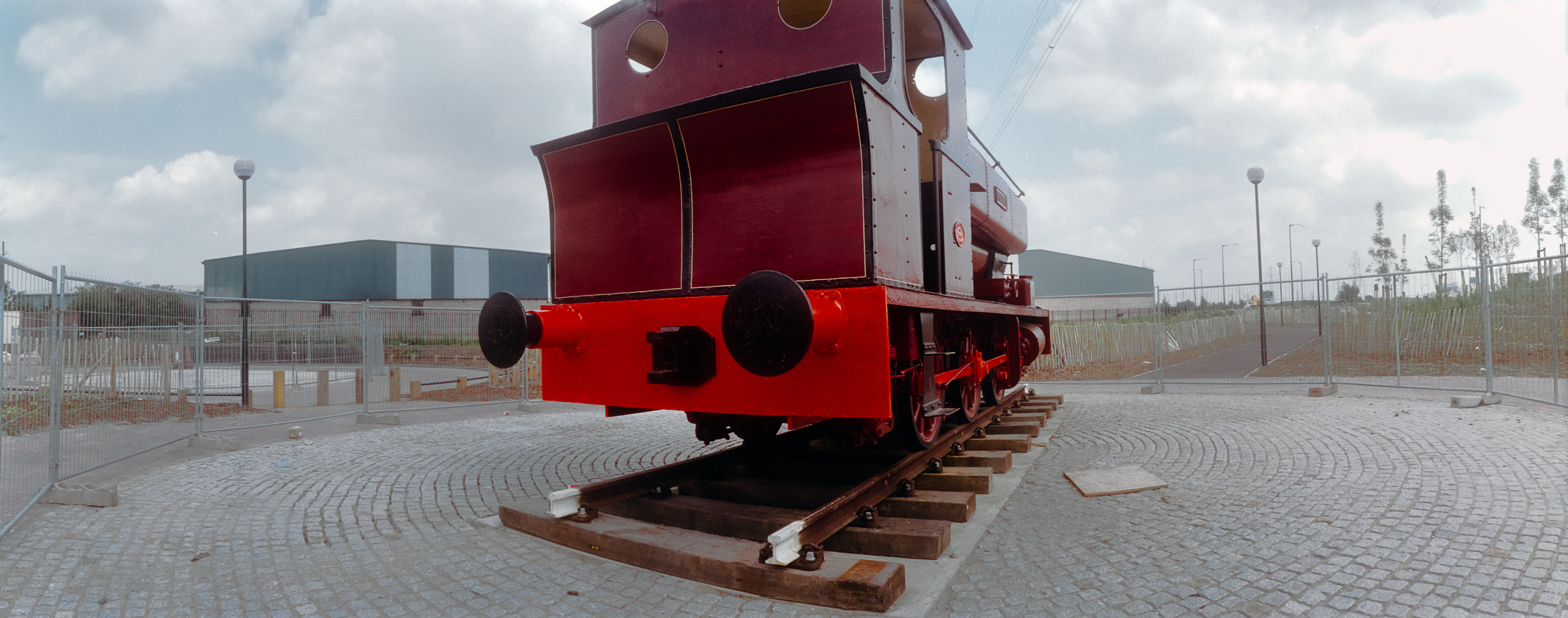
Robert, a 0-6-0 tank engine was built in 1933 for the Staveley Coal and Iron works and worked in their sidings until 1969. It then went to various preserved railway sites, at one of which it gained its name. Kew Bridge Steam Museum in 1993 restored it to look like a Beckton Gas Works engine (presumably for the LDDC) and it was placed here. After some vandalism Newham Council took Robert over and moved it close to Stratford Station. The engine was again moved during building works assocatied with the 2012 Olympics and finally came back to a different location outside Stratford Station in 2011. It was still there when I last went to Stratford a few weeks ago.
Beckton, Newham, 1994, 94-716-43
I took a long walk around Beckton, and made quite a few normal format images in black and white, but relatively few colour panoramas, mainly close to the station, then walked rather futher around the area making more panoramas, only relatively few of them on-line at Flickr – two of those in this post are online for the first time including ‘Link Road, Beckton’ below.
Link Road, Beckton, Newham, 1994, 94-716-11
I this was part of one of the ring road schemes around London that was never built, Ringway 2, which was planned go under the River Thames at Gallions Reach in a new tunnel between Beckton and Thamesmead. When I made this picture it simply came to a dead end not far on.
More panoramic pictures from around the DLR Beckton branch in a later post.
Limehouse and the City – Panoramas 1994: I made one panorama at the end of my trip to Limehouse in June which is on a film processed in July which I overlooked when posting pictures to Flickr.
This was taken from the top floor of John Scurr House on Ratcliffe Lane where there are open balconies leading to the flats it shows both the National Rail and DLR Limehouse stations with the DLR viaduct leading east, with the white tower of St Anne’s Limehouse just visible at extreme right before the top of the brickwork of the stairs.
You can also just see the north side of Limehouse Basin on the other side of Branch Road, and lower right of centre is a small but packed garden centre. A bus goes along Commercial Road and you can see the houses and flats of Limehouse and Bow beyond. Like all the other pictures in this post it was taken with a swing-lens panoramic camera with a horizontal angle of view of over 120 degrees.
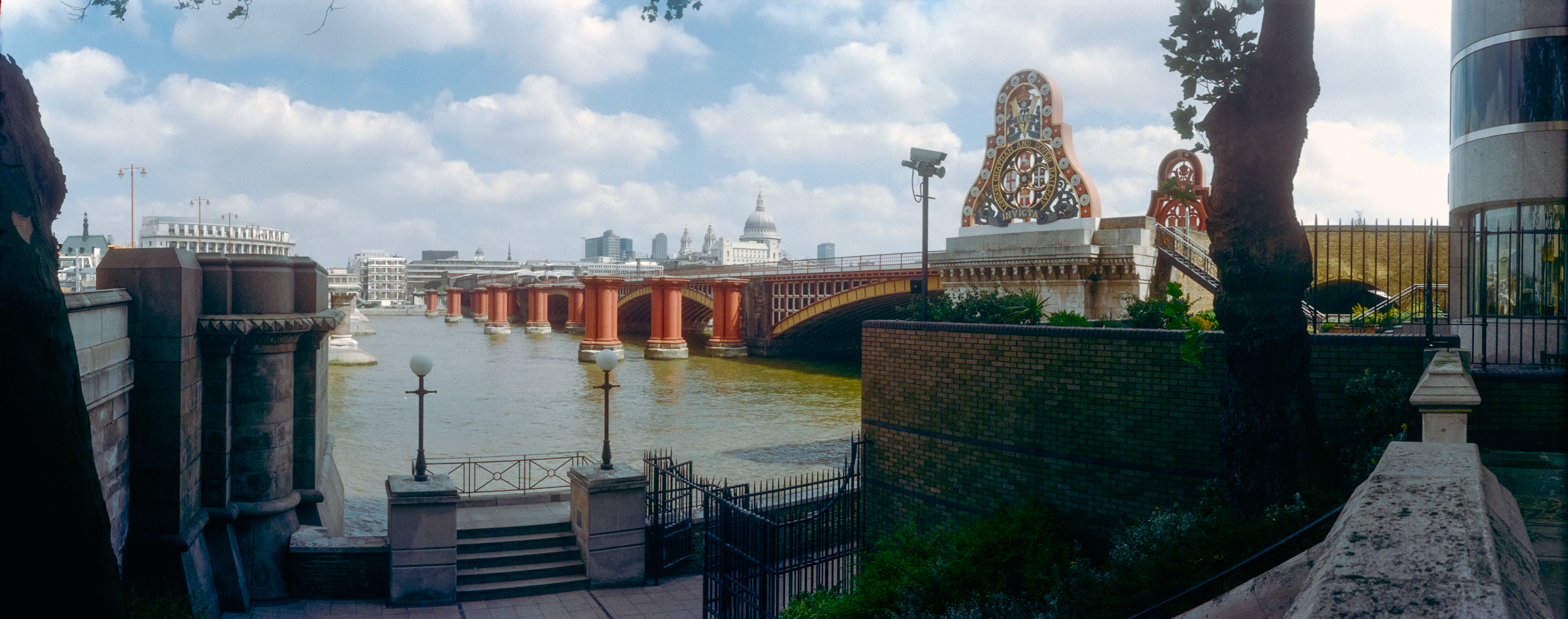
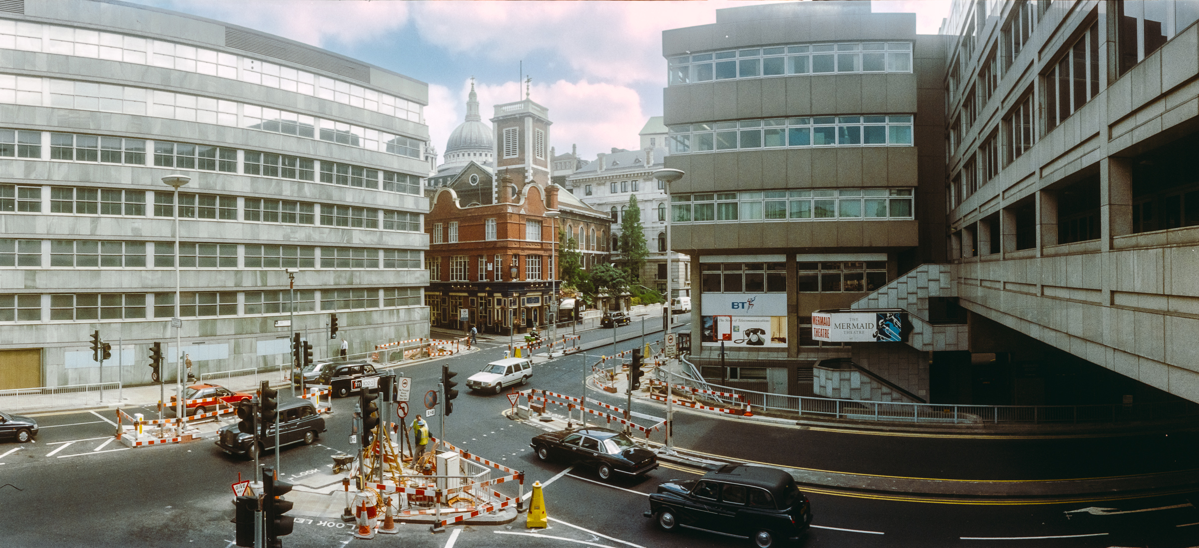
Blackfriars Rail Bridge, Blackfriars Bridge, River Thames, Southwark, 1994, 94-701-42
Early in July I took a train to Waterloo and walked into the City from there, pausing before I crossed Blackfriars Bridge to make this panorama. This is the only place where the City comes ‘South of the River’ and where I was standing in Rennie Garden I was already in the City of London, though the wall at right and half the rail bridge past it is in Southwark.
While the City boundary for the other bridges is in the centre of the river, for some reason the Blackfriars and Southwark Bridges Act 1867 put the full length and its southern end within the city’s borders, in the parish of St Anne Blackfriars.
The garden here Rennie Garden is named after John Rennie (1761 – 1821) the engineer who built several of London’s bridges but not this one, which was by by Joseph Cubitt, also responsible for the dismantled railway bridge whose red piers remain.
This was the site of the Albion Flour Mills designed by Samuel Wyatt on this site in 1786 to house the machinery of Matthew Boulton and steam engine of James Watt – and it was this steam-powered corn mill, the first major factory in London, which is thought to be the inspiration for William Blake’s ‘dark satanic mills’.
The Albion Mill died by its own hand, burnt down in 1791 by a fire probably caused by poor maintenance when a bearing overheated, but four years earlier Robert Barker had sent his son Henry Aston Barker to sit on the roof of the building to make the sketches for his ‘London from the roof of the Albion Mills‘ which he then added detail, “greatly enlarged and painted in distemper on canvas.” He coined the name ‘panorama’ and in 1787 patented the idea. His panorama, first shown at the Albion Mill shortly before it was burnt down and then shown in various galleries in London.
Sets of aquatints were made by Frederick Birnie which toured Europe and went to the United States and while these survive in various collections the original panorama is lost.
Puddle Dock, Queen Victoria St, City, 1994, 94-701-33
Puddle Dock was a dock and also a sewer outfall and was filled in during the comprehensive reclamation and redevelopment of the area between 1962 and 1972 which created Upper Thames Street as a major road and Puddle Dock linking this to Queen Victoria Street underneath part of Baynard House, a Brutalist office block built for BT and completed in 1979.
As a part of plans to separate vehicle and pedestrian movement in the City it included a walkway leading to Blackfriars Station from which I made this panorama. The dome of St Paul’s can be seen just to the left of the tower of St Andrew by the Wardrobe.
Sculpture, Farringdon Rd, Holborn Viaduct, City, 1994, 94-702-51
Holborn Viaduct was London’s first flyover, connecting the City with Holborn over the deep valley of the River Fleet, which had be culverted here in the 18th century, in part for the building of New Bridge Street. Built in 1863-69 it links Holborn Circus with Newgate Street and was a major redevelopment ‘”the most ambitious and costly improvement scheme of the [nineteenth] century” (White 47), and it involved some outstanding feats of Victorian engineering.‘
Over the years I’ve made quite a few panoramas on and of the viaduct and written about it at some length – here are a few from 1994. You can read a detailed account on the Victorian Web site.
Sculpture, Farringdon Rd, Holborn Viaduct, City, 1994, 94-702-52
Sculpture, Farringdon Rd, Holborn Viaduct, City, 1994, 94-703-11
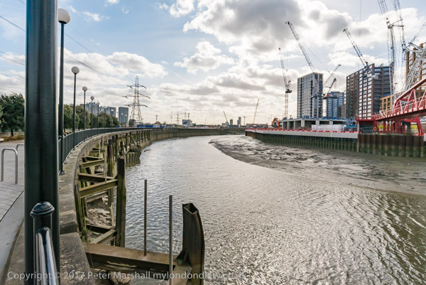
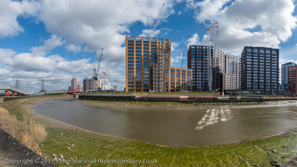
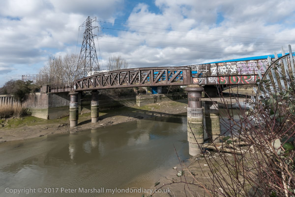
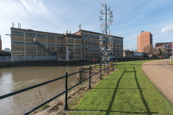
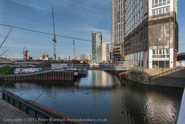
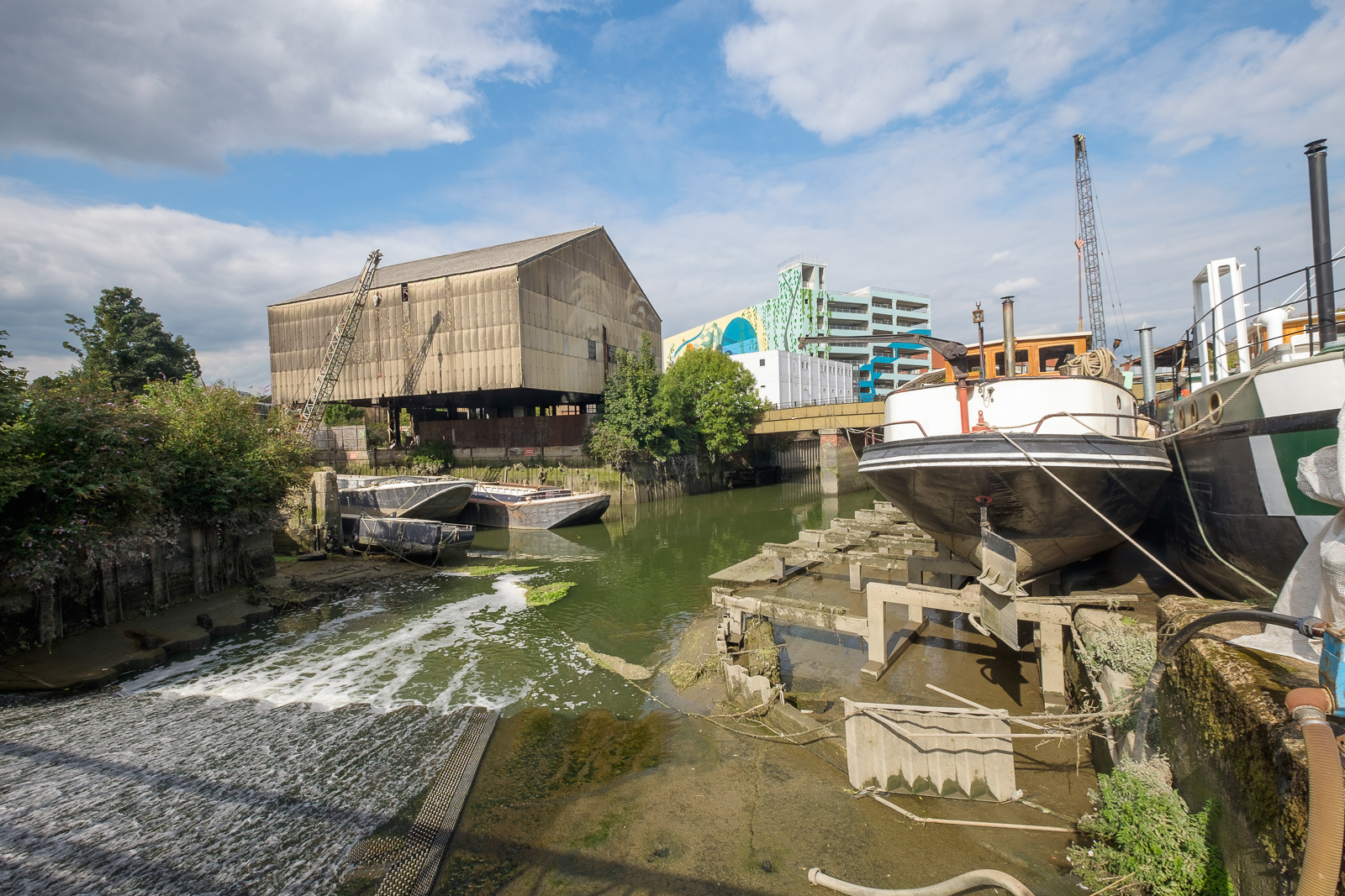
Canning Town, Cody Dock and Stratford: On Thursday 2nd March 2017 I made a rather convoluted walk along Bow Creek and the Lea Navigation, arranged around a meeting I had at Cody Dock. You couldn’t then – and can’t quite yet walk beside the river the whole way, but to get to the meeting I had to abandon a small part of the first stretch and catch the DLR, walking on from the meeting to Stratford High Street where I caught the DLR again to go back and complete the short part I’d had to miss out earlier.
In this section of My London Diary I included pictures taken both at the start and at the end of my walk, which began at Canning Town Station.
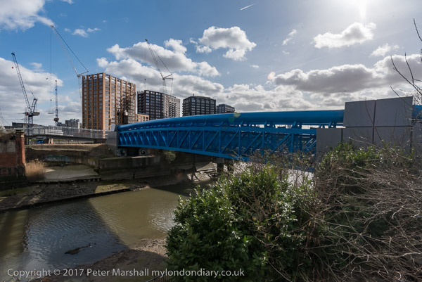
The riverside walkway at Canning Town is open after many years and can take you to the bridge to London City Island.
People were living in some of the blocks on the “Island” but there was still a lot of work continuing in this area which Bow Creek loops around on three sides. Another bridge was built across the DLR tracks to allow people from South Bromley in Tower Hamlets a pedestrian route to the riverside path and Canning Town station. Open for a short time it closed well before the station entrance became open, and a gate on it was firmly locked when I tried to cross it.
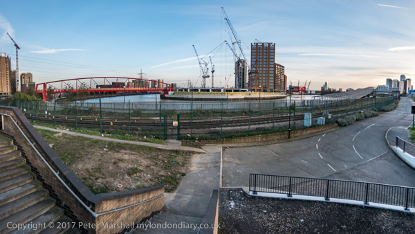
This meant I had to make a lengthy detour walking around the Ecology park to get to the Blue Bridge which took me to the East India Dock Road.
This meant I had to hurry back to Canning Town Station to get the DLR to Star Lane for my meeting at Cody Dock and couldn’t then walk along the north side of the road to take more pictures.
I paused briefly to photograph a sculpture made from shopping trolleys in a mock DNA double helix.
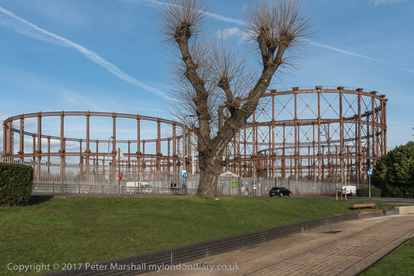
My next stop was to photograph the The Imperial Gas Light and Coke Co’s 1872-8 Bromley-by-Bow gasholders and the war memorials – originally at Beckton – with an eternal flame next to a monument to company workers killed in both World Wars.
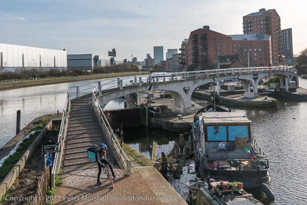
Steps leading down from Twelvetrees Bridge at Bow Locks took me down to the towpath beside the Lea Navigation.
Three Mills is a tide mill dating from 1776 (though on the site of earlier tide mills mentioned in the Domesday Book) on the Three Mills Wall River. It is the largest tide mill in the UK and the largest surviving in Europe.
Another sculpture on The Line, unveiled on the centenary on Three Mills Green and moved to this position on Short Wall is by Alec Peever and commemorates three men who died in 1901 They died going to the aid of a fourth who had been overcome by the lack of oxygen at the bottom of a well they were investigating.
I walked on to Stratford High Street, turning west to go to Bow Bridge and the Lea Navigation before going back beside St Thomas’s Creek and along Stratford High Street to the DLR Stratford High Street Station for the train to Canning Town.
More from Bow Creek
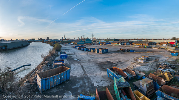
It was beginning to get a little dark as I came out from the station to photograph from the north side of East India Dock Rd.
This was still an industrial area although a large area seemed now to be unused. I thought it would probably not be long before this area too was covered in flats as I walked back to the station.
Cleator Moor & Loweswater: I do sometimes leave London and at the beginning of September 2018 I was on holiday with a group of friends in Ennerdale at the west of the Lake District.
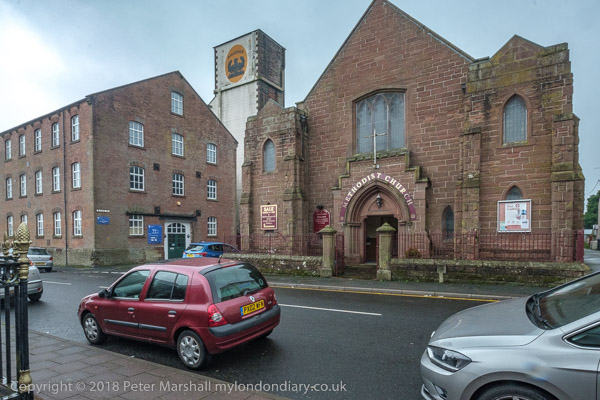
On Sunday 2nd September some of our party wanted to go to a morning service at the Methodist Church in Cleator Moor. It wasn’t my cup of tea but there was a spare seat in the car and I went along for the ride, and while they worshipped took a walk around the town and made some pictures.
It perhaps wasn’t the kind of weather most people would choose for making photographs, dull and with occasional light rain, but as I wrote, this “seemed to be in keeping with the mood of the place“.
Cleator Moor was once a prosperous mining town, now rather desolate and depressed. It’s a small town, with a population now of around 7,000 but was built on a rather grander scale than that might suggest. In its heyday the population would have been rather higher.
This was an important area in the early days of the industrial revolution as the local mines supplied both coal and the iron ore haematite and there was local limestone – all that was needed to make iron and steel. Cleator Moor had long produced iron but got its first coke-fired blast furnace in 1841 though output again went up considerably with improved furnaces in the 1860s. It was one of many pig iron producers in the area, particularly around Workington which became a major port.
As demand for coal and iron ore increased in the second half of the nineteenth century many migrants came to the town to work in the mines and iron works, with the population increasing in the 30 years between 1841 and 1871 from 763 to 10, 420. Over a third came from Ireland and the town became known as ‘Little Ireland’.
Most of the Irish were Catholic, but there were also Protestants from Ireland and Scotland and Cleator Moor saw a great deal of sectarian violence from the 1860s to the 1890s. Among the town’s 15 Grade II listed buildings is the Roman Catholic St Mary’s Church, designed by noted church architect Edwarde Welby Pugin and consecrated in 1872, replacing a mission church built in 1853.
In it’s heyday the town was served by two railway lines, each with its own station, though both lines were mainly used for mineral traffic. Passenger services ended around1930 though goods services continued for some years. In the early years of the 20th century the local iron ore ran out and the coal became too expensive to mine and the town began to go into decline.
It received a boost in 1938 with the coming of Kangol, founded by Jakob Henryk Spreiregen (1894 – 1982). Born in Warsaw he moved with his family to France in 1910 and coming to the UK in 1915 and serving in the Medical Corps in the war and was naturalised in 1920. The Kangol brand name came in 1930, from Knitting ANGora WooL.
Spreiregen had begun manufacturing hats in London in 1916 as well as importing basque berets from France. In 1938 seeing another war coming he realised there would be a great demand for miltary berets and leased a mill in Cleator, importing machinery from a French beret factory. Kangol opened a new factory in Cleator in 1950, then employing 110 people. Kangol diversified into crash helmets, seat belts and ladies fashion hats and enjoyed great success, but was acquire by a US company in 1972.
Kangol continued to grow but more and more production shifted abroad. They became the largest hat producer in the world and the Cleator site employing 690 people the largest hat factory in Britain. But in 1997 the factory was closed, remaining just a small distribution site until finally closing with the loss of 32 jobs there in 2009. Cleator had lost its second major industry.
As I wrote in 2018, “The town conveys a strong feeling of depression, though lifted somewhat by a number of buildings of some quality, and parts of the main street have a pleasing uniformity, with simple terraced housing, its doors opening directly on the pavement. The central square, with library, municipal offices and a couple of fine parades, as well as some interesting sculptures by Conrad Atkinson who was born in the town. One of L S Lowry’s close friends was a bank manager here, and he often came to stay, making a number of paintings, and I could see why the place interested him.”
It was still raining intermittently after lunch when we drove to Loweswater for a rather wet circular walk from Fangs Brow – rather typical of the Lake District. Though we did have some fine days during our week there.
Glasgow Visit 2008: In August 2008 with my wife and elder son and friends I went to Iona. The journey up from London is a long one and we decided that rather than try to do it in one day we would take the opportunity to spend a few days in Glasgow on our way, staying in a hotel close to the School of Art in the centre of the city, named after Charles Rennie Mackintosh.
We were in Glasgow for only five days but managed to see quite a lot of the city and some of its surroundings as my pictures show. Looking back I’m surprised at the variety of subjects in the roughly 2000 images I took, working over a 12 hour day on most of the 5 days we were there.
Only a fairly small fraction of the pictures are on My London Diary – partly because this wasn’t London and I then felt a bit embarrassed about posting work from another city. But the web site – which I updated regularly from around 2000 to the start of 2022 except during the lockdown and is still on line was very much my personal diary and so does include at least some of my pictures from outside London.
All were taken on the 12Mp Nikon D300, a DX format camera which I had bought earlier in the year. It was a very usable camera with decent autofocus and nothing that came later from Nikon was really much of an improvement, though the sensor size and pixel count increased. Should you want a good, cheap DSLR a secondhand D300 would still be a good choice, so long as the shutter count was well below the rated 150,000.
I think I had both a wide-angle and telephoto zoom with me. The Raw images I made have suffered a little from the processing to produce jpegs – software has improved significantly since 2008, and I think all of them could benefit from being made a little brighter. But life is too short to re-process them all.
For convenience I divided the pictures into eight rather arbitrary sections to post them on My London Diary, and I’ll include the direct links to these at the bottom of this post. But you can start at ‘My Pictures’ and click the link at the bottom of each page to go through the complete set I’ve posted.
This wasn’t my first visit to Glasgow, but I don’t think any pictures from my earlier visit when we spent a week there are online, and on the brief visit with friends back in around 1962 I took no pictures – I think I’d finished my holiday film on Skye, where my holiday also almost ended as I fell down a mountain.
Mmong other holidays in Scotland I’ve also spent a couple of weeks in Edinburgh – including once for the festival. And though I enjoyed both cities, I found Glasgow interested me more. If I ever return to Scotland it will be to Glasgow, as I now feel too old to walk the West Highland Way.
My walk in the City of London towards the end of March 1989 began at Bank Station, perhaps because the Bank of England is in many ways the centre of the City, but probably also because until 1994 the Waterloo and City line was a part of our railway network and I could travel there as a “London terminus” on my rail ticket. In 1994 it became part of the London Underground (they paid £1 for it) and from then on I needed to pay them for the journey. I think back then there were no services on the “drain” on Saturday aftenoons or Sundays.
War Memorial, Bank of England, City, 1989 89-3d-64
Over the years I’ve taken many slight variations on this picture with the London Troops War Memorial and the Bank of England. The memorial to the troops of London who died in the Great War was designed by Sir Aston Webb, with carving and lettering by William Silver Frith and the bronze figures by sculptor Alfred Drury and was unveiled on the day after the second anniversary of Armistice Day on 12th November 1920.
Later a further dedication to those who died in the Second World War was added. The quality of the statues and carving and overall its design make it one of the more impressive of war memorials. Grade II listed when I made this picture it was upgraded to II* more recently for the 100th anniversary of the Battle of the Somme.
The memorial stands in the triangle of public space in front of the Royal Exchange but this picture was taken from the side to include the Bank of England as the background. It’s perhaps slightly unfortunate that I included the sign for the public toilets at the bottom edge, useful though they were – and then like others in the City – free to use.
George & Vulture, George Yard, City, 1989 89-3d-52
The George & Vulture describes itself as a City institution and there has been an inn on this site since 1142 or 1175, depending on who you believe – or 1600 according to my picture. Before the 1666 Great Fire there were supposedly two inns here, the earliest The George and a later establishment, The Lively Vulture, but they were amalgamated in the rebuilding.
It gets numerous mentions in Dicken’s Pickwick Papers and has been the headquarters of the City Pickwick Club since it’s inaugural dinner in March 1909 when it was founded incorporating his earlier Pickwick Coaching Club by Sir James Roll. Initially limited to 30 members that has increased over the years and in 2009 was raised to 100; they still meet for dinner there four times a year, and it is also host to other Dickens events.
Rather than a pub it is now a City chop house or restaurant, though open some evenings for cold plates and drinks; run by Samuel Smiths Old Brewery it offers a full range of their beers as well as other drinks.
Fountain, George Yard, St Michael’s Alley, City, 1989 89-3d-53
The City’s alleys have long fascinated many, and I’d first explored them before I was taking many photographs, following walks from one of many guides to London. It’s still easy to get a little confused in following them, particularly when some parts such as George Yard has changed rather.
You will search in vain for this fountain which then stood in the open area at the end of George Yard and St Michael’s Alley (though you could also reach it from Bell Inn Yard or Bengall Court and it was just a few steps from the end of Castle Court.
Fountain, George Yard, St Michael’s Alley, City, 1989 89-3d-42
Both the George & Vulture and the the Church of St Edmund the King in the background of this picture remain, but much of the rest around here has been replaced.
Fountain, George Yard, St Michael’s Alley, City, 1989 89-3d-43
I assume the statue was of St Michael and to me it and the mosaic floor have a look of the 1950s or 60s about them, but neither this statue nor the fountain in which it stood get a mention in any of the books about London I own. Most of my pictures were of the mermaids who obviously appealed to me more.
I have no idea what happened to these sculptures, and have been unable to find any more information about them. The yard is now home to rather Dalek-like structures, surrounded by seats and flower beds, presumably provided ventilation for areas below. The whole site on the west side of Gracechurch Street south of Bell Inn Yard which was the headquarters of Barclays Bank was redeveloped shortly after I made these images, with the distinctively curved 17 floors of 20 Gracechurch being completed in 1994.
Sculpture, Lombard St, City, 1989 89-3d-46
I walked out onto Lombard Street where I made several exposures of this Grade II listed bronze ‘Chimera with Personifications of Fire and the Sea’ by Francis William Doyle-Jones from 1914 on the 1910 bank building. I was at the time thinking of putting together a compilation of pictures of London’s ‘topless’ women.
Sculpture, Lombard St, City, 1989 89-3d-33
A wider view taken from the corner with Birchin Lane, where the view today is little different to that in 1989, except that the hanging TSB 1810 sign on Falcon House at left, there until 2016, has since been replaced by one peculiarly illegible one for Falcon Fine Art.
My walk around the city continued, though I’ve digitised relatively few pictures from it and soon moved away further east towards Spitalfields, as you will see in my next post on it.
I began another walk from Camberwell on Sunday 12th February 1989, starting from a bus stop on Camberwell Road I made my way east towards Sedgemoor Place.
The Aged Pilgrims’ Friend Society was established in 1807 by a group of Christians concerned about “the aged and infirm Christian poor”. William Wilberforce, best known as an anti-slavery campaigner, was its Vice-President in the early years. At first it provided life pensions to Protestants over 60 whose income was less than 5s (25p) a year and by 1825 had supported over 800 pensioners with pensions of five or ten guineas a year.
The Aged Pilgrims’ Friend Society were given a site in Camberwell by William Peacock Esq and raised the money to build their first almshouses there, opening in 1837 to house 42 pensioners. The Tudor-style building is Grade II listed. It was sold by the Aged Pilgrims’ Friendly Society who by then had added an ‘ly’ to there name in 1991 and is now flats.
The Aged Pilgrims’ Friend Society were given a site in Camberwell by William Peacock Esq whose donation is recorded above the doorway and raised the money to build their first almshouses there, opening in 1837 to house 42 pensioners. The Tudor-style building is Grade II listed. It was sold by the Aged Pilgrims’ Friendly Society in 1991 and is now flats.
St Giles’ Hospital, Havil Street, Camberwell, Southwark, 1989 89-2c-26
The picture shows the demolition of former workhouse and the start of the conversion to flats of the Grade II listed circular ward tower fronting onto Havil Street. This was built in 1889-90 for the Camberwell Workhouse Infirmary, later St Giles’s Hospital, architect W S Cross. Each fllor contained 24 beds radiating around a central shaft, in which heating and ventilation services were located. I had photographed this building on a walk a few weeks earlier and had gone back to see if work was progressing and I could get a better view.
Plans for the Sceaux Gardens estate in the mature grounds of the former Camberwell House Lunatic Asylum were approved in 1957 and included two 15 storey tower blocks, Lakanal House and Marie Curie House. The estate was named after Sceaux near Paris which Camberwell had twinned with in 1954. I’ve visited Sceaux a few times and it has a rather better palace and park where festivals are held.
The Lakanal fire in 2009 killed 6 and injured at least 20 more; the recommendations from the enquiry were not implemented but would have prevented the later even more disastrous fire at Grenfell Tower. I think this block is probably Lakanal, but can find no details about the statue – and it certainly isn’t Lakanal.
Joseph Lakanal (1762 – 1845) was a French politician, and an original member of the Institut de France and one of the leading administrators of the French Revolution and responsible for educational reforms. He spent some time in the USA and helped to found and became President of what later became Tulane University before returning to France.
Camberwell Church St, Camberwell, Southwark, 1989 89-2d-63
I walked back west along Peckham Road to Camberwell Church St, pausing to take a couple of pictures not online and then this view of houses and a shop on the south side of the street, possibly at 70-72.
Houses, Camberwell Grove, Camberwell, Southwark, 1989 89-2d-65
I was on my way to Camberwell Grove to make photographs in the northern part of the street which I had not visited on my earlier walks. Just a few yards down the street I turned around and took this view looking up towards Camberwell Church St. At left is the path to Chamberlain Cottages mentioned in an earlier walk.
Houses, Camberwell Grove, Camberwell, Southwark, 1989 89-2d-66
A little further down I found this terrace with two porches on houses in the centre. Like most of the buildings along this part of the street this is Grade II listed, described as ‘Early C19 with some later C19 alterations’.
Flats, McNeil Rd, Camberwell Grove, Camberwell, Southwark, 1989 89-2d-52
The flats at left are 125-151 Camberwell Grove and you can see the spire of St Giles Camberwell in the distance. This is the Lettsom Estate, named after John Coakley Lettsom (1744-1815) who lived in Grove House, just beyond the southern end of Camberwell Groce, long demolished. He was Quaker physician and herbalist, who was friends with Benjamin Franklin, Dr. Johnson, Boswell and other leading figures of the day. This land had been a part of Lettsom’s estate.
When the flats were built in the early 1970s their scale was designed to match the nineteenth century housing along this section of Camberwell Grove – although they have four floors rather than the three in most of this. Their brickwork is also of a similar colour but they lack any of the interesting features of the older buildings and are relatively bland.
I made my way through the estate and on to Vestry Gardens where my next post on this walk will begin.
My walk a few days ago in September 2022 began at Kew Bridge Station. I’d come half an hour before I was due to meet my two companions to take a short walk around one of the newer parts of the area before meeting them for a longer walk to Isleworth.
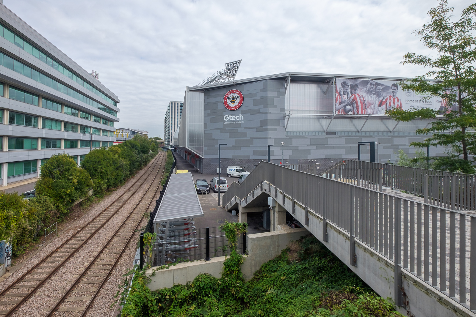
Lionel Road runs north of the railway up to meet the Great West Road. It used to be a rather run down area with railway sidings on one side and a few old commercial buildings and works to the north. The last time I’d walked down here on my way to Gunnersbury Park in 2018 the whole area had been a building site, but now is home to Brentford FC, currently doing pretty well in the Premier League.
Brentford was my local team when I was a kid, and several members of the award-winning under-11 team I played for at left back on went on to play for them at their old ground (and at Chelsea.) One of the other patrol leaders from my scout group stayed there until he retired, though I never met him after I hung up my woggle, but read his obit in the local rag.
Past there I came to the Great West Road, a 1930s dual carriageway with cycle tracks I sometimes used further west on my way home from school. In the 1980s or 90s I photographed most of the remaining Art Deco factories along it, though the bulldozers got to some first. Now it reminds me of J G Ballard’s novels, particularly ‘Crash’, set around the area we both lived in, with the elevated M4 above the older modern road.
A new Brentford of tall blocks has sprouted here, though more land remains to be built on. A little-used rail line goes through it, the Kew Curve, with Brentford’s stadium replacing the sidings and cattle pens to its west, with new building on the east in what was Brentford Market. It moved to this site in 1893 after the Brentford Local Board had bought the 2 acre site from the Rothschild estate because market trading in the area around the Express Tavern immediately south of the station which had developed informally away from Brentford’s traditional market in Market Place had become a public nuisance. The site was extended in 1905 and then covered land now part of the Chiswick Roundabout. The market moved to the edge of Southall in 1974 as the new Western International Market and the Fountains Leisure Centre was built on part of the site, with the rest staying derelict for years.
My maternal grandfather, then a market gardener in Feltham, would drive his cart with produce to Brentford Market in the early years of the last century, past the house in Hounslow where my father, then a young boy, used to see him driving past. Around twenty years later when he became engaged to my mother he found out who he was.
I met my two colleagues and we walked together down by the west side of Kew Bridge to the Thames. To our right was where the Kew Bridge Ecovillage had squatted from June 2009 until May 2010, now occupied by 164 flats, a business centre, gym and pub.
The Hollows runs west between riverside moorings and recent blocks of luxury flats, eventually returning us to Brentford High St, and a park beside the river now called Watermans Park. This was the site of Brentford Gas Works which straddled the High Street here and was a great attraction when we took the bus through it in my childhood, usually on our way to Kew Gardens. Entrance then was only an old penny, and it was a cheap outing for families in the area. My father would have his scissors in his pocket and perhaps take the odd small cutting to grow in our garden. Rather cheaper than garden centres.
But if you were lucky as the bus drove slowly down the usually congested street, one of its Intermittent Vertical Retort would open sending a wall of red hot coke to the ground, quite an amazing site as we peered from the top deck. It almost made up for the smell.
A gas works had been set up here and began production in 1821, first supplying has for lighting the turnpike to Kensington, but later serving large areas around. Later other gas works were set up in Southall and then elsewhere as demand continued to rise. in 1926 the Brentford gas company became a part of the Gas Light and Coke Co which later became British Gas plc. Brentford Gas Woks closed in 1963 and the riverside buildings were demolished in 1965 though the large gasholder remained until 1988.
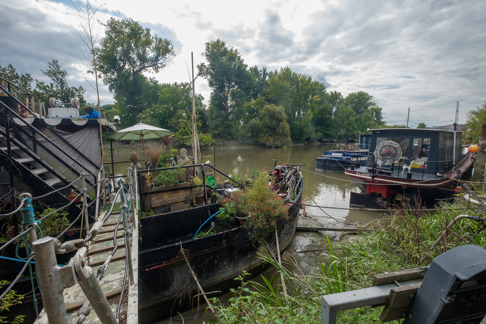
All than now remains of the gas works are some of the substantial posts of the gas works jetty, where colliers once brought in coal. There has been a long battle over the rights to moorings here between boat owners and Hounslow Council with boat owners claiming that the foreshore here belongs neither to the council nor to the PLA but to the Bishop of London, and refusing to abide by various eviction notices. Most have now moved but some derelict boats remain.
Brentford Ait runs along the centre of the river here. It was bought in the late 19th century by the Crown who planted trees on it to hide the gas works from visitors to Kew Gardens on the opposite bank. A few yard upstream is Lot’s Ait, where the Thames Steam Tug and Lighterage Company Ltd set up a boatyard in 1920 – most of the Thames lighters were built there. The boatyard closed in the 1970s, but was reopened in 2012 when a new footbridge was constructed to it.
As well as the park, the Watermans Arts Centre was also built on the gasworks site. We walked between it and the river, and continued on the riverside path, past the bridge to Lots Ait and recent blocks of flats. There are new moorings around here too.
A small spit of land leads from the bottom of Ferry Lane (more new flats) to an artwork by the riverside. I’m not quite sure what to make either of Liquidity or another similarly decorated column not far away, but it could provide a useful windbreak in bad weather. This was where once a ferry ran across to Kew Gardens.
We followed the Thames Path around a small dock, on what was the site of the Thames Soap Works and then continued along the side of the River Brent which flows into the Thames here, continuing along this beside the winding river past another boatyard to Brentford High Street.
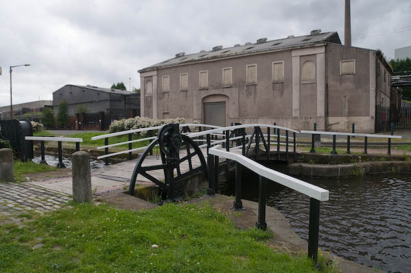
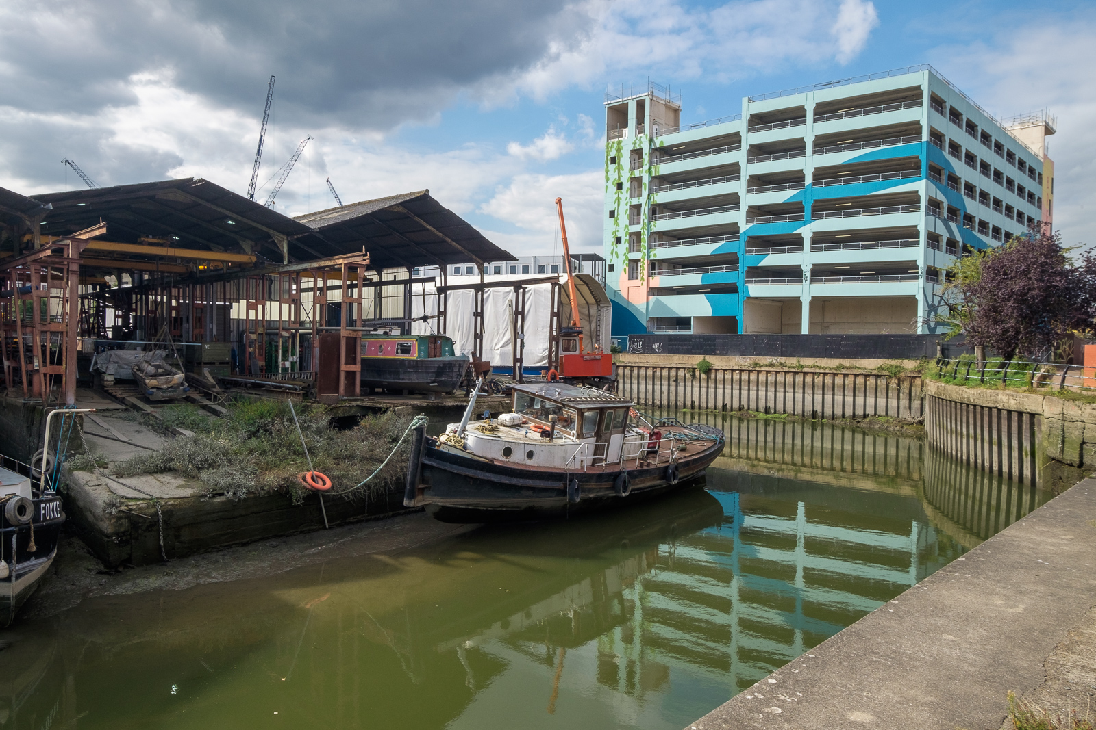
A few yards along we turned left down Dock Road to Thames Lock, past a huge mural and the other end of the boatyard, to Thames Lock, the southern end of the Grand Union Canal. Here we took the path beside the north side of the canal, leading across a bridge over the Brent to Johnson’s Island and Catherine Wheel Road.
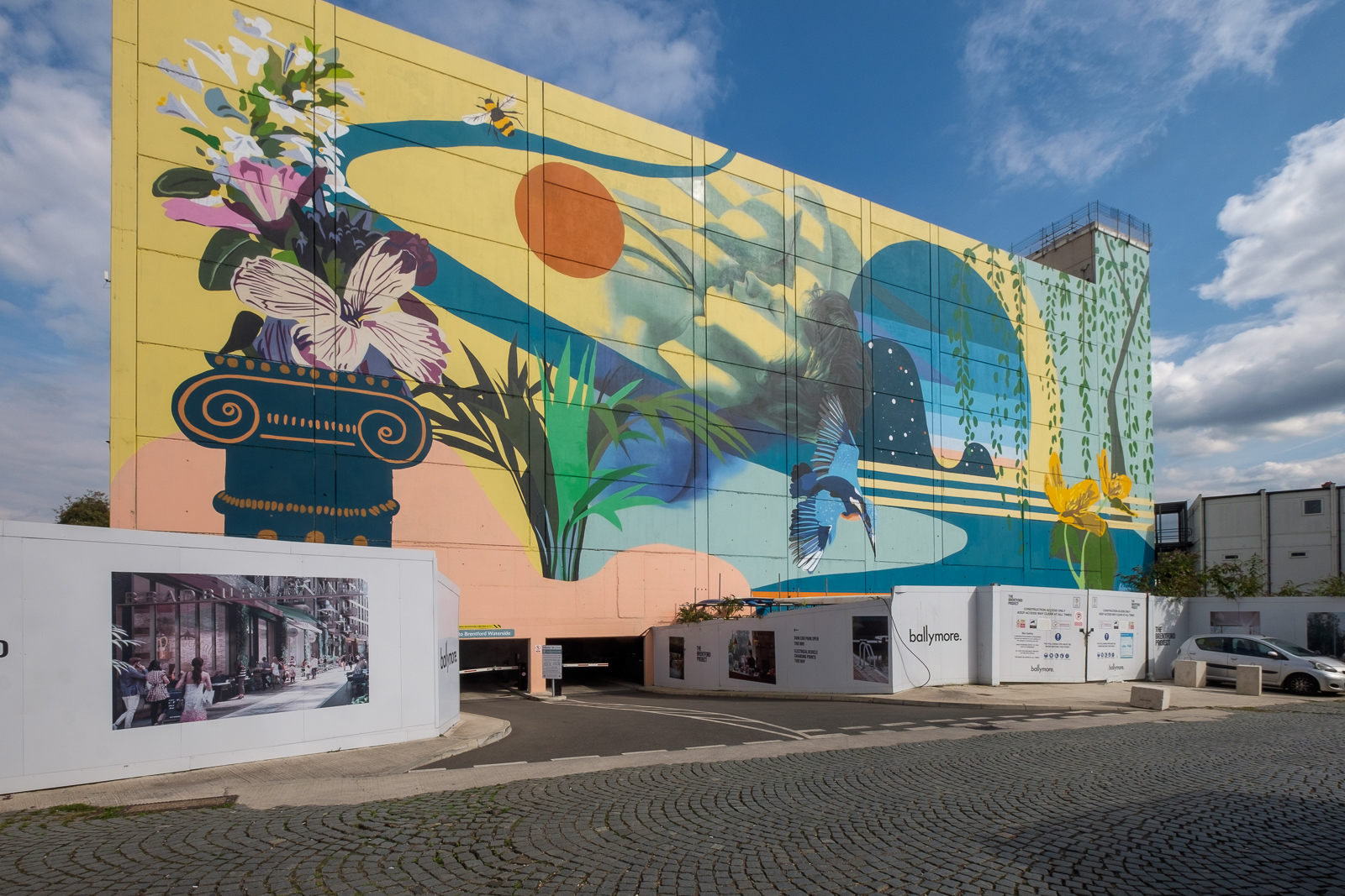
The mural, on the side of a multi-story car park had included a giant kingfisher, and I’d joked saying this was the only kingfisher we’d see in Brentford. But as we walked across the bridge over the River Brent and stopped to take pictures, perched on the top of a post there was one, still only for a second before flying out of sight. By the time I’d raised my camera to my eye it was gone, though since I had and extreme wideangle lens it would hardly have been visible, just a few more colourful pixels.
I’d planned to walk along Brent Way and rejoin the canal towpath, but the whole of this area is now a huge building site, and instead we walk along the High Street to the canal bridge. I couldn’t bring myself to walk down to the Gauging Lock preserved there, though I’ve done so several times before, but the changes to the area, now with a marina, flats and hotel made me feel too sad; we simply stood on the bridge and looked for a while before moving on.
Part 2 will continue the walk from here to its end in Isleworth. You can see more pictures from the walk in a Facebook album.
Bow Common Lane, Bow Common, Tower Hamlets, 1988 88-7r-35
Although this image is labelled as being on Cantrell Road in my very skeletal notes written small in black ink on the contact sheet, it is actually still there next to the railway on the west side of the gasworks site in Bow Common Lane.
This fairly substantial house is on the edge of the gas works site mentioned in the previous post and I wondered if it might have been a part of this development, perhaps a manager’s house. The gasholder was removed in 2016-7
Bow Common, Tower Hamlets, 1988 88-7r-21
I’m fairly sure that Turnbull & Son Builders were not on Cantrell Road as my notes suggest, but certainly somewhere in Bow Common, possibly on Bow Common Lane, Devons Road or St Paul’s Way which were on my route. Little of the older industry in the area now remains.
Bow Common, Tower Hamlets, 1988 88-7r-23
Again there is a frustrating lack of information on the contact sheet, possibly because I was lost. So I’m unsure of the location of this detached Victorian house, but I think it may have been on Turners Road which I went down on my way to Clemence St.
Finally a location I can be sure of, as the block in the background has two signs on it. ‘No Ball Games’ is on not helpful, but over the entrance way just above the thighs of what looks to me a naked rudimentary female figure I can read ‘Gatwick House’.
Although Trevor Tennant (1900-80) entitled this ‘play sculpture’ Gulliver it still looks female to me. It is described in The Buildings of England London: East as “in Festival of Britain Spirit”, though it looks vaguely Henry Moore to me. Tennant in taught at various art colleges including Camberwell School of Art (1930-4). The sculpture commissioned by the LCC for the Locksley Estatew was probably installed when the block was built in 1954-6 and by the time I photographed it was deteriorating – perhaps due to some rather more robust physical play than anticipated. It was originally at the centre of a large sandpit with the base buried in the sand. I suspect the sand was removed after being too often used as a toilet for dogs, a common fate with sandpits in public places.
A gloomy building by a gloomy canal, close to St Anne’s Church which towers above the tree at right. This building at the rear of a ‘dangerous structure’ on Commercial Road opposite the church is still standing, though the lower structures to the right have been demolished. I think this is 777 Commercial Road, a former sail loft, part of the Grade II listed run of buildings here. According to the listing, 777 dates from 1893-4 and was designed by Marshall & Bradley and built by J.H. Johnson for Caird and Rayner. The site is now ‘Sailmakers’ a mixed-use development which will retain the building frontage.
The Flood barrier on the Limehouse Cut presumably became redundant after the building of the Thames Barrier. On the other side of Commercial Road you can see both St Anne’s Church over a billboard and Limehouse Town Hall.
The Empire Memorial Sailors’ Hostel, now called The Mission Building, was built in 1924 to house some of the many sailors in the city needing lodgings. Money to fund it came from an appeal organised largely by women from across the British Empire to save these men who might otherwise have spent the night and their earnings in the company of the oldest profession. They appealed for the funds to build it as a memorial to the 12,000 merchant seamen who were killed in the Great War.
The Grade II listed building originally had 205 single rooms (cabins) and appears to have been designed to the demands of a committee whose members advocated differing styles. It was enlarged in 1932 along Salmon Lane to meet the huge demand, but as the docks closed became a hostel for the homeless. It closed in 1985, presumably not because of any lack of homeless people but because of the cost of housing them, and in 1994 was sold off to a developer who converted it to a gated and portered residential development.
4-12 West India Dock Road, Limehouse, Tower Hamlets, 1988 88-7r-14
A little of the old West India Dock Road, this row of shops is now long gone. The large Grade II listed building at right is still there, built as the Passmore Edwards Sailors Palace, the Headquarters of the British And Foreigh Sailors Society in 1901, with a grand frontage including a crowned Britannia holding on each shoulder a strangely morphed galleon and child. The side view here is rather more utilitarian.
Sail Makers, Ships Chandlers, 11, West India Dock Rd, Limehouse, Tower Hamlets, 1988 88-7r-16
A sign over the door for Pastel Print shows its use in 1988, when local demand for sails, candles and other marine equipment has shrunk to zero. A plaque near the apex of the facade states ‘ERECTED AD.1860’. I think it has now been made into flats and offices retaining the facade.
The next part of my walk, going back into Bow and on towards Bromley-by-Bow will continue in a later post.
Clicking on any of the pictures will take you to a larger version in my album 1988 London Photos from where you can browse the album.
Sigmund Freud, sculpture, Oscar Nemon, Fitzjohn’s Avenue, Belsize Lane, South Hampstead, Camden, 1988 88-7h-61
Around Swiss Cottage 1988: Sigmund Freud (1856–1939) escaped from Austria after it was annexed by Nazi Germany and came to London, spending his final year until his death in the house in Maresfield Gardens which now houses the Freud Museum. Croatian sculptor Oscar Nemon made three busts of Freud for his 75th birthday in 1931 and visited him in London in 1938 to make a final bust on which the head of this sculpture was based. Funds were later raised for him to create this bronze sculpture which was unveiled in 1970 next to Swiss Cottage Library where I photographed it.
In 1998 it was moved to a more prominent position at the junction of Fitzjohn’s Avenue and Belsize Lane and it was Grade II listed in 2016.
The five tower blocks of the Chalcots Estate where built for the London Borough of Camden in 1967-8. Taplow, Burnham, Bray, and Dorney are 23 storeys while Blashford has 19. The land was owned by Eton College and the names come for the area around Eton.
Cladding was added to the towers in 2006 by the same companies that clad Grenfell Tower but using fire-resistant rock-wool. When a fire broke out in a flat in Taplow in 2012 the fire was contained and did not spread and there were no deaths.
Originally a stucco double-fronted Italianate Victorian villa, it was converted in 1890 into the Eton Avenue Hall for the Hampstead Conservatoire, a prestigious private music college; Cecil Sharp the great collector of English folk song was its principal from 1896-1905 and composer Arnold Bax one of his pupils.
The building was converted again after the college had closed and opened as the Embassy Theatre in 1928, with a school of acting from 1932. Damaged in the war it reopened in 1945, continuing as a theatre until 1956 when it was sold to the Royal Central School of Speech and Drama, now a college of London University.
College Crescent, South Hampstead, Camden, 1988 88-7k-63
College Crescent was built by the Eyre family who were (and are) major landowners in Swiss Cottage and parts of Hampstead, with the first houses built in the late 1840s. Initially it was named as three streets, College Villas Road, College Terrace and College Crescent.
40 College Crescent was not one of the original houses, but was built around 1880 on the site of Abbey Farm Lodge as the family home for Samuel Palmer or Huntley and Palmer’s biscuit firm in Reading. Following his death this area of open space with a drinking fountain and shelter – as its inscription states – “presented to the Borough of Hampstead for the public benefit in memory of the late Samuel Palmer of Northcourt, Hampstead by his widow and family. 1904”. It was Grade II listed in 1993.
St. Thomas More, Roman Catholic, Church, Maresfield Gardens, Hampstead, Camden, 1988 88-7k-64
In 1938 the Archbishop of Westminster bought Hyme House at 3 Fitzjohn’s Avenue, for some years the studio of successful society portrait painter Philip de László (1869-1937) as the first English home for the Swiss-based Sisters of Mercy of the Holy Cross. The Sisters converted the studio into a church and bought the next two houses on the street to set up a girls school which they ran until 1985, after which it became a hotel.
In 1950 the studio had become too small and a second church was built on the site, but further expansion made this inadequate. The current church, built a restricted site on tennis courts at the back of the house and fronting onto Maresfield Gardens was designed by Gerard Goalen following the Second Vatican Council to maximise participation of the laity in the Mass. It was Grade II listed in 2016.
A very rectangular house with a gate made largely of circles, but with the ironwork on the top of the gate reflecting the only non-rectangular feature of the frontage, and carefully positioned on top of it.
The Tower, Fitzjohn’s Ave, Hampstead, Camden, 1988 88-7k-46
An irresistable Gothic fantasy. Development in this area had been prevented for years after the death of the estate owner Sir Thomas Maryon Wilson in 1821, whose will prevented his sons building on the land, and efforts by his son (confusingly of exactly the same name) to get the will amended came to nothing. When he died, his brother Sir John inherited and was able to make a deal making part of the estate a part of Hampstead Heath and making development possible in other areas.
The Tower, Fitzjohn’s Ave, Hampstead, Camden, 1988 88-7k-32
Sir John divided the estate in 1873 with his son Sir Spencer Maryon Wilson who developed Priory Road and Fitzjohn’s Avenue from 1875 on, as a wide road with wide pavements linking Swiss Cottage and Hampstead which was described by Harpers Magazine a few years later as “one of the noblest streets in the world”.
The Tower, Fitzjohn’s Ave, Hampstead, Camden, 1988 88-7k-33
A much quoted Camden History Society article describes the Tower at No 25 as an ornate mansion which is now “a fine example of ‘Disneyland Gothic'”. The building with 25 rooms dates from 1880-1, its architect JT Wimperis, a very prolific Victorian architect for Herbert Fleming Baxter (1839-1905), an extremely wealthy American merchant who was a part of a family with extensive estates in Shropshire. The house has been restored and is now divided into flats. Rather surprisingly it was not Grade II listed until 1999.
My walk will continue in a later post.
Click on any of the pictures to go to a larger version in the album 1988 London Photos, from where you can browse through the album.