Olympics, Illegal Policing & Cody Dock: On Saturday 21st July 2012 I went to Stratford, first to photograph the Olympic flame being carried along the High Street, then to join a tour of the Carpenter’s Estate led by CARP (Carpenters Estate Against Regeneration.)
What should have been a straightforward visit was help up by police at the BBC’s request for around an hour without any legal reason before we were able to enter Lund Point, a tower block overlooking the Olympic area. This made me late for the Open Day at Cody Dock, where I arrived as most people were leaving.
You can read more detailed accounts of the events on My London Dairy, with many more pictures – links below.
Olympic Flame at Stratford Six Days Early
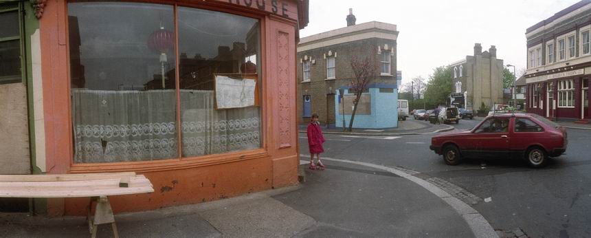
Stratford High St
The Olympic flame visited Stratford briefly but avoided the Olympic site where it was not due until the following Friday. I was surprised at how few came out to watch it.

The torch itself generated a little more interest. I’ve no idea who 070 was carrying it, and she handed it over to 071 at the junction with Warton Rd, which leads into the Olympic site a couple of hundred yards away.
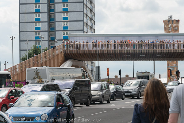
An organised party of people visiting the Olympic site watched from the temporary bridge taking the Greenway over the High Street – with a big wooden torch behind them.
Newham’s Shame – Carpenters Estate Tour

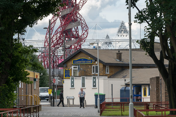
The Carpenters Estate, close to Stratford Station, was one of the better council developments of the 1960s, with a large area of two-story terraced housing, some maisonettes and three 22 storey point blocks as well as some existing small industrial premises. It included shops, a pub and a school, and later a community and health centre and remained a very popular estate.

But Newham Council saw the estate as simply as an opportunity to sell and make money and as a part of Mayor Robin Wales’ plans to make Stratford ‘London’s Third City’, even if this meant getting rid of many of the people who currently live there. The council began moving people out around 2004, leaving properties in good condition empty in a borough with London’s largest housing problem. In 2012 they were still hoping to sell it to University College for a new campus.
In 2011 the council decided to fix the elections to the Carpenters Tenant Management Organisation (TMO). They barred freeholders on the estate from standing for the new board of management and ‘lost’ five out of the six leaseholder nominations. At the AGM the TMO officials employed security guards to refuse entry to all freeholders who had been invited to attend.
The TMO was supposed to stand up for residents and to fight against the low valuations being made by the council for compulsory purchase of properties on the estate, but was now essentially a tool of the council. This led to residents setting up Carpenters Against Regeneration Plans (CARP) to challenge what they say are unconstitutional decisions made by the TMO and to get it to fulfil its duties to all residents of the estate, and to fight for the future of the residents and for a sustainable community.
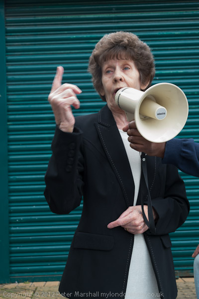
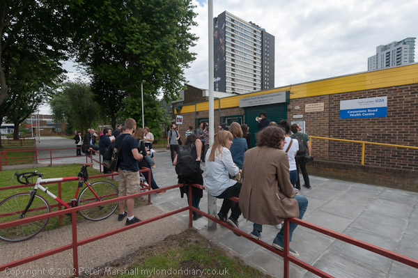
The tour began at Stratford Station and we were taken on a long walk around the estate, with several CARP members speaking at various points.
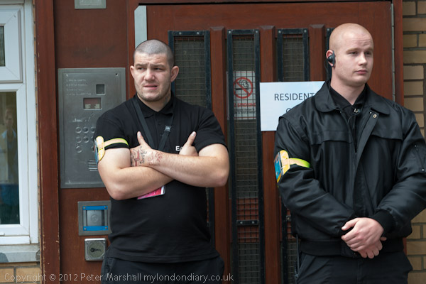
When we tried to visit two flats we had been invited to see in Lund Point we were stopped, first by BBC security and later by police, who stopped us from entering for around an hour and a half, but finally had to allow us to go in since we had an invitation from the residents of the two flats – more below.
We continued to go around the estate and talk with some of the nearby businesses which are closing as people move out and redevelopment is taking place along the High Street, as well as briefly visiting James Reilly Point, where the BBC had wanted to set up their coverage, but determined action by one of the residents there had caused them to change their plans. Then we returned to Lund Point.
More information and pictures at Newham’s Shame – Carpenters Estate.
Police Deny Olympic Residents Access to Homes
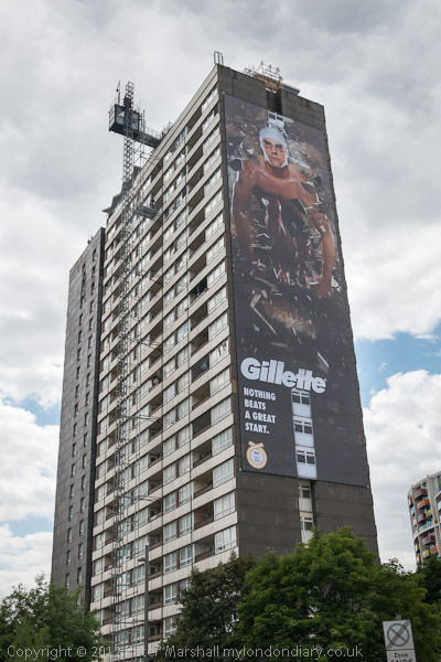
Lund Point, Stratford
Following a request from BBC Security, police denied residents access to their tower block home close to the Olympic site in Stratford for well over an hour, before having to acknowledge they had no power to do so.

Colin, a resident in Lund Point on the Carpenters Estate in Stratford had invited a group viewing the estate in a tour organised by CARP (Carpenters Estate Against Regeneration) to come to his flat to see the high standard of accomodation in the 1966 tower block and the views across the estate. We tried to enter the building at 1.15pm but were blocked by BBC Security.
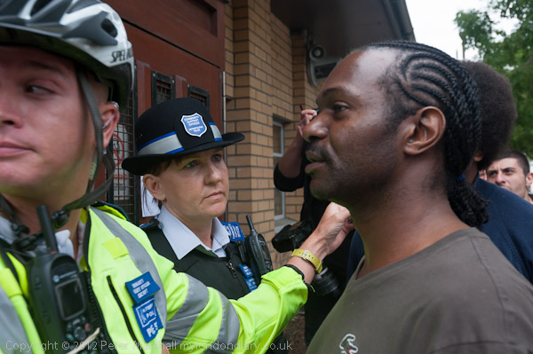
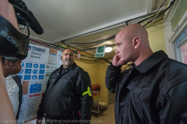
When we returned 55 minutes later, there were a group of five PCSOs and a police officer assisting the security men in blocking our entrance. Again the resident and the group were refused entry but the police officer present refused to discuss why. She called for reinforcements; first one more officer and then two police vans arrived. Eventually I think a more senior officer decided that they were acting unlawfully and we were allowed to enter just before 3pm.
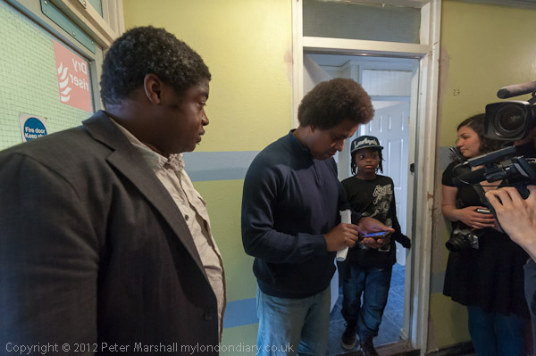
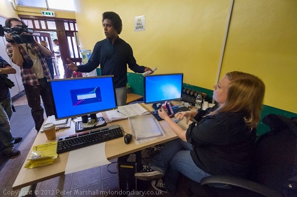
Inside there was further resistance from BBC security and it soon became obvious why the BBC were reluctant to allow me and other members of the press on the tour to enter. Although this was still a residential building with around 30 flats still occupied, the interior appeared to be a health and safety nightmare, with cables, desks in lobby areas and so on.
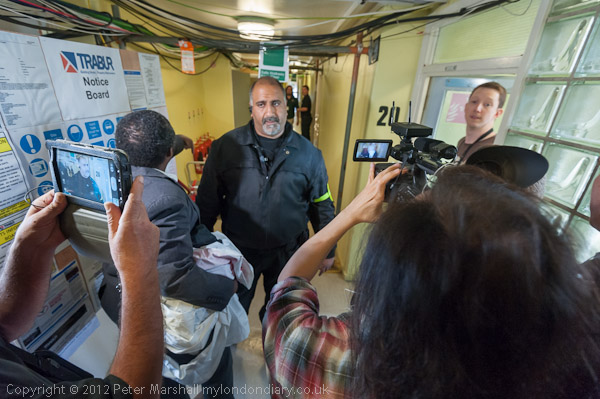
After visiting the first flat, we tried to visit another resident who owns a flat on the 20th floor of the block, and again police and security at first told us this was impossible. But we pressed on; we were blocked as we exited the lift, but when Warren confirmed he had invited us were eventually allowed through.
This is a residential area where people still live, despite the cables and poles
More at Police Deny Olympic Residents Access
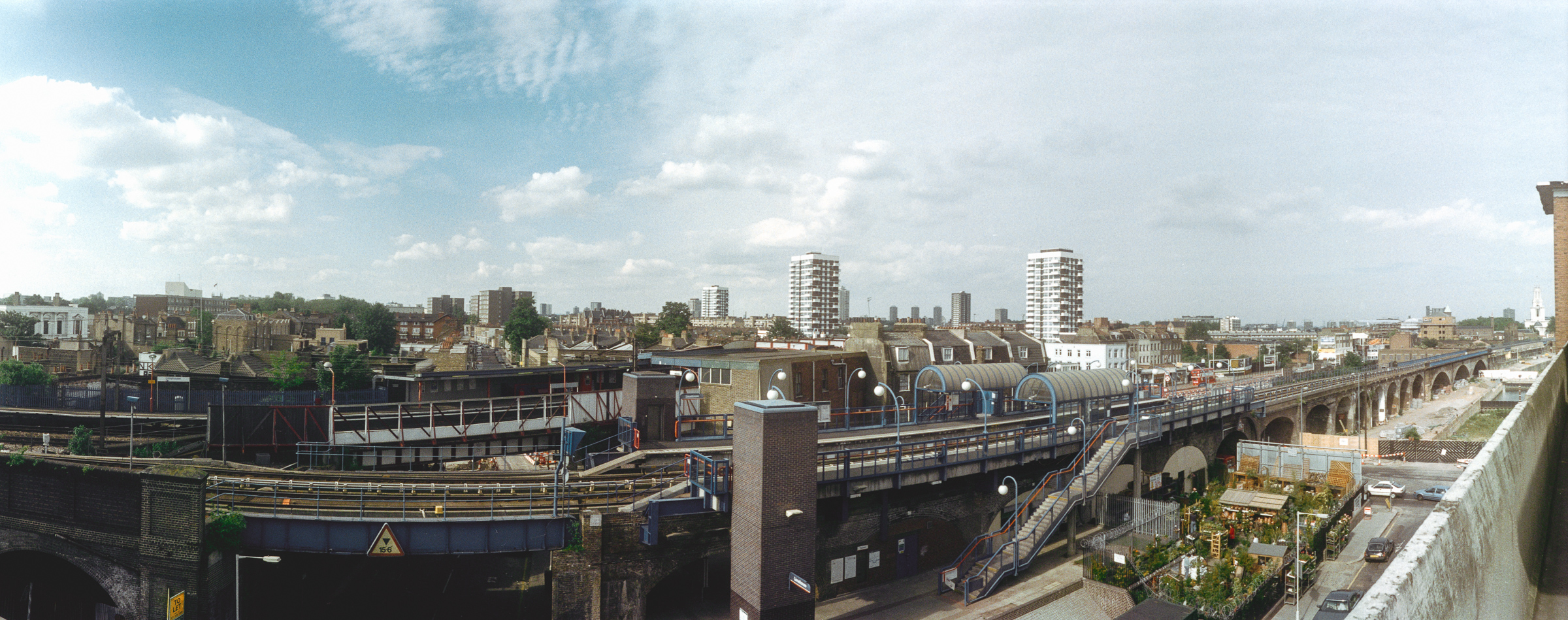
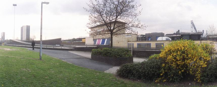
Olympic Views
Lund Point, Stratford
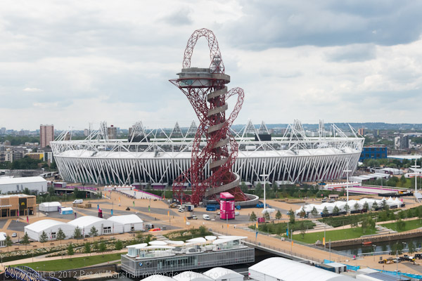
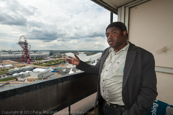
Although the BBC has taken over most of the top 5 floors of Lund Point on the Carpenters Estate next to the Olympic park as studios for its coverage of London 2012, there are still some flats occupied by owner occupiers in the block. On a tour with residents group CARP (Carpenters Against Regeneration Plans) I was invited to visit a flat on the 20th floor of this 22 storey block.
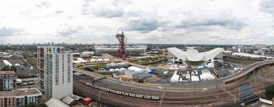
I had a very limited time to work but managed to make a couple of panoramas as the single images while I was there.
More, including some different ways of representing the panoramic view on My London Diary: Olympic Views
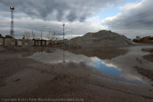
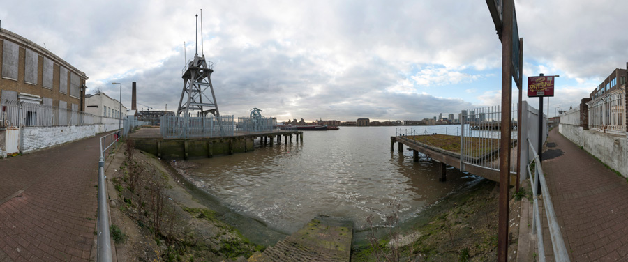
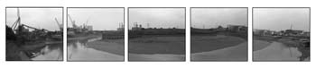
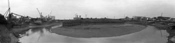
Cody Dock Open Day
South Crescent, Canning Town
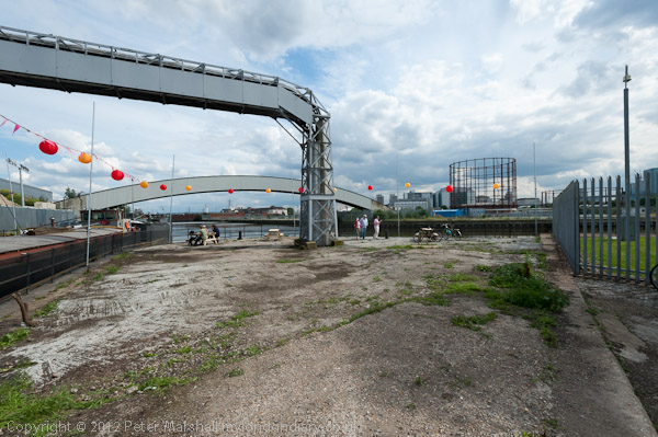
The hold-up by security and police made me too late for the Open Day at Cody Dock but I did manage to take a few pictures. You can see more in my post on My London Diary in April 2012 when I wrote Cody Dock in April and wrote Gasworks Dock Revived, which tells something of the history of the dock and the efforts being made to develop it into a real community resource, as well as filling a vital link in the footpath along the bank of Bow Creek from Bow Locks eventually to the Thames (there is still another gap beyond Cody Dock.
A few more pictures: Cody Dock Open Day
Flickr – Facebook – My London Diary – Hull Photos – Lea Valley – Paris
London’s Industrial Heritage – London Photos
All photographs on this page are copyright © Peter Marshall.
Contact me to buy prints or licence to reproduce.