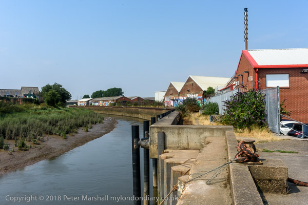
Barging on Bow Creek: On Wednesday 12 October 2011 I was pleased to get paid to go back to Bow Creek and take photographs of a working barge on Bow Creek in Poplar.
Bow Creek is the lower part of the River Lea, between Bow Locks and the River Thames. Bow Locks mark the southern end of the Lea Navigation and since London’s oldest canal, the Limehouse Cut opened in 1770, most canal traffic took advantage of this to take a more direct route to the Thames and avoid the dangerous and meandering tidal Bow Creek.
The River Lea remains tidal some miles above Bow Lock, but this tidal section is separate from the navigation, although there are various channels and locks such as City Mill Lock and Carpenters Lock on the Olympic site which link the two.

Bow Creek continued to be used for navigation, including for bring coal to West Ham Power Station and the huge Imperial Gas Light & Coke Company gas works at Bromley-by-Bow.
But the gas works closed in 1976 although its gasholders remain – they were still in use for gas storage until 2010. (I went inside the site to photograph them in 2022.) Planning permission has now been granted for 2,200 new homes on the site, retaining the seven gasholders. The gas works dock is now Cody Dock, a creative and community hub with moorings and a short walk from the DLR at Star Lane, hosting many intersting events.

West Ham Power Station ended production in 1983 and was then demolished to build a business park. In the lower sections of Bow Creek there were still a number of timber yards and a ship repair business still using the creek at least in the 1980s, but I think all all commercial traffic has now ended.

Much was made during the construction of the Olympic site of the use of barges to carry waste away from the area, and a new lock was built at great expense on the Prescott Channel at Three Mills Green, but I think barges were only used for PR photographs and the huge majority of waste was taken out by lorries.

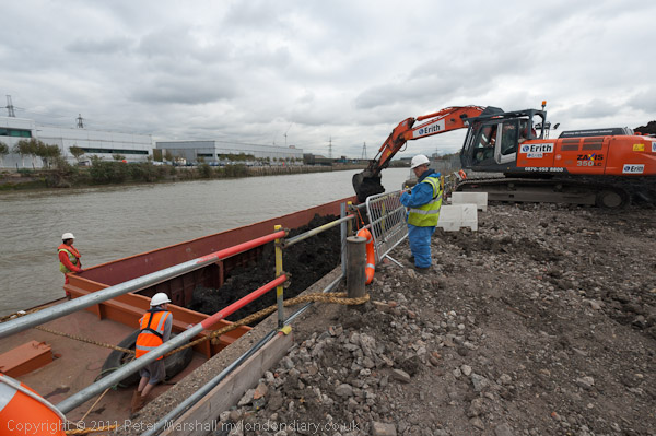
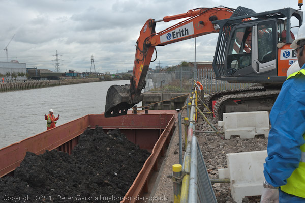
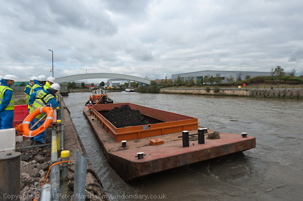
So I was pleased to hear that “the people cleaning up the gas works site at Poplar … were using barges to carry out the highly toxic soil from the site* and “… “was delighted to be given a commission to go and photograph the barging.”

On My London Diary I write more about my relationship with the River Lea which had begun in 1981 when “I heard a story on the radio that commercial barge traffic was about to come to an end on the Lea Navigation, and decided to travel across London to record its last days.” From then I carried out a major project on the river, but was disappointed to have a funding application turned down.

I returned to the River around ten years later and again in the early 2000s, with more frequent visits after the Olympic bid was successful – although access to the main site was soon impossible. In 2010 I published Before the Olympics, ISBN: 978-1-909363-00-7 with over 200 pictures from the source to the Thames.

The My London Diary post also describes my experience on the visit – how I had to dress up to take the pictures – and that although I’d been promised I would have half an hour to take photographs it actually ended up as 11 minutes.

After taking the pictures – both for the project PR and myself – I had the rest of the day to take a walk along Bow Creek again and made my way to the Thames on the Greenwich meridian, where I found “a new marker installed in the Virginia Quay estate next to West India Docks station, built since I carried out my ‘Meridian Project‘ in the 1990s and made an unsuccessful bid to create a’Meridian Walk’ to mark the new millennium.” Now there is a sculpture trail, The Line, which in part follows Bow Creek – and includes work at Cody Dock.
All pictures in this post are from Wednesday 12 October 2011. There are many more pictures from my walk as well as the barging at Barging on Bow Creek
Flickr – Facebook – My London Diary – Hull Photos – Lea Valley – Paris
London’s Industrial Heritage – London Photos
All photographs on this page are copyright © Peter Marshall.
Contact me to buy prints or licence to reproduce.