Posts Tagged ‘sculpture trail’

Canning Town, Cody Dock and Stratford – 2017

Sunday, March 2nd, 2025

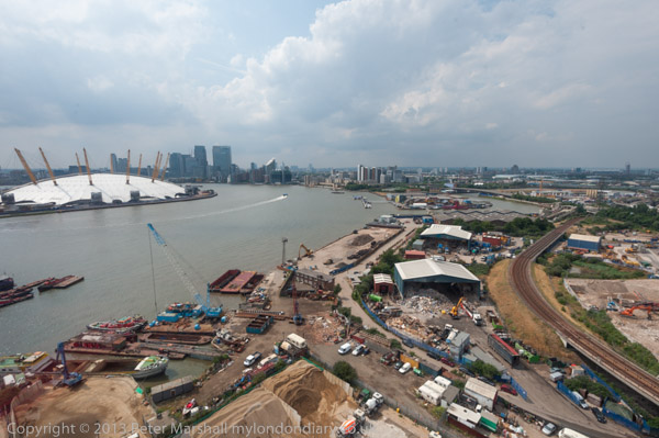
Canning Town, Cody Dock and Stratford: On Thursday 2nd March 2017 I made a rather convoluted walk along Bow Creek and the Lea Navigation, arranged around a meeting I had at Cody Dock. You couldn’t then – and can’t quite yet walk beside the river the whole way, but to get to the meeting I had to abandon a small part of the first stretch and catch the DLR, walking on from the meeting to Stratford High Street where I caught the DLR again to go back and complete the short part I’d had to miss out earlier.

Bow Creek & Canning Town

Canning Town, Cody Dock and Stratford - 2017

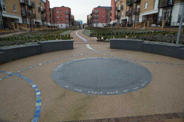
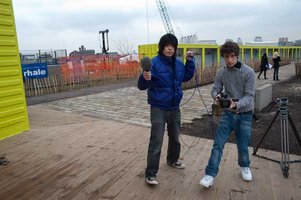
In this section of My London Diary I included pictures taken both at the start and at the end of my walk, which began at Canning Town Station.

Canning Town, Cody Dock and Stratford - 2017

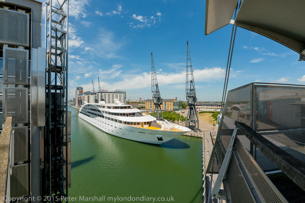
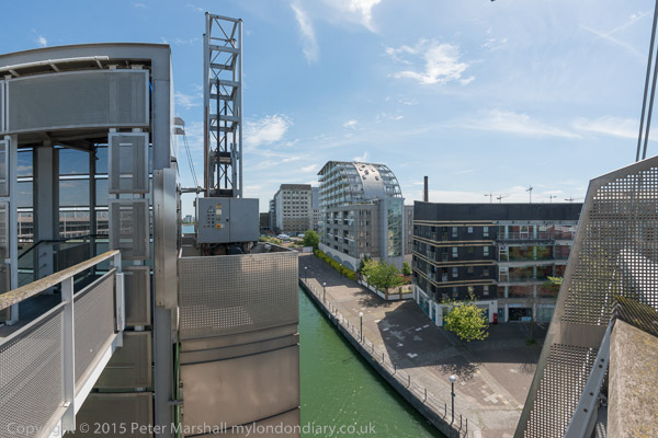
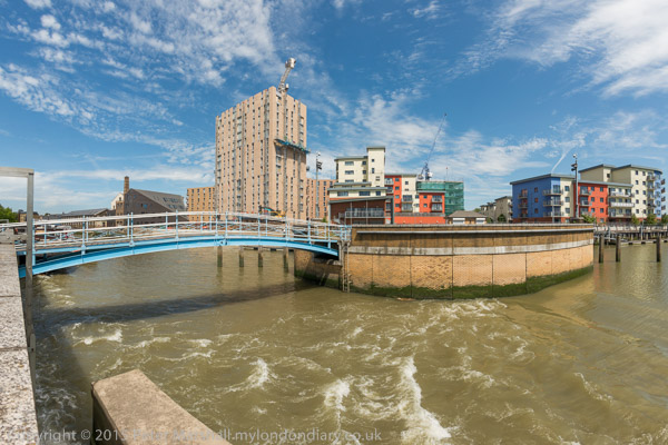
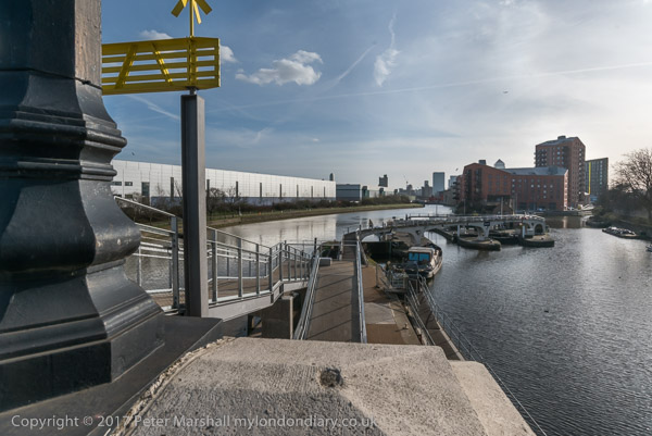
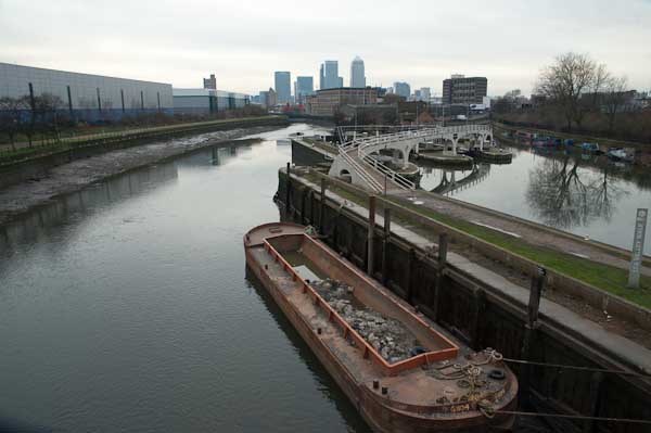
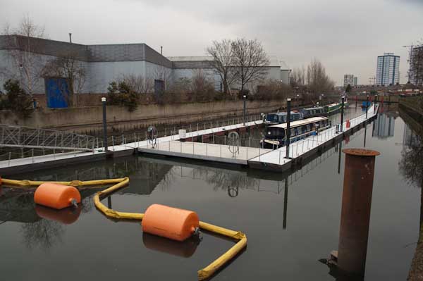
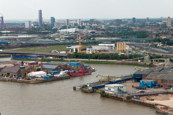
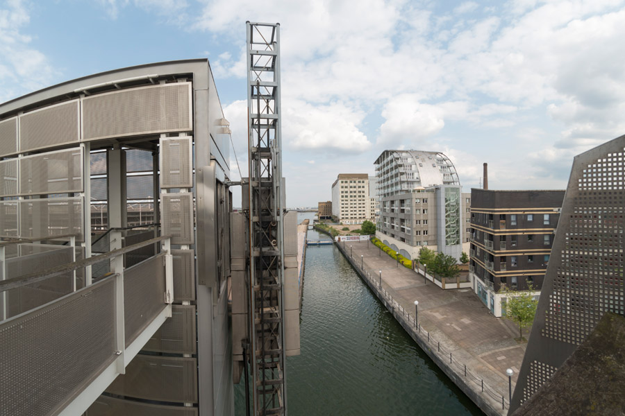
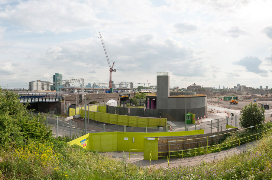
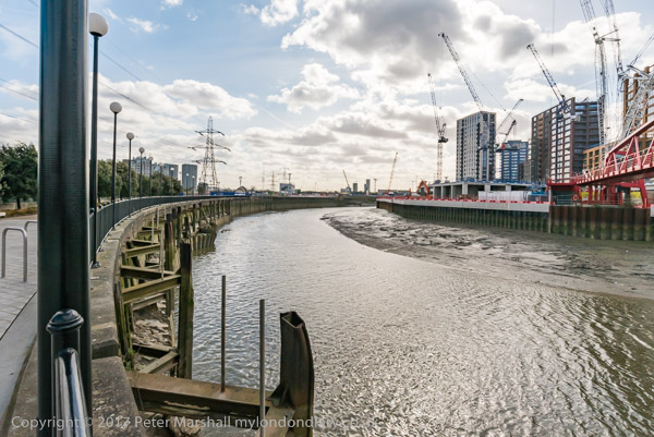
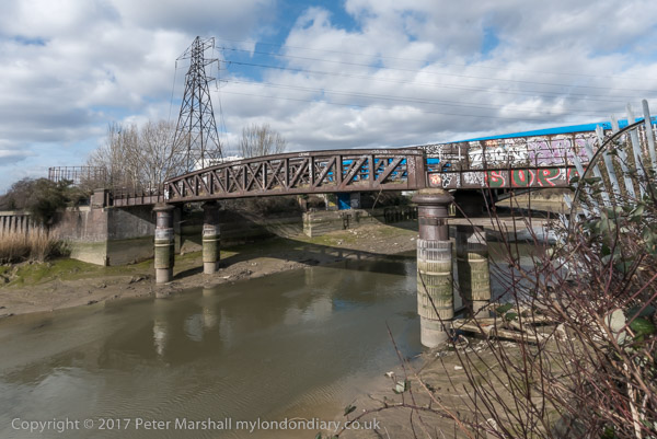
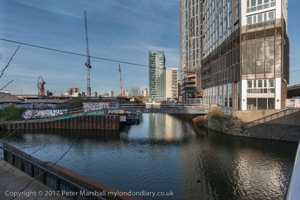
The riverside walkway at Canning Town is open after many years and can take you to the bridge to London City Island.

Canning Town, Cody Dock and Stratford - 2017

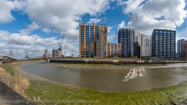
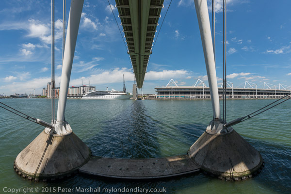
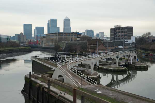
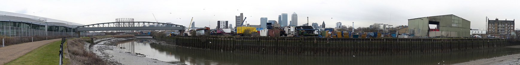
People were living in some of the blocks on the “Island” but there was still a lot of work continuing in this area which Bow Creek loops around on three sides. Another bridge was built across the DLR tracks to allow people from South Bromley in Tower Hamlets a pedestrian route to the riverside path and Canning Town station. Open for a short time it closed well before the station entrance became open, and a gate on it was firmly locked when I tried to cross it.

Canning Town, Cody Dock and Stratford - 2017

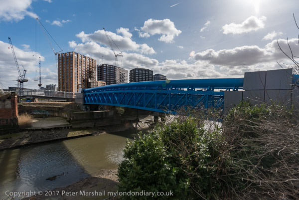
This meant I had to make a lengthy detour walking around the Ecology park to get to the Blue Bridge which took me to the East India Dock Road.

Canning Town, Cody Dock and Stratford - 2017

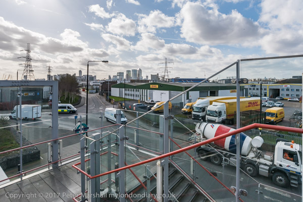
This meant I had to hurry back to Canning Town Station to get the DLR to Star Lane for my meeting at Cody Dock and couldn’t then walk along the north side of the road to take more pictures.
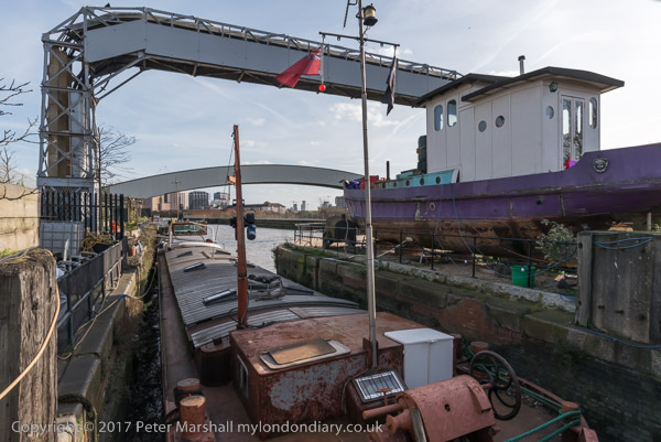
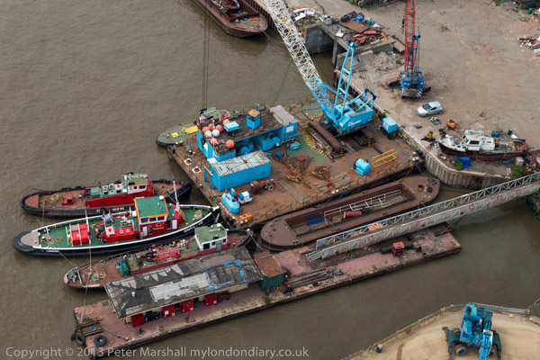
Cody Dock

I made a few pictures on my walk from Star Lane to Cody Dock, and then rather more after my meeting, at first in the dock itself,

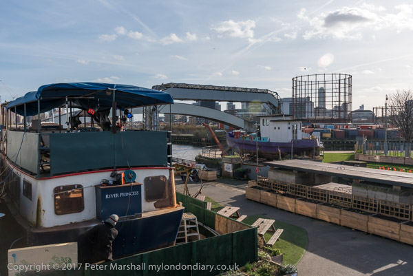
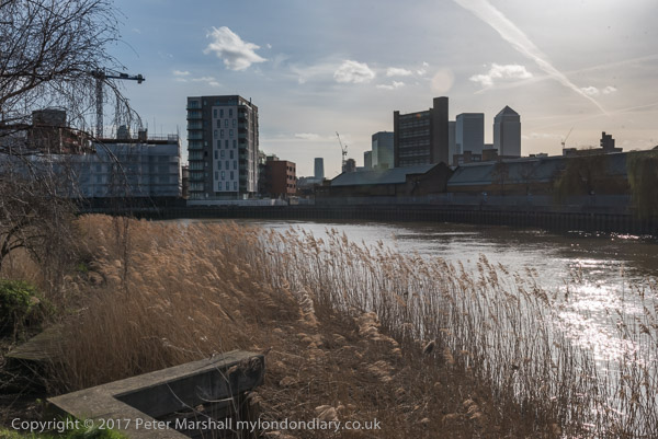
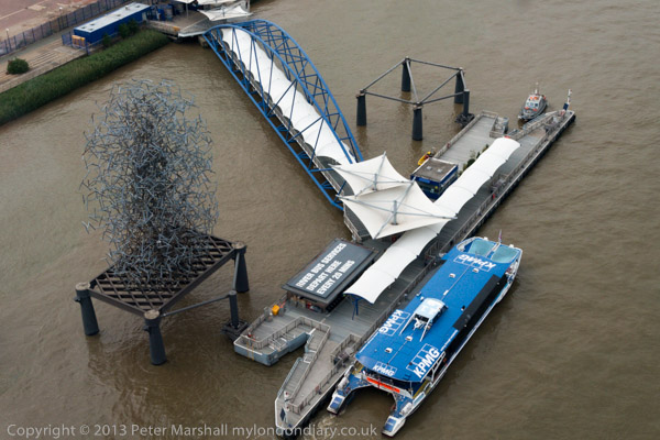
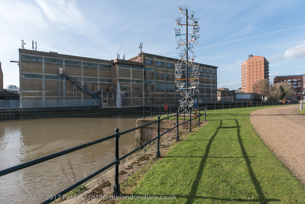
and then on the riverside path, thankfully renamed from ‘Fatwalk’ to ‘Leawalk’ and a part of ‘The Line’ sculpture trail.

Leawalk to Bow Locks

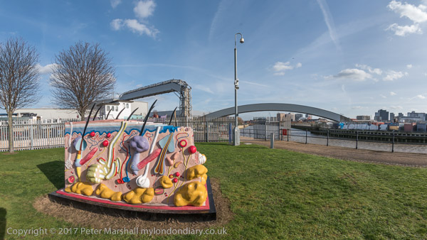
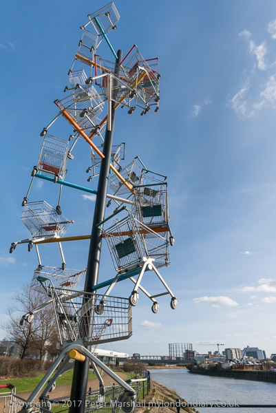
I paused briefly to photograph a sculpture made from shopping trolleys in a mock DNA double helix.

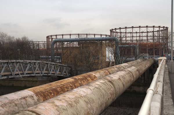
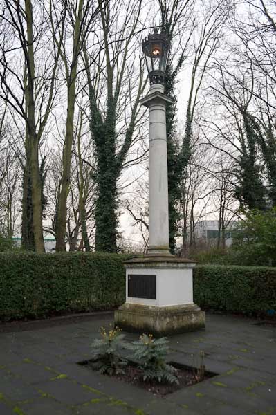
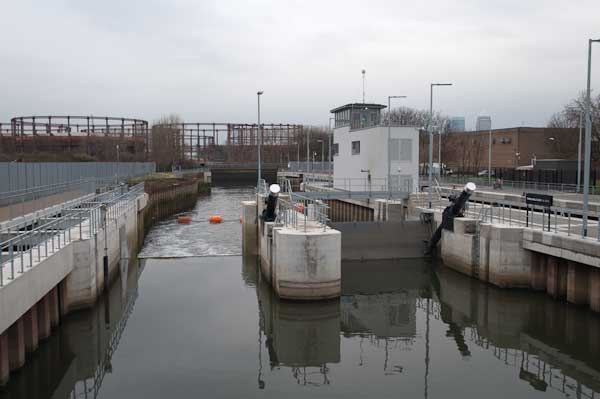
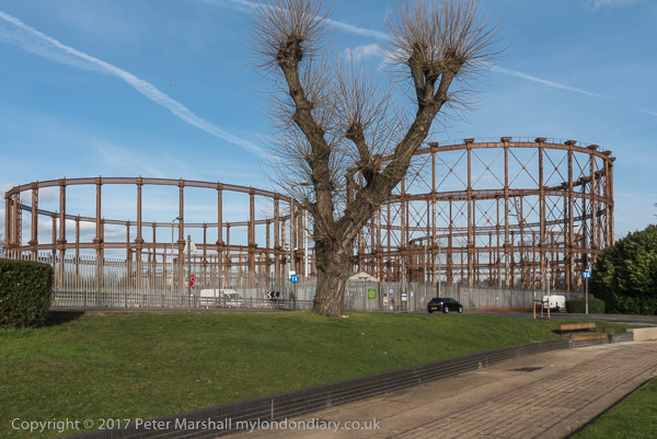
My next stop was to photograph the The Imperial Gas Light and Coke Co’s 1872-8 Bromley-by-Bow gasholders and the war memorials – originally at Beckton – with an eternal flame next to a monument to company workers killed in both World Wars.

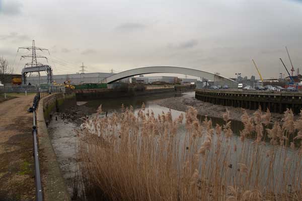
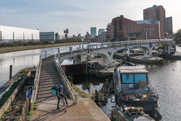
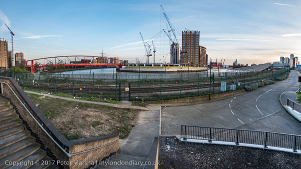
Steps leading down from Twelvetrees Bridge at Bow Locks took me down to the towpath beside the Lea Navigation.

Bow Locks

Three Mills & Stratford

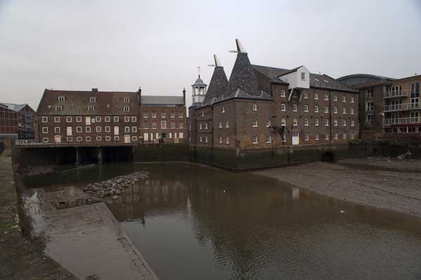
Three Mills is a tide mill dating from 1776 (though on the site of earlier tide mills mentioned in the Domesday Book) on the Three Mills Wall River. It is the largest tide mill in the UK and the largest surviving in Europe.

Another sculpture on The Line, unveiled on the centenary on Three Mills Green and moved to this position on Short Wall is by Alec Peever and commemorates three men who died in 1901 They died going to the aid of a fourth who had been overcome by the lack of oxygen at the bottom of a well they were investigating.

I walked on to Stratford High Street, turning west to go to Bow Bridge and the Lea Navigation before going back beside St Thomas’s Creek and along Stratford High Street to the DLR Stratford High Street Station for the train to Canning Town.

More from Bow Creek

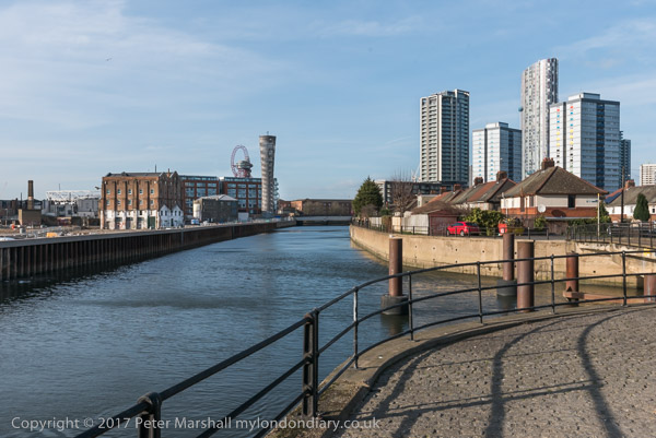
It was beginning to get a little dark as I came out from the station to photograph from the north side of East India Dock Rd.

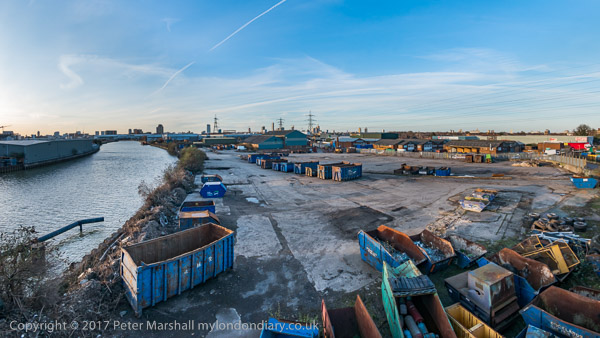
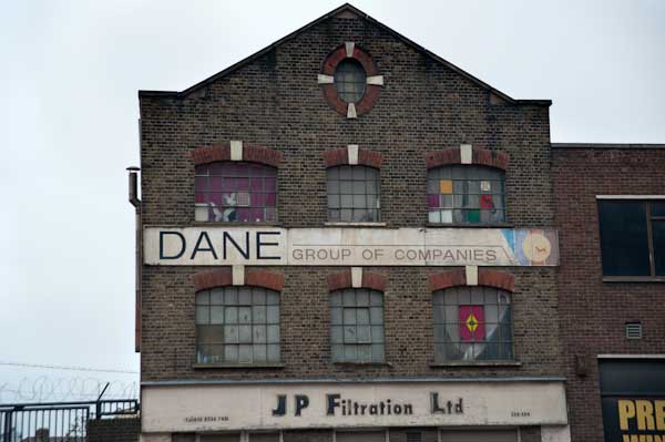
This was still an industrial area although a large area seemed now to be unused. I thought it would probably not be long before this area too was covered in flats as I walked back to the station.

You can see many more pictures and read more about the walk in my four posts on My London Diary:
Three Mills & Stratford
Leawalk to Bow Locks
Cody Dock
Bow Creek Canning Town


FlickrFacebookMy London DiaryHull PhotosLea ValleyParis
London’s Industrial HeritageLondon Photos

All photographs on this page are copyright © Peter Marshall.
Contact me to buy prints or licence to reproduce.


G4S Abuses, The Line & Barking Creek 2015

Tuesday, June 4th, 2024

G4S Abuses, The Line & Barking Creek: My day on Thursday 4th June 2015 began with a protest outside the AGM of G4S on the UN International Day of Innocent Children Victims of Aggression, after which I took a walk around the Royal Victoria Dock looking at the three sculptures then on London’s meridian sculpture trail before going for a longer walk around Barking Creek on this fine early summer day.


G4S AGM Torture Protest, Excel Centre, Custom House

G4S Abuses, The Line & Barking Creek

I travelled out to the Royal Victoria Dock in Newham for a protest outside the Excel Centre where G4S was holding its AGM. It was the UN International Day of Innocent Children Victims of Aggression and protesters were there as G4S runs the Israeli prisons where Palestinian children are held in small underground cells in solitary confinement, often for many days.

G4S Abuses, The Line & Barking Creek

An Avaaz petition with 1,792,311 signatures had called on G4S to stop running Israeli prisons and Inminds had held regular protests outside the Victoria St head offices of the company.

G4S Abuses, The Line & Barking Creek

Some had bought shares in 2014 so they could attend the AGM and ask questions, and there were angry scenes inside the AGM as they were forcibly ejected. In 2015 there were also shareholder protesters, but security for the meeting was tight and mobile phones were prohibited and press were very definitely not allowed access.

G4S Abuses, The Line & Barking Creek

As the protest outside continued, some of those who were ejected this year came and spoke about what had happened when they tried to ask questions, and the general feeling inside the AGM, which appeared to be one of some despondency.

G4S Abuses, The Line & Barking Creek

Security at Excel made attempts to move the protesters further away from the building. Eventually a request was made to reduce the noise as there were students inside taking an exam and after some discussion the protesters moved back

G4S also runs immigration detention centres in the UK where various human rights abuses have been disclosed by reporters.

More at G4S AGM Torture Protest.


The Line – Sculpture Trail, Royal Victoria Dock

I left the protest and took the opportunity to walk across the high level bridge over the dock, taking a few pictures, and then along the path around the dock to the DLR station at Royal Victoria.

As on other occasions I found the views from the bridge stunning, and those at ground level were also interesting.

By the time I came to the first of the three sculptures on London’s sculpture trail on the Greenwich meridian the first two of these seemed extremely underwhelming. All have now been replaced by other works in a trail that regularly changes.

The only one I found of any interest was ‘Vulcan’ (1999), a 30ft-high bronze figure by late Scottish artist Eduardo Paolozzi, now in Edinburgh, close to his home town of Leith. You can see pictures of the other two on My London Diary.
The Line – Sculpture Trail


Barking Creek

It was a fine afternoon and I decided to return to Barking, hoping to go along the path on the west bank of Barking Creek to the hames, marked on my OS map as a traffic-free cycle route. But as in the previous year I found it fenced off and with a locked gate.

Instead I made my way north along Barking Creek, past Cuckold’s Haven to the Barking Barrage, a half tide barrier opened in 1998, going across this and returning alongside the east bank of the Creek to the A13, where I took a bus to Beckton and the DLR.

Barking in the nineteenth century claimed the world’s largest fishing fleet, with 220 commercial boats, going out into the North Sea fishing grounds, and fishing was the major industry of the town. But in the 1860s the fleet moved out to Gorleston in Suffolk and Grimsby in Lincolnshire, both much closer to the fishing grounds.

Until then the fish had been kept fresh by ice, gathered on Barking marshes in the winter and stored in large ice houses until taken out in the boat, or stored live, swimming in sea water tanks inside the boats. A fast schooner was used in the heyday to bring the catch from the fleet back to Barking so they could continue fishing for up to a couple of months. Once in Barking the fish was then well-placed for the London markets.

The coming of the railways meant that fish from Gorleston or Grimsby could be taken rapidly to London for sale, and the industry in Barking collapsed almost overnight. There are still a few boats moored on the river at Roding, but the only fishing is a few mainly elderly men sitting by the river with rod and line, who I’ve never seen getting a bite. And it would certainly be a brave man who would eat anything out of the Roding or Thames.

But fish is now coming back to Barking, or at least nearby Dagenham Dock, under a City of London Scheme, but although this has received planning permission it apparently still needs an Act of Parliament. Progress on this was halted by the dissolution of Parliament on 30 May 2024.

More pictures on My London Diary: Barking Creek.


FlickrFacebookMy London DiaryHull PhotosLea ValleyParis
London’s Industrial HeritageLondon Photos

All photographs on this page are copyright © Peter Marshall.
Contact me to buy prints or licence to reproduce.


A Walk Along Bow Creek, 2017

Thursday, March 2nd, 2023

On Thursday 2nd March 2017 I had a meeting at Cody Dock about my photographic exhibition there later in the year. The weather forecast was good and promised me a day with blue sky and some clouds, perfect for my photography, particularly for some panoramas, where a clear blue sky or sullen grey overcast are both killers, so I rushed to get on an earlier train than I needed for the meeting to give time to take a walk along a part of Bow Creek before the meeting.

Years earlier there had been plans for a walk beside Bow Creek all the way from where it meets the Thames at Trinity Buoy Wharf up to the Stratford to join the tow path beside the Lea Navigation, but so far only some separate sections have materialised. The original plans envisaged two bridges taking the path across Bow Creek, and although a competition was organised (and won) for designs for one of these, neither had been built, largely because the money wasn’t there.

This section of the Leawalk has yet to open

Instead the plans were changed to make use of existing bridges, but vital riverside sections remain closed, either because of existing users of the land refusing access or because of new developments taking place in the area. One such development, that of London City Island has recently provided a new bridge which allows an alternative route to the mouth of the creek.

The red bridge built for London City Island

Part of the problem has probably been that the walk is along the boundary of two local authorities, Tower Hamlets and Newham, with sections in both.

Cody Dock

I walked one section before the meeting, but came to a locked bridge which led to a fairly lengthy detour, and ended up with me having to run along the West India Dock Road to catch the DLR to get to the meeting in time.

Cody Dock

There is currently no path between that road and Cody Dock which would have been a faster route for me. Instead I took the DLR from Canning Town one stop to Star Lane, from where a walk through an industrial estate took me to Cody Dock.

After the meeting I was able to rejoin the riverside path, now renamed the Leaway after I and many others made fun of its previous title as the Fatwalk, and made my way to Stratford.

One of the works on ‘The Line’

On my way I was pleased to find a newly opened link from Twelvetrees Crescent (named after a Mr Twelvetrees who built a bridge there to his factory) to the footpath between the river and the Lea Navigation, enabling me to avoid the rather nasty detour between here and the path via the horrendously busy Blackwall Tunnel Approach road.

This part of the Leaway is now walked much more, not least because if forms part of of ‘The Line’ sculpture trail, which rather roughly follows the Meridian from Greenwich to Stratford. But those following this still have, like me, to take the DLR or walk along busy and dusty roads from Canning Town to Cody Dock.

There was still plenty of daylight left by the time my wanderings took me to the DLR Stratford High Street station, where I entrained back to Canning Town for a few more pictures which both lack of time and the position of the sun had made impossible before my meeting. Then it was back to the station for the Jubilee Line back to central London.

Many more pictures from these walks on My London Diary at:
Three Mills & Stratford
Leawalk to Bow Locks
Cody Dock
Bow Creek Canning Town


An East London Ride – 2010

Friday, February 3rd, 2023

Salmon Lane Locki, Regents Canal

It’s perhaps misleading to call this a ride, since I spent most of the day on Wednesday 3rd February 2010 actually off my bike, parking it neatly to take photographs. Although a bicycle has been my main personal transport now for over 70 years (when I’m not using public transport or walking) I’m not really a cyclist. Or at least just a pragmatic cyclist, using a bike just to get from A to B (and on this day to C,D and most of the letters of the alphabet.)

An East London Ride - 2010
Memorial to firewatchers of Stepney Gas Works

And just very occasionally for a bit of exercise. I have used exercise bikes and always thought why bother when you could use the real thing, though I suppose when its pouring with rain or below zero there might be some point in them. And though one wouldn’t help me to take photographs I would be less likely to be killed by careless or dangerous drivers.

An East London Ride - 2010
Bromley-by-Bow gasholders, Twelvetrees Bridge

Back at the end of 2002 I bought myself a Brompton folding bike, and a year or three later when I was undergoing a Q & A interview for an amateur photography magazine it became my answer to ‘What is your most useful photographic accessory’. It had replaced the answer to a similar question from another such magazine which was ‘a good pair of shoes’.

Eternal flame, West Ham Memorial Gardens

Once you have practised a few times the Brompton folds (and unfolds) in a few seconds into a fairly compact package, which has the advantage you can take it at any time onto our trains and underground system. It’s too heavy for me to comfortably carry any distance, but I added the tiny wheels which mean you can pull it rather like a suitcase, only actually lifting it when necessary. And I bought the bag which fits on in front of the handlebars which was about the right size for my camera gear and essentials like a bottle of water or a flask of coffee and sandwiches.

The end of the ‘Fatwalk’

I can’t know remember exactly how I got to the start of my ride, though I think I probably rode from Waterloo to Fenchurch Street for a train to Limehouse station, crossing the Thames on Southwark Bridge. But from there on the pictures make my route fairly clear.

Bow Creek and Bow Locks

I cycled roughly along the Regents Canal up to the former Stepney Gas Works site north of Ben Johnson Road. There had been a fight to save more elements of the former gas works including gas holders which were some of the oldest surviving in the world; although some were said by English Heritage to be of national importance an attempt to get one of them listed failed. Eventually the area was redeveloped by Bellway Homes with only token ‘public art’ residues of the works.

From there I headed east to the bridge at Twelvetrees Crescent across Bow Creek and the Lea Navigation to visit another gas works site, the West Ham Memorial Gardens where war memorials, a permanent flame and a statue of Sir Corbett Woodhall are in a small wooded area close to the remarkable group of gas holders for the former Bromley-by-Bow Gas Works.

Three Mills

From there I went down to the recently opened path beside Bow Creek, part of a planned riverside walk which had been landed with the ridiculous name of The Fatwalk. As I commented then, most of the walk, meant to lead from Three Mills all the way to the Thames was still closed (and is still closed 13 years later) and by the time they were open the “nincompoop who thought that ‘The Fatwalk’ was a good name for this route will probably have retired or died or moved to another job for which he (or she) is equally incapable and common sense will prevail as we walk or cycle along the Bow Creek Trail.”

New Lock, Prescott Channel

The walk still only goes as far south as Cody Dock, now a thriving community resource and hub with events and exhibitions and worth a visit, but in 2010 still undeveloped. The silly name has gone and this path is now also a part of London’s sculpture trail, The Line, making its way from the Greenwich Peninsula to Stratford.

Three Mills Wall River

At the end of the Fatwalk, I had to turn around and go back to the Twelvetrees Crescent bridge, where I once again photographed the locks from the Lea Navigation to Bow Creek. Now there are new steps leading down from this bridge to the towpath, but then I had to go across and join the fast-moving traffic on the Blackwall Tunnel Northern Approach to make my way to Three Mills.

Stratford High St

Three Mills is home to one of Newhams only four Grade I listed buildings and the House Mill, a tide mill, was built in 1776, though there had been tide mills here at least since the Domesday book.

Olympic stadium

The film studios here were converted from a gin factory where Chaim Weizmann developed a new biochemical process to produce acetone needed for explosive production in the First World War – which led to the Balfour Declaration and later to Weizmann becoming the first president of Israel.

Bridge over City Mill River

Past the studios I visited the new lock on the Prescott Channel, opened in 2009. Supposedly this was to be used by barges to carry away waste and bring in material for the development of the Olympic site instead of lorries, but was in practice only used for photo-opportunities. The Prescott Channel was built in the 1930s, part of a large flood relief programme, that was also largely to provide jobs at the height of the depression.

I get interviewed for a student film

Finally I cycled up to the Olympic site, a building site with little or no public access, but parts of the ‘Greenway’ – the path on the Northern Sewage Outfall – were still open and gave extensive views. The reason I was in London on this particular day, when the weather wasn’t at its best was to be interviewed and filmed by a group of students at the View tube on the Greenway. I can’t remember ever seeing the video. After the interview I made my way to Stratford to fold the Brompton and start my journey home on the Jubilee Line.

Bow Creek – right click to open at a viewable size in a new tab

As well as taking single images I also produced a number of panoramas, taking a series of pictures from the same position to be stitched together. These include some 360 degree views, produced by software from 6 or 8 individual images. The pictures were taken on a Nikon D700 and are each 12Mp, but the combined files are huge. It isn’t easy to display these on the web, and they fit even less well on this blog. I’ll post one here on a rather smaller scale and invite you to double click on it to see it larger, though still much reduced. You can find more online here.

Olympic Site Revisited
Three Mills
Bow and The Fatwalk


Dangleway, Silvertown and Stratford Marsh

Sunday, June 26th, 2022

Dangleway, Silvertown and Stratford Marsh: My day out on Wednesday 26 June 2013 began by taking the tube to North Greenwich and then walking to the cablecar for the ride across the Thames.

Back then I commented “Given the huge losses it is sustaining I can’t see it remaining open too much longer, so if you’ve not taken a ride don’t leave it too long“, and I’m surprised to find it still running 8 years later. But perhaps not for much longer, as the sponsorship deal with the Emirates Airline comes to an end this month, and no other company has come forward to pick up the tab, even though TfL have offered a huge reduction for the privilege.

Never a sensible contribution to London’s travel network it remains one of London’s cheaper and more interesting tourist attractions. I’m not sure whether the fact that it now lands on the north bank spitting distance from London’s now misplaced County Hall adds to its chances of retention, but it could make it more likely to be brought within the normal London fare structures.

There are already fare reductions for people with Travelcards, and frequent users can buy a ticket which reduces the cost to make it a viable part of a commute to work, particularly as you can take a bike with you for free. However I suspect the number of ‘frequent fliers’ is probably only in two figures. Its also a service which is more affected by weather than surface transport, closing down in high winds.

But it does have the height to give some splended views, even if the surrounding area is perhaps less rich than that of London’s other aerial attraction, the London Eye. Actually for me is considerably more attractive, and it’s an area which is now rapidly developing on both sides of the river, with new residential developments replacing old industrial and commercial uses.

The dangleway is also a part of the East London sculpture trail, The Line, which vaguely follows the Greenwich Meridian, from North Greenwich to Stratford and makes an interesting walk, although this will become a more interesting walk once the riverside path from Cody Dock to the East India Dock Road is opened, something we have been waiting for around 20 years. One day it might even extend past Canning Town station to Trinity Buoy Wharf, but we may not live that long.

Although you can see the riverside from above, little of it is now publicly accessible, though I walked along Bow Creek and a little of the Thames here back in the 1980s taking photographs now on Flickr. But back then the Royal Victoria Dock was largely fenced off and you can now walk around it and over a high-level bridge which also has interesting views.

Or at least you can most of the time. But the area becomes a high security zone with the bridge closed when the Excel Centre is full of arms dealers selling often illegal arms to repressive regimes around the world – every other September. Fortunately it was June, though I was back there for the DSEI protests in September – and in other years.

The DLR also runs through the area on a viaduct, and from the train and the stations you also get some interesting views, though the train windows are often rather to dirty for taking photographs. That you are looking south from the line can also mean the sun is shining directly into the lens.

This is the Woolwich branch of the DLR and at Canary Wharf I changed onto a train towards Stratford, alighting at Pudding Mill Lane to walk up onto the Greenway. I arrived just too late to go into the View Tube there so I had to be content with making pictures from the Greenway which runs high through the area.

I’d begun making photogrfaphs here back in the 1980s, and had published some of these on my my River Lea/Lee Valley web site – and in the Blurb book ‘Before The Olympics‘, returning to the area occasionally and photographing it as it changed and particularly as the Olympic site developed. Progress on restoring the area to some useful purpose appeared to be very slow

More on My London Diary where the pictures are also larger – though you can see these ones larger by opening the images in their own window.
Stratford Greenway Olympic Revisit
Victoria Dock and Silvertown
Emirates ‘Airline’ – Arab Dangleway


London’s Cheapest Flight: June-July 2013

Friday, July 23rd, 2021

Eight years ago I took a couple of rides on the Emirates Air Line, better known thanks to London blogger Diamond Geezer as the ‘dangleway’ and posted a number of the pictures that I took from it.

As I pointed out then, “in transport terms its a joke, a slower and more expensive route on almost any possible journey“, but to my surprise this joke is still running eight years later despite huge losses, and my exhortation “if you’ve not taken a ride don’t leave it too long” was then misplaced. Though given the effects of the virus on air travel it may not last much longer, but perhaps the extensive developments on the south bank on the Greenwich Peninsula and the replacement of industrial sites by housing on the north bank, together with the move of the Greater London Authority to the Crystal at the north end of the route by the end of the year may provide a few more customers.

One advantage of the current situation is that, according to the TfL web siteOnly one passenger is allowed per cabin, unless a household or group is travelling together” so you can be sure of having it to yourself, or chosing those you want to travel with. The poor people in the picture above had to share a ride with me.

I think there were notices in the cabins telling you to remain in your seats during the short journey, but clearly I didn’t entirely obey these, but there was no one around to see. Perhaps there might be safety issues if a full cabin of Sumo wrestlers began to throw themselves around but I don’t think my careful movements were any problems.

The service runs weekdays days from 7am to 11pm, stopping an hour later on Fridays and Saturdays and opening later at weekends. It also stops in very strong winds and thunderstorms, though one London reporter made a story out of using it this January as storm Christoph was approaching. His photographs don’t really support his story of being buffeted around by the wind but I imagine there was some tangible swinging motion. When there is any real danger it closes – and that happens around a hundred times a year. There are also some closures for maintainence.

My journeys were both smooth and rather quiet, and the ride seemed much shorter then the 10 minutes it took. A single journey costs £4, more or less the same as in 2013. I generally avoid air travel, but I imagine the carbon footprint of this short journey is quite low.

Back in 2013 I commented “it should be promoted as one of London’s cheaper and more interesting tourist attractions, giving a rather better view than the helter-skelter on the Olympic site at around a tenth of the cost, and with the added attraction of motion in three dimensions.” It has so far only attracted a few more discerning tourists, some of whom are doubtless also following London’s public art trail, The Line and get an unusual view of Antony Gormley’s Quantum Cloud on their ride.


All photographs on this and my other sites, unless otherwise stated, are taken by and copyright of Peter Marshall, and are available for reproduction or can be bought as prints.