Canning Town Walk (2007): 8

8 North Woolwich Road

An elevated section of the Docklands Light Railway runs along the south side of North Woolwich Road. Opened in 2006, it currently runs to King George V station in North Woolwich, but tunnelling is in progress to take it under the Thames to Woolwich. [It opened in 2009]

Canning Town Walk (2007): 8 DLR under construction from Silvertown Way. 
DLR under construction from Silvertown Way – 2004. 

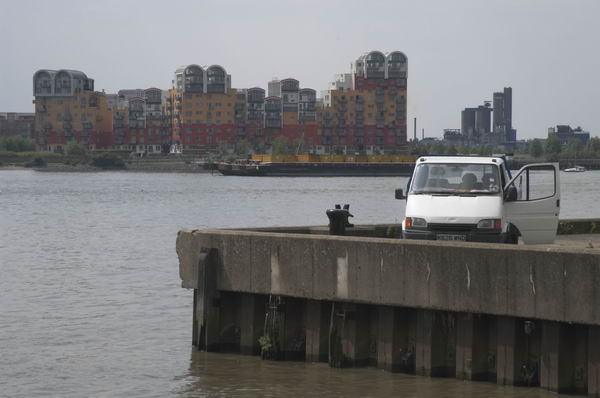
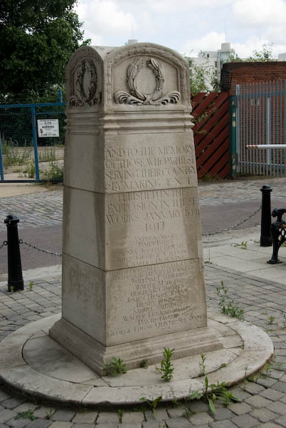
Turn left and walk east along North Woolwich Road; roughly 100 meters on is a site entrance which includes a monument to the Silvertown Explosion.
Canning Town Walk (2007): 8

The Brunner Mond chemical works opened here at Crescent Wharf in West Silvertown in 1893, producing first soda and then caustic soda. But by 1914 the works was idle, and the government needed a factory to purify TNT. This was known to be extremely dangerous and a process that should be carried out in a remote area, and not in this highly populated area such as this. Dr FA Freeth, Brunner Mond’s head chemist later made his views about the process clear:

It worked but was manifestly dangerous. At the end of every month we used to write to Silvertown to say that their plant would go up sooner or later.” But the Government, at a safe distance in Whitehall, decided that the risk was worth taking. It was the people of Silvertown who were, largely unwittingly, taking it.

Sooner or later” turned out to be Friday 19 January 1917 when a fire caused 50 tons of TNT to explode. They heard the bang in Cambridge and Guildford. Around 70,000 properties were damaged, costing £2.5 million. Over 70 people were killed (12 of the bodies were never found) and 400 injured. Because of war-time restrictions, it was 3 days before the news was in the papers.

This site is now under application for development as Minoco Wharf. In January 2005 the Mayor removed its safeguarded wharf status, which will allow more freedom in its development. [Renamed ‘Royal Wharf’ and recently completed it includes 3,385 new homes, a primary school, leisure facilities and retail and commercial office space.]
Canning Town Walk (2007): 8
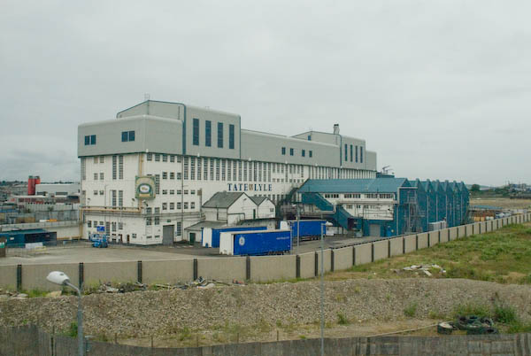
Tate & Lyle’s Plaistow wharf

A little to the west is Peruvian Wharf, which includes the site of the old guano works and Tate & Lyle’s Plaistow wharf. (Tate & Lyle have consolidated their activities at Thames Refinery to the east in Silvertown.)

The application to develop this site, which still has safeguarded wharf status, went to public enquiry and was refused in 2006. There are further applications, mainly for industrial use. The best views of these sites are from the DLR. [The site was bought by the Port of London Authority in 2016 and part leased to for an aggregate wharf and concrete batching plant.]

Continue along North Woolwich Road and walk up the steps immediately behind Barrier Point into Barrier Park.

Canning Town Walk (2007): 8

Barrier Point residential development, architects Goddard Manton Partnership (they took some ideas from their earlier Pierhead Lock at West India Docks) is in two parts, the ‘Seven Steps’ garden apartments occupied in 2000, and the landmark tower completed in 2001. It provides 252 “concierged apartments” and attracted various awards, making it “the most decorated contemporary housing development” in Britain. It forms an impressive wall at right-angles to the Thames, with suitably maritime railings and decks, although these perhaps give it too much of a 1930s international modern feel. The tower, a shining white lighthouse, is a grand effect.


This walk will continue in a later post with Part 9: Barrier Park

You can read the whole document as I published it in 2007 beginning here and see more pictures I took in 2007 on My London Diary at Canning Town, Victoria Dock, Silvertown West.


FlickrFacebookMy London DiaryHull PhotosLea ValleyParis
London’s Industrial HeritageLondon Photos

All photographs on this page are copyright © Peter Marshall.
Contact me to buy prints or licence to reproduce.
Canning Town Walk (2007): 7

7 Royal Victoria Docks from the footbridge

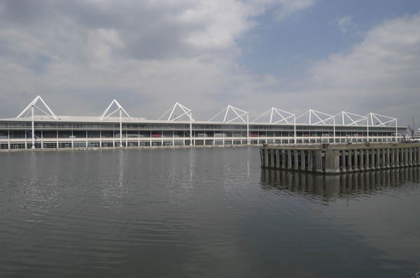
From the top of the bridge there is a splendid view in all directions. Starting at the ExCeL centre and moving clockwise we see:

  • ExCel, standing for Exhibition Centre London. This was an LDDC idea, but not completed and opened until 2000. It has attracted many hotels to the area – including the floating Sunborn Yacht hotel.
Canning Town Walk (2007): 7 Royal Victoria Docks from the footbridge
  • In the distance, you can see East London University, one of the developments on the Royal Albert Dock, which is worth a visit of its own, particularly for the group of cylindrical student residences, looking rather like oil storage tanks.
Canning Town Walk (2007): 7 Royal Victoria Docks from the footbridge
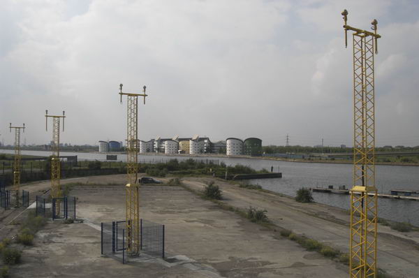
  • East London University and flight path beacons for City Airport, King George V Dock, North Woolwich
Canning Town Walk (2007): 7 Royal Victoria Docks from the footbridge
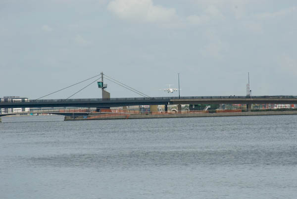
  • Closer than that, spanning the area and separating the Royal Victoria Docks from the two later Royal Albert and King George V docks is the Connaught Crossing, completed in 1990.
Canning Town Walk (2007): 7 Royal Victoria Docks from the footbridge
Millennium Mills and Eastern Quay
  • The large area on the right of the dock, including the area of water off from the main dock and the large bulk of Millennium Mills (built for Spillers flour in 1933) is the Silvertown Quays site, a £1.5 billion development that got planning permission in May 2007. This includes conversion of the mills into flats, 5,000 new homes, various community facilities, a lively town centre for Silvertown and the Biota! Project, a large aquarium designed by Terry Farrell & Partners for London Zoo. (though we don’t expect it to be anything like as good as The Deep in Hull!)
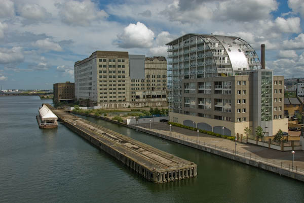
  • Close to the bridge is Eastern Quay (2003 Gardner Stewart Architects), constructed with a steel frame and is one of the first residential apartment blocks in the United Kingdom to have fully-glazed exterior walls. It uses advanced glazing technology to stop residents getting fried.

The large development, mainly of fairly small houses is Brittania Village, which began in 1994 with a Peabody development of 85 homes. The LDDC then made a deal with Wimpey for 777 more, along with some limited community facilities, including a primary school, in 1995. The area was completed with a few more Peabody trust and East Thames Housing Group properties.

Canning Town Walk (2007): 7 Royal Victoria Docks from the footbridge

Walk or take the lift down to dock level at the south end of the bridge, and walk through the arch at the centre of the semi-circular ring of shops.

Here there is a plaque marking the opening of the West Silvertown Urban Village by the government minister Selwyn Gummer in 1996.

Turn left and then right at the roundabout with a tall chimney and walk down Mill Road to the main road (North Woolwich Road.)

The large chimney in the middle of the roundabout dates from the 1930s. At the southern end of Mill Road are some workers cottages which appear to date from around 1900.

Cross the main road to the south side, taking great care. A suitably placed pedestrian crossing is only in planning application stage! [There is now a light-controlled crossing for pedestrians and cyclists.]

If you have plenty of time, you might like to make a detour to Lyle Park at this point, off Bradfield Road, a couple of hundred yards to the east. The park was presented to West Ham by Abraham Lyle & Son in 1924 and contains the fine metal gates from Harland & Wolff Ltd, ship builders, ship repairers and engineers in Woolwich Manor Way, Beckton from 1924-1972 (their actual shipyards were in Belfast and Govan.) The park also provides good views across the Thames to Greenwich Millenium Village and elsewhere.

Canning Town Walk (2007): 7 Royal Victoria Docks from the footbridge

This walk will continue in a later post with Part 8: North Woolwich Road.


You can read the whole document as I published it in 2007 beginning here and see more pictures I took in 2007 on My London Diary at canning town, victoria dock, silvertown west.


FlickrFacebookMy London DiaryHull PhotosLea ValleyParis
London’s Industrial HeritageLondon Photos

All photographs on this page are copyright © Peter Marshall.
Contact me to buy prints or licence to reproduce.

1995 Colour – Poplar, Bow, Leyton, North Woolwich & Silvertown

Poplar, Bow, Leyton, North Woolwich & Silvertown: These pictures come from a number of visits to areas of London working on several different projects and are my final selection of colour panoramas made in 1995. There are a few more colour images, including some panoramas I made in 1995 in the images in the Flickr album as well as many I have not digitised; some very similar to those online, others that I now find of less interest. Some of these were taken as a part of my project on the Greenwich Meridian in London – you can see a set of 16 images from this on the urban landscape web site.

Bow Locks, River Lea, Bow Creek, Bow, Tower Hamlets, 1995, 95p4-752

Bow Locks separate the tidal River Lea from the Lea Navigation and the Limehouse Cut which offers an alternative route to the Thames to avoid the winding and dangerous Bow Creek. First built in 1850 they were remodelled in 1930. At the highest Spring tides water from Bow Creek would overtop the locks and raise the level of the canals here – the locks were modified in 2000 to stop this and avoid the silting it caused.

London Galvanizers, Leven Rd, Poplar, Tower Hamlets, 5p4-743
London Galvanizers, Leven Rd, Poplar, Tower Hamlets, 95p4-743

The Poplar Gas Coompany built a local gas works here in the 1820s at the request of the Poplar Vestry after ratepayers lobbied them to provide gas street lighting. The site was cleared in 2011 and I was commissioned to photograph the removal of toxic earth from the site using barges on Bow Creek. Something around an eigth of the material was removed in this way, tides making the removal of more difficult. The original gasholders had to be built to special safety standards because of their proximity to the West India Dock wall. The last of the gasholders was removed in 2017.

London Galvanizers had modernised their galvanizing plant here in 1983-5 and were one of the most important jobbing galvanizers in London and the Home Counties.

Langthorne Rd, Leyton, Waltham Forest, 1995, 95p4-862

This street corner is close to the Meridian and I had stood here for some time outside the Chinese restaurant which was having some joinery work done. I liked the contrast between its orange paint and the blue on the opposite corner and the warm brown of the Birkbeck Tavern at right. I think I had made at least one exposure when a young girl in a red coat on roller skates came to see what I was doing – and I made this exposure as a red car come around, filling an otherwise rather empty grey space.

St Patrick's Catholic Cemetery, Langthorne Rd, Leyton, Waltham Forest, 1995, 95p4-841
St Patrick’s Catholic Cemetery, Langthorne Rd, Leyton, Waltham Forest, 1995, 95p4-841

The Meridian also passes through this cemetery and I chose a viewpoint which included the cemetery chapel with a fine group of monuments in the foreground, I think all for people of Italian origin.

Stratford Station, Great Eastern Rd, Stratford, 1995, 95p4-963
Stratford Station, Great Eastern Rd, Stratford, Newham,1995, 95p4-963

I’m unsure what this railway building to the east of the station was, perhaps a 1930s signal box. Parts of this area have now been redeveloped, and this has been behind fences for more than ten years and could stil be there, as least in part.

King George V Dock, Woolwich Manor Way, North Woolwich, Newham, 1995, 95p9-171

Finally four pictures from a walk along Woolwich Manor Way, this taken looking westwards along the south side of the King George V Dock. You can see the bridge over the dock entrance at right and the City Airport terminal and Canary Wharf at the end of the dock.

Royal Albert Dock Basin, Woolwich Manor Way, North Woolwich, Newham, 1995, 95p9-161

At left is the old swing bridge that took the road over the dock entrance from the basin. To its right is the elevated DLR and the pumping station at the centre of the Gallions roundabout. Further on only two buildings were standing along the side of the Basin, the Gallions Hotel and the Royal Docks Pumping Station.

Containers, Woolwich Manor Way, North Woolwich, Newham, 1995, 95p9-162

Land to the south of the Royal Albert Dock Basin just east of Woolwich Manor Way.

King George V Lock, Woolwich Manor Way, North Woolwich, Newham, 1995, 95p9-153

This swing bridge across the dock entrance is still there.

Royal Victoria Dock, Silvertown, Newham, 1995, 95p11-262

This was taken from Silvertown Way, looking across the Royal Victoria Dock. There are still cranes along the dockside here but the foreground now has flats. The Millenium Mills are still there, but there is nothing in the picture where the Excel Centre now stands and none of the other new developments on the north side of the dock. The council flats at the right have been demolished.

You can see these and some other colour pictures I took in 1995 at 1995 London Colour.


FlickrFacebookMy London DiaryHull PhotosLea ValleyParis
London’s Industrial HeritageLondon Photos

All photographs on this page are copyright © Peter Marshall.
Contact me to buy prints or licence to reproduce.