Canning Town Walk (2007): 10

10 Riverside

This is the final part of this walk.

Take the DLR from Pontoon Dock to East India Station. [There is now a train every 10 minutes during normal hours.]

Canning Town Walk (2007): 10 Riverside C) 2007, Peter Marshall

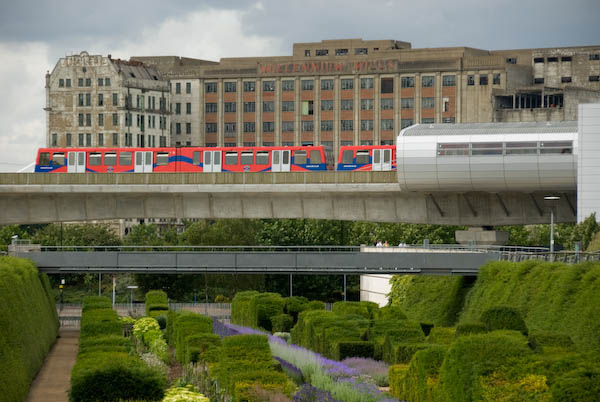
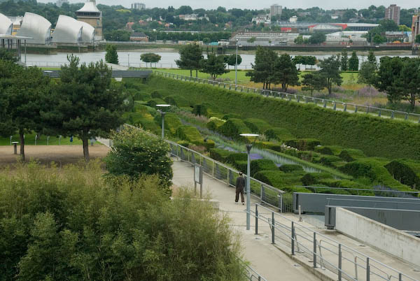
From the platform level you get good views, both through the windows and at each end of the long platform, of the Park, Barrier Point, Royal Victoria Dock and elsewhere.

Canning Town Walk (2007): 10 Riverside C) 2007, Peter Marshall
Listed Grain silo at Pontoon Dock

The train journey provides some of the best views of the riverside properties in this area, which otherwise are often impossible to access. It also gives a rapid overview of an area that is time-consuming to access on foot.

Canning Town Walk (2007): 10 Riverside C) 2007, Peter Marshall
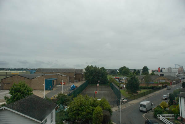
Barrier Point from the DLR

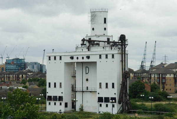
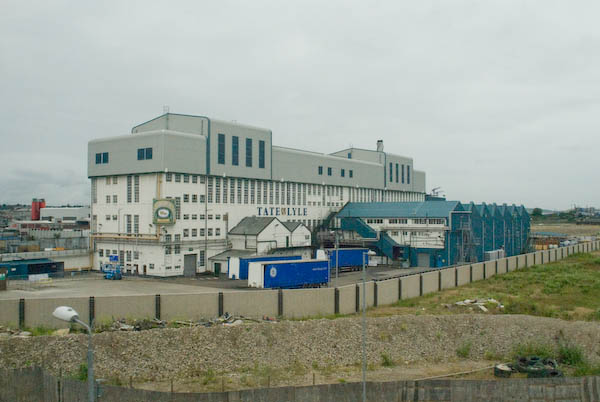
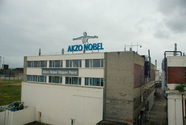
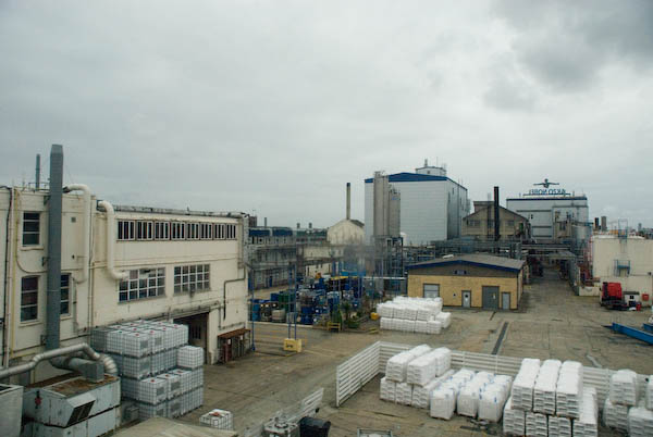
You should have no problem in identifying one of the Tate & Lyle buildings on the route, as well as Akzo Nobel, although you may recognise some of their brand-names – such as Crown, Bergger and International Paints, Sandtex and Sadolin – more easily. [I think only the Tate & Lyle Plaistow Wharf factory remains. Much was demolished to build Royal Wharf, as well as to the west of Plaistow Wharf where the land now remains empty.]

Canning Town Walk (2007): 10 Riverside C) 2007, Peter Marshall
Lyle Park from the DLR
Canning Town Walk (2007): 10 Riverside C) 2007, Peter Marshall

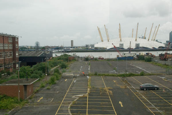
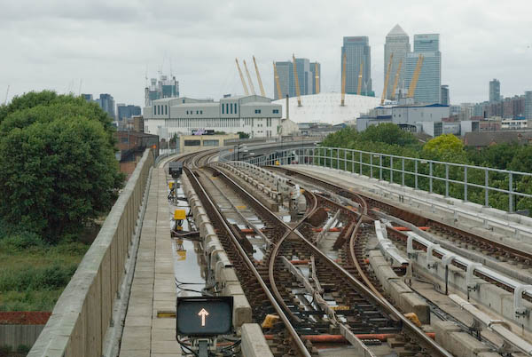
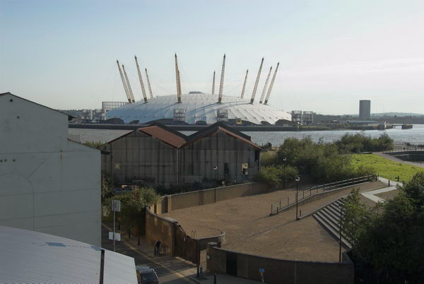
From the train you can also see the mouth of the River Lea and Trinity Buoy Wharf with its lighthouse and stack of containers in use as artists studios, as well of course as the Millennium Dome.

After Canning Town station, the line curves around the River Lea and climbs through the ecological reserve at Bow Creek and over the viaduct across Bow Creek. This section of the DLR was built in 1994 for the Becton extension.

From East India you have the choice continuing on the DLR towards the centre of London (change at Poplar for the DLR to Canary Wharf and the Jubilee Line), or taking a journey back to Canning Town.

If you have time and energy for a further walk, go north out of the station onto East India Dock Road and after crossing Bow Creek follow the path beside the creek to go over the Lower Lea Crossing. Again this elevated bridge gives good views across the Thames and Bow Creek to the south. [Now you can if you wish take a short cut by going out of the Bow Creek exit of the station, across the red bridge and through London City Island to the Lower Lea Crossing.]

Canning Town Walk (2007): 10 Riverside C) 2007, Peter Marshall
Leamouth, Thames & Millennium Dome, 2009

When the bridge descends to a roundabout under the Silvertown Viaduct, you can either continue under it to Royal Victoria Station, or cross the road just before the roundabout and take the steps up to the top of the viaduct and walk to Canning Town station.


You can read the whole document as I published it in 2007 beginning here and see more pictures I took in 2007 on My London Diary at Canning Town, Victoria Dock, Silvertown West.

Canning Town Walk (2007): 9

9 Thames Barrier Park

The children’s fun area is a nice idea, [32 computer controlled fountains] but this works better at Parc Citroen in Paris, and hasn’t stood up to British weather or use. We just don’t have the same level of upkeep in Newham as does the City of Paris. Competitions such as was carried out for this are a good idea, but only if the judges think rather more about what the result will look like in ten years time rather than on the sketches. It is also unfortunately not possible to enter the Green Dock at the ground level at the north end and walk through it (there is still an entry at the south end.)

[The park is managed by the Greater London Authority and was built on one of the most polluted sites in the country, the former PR Chemicals factory, which took years to decontaminate.]

The sides of the dock were lined by a metal fence with lower wires, which have currently been removed. In their place the fence is lined by normal street safety barriers, tied together with plastic bags. Although it may be effective, it is visually unacceptable and hopefully the fences are to be repaired and these removed.

The two buildings in the park have a Japanese feel. One usefully houses toilets and a café, while the other was erected by Newham in memory of the victims of war. Its undulating seating was intended to carry on the wave theme of the Green Dock, but is perhaps of more interest to skateboarders than for comfort.

Walk along the edge of the ‘Green Dock’ to the riverside.

The park gives an excellent view of the Thames Barrier. Silvertown was one of the areas to be flooded in 1953, though rather less disastrously than Canvey, although some 1130 homes here were flooded. It took until 1982 for the Thames Barrier to be completed. Estimates of how much longer it will remain effective with the sea level rise due to global warming vary widely, but certainly at the moment it is getting used rather more often than was envisaged.

Walk back along the other edge of the Green Dock to the cafe and/or the station.


It’s some years since I’ve been back to the park, and it would be interesting to see how it has changed over the years. Perhaps I’ll find time this summer.

This walk will continue in a later post with Part 10: Riverside which mainly looks at views from the DLR.

You can read the whole document as I published it in 2007 beginning here and see more pictures I took in 2007 on My London Diary at Canning Town, Victoria Dock, Silvertown West.


FlickrFacebookMy London DiaryHull PhotosLea ValleyParis
London’s Industrial HeritageLondon Photos

All photographs on this page are copyright © Peter Marshall.
Contact me to buy prints or licence to reproduce.