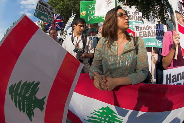
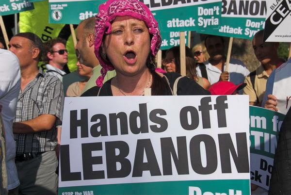
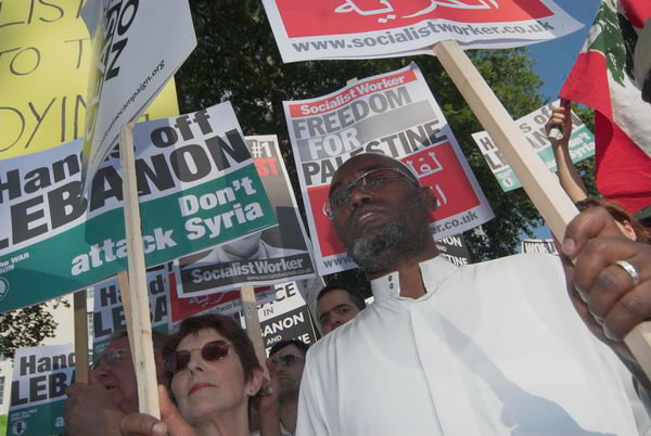
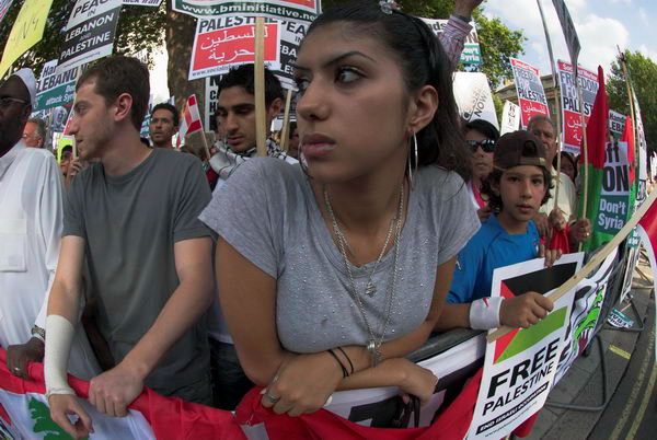
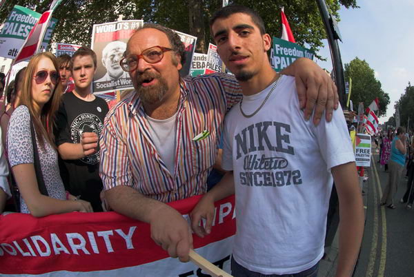
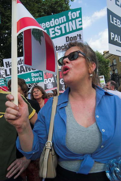
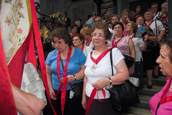
Lebanon: Ceasefire Now!: In July 2006 there were protests in London over Israeli attacks on Lebanon and Palestine. There had been a large march on 22nd July and the pictures here are from a second protest on the following Friday, July 28th.
I posted about the first of these events here last week and you can read further details about what was happening around the world including in Lebanon and Palestine on July 28th on Wikipedia. UK Prime Minister Tony Blair was on that day in Washington holding talks with President George W. Bush on the crisis in the Middle East.
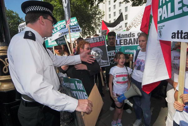
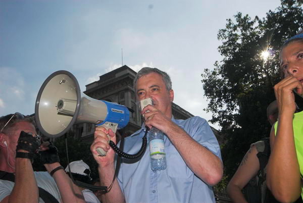
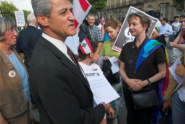
Police officer remonstrates with a child using megaphone in the prohibited areaAndrew Murray of ‘Stop the War’ who organised the demo was allowed to make a brief address
I didn’t write much about this protest at Downing St: “Several hundred demonstrators lined up on the pavement in Whitehall opposite Downing Street. They included a number of Jewish protesters who also felt that the Israeli bombing and invasion was an entirely disproportionate action, as well as supporters of Hezbollah.”
A delegation prepares to take a letter to Downing St demanding that Blair calls for an immediate ceasefire (he didn’t)
The presence of many Jewish protesters has been a continuing feature of all the protests against the Israeli attacks on Palestine and Gaza, something which is seldom mentioned or given any prominence in media coverage or the comments by politicians on these events.
Jew and Arab in solidarity opposing the Israeli action
Accurate reporting on these events and an end to government ministers and leading politicians describing them as hate marches and respecting those Jews who feel compelled to protest against the Israeli government actions – rather than promoting the views of pro-Zionists would I am sure have lessened both the rising anti-Semitism and Islamophobia we now see.
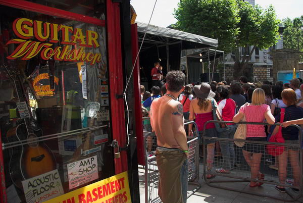
Tin Pan Alley & Our Lady of Mount Carmel: Sunday 16th July 2006 I went to the Tin Pan Alley Festival in Denmark Street, a short street off the Charing Cross Road, for many years the centre of the UK popular music industry, but now sadly declined. There are still some shops selling instruments, but the music publishers, newspapers and most recording studios have disappeared, and much redevelopment has taken place, including behind some of the seventeenth century and later facades.
It was a crowded and very noisy event and I found little to photograph, soon leaving for Clerkenwell to photograph the annual Italian festival there.
The 2026 Procession in Honour of Our Lady of Mount Carmel takes place this Sunday, July 19, 2026 at 3:30 but the street festival there begins around noon and continues long after the procession. It’s an event I’ve photographed many years since I first knew about it in the 1990s, but this year I think it will be far to hot for me to travel and work there.
Here as usual is what I wrote back in 2006 with normal capitalisation and spelling corrections, along with a few of my favourite images and links to the many others still on My London Diary.
Tin Pan Alley Festival
Denmark Street
Crowding around the stage in ‘Tin Pan Alley’
Not a lot to say about the Tin Pan Alley Festival in Denmark Street. It was noisy, fun if you like that kind of thing (but 15 minutes was long enough for me) and for a good cause.
A game of football around the corner
Denmark Street is perhaps more interesting on other days, I must take my “famous” (allegedly ex-beatle) guitar in for repair sometime.
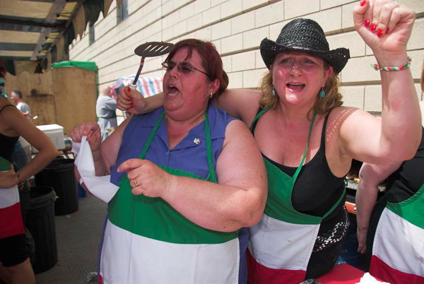
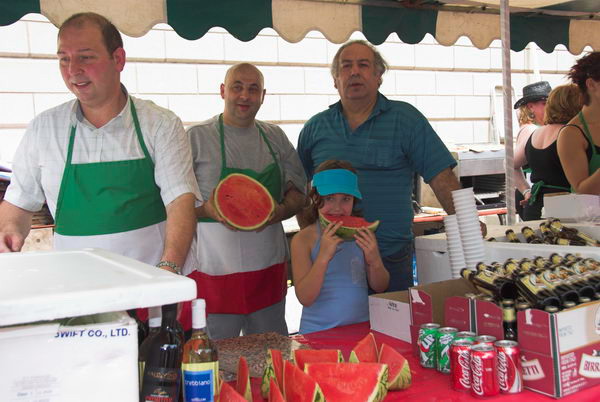
Ladies on one of the stalls at the Sagra in Warner StAnd men. More on My London Diary
The Italian Church festival is one of the great events of the London calendar, which fortunately hasn’t yet been noticed by too many non-Italians.
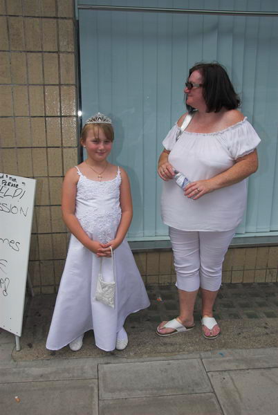
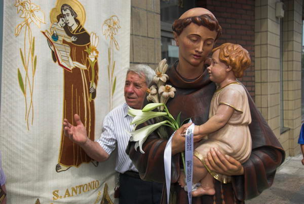
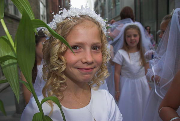
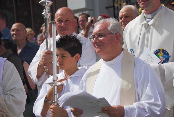
First communicant poses with her motherStatues and banners are carried in the processionA group of women leave the church to take part in the procession
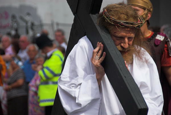
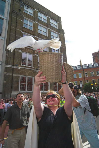
The Procession In Honour Of Our Lady Of Mount Carmel Attracts several thousands. Good food, good wine and Italian beer along with other things for sale, colourful statues, and a cast list that included Pope Benedict XVI, Jesus, the Four Evangelists and many more, all parading through the streets around St Peter’s Church in Clerkenwell.
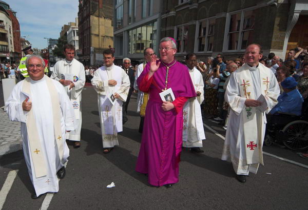
First communicantsPadre Carmelo di Giovanni, parish priest from 1991 to 2014Jesus carries a heavy wooden crossThere were three baskets each with a pair of doves who were reluctant to flyAnother Jesus led the first communicants
At the end of the procession is Our Lady Of Mount Carmel and the priests; as they join it, doves are released and the crowd of parishioners joins in a solemn procession of witness around the streets.
The clergy with a visiting dignitary
There are very many pictures from the event beginning here on My London Diary and spread over around a dozen pages, beginning with a number from the Sagra, the street festival in the street below the church. This continues with music and dancing ofter the procession (as well as eating and drinking) but in 2006 I needed to leave rather than continue photographing.
Rathayatra, Roller Skates & the World Cup: I began Sunday 18 June 2006 by photographing the annual Rathayatra chariot festival in Hyde Park and on its way to Trafalgar Square, before going to Parsons Green where I found the West London Green Fair rather disappointing but did briefly meet a large crowd on roller skates on a ride around London.
Later I went to New Malden to meet a friend and photograph Koreans who had gathered at a local pub to watch South Korea playing France in Leipzig in Group G of the 2006 World Cup. South Korea had earlier beaten Togo, and drew with France but a few days later lost to Switzerland and so failed to progress to the knockout phase of the cup. Below is what I wrote in 2006 (with the usual corrections) and links to more pictures from the day.
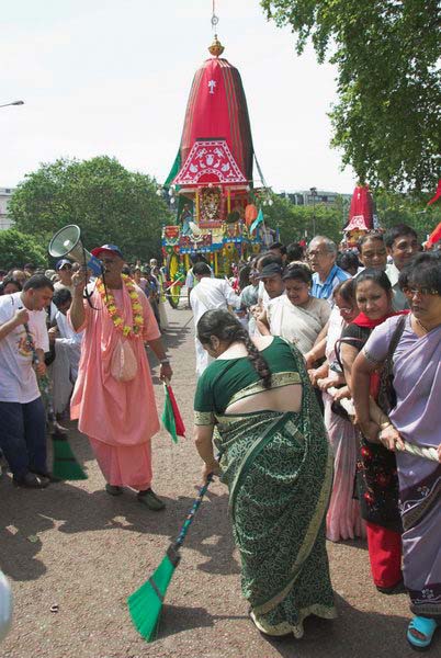
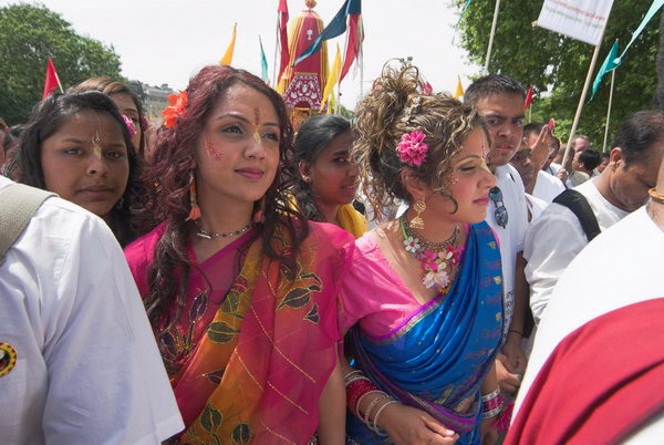
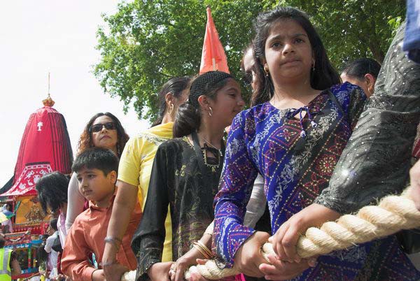
Hare Krishna: Rathayatra Festival
Hyde Park to Trafalgar Square
One of London’s more colourful annual events is the Rathayatra or Chariot Festival organised by the Hare Krishna movement. The three chariots carry representations of three deities, Lord Jagannatha (Krishna, the Lord of the Universe), Lady Subhadra and Lord Balarama, and pulling the ropes grants eternal service at the end of life in the spiritual world.
The ceremony dates back around 5000 years in the ancient holy city of Jagannath Puri in Orissa, India, but was only established in London rather more recently in 1969.
The chariots are accompanied by musicians and dancers, and there is free food for all at Trafalgar Square where the procession ends.
This year’s festival also celebrated the 108th anniversary of the birth of A C Bhaktivedanta Swami Prabhupada (1896-1977), who in 1966 founded the Hare Krishna movement.
I called in briefly at the West London Green Festival at Parson’s Green on my way to New Malden, but there didn’t seem to be much happening there.
The Skate Rollerstroll called in briefly, but didn’t stop for long.
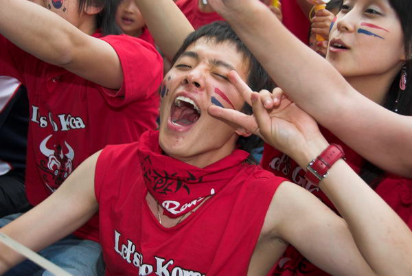
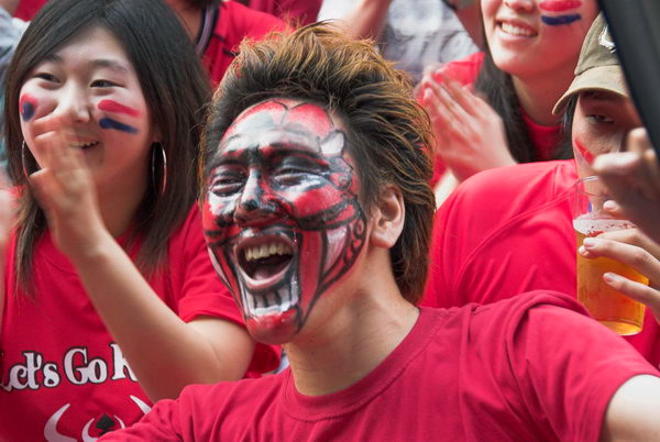
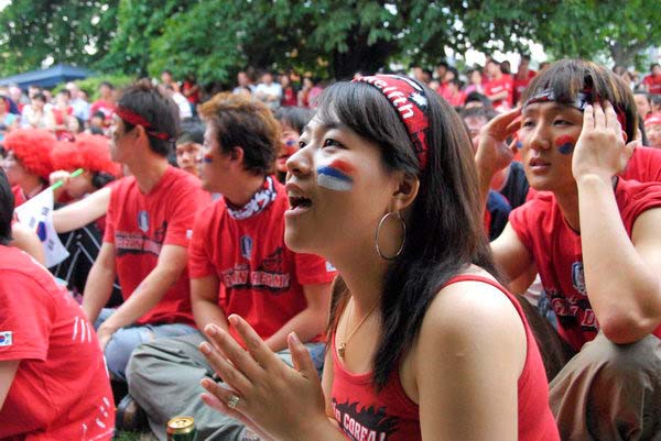
Korea v France
The Fountain Pub, New Malden
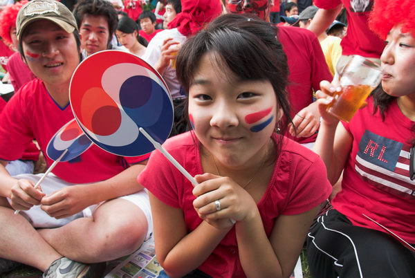
Korean Face painting in New MaldenI’m about to have two stripes painted on my cheeks by this young woman
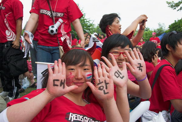
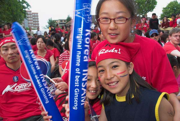
I was on my way to New Malden, where I met up with Paul Baldesare to go and photograph Korean supporters watching the Korea v France match at one of the local pubs.
Both inside the pub and in the garden were a whole lot of large screens, with Koreans coming to watch the game.
We got there quite a while before the start when everyone was just starting to get into the mood. Soon we both had red and blue stripes painted on our faces.
It was very much a community event, with everyone enjoying themselves, and emotions obviously ran high once the game had started.
Along with the hundreds of Koreans there were a few non-Korean locals, and one French woman with a France t-shirt. I talked to her briefly before the game began, but couldn’t find her later when I went to take some photographs in the crowd. So everyone in my pictures is a Korea supporter.
When I left, a few minutes into the second half, Korea were trailing 1-0. I missed the equaliser, and the after-match celebrations when the High Street was full of Koreans celebrating the draw.
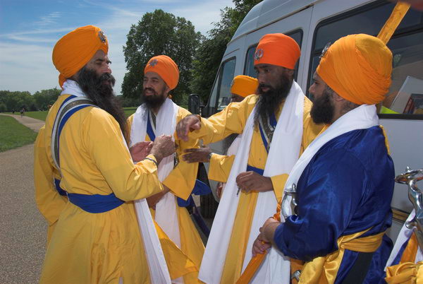
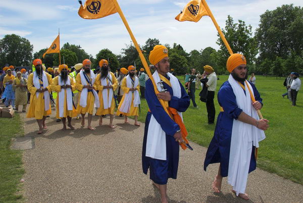
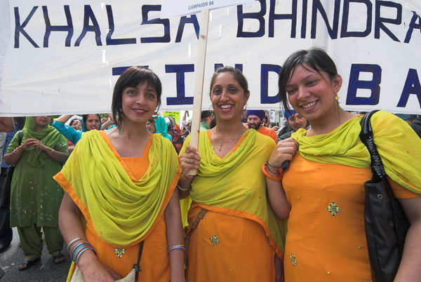
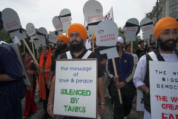
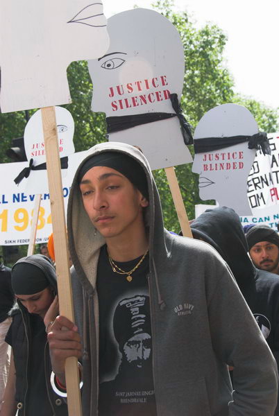
Old Comrades, Women for Life & Sikhs: Sunday 4th June 2006 was a day for marching and running on the streets of London. In the City, the London Regiments were remembering their fallen comrades, and several thousand women were raising funds for cancer research. In Hyde Park I joined several thousand Sikhs at a rally before they marched in memory of the martyrdom of the Fifth Guru and the Indian genocide of Sikhs, calling for the release of political prisoners and the formation of an independent Sikh state.
I wrote a rather longer piece than usual, ending with a complaint about the police harassment of photographers during the Sikh march. There do seem to be some officers who really have a very negative attitude towards photographers, and at times in particular towards those with UK Press Cards. Though formally these are recognised by all police forces in the UK, that recognition too often means nothing on the street. Below is what I wrote in 2006 – with the usual minor corrections.
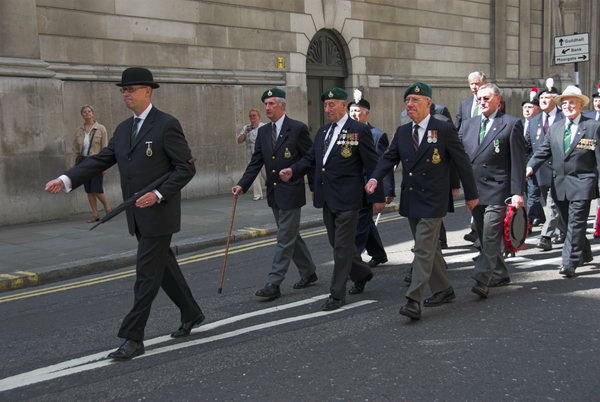
London Old Comrades
Bank of England
Early Sunday the centre of the real City, around the Bank Of England is generally pretty empty, but today things were going on. Immediately north of the bank a small group of ‘old comrades’ from the London Regiments were preparing to march and lay poppy wreaths at the monument to their fallen comrades in front of the Royal Exchange. Some of those I spoke to had fought in the second world war, though there were also some younger people there. It’s a remembrance that has taken place twice a year since 1919.
It was a solemn and ceremonial occasion, impressive and colourful, with a well-disciplined smoothness. The monumental architecture of the Bank made a good setting, although the area on top of Bank Station itself is too fussy and cluttered.
Towards the end of the event, when the numbers had thinned out a bit, London Wall was still fairly full.
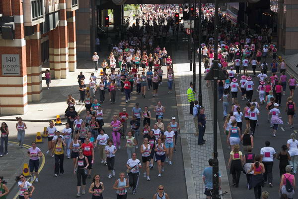
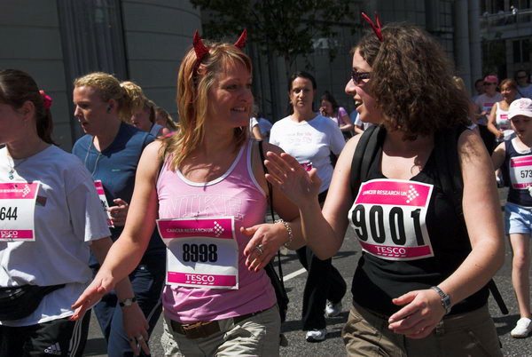
As they marched off, I peeled left in search of 750,000 women, or rather that fraction who were taking part in the Central London event. ‘Race For Life’ for Cancer Research UK, is the UK’s largest women-only nationwide fund-raising day. There certainly were a lot of them, [around 10,000], at times packing even the wider streets full from side to side, making it hard to walk along Cornhill.
Women of all ages, shapes, sizes, races and speeds running, walking or limping or wheel-chairing around the 5km course. There were fewer serious runners than I’d expected and less fancy-dress, but the sheer numbers were impressive.
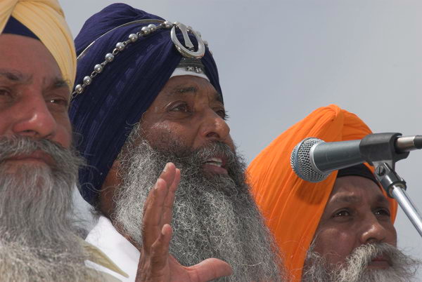
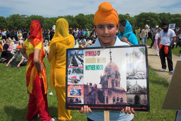
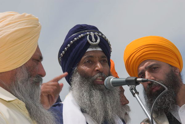
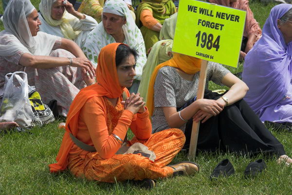
The Sikh Remembrance March and Freedom Rally commemorated the martyrdom of the fifth guru, Sri Guru Arjan Dev Ji 400 years ago, as well as the events of 1984.
Guru Arjan Dev Ji compiled the first version of the Sikh holy book, the Guru Granth Sahib, in 1604, writing many of the hymns within it. He was arrested in Lahore in 1606 on the orders of Mogul Emperor Jehangir, tortured for 5 days and martyred on the banks of the River Riva.
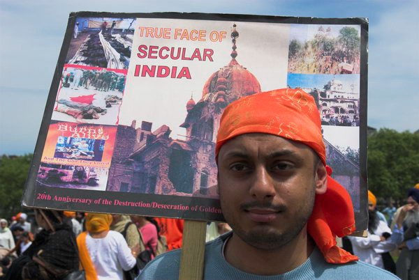
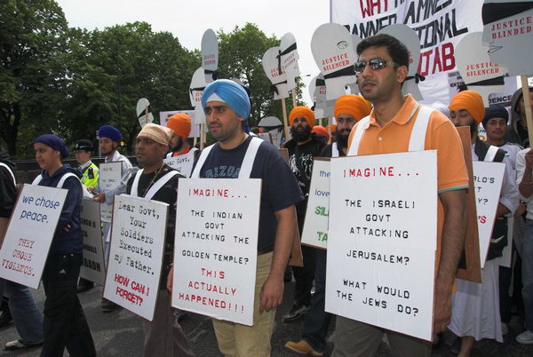
Punjabi speakers at the rally in Hyde Park described the events of 1984. The marchers demanded an acknowledgement of the Indian genocide of Sikhs, the release of Sikh political prisoners held in Indian jails, and for the establishment of an independent secular state of Khalistan in the Punjab.
During the annual celebration of the death of Sri Guru Arjan Dev Ji in 1984, Indira Ghandi sent her troops to attack Sikh militants in the Golden Temple at Amritsar. Many innocent pilgrims – men, women and children – were killed in the brutal assault. Thousands more died around the Punjab, particularly in the riots incited by government TV and radio stations after the October assassination of Indira Ghandi by her Sikh bodyguards.
After the speeches came prayers, and then the march set off for Trafalgar Square and another rally. This was a serious event, with strongly felt grievances, and an impressive display of Sikh tradition and feelings.
The marchers were pleased to find photographers taking an interest in their cause, with many of them encouraging me and thanking me for my presence. Some had heard of this web site [My London Diary] too.
The march sets off in Hyde Park, with five men representing the original Panj Piare (Five Beloved Ones.)
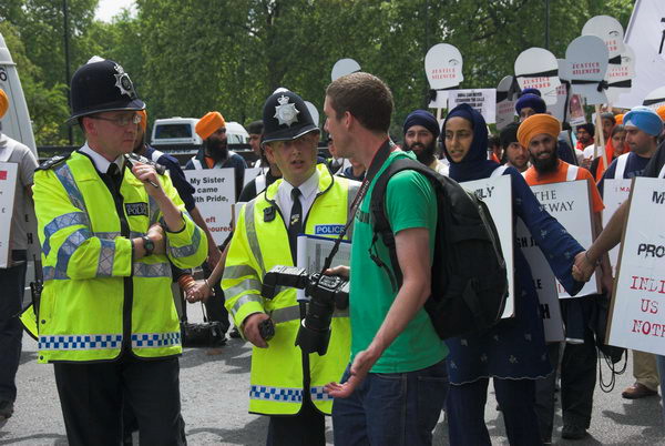
Until we were close to Hyde Park Corner, the police were helpful and in good humour too, but then along came one of the rotten apples, someone who just wanted to push photographers around. He came and told me to get off the road, as I was stopping the demonstration. This was clearly absolute nonsense, and I tried to tell him, but reason held no interest for him.
Police harass a photographer trying to do his job. I and other photographers got the same treatment
Other photographers got harassed too. You can see one of them in my picture. We are accused of holding up the march, generally nonsense as most of us want to capture action in our images, and if people even slow down, will wave them on.
Of course it’s those at the actual front of the march who would have any effect on its progress. Further back where we were working, small gaps develop and are closed up all the time without affecting the overall progress.
I have respect for the police – some at least of their work is essential, but this kind of petty and stupid behaviour simply makes their job harder for no reason.
It also makes the work of photographers impossible. I can’t work unless I can stand in the right place to take pictures, and that is seldom on the sidelines. At the highest level, the police realise this; it’s about time they got some of the little dictators in the middle to put it into practice.
The message of love & peace SILENCED BY TANKS
Of course the policing of many marches is over the top. There were probably ten times the number needed for this event, which was predictably well ordered, good natured and essentially self-policing. Traffic control was really all that was required. Perhaps harassing photographers makes these surplus guys on overtime think they have a purpose.
Twenty minutes later, along with several of the other photographers, I was on my third warning from this guy and he was getting redder and more and more tense. I was interested in how the situation might develop, but I was also tired and it was time for me to go elsewhere.
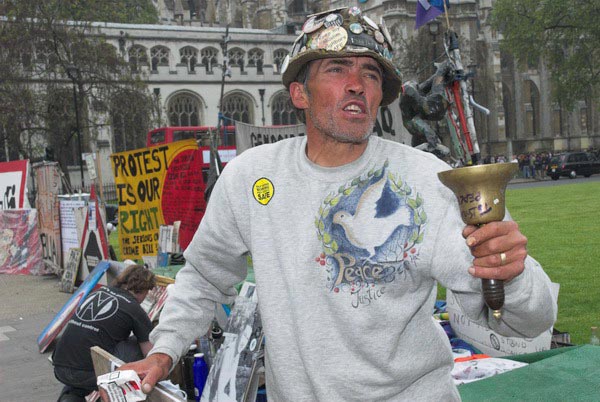
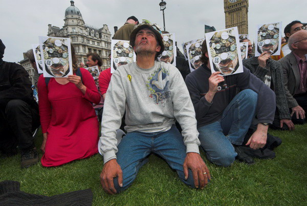
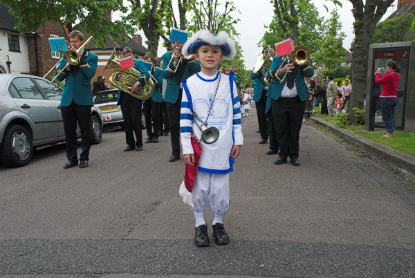
Brian, Bears, Morris and May Queens: On Saturday 13th May 2006 I went to Parliament Square where I photographed resident peace protester Brian Haw and Morris Dancers, going on to more dancers performing in Trafalgar Square as a part of a Westminster Day of Dance. From there the Underground took me out to Hanger Lane from where I walked to Brentham to photograph the 100th anniversary of the first Brentham May Queen crowning.
Brian Haw at Parliament Square
Brian and the Bears
Brian Haw lost the appeal by the government over his protest in Parliament Square, the court deciding that the Serious Organised Crimes And Police Act did apply to his protest after all, despite it having started around 4 years before the act came into force. It seems to be a decision that reflects more on the ability of the government to apply pressure rather than one that suggests an independent judiciary.
At the moment, Brian is still there, his protest now regulated by the police, but it seems rather likely that at some moment the feel convenient they will decide to terminate it. On Saturday morning I went to have a short word with him and take some more pictures, particularly of some of the bears who are with him.
His protest from the start has been about the killing of children, at first by the effects of sanctions, then by the war, and the teddy bear symbolises this (I think of one of the most poignant images from the Second World War, by Cecil Beaton, of a child in a hospital bed with a teddy bear.) I hope to be back to see Brian tomorrow, with a few friends, if he is still there. [He was, and depite constant harassment remained there until ill-health forced him to leave in 2011, dying in a German hospital six mohnths later.]
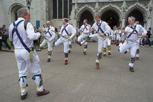
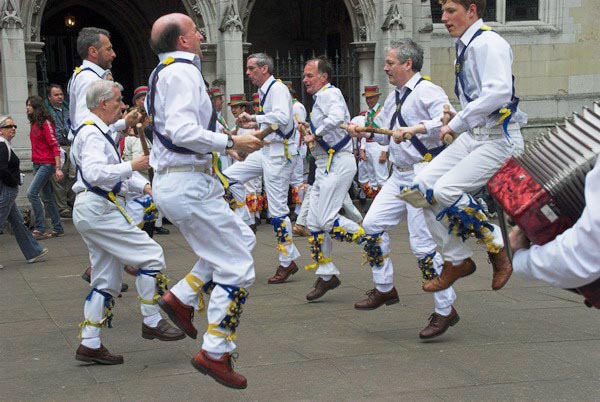
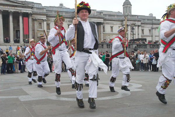
For several years there has been a dance festival in Westminster in May, with teams of Morris Dancers from around the country. I caught up with them briefly dancing in front of St Margaret’s Church next to Westminster Abbey, then a little later in Trafalgar Square.
Although i’ve never had a great desire to take up Morris myself, it certainly is one of our English traditions, going back at least 500 years – the first written record of it is in 1448.
It was still alive in many villages in the nineteenth century and a revival started in the early twentieth century particularly through the work of Cecil Sharp, who collected over 170 different dances around the country and started the English Folk Dance Society in 1911. Sharp and Mary Neal published books of dances, and in the 1920s and 30s, country dancing became a part of most young school children’s week. How I hated it in the 1950s!
It is perhaps that enforced participation that led to Morris Dancing being thought of as something false and lacking in credibility. In a curious anomaly, our Arts Councils refuse to support English ethnic dances while (quite rightly) giving aid to foster dance and related activities among minority ethnic groups. Despite this, Morris Dancing has continued to grow both in the UK and now increasingly abroad, particularly in Canada and the USA.
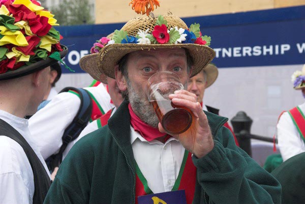
All the teams in Trafalgar Square were men, although there are also many women dancers. One of the things that comes out in my pictures is that the dance is at times a very athletic event. Many of the traditional dances use swords or staves and have a link to martial arts. Morris also has a strong link to another English tradition, the ale house.
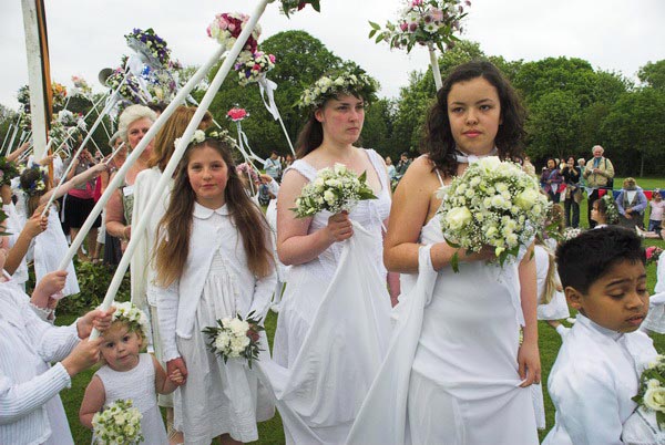
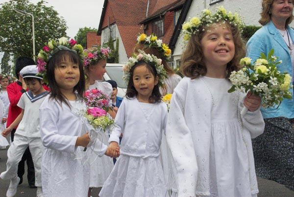
May continued for me with another May Queen. Last year (2005) I had photographed the oldest continuing May Queen event at least in the London area, the Merrie England and London May Queen Fayre at Hayes, Kent, held continuously since 1913. This year I went instead to Brentham, where a May Fayre with maypole dancing was held in 1906, and its centenary was held this year.
For this event, the organisers had managed to find and invite along many former May Queens, including some from the 1950s. Some had come long distances to be there, including one now living in America.
Brentham was one of the earliest “garden village” estates, built by ‘Ealing Tenants’ a co-partnership housing scheme started in 1901 and largely completed by 1915. The road layout was designed by Raymond Unwin and Barry Parker, and it was in many ways a model for other and better known garden villages.
The Brentham May Queen is less formalised that the south London events, with little or no long speeches and ceremonies (unlike Hayes it was not set up by a Dulwich schoolmaster.)
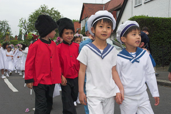
As well as the May Queen Elect and previous May Queens, each with a small group of attendants, there is also a herald who leads the parade (aided today by a brass band) Brittania, Sailor and Soldier, and, leading the large group of around 150 young girls dressed in white with flowers, a Jack In The Green, covered with leaves, with just bare legs and sandals visible.
The crowning of the 2006 Brentham May Queen
After the parade around the area, there was a short ceremony in one of the fields by the River Brent in which last year’s May Queen crowned the new queen, and a very short speech. Following this were country dances and dancing round the maypole, but I left before this began.
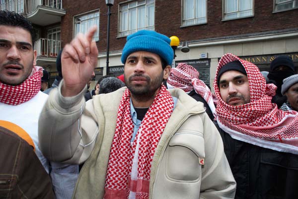
Muslims, Iran, Canary Wharf & Queer is Here: Saturday February 4th was a busy day for me with a couple of protests, a trip to Canary Wharf and then the opening of a show in the Foyer of the Museum of London which included some of my work from ten years of London’s Pride marches.
The first of the protests was by Hizb Ut-Tahrir Britain, a radical Muslim organisagion which was proscribed in the UK in January 2024 following a protest outside the Egyptian Embassy which called on ‘Muslim Armies’ to take action against Israel. I’d first photographed a group which had been formed by its former leader for ten years, Omar BakrI Muhammad at a protest in Trafalgar Square in 1998 and later had photographed a number of the Hizb Ut-Tahrir protests, including the one for which they were banned.
The ban was part of a government attempt to stigmatise all protests against the Israeli attacks taking place on Gaza as ‘hate protests‘ and the BBC and other media outlets aided them by failing to properly distinguish the protest by a few hundred radical Muslims from the hundreds of thousands who marched peacefully at the same time through London calling for peace and justice in Palestine. Had they thought if they could get away with proscribing Stop the War, CND and the Palestine Solidarity Campaign they would surely have done so.
Here I’ll re-post a normally capitalised and slightly corrected version of what I wrote back in 2006 on My London Diary about that and other events of the day, along with links to more pictures including the full set of my pictures used in the museum show.
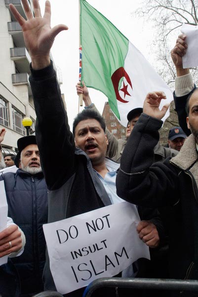
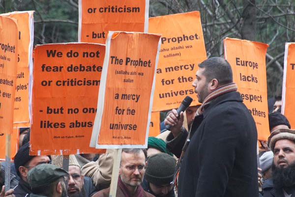
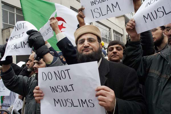
Defend the Honour of the Prophet
Danish Embassy
Speaker addressing crowd penned in on the pavement at the official demonstration opposite the embassy.
Several thousand British Muslims turned up outside the Danish Embassy around midday on Saturday 4 February 2006 to protest peacefully about the publication of cartoons by a Danish newspaper some months ago, following their re-publication in a number of other newspapers around Europe and on the Internet. Although I understand their outrage, and support their right to protest, the world-wide reactions have seemed excessive, with violence and injuries as well as lurid threats of death and atrocities presenting a very negative image of Islam.
Some demonstrators wanted to continue after the official end of the demonstration, but were urged to go home.
To the credit of British Muslims, this demonstration was peaceful and restrained, with official placards provided by organisers Hizb Ut-Tahrir, Britain saying things such as ‘we do not fear debate or criticism – but no one likes abuse‘, ‘Islam says – don’t insult other peoples religions‘ and ‘Europe lacks respect for others’, or simply praising the prophet, although some of the speeches sounded rather more inflammatory.
Stewards (and of course the police) generally kept everyone well under order, as well as making sensible photography virtually impossible during the rally. After the event was officially over it was possible to take more pictures
The problem is I think not that “Europe lacks respect” but that our tradition is a secular liberal one which respects and upholds freedom of speech and opinion (our blasphemy laws, which should have been repealed long ago, are seldom invoked.)
There are many things said and written that I find offensive (including several of the cartoons at issue) and you and I have the right to state our objections, to debate or criticise and even to stop eating Danish butter – but not to stir up hatred or issue death threats. Despite some press reports, this demonstration was generally well-ordered, and I saw none of the placards which have led to calls for people to be prosecuted.
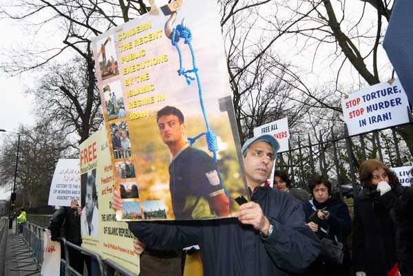
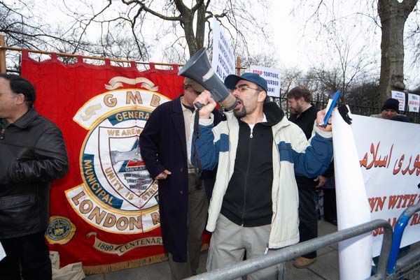
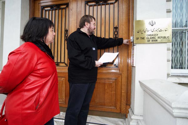
Protestors hold posters about public executions, torture and imprisonment of workers opposite Iran’s London Embassy in Kensington.
Meanwhile, a short distance away, a demonstration that perhaps should have attracted rather more support from the Muslim community was taking place opposite the Iranian embassy. Perhaps 50 people had gathered there to protest against human rights abuses in the Islamic Republic of Iran, and to support workers there who have no right to strike or organise under Iran’s draconian labour law.
The demonstration is a show of solidarity with Iranian trade unionists and the GMB London Region banner added colour.
In January 2004 workers staging a sit-in at the Khatoon Abad copper plant were attacked by riot police, with four killed and many more injured. Recently, bus workers in Tehran have been arrested for planning and carrying out strike action. According to Amnesty International, around 500 are still in jail, without charges being made or access to lawyers. Some of them have been beaten in prison, and their wives and children also beaten in raids on their homes.
A letter of protest was taken to the door of the embassy but nobody came to accept it
There are many more abuses of human rights being committed under the name of law in Iran including torture, murder and public executions (even of minors) for offences including ‘un-Islamic behaviour‘. Given the amount of news coverage on Iran at the moment over uranium enrichment, it is perhaps surprising that other stories from Iran – such as these – have not attracted more attention. And since most of those who are suffering are Muslim, I’m suprised at the apparent lack of solidarity from the community in Britain.
I left for a late lunch, then went on to Canary Wharf, where I had things to do. Although it was a very dull day I took a few pictures before catching the Docklands Light Railway to Bank and walking through the empty City to the Museum Of London on London Wall.
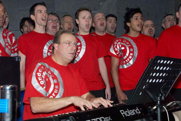
London Gay Mens Chorus at the opening of ‘Queer is Here’ at the Museum of London.
At the Museum Of London was an event I had a personal interest in, the opening of a foyer display ‘Queer Is Here‘. I’d provided the dozen images used on the front of the large display panel beside the general text on the show, and there was also a screen beside it showing more of my images taken at London Gay Pride Parades from 1993-2002. In those ten years of Pride I took perhaps 5,000 images, and the display shows around 40 of the best of them.
Gay Pride parade in Piccadilly, June 1994. Picture by Peter Marshall from ‘Ten Years of Pride’ , part of the ‘Queer is Here’ exhibition at the Museum of London.
There were a few of these on My London Diary already (along with many from later Prides) but I posted the full set of pictures used in the show.
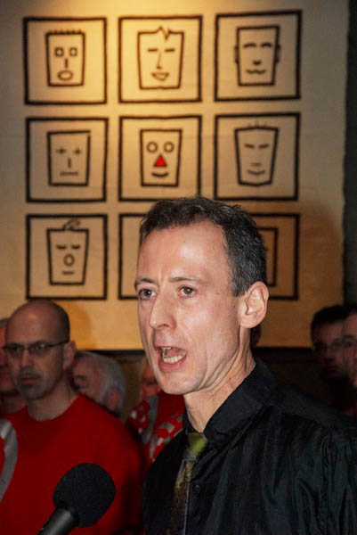
Peter Tatchell
The exhibition was opened by Peter Tatchell, who I’ve photographed many times over the years, and was enlivened by a spirited performance from the London Gay Mens Chorus. After the month at the Museum Of London the display was to tour to libraries and other venues in London and possibly elsewhere around the country
Land Mines and the Lea Valley: Fortunately these were two entirely separate events on October 14th 2006. The landmines were in Hyde Park in a display by Handicap International and after visiting this I took a walk across the Lea Valley from Holloway to Tottenham and Walthamstow where I was going to collect a set of my pictures which had been on show at Walthamstow Pumphouse Museum. Here is a slightly edited version of what I wrote in 2006 with a few of the pictures from the day – and a link to many more from the walk on My London Diary
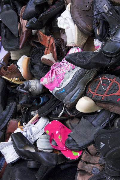
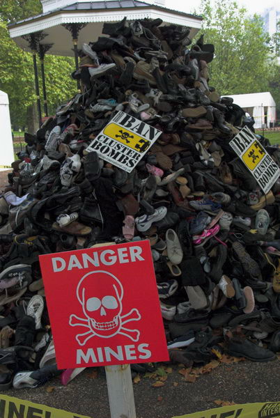
Ban Landmines and Cluster Bombs
Handicap International, Hyde Park
Saturday in Hyde Park there were land mines. Fortunately they were mainly carefully marked as well as having been made harmless. For many people around the world they are daily hazard, the deadly and maiming residues of war.
Just as dangerous, if not more so, are cluster bombs. These are produced by the sophisticated weapons industries of many countries including Britain and America, and also used by our armies and air forces, dropped from aircraft or fired as artillery.
Each cluster bomb contains from a dozen to several hundred lethal bomblets, which are distributed over a wide area, intended to kill infantry or guerillas, but entirely indiscriminate in their action. Between 5-30% fail to explode on impact, usually getting buried in soil; those dropped over 30 years ago in Vietnam are still killing and maiming people, especially children, there. Almost 2,000,000 were scattered over Iraq in 2003-4.
I went to Hyde Park to sign the petition organised by Nobel peace prize-winning charity Handicap International to aim for a world-wide ban on these weapons.
Handicap International now has urgent appeals for Gaza, Ukraine and Sudan and invites you to join them in campaigning to “Fully implement the treaties banning landmines and cluster munitions without delay and encourage non-signatory states to sign their petition.”
Tottenham to Walthamstow
This stadium entrance had potential, but I couldn’t get myself into the right mood
After my brief visit to Hyde Park, I was on my way to Walthamstow to collect some of my pictures of the Lea Valley that had been on show at the Pump House Museum, and as it was a nice day, decided to walk the last few miles across the Lea Valley and take a few more pictures.
South Tottenham
I began my walk in Holloway, going post the Emirates Stadium and then across South Tottenham.
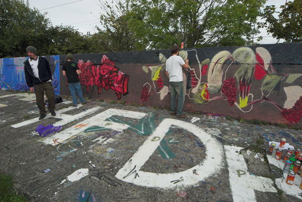
In King George V Park I found some graffiti artists at work, and took pictures of a few of the many murals, before heading down the Lea Navigation to Springfield and across to Walthamstow Marshes, a surprising area of open space so near to the centre of a major city.
Then I made my way between reservoir and waterworks to the Lea Flood Relief Channel and St James’s Park, surrounded with remarkably brooding lime trees.
There are many more pictures from the walk on My London Diary, but surprisingly I don’t appear to have taken a picture of the Walthamstow Pumphouse Museum on this occasion. I think I had stopped to take so many pictures on the way that I was in rather a hurry to collect my pictures which had been on show for Open Heritage Day there and get home.
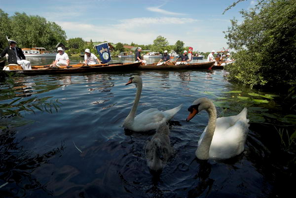
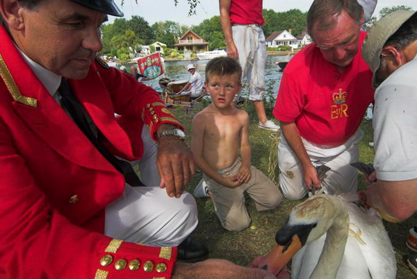
Swan Upping on the Thames: On Monday July 17 2006 I again photographed the annual Swan Upping which takes place on the River Thames over five days, in the third week of July starting on Monday at Sunbury Dock and ending on the Friday of that week at Abingdon Bridge. Like many who live close to the river – a five minute walk for me – I’d heard about this for many years but is was only in 2001 that I first saw and photographed the event – before then I had always been teaching during that week.
It is a ceremony that began in the twelfth century where a part of their huge grab of the country the Norman invaders claimed ownership of mute swans on open water as well as all the land. Later they granted some rights over the swans to others including London Livery Companies the Worshipful Company of Vintners and the Worshipful Company of Dyers, who now share the rights to swans on the Thames equally with King Charles III.
You can find pictures and text from a number of years on My London Diary, up to 2013, when I had photographed it ten times and I then decided I was simply repeating myself. I might go again, perhaps just to watch the spectacle but not to try and cover it in any depth.
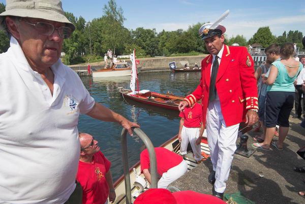
The Queen’s Swan Warden Christopher Perrins, Professor of Ornithology at the University of Oxford’s Department of Zoology and the Queen’s Swan Marker, David Barber
Some years I wrote at some length about the history and what actually takes place, but here I’ll post my first post about the event in 2001 and the post I made in 2006, the year in which all pictures here were taken.
2001
Swan upping is an annual event, counting swans along the Thames from Sunbury to Abingdon takes a week. The Crown decided it was a good thing to claim the swans around the 12th century, so they could gorge themselves on them at banquets, [later] they let some of their rich mates in the city have a share, but protected them from the people by severe penalties.
Swans are seldom eaten now, but upping continues to divide the Thames birds between the Crown, the Dyers and the Vintners.
2006
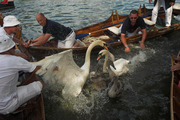
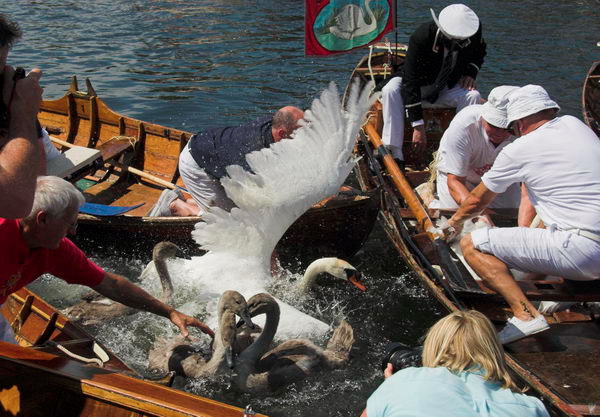
I’ve said rather a lot about swan upping in some previous years. It’s a fascinating and colourful event, which keeps a record of swans on the River Thames, as well as giving them a useful health check. The swans are handled very carefully and care is taken to avoid undue distress (though some of the press present this year could have been rather more careful.)
Swans are no longer normally eaten, but are admired for their decorative effect and looked after. Although anglers are now rather more responsible than in the past, the birds examined still often have signs of damage from discarded hooks and line. Many cygnets die in the first few months before the uppers come around, either from predators or other hazards.
I still feel an excitement watching the skill of the uppers as they surround a family of swans, gradually closing in on them, avoiding gaps and then grabbing them out of the water.
Great care is also taken when releasing the family back into the river, and usually only a few seconds later they are swimming serenely as ever.
Eric who cycled along the towpath to try to lure the swans into suitable places for upping using crushed digestive biscuits
One of the smaller mysteries to me is how there are so many swans on the river, but so few mating pairs – and many of these with very small broods. Of course there are many other lakes and rivers around, and swans can and do move around, although many of the adults in these pictures were ringed as cygnets in more or less the same locations.
The swans get recorded – here the leg ring is being checked while the Swan Master looks at the bird’s beak.
In 2006 I left the uppers at Runnemede, but in some years I went with them to Windsor where they stand to drink a Royal Toast in Romney Lock and then, on the way to the Eton Boathouses at Windsor, the Dyers and Vintners salute the Royal Uppers by standing in their boats with oars upraised.
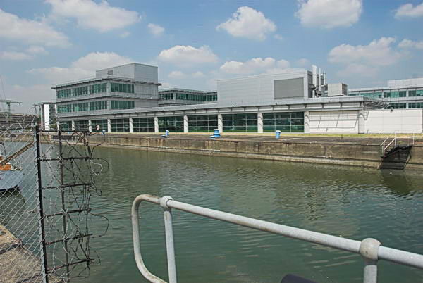
North Woolwich Photos: My account of my day on Friday 16 June 2006 is rather short – and manages to include a mis-spelling: “I took a trip to North Woolich and made some pictures there.” And the 45 pictures I posted had only the additional heading “North Woolwich, Thames, Royal Docks & Silvertown” but no captions. I think they deserve more, so I’ll correct that for a few of them in this post.
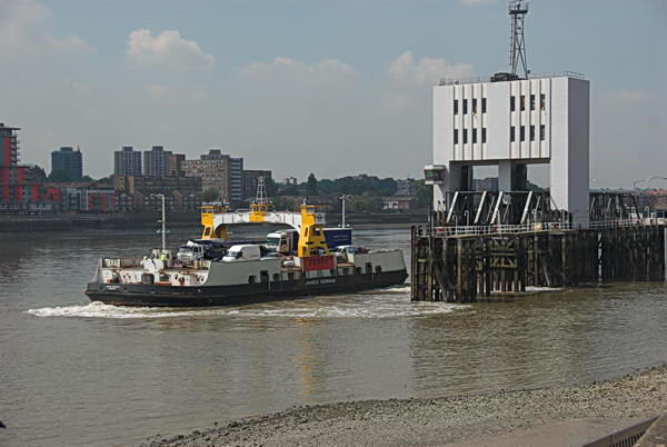
Woolwich Ferry, North Woolwich, 2006
The ferry is the James Newman, built in 1963 and named after a prominent local figure who was Mayor of Woolwich in 1923–25 and was taken out of service in 2018. But I hadn’t arrived on the ferry but had put my folding bike onto a Silverlink service on the North London Line which then ran from Richmond to North Woolwich Station (the section from Stratford to North Woolwich close at the end of 2006.)
The building in the background of the second image is North Woolwich Station, though it had by that date been abandoned by trains which stopped being used as a station in 1979, replaced by a considerably less grand and basic structure on its south side. For some years it was a museum and this fine 1854 building is now home to the New Covenant Church. My picture is taken from the riverside path.
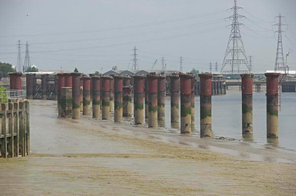
Old Bargehouse Draw Dock and Causeway
Next came three pictures showing the reverside flats just past the Old Bargehouse Draw Dock and Causeway at the end of Bargehouse Road. Until the Woolwich Free Ferry was introduced in 1889 this was where ferries ran across the river to Woolwich. On this occasion I’d cycled past the remains of the Free Ferry without taking any pictures, probably because I had photographed them on several occasions before. You can see the other two pictures of the flats on My London Diary.
I took a few pictures looking across the River Thames most of which I didn’t post on My London Diary and then this one after I’d crossed the lock gates of the King George V Dock entrance and had come to the lock entrance to the Royal Albert Dock Basin. The building here has since been replaced by the flats of Lockside Way.
The riverside path – part of the Capital Way – continues north to an abrupt end close to Atlantis Avenue and this view from its end shows the remains of the jetty which brought coal to the Beckton Gas Works. I retraced my path, taking more pictures – some concrete pipe sections, a disused lock gate and a lorry park on My London Diary and then made my way to Woolwich Manor Way.
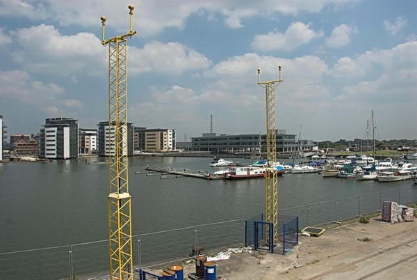
Royal Albert Dock
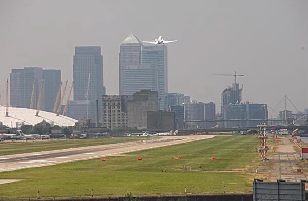
Here I could photograph across the dock. At the left are new flats built between the dock and University Way and in the foreground are two yellow towers carrying approach lights for the runway of London City Airport.
A plane takes off from London City Airport
The haze that you see in this picture, taken with a 300mm (equivalent) lens is a little more obvious than in the other pictures thanks to air pollution, which the airport contributes to.
I made some more photographs in North Woolwich – tthere was a Football World Cup taking place in Germany – England were eventually knocked out by Portugal in the quarter-finals.
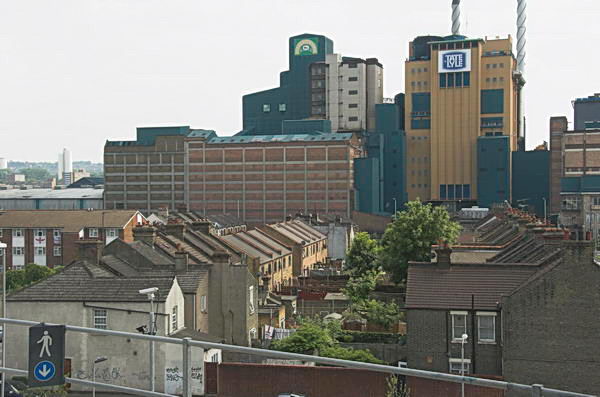
London City Airport DLR station had opened in December 2005 and I was able to take photographs from there both of the Airport Terminal and of Tate & Lyle’s sugar refinery.
Thame Barrier Park
I took more pictures in Silvertown and Canning Town, some of which you can see on My London Diary, before making my way back to Central London. There I took some more pictures around Brick Lane, some of which I put on My London Diary in a seperate post. It had been a good day for me.
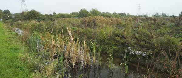
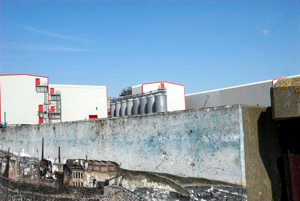
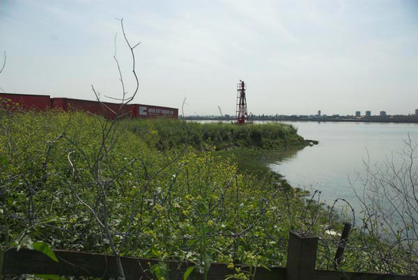
Rainham and Hornchurch: On Thursday 11th May 2006 I put my Brompton folding bike on the train for the journey across London to Rainham Station. The journey, around 31 miles in a straight line, though rather longer on the ground, took me almost two hours on three trains, one Underground. As usual I took a book to read and relaxed on the journey.
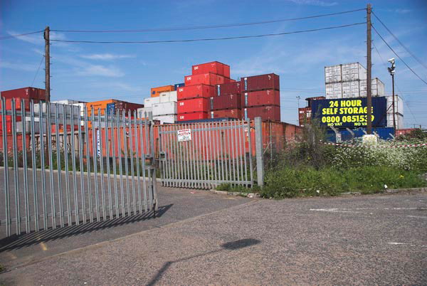
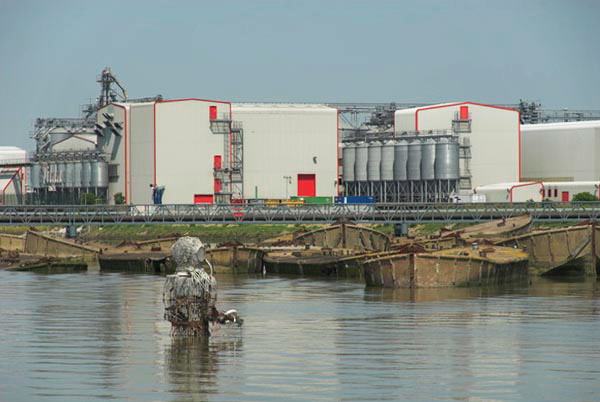
Containers on Rainham Marshes
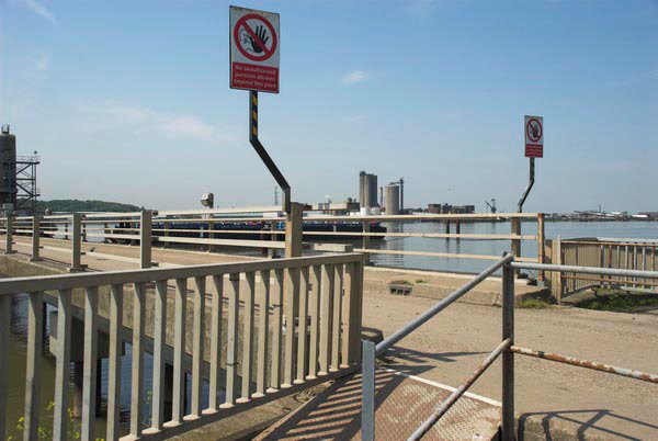
Rainham is in Havering, part of Greater London and is the last station out to the east on the C2C rail service where the Travelcard I used covered. I did several rides and walks from here into Essex over the years, but I on this one stayed inside Greater London.
Mural of previous industry in the area and Tilda Rice works
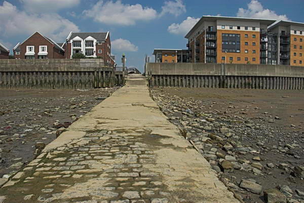
The first part of this bike ride followed the route of the London Loop path around the outskirts of London, which at that date came to a dead and desolate end at Coldharbour Point. The path now continues to end in Purfleet, and if you have the stamina you can continue walking on a riverside path which ends at Tilbury Docks before having to retrace your steps to Grays.
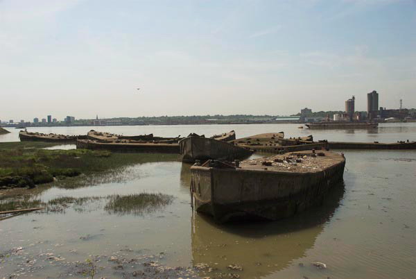
Derelict concrete barges in the Thames built for the Mulberry Harbour used for the D-Day landings
I didn’t write much about the ride back in 2006, and I didn’t ride very far. After returning from the end of the path I had a short ride west along the A13, which I don’t recommended as it is certainly not cycle friendly with much fast-moving traffic. The Mardyke Estate, where I went after that is now called ‘Orchard Village’ which at least avoids confusion with the Mardyke, a small river a few miles to the east. I continued roughly north through South Hornchurch, finally ending my ride at the District Line station of Elm Park.
The sculpture in the river facing the barges and the Tilda Rice plant is Diver: Regeneration by local sculptor John Kaufman, who died in 2002, not long after it was placed here in the mud in 2000. Some of the funding for it came from the landfill company which carried waste here to raise parts of the marshes above sea level.
Waste Transfer Jetty – Landfill is raising much of the below sea-level marshes
My pictures don’t reflect the nature of the area which has large areas of open with marshes and country parks and two rivers flowing through it, the Beam River and the Ingrebourne which flows into the Thames at Rainham Creek. I think it is also an area which has seen considerable regeneration since 2006 in the London Riverside area of Thames Gateway redevelopment.
Coldharbour Point and the barbed wire where the London Loop then ended
Here’s my account with the usual minor corrections from 2006:
Rainham is at the eastern edge of London, an area of marsh, industry, warehouses, container stacks, dereliction and landfill on the Essex (north) bank of the Thames, cut across by the elevated A13 trunk road which sweeps across the creek and on over the marshes to Purfleet, alongside the new Channel Tunnel Rail Link.
Rainham Creek from the A13
One day the Thames Path will continue past Coldharbour Point, but for the moment it’s a dead end. I eat my sandwiches and then turn back, making my way up onto the elevated roadway, but the views are disappointing.
Mardyke Estate, South Hornchurch
At the next roundabout west I take a look around, leave the main road and then head north, past disused areas of the Ford Dagenham site and up through the Mardyke Estate and South Hornchurch.
At Elm Park the heat of our first hot day if the year – 25 Celsius in the shade, but I’ve been constantly in sun – gets to me and I give up and take the Underground towards home.
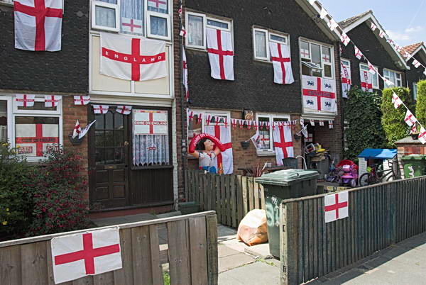
One of many houses decorated for the Cup Final. Unfortunately West Ham lost to Liverpool
The heat has buckled some of the rails and the District Line train has to crawl along, more or less at my cycling speed, but at least I can just sit and rest.