More Thames Path – 2011

Charlton to Belvedere
More Thames Path - 2011

Charlton to Belvedere
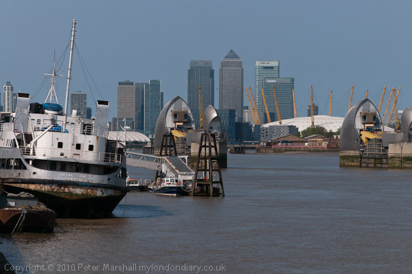
The view upriver from Charlton with the Thames barrier, Dome and Canary Wharf

Charlton to Belvedere: On Monday 25 April 2011 I went with my wife and elder son on a walk from Charlton Station to Belvedere. They walked but I rode on my folding Brompton bike as I was still suffering from plantar fasciitis and walking any distance became too painful.
More Thames Path - 2011

Charlton to Belvedere
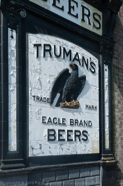
A derelict pub in Charlton

As a cyclist any pressure is on the ball of the foot, with no weight at all on the heel and arch where the pain can be intense. Gel insoles help a little for walking and I was still managing to photograph events, but longer – and faster – walks were still completely out of the question for me.
More Thames Path - 2011

Charlton to Belvedere
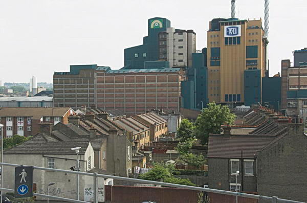
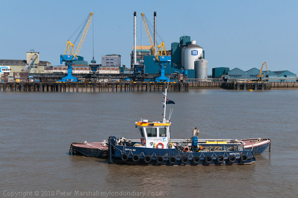
Tate & Lyle in Silvertown

I’d been to see my doctor who was sympathetic and told me that physiotherapy might help, but given the waiting list for appointments the pain would probably have gone away before I got one. But there were exercises that could help – and after I had spent a few months rolling a baked bean tin back and forth under my heal while having breakfast the pain did eventually go away.
More Thames Path - 2011

Charlton to Belvedere
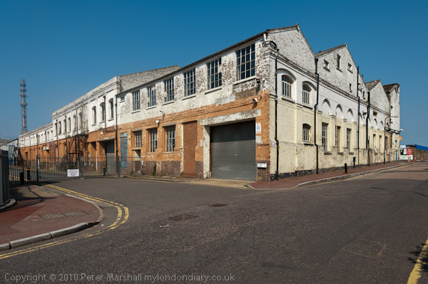
Warspite Rd/Bowater Rd SE18

The bike was a great idea. Linda and Sam were fast walkers and intent on getting to our destination, while as a photographer I kept stopping and sometimes wandering a little to one side to get into the right position to take pictures. Then I would see them a couple of hundred yards ahead and would need to run to catch up. So much easier on the bike.
More Thames Path - 2011

Charlton to Belvedere

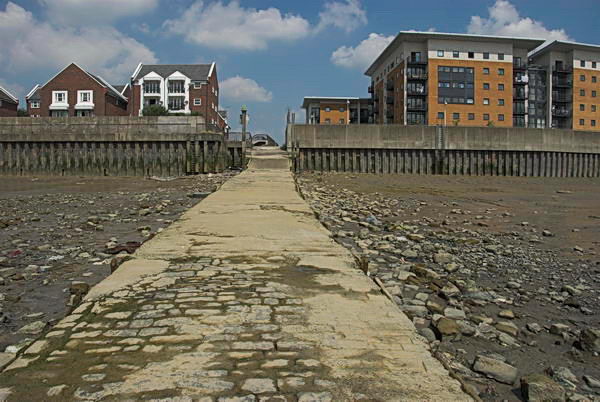
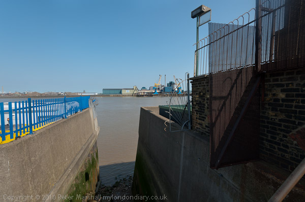
I took advantage of my bike to make some longer than normal diversions, at one stage cycling down a road to reach the river where there was no riverside path but riverside steps. I had a scary moment here, walking out on a ledge to get a better view I lost my balance and began to shake uncontrollably in front of a 10 foot drop onto the concrete steps and rubble of the foreshore. Fortunately I managed instead to grab hold of a rail behind me and after holding it for a few seconds steady myself enough to edge back to safety. I was only too aware of a history of photographers falling to their deaths while ‘getting a better view’.
More Thames Path - 2011

Charlton to Belvedere
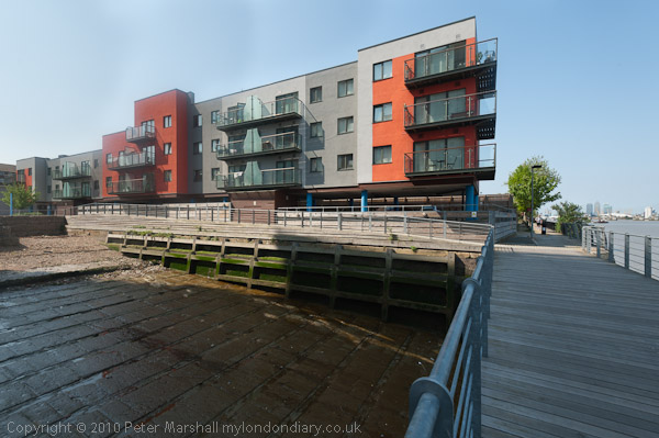
Recent flats on the former Royal Dockyard at Woolwich

Eventually I stopped shaking and was able to get back on my bike and hurry after the others. And no, I didn’t tell them what had happened and they still won’t know about it unless they read this.
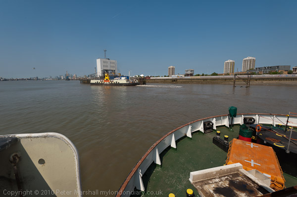
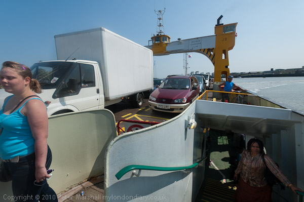
We were on the John Burns, named after the great trade unionist and Labour politician who called the Thames ‘liquid history’.

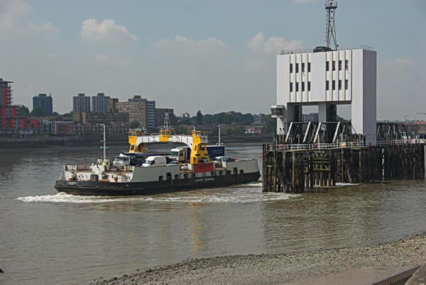
At Woolwich we took a ride across on the Free Ferry. Folding the Brompton I could walk past the ‘No Bicycles’ sign and go below deck with the others. I’d hoped we could return by the tunnel, but it was closed so we had a short walk in North Woolwich and a second ferry ride.
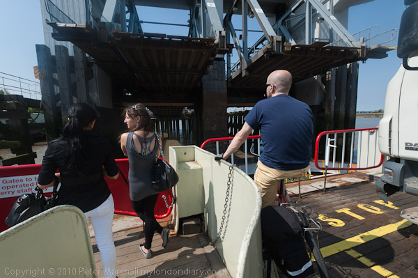
Coming back to Woolwich I kept on the vehicle deck. Bikes get to ride off before the cars.

When the Thames Path was declared a National Trail and then opened in 1996 it ended at the Thames Barrier. Our walk in 2011 began at Charlton station so only the first short section was on that and beyond we were walking the Thames Path Extension. I had previously walked all of this route, and further on as far as Cliffe. If you have the stamina you can now continue all the way to the Isle of Grain though a bike would really be a good idea. Perhaps one day I’ll do it.

The Royal Arsenal site, once an official secret is now a tourist destination, complete with various sculptures, including Peter Burke‘s Assembly
There are glimpses of the river and these waste transfer barges though trees and over bushe and Beckton on the opposite bank
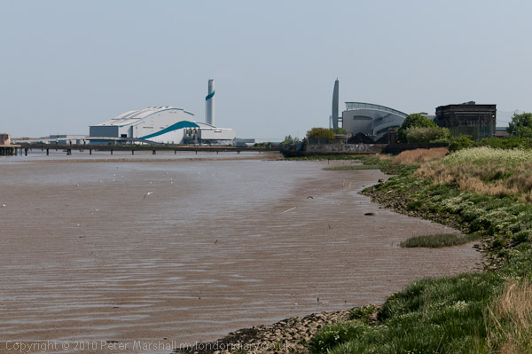
One of the larger tributaries of the Thames is the treated outfall from Beckton sewage works at left. close to Barking Creek
Waste incinerators and the Bazalgette pumping station
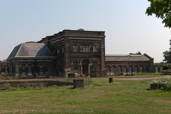
The Romanesque Crossness Southern Outfall Works opened in 1865, pumping sewage out when the tide would take it seawards
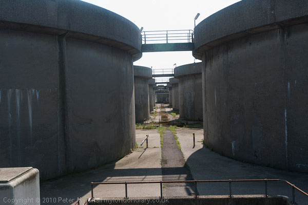
Part of the more utilitarian 1950s sewage treatment plant at Crossness
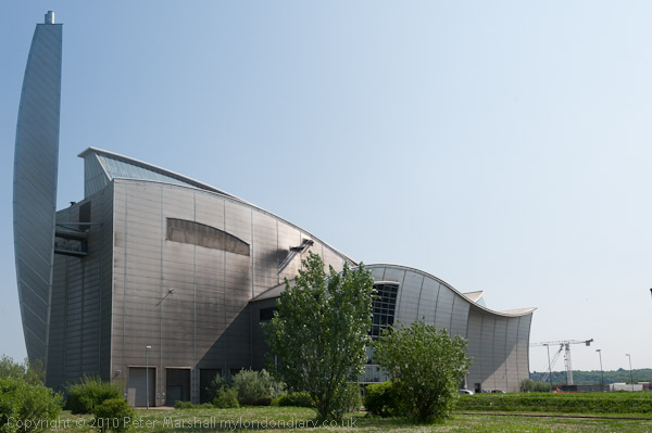
The 1998 sludge incinerator, an elegant swan-like metal structure
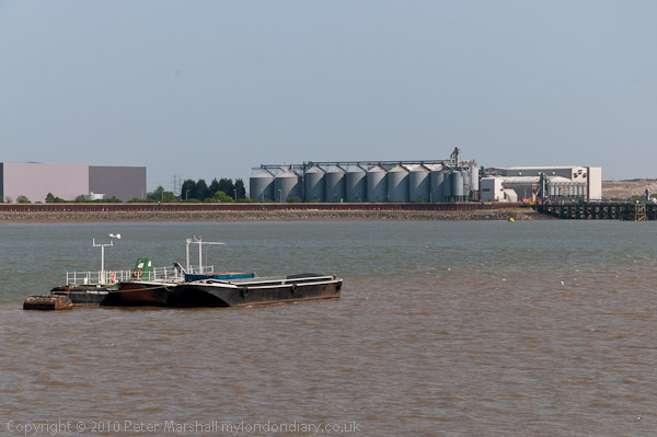
Looking downstream to silos at Rainham

On this ‘walk’ I gave up here and cycled to Belvedere station to get home for a meeting in the evening, while the two walkers continued to the Darent and then walked back to Slade Green station.

Many more pictures on My London Diary from the walk and the ferry at More Thames Path.


FlickrFacebookMy London DiaryHull PhotosLea ValleyParis
London’s Industrial HeritageLondon Photos

All photographs on this page are copyright © Peter Marshall.
Contact me to buy prints or licence to reproduce.


Woolwich Riverside and Royal Artillery

Woolwich Riverside and Royal Artillery: More pictures from my walk around Woolwich in August 1994

Waste Land, Woolwich Church St, Woolwich Ferry, River Thames, Woolwich, Greenwich, 1994, 94-807-42

This area, previously occupied by engineering works, has now been redeveloped with a luxury development of tall housing blocks on Mast Quay, “A magnificent crafted living space with panoramic views of the River Thames.”

Entrance, Woolwich Foot Tunnel, Woolwich, Greenwich, 1994, 94-809-13

As well as getting a free ferry, Woolwich also got a foot tunnel under the River Thames, opened by the London County Council in 1912. The tunnel is just over 500 meters long and remains delightfully cool on hot summer days.

Many cyclists also use the tunnel despite bylwws prohibiting cyclists. Electronic signs were installed in 2016 which used a computerised system to measure traffic and messaged ‘No cycling allowed‘ in red at busy times but ‘Please consider pedestrians‘ in green when the tunnel was fairly empty. Greenwich council was in favour of changing the bylaws to legalise this, but Tower Hamlets refused and the system was discontinued. Many cyclists still ride.

The tunnel provides a useful route across the river, particularly when the ferry is out of action, but most times I’ve used it one of both of the lifts at each end have not been working. I’ve never counted the steps but there are rather a lot of them, particularly when going up.

River Thames, Woolwich, Greenwich, 1994, 94-809-21

Downstream from the ferry in what in 1994 was I think an open area, once the site of Woolwich Power Station, demolished in 1978-9 though the coaling jetty in this picture is still there. There is still a riverside walk but most of the site is now occupied by tall blocks of flats.

River Thames, Woolwich, Greenwich, 1994, 94-809-22

A bridge here links the former coaling jetty with the riverside path.

From Riverside Path, Woolwich, Greenwich, 1994, 94-809-33
Steps from Riverside Path, Woolwich, Greenwich, 1994, 94-809-33

This area is now covered by tall flats, though there is a small segment of parkland with fountains.

Mural, Thames Barrier, Woolwich, Greenwich, 1994, 94-812-65

I cannot remember exactly where I found this mural of the Thames Barrier in Woolwich and I think it was soon demolished.

Royal Artillery Memorial, St George's Garrison Church, Grand Depot Road, Woolwich, Greenwich, 1994, 94-812-52
Royal Artillery Memorial, St George’s Garrison Church, Grand Depot Road, Woolwich, Greenwich, 1994, 94-812-52

Built for the garrison in 1862-3 it was hit by a V1 flying bomb in 1944 and the church was largely destroyed by fire. In 1970 more of the building was demolished but a canopy roof added to protect the apse and its polychromatic Victorian brick and decorations, with a memorial garden added in the former nave. It was listed in 1973. In 2011 it was transferred out of military ownership and since then there has been some restoration work, partly lottery funded.

Cannon, Royal Artillery Barracks, Woolwich, Greenwich, 1994, 94-808-32

The barracks was the home of the Royal Artillery from 1776 until 2007. Its 1,000 foot long Georgian frontage is said to be the longest in Europe if not the world. Since 2007 most of it has been rebuilt behind this, and in 2016 the Ministry of Defence announced plans for all army units to move out by 2028.

The cannon is the “17.75-ton Bhurtpore gun, captured by Field Marshall the Viscount Combermere after the 1826 siege of Bhurtpore” and brought here in 1828. When the Royal Artillery moved out they took this and four other cannons with them, doubtless a vital part of our country’s defence.

More from 1994 to come.


FlickrFacebookMy London DiaryHull PhotosLea ValleyParis
London’s Industrial HeritageLondon Photos

All photographs on this page are copyright © Peter Marshall.
Contact me to buy prints or licence to reproduce.


More From the Woolwich Free Ferry – 1994

More From the Woolwich Free Ferry: I went on the ferry across to North Woolwich, taking pictures while I was on the ferry, I think mainly in black and white.

Woolwich Ferry, River Thames, Woolwich, Greenwich, 1994, 94-810-51

Taken while I was waiting at Woolwich for vehicles and passengers could come off the ferry.

Woolwich Ferry, River Thames, Woolwich, Greenwich, 1994, 94-811-42

At North Woolwich while vehicles were still driving off and foot passengers were boarding for the journey to Woolwich.

Riverside Path, River Thames, North Woolwich, Greenwich, 1994, 94-810-12

I got off the ferry at North Woolwich and took a short walk along the riverside path, making this picture and then returning to catch the ferry back. This screw was in the path. The ferry terminal is at right.

Woolwich Ferry, River Thames, Woolwich, Greenwich, 1994, 94-810-32

I don’t know whether the pictures below on the ferry were made on the outward or return journey.

Woolwich Ferry, River Thames, Woolwich, Greenwich, 1994, 94-810-33
Woolwich Ferry, River Thames, Woolwich, Greenwich, 1994, 94-810-41

Soon I was back in Woolwich and taking more pictures there – to be in a later post.

The Woolwich Ferry

The Woolwich Ferry: Continuing my walk in Plumstead and Woolwich in August 1994 I came to the Woolwich Ferry and couldn’t resist taking a ride across the river on it. And since I wanted to continue my walk in Woolwich, rather than in North Woolwich, I stayed on the ferry to come back.

Woolwich Ferry, River Thames, Woolwich, Greenwich, 1994, 94-808-41

There had almost certainly been a ferry across the Thames at Woolwich at least since the Norman Conquest, though the first written reference by name only came when it was sold together with a house by William de Wicton to William atte Halle for £10. In the early years of the 19th century there were three Woolwich Ferry Acts (1811, 1815 and 1816) establishing a commercial ferry.

These were passed in particular for the movement of troops and supplies from Woolwich Arsenal across the river. From 1846 there was also a rail connection from North Woolwich to Stratford and eventually there were three steam ferries on the route

Woolwich Ferry, Ambulance Station, River Thames, Woolwich, Greenwich, 1994, 94-807-11

After the Metropolitan Board of Works (MBW) was created in 1855 it had taken over toll bridges in West London and made them free to use. People to the east of London in Greenwich and Woolwich argued that they should also be able to cross the river without paying. Eventually in 1884 the MWB agreed and tasked Sir Joseph Bazalgette to oversee the provision of approaches, bridges and pontoons for the ferry. These were built by the still familiar name of Messrs Mowlem in 1887-9. (The company is no longer; having got into financial difficulties it was acquired by its rival Carillion in 2005.)

Woolwich Ferry, River Thames, Woolwich, Greenwich, 1994, 94-807-12

The London County Council was established on 21st March 1889, two days before the Free Ferry was due to open and so it was Lord Roseberry, the LCC’s first chairman who led the huge procession and festivities to the new ferry terminal in Woolwich and announced to a crowd of thousands “The free ferry is open to the public.

There was only one paddle steamer working the ferry that weekend and it must have got very crowded. As well as those in Woolwich , “the Great Eastern Railway Company carried 25,000 people to its North Woolwich terminus, most of whom were intent on riding the ferry.”

Woolwich Ferry, River Thames, Woolwich, Greenwich, 1994, 94-807-13

The initial fleet of two paddle steamers soon became three and were replaced by newer paddle steamers in the 1920s. It was these that inspired the story and wonderful illustrations by Charles Keeping in his 1968 children’s classic ‘Alfie and the Ferryboat (1968), very much enjoyed a few years later by myself and my two boys. So of course we had to come to Woolwich and I took my first crossing with them in the early 1980s.

Woolwich Ferry, Ambulance Station, River Thames, Woolwich, Greenwich, 1994, 94-807-11

But by the time that book was published the paddle steamers had gone, replaced from 1963 by the diesel-powered double ended James Newman, John Burns and Ernest Bevin which enabled vehicles to drive up newly built causeways with hinged bridges and drive directly onto the ferries, greatly speeding up the loading. As they were double-ended vehicles could also drive off forwards on the other side and the ships did not need to reverse. They were steered from a central bridge over their roadways.

Woolwich Ferry, River Thames, Woolwich, Greenwich, 1994, 94-807-12

The ferries in my pictures continued in service until 2018, when the ferry closed down for four months waiting the arrive of replacements. These have had various problems with London May Sadiq Khan apologising and saying the new vessels “aren’t good enough.”

Woolwich Ferry, River Thames, Woolwich, Greenwich, 1994, 94-807-13
Woolwich Ferry, Ambulance Station, River Thames, Woolwich, Greenwich, 1994, 94-807-22

I had just missed the ferry and spent it walking around the area and taking pictures.

Woolwich Ferry, Ambulance Station, River Thames, Woolwich, Greenwich, 1994, 94-807-33

All of the pictures before this one have been of a vessel not in use, moored at Woolwich but in this picture you can see one ferry at the North Woolwich terminal and another approaching Woolwich, and I hurried up the approach to catch it. In my next post from 1994 I will include some pictures I made on the ferry.


FlickrFacebookMy London DiaryHull PhotosLea ValleyParis
London’s Industrial HeritageLondon Photos

All photographs on this page are copyright © Peter Marshall.
Contact me to buy prints or licence to reproduce.


Plumstead Panoramas – 1994

Plumstead Panoramas: More colour panoramas from my walk in Plumstead in August 1994.

Lakedale Rd, Tewson Rd, Plumstead, Greenwich, 1994, 94-806-62

Plumstead is a hilly place, rising quite steeply from the River Thames as I remember from my first visit to the area when still in short trousers, trudging up a long hill holding my mother’s hand to visit some distant relatives, whose names I no longer remember, nor exactly where they lived. Their back garden went up steeply behind the terrace house.

I don’t think it was this road was the one I walked up back then, but it was still hilly and you can see the houses going down on both sides and I think in the distance to trees and buildings on the other side of the river.

Park, Plumstead Common, Plumstead, Woolwich, Greenwich, 1994, 94-809-61

The previous picture was taken just a few yards from Winn’s Common, one of several areas also including Bleak Hill and The Slade which make up Plumstead Common. I think this is close to Lakedale Road and shows the foundations of a building with beyond it the rose garden in the next picture.

Park, Plumstead Common, Plumstead, Woolwich, Greenwich, 1994, 94-808-13

I made several other pictures on Plumstead Common, though I can’t remember exactly where on the common this was and can find no traces now of this sunken garden with walkways which must once have been covered by plants and flowers but seem to have left in a semi-derelict state, though there are still some rose bushes.

Plumstead Common, Plumstead, Woolwich, Greenwich, 1994, 94-808-23

Here I deliberately tilted the panoramic camera to give a curved horizon rather than try to level it with a spirit level as I usually did, partly to include the lower edge of the bushes and small trees, but also to create a kind of enclosed space.

Across the common is a pub, the Woodman, one of the 5 Plumstead Common Idlers, ‘the Woodman who never felled a tree’ at 35 The Slade.

“The Star which doesn’t shine in the sky,
the Woodman who doesn’t cut down trees,
the Ship that cannot sail the seas,
the Mill which doesn’t grind corn,
and Who’d a Thought it!”

Radnor Crescent, Plumstead, Woolwich, Greenwich, 1994, 94-809-62

Radnor Crescent is some distance to the east on the edge of Winn’s Common and I’m not sure exactly which direction I was looking to make this picture, perhaps looking towreds Shooters Hill.

Waste Land, Woolwich Church St, Woolwich Ferry, River Thames, Woolwich, Greenwich, 1994, 94-807-42

From here I walked to Woolwich and the Woolwich Ferry. More pictures from Woolwich in a later post.


FlickrFacebookMy London DiaryHull PhotosLea ValleyParis
London’s Industrial HeritageLondon Photos

All photographs on this page are copyright © Peter Marshall.
Contact me to buy prints or licence to reproduce.


North Woolwich Photos – 2006

North Woolwich Photos: My account of my day on Friday 16 June 2006 is rather short – and manages to include a mis-spelling: “I took a trip to North Woolich and made some pictures there.” And the 45 pictures I posted had only the additional heading “North Woolwich, Thames, Royal Docks & Silvertown” but no captions. I think they deserve more, so I’ll correct that for a few of them in this post.

North Woolwich Photos - 2006
Woolwich Ferry, North Woolwich, 2006

The ferry is the James Newman, built in 1963 and named after a prominent local figure who was Mayor of Woolwich in 1923–25 and was taken out of service in 2018. But I hadn’t arrived on the ferry but had put my folding bike onto a Silverlink service on the North London Line which then ran from Richmond to North Woolwich Station (the section from Stratford to North Woolwich close at the end of 2006.)

North Woolwich Photos - 2006

The building in the background of the second image is North Woolwich Station, though it had by that date been abandoned by trains which stopped being used as a station in 1979, replaced by a considerably less grand and basic structure on its south side. For some years it was a museum and this fine 1854 building is now home to the New Covenant Church. My picture is taken from the riverside path.

North Woolwich Photos - 2006
Old Bargehouse Draw Dock and Causeway

Next came three pictures showing the reverside flats just past the Old Bargehouse Draw Dock and Causeway at the end of Bargehouse Road. Until the Woolwich Free Ferry was introduced in 1889 this was where ferries ran across the river to Woolwich. On this occasion I’d cycled past the remains of the Free Ferry without taking any pictures, probably because I had photographed them on several occasions before. You can see the other two pictures of the flats on My London Diary.

North Woolwich Photos - 2006

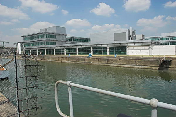
I took a few pictures looking across the River Thames most of which I didn’t post on My London Diary and then this one after I’d crossed the lock gates of the King George V Dock entrance and had come to the lock entrance to the Royal Albert Dock Basin. The building here has since been replaced by the flats of Lockside Way.

North Woolwich Photos - 2006

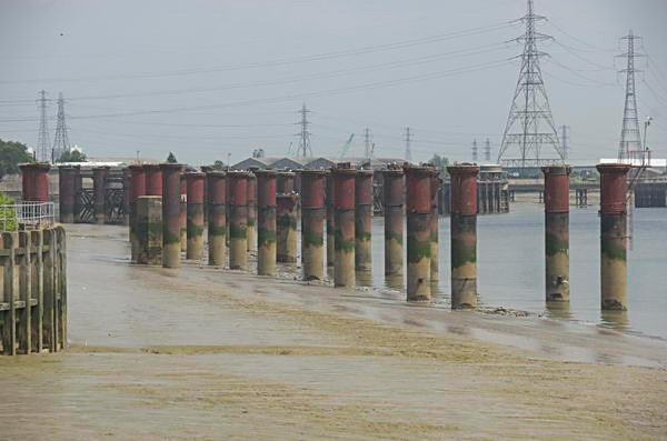
The riverside path – part of the Capital Way – continues north to an abrupt end close to Atlantis Avenue and this view from its end shows the remains of the jetty which brought coal to the Beckton Gas Works. I retraced my path, taking more pictures – some concrete pipe sections, a disused lock gate and a lorry park on My London Diary and then made my way to Woolwich Manor Way.

Royal Albert Dock

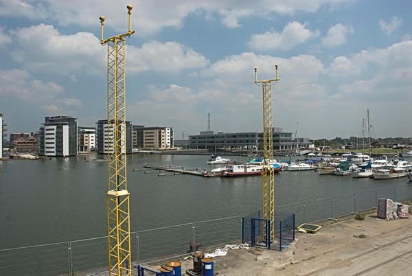
Here I could photograph across the dock. At the left are new flats built between the dock and University Way and in the foreground are two yellow towers carrying approach lights for the runway of London City Airport.

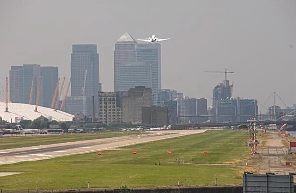
A plane takes off from London City Airport

The haze that you see in this picture, taken with a 300mm (equivalent) lens is a little more obvious than in the other pictures thanks to air pollution, which the airport contributes to.

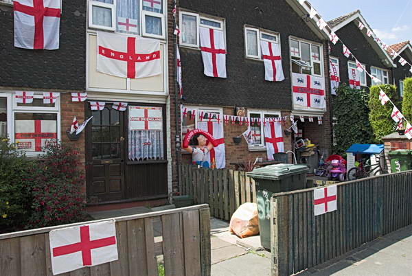
I made some more photographs in North Woolwich – tthere was a Football World Cup taking place in Germany – England were eventually knocked out by Portugal in the quarter-finals.

London City Airport DLR station had opened in December 2005 and I was able to take photographs from there both of the Airport Terminal and of Tate & Lyle’s sugar refinery.

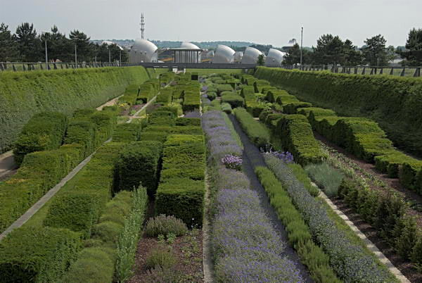
Thame Barrier Park

I took more pictures in Silvertown and Canning Town, some of which you can see on My London Diary, before making my way back to Central London. There I took some more pictures around Brick Lane, some of which I put on My London Diary in a seperate post. It had been a good day for me.

More pictures:
North Woolwich, Thames, Royal Docks & Silvertown
Brick Lane


FlickrFacebookMy London DiaryHull PhotosLea ValleyParis
London’s Industrial HeritageLondon Photos

All photographs on this page are copyright © Peter Marshall.
Contact me to buy prints or licence to reproduce.


Stratford, Woolwich & Chelsea

Stratford, Woolwich & Chelsea
Perhaps the only thing these three parts of London really have in common was that I photographed in them in the last few days of July 1988. The first two were on a family visit to the railway museum then at North Woolwich station, largely for the benefit on my two sons, then aged 12 and 9, and both with a real interest in railways and had decide on this as a birthday outing for the elder. I think we probably had a few of their friends with us, some in the second picture below.

Stratford Station, Stratford, Newham, 1988 88-7m-34-positive_2400
Stratford Station, Stratford, Newham, 1988 88-7m-34

North London Line, Stratford Station, Stratford, Newham, 1988 88-7m-35-positive_2400
North London Line, Stratford Station, Stratford, Newham, 1988 88-7m-35

And once we were in North Woolwich it would have been a shame to miss the free ride across the River Thames on the Woolwich Ferry. One of their favourite books when younger had been Alfie and the Ferryboat, by Charles Keeping, published in 1968 Keeping, born close the the Thames in Lambeth tells the story of a small boy from Woolwich crossing the river on the ferryboat to ‘the other side of the world’ in search of his old sailor friend Bunty and his dog.

Woolwich Ferry, North Woolwich, Newham, 1988 88-7m-24-positive_2400
Woolwich Ferry, North Woolwich, Newham, 1988 88-7m-24

Keeping was a superb and innovative illustrator and the book is perhaps his best work. Copies of it are now hard to find and rather expensive.

Woolwich, Greenwich, 1988 88-7m-12-positive_2400
Woolwich, Greenwich, 1988 88-7m-12

The ferry that Alfie took was one of the same that we took, which were introduced in 1963 – the John Burns, Ernest Bevin and James Newman, double-ended ships with powerful diesel engines which were replaced in 2018 after 55 years on the run.

I only made twelve black and white pictures on this trip, along with three in colour, probably too occupied with herding 12 year-old boys than photography, and getting them all back to a birthday tea on the other side of London.

Moorings, River Thames,Cheyne Walk, Worlds End, Chelsea, Kensington & Chelsea, 1988 88-7m-14-positive_2400
Moorings, River Thames, Cheyne Walk, Worlds End, Chelsea, Kensington & Chelsea, 1988 88-7m-14

Days are long in July, and four days later I began taking pictures on Battersea Brdige and then a short walk in Chelsea.

Crosby Hall, Cheyne Walk, Chelsea, Kensington & Chelsea, 1988 88-7n-02-positive_2400
Crosby Hall, Cheyne Walk, Chelsea, Kensington & Chelsea, 1988 88-7n-02

Probably I had looked at pictures I had taken earlier in the year and decided there were some I would like to retake, or perhaps found some things I had missed. I spent a lot of time on researching the areas I was photographing, which was much harder before the days of the world wide web – and many of the books I had to rely on were years out of date, often pre-war or even older.

Sir Hans Sloane, memorial, Chelsea Old Church, Cheyne Walk , Chelsea, Kensington & Chelsea, 1988 88-7n-62-positive_2400
Sir Hans Sloane, memorial, Chelsea Old Church, Cheyne Walk , Chelsea, Kensington & Chelsea, 1988 88-7n-62

I think I may not have got a picture – or not one I liked of this memorial to Sir Hans Sloane (1660-1753), an Anglo-Irish doctor and collector who travelled widely to France and the Caribbean, where he supposedly invented drinking chocolate as well as giving a harrowing account of the sadistic punishments inflicted on slaves and married the wealthy widow of one of the larger slave owners.

Her money from slavery and his income from a doctor and investments in property and slave trading companies enabled him to build up a collection of 71,000 items which he left to the British Nation. These provided the foundation of the British Museum, the British Library and the Natural History Museum.

Christchurch St, Chelsea, Kensington & Chelsea, 1988 88-7n-55-positive_2400
Christchurch St, Chelsea, Kensington & Chelsea, 1988 88-7n-55

But after taking around thirty pictures the next (not on-line) shows a view from the back of two women on a station escalator, with the next frame on the Commercial Road in Limehouse. I think I will have taken the Underground from Sloane Square to Tower Hill and walked to Tower Gateway for the DLR which had opened in 1987 to Limehouse. But pictures from my longer walk from there will be in a further post.


Click on any of the pictures to see a larger version in my album 1988 London Photos, from where you can browse the rest of the album.