1995 Colour – Greenwich Meridian: The second of a series of posts on my colour work, mainly in London, from 1995, 35 years ago and when I’d been working extensively with colour negative film for ten years, though still continuing to work with black and white.

In 1992 I began making colour panoramas using a Japanese Widelux F8 swing lens panoramic camera – and later I used a Russian Horizon which gave similar results. Both worked with normal 35mm film but produced negatives that were a little under 60mm wide rather than the 36mm of normal cameras. Both use clockwork to swing the taking lens around a third of a circle exposing the film through a narrow slit behind the lens. The film was held in a curved path – again around a third of a circle – with the lens at the centre of the circle so that the lens to film distance remained constant.

This arrangement avoided the change in distance from the lens to film that gives some stretching of the subject towards the edges of the frame – and begins to become very noticeable in ultra-wide lenses, particularly wider than around 18mm focal length on a 35mm camera.

Using the curved film plane avoids this distortion and enables a much wider field of view, while using a fairly moderate focal length – the Widelux has a 26mm f2.8 lens and gives negatives 24x56mm with a horizontal angle of view of 123 degrees.

But there is a downside. Creating the image in this way gives a curvature to objects which is unlike our normal vision which is particularly noticeable on any straight lines, though lines parallel to the axis the lens rotates around remain straight – so if you hold the camera level, verticals will remain straight. But other lines become curved with the effect increasing away from the image centre, giving what is often called a “cigar effect“.

This is a constraint which makes composition far more difficult using a swing lens camera, and was not helped by a rather poor viewfinder on the Widelux. Usually for landscape work I tried to visualise the effect of the curvature and chose a suitable camera position, levelled the camera on a heavy Manfrotto tripod using the spirit level on the camera top plate, lining the camera up using two arrows on the top plate to show the extent of the view (more accurately than the viewfinder) and then pressing the cable release to make the picture.

For photographing events and some creative effects this is a camera you can use handheld, but you have to remember that even when using its fastest speed of 1/250 second the camera actually takes quite a lot longer to scan around the curved film.

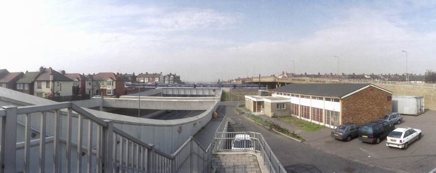
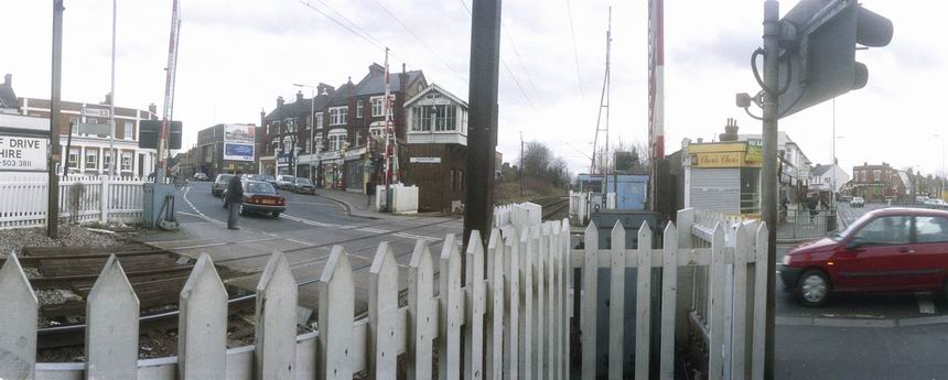
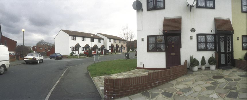
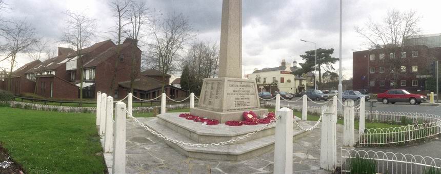
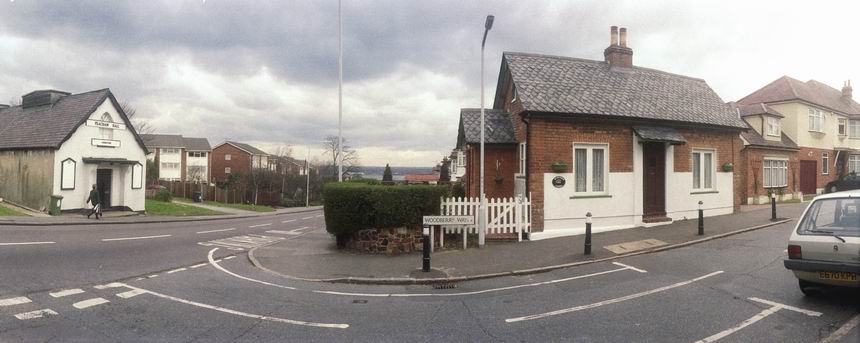
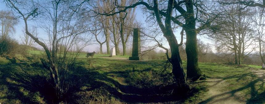
These pictures are from a project I began in 1995 with the approaching Millennium in mind. It seemed to me to make sense to carry out a project based on the Greenwich Meridian.

So I set about walking the Meridian, photographing it at various points in London and used some of these pictures in an attempt to get public funding for a Meridian Walk with some markers in pavements and a web site and publication. Panoramic images seemed a very appropriate format for illustrating the line.

Unfortunately my grant application as usual was unsuccessful, but I did go on to take some more photographs. In 2009 others produced a Greenwich Meridian Long Distance Path covering all of the Meridian in England from Peacehaven to Sand La Mere which of course goes through London and we also have The Line Sculpture Trail. Quite a few more Meridian markers were also added in London since I made this walk.
Many more panoramas from my Meridian project and other colour images from 1995 in the album 1995 London Colour.
Flickr – Facebook – My London Diary – Hull Photos – Lea Valley – Paris
London’s Industrial Heritage – London Photos
All photographs on this page are copyright © Peter Marshall.
Contact me to buy prints or licence to reproduce.