It wasn’t of course the last time I went to Wandsworth – I was even back there a couple of weeks ago, walking through the same areas, though much of it now hardly recognisable.
West Hill Primary, School, Broomhill Rd, Wandsworth, 1990, 90-3c-25
The school building is locally listed and its address is 5 Merton Road, but this is the view from Broomhill Road.
London Theatre School, Chapel Yard, Wandsworth, 1990, 90-3c-26
On a second image I made of this building I can just about make out the inscriptions on the frontage as at left ‘Erected 1573, Enlarged 1685 and on the right ‘Repaired 1809 – 31, Rebuilt 1882’. You can read all four plaques lower on the building on the London Remembers site.
This is Wandsworth Chapel and possibly the site was first used by Huguenots, though perhaps only rather later than this. Another plaque lower down mentions a Dutch congregation but from 1713-87 this was the ‘French Church.’ Later from 1809 it was Congregational and a plaque states they continued to use it for mission work until 1939 after moving to a new church on East Hill in 1860. Its history reflects the many immigrants who settled in Wandsworth and set up industries along the Wandle using its water and the power it could generate.
The current building with a hall which could hold 500 people opened in 1883 and is locally listed. Since housing the London Theatre School it became the National Opera Studio.
Pizza Delivery, Scooters, Wandsworth High St, Wandsworth, 1990, 90-3e-65
Pizza Delivery began in the UK in the mid-1980s, but back in 1990 you had to phone for a pizza, with on-line ordering only becoming widespread in the late 1990s. It was still fairly unusual in 1990 and HIPPO PIZZA with this row of five scooters ready and waiting for a call was something of a pioneer.
Entrance, Car Wash, Wandsworth High St, Wandsworth, 1990, 90-3e-66
‘Welcome, Please Drive In’ for a ‘Guaranteed Complete Clean’. At at right someone sits waiting. There is still a ‘HAND CAR WASH’ here on the High Street.
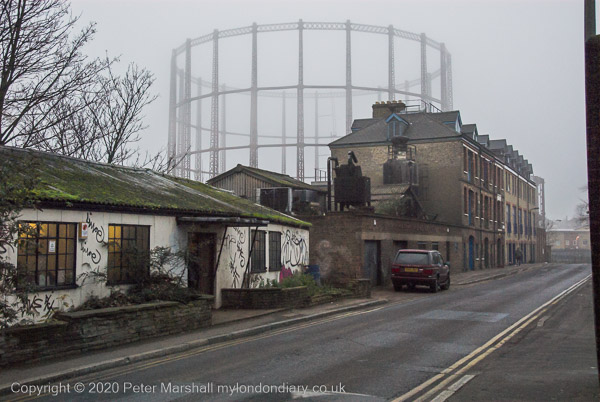
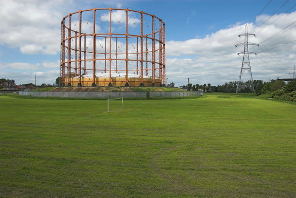
Gas Holder, Armoury Way, Wandsworth, 1990, 90-3e-51
I walked up Ram Street again to Armoury Way and took a few more pictures of the gas holder – which I’ve written more about in earlier posts about this walk.
Gas Holder, Armoury Way, Wandsworth, 1990, 90-3e-53
I think I then looked at my watch and hurried to Wandsworth Town Station taking no more pictures to catch a train rather than have to wait another half hour for the next one.
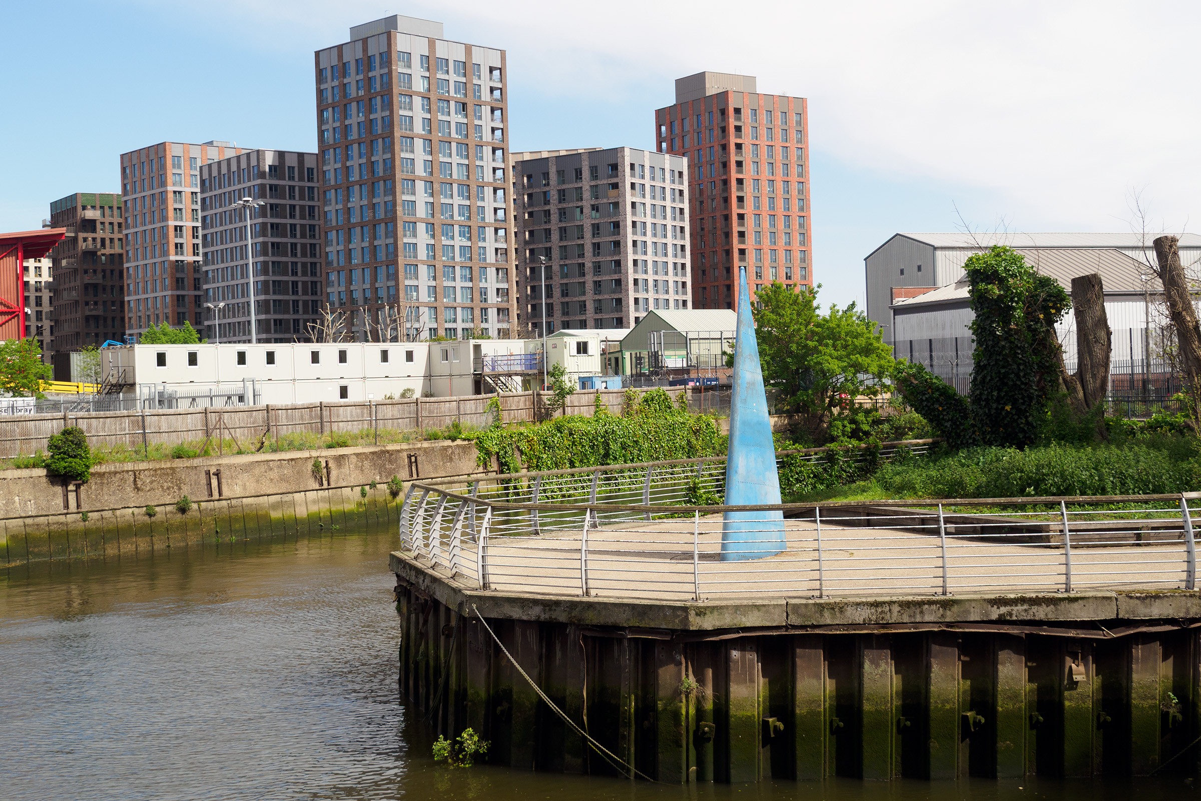
Finally, here is just one picture from the area I made on my last visit in April 2026, looking across where Bell Lane Creek and the River Wandle join. On ‘The Spit’ is a sculpture, ‘Sail’, by Sophie Horton placed there in 2003, financed by the Wandsworth Challenge Partnership. It was inspired by the sail of a dinghy, though I don’t think these have ever sailed up here. But perhaps in the new Wandle Riverside they will.
The flats are part of a new development on the former site of the Wandsworth Gasworks. And where I was standing to take this picture where there is now a riverside path leading to the River Thames was, back in 1990, part of the Shell Oil Terminal.
Courthouse Community Centre, 11, Garratt Lane, Wandsworth, 1990, 90-3b-42
This was built in 1858 apparently as one of the first courts under the 1846 County Courts Act and is Grade II listed.
It was alleged to be near-derelict in the 1970s when it was first Grade II listed and was handed over to Wandsworth Council, becoming a community centre for the Arndale Estate. Then it became the Wandsworth Museum but that was closed in 2008 to turn it into Wandworth Library. The museum was moved West Hill Library then closed in 2015. In 2014 the council decided to move the library and to sell or let the building . I think it is now offices.
Salvation Army Citadel, Ram St, Wandsworth, 1990, 90-3b-43
I crossed Wandsworth High Street and walked up Ram Street. stopping to take this view of the Salvation Army Citadel, built in 1907, but now replaced in 2008 by a more modern building. Doubtless a much more functional building its rounded lines have nothing of the military features of the old with its castellated tower.
The Wandsworth Gas Company gasholder is no longer visible. Gasholders such as this were still in use for storage and to regulate gas pressure for some years after the changeover to natural gas and the closure of our gas works. Once a common feature of our townscapes, most have now gone, with just a few of the guide frames of particular interest being listed and saved, some converted to contain flats.
I think this one was dismantled around 15 years ago, but at least until recently its base could be seen from the railway line to the north.
Gas Holder, Swandon Way, Wandsworth, 1990, 90-3a-54
A closer view of the gasholder which clearly shows the three sections which would be lifted up inside each other by the gas as more gas was pumped into the holder (and were known as lifts.) The first ‘telescopic’ gasholder was invented in 1824. This example was built in 1972 and was said to be the largest of its type in the UK. Gas was stored at only a little above atmospheric pressure
Gas Holder, Houses, Barchard St, Ram St, Wandsworth, 1990, 90-3b-44
Controversial plans were approved by Wandsworth council for the redevelopment of the gas works site to include a 29 storey tower – rather taller than the old gasholder. I think that the massive concrete base which held the water to seal the bottom of the gas holder is to be retained to save the huge environmental cost of its removal.
I rather liked the way the old gasholders – here and elsewhere – contributed to the townscape, and they were certainly local landmarks. But the Wandsworth Society and other objectors are correct to point out the main tower block of the development with a height of 29 storeys, “is quite ‘out of context’ next to the River Wandle. The site of the tower cannot be considered to be a ‘town centre’ site nor is it close to a ‘cluster’ of buildings of a similar nature. The application cannot be considered to ‘make a positive contribution to local character and context’“.
Gas Holder, Armoury Way, Wandsworth, 1990, 90-3b-31
A final picture of the gas holder.
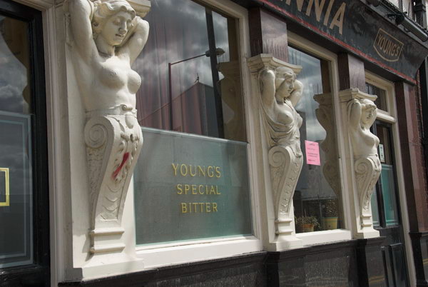
Ram Brewery, River Wandle, Wandsworth High St, Wandsworth, 1990, 90-3c-12
The rest of the area north of the town centre has also seen massive redevelopment, though at least the major historic elements of the Ram Brewery have been retained – and now contain the Sambrook Brewery.
Here you can see one of the more modern parts of the brewery, which looked more like a chemical plant than how I imagine real beer being made.
The area is now covered by large bocks of around 4-7 storeys and I think the only thing visible in this image that remains is the brewery chimney. There is now a walk alongside the Wandle, but little of interest to see from it.
Ram Brewery, River Wandle, Wandsworth High St, Wandsworth, 1990, 90-3c-15
Young’s beers are now brewed by Carlsberg Marston’s Brewing Company in Bedford, though they have re-branded them to include London in their names.
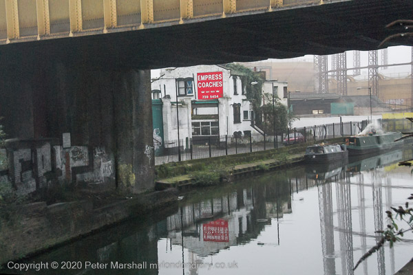
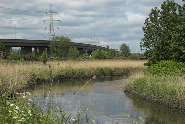
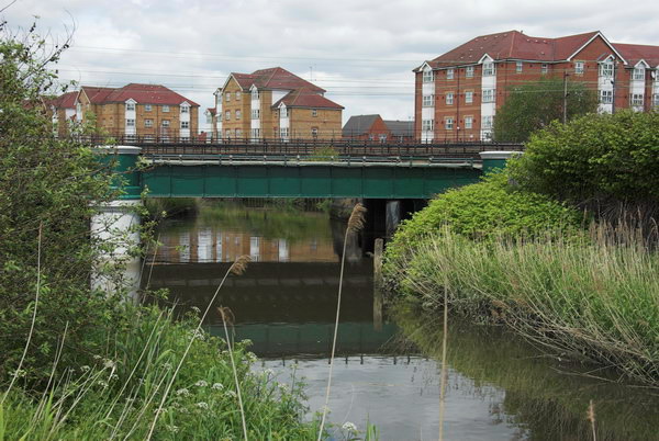
River Wandle, Armoury Way, Wandsworth, 1990, 90-3b-32
More From Wandsworth: My walk on Sunday 4th March 1990 had begun at Clapham Junction in Battersea with St John’s Road & East Hill, Battersea and I had continued into Wandsworth with the post Mont Nod and Old York Road – Wandsworth 1990, ending with a view of York Road from the platform of Wandswoth Town Station.
Wandsworth Tyre Service, 543, Old York Rd, Wandsworth Town, Wandsworth, 1990, 90-3a-52
I didn’t catch a train but came back down the stairs and on to York Road walking west along it. The Wandsworth Tyre Service was on the corner with Tonsley Hill and was one of many shops along the York Road, a kind of minor high street. There are still shops, but their character has changed greatly; this is now Pad Thai Story, the first of three authentic Thai restaurants set up by three Thai friends, here and in Battersea and Hammersmith and apparently highly recommended with, for London, reasonable prices. Back in 1990 I think the culinary peak of Old York Road was probably a fish and chip shop.
Next door, in what was then a doctor’s surgery is now a florist; there are a variety of other food outlets as well as several estate agents and a few more useful shops in a a fairly typical gentrified street.
According to various estate agents, this area, sometimes know as Tonsley for the several streets including this name, is one of Wandsworth’s most sought-after locations. An informative blog tells me “Tonsley Hall, the residence of Sir Richard Blackmore, the physician and poet who died in 1729… was pulled down in about the middle of the nineteenth century” but I cannot find why the house was given the name Tonsley.
The Grapes, 39, Fairfield St, Wandsworth, 1990, 90-3a-53
I walked down to Fairfield Street – the fair field was in the area to the north of Old York Road. Merrie England in the Olden Time published in 1841 states:
 "Wandsworth Fair exhibited sixty years ago Mount Vesuvius,
 or the burning mountain by moonlight, rope, and hornpipe-
 dancing; a forest, with the humours of lion-catching;
 tumbling by the young Polander from Sadler's Wells; several
 diverting comic songs; a humorous dialogue between Mr.
 Swatehall and his wife; sparring matches; the Siege of
 Belgrade, &c. all for three-penee!

 On Whit-Monday, 1840, Messrs. Nelson and Lee sent down a
 theatrical caravan to Wandsworth Fair, and were moderately
 remunerated. But the “Grand Victoria Booth” was the rallying
 point of attraction. Its refectory was worthy of the
 ubiquitous Mr. Epps—of ham, beef, tongue, polony, portable
 soup, and sheep's trotter memory!

 Cold beef and ham, hot ribs of lamb, mock-turtle soup that's
 portable,

 Did blow, with stout, their jackets out, and made the folks
 comfortable!"
But this was perhaps one of the last days of the fair.
The pub is still open and is Grade II listed public house described as an early/mid-19th Century building and so was probably there in the closing years of the fair a few yards away.
Gas Holder, Swandon Way, Wandsworth, 1990, 90-3a-54
According to the Wandle Industrial Museum, the Wandsworth Gas Company was established at a meeting at the the Spread Eagle Inn in Wandsworth in 1834 and was producing gas by the following year. By the 1920s it had grown into one of the largest London Gas companies, with coal being brought in barges to the canal basin close to the mouth of the Wandle. From 1906 colliers delivered coal to it on the Thames and the company produced some of the cheapest gas in London – making it particularly popular with balloonists.
At nationalisation in 1949 the company supplied an area of 160 square miles and had a fleet of six upriver colliers bringing over half a million tons of coal a year. Gas production ceased in 1970, but the gas holder continued in use for storage for many years.
Estate agents variously describe this building as being built between 1930 and 1949 or 1967 to 1975, but whatever its date of completion it was built in a 1930s Streamline Moderne style as my picture shows. Its a style which has attracted a large degree of architectural snobbery over the years, including in the great Pevsner Buildings of England series. I suspect it probably dates from the post-war rebuilding of Wandsworth, but would welcome correction.
Wandsworth Town Hall, Fairfield St, Wandsworth, 1990, 90-3a-42
By contrast, the to my mind rather pedestrian Wandworth Town Hall is both Grade II listed and described in detail in the listing and on other web sites. I think the architectural details are of far more interest than the overall building, built in 1935-7 to the designs of Edward A Hunt. I turned away to the east and didn’t then photograph the south side of the building on Wandsworth High Street, perhaps the buildings more interesting aspect with a fine “bas relief frieze depicting events in Wandsworth’s history by David Evans and John Linehan.”
P G Marshall & Sons, Tonsley Hill, Wandsworth, 1990, 90-3a-45
One of the main Tonsley streets, this had a particular interest for me, as although there are many Peter Marshalls, some rather more famous than me, this was possibly the first time I had been greeted by my initials when walking the streets of London. So far as I am aware this P G Marshall was no relative. But the business ‘Purpose Made Joinery‘ also had some resonance – among his many trades, before my father became self-employed he had worked as a joiner around 1920 when motor vehicle bodies were still often made of wood.
Of course the coincidence of initials was not the only reason I stopped to take this picture. The railings with their spears beside the steps and the jagged edge above the side gate also appealed.
Gate, Geraldine Rd, Wandsworth, 1990, 90-3a-24
I crossed East Hill and went down Geraldine Road admiring the brickwork and decoration of the house on the corner (my photo not digitised) which I think was then home to the probation service. I think this wrought iron gate was on the detached house on the corner of Eglantine Road which now has a rather different but still attractive fence and gate and the veranda with slim iron columns.
On the corner of Geraldine Road and Rosehill Road I found this row of harshly pollarded trees stretching down the road with the tall thin Greek Revival tower of Robert Smirke’s Grade II* listed St Anne’s Church, Wandsworth in the distance down Rosehill Road.
My next post about this walk will begin with two more pictures of this church.
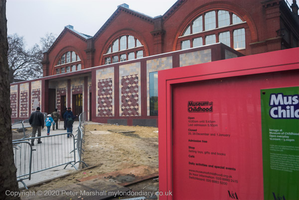
A Murky Solstice in Bethnal Green – Quite a few years earlier I’d photographed some of the panels on the south side of the Museum of Childhood next to Museum Gardens on Cambridge Heath Road.
The Grade II listed iron-framed building was originally part of the extensive museum complex in South Kensington built in South Kensington in 1856-7, but was taken down in 1865-7 when the V&A building there was extended and reassembled in Bethnal Green where it opened as Bethnal Green Museum in 1872.
Since then it has gone through a number of identities as a museum, housing agricultural products and works of art, then an art museum with a growing children’s collection, and in 1974 it became the Museum of Childhood. Renovated and extended in 2005-6 it work on this was just finishing though it had reopend when I took these pictures. It closed again in 2019 to be transformed into ‘Young V&A’.
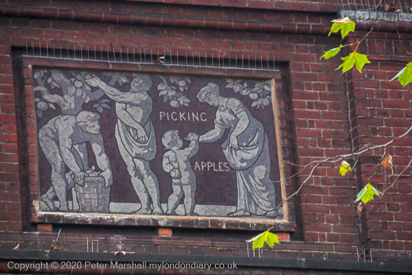
My interest was in the mosaic panel in each bay facing the park illustrating agriculture and the arts and sciences which had been designed by F.W. Moody, the Instructor in Decorative Art at the National Art Training School and responsible for much decoration at the V&A and elsewhere in South Kensington and assembled by his female students in the South Kensington Museum mosaic class.
I’d been asked to supply a picture of these mosaics to be used in the book ‘The Romance of Bethnal Green’ by Cathy Ross, ISBN 978-1-901992-74-8 along with some of my other pictures I’d taken on film in the 1980s and 90s, but I wasn’t happy with the quality of the film image.
So after lunch on Thursday 21st December 2006 I set out for Bethnal Green to make a replacement digital image using my Nikon D200. But I hadn’t really worked out how long it would take me to get there across London and that the sunset was at 15.53. Nor that it was a rather dull day with some slight fog in the city. By the time I was on site it was decidedly gloomy.
But there was enough light for me to made a decent job of it with the digital camera, taking the colour images in this post (and more) which I later converted to black and white for publication. And after taking these pictures I took a walk up Cambridge Heath Road to the Regents Canal and made a few more pictures around there before
Here’s the paragraph I wrote at the time:
Thursday was a cold dark day, the mercury hanging on zero and grey in the air, a fog which never quite cleared. I needed just one more picture for the project on Bethnal Green and emerged from the Underground half an bour before the shortest day of the year officially turned to night. Having done what I had to do, I kept walking as it got darker still, and more lights came on.
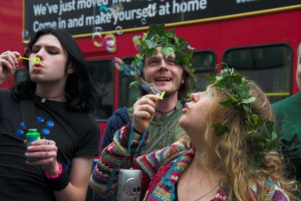
Beltane, Chariot Festival, Barking & Whitechapel: I had an interesting and varied day at events and places across London on Sunday 28th May 2006, taking rather a lot of photographs. Appropriately for a Sunday I covered two religious events.
Pagan Pride – Beltane Bash – Holborn
My working day began at Holborn, having caught a fairly early train into London. Now I like to relax a bit on Sundays, but for many years I often came up by the first train to take photographs. Though it wasn’t that early on Sundays, departing around 8am.
I took a bus from Waterloo to Holborn and walked the few yards to the Conway Hall at the north-east corner of Red Lion Square.
Here (with corrected capitalisation) is what I wrote about this event on My London Diary in 2006.
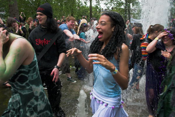
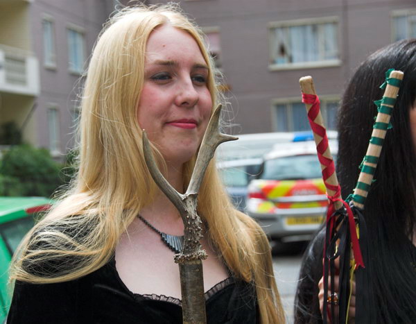
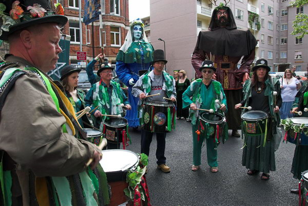
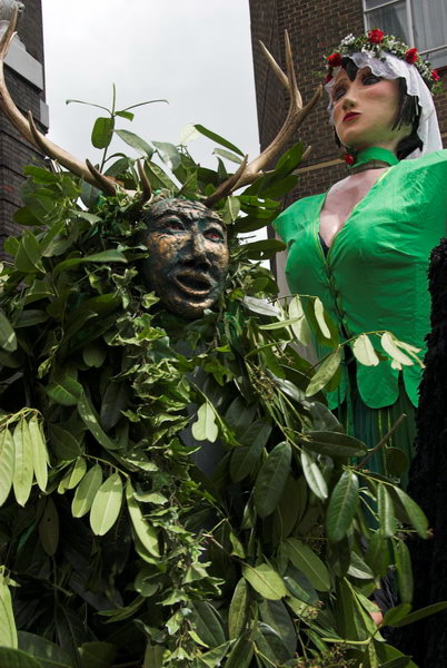
The Pagan Pride Parade in Holborn is now a regular annual event, a part of the Beltane Bash that takes place in the Conway Hall in Red Lion Square. Mostly it was the same people as last year, but I found it hard to get into the mood to take pictures.
As usual the parade was led by Jack In The Green – a dancing bush – the Green Lady and the Bogies. The Giants included the Morrigan (in green and flowers to welcome summer) with Black Ravens, Old Man Thunder and Old Dame Holder, along with the rest of it.
Dancing round the fountains was energetic, but somehow for me the event didn’t really get going, and lacked any real climax, people just slowly began to fade away.
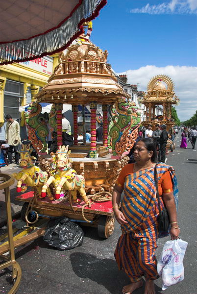
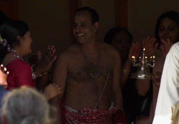
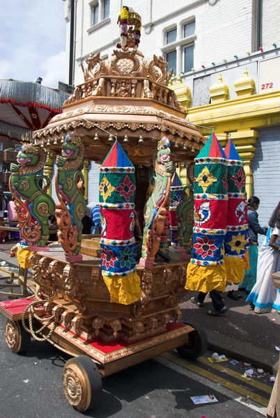
Chariot Festival, Sri Mahalakshmi Temple – East Ham
Those taking part in the Pagan Pride parade began to make their way back to Conway Hall for the rest of their day of events, but I rushed to Holborn underground station to take the Central line eastwards, changing at Mile End to get to East Ham. But I had stayed too long with the pagans.
The Sri Mahalakshmi Temple had been built in 1989 and opened and was almost opposite the station. Before that Hindus and worshipped at a converted shop on the corner of Kensington Avenue and High Street North, around 300 yards north from the station.
Unfortunately I had arrived too late and the procession on the streets had ended, though I was still able to photograph the chariots outside and a few of the people. I made a mental note to come back and cover this event another year, but although I photographed other chariot festivals including one in Manor Park, East Ham, I’ve never returned for this one.
I was in East Ham and the afternoon lay ahead; it was a fine day and I decided this was a great opportunity to take a walk a little further to the east by the River Roding. I took a few pictures of the chariots, then went to walk along by the River Roding and to photograph a new development by the railway in Barking.
The half-mile walk along unkonwln was rather uninteresting. It’s a long suburban street lined with terraces of working class housing from the early twentieth century on both sides, named for the family who once owned the estate on which it was built. As Stephen Benton points out in his London Postcode walk it has one small claim to fame, and almost every famous pop guitarist from the the 70s and 80s – including those from the Beatles, Rolling Stones, Yardbirds, The Who as well as musical failures like me will have started with Bert Weedon’s ‘Play in A Day – Guide to Modern Guitar’, first published in 1957. Weedon (1920-2012) was born here, though he had probably moved away long before he became famous.
The path led on to Watson Ave, with a view of the Leigh Road gasholder in what is now the derelict Leigh Road Sports Ground. The Barking Gas Works opened here in 1836 but was purchased in 1912 by the Gas Light and Coke Company, who closed it as they had the much larger and more economical works they had opened at Beckton in 1870. But the holder remained and was I think still in use by the North Thames Gas Board possibly until the change from coal gas to natural gas. The area around it became their sports ground.
At the end of Watson Ave is a long footbridge which took me over the North Circular Road, from which I took a few pictures before going through an industrial estate.
I made quite a few pictures in the Tanner Street area, where a considerable amount of new development was taking place.
I told myself I would return here later, but I don’t think I’ve done so yet.
I think I had travelled back from Barking on a Hammersmith & City line train and needed to change soemwhere to the District Line. Having got off the train I decided I had time for a short walk around on before needing to continue my journey. I only taok a few pictures, perhaps making 20 exposures, and there are only four pictures on My London Diary.
Bromley-by-Bow – July 1988. My previous post on my walk on Sunday 31st July 1988 ended at Watts Grove off Devons Road, and I spent some time exploring the area around here and in Bow Common and Bow.
All Hallows, Church, Devons Rd, Bow, Tower Hamlets, 1988 88-7s-45
The church of All Hallows on Devons Road was funded by the Clothworkers’ Company who got the money from the site of All Hallows Staining, demolished except for its tower in 1873. That tower, now Grade I listed, is still there just off Mark Lane, next to St Olave’s Church Hall. They paid for a church by architect Ewan Christian, completed in 1874. Unfortunately this was badly damaged by bombing, and only its core remained in the new church on the site by A P Robinson completed in 1955 in an ‘Early Christian’ style. The church has its address on Blackthorn St and is not yet listed.
There was still a tyre shop, though no longer J R Tyres, at 119 Devons Road in 2021, though I think this end of the row of shops is currently being rebuilt. Some years since I made this picture this shop had previously been rebuilt, its ground and upper floor losing their late Victorian frontage.
The Widow’s Son, The Bun House, pub, Devons Rd, Bow, Tower Hamlets, 1988 88-7s-32
The Widow’s Son has the distinction of being the only listed building in the South Bromley Ward of Tower Hamlets, though I suspect its Grade II* listing reflects the legend associated with it – of the widow’s son who joined the Navy to fight Napoleon and wrote telling his mother he would be home for Easter and told her to cook a hot cross bun and have it waiting for him. He never came, but every year on Good Friday she baked a fresh bun for him, and a large collection was found hanging in a net from the ceiling beams of her cottage after her death.
The Widow’s Son, commonly known as the Bun House, was built on the site of her cottage, and the net containing the buns, was hung above the bar, with a sailor from the Navy adding another each year on Good Friday. From some time in the 1990s the buns were baked and supplied by Mr Bunn’s Bakery, a family-run business a few miles away in Chadwell Heath.
The pub was built around 1848, and its single bar largely retains its fittings from around the 1870s. It closed and was put up for sale in 2016, but was reopened in time for Bun Day in 2017 and was refurbished with new kitchens in 2019 and is more a pub/restaurant. I think it reopened after a further temporary closure due to Covid, but haven’t been able to check personally.
Joe’s Auto Spares, Cantrell Rd, Bow, Tower Hamlets, 1988 88-7s-34
Joe’s Auto Spares were in a railway arch immediately west of the Cantrell Road Bridge, where there are still businesses in the arches, though many are now being priced out as railway arches – such as those in the centre of Brixton – are redeveloped and re-let at much higher rents.
I walked into the southern end of Tower Hamlets Cemetery Park to take a wider view showing the railway bridge and Joe’s Auto Spares, with one of the two remaining gasholders of Bow Common Gasworks behind. The gasholders, long redundant, were only demolished a few years ago and the site is now a development of around 1450 homes, a new sixth form centre, some commercial uses and a new area of open space.
Car spares, Cantrell Rd, Bow, Tower Hamlets, 1988 88-7s-36-positive_2400
I couldn’t resist taking another picture of the scrapyard beside the railway which has featured in a previous post. The site is now a part of the Tower Hamlets Cemetery Park.
Walking back towards the east I came to Rounton Road, where a row of late Victorian houses was being demolished. I think the tower block just visible in the background is probably Gayton House just off of Knapp Rd. The whole area around Rounton Road has been redeveloped.
Lozinki Ltd, an engineering company helpfully give their address as Rounton Ropad, Bow, and their site is now Miami Car Wash. Through the railway brdige you can see Navenby Walk. The tree is also still there.
The railway bridge, as well as the brick building are still there but the writing on the wall for H Barnett & Co, as well as the Vehicle Spares sign have gone and the wall and street sign both replaced. The building, obviously much altered by the brickwork, is a sub-station for the railway with a bridge carrying cables across to the tracks at its rear.
I still had a lot of wandering to do – so there will be further posts from my walk around Bow.
There were several reasons I used to like going to this area of North Kensington to make photographs, one of which was that when people asked me where I had been I could tell them I’d been to the North Pole, which was just down past the end of Barlby Rd on North Pole Rd. Sadly the North Pole was bought by a property company in 2012 who turned the upper floors into flats and soon closed the pub which became a Tesco Express around 2015.
The Pall Mall Deposit and Forwarding Co became a limited company in 1899, with premises just off Regent St, and built this large storage facility to the design of W G Hunt in 1911 (the often given date of 1901 is most probably a much-quoted typo.) Furniture storage was quite big business at the time as a large proportion of the more affluent lived in rented houses, often moving frequently. The building extends some way back from Barlby Road and has been a rather trendy centre for offices, studios etc, selling itself as close to Portobello Road.
Ladbroke Hall, Clement-Talbot Motor Works, Barlby Rd, North Kensington, Kensington & Chelsea, 1988
Barlby Road was also the location of the first purpose built English car factory, the Clement-Talbot Motor Works built from 1903-11, architect William T Walker. According to Cherry and Pevsner (London 3 : North West) this reinforced concrete building used the Hennebique system, but for the office building fronting the road this was well-disguised by “a festive Wrennaisance front”.
Kensal House, Ladbroke Grove, North Kensington, Kensington & Chelsea
North of the Great Western mainline, which bisects the area, is its greatest architectural gem, Kensal House, built in 1936 by Maxwell Fry leading a small group of like-minded architects. Even in the rather run-down state I photographed it, the ensemble is impressive. It’s and impressive modernist building and rather more functional than some, and the low cost flats included what were for the time some very up-to-date features.
Kensal House, Ladbroke Grove, North Kensington, Kensington & Chelsea
The site was developed by the Gas Light & Coke Company who owned the site and the adjoining gas works to provide housing for their employees – 54 three-bedroom and 14 two-bed flats- and virtually everything – down to the irons – was gas powered. Of course gas lighting was still very common – and in my youth there were still many older people who preferred its more gentle light. But as built there was no electricity in these gas company flats.
Kensal House, Ladbroke Grove, North Kensington, Kensington & Chelsea
As well as two large blocks of flats the site also contained a nursery, with a curved frontage that ran around the former site of a gas holder. One of those who worked with Fry on the designs was social reformer Elizabeth Denby who had also worked with him at the Peckham Health Centre.
Kensal House, Ladbroke Grove, North Kensington, Kensington & Chelsea
The gas works have gone, with Sainsbury’s and Argos in their place, but the railway remains. Some of these flats must have been great places for train spotters, but the Kings and Castles thundering past might have upset the sleep in those days of single glazing and poor sound insulation. And gas works did produce some fairly noxious odours and pollution, though if they provided your living that probably seemed less of a problem.
Kensal Green Basin, Grand Union Canal, Paddington Branch, North Kensington, Kensington & Chelsea, 1988
You can still see Kensal Green Basin when you go to get your shopping at Sainsbury’s on Canal Way, though it is largely well hidden behing bushes around the car park and seems an missed opportunity – as do many of the planning decisions in this area. A large and ugly canalside building now straddles its entrance from the canal. Further along Canal Way there are still a couple of gas holders at the west end of the gas works site.
At left is the Grade II listed St Charles’ Hospital in Exmoor St, built in 1881 as the St Marylebone Union Infirmary. Surprisingly it is still in medical use, providing mental health services and as a community health centre. Part of the building are rather more attractive than this view suggests. John Nodes and Sons Ltd provided a very handily based funeral service.
Barlby Rd, North Kensington, Kensington & Chelsea, 1988
Finally back to Barlby Rd, and a terrace of houses still present close to Ladbroke Grove. On the left you can still see one of the gas holders of the Kensington Gas Works, and to the right of the block the Great Western Mainline and one of the blocks of Kensal House.
As usual there are a few more pictures from my walks around the area in 1988 in the album, and clicking on any of the pictures here should take you to a larger version in the album from which you can move through it to see all those I have put online.
All photographs on this and my other sites, unless otherwise stated, are taken by and copyright of Peter Marshall, and are available for reproduction or can be bought as prints.