Thames Path – Cholsey to Shillingford – 2010

Thames Path – Cholsey to Shillingford: Pictures from a walk on Saturday 3rd April 2010 in South Oxfordshire from Cholsey station to a bus stop in Shillingford, mainly along part of the Thames Path, though with a few added detours, both voluntary and involuntary.

Thames Path - Cholsey to Shillingford - 2010

The Thames Path was officially opened in 1996, though I’d walked and cycled much of it in and around London many years earlier before and had made a very minor contribution to the consultation during its planning. I’d also photographed much further to the east along the Estuary on much of its English Coast Path extension from Woolwich to the Isle of Grain.

Thames Path - Cholsey to Shillingford - 2010
Brunel’s Moulsford Railway Bridge had earlier in the day taken us to Cholsey

From the early 1990s together with my wife and one or both my sons we often made walks in the South-East, including along the River Lea, the Pilgrims Way, the Grand Union Canal, the London Loop as well as various unnamed routes largely along public footpaths throughout the year and in all kinds of weather.

Thames Path - Cholsey to Shillingford - 2010

In the early 2000s we decided we would try to walk the parts of the Thames Path to the west of London, where we had only walked a few short sections, bought a guide to the path and a series of OS maps. We were still walking in other areas as well and it was not until April 2013 that we finally covered the section of the walk to the source.

Thames Path - Cholsey to Shillingford - 2010
Oxford University boat house at Wallingford was deserted – they were at Putney for the Boat Race

One of the reasons it took us so long was that we relied on public transport to get us to the river and back home at the end of each day’s walk. So the walk had to be divided up for us into short sections ending at a station or a bus stop and the further west we walked the scarcer these became. We managed to get a little west of Oxford a day at a time, but beyond Duxford (a short walk from Hinton Waldrist which had a bus service) there seemed to be nowhere we could sensibly reach or return to by public transport before or after a day’s walk.

Thames Path - Cholsey to Shillingford - 2010

In 2013 we did complete the walk, booking a couple of nights bed and breakfast on the way to the source to do so.

Thames Path - Cholsey to Shillingford - 2010

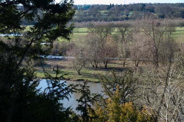
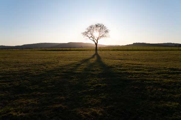
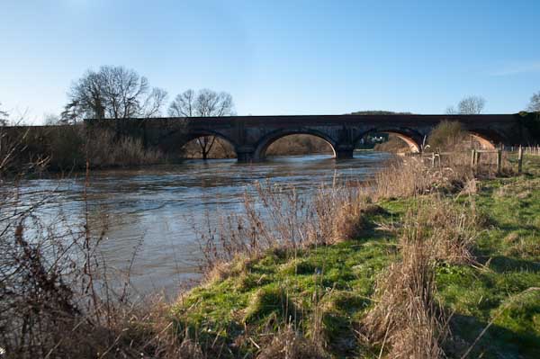
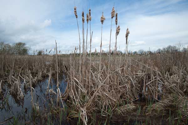
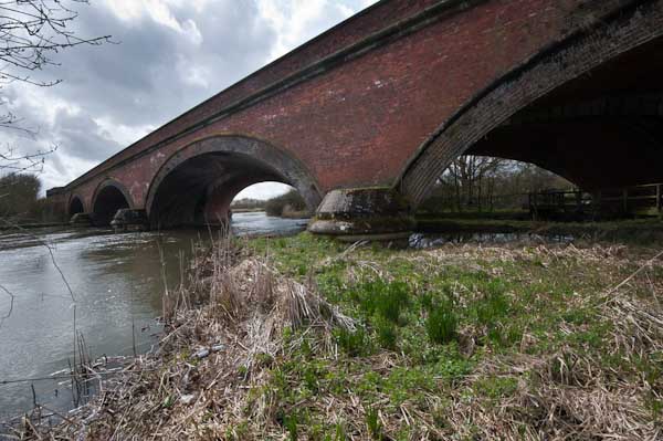
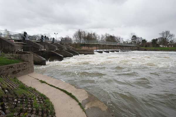
But back to April 2010. We travelled to Cholsey by train, changing at Reading, an easy and relatively short journey – less than an hour and a half. Cholsey isn’t on the Thames Path but it was only around a mile to walk to it, and then down to Moulsford Railway Bridge on the Thames itself.

War Memorial in the town centre (another detour from the path)

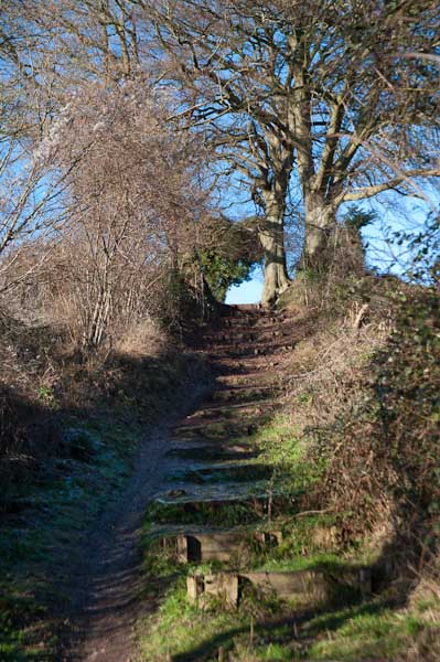
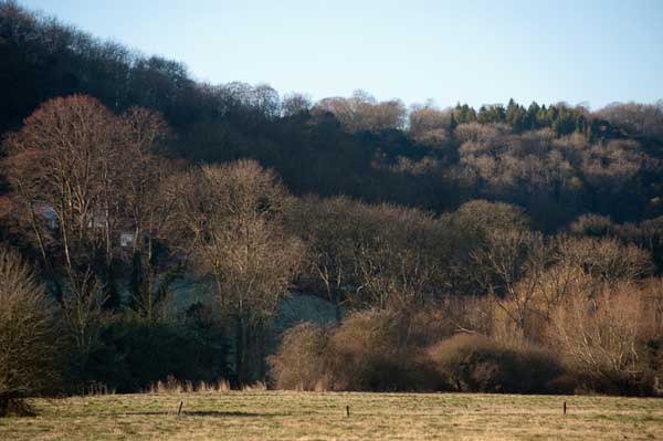
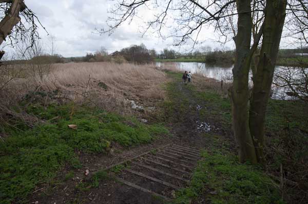
I’ll spare you the details of the walk though these are given at some length in the pictures and text on My London Diary – and of course in many text and online publications on the Thames Path.

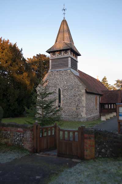
Wallingford, the only major town on this section of the Path is well worth a visit – back in the day it had been “the most important town in Berkshire and had its own Royal Mint from the 10th to 13th centuries. Devastated by the Black Death, it became prosperous again in the 18th and 19th century with the river allowing it to trade with London and supporting thriving malting, brewing and ironfounding industries.”

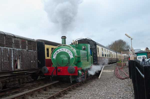
But then came the railways and all Wallingford got was a short branch line, “now a preserved railway where I was dragged a rather tedious kilometre or so to see Ivor the Engine pulling out of the station on the edge of town.”

At Benson we crossed the river by a footbridge over the weir

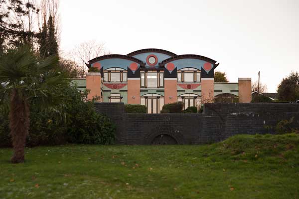
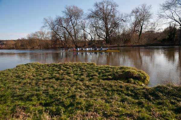
We did also manage to miss the path in Wallingford, and make an interesting diversion before retracing our steps. We saw few other walkers, but in the Summer parts of the Thames Path get pretty crowded. But one advantage of following a national trail like this is that they are well waymarked and also never overgrown, though there are sometimes diversions.

Preston Crowmarsh

[Near to home we have one of these diversions in Egham, where a small bridge has been officially blocked since early 2024 and is expected to remain closed until at least 2026. The damage looks relatively minor and many walkers have continued to use the bridge despite the barriers erected.]

Shillingford Bridge

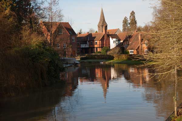
Above Wallingford the Path crosses to the opposite band of the river and goes to Benson and on to Shillingford. Here we walked away from the river to a bus stop and stood waiting for the Express bus to Reading at that time a roughly hourly service – and took an hour to get to Reading Station. Or at least I stood waiting but Linda decided to go for a walk and I had to stand in the bus doorway and persuaded the driver to wait as I shouted at her to rush towards us.

Thames Path- Cholsey to Shillingford


FlickrFacebookMy London DiaryHull PhotosLea ValleyParis
London’s Industrial HeritageLondon Photos

All photographs on this page are copyright © Peter Marshall.
Contact me to buy prints or licence to reproduce.


Thames Path – Pangbourne to Cholsey

I grew up not far from the Thames, though rather more of my young days were spent playing in and around one of its tributaries, the River Crane both in the wilder areas of Hounslow Heath and to the north and in the rather tamer Crane Park, where I caught tiddlers, sticklebacks which were destined to die in jam jars, and learnt that small boys on bicycles were faster than irate whistle-blowing park keepers.

Thames Path - Pangbourne to Cholsey

But the river was there, a formidable barrier protecting us in Middlesex from the wilds of Surrey, though we occasionally crossed it on bridges and ferries, perhaps to go to Kew Gardens in search of plant specimens. This was before the days of garden centres, and my father, a keen gardener carried scissors in his waistcoat pocket and would occasionally take a small cutting from gardens as we walked past or visited, or find seeds. Gardeners where we lived didn’t buy seeds – they saved them and swapped them with others.

Thames Path - Pangbourne to Cholsey

And the Thames was the river where I learnt to swim, if only badly, with a paddling pool and a swimming area with a springboard in the riverside park, The Lammas. Later I learnt to row at Isleworth, in a heavyweight Sea Scout boat – and we swam there too, despite the filthy oily state of the mud and water.

Thames Path - Pangbourne to Cholsey

Older and wiser I kept to the riverside paths, walking them both in Middlesex and Surrey and also out to the east of London, sometimes taking my family with me, but also on walks with other photographers and on my own. And when plans were being made in the 1980s for a Thames Walk I made a few suggestions on the proposed path of what in 1989 became the Thames Path.

Far more of the river in London is now accessible to the public than back in the 1970s and 80s when much of the riverside was still a working area, though many of the wharves were derelict. But as I found when I joined a small group led by a Tower Hamlets official with responsibility for footpaths, parts of the path on the north bank were still not always easy to access, with developers and residents erecting gates and barriers and making some parts appear private. Some years later The Guardian in 2015 published Privatised London: the Thames Path walk that resembles a prison corridor which showed that little had changed.

But like many others, my family has now walked the Thames Path, from the Thames Barrier at Charlton to the source in Gloucestershire, as well as some way to the east along both shores. Most of the path proper is readily accessible by public transport and can be done as a series of one-day walks, travelling and returning from from our home in Staines or from London. But for the final three days of walking we had to spend a couple of nights in hotels on the route.

At Streatley the path goes through a small lake

At the start of 2010, we spent both New Years Day and January 2nd walking two short sections of the walk, from Reading to Pangbourne on Friday 1st and returning to Pangbourne on the Saturday to walk to Cholsey. Both Cholsey and Pangbourne have stations with trains to Reading, so access was easy, although Cholsey station is over a mile from the Thames Path.

The pictures here are all from Saturday 2nd January, on what is perhaps the most scenic stretch of the Thames Path. It was a bitterly cold day, which was perhaps as well, as the parts of this section would have been very muddy and a little flooded. But the mud was frozen and most of the ice on the flooded parts was thick enough to take our weight. It was more pleasant walking across the ice than it would have been wading through the few inches of mud and freezing water, almost certainly just deep enough to overtop my walking boots.

At the start of the walk from Pangbourne, after crossing the river the path climbs a little up a ridge, with occasional views through the trees across the valley. It then goes down to the riverside again, passing under one of Brunel’s fine brick bridges for the GWR to the Goring Gap, where the Thames runs between wooded hills. Goring itself is the kind of place I like to avoid, though I’m sure it has its charms, but I’ve always seen it as a kind of playground for the self-satisfied rich. We crossed the river to Streatley on the south side, a village owned by Oxford Brewery owners the Morrell family until they sold it in in 1938. They had protected it from development.

It was here that we found the worst flooding on the path, and almost took one look at a gate leading on to a lake and turned round – we could have ended our walk here and returned to Reading from Goring station. But eventually we decided the water couldn’t be too deep and perhaps the ice might hold our weight and we went on. I think we all got wet feet.

There were more icy bits on the rest of the walk, but nothing quite so bad, and we continued our walk along the Thames Path. Unfortunately at Moulsford the path leaves the river – the towpath switches to the opposite bank, and although this is a Ferry Lane, the ferries are long gone. Moulsford would be a pleasant enough village were it not on the A329, and the one kilometre trek along this relatively busy road was tedious, though we did make a short diversion to see the parish church.

Our walk along the Thames Path ended when this left the road to return to the river, but we had further to go before turning off onto a footpath on our way to Cholsey station, adding another mile to our walk.

More on My London Diary at Thames Path including our walk on the previous day from Reading to Pangbourne.


Thames Path – Pangbourne – Cholsey

Whitchurch from the bridge from Pangbourne

Thames Path – Pangbourne – Cholsey: At the start of 2010 we were still walking sections of the Thames Path. On New Years Day we had walked from Reading to Pangbourne, and on the following day caught the train back to Pangbourne to begin our day’s journey there.

The Thames from the Thames Path along a hillside west of Whitchurch

We were heading to Cholsey, around 8 miles away, an easy distance suitable for a short day with over an hour’s rail travel at each end. Cholsey is a small village and has a railway station a little over a mile from the Thames Path with trains back to Reading from where trains run – if rather slowly – back to Staines.

Gatehampton Bridge

Pangbourne is a much larger village, and its station is a short walk from where we joined the Thames Path, and there were a few shops where we could buy some crisps and sweets to supplement the sandwiches in our bags and even a public toilet, so a very useful place to start a walk.

Before our walk really started we spent a little time in Pangbourne, visiting the parish church and photographing the Pang before rejoining the Thames Path at Whitchurch Bridge. Crossing the bridge takes you to Whitchurch, perhaps a prettier village than Pangbourne. Here the path takes quite a long detour away from the river bank and up on a hillside, with some extensive views through trees of the river and country to the south, before going back down to the riverside.

The railway line crosses the path and the river at Gatehampton Bridge, built by Brunel for the GWR main line in 1838 but the path stays on the north bank, passing between the tree-covered slopes of the Goring Gap, where the river cut through to seperate the Chilterns from the Berkshire Downs. Winter sun on the leafless bare branches was magical.

The bridge linking Goring on the north bank with Streatley on the south seems a rather primitive and temporary wooden structure, but has been here since 1923 when it replace the earlier bridge from 1837. Before then there had been both a ferry and a ford, though this was probably more often passable on horseback than on foot. It takes two bridges to reach Streatley from where the Thames Path proceeds westward on the south bank.

Streatley from Goring lock

At Streatley, a village until 1938 owned by the Oxfordshire brewers Morrell we visited the church and then set out on a partly underwater path by the river. December 2009 had been one of the wettest months on record and we began to doubt the wisdom of We thought about turning back and abandoning the walk, taking a train from Goring, but after seeing a walker paddle through towards us decided to continue.

Fortunately it was only a few inches deep, but despite our boots I think we all got wet feet. The day was around freezing, but walking kept our feet warm, and many of the smaller puddles along the rest of our route were frozen over, as well as the mud, and it was much easier to walk than had it been warmer.

The Beetle and Wedge at Mouslford looked very closed

A little further on the tow path moves from the south to the north bank, not a great problem in the past for craft being towed who could pole over to the other side, but more so for walkers, who need to take a path away from the river and along a main road for a mile or so leaving the path were it went down towards the Moulsford railway bridge and continuing to a footpath beside the railway to Cholsey station.

More pictures from this walk at Pangbourne – Cholsey and more from the previous day’s walk at Reading – Pangbourne. You can read my original post at Thames Path.