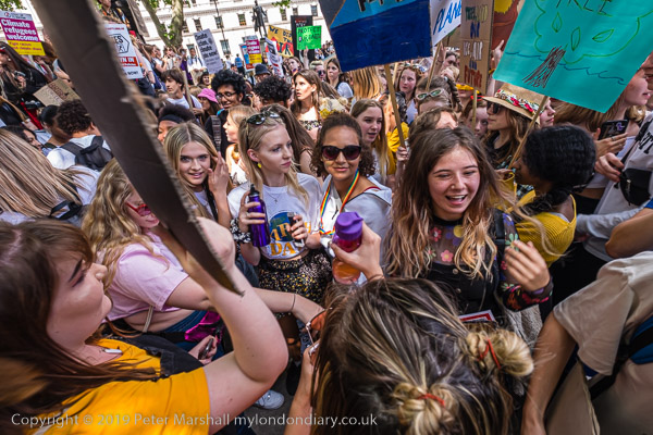
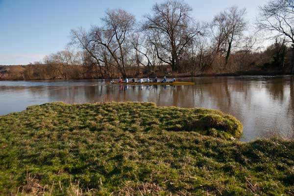
Youth Strike for Climate: London, Friday 24 May 2019
As we are expecting record May temperatures in the next few days and a summer with more deaths than ever from excessive heat, it is abundantly clear that the response of governments and politicians around the world to the climate crisis has for many years been woefully inadequate – and continues to be so.
Of course many of us have been pointing this out for many years, stressing the need for drastic changes to move away from the use of fossil fuels. As well as a huge shift to renewable energy this would also have needed dramatic changes in lifestyle in the industrialised countries and a move away from the politics and economics of greed and inequality.
Back in 2019 many young people saw we were heading towards catastrophe and failing globally to take effective steps to ameliorate the unavoidable crisis. They face a future world where temperatures will be generally several – perhaps five – degrees higher and our current global weather systems will be replaced by more extremes, with even more common fires and floods.
The younger you are now, the worse the problems will get in your lifetime, so it is hardly surprising that the young are more concented, and that many thousands around the world took part in a global climate strike against the lack of action by governments worldwide to combat the climate crisis in London in May 2019.
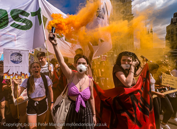
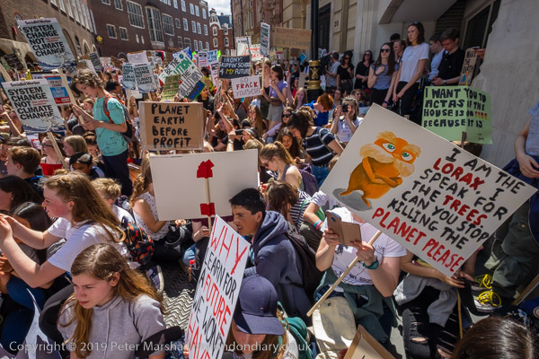
It was a protest with a great deal of energy, with a large crowd of mainly school students meeting in Parliament Square before marching past several ministries and staging a sit-down outside the Ministry of Education demanding that climate change becomes a vital aspect of the curriculum.
A crowded sit-down on the street at the Education Ministry
Clearly many school art departments were already getting involved, with protesters carrying an unusually numerous wide range of placards, for once hugely outnumbering those mass-produced by the Socialist Workers Party.
A brief protest at Downing St
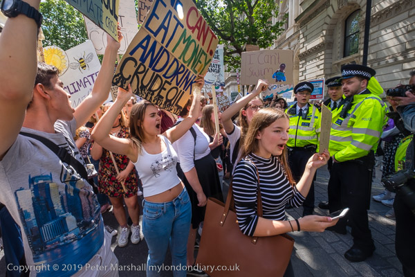
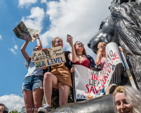
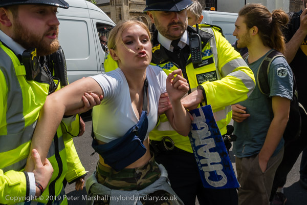
From there they marched back up Whitehall past Downing Street to hold a rally in front of Nelson’s Column, then returning to protest at the Department for Business, Energy & Industrial Strategy and finally going back to Parliament Square.
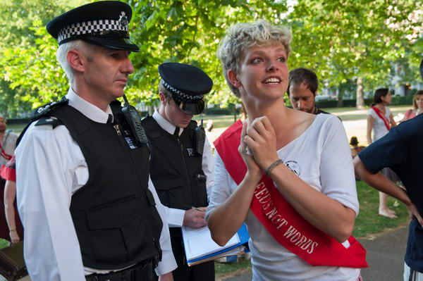
By then I think some police tempers were getting a little frayed and some students were manhandled rather aggressively off the road – and at least one minor was arrested.
I’d got tired with some often rather fast marching and the protest was still continuing when I decided it was time to go home.
Violence Against Women, Charlie X & MI6 – Friday 14th February 2014 was the second One Billion Rising event with an event in Trafalgar Square. I walked away down Whitehall to photograph Charlie X protesting over climate chaos and then went to MI6 at Vauxhall Cross for a protest on the 12 anniversary of the illegal transfer of Shaker Aamer from torture at a US airbase in Afghanistan to Guantanamo before returning home.
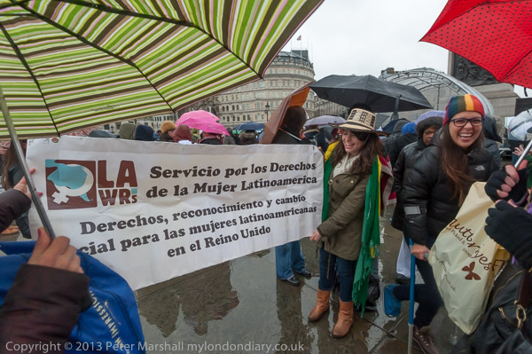
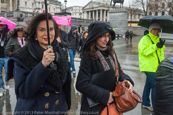
One Billion Rising – End Violence Against Women – Trafalgar Square
UK group for human rights for Latin American women
People had come to strike, dance and rise in defiance against the injustices suffered by women at the second One Billion Rising event, begun as a call to action against the UN figure that 1 in 3 women in the world will be beaten or raped.
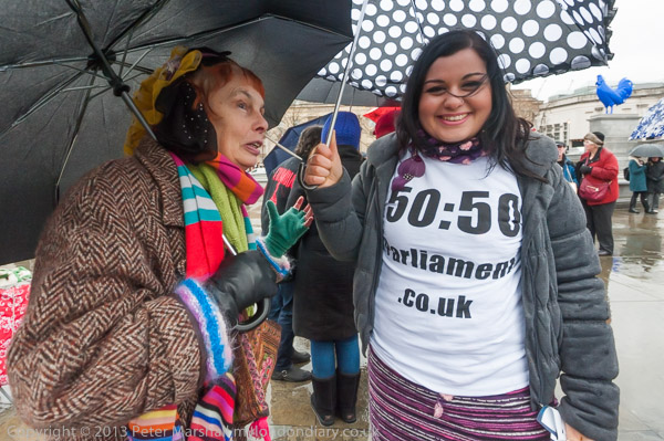
Raga Woods and a supporter of the 50:50 campaign for equal representation in parliament
This was an initiative by playwright and activist Eve Ensler (known for her play The Vagina Monologues), and her organisation V-Day, and the first event in 2013 had involved over 10,000 events worldwide. In 2014 things were happening in 168 countries.
The Home Office say there are an average of 85,000 women raped each year in England and Wales, along with 400,000 sexually assaulted and that 1 in 5 women experience some form of sexual violence in their adult life.
“The event started with a brief photo-op which was just lots of people posing behind a banner. I almost missed it, but I wouldn’t have really missed much. I didn’t recognise many of them, though they may well have been celebreties.
One I did know was Bianca Jagger, who I’ve photographed on various occasions. But you many well spot others you know.”
Afterwards there was some dancing on the stage and I photographed some of those who had come to the event. I left before the speeches.
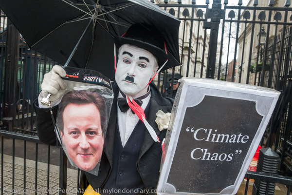
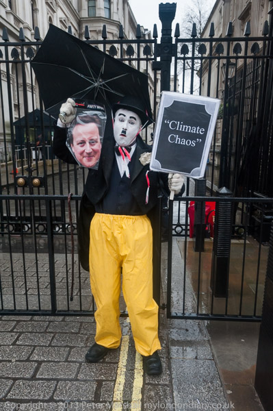
At the gates to Downing Street I met Charlie Chaplin mime Charlie X holding the head of PM David Cameron protesting against climate chaos and in solidarity with those who are flooded out and with those fighting fracking around the UK. His message was ‘Frack This for a Larf!
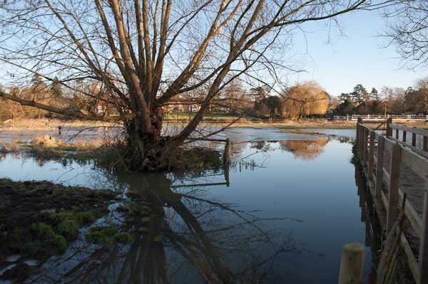
It was as his e-mail earlier had indicated, “crap weather“, cold and wet with the latest in a series of storms hitting London, and that this was the perfect context for a protest drawing attention to a protest over climate chaos and in solidarity with those people being flooded out across the country.
I had come up to London not knowing if my home would be flooded by the time I returned. Parts of the streets outside had been under a few inches of dirty water as I walked to the station and the ditch at the back of our garden had overflowed a couple of hundred yards downstream.
The local drains were all flooded and we were having to go to friends in the next street to wash etc – or rely on public services further afield. I was pleased to find the situation no worse when I finally arrived home but it was another week before Thames Water managed to get our sewage flowing again.
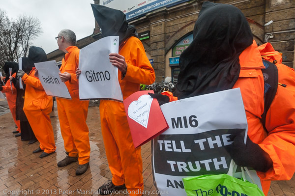
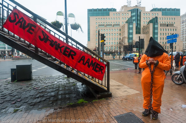
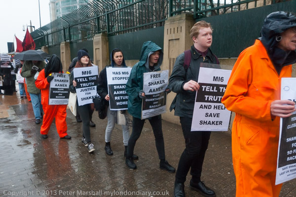
‘Justice Demands the Truth’ Vigil – MI6, Vauxhall Cross
“On the 12th anniversary of Shaker Aamer’s illegal rendition to Guantanamo, a protest called on MI6 to tell the truth and stop working to stop him being returned to his family in London, and handed in a Valentine card to MI6 head Sir John Sawer.”
It was on St Valentine’s Day 2002 that Shaker Aamer “was illegally and forcibly transferred from Bagram Airbase, where he had been tortured as MI6 agents looked on and helped with his interrogation to Guantanamo, where his imprisonment without trial and with frequent and regular ill-treatment and torture continues to this day.”
Aamer’s home and family were a short distance away in Battersea but he had been captured by bandits when working for a charity in Afghanistan and sold the the US authorities there.
On the same day in 2002, his youngest son was born in London, a son living with his family in Battersea who has never seen his father. In 2014 Aamer was still being held in chains in solitary confinement and his health was in danger after a lengthy hunger strike.
The US could find no evidence of his involvement in terrorism and he was cleared for release in 2007 – but they wanted to send him back to Saudi Arabia where he would have conceniently disappeared without trace.
Aamer had married a British woman and been granted residency to live in the UK and was applying for citizenship before his capture. His supporters were convinced that he was only still being held in prison “because of various lies told by British security agencies MI5 and MI6 to our government, which Jack Straw, Foreign Secretary from 2001-6 and later Secretary of State for Justice apparently believed.”
Those lies were told because both US and UK intellegence agencies would be highly embarassed by the evidence he would give about his continued torture in Guantanamo and his torture at Bagram.
Security at the MI6 building refused to accept the Valentines card they tried to present, but eventually they pushed it through a gap in the gate. But Shaker was only finally released and able to return to the UK on 30th October 2015.
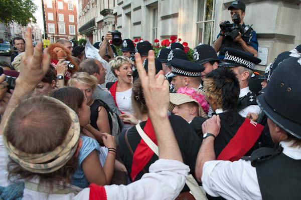
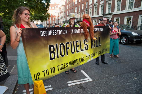
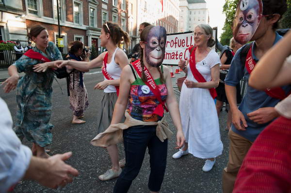
Climate Rush Palm Oil Gala: On Wednesday 1st July 2009 Climate Rush protested outside the Millennium Hotel in Grosvenor Square where industries deforesting tropical forests to grow biofuel crops including palm oil were holding a Gala Dinner and Dance.
Palm oil production is causing a particular problems in Indonesia, where indigenous people have seen their traditional lands taken over by companies for palm oil production under unfair laws.
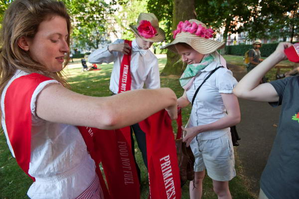
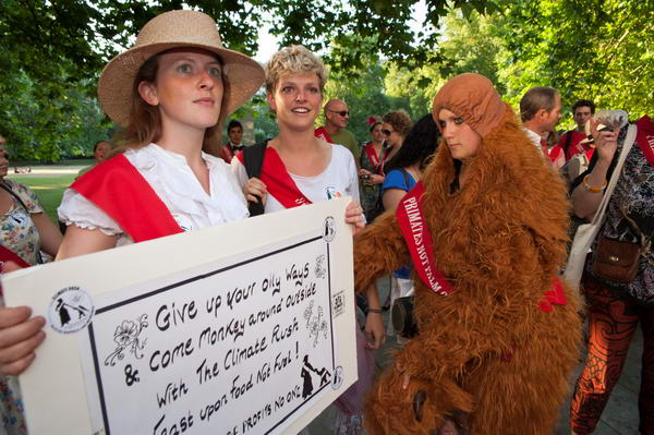
Primates not Palm Oil; Food not Fuel
The forests were their land and the living and many who have been moved off have been left in marginal land often without clean water supplies and the promises made by the palm oil companies to the people have not been kept, and the regulations which offer them some very limited protection have not been enforced by the authorities, with many sufferting violent attacks by armed security forces and police.
Police offer Tamsin Omond and Climate Rush a nice safe protest pen
Palm oil plantations disrupt natural drainage and bring problems of pollution and flooding. Destruction of their habitats eliminates most of the wildlife and species including the orangutan and the Sumatran tiger are under threat.
A detailed report, ‘Losing Ground’ for Friends of the Earth looked in particular at the human rights issues and concluded that “The EU target to increase agrofuel use is misguided, risking environmental damage and human rights abuses on an even bigger scale.“
Climate Rush’s flyer for the event stated “90% of orangutans have disappeared since the Suffragettes first appeared 100 years ago.“
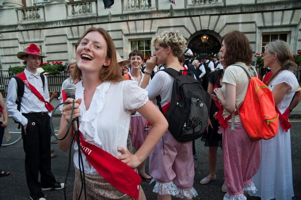
They began their protest with a picnic in the park of Grosvenor Square opposite the hotel entrance, and people got ready for the protest.
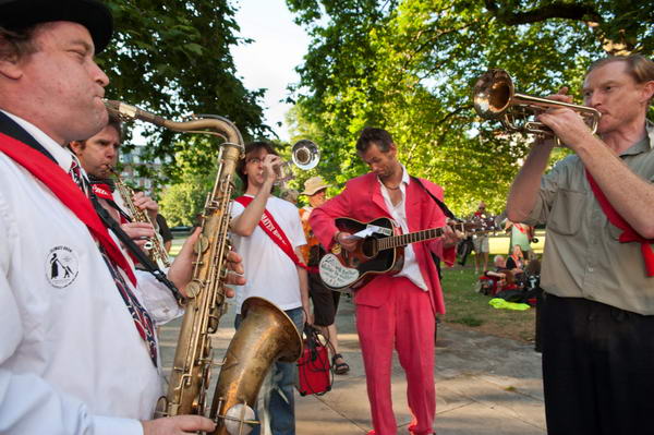
When their Jazz Band began to play, people moved out onto the street and blocked it dancing outside the hotel. They rejected police requests to move into the pen which police told them was created “for your safety“.
The police concentrated their actions waiting for the expected “rush” to the hotel, protecting the hotel with a small line of officers.
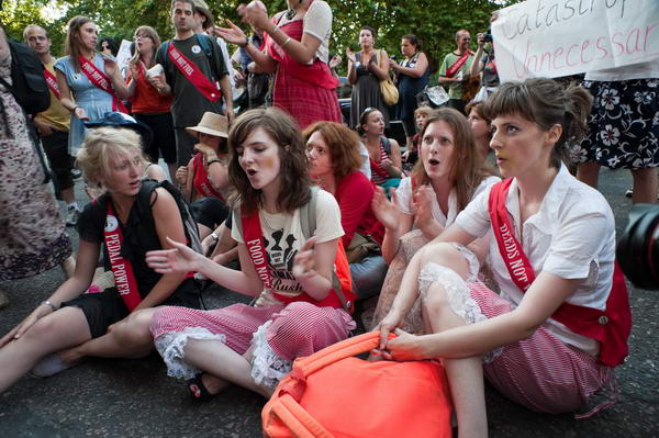
After around half an hour of dancing on the street the “rush” came, though I think it was really only ever a token attempt to enter the building. Most of the police seemed fairly relaxe or even amused by it, but there were a few who reacted rather violently and a couple of protesters were rather roughly thrown to the ground when a small group of police charged into them.
After this, the protesters moved back and sat down on the road in front of the doorway for a while.
Eventually they decided to get up and briefly danced a conga, before deciding to go back into the park to continue their picnic, and I felt it was time to go home for my own dinner.
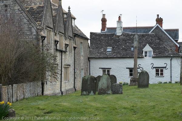
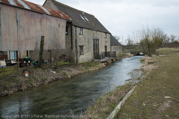
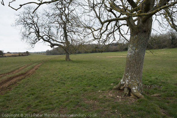
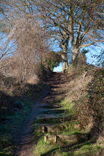
The Source of the Thames: Ten years ago today we were engaged on a very different walk to those I’ve been writing about in recent posts on my wanderings in London in 1989. Together with my wife and elder son we were about to complete our walk along the length of the Thames Path which had begun a couple of years earlier.
Cricklade
Of course I’d walked along by parts of the Thames in and around London, out to Windsor and towards Reading and to the east all the way to rather remoter regions on the estuary beyond the end of the route over the years in piecemeal fashion, but around 2010 we’d bought a guide to the Thames Path and began walking and marking off sections in an organised way.
The National Trails site says the path is 185.2miles (298 km) from its source in the Cotswolds to Woolwich. The path was first proposed in 1947 but it was only 49 years later that it was officially opened in 1996, though I’d walked a few sections and made some minor suggestions after the Ramblers released a draft for consultation a few years earlier.
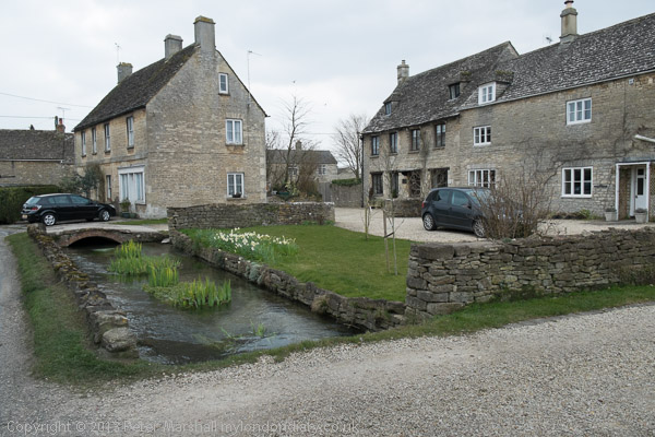
Ashton Keynes
Some physical improvements needed to be put in place, with several footbridges needed to cross the river where ferries had long ceased operation, and there were also many negotiations with riverine land owners, angling groups and local authorities to allow access. Not all these were successful, and there are still lengths of the route which are less than optimal in the upper reaches of the river.
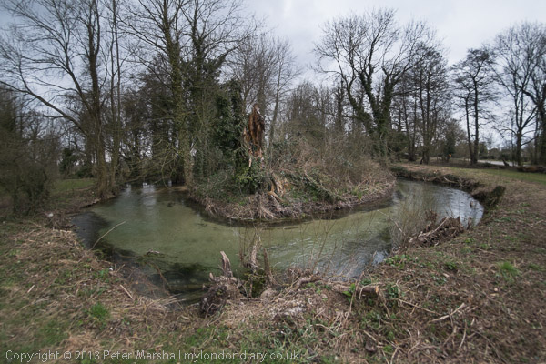
Neigh Bridge Country Park
According again to the site, the trail is “Easy to reach by public transport”, but that is only partly true. Even below Oxford there are some sections a mile or two from the nearest station or bus stop which adds significantly at one or both ends of a day’s walk, and once you get much past Oxford things become more difficult or impossible, certainly for those of us coming from the London area.
Old Mill Farm
The last reliable and reasonably frequent bus route from Oxford back in 2013 took us to Hinton Waldrist, a small village a mile or two from the path, and our day walks had ended there. For the final section my son had booked us into two nights accommodation on route between there and the source, at Buscot and Cricklade and we returned home at the end of our third day of walking from Kemble Station, a mile and a half from the source.
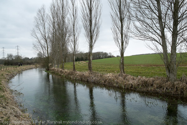
We had decided to make the walk in the week after Easter Sunday, which in 2013 was on March 31st and had begun on the Tuesday. On Thursday 4th April 2013 we left our hotel in Cricklade by 9am and after a short look around the town began the final day of our 3 day walk.
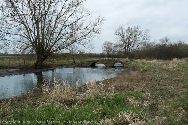
It was a cold day and there was still ice on some of the puddles. Our route guide – David Sharp’s ‘The Thames Path’ – told us we had 19.7km to walk to the source, but we had to do a little further as there was a diversion: “The Thames has changed course and is now flowing over the Trail, just inside Gloucestershire” a notice with a helpful map told us – and another 2.5km to the station. The guide was otherwise excellent, but would have been rather easier to follow had we been walking down-river as it suggested and described rather than in the opposite direction.
On My London Diary I described our route and day in some detail so I won’t repeat that here, and there are over 80 pictures from the day in the account. Perhaps some of them are a little misleading as I used a fisheye lens and made the river look as if it turns considerably more than its already rather twisty route. The were some long and rather boring sections too on which I took no pictures.
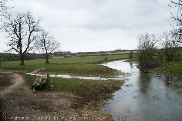
There was no river on the final section
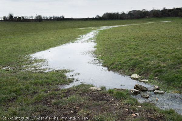
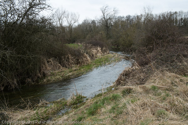
Scenically this is one of the less interesting of the Thames Path sections, but it was important to complete the walk, even if the final section was completely dry. It was bitterly cold and would have been more enjoyable in warmer weather even though we were well wrapped up – and needed to take a short rest in a pub in Ashton Keynes in the middle of the day to warm up before continuing.
The dry spring – though Spring had been wet
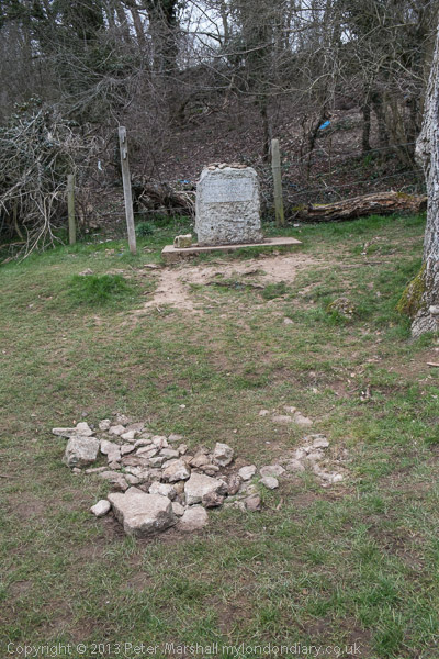
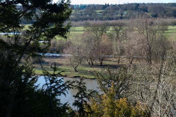
The source was something of an anti-climax. What is supposedly a spring with a stone marking it erected there by the Thames Conservators. I don’t know when water was last seen there, and others I know who have walked the river have all found it dry. The best I could find for some distance down the hill was a blue pipe on the grass – but there was nothing flowing from that either. There were some deep puddles in the mud by a gate some way down, and a larger one in the grass just above Thames Head, but it was only below the Fosse Way (A433) at Thames Head that a small stream became visible.
Kemble
We walked to Kemble station to find we had just missed a train and it was 50 minutes to wait for the next. There was what looked like a cosy waiting room but it was locked. It was far too cold to stand and wait on the windswept platform so despite our aching legs we went for a walk around Kemble before catching the first of three trains for our journey home.
More about the three days of our walk on My London Diary:
I grew up not far from the Thames, though rather more of my young days were spent playing in and around one of its tributaries, the River Crane both in the wilder areas of Hounslow Heath and to the north and in the rather tamer Crane Park, where I caught tiddlers, sticklebacks which were destined to die in jam jars, and learnt that small boys on bicycles were faster than irate whistle-blowing park keepers.
But the river was there, a formidable barrier protecting us in Middlesex from the wilds of Surrey, though we occasionally crossed it on bridges and ferries, perhaps to go to Kew Gardens in search of plant specimens. This was before the days of garden centres, and my father, a keen gardener carried scissors in his waistcoat pocket and would occasionally take a small cutting from gardens as we walked past or visited, or find seeds. Gardeners where we lived didn’t buy seeds – they saved them and swapped them with others.
And the Thames was the river where I learnt to swim, if only badly, with a paddling pool and a swimming area with a springboard in the riverside park, The Lammas. Later I learnt to row at Isleworth, in a heavyweight Sea Scout boat – and we swam there too, despite the filthy oily state of the mud and water.
Older and wiser I kept to the riverside paths, walking them both in Middlesex and Surrey and also out to the east of London, sometimes taking my family with me, but also on walks with other photographers and on my own. And when plans were being made in the 1980s for a Thames Walk I made a few suggestions on the proposed path of what in 1989 became the Thames Path.
Far more of the river in London is now accessible to the public than back in the 1970s and 80s when much of the riverside was still a working area, though many of the wharves were derelict. But as I found when I joined a small group led by a Tower Hamlets official with responsibility for footpaths, parts of the path on the north bank were still not always easy to access, with developers and residents erecting gates and barriers and making some parts appear private. Some years later The Guardian in 2015 published Privatised London: the Thames Path walk that resembles a prison corridor which showed that little had changed.
But like many others, my family has now walked the Thames Path, from the Thames Barrier at Charlton to the source in Gloucestershire, as well as some way to the east along both shores. Most of the path proper is readily accessible by public transport and can be done as a series of one-day walks, travelling and returning from from our home in Staines or from London. But for the final three days of walking we had to spend a couple of nights in hotels on the route.
At Streatley the path goes through a small lake
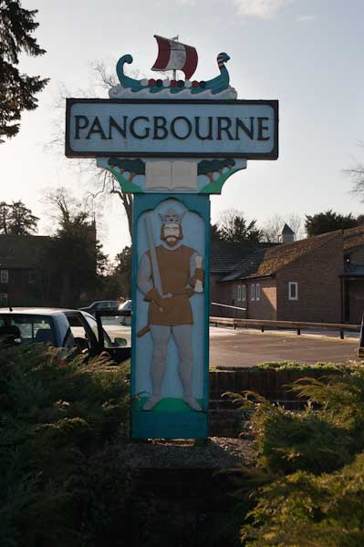
At the start of 2010, we spent both New Years Day and January 2nd walking two short sections of the walk, from Reading to Pangbourne on Friday 1st and returning to Pangbourne on the Saturday to walk to Cholsey. Both Cholsey and Pangbourne have stations with trains to Reading, so access was easy, although Cholsey station is over a mile from the Thames Path.
The pictures here are all from Saturday 2nd January, on what is perhaps the most scenic stretch of the Thames Path. It was a bitterly cold day, which was perhaps as well, as the parts of this section would have been very muddy and a little flooded. But the mud was frozen and most of the ice on the flooded parts was thick enough to take our weight. It was more pleasant walking across the ice than it would have been wading through the few inches of mud and freezing water, almost certainly just deep enough to overtop my walking boots.
At the start of the walk from Pangbourne, after crossing the river the path climbs a little up a ridge, with occasional views through the trees across the valley. It then goes down to the riverside again, passing under one of Brunel’s fine brick bridges for the GWR to the Goring Gap, where the Thames runs between wooded hills. Goring itself is the kind of place I like to avoid, though I’m sure it has its charms, but I’ve always seen it as a kind of playground for the self-satisfied rich. We crossed the river to Streatley on the south side, a village owned by Oxford Brewery owners the Morrell family until they sold it in in 1938. They had protected it from development.
It was here that we found the worst flooding on the path, and almost took one look at a gate leading on to a lake and turned round – we could have ended our walk here and returned to Reading from Goring station. But eventually we decided the water couldn’t be too deep and perhaps the ice might hold our weight and we went on. I think we all got wet feet.
There were more icy bits on the rest of the walk, but nothing quite so bad, and we continued our walk along the Thames Path. Unfortunately at Moulsford the path leaves the river – the towpath switches to the opposite bank, and although this is a Ferry Lane, the ferries are long gone. Moulsford would be a pleasant enough village were it not on the A329, and the one kilometre trek along this relatively busy road was tedious, though we did make a short diversion to see the parish church.
Our walk along the Thames Path ended when this left the road to return to the river, but we had further to go before turning off onto a footpath on our way to Cholsey station, adding another mile to our walk.
More on My London Diary at Thames Path including our walk on the previous day from Reading to Pangbourne.
Thames Path – Pangbourne – Cholsey: At the start of 2010 we were still walking sections of the Thames Path. On New Years Day we had walked from Reading to Pangbourne, and on the following day caught the train back to Pangbourne to begin our day’s journey there.
The Thames from the Thames Path along a hillside west of Whitchurch
We were heading to Cholsey, around 8 miles away, an easy distance suitable for a short day with over an hour’s rail travel at each end. Cholsey is a small village and has a railway station a little over a mile from the Thames Path with trains back to Reading from where trains run – if rather slowly – back to Staines.
Gatehampton Bridge
Pangbourne is a much larger village, and its station is a short walk from where we joined the Thames Path, and there were a few shops where we could buy some crisps and sweets to supplement the sandwiches in our bags and even a public toilet, so a very useful place to start a walk.
Before our walk really started we spent a little time in Pangbourne, visiting the parish church and photographing the Pang before rejoining the Thames Path at Whitchurch Bridge. Crossing the bridge takes you to Whitchurch, perhaps a prettier village than Pangbourne. Here the path takes quite a long detour away from the river bank and up on a hillside, with some extensive views through trees of the river and country to the south, before going back down to the riverside.
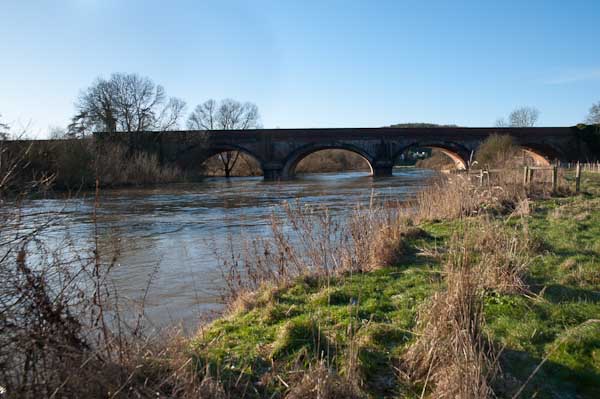
The railway line crosses the path and the river at Gatehampton Bridge, built by Brunel for the GWR main line in 1838 but the path stays on the north bank, passing between the tree-covered slopes of the Goring Gap, where the river cut through to seperate the Chilterns from the Berkshire Downs. Winter sun on the leafless bare branches was magical.
The bridge linking Goring on the north bank with Streatley on the south seems a rather primitive and temporary wooden structure, but has been here since 1923 when it replace the earlier bridge from 1837. Before then there had been both a ferry and a ford, though this was probably more often passable on horseback than on foot. It takes two bridges to reach Streatley from where the Thames Path proceeds westward on the south bank.
Streatley from Goring lock
At Streatley, a village until 1938 owned by the Oxfordshire brewers Morrell we visited the church and then set out on a partly underwater path by the river. December 2009 had been one of the wettest months on record and we began to doubt the wisdom of We thought about turning back and abandoning the walk, taking a train from Goring, but after seeing a walker paddle through towards us decided to continue.
Fortunately it was only a few inches deep, but despite our boots I think we all got wet feet. The day was around freezing, but walking kept our feet warm, and many of the smaller puddles along the rest of our route were frozen over, as well as the mud, and it was much easier to walk than had it been warmer.
The Beetle and Wedge at Mouslford looked very closed
A little further on the tow path moves from the south to the north bank, not a great problem in the past for craft being towed who could pole over to the other side, but more so for walkers, who need to take a path away from the river and along a main road for a mile or so leaving the path were it went down towards the Moulsford railway bridge and continuing to a footpath beside the railway to Cholsey station.
Oak House, Old Palace Place, King St, Richmond, 1988
I went to Richmond fairly often fairly in my youth some 25 years or so before I took these pictures, sometimes on my bike, on the 37 bus from Hounslow Garage or by car with a friend from school who had a part-time job and could afford to run a Morris Minor. On the bike I would generally ride around Richmond Park, and I took my first cassette of black and white film mainly of the trees there, sending them away to be processed and getting back 36 crinkle-edged black and white enprints. D & P cost something like 17s11d (around 90p) and it was several years before I could afford to take another film. The prints were a dull grey, with no trace of either white or black, but even well-printed they would have been of no great interest.
Flooding, River Thames, Richmond, 1988
When we went together in my mate’s car, often with a third friend, it was to sit with a cup of coffee on the terrace of a coffee bar, watching the girls go by while our coffee cooled. I doubt we could ever afford more than a single cup, and certainly none of us had the nerve to talk to any of those passing girls. Richmond at the time was full of young foreign au-pairs, all rather older than us.
Flooding, River Thames, Richmond, 1988
I think most of my bus journeys were made on my own, visiting the Palm Court Hotel to listen to jazz in the bar there, standing making a pint of bitter (probably Red Barrel or Worthington E – I then knew no better) last and last as I couldn’t afford another. It was always a rather lonely evening, with little conversation – though occasionally some older man would attempt to pick me up but I wasn’t interested. But there was some truly great music from the likes of Bobby Wellins.
Flooding, River Thames, Richmond, 1988
Later, in my thirties, I would visit Richmond regularly, having joined the photographic society there and made a few friends who shared some of my photographic interests. Club photography was in general tired and formulaic and had little to offer, but became used to doing my own thing often to the derision of the majority of the members. I still remember the frisson of revulsion when a visiting judge for an inter-club competion not only praised my entry but awarded it one of the prizes.
Flooding is frequent at Richmond, where the Thames is still tidal (though a half-lock prevents it draining out completely at low tide) and there are always motorists who ignore the warning notices. I think it comes up over parts of the towpath most months during Spring Tides. These pictures were taken in March when I had probably come on one of my regular visits to a couple of second-hand bookshops that often had decent photographic books in stock at a time when these were rare. Many were review copies, probably never reviewed but sold to the dealers as one of the perks of a poorly-paid job. I decided if ever I became a book reviewer (which eventually I did) I would never sell copies, and I didn’t though there were some I gave away, but many more I refused to take.
Once a month we came to visit friends in Kennington, arriving for lunch on a Sunday, and I would often travel up earlier than the rest of my family and spend some time walking around and taking pictures, and I think this may have been taken on one of those mornings. I think I will have chosen this angle on the ornamented Heath Terrace carefully, not just to show the 4 white chimneys of Battersea Power Station at left, but also the rather Lego-like tower block at right, and choosing to put a concrete post at the right edge.
Heath Terrace is still there, though I think now entirely residential, and I’m not sure you can still see the power station, certainly not in summer when Streetview is on its rounds, as that small tree has grown considerably. The concrete post, which I assume was a lamp post as well as holding some other sign has disappeared.
Clapham Manor St, Clapham, Lambeth, 1988
This Grade II listed building at 42 Clapham Manor St is now home to the London Russian Ballet School and Kids Love Lambeth. It was built in 1854, architect by James Thomas Knowles Snr, as the Clapham General Dispensary for the ‘The Clapham Sick Poor Fund’ formed in 1849 and provided free medical and surgical services for almost a century, closing in the early 1950s.
In 1959 the building was used by the London County Council for industrial training for people with special needs. It later became a pre-school playground and adult education centre, which I think it was at the time of my photograph. Shortly after in 1989 it became empty and suffered some fire damage which led to considerable internal rebuilding. Still owned by Lambeth council, it became a taxi training school until 2005-6 when the council sold the building and its considerable premises at the rear. For some years it was in illegal use as ballet studios, with this being made legal in 2013.
James Thomas Knowles Snr (1806-1884) designed the building free of charge and it was paid for by public subscription. As well as its architectural merit is is listed as one of the earliest provident dispensaries to survive in London.
All photographs on this and my other sites, unless otherwise stated, are taken by and copyright of Peter Marshall, and are available for reproduction or can be bought as prints.