Posts Tagged ‘Cricklade’

Thames Path: Buscot to Cricklade – 2013

Wednesday, April 3rd, 2024

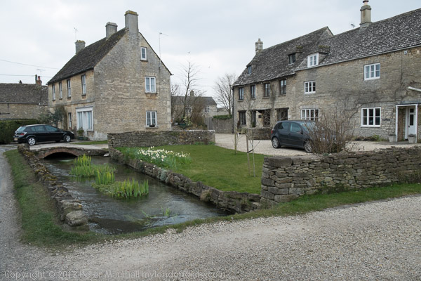
Thames Path: Buscot to Cricklade: Together with my wife and elder son I had on Saturdays spread over several years walked much of the Thames path. We’d walked it chunks of around 8-12 miles a day between places which could be reached by public transport but had come to a halt at Shifford, near Hinton Waldrist, 9 miles to the southwest of Oxford from which, at least back around 2012 it was still possible to take a bus. Thanks to cuts I think the bus service is now too infrequent to be of use.
Thames Path: Buscot to Cricklade - 2013
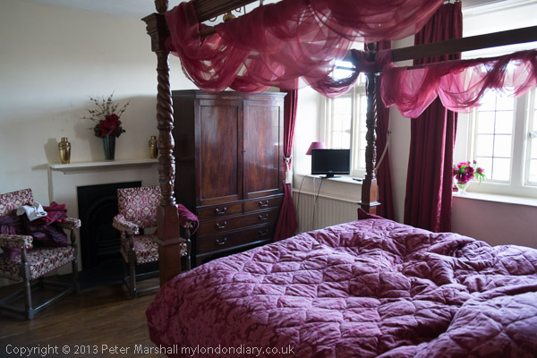
The room next to ours at Buscot had a four poster bed

But further upstream there was little or no public transport – and what little there was didn’t go in useful directions for us. So my son had booked us into a couple of hotels to bridge the gap, giving three longish days of walking. We travelled fairly light with just essentials in rucksacks – and of course for me a small camera bag, but it was still fairly taxing – and something I couldn’t repeat now, 11 years later.
Thames Path: Buscot to Cricklade - 2013

You can read my account of the three days, complete with rather a lot of pictures on My London Dairy at Thames Path: Shifford to Buscot, Buscot to Cricklade and Cricklade to the Source.
Thames Path: Buscot to Cricklade - 2013
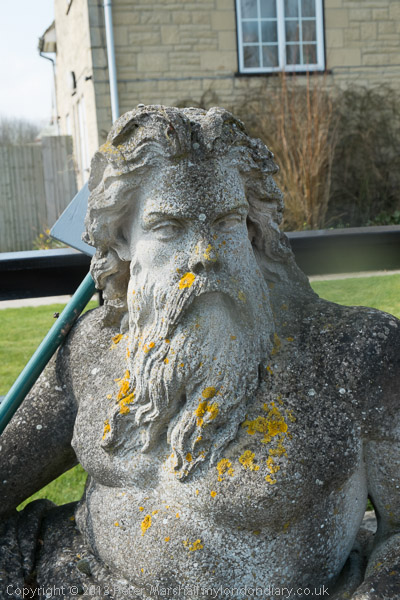
Old Father Thames

I’d kept my photography equipment minimal too, taking just one camera, a Fuji X-Pro1 and I think two lenses. One was the Fujifilm XF18-55mmF2.8-4 R LM OIS, a mouthful almost larger than the lens itself, Fuji’s 18-55mm kit lens. It’s a fairly small and light lens but a remarkably good one. Fuji has since brought out zooms with wider focal length ranges, wider apertures (and higher prices) and I have some, but within its limitations I think this remains my favourite.
Thames Path: Buscot to Cricklade - 2013
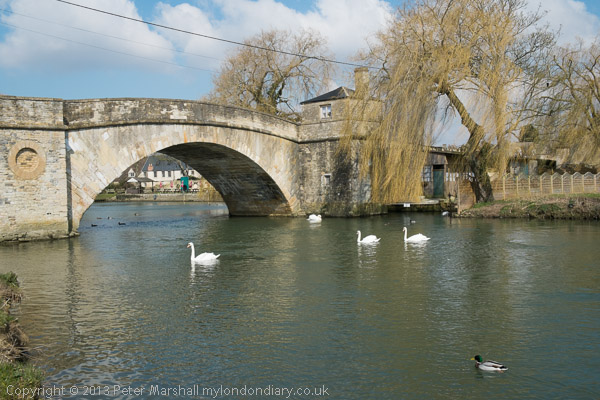
Halfpenny Bridge – the toll house at right – Lechlade

I don’t think I then owned a wider Fuji lens than the zoom with the 18mm being equivalent to 27mm on a full-frame camera, rather a moderated wide-angle for me, but for those scenes where I felt a need for a wider view I also took my Nikon DX 10.5mm fisheye with a Fuji adaptor. Compact and lightweight, this worked well but was a little fiddly to use. I’ve never found using lenses with adaptors quite as satisfactory as those in the actually camera fitting. I don’t think any of the pictures I put online for this section of the walk were made with this, though some for both other days are.
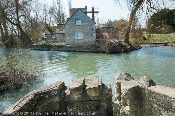
The entrance to the Thames and Severn Canal across the Thames

The Buscot to Cricklade section of the walk was a little shorter than the first day when we probably walked a total of sixteen or seventeen miles, but includes some of the best and some of the worst parts of the route. There are some delightful sections of riverside walking and Lechlade is certainly a town worth visiting, as we did, although a diversion from the Thames Path itself.
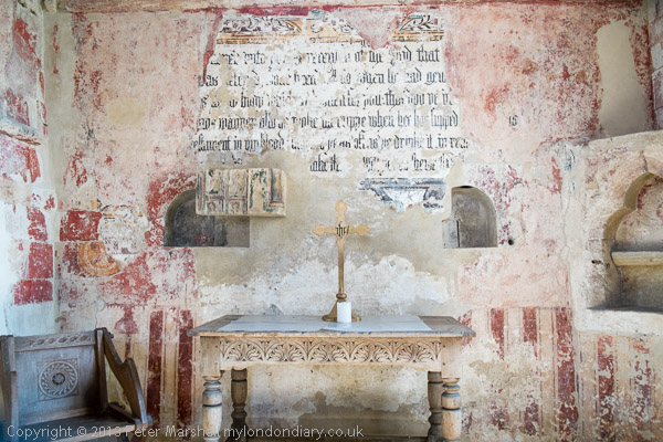
The next mile or so is arguably the most interesting section of the Thames Path, at least in its upper reaches, with the start of the Thames and Severn Canal. It’s also here that the Thames towpath begins – or for us ends.
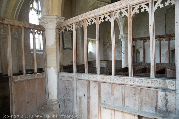
And a short distance further on is the remarkable St John the Baptist Church at Inglesham, saved and restored by William Morris and his his pre-Raphaelite friends founded the Society for the Protection of Ancient Buildings (SPAB) or ‘Anti-Scrape’ to oppose the gothicisation of buildings such as these.
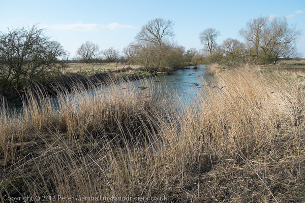
But then comes a long trek over a mile beside a busy A361 followed by a longer one along along paths and lanes with hardly a sniff of a the river until you reach Castle Eaton, a village which seemed closed (and its pub certainly was.)
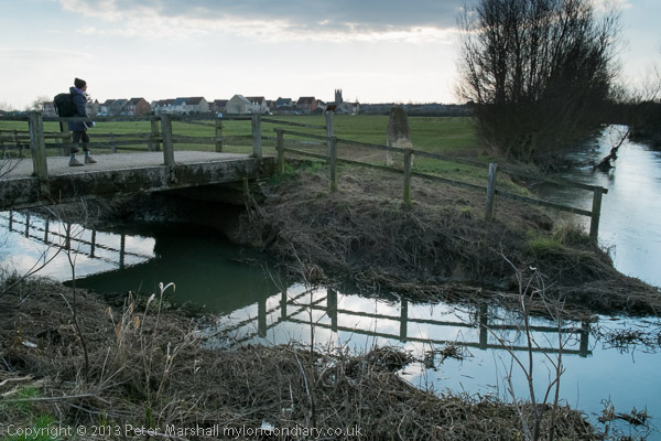
From there the path does follow the river all the way into Cricklade, though as I noted “going every direction except a straight line to there“. Finally we arrived at the White Hart, supposedly the poshest and oldest principal coaching inn at Cricklade since the time of Elizabeth 1 but bought by Arkells Brewery in 1973. Our rooms in a more modern part of the building were comfortable enough but rather less impressive than those on the previous night at Buscot.

Thames Path: Cricklade to the Source
Thames Path: Buscot to Cricklade
Thames Path: Shifford to Buscot


FlickrFacebookMy London DiaryHull PhotosLea ValleyParis
London’s Industrial HeritageLondon Photos

All photographs on this page are copyright © Peter Marshall.
Contact me to buy prints or licence to reproduce.
The Source of the Thames

Tuesday, April 4th, 2023

The Source of the Thames
Thames Head – where the river is first visible

The Source of the Thames: Ten years ago today we were engaged on a very different walk to those I’ve been writing about in recent posts on my wanderings in London in 1989. Together with my wife and elder son we were about to complete our walk along the length of the Thames Path which had begun a couple of years earlier.

The Source of the Thames
Cricklade

Of course I’d walked along by parts of the Thames in and around London, out to Windsor and towards Reading and to the east all the way to rather remoter regions on the estuary beyond the end of the route over the years in piecemeal fashion, but around 2010 we’d bought a guide to the Thames Path and began walking and marking off sections in an organised way.

The Source of the Thames

The National Trails site says the path is 185.2miles (298 km) from its source in the Cotswolds to Woolwich. The path was first proposed in 1947 but it was only 49 years later that it was officially opened in 1996, though I’d walked a few sections and made some minor suggestions after the Ramblers released a draft for consultation a few years earlier.

Ashton Keynes

Some physical improvements needed to be put in place, with several footbridges needed to cross the river where ferries had long ceased operation, and there were also many negotiations with riverine land owners, angling groups and local authorities to allow access. Not all these were successful, and there are still lengths of the route which are less than optimal in the upper reaches of the river.

Neigh Bridge Country Park

According again to the site, the trail is “Easy to reach by public transport”, but that is only partly true. Even below Oxford there are some sections a mile or two from the nearest station or bus stop which adds significantly at one or both ends of a day’s walk, and once you get much past Oxford things become more difficult or impossible, certainly for those of us coming from the London area.

Old Mill Farm

The last reliable and reasonably frequent bus route from Oxford back in 2013 took us to Hinton Waldrist, a small village a mile or two from the path, and our day walks had ended there. For the final section my son had booked us into two nights accommodation on route between there and the source, at Buscot and Cricklade and we returned home at the end of our third day of walking from Kemble Station, a mile and a half from the source.

We had decided to make the walk in the week after Easter Sunday, which in 2013 was on March 31st and had begun on the Tuesday. On Thursday 4th April 2013 we left our hotel in Cricklade by 9am and after a short look around the town began the final day of our 3 day walk.

It was a cold day and there was still ice on some of the puddles. Our route guide – David Sharp’s ‘The Thames Path’ – told us we had 19.7km to walk to the source, but we had to do a little further as there was a diversion: “The Thames has changed course and is now flowing over the Trail, just inside Gloucestershire” a notice with a helpful map told us – and another 2.5km to the station. The guide was otherwise excellent, but would have been rather easier to follow had we been walking down-river as it suggested and described rather than in the opposite direction.

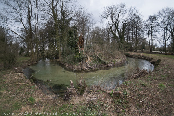
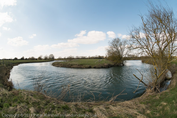
On My London Diary I described our route and day in some detail so I won’t repeat that here, and there are over 80 pictures from the day in the account. Perhaps some of them are a little misleading as I used a fisheye lens and made the river look as if it turns considerably more than its already rather twisty route. The were some long and rather boring sections too on which I took no pictures.

There was no river on the final section

Scenically this is one of the less interesting of the Thames Path sections, but it was important to complete the walk, even if the final section was completely dry. It was bitterly cold and would have been more enjoyable in warmer weather even though we were well wrapped up – and needed to take a short rest in a pub in Ashton Keynes in the middle of the day to warm up before continuing.

The dry spring – though Spring had been wet

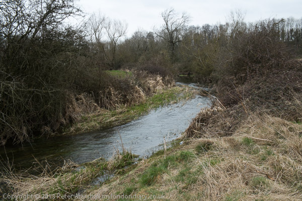
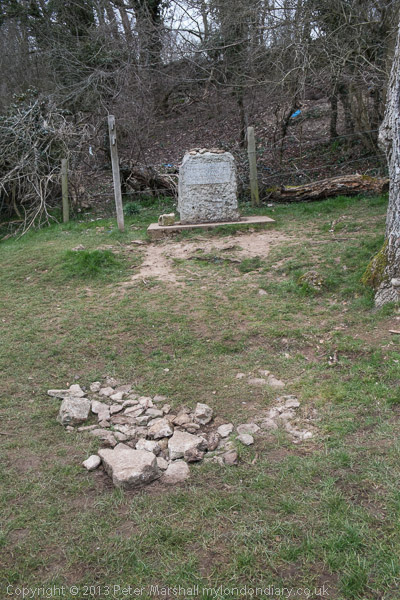
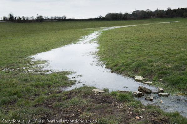
The source was something of an anti-climax. What is supposedly a spring with a stone marking it erected there by the Thames Conservators. I don’t know when water was last seen there, and others I know who have walked the river have all found it dry. The best I could find for some distance down the hill was a blue pipe on the grass – but there was nothing flowing from that either. There were some deep puddles in the mud by a gate some way down, and a larger one in the grass just above Thames Head, but it was only below the Fosse Way (A433) at Thames Head that a small stream became visible.

Kemble

We walked to Kemble station to find we had just missed a train and it was 50 minutes to wait for the next. There was what looked like a cosy waiting room but it was locked. It was far too cold to stand and wait on the windswept platform so despite our aching legs we went for a walk around Kemble before catching the first of three trains for our journey home.

More about the three days of our walk on My London Diary:

Thames Path: Cricklade to the Source
Thames Path: Buscot to Cricklade
Thames Path: Shifford to Buscot

Old Father Thames – Buscot to Cricklade

Sunday, April 3rd, 2022

Old Father Thames – Buscot to Cricklade Nine years ago on Wednesday 3rd April 2013 I was walking the Thames Path with my wife and elder son, who had planned a three day walk along the upper reaches of the river as a birthday present for my wife. Her birthday is in the depths of winter but we thought the start of April might have better weather.

Old Father Thames - Buscot to Cricklade
St John the Baptist at Inglesham, saved by William Morris from the threat of Gothicist ‘restoration’

We’d walked the lower parts of the Thames path and further out towards the estuary in a number of day walks, travelling by public transport to suitable starting points and back home at the end of the day. This had got us as far as Duxford, a short walk from the end of a bus route to Hinton Waldrist, 9 miles southwest of Oxford, west of where public transport to places close to the river is sparse and journey times from home too long.

Old Father Thames - Buscot to Cricklade
The room next to ours at Buscot Manor; ours was plainer but very comfortable

So we had booked two nights accommodation to allow us to complete the walk, ending at the source which is close to Kemble station from where trains would take us home via Swindon and Reading.

Old Father Thames - Buscot to Cricklade
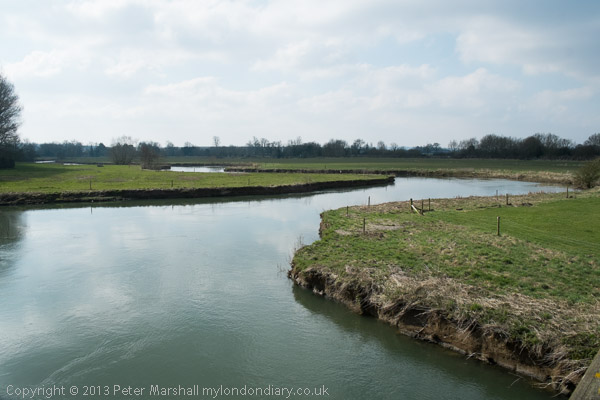
Meanders make the journey longer

On Tuesday we had set off early to take the train to Reading where we changed for Oxford and then found the bus to Hinton Waldrist. By the time we got within five miles of the village we three and the driver were the only passengers. It had been just below zero when we set out but had warmed up a little and the sun was shining as our walk began. You can read more about the days walk and see pictures at Thames Path: Shifford to Buscot. I’d finished the day in which we had walked around 15 or 16 miles totally exhausted, but a good soak in a hot bath had eased some of my aches and pains.

Old Father Thames - Buscot to Cricklade
Old Father Thames

Wednesday we were up early for breakfast, having slept well at Buscot Manor, though we hadn’t paid the extra for a room with a four-poster, though I did take a photograph of one. Breakfast, shared around a large table with the other guests, was enormous and it was hard to get up from the table and begin our walk.

Old Father Thames - Buscot to Cricklade
Ha’penny Bridge in Lechlade

Being gluttons for punishment as well as at the table we started the day by deliberately going in completely the wrong direction to make a tour of the village, now largely owned by the National Trust before rejoining the Thames Path.

Old Father Thames - Buscot to Cricklade
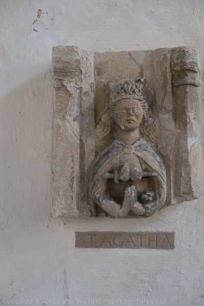
St Agatha in St Lawrence’s Church, Lechlade

At St John’s Lock we found Old Father Thames, made in 1854 for the Crystal Palace and later moved to Thames Head but relocated here as protection against vandalism. At Lechlade, this is the highest lock on the Thames, which is theoretically navigable as far as Cricklade, though few boats now go beyond the Halfpenny Bridge in Lechlade.

Old Father Thames - Buscot to Cricklade
The entrance to the Severn & Thames Canal

We spent some time in Lechlade, buying sandwiches for our lunch, then looking around the church before my companions mutinied and dashed into a tea-shop and I had to follow them. We wasted some time there before we walked out and carried on towards Inglesham. The area around here was perhaps the highlight of the whole walk, but our delay in Lechlade meant we couldn’t stop long enough to properly examine the mouth of the River Coln and entrance to the Thames and Severn Canal and the first bridge over the canal on our way. The canal was abandoned in 1927 though parts have now been restored.

Old Father Thames - Buscot to Cricklade
St John the Baptist, Inglesham

The real gem of the walk is the Church of St John the Baptist at Inglesham, a splendid medieval survival thanks to the efforts of William Morris, who along with his pre-Raphaelite friends founded the Society for the Protection of Ancient Buildings (SPAB) or ‘Anti-Scrape’ to oppose the gothicisation of buildings such as these. But past here the walk deteriorates, with a mile and a half beside a busy road and a further 2 mile road walk “offering no scenic attraction at all“.

Old Father Thames - Buscot to Cricklade
A rare glimpse of the Thames , our first since Inglesham

It might have been better if the Thames Path had taken a detour along the Thames and Severn Canal. As the Rambler’s Association noted in their 1977 Survey, the county councils “suggested a new footpath creation to follow the river from Lechlade to Cricklade but objections, primarily from farmers and anglers, led to the abandonment of this concept.” They comment that the Thames path here “is in places so dull or dangerous that it begs the question whether objections from landowning or angling interests should always be allowed to override the need for providing a simple public amenity.”

Old Father Thames - Buscot to Cricklade

It’s only in the final mile or three into Cricklade that the walk comes alive again, rejoining the river and giving a glimpse of what the Thames Path in this region should be. We made our way to the White Hart, the principal inn at Cricklade since the time of Elizabeth I, though our room was in a modern extension at its rear. There was still just a little time to explore the town, basically a single street, before settling down to a decent Indian meal a short distance from the hotel.

Old Father Thames - Buscot to Cricklade
Cricklade seen across a meadow from the path

You can read about the final day of the walk, where there were detours due to flooding and flurries of snow in a bitter wind before we reached the end, on my London Diary. Here are the links to all three days of our walk, which I’m glad we did then as I don’t think I could make it now.

Thames Path: Cricklade to the Source
Thames Path: Buscot to Cricklade
Thames Path: Shifford to Buscot


Thames Path

Sunday, April 4th, 2021

One of the many things I ought really to do is to put together a book of my pictures of the Thames Path. Of course quite a few others have done so, but I think mine would provide a slightly different view.

I think I’ve walked every section of it over the years, parts of it many times, though there may possibly be a few yards I’ve missed actually in London where there are routes on both sides of the river. I’ve also gone rather further east on both banks, as the Thames Path stops rather prematurely at the Thamea Barrier while the paths continue.

I’ve never quite been to the mouth of the Thames, traditionally marked at various places including the the Nore sandbank, Yantlet Creek – where the City put up the London Stone, and though I cycled to Leigh-on-Sea in 2005 I think I missed the Crow Stone.

Most of the sections of path upstream from Windsor I’ve walked on various days with my family. As far as a little above Oxford it’s fairly easy to travel by public transport to the start of a day’s walk and back from the end, but above that there are few buses and no stations until you get close to the source. So the final (or initial) 60-70 km had eluded us.

In 2013, my elder son planned the expedition to complete the route, booking bed and breakfast for the three of us at Buscot and Cricklade so we had three days to walk. On the Tuesday following Easter, two trains (both running late) took us to Oxford, despite Easter Holiday engineering works still in operation and we took the bus to Hinton Waldrist. For the last five miles we were the only passengers and the bus had a problem in the village squeezing past a parked tractor.

We were still a couple of km away from the Thames Path, but the sun was out and despite being rather close to zero it was good walking weather. The map and guide book said there was still a ford across an old stream of the river at Duxford which would have saved us some walking, but there had been considerable rain in previous weeks and it was clearly impassable; even on the longer way round we occasionally needed to detour around flooded sections of path.

We just made it for a late lunch before the pub at Tadpole Bridge stopped serving, having seen only one other person on the first five miles or so of our walk. It was good to have a pint, though the food suffered from the restaurant’s aspirations, and service was fast. The river winds considerably around here and I think we walked at least twice as far as a crow might fly to get to Radcot and from there on to Kelmscott where we again paused. We were a day early for the first opening of the Manor there, perhaps as well as we didn’t have time to appreciate it, but we did visit William Morris’s grave and the local pub before continuing our slog to Buscot Manor, an interesting and welcoming place to spend the night.

The following morning after a very large breakfast with other guests we made a short tour of the village before continuing along the Thames Path towards Lechlade, where I was forced to waste time snared into a tea shop by my companions. Eventually we made it and walked on past the start of the Thames and Severn canal to the Church of St John the Baptist at Inglesham, a splendid medieval survival thanks to the efforts of William Morris, who along with his pre-Raphaelite friends founded the Society for the Protection of Ancient Buildings (SPAB) or ‘Anti-Scrape’ to oppose the gothicisation of buildings such as these.

Then came the worst section of the Thames Path, a mile or so on the verge of the busy A361 followed by another couple along a bridle path and country lanes out of sight of the river. Between Inglesham and Castle Eaton there is no real Thames Path – except for a couple of hundred yards beside the river in the 4 or 5 mile stretch. Though except for the A361 it is a decent country walk. The route does run beside the river from Castle Eaton to Cricklade where we made for the oldest and poshest pub, the White Hart where we were booked. And after finding our room found a good Indian restaurant not far away.

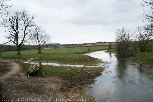
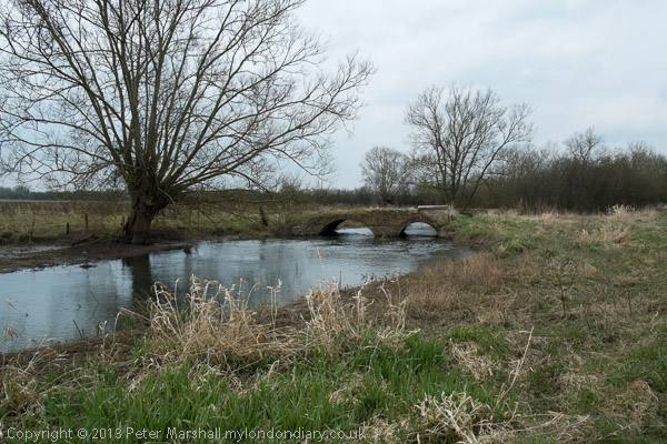
After a disappointing breakfast we took a short walk around Cricklade before continuing our journey. Flooding in the area meant the path had been diverted but it wasn’t a bad diversion and we were soon walking with the river through a land almost entirely covered by unfilled gravel pits, something there is no shortage of close to home. These cover the land east and west of the charming village of Ashton Keynes, west of which it’s hard to decide where the river actually flows. According to the Thames Path Guide, the Thames follows several coursed through Ashton Keynes, though some distance further up you do walk beside a decent small river.

Past the A 329 the river rather peters out, and by the time we reached Thames Head on the A 433 Fosse Way all that was left was damp grass. Across the road we struggled up a small hill to the official source, a dry spring that is marked by a stone placed here by the Thames Conservators. From here it was downhill to Kemble Station and a long wait for a train to Swindon, where we changed for Reading and then another train home.

More details and many more pictures on My London Diary.
Thames Path: Cricklade to the Source
Thames Path: Buscot to Cricklade
Thames Path: Shifford to Buscot