London Loop – Enfield Lock to Chigwell – If you want a good walk on the outskirts of London to walk off a little of the excesses of Christmas I can recommend this section of the London Loop. In the book guide we – myself my wife and my elder son – used on 28th December 2006 it was section 13, but now appears to be split into two parts as Sections 18 and 19. You can download excellent walk guides from Inner London Ramblers. Bits can be muddy so you need walking boots.
It’s not a particularly long walk and starts and ends at stations. Photographers always add a little by wandering around a bit and running up slopes to get a better view. But back in 2006 a little under 9 miles was fine for me, though now I might prefer to split it into the two sections.
The rail journey to Enfield Lock takes around an hour and a half for us, changing from the Victoria Line to Greater Anglia at Tottenham Hale, and coming home from Chigwell which is on the Central Line just a little longer. The walk itself at a moderate pace with a stop to eat our sandwiches a little over 4 hours, and in December to finish in daylight means starting walking around noon, though we made it a little earlier and arrived at Enfield Lock just after 11am.
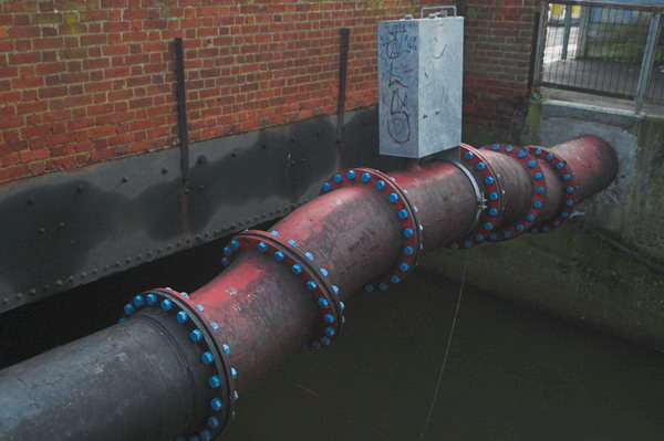
My first picture online came not long after, although the rather decorative length of piping in the top picture may not appeal to all. I think it was over the Turkey Brook, though I can’t exactly remember the location. But soon we were walking past the 1907 Lee Conservancy Offices at Enfield Lock and then a short distance beside the Lea Navigation.
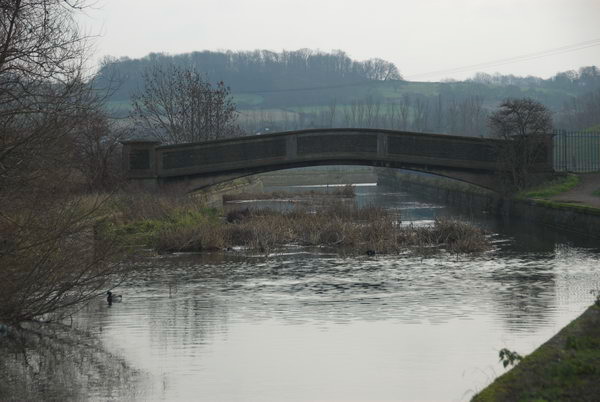
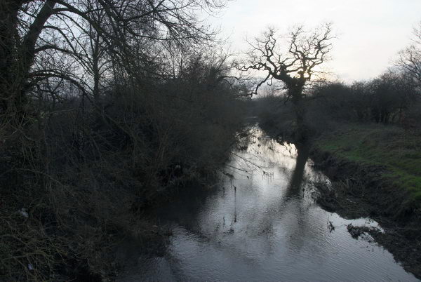
Then we crossed the navigation taking the footpath to Sewardstone walking to the north of King George’s Reservoir and following one of the branches of the River Lea and then crossing another wide flood relief channel and then coming to something that looks rather more like a proper river.
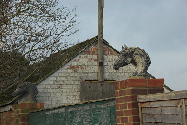
The route from here is uphill for some way. Somewhere we passed two horses heads and and on the Sewardstone Road a nursing home.
A few yards along the busy road (its the A12) we left and continued uphill, pausing at times to admire the view across the Lea Valley.
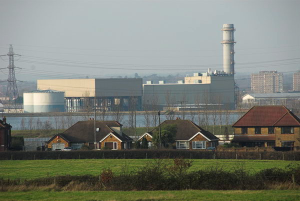
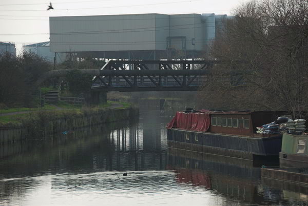
Here we got another view of the rather mysterious structure that had loomed above the Lea Navigation which is Enfield Power Station, built in 1997-9, a gas-fired power station built partly on the site of the decommissioned Brimsdown Power Station.
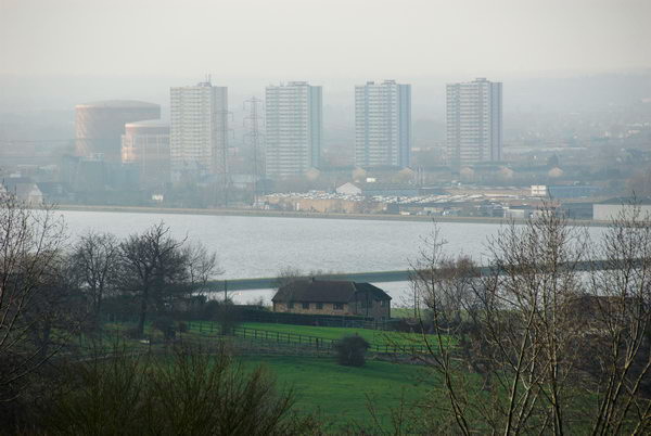
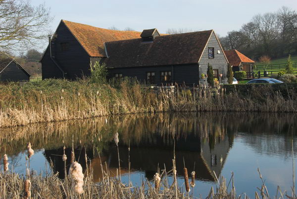
A little further on there were more views, across the reservoirs to Ponders End. But soon we came to more rural scenes including the pond and houses of Carrolls Farm.
The next section of the walk involved a lot of woods and is part of Epping Forest and also includes the Scout camp at Gilwell. The IL Ramblers notes recommend an alternative route which gives better views, but we only had the book and I made few pictures on this section – none of which are on the web.
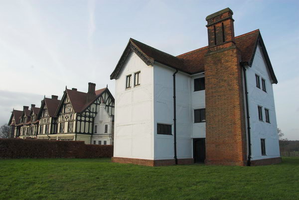
We stopped to eat our sandwiches beside Queen Elizabeth’s Hunting Lodge on Chingford Plain where we also bought crisps and soft drinks to go with them, and sat around rather too long before taking a look at the building and then continuing.
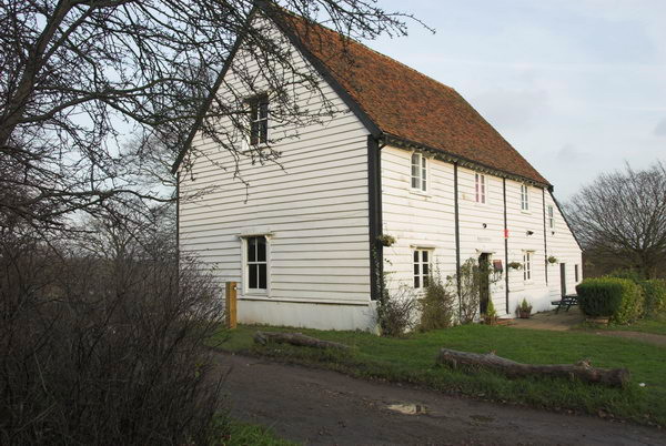
Here we got a little lost in Epping Forest as the directions in the book were perhaps rather less clear than those online, so I think our route was just a little different to that intended. We found the Butler’s Lodge, but despite the promise in the book it was not serving tea.
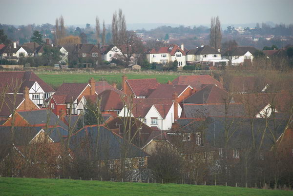
There were some views on our way, but the suburbs here are not really picturesque. I think the river in the picture below is the Roding rather than the Ching which was more of a small ditch where we crossed it.
Parts of the route led along roads and perhaps the best that can be said for them are that they were downhill – and by this time I was getting tired. Eventually we came to the station and sat down and waited for a train.
There are a few more pictures as well as those above on My London Diary.
Flickr – Facebook – My London Diary – Hull Photos – Lea Valley – Paris
London’s Industrial Heritage – London Photos
All photographs on this page are copyright © Peter Marshall.
Contact me to buy prints or licence to reproduce.


