1995 Colour Part 5 – Waltham Forest

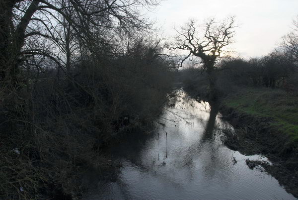
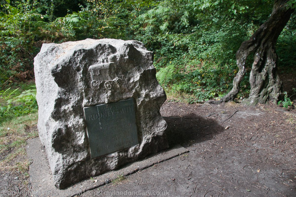
1995 Colour Part 5 – Waltham Forest: My Greenwich Meridian project had taken me into North London as far as Pole Hill in Chingford, but I also wandered more widely in the London Borough of Waltham Forest and even strayed into its neighbouring borough of Redbridge, photographing both with a panoramic camera and my ”normal’ pair of Olympus OM4s on black and white and colour.

Pond, Epping Forest, Whipps Cross, Waltham Forest, 1995, 95p03-262

Most of the pictures taken with these OM4s were made with the Olympus 35mm shift lens which could slide vertically and horizontally in its mount, particularly useful for photographing tall buildings when it by shifting it up I could keep holding the camera level and place the horizon close to the bottom of the image, so avoiding converging verticals or including large foreground areas.

Leisure Centre, New Road, Chingford, Waltham Forest, 1995, 95p03-441
Leisure Centre, New Road, Chingford, Waltham Forest, 1995, 95-3o-23, 1995, 95c03-335

But often I had the shift on a camera loaded with black and white film, with the 28mm on the OM4 with colour in it. I also carried an ultra-wide 21mm, a 50mm and a short telephoto lens for use when needed.

Houses, Sunset Ave, Woodford Green, Redbridge, 1995, 95p03-142

And just occasionally I photographed the same subject both with the swing lens panoramic and with one or other of the Olympus cameras – and I’ll include a couple of examples in this post. All of these pictures were made in February or March 1995.

Lee Valley Viaduct, North Circular Rd, South Chingford, Waltham Forest, 1995, 95p02-251
Southend Rd, North Circular Rd, South Chingford, Waltham Forest, 1995, 95p01-233
Recreation Ground, Higham Hill, Waltham Forest, 1995, 95p01-263
Sandpiper Close, Higham Hill, Waltham Forest, 1995, 95p02-122
Sandpiper Close, Higham Hill, Waltham Forest, 1995, 95c02-352

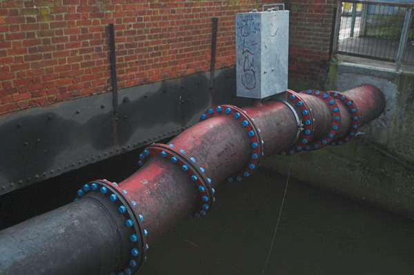
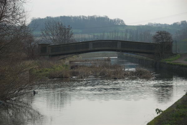
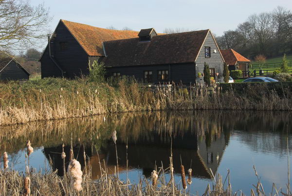
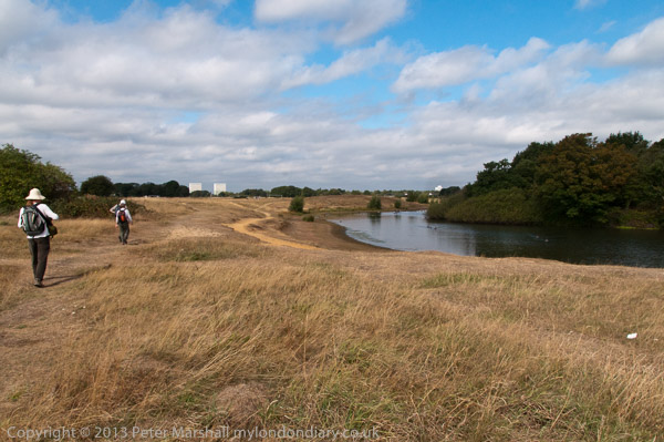
For these Sandpiper Close pictures I think the added angle of view of the panoramic greatly improves the image and gives for me a much more powerful impression of what I saw and felt standing there and looking down into the Lea Valley.

Riverhead Close, Higham Hill, Waltham Forest, 1995, 95p02-113

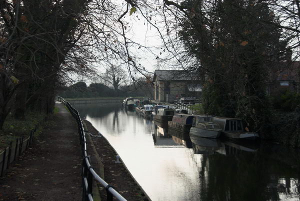
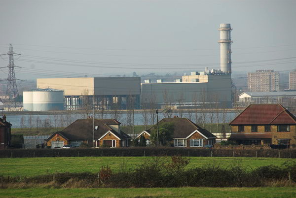
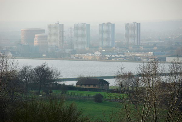
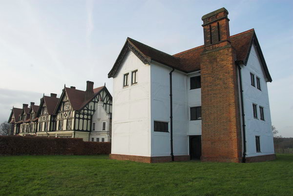
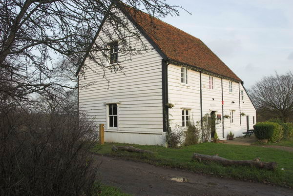
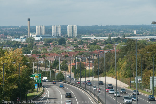
Although the two pictures of the Leisure Centre where only taken a few feet apart, they are very different images. Standing further back for the panoramic gives a better overall view of the site, but moving closer concentrates on the foreground. The slight colour difference between the two images – neither of them quite right – also complicates the issue. Colour balancing many of these old negatives is often very tricky.

Clicking on any of the images above will take you to a larger version on Flickr. You can also find some of the black and white pictures I took on the same walks in my album 1995 London Photos beginning at this picture. My next post in this series will look at more of the non-panoramic images from Waltham Forest.


FlickrFacebookMy London DiaryHull PhotosLea ValleyParis
London’s Industrial HeritageLondon Photos

All photographs on this page are copyright © Peter Marshall.
Contact me to buy prints or licence to reproduce.


Posters, Pub, Mission, Gym, House & Flats, Leytonstone 1989

More from my walk on Sunday September 3rd 1989 which had begun in Stratford, from which some images appeared in my web site and self-published book ‘1989’, ISBN: 978-1-909363-01-4, still available. For those images which were in the book I’ll show the book pages here.

Posters, Pub, Mission, Gym, House & Flats
Posters, High Rd, Leytonstone, Waltham Forest, 1989 89-9a-44

Posters, Pub, Mission, Gym, House & Flats
Plough & Harrow, pub, 419, High Rd, Leytonstone, Waltham Forest, 1989 89-9a-45

London City Mission, Ferndale Rd, Leytonstone, Waltham Forest, 1989 89-9a-46

The Victoria County History records an incredible number of missions in Leytonstone mostly formed in the late nineteenth century when this area must have seemed particularly Godless. This mission in Ferndale Road began about 1895 “when the five children of Henry Borton, a builders’ merchant at Wanstead, began holding evangelistic services in the Assembly Rooms. In 1901 their father built for them the present hall in Ferndale Road, designed in brick and stone with baroque features by T. & W. Stone. “

In 1948 the last of these children working there invited the London City Mission to take charge of the building and it became their central Hall. Google Street view shows it in 2008 as Christ Apostolic Church but by 2018 it had become Gospel Generation, “A Church Like No Other“.

Hyams Gymnasium, 857 High Rd, Leytonstone, Waltham Forest, 1989 89-9a-32
Hyams Gymnasium, 857 High Rd, Leyton, Waltham Forest, 1989 89-9a-32

I can find little or nothing on-line about Hyams Gynasioum other than my pictures, but the building is still there this side on Gainsborough Road with its entrance on High Rd, but in very different use.

This is now The Walnut Tree, a Wetherspoon pub, and as often it has some history of the area it its web page, but this does not mention Hyams Gym. The figures on the building’s side have gone and its groundfloor windows have been bricked up but the rows of 8 or 9 upper floor gym windows remain.

Leytonstone House, Hanbury Drive, Leytonstone, Waltham Forest, 1989 89-9a-33

Leytonstone House has lost its Virginia creeper but otherwise looks much the same, though I think its surroundsings are now different.

Wikipedia statesLeytonstone House, built 1800 and Grade II-listed, was the home of Sir Edward Buxton, MP and conservationist, who with his brother played a big part in preserving Epping, Hainault and Hatfield forests. It housed Bethnal Green School for the juvenile poor from 1868 to 1936.”

Leyton Flats, Snaresbrook, Waltham Forest, 1989 89-9a-21

Leyton Flats in Snaresbrook is not a tower block but a green space that is part of Epping Forest, largely open grass land but some woodland and two large ponds, Hollow Pond and Eagle Pond which is one of the oldest in the forest and swarms with swans, probably because many injured swans nursed to health by swan resuce organisations on the Thames have been released here. But people are more likely to be imprisoned as the Flats is also home to Snaresbrook Crown Court.

The house in the distance here is at 85, 85a and 87 Whipps Cross Rd, on the corner of Chadwick Road. Locally listed, The Gables was built in 1895 and was part of the Wallwood Park estate which was once the home of the Governor of the Bank of England William Cotton who died in 1845.

Leyton Flats, Snaresbrook, Waltham Forest, 1989 89-9a-23

Another sculptural group of fallen trunks in the south-east corner of Leyton Flats.

Leyton Flats, Snaresbrook, Waltham Forest, 1989 89-9a-26

Men are fishing in the Hollow Pond on Leyton Flats, close to the Whipps Cross roundabout and Whipps Cross Hospital. The pond, the result of gravel workings, is also a boating lake. Water from the ponds may eventually find its way into the River Roding, but they have never as has been claimed fed the ornamental lakes of Wanstead Park.


FlickrFacebookMy London DiaryHull PhotosLea ValleyParis
London’s Industrial HeritageLondon Photos

All photographs on this page are copyright © Peter Marshall.
Contact me to buy prints or licence to reproduce.


London Loop – Enfield Lock to Chigwell

London Loop – Enfield Lock to Chigwell – If you want a good walk on the outskirts of London to walk off a little of the excesses of Christmas I can recommend this section of the London Loop. In the book guide we – myself my wife and my elder son – used on 28th December 2006 it was section 13, but now appears to be split into two parts as Sections 18 and 19. You can download excellent walk guides from Inner London Ramblers. Bits can be muddy so you need walking boots.

London Loop - Enfield Lock to Chigwell

It’s not a particularly long walk and starts and ends at stations. Photographers always add a little by wandering around a bit and running up slopes to get a better view. But back in 2006 a little under 9 miles was fine for me, though now I might prefer to split it into the two sections.

London Loop - Enfield Lock to Chigwell

The rail journey to Enfield Lock takes around an hour and a half for us, changing from the Victoria Line to Greater Anglia at Tottenham Hale, and coming home from Chigwell which is on the Central Line just a little longer. The walk itself at a moderate pace with a stop to eat our sandwiches a little over 4 hours, and in December to finish in daylight means starting walking around noon, though we made it a little earlier and arrived at Enfield Lock just after 11am.

London Loop - Enfield Lock to Chigwell

My first picture online came not long after, although the rather decorative length of piping in the top picture may not appeal to all. I think it was over the Turkey Brook, though I can’t exactly remember the location. But soon we were walking past the 1907 Lee Conservancy Offices at Enfield Lock and then a short distance beside the Lea Navigation.

London Loop - Enfield Lock to Chigwell

Then we crossed the navigation taking the footpath to Sewardstone walking to the north of King George’s Reservoir and following one of the branches of the River Lea and then crossing another wide flood relief channel and then coming to something that looks rather more like a proper river.

The route from here is uphill for some way. Somewhere we passed two horses heads and and on the Sewardstone Road a nursing home.

A few yards along the busy road (its the A12) we left and continued uphill, pausing at times to admire the view across the Lea Valley.

Here we got another view of the rather mysterious structure that had loomed above the Lea Navigation which is Enfield Power Station, built in 1997-9, a gas-fired power station built partly on the site of the decommissioned Brimsdown Power Station.

A little further on there were more views, across the reservoirs to Ponders End. But soon we came to more rural scenes including the pond and houses of Carrolls Farm.

The next section of the walk involved a lot of woods and is part of Epping Forest and also includes the Scout camp at Gilwell. The IL Ramblers notes recommend an alternative route which gives better views, but we only had the book and I made few pictures on this section – none of which are on the web.

We stopped to eat our sandwiches beside Queen Elizabeth’s Hunting Lodge on Chingford Plain where we also bought crisps and soft drinks to go with them, and sat around rather too long before taking a look at the building and then continuing.

Here we got a little lost in Epping Forest as the directions in the book were perhaps rather less clear than those online, so I think our route was just a little different to that intended. We found the Butler’s Lodge, but despite the promise in the book it was not serving tea.

There were some views on our way, but the suburbs here are not really picturesque. I think the river in the picture below is the Roding rather than the Ching which was more of a small ditch where we crossed it.

Parts of the route led along roads and perhaps the best that can be said for them are that they were downhill – and by this time I was getting tired. Eventually we came to the station and sat down and waited for a train.

There are a few more pictures as well as those above on My London Diary.


FlickrFacebookMy London DiaryHull PhotosLea ValleyParis
London’s Industrial HeritageLondon Photos

All photographs on this page are copyright © Peter Marshall.
Contact me to buy prints or licence to reproduce.


Epping Forest Centenary Walk

Epping Forest Centenary Walk 2009: London is in some ways a ‘green city’ with over 3,000 parks of varying sizes within the boroughs which make up Greater London. These range from pocket handkerchief areas to large commons and royal parks such as the roughly 2500 acre Richmond Park.

Epping Forest Centenary Walk
Wanstead Flats

London Mayor Sadiq Khan supported London being designated as the world’s first National Park City in 2019 and announced plans to increase the amount of ‘green space’ to 50%. This isn’t a huge target as according to the capital’s environmental records centreRoughly 47% of Greater London is ‘green’; 33% of London is natural habitats within open space according to surveyed habitat information and an additional 14% is estimated to be vegetated private, domestic garden land.”

Epping Forest Centenary Walk
One of the Montague Road Estate flats had misssiles on its roof for the Olympics

In order of size, starting with the largest they categorise this as Other Urban Fringe, Parks And Gardens, Natural And Semi-natural Urban Greenspace, Green Corridors, Outdoor Sports Facilities, Unknown and amenities with other minor contributions. Some 22% is classified as Green Belt which gives some quite strong protection against development, though my borough is currently proposing to build on a little of it.

Epping Forest Centenary Walk
The walk goes on a bridge across the North Circular Road

The protection of green spaces in and around London has a long history, back to the Norman conquest when kings set up royal hunting grounds convenient to their palaces in Westminster and further afield. These were called forests, though most were mainly open land rather than full of trees; the name was a legal term meaning only the king had the right to hunt deer in them. One of the larger areas, established by Henry II in the 12th century was Epping Forest, part of an even larger Forest of Essex.

Epping Forest Centenary Walk
Memorial to a famous evanglalist Gypsy Rodney Smith born in a bender here

Enclosures began to threaten the future of the forest at the start of the 19th century when around a third of the remaining forest was allowed to be privatised for building development and farming by the lords of various manors in the forest. By 1870 around two thirds of the forest had been enclosed.

Warren Pond

By this time many people had become worried about the loss of the commons, particular after neighbouring Hainault Forest had been sold off by the Crown, the trees removed and the area turned into poor agricultural land. More and more people were coming out from London during their free times to enjoy the green spaces in the outskirts and preservation societies were set up.

Queen Elizabeth’s Hunting Lodge

The City of London became involved after it bought land at Manor Park for the City of London Cemetery. Traditonally the city had organised Easter Monday stag hunts in the forest, but they now became commoners with the right to graze animals, and began legal actions agaimst lords of the manor who had enclosed forest land. Eventually Acts of Parliament allowed them to purchase the forest manors and an court in 1874 ruled that all enclosures made since 1851 were illegal.

Under the Epping Forest Act 1878 the forest ceased to be a royal forest and became managed by the City – as it still is. The Crown lost its right to venison and commoners lost some of their rights too, but the City Conservators were obliged to “at all times keep Epping Forest unenclosed and unbuilt on as an open space for the recreation and enjoyment of the people.”

The preservation of Epping Forest was the first major victory in Europe for the modern environmental movement. Four years later it was endorsed by Queen Victoria, who although it was no longer royal but in the hands of the City of London, nevertheless stated “It gives me the greatest satisfaction to dedicate this beautiful forest to the use and enjoyment of my people for all time“.

On the 100th anniversary of the Epping Forest Act in 1978, the Friends of Epping Forest began a annual series of anniversary walks from along a route they established from Manor Park Station to Epping. The Friends were originally formed to oppose the routing of London’s orbital M25 through the Forest, leading to it being put in a tunnel. But they have been less successful in opposing some other breaches of the 1878 Act, and in 1989-94 a large section of the south of the forest was lost to build the M11 link road, and during the London 2012 Olympics a temporary police station was allowed to be built on Wanstead Flats.

Epping Station at the end of our walk

I walked the Epping Forest Centenary Walk with some of my family and a friend on Bank Holiday Monday 31 August 2009, and you can download a leaflet including a map (though I’d advise also having the OS Explorer 174) of what has now been renamed the Epping Forest Big Walk. According to this it is 14.1 miles (22.7km) but we managed to walk rather further, possibly partly because we got a little lost at times. Of course you can do the walk in stages rather than all on the same day. If you want to walk with others you can join the free Big Walk this year on Sunday 17th September 2023 to be led by experienced guides!