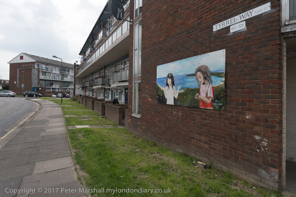
Israel, City Island, Mayfair & West Hendon: I did a lot of travelling around London ten years ago on Thursday 22nd January 2015 by public transport and on foot. First I made the journey by rail, underground and DLR to the Excel Centre for a picket calling on HP to stop supporting Israeli prisons and military, then walked to the Lower Lea Crossing to photograph building work on City Island and on to the DLR at East India station to go to Canning Town From there the underground took me to Green Park and the Ritz where I met a small group from Class War on a visit to ‘Rich London’.
I had to leave them on Bond Street to make my way- tube, a short walk between stations in West Hampstead and rail to Hendon with another short walk to meet West Hendon Estate where residents were just coming out from a meeting to march from the estate to a rally outside Hendon Town Hall and I walked the just over a mile with them. But after around 20 minutes of the rally I felt very tired and had to leave for home – another short walk and an hour and a half of travel.
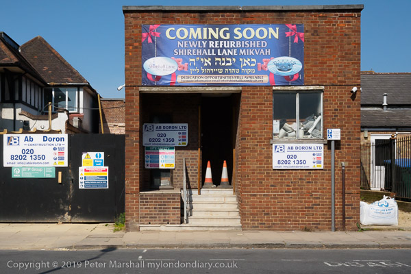
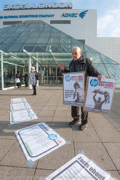
Stop Arming Israel picket HP at BETT
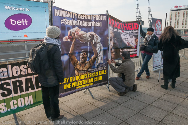
Protesters had come to picket the Excel Centre where Hewlett Packard’s Vice-President for Worldwide Education, Gus Schmedien, was speaking at the BETT education technology show, to ask ‘What about the Palestinian Children You’re Helping Kill?’ They had set up a highly educational display close to the entrance and also gave some speeches and handed out fliers.
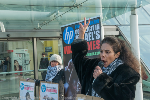
HP supply equipment and services which keep both the Israeli prison system and the Israeli military running and so support the killing, torture and other illegal activities of the Israeli regime.
Many of the teachers and others going into BETT stopped to take leaflets and talk with the protesters, some taking photographs of themselves or colleagues in front of the protest.
More pictures at Stop Arming Israel picket HP at BETT‘
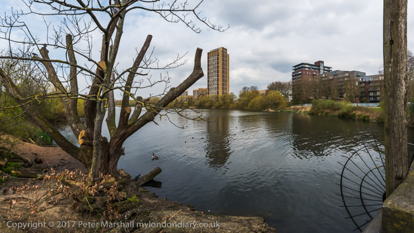
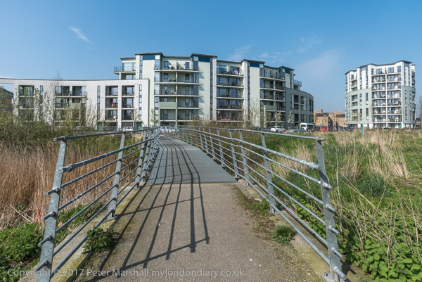
City Island – Lower Lea Crossing

Building work both on the former Pura Foods site on Bow Creek, now renamed City Island and on the Limmo Peninsula site on the eastern bank of Bow Creek was now going ahead.

City Island isn’t an island but in the downstream loop of the s-shaped bend of Bow Creek south of the East India Dock Road and is surrounded on three sides by the tidal river.

Building on City Island was abandoned after the site had been cleared and a single building erected when the financial crisis hit in 2008 and it was now shooting up fast. The elevated Lower Lea Crossing
More pictures City Island – Lower Lea Crossing
Class War visit ‘Rich London’ – The Ritz and Old Bond St
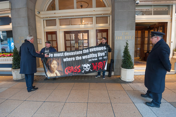
I met with a small group from Class War outside the Ritz where they were holding their banner with its quotation from US Anarchist Lucy Parsons (1851-1942), “We must devastate the avenues where the wealthy live“.
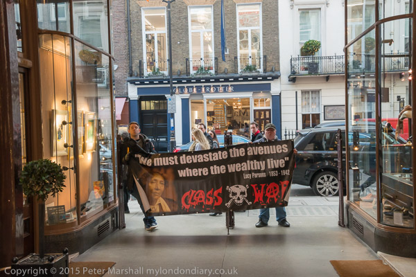
From there they took the banner to stand in front of some shops on Piccadilly and then onto Old Bond Street, pausing outside De Beers and then into the Royal Arcade.
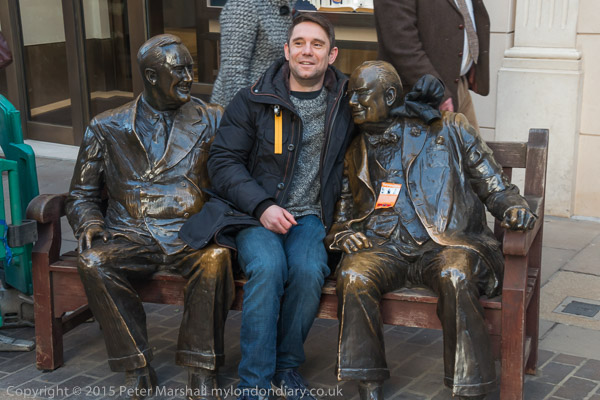
It seemed a fairly aimless wander, Stan took a seat with Churchill (who is wearing a Class War ‘Spot the Tory’ sticker.)
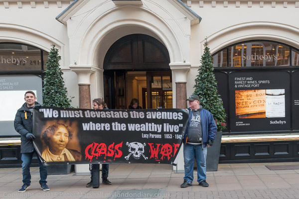
I left them holding up the banner outside Sothebys to go to Bond St and make my way to West Hendon.
More pictures. Class War visit ‘Rich London’.
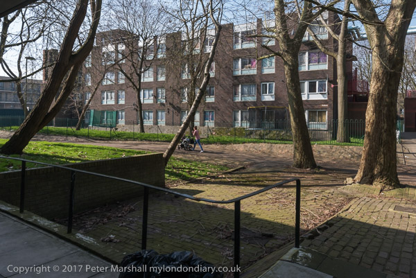
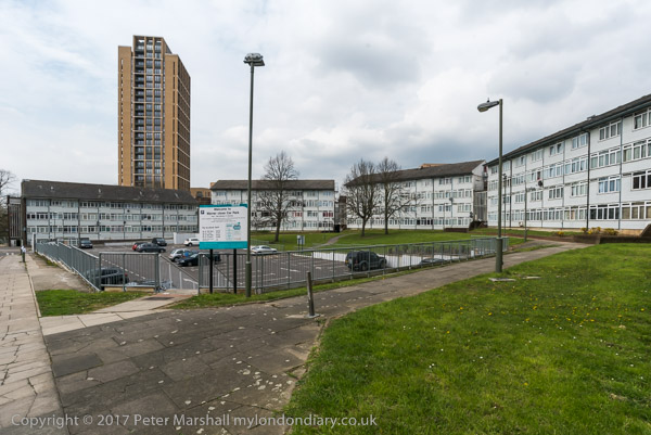
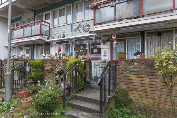
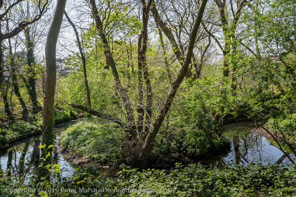
West Hendon march for Social Housing – Hendon
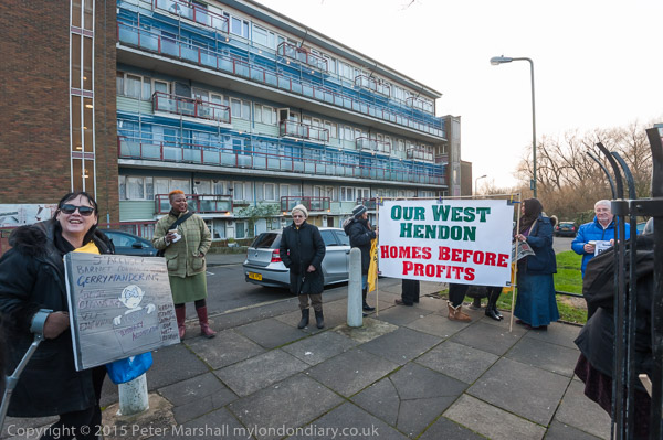
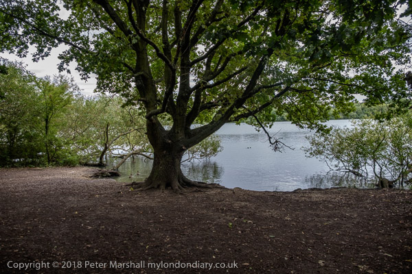
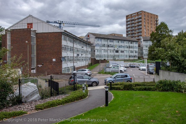
Residents on the West Hendon estate overlooking the Welsh Harp reservoir were fighting the the redevelopment of their estate for sale to the rich. Its waterside location makes it a very desirable location for developers and estate agents.

The residents were campaigning for all who live on the estate to be rehoused in the area and I arrived at the end of a meeting in the community centre with speakers from other housing campaigns including Focus E15 from Stratford.

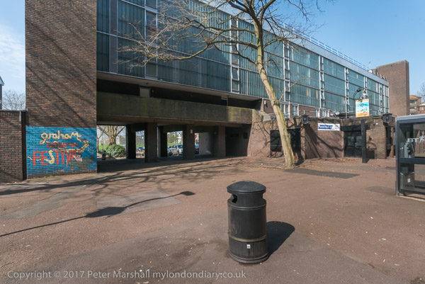
I took pictures of them posing outside the community centre then went inside where free hot soup was very welcome before we went outside for a march around the estate. A banner was dropped from one of the balconies with the message ‘Public Housing Not Private Profit’.

Part of the area to be built on was York Memorial Park, a green open common designated as “a War Memorial in perpetuity” to the 75 people killed and 145 severely injured by a bomb dropped here on 13th February 1941. Over 366 houses were destroyed and a further 400 damaged by the blast, with 1500 people made homeless.
You can read more about this on ‘Broken Barnet‘ which relates how the promises that this would be preserved “were quietly buried by Barnet Tories, once they had made a deal, in secret, with Barratt London” and that at the Housing Inquiry they even denied the existence of the park – where there is now a 29 storey tower block of luxury flats.
We stopped here for a short memorial service to a Hendon war hero, Dorothy Lawrence, the only female Sapper of WW1, serving in the Royal Engineers, 51st Division 179th Tunnelling Company, BEF. You can read more about her and her unfortunate life after this in my post from 2015.

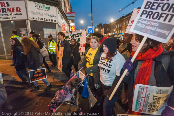
Then we marched for a mile or so in the dark to Hendon Town hall where the third day of the Housing Inquiry had just finished ned for a rally with a number of speeches from people from West Hendon and other campaigners, including Jasmine Stone from Focus E15. Some who spoke had been at the enquiry and were able to tell the crowd what had happened so far. But I was too tired to stay to the end of the rally.
More at West Hendon march for Social Housing.
Flickr – Facebook – My London Diary – Hull Photos – Lea Valley – Paris
London’s Industrial Heritage – London Photos
All photographs on this page are copyright © Peter Marshall.
Contact me to buy prints or licence to reproduce.