Posts Tagged ‘St Thomas's Creek’

Chariot Festival, Olympic Site and Notting Hill

Saturday, August 27th, 2022

Chariot Festival, Olympic Site and Notting Hill

Chariot Festival, Olympic Site and Notting Hill. Sunday 27th August 2006, sixteen years ago was a busy day for me, travelling to East Ham to photograph a colourful Hindu festival, then on to Stratford for a short walk along the High Street and Bow Back Rivers, before taking the underground and ending up on Ladbroke Grove for the Children’s Day of the Notting Hill Carnival.

It was part of a very full few days for me, having got back to London after a couple of weeks in Paris and a few days with family in Beeston. Friday I’d put my folding bike on the train to Greenhithe and spent a day cycling around there and Swanscombe, Saturday I’d walked around 12 miles on the London Loop and after the events here on Monday I’d returned to Notting Hill for the carnival itself, after which I needed a few days rest. The text here is taken from My London Diary – with a few corrections, appropriate capitalisation and some additional comments. There are some more details in the captions on the picture pages of these events.


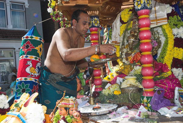
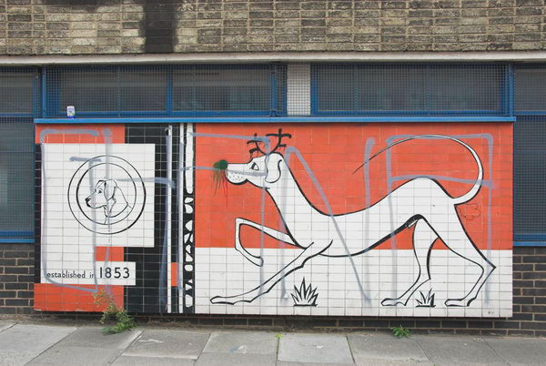
Sri Mahalakshmi Temple Chariot Festival – East Ham

Chariot Festival, Olympic Site and Notting Hill

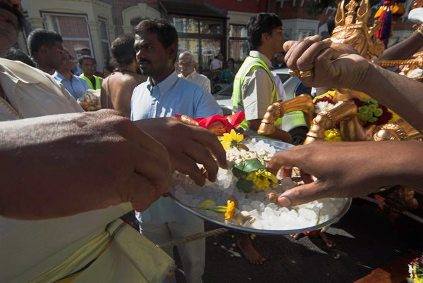
Sunday morning found me in East Ham, where the Hindu Sri Mahalakshmi Temple was holding its chariot festival. It was a colourful and friendly event, but I soon felt I’d taken enough pictures and left.

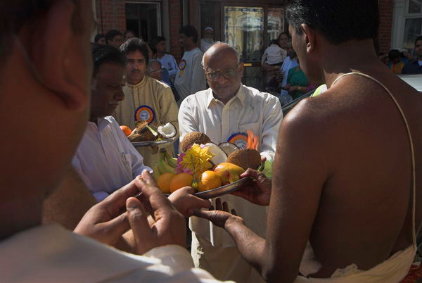
It’s hard to show the flames when the offerings of food are made to the god, and difficult to catch the colour of the occasion.

more pictures


Lea Navigation and Bow Back Rivers – Stratford

On my way back from East Ham I stopped off at Bromley-by-Bow and walked up to Stratford High Street and along the rivers and channels there.

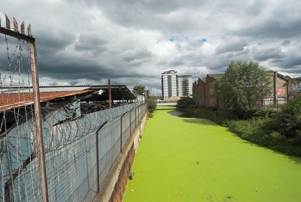
Parts were so thickly covered with bright green growth that they looked as if I could have walked along them.

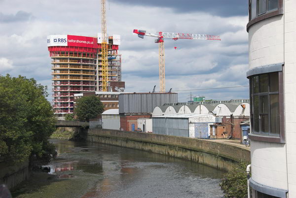
There was another site demolished on the high street, with new housing starting to go up.

more pictures


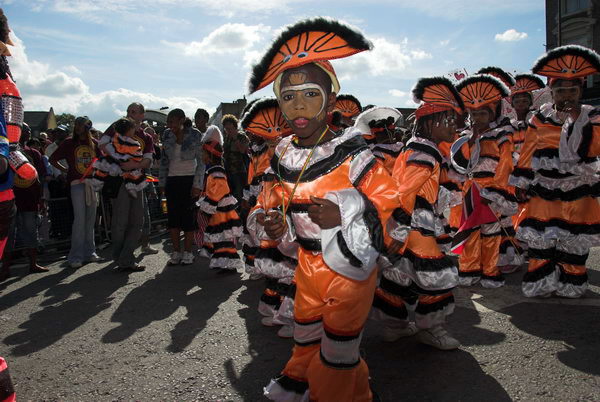
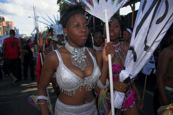
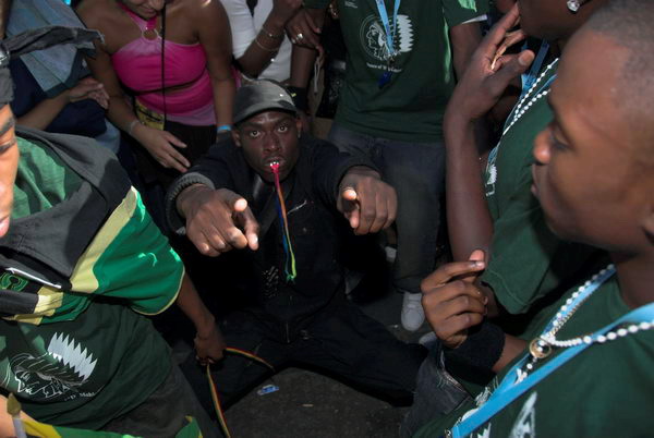
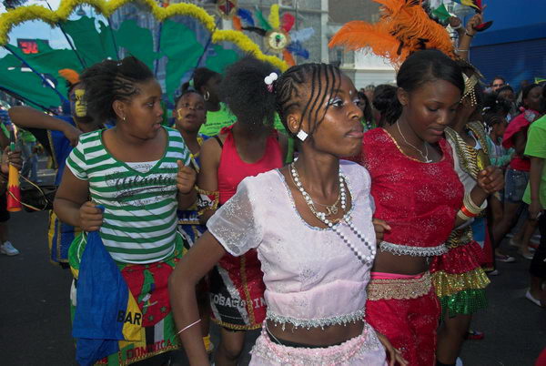
Notting Hill Carnival – Childrens Day – Notting Hill

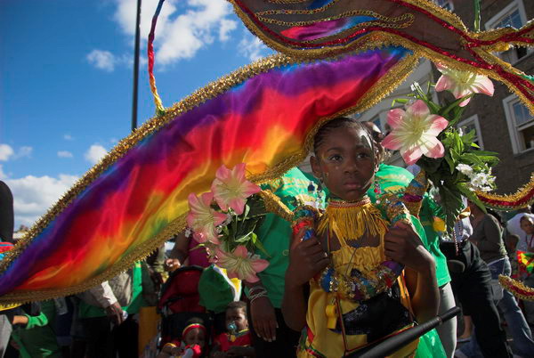
But the big event of August is always Notting Hill Carnival, and I was there both on the Sunday afternoon for Childrens’ Day and for the main event on the Monday, shooting both black and white film and colour digital.

[I noted back in 2006 that when I would get round to processing the black and white film is “anyone’s guess”. I think it was around ten years later that I finally admitted I wasn’t going to develop the chromogenic black and white films myself and the chemicals were probably past their best and I sent them for commercial processing. Though by then I wasn’t sure whether I had taken them in 2006 or 2007. But back to my 2006 post.]

Perhaps it’s because I’m getting older, but I didn’t get the same buzz from this year’s event as in previous years, though most of the same things seemed to be around.

Perhaps this was the problem; most of them did seem to be the same, two years on from when I last photographed the event. Last year, 2005, I tried to go, dragging myself to the station with a knee injury, but the pain was too much to continue. This year my knee held out, though I was glad to sink into a seat on the Underground at Latimer Road at the end of the day.

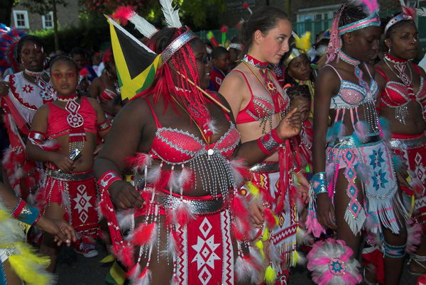
I didn’t take many colour pictures on Children’s Day, and most weren’t of children, and I think I probably didn’t stay long, but there are many more on the pages which follow on from there taken the following day.

more pictures


Marshgate Lane

Friday, January 15th, 2021

Marshgate Lane, Stratford Marsh, Stratford, Newham, 1990 90-9h-53_2400-2
Marshgate Lane from Northern Outfall Sewer, 1990

Marshgate Lane runs through the centre of Stratford Mash and what became the London 2012 Olympic site. It’s southern end was a short distance north of the bridge over St Thomas’s Creek on Pudding Mill Lane, and it ran parallel and a few yards to the east of Pudding Mill Lane, which rejoined it just south of the Northern Outfall Sewer. Marshgate Lane then continued in its northerly route past Knobs Hill to run beside the Old River Lee and across both the City Mill River and the Waterworks River to Carpenters Road.

City Mill River, Marshgate Lane, from Greenway, Northern Outfall Sewer, Stratford Marsh, Newham, 1983 33x-32_2400
Industry between Marshgate Lane and the City Mill River, 1983

It’s southern area still follows the same route, though it now starts at Stratford High St, which was previously Pudding Mill Lane, and north of the sewage outfall its route is completely different. But what was back in the 1980s a street lined for much of its route with industrial premises is now a wasteland with some athletic facilities, parts of which will shortly be covered with tall blocks.

Marshgate Lane, Stratford Marsh, Stratford, Newham, 199090-9g22_2400
Maryland Plastics, St Thomas’s Creek, Pudding Mill Lane, 1983

As well as the Olympic devastation, Crossrail has also played havoc with the southern area. An earlier addition with little disruption was the Docklands Light Railway, extended to Stratford for the Olympics and opened to the public in 2011 with a station on Pudding Mill Lane, which gives considerably more convenient access to the area.

Marshgate Lane, Stratford Marsh, Stratford, Newham, 1990 90-9g24_2400
Marshgate Lane, 1990

It isn’t always easy to decide now exactly where I took some of these pictures as I wandered freely around the area, both on the streets, on the Greenway and other footpaths and through some small areas of waste land. So some pictures captioned as Marshgate Lane may actually be on Pudding Mill Lane or even Barbers Rd or Cooks Road.

Marshgate Lane, Stratford Marsh, Stratford, Newham, 1990 90-9g26_2400
Marshgate Lane, 1990

There was considerable opposition from some of the businesses in the area to the redevelopment for the Olympics, and for some it was the end of their business, while a few did well out of their relocation. I continued to photograph in the area during the redevelopment, though access to much of it was closed, the area surrounded by a blue fence and security guards. Now there is little to attract me back to Stratford Marsh, and my few visits before Covid have been sadly disappointing.

Marshgate Lane, Stratford Marsh, Stratford, Newham, 1990 90-9h52_2400
Marshagate Lane, 1990

More pictures from the 1980s on Flickr.


All photographs on this and my other sites, unless otherwise stated, are taken by and copyright of Peter Marshall, and are available for reproduction or can be bought as prints.


City Mill Lock & Blaker Rd

Thursday, January 14th, 2021

City Mill Lock, Blaker Rd,  Stratford Marsh, Stratford, Newham, 1990 90-9f-32 (2)_2400
City Mill Lock, Blaker Rd, Stratford Marsh, Stratford, Newham, 1990

City Mill Lock connected the tidal Waterworks River with the Bow Back Rivers which are a part of the Lea Navigation and thus at a constant level. There is another lock connecting the two systems further north where Carpenters Lock connects the Old River Lea to the start of the Waterworks River close to Carpenters Road. Both locks were built in the 1930s when considerable work was carried out, mainly to reduce flooding but also with the intent of increasing commercial traffic on the Back Rivers, particularly the City Mill River. But I think this never happened and by the 1960s these streams were seldom if ever used.

City Mill Lock, Blaker Rd,  Stratford Marsh, Stratford, Newham, 1983 36m-35_2400
City Mill Lock, Blaker Rd, Stratford Marsh, Stratford, Newham, 1983

The River Lea was at least theoretically navigable at the right stage of the tide some way further north – and of course much further by kayaks, though there are legal restrictions on parts of its many streams.

Since the Olympics, the tidal flow on the river has been regulated by a new lock on the Prescott Channel at Three Mills which I photographed in 2010. The original intention of British Waterways that the river above this point should be non-tidal but its level still varies, perhaps simply with the river flow.

City Mill Lock, St Thomas's Creek, Stratford Marsh, Newham, 1983 36m-22a-positive-2_2400
City Mill Lock, St Thomas’s Creek, Stratford Marsh, Newham, 1983

The lock gates had clearly seen rather better times and the lock was unusable. These gates were replaced as a part of the makeover of the area for the Olympics.

City Mill River, Stratford Marsh, Stratford, Newham, 1983 35v-15_2400
City Mill River, Stratford Marsh, Stratford, Newham, 1983

Just to the west of the lock, behind the lock keepers house, St Thomas’s Creek turns towards the north and becomes the City Mill River. A few boats were moored here, next to Blaker Rd.

City Mill River, Blaker Rd,  Stratford Marsh, Stratford, Newham, 1983 35v-13_2400
City Mill River, Blaker Rd, Stratford Marsh, Stratford, Newham, 1983

Continuing north beside the City Mill River along Blaker Road led to a footpath which went under the Northern Outfall Sewer in a tunnel. It was possible to access the Greenway walkway on the sewer from here.

City Mill River, Blaker Rd,  Stratford Marsh, Stratford, Newham, 198335v-26_2400
City Mill River, Blaker Rd, Stratford Marsh, Stratford, Newham, 1983

From where you could look down on the path and the railings beside the river.

City Mill River, Stratford Marsh, Stratford, Newham, 1983 35v-25_2400
City Mill River, Stratford Marsh, Stratford, Newham, 1983

This is the view looking back down the City Mill River towards City Mill Lock, now rather different.

City Mill River, Railway, Stratford Marsh, Newham, 1983 36m-43

The footpath led on past the Northern Outfall Sewer to a rather strangely angled basin taking the river under the main railway lines. From here you could continue walking beside the river and eventually reach the north end of Marshgate Lane and Carpenters Road.

The last time I tried to repeat this walk, in 2019, it was not possible, with work still taking place in the area and fences stopping me. As well as work still taking place after the 2012 Olympics, parts were blocked by work on Crossrail.

More pictures on Flickr.


All photographs on this and my other sites, unless otherwise stated, are taken by and copyright of Peter Marshall, and are available for reproduction or can be bought as prints.