Goodbye to Wandsworth – 1990

Goodbye to Wandsworth – 1990: The final post on my walk on Sunday 4th March 1990 which had begun at Clapham Junction in Battersea with St John’s Road & East Hill, Battersea – 1990. The previous post on this was walk was Point Pleasant and the Thames.

It wasn’t of course the last time I went to Wandsworth – I was even back there a couple of weeks ago, walking through the same areas, though much of it now hardly recognisable.

West Hill Primary, School, Broomhill Rd, Wandsworth, 1990, 90-3c-25

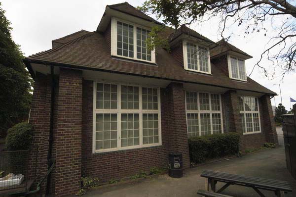
The school building is locally listed and its address is 5 Merton Road, but this is the view from Broomhill Road.

London Theatre School, Chapel Yard, Wandsworth, 1990, 90-3c-26

On a second image I made of this building I can just about make out the inscriptions on the frontage as at left ‘Erected 1573, Enlarged 1685 and on the right ‘Repaired 1809 – 31, Rebuilt 1882’. You can read all four plaques lower on the building on the London Remembers site.

This is Wandsworth Chapel and possibly the site was first used by Huguenots, though perhaps only rather later than this. Another plaque lower down mentions a Dutch congregation but from 1713-87 this was the ‘French Church.’ Later from 1809 it was Congregational and a plaque states they continued to use it for mission work until 1939 after moving to a new church on East Hill in 1860. Its history reflects the many immigrants who settled in Wandsworth and set up industries along the Wandle using its water and the power it could generate.

The current building with a hall which could hold 500 people opened in 1883 and is locally listed. Since housing the London Theatre School it became the National Opera Studio.

Pizza Delivery, Scooters, Wandsworth High St, Wandsworth, 1990, 90-3e-65

Pizza Delivery began in the UK in the mid-1980s, but back in 1990 you had to phone for a pizza, with on-line ordering only becoming widespread in the late 1990s. It was still fairly unusual in 1990 and HIPPO PIZZA with this row of five scooters ready and waiting for a call was something of a pioneer.

Entrance, Car Wash, Wandsworth High St, Wandsworth, 1990, 90-3e-66

‘Welcome, Please Drive In’ for a ‘Guaranteed Complete Clean’. At at right someone sits waiting. There is still a ‘HAND CAR WASH’ here on the High Street.

Gas Holder, Armoury Way, Wandsworth, 1990, 90-3e-51

I walked up Ram Street again to Armoury Way and took a few more pictures of the gas holder – which I’ve written more about in earlier posts about this walk.

Gas Holder, Armoury Way, Wandsworth, 1990, 90-3e-53

I think I then looked at my watch and hurried to Wandsworth Town Station taking no more pictures to catch a train rather than have to wait another half hour for the next one.

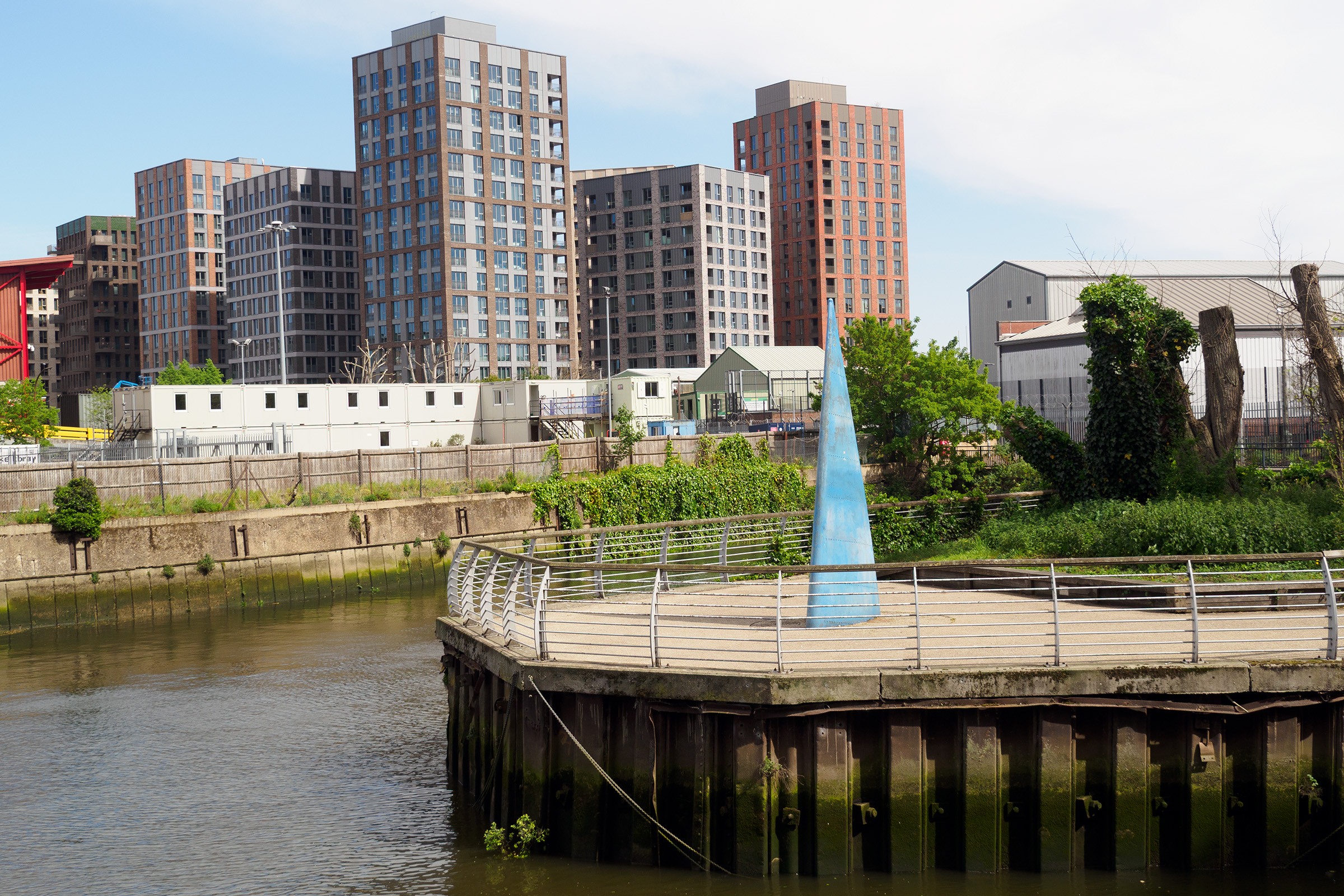
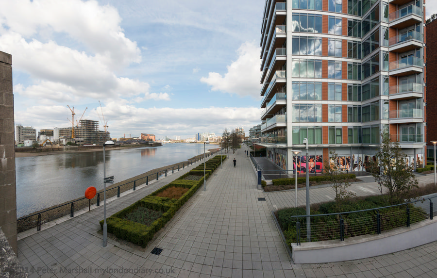
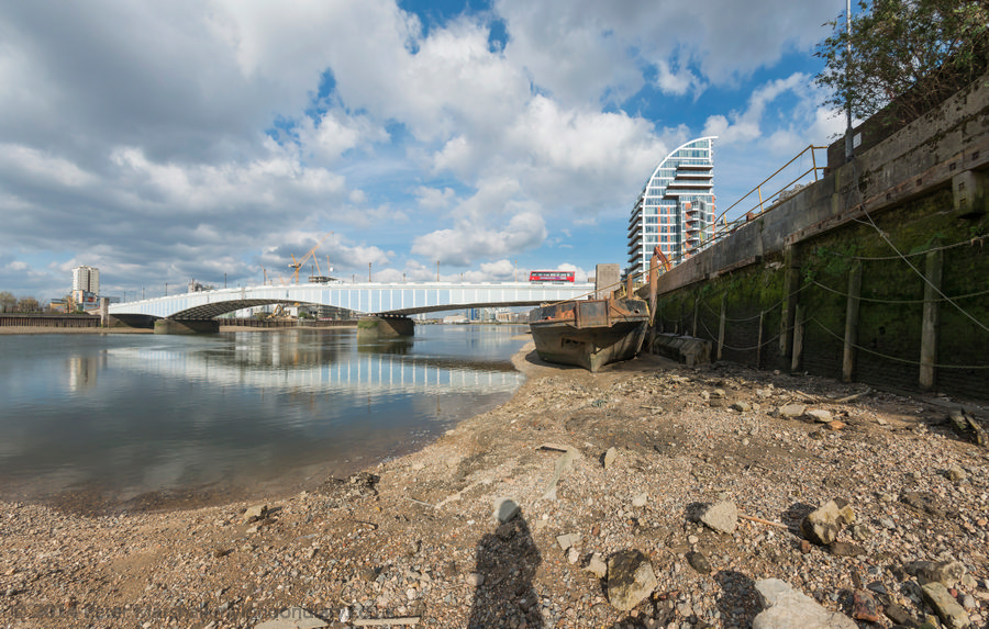
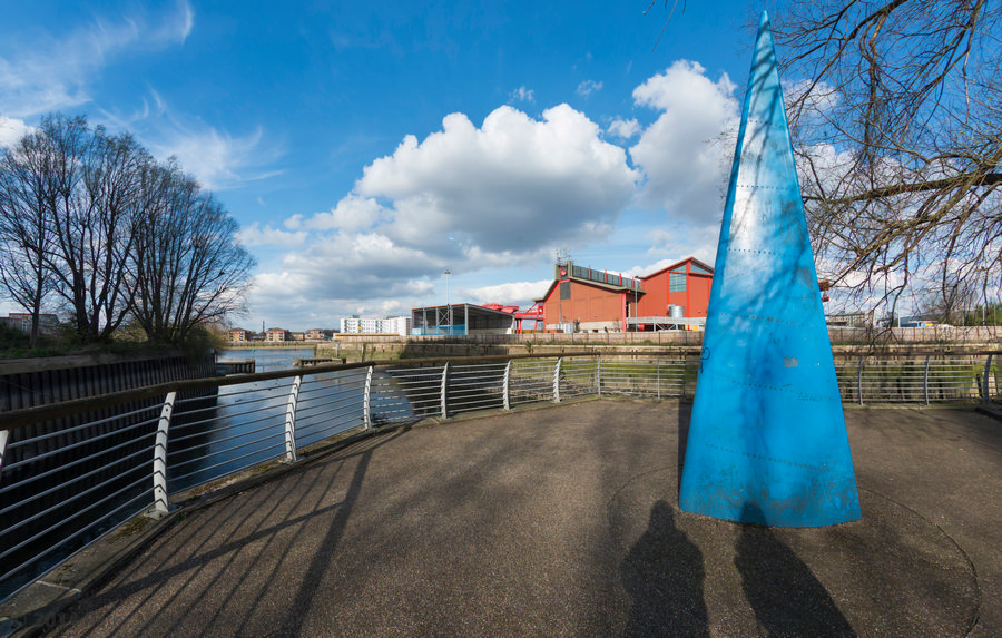
Finally, here is just one picture from the area I made on my last visit in April 2026, looking across where Bell Lane Creek and the River Wandle join. On ‘The Spit’ is a sculpture, ‘Sail’, by Sophie Horton placed there in 2003, financed by the Wandsworth Challenge Partnership. It was inspired by the sail of a dinghy, though I don’t think these have ever sailed up here. But perhaps in the new Wandle Riverside they will.

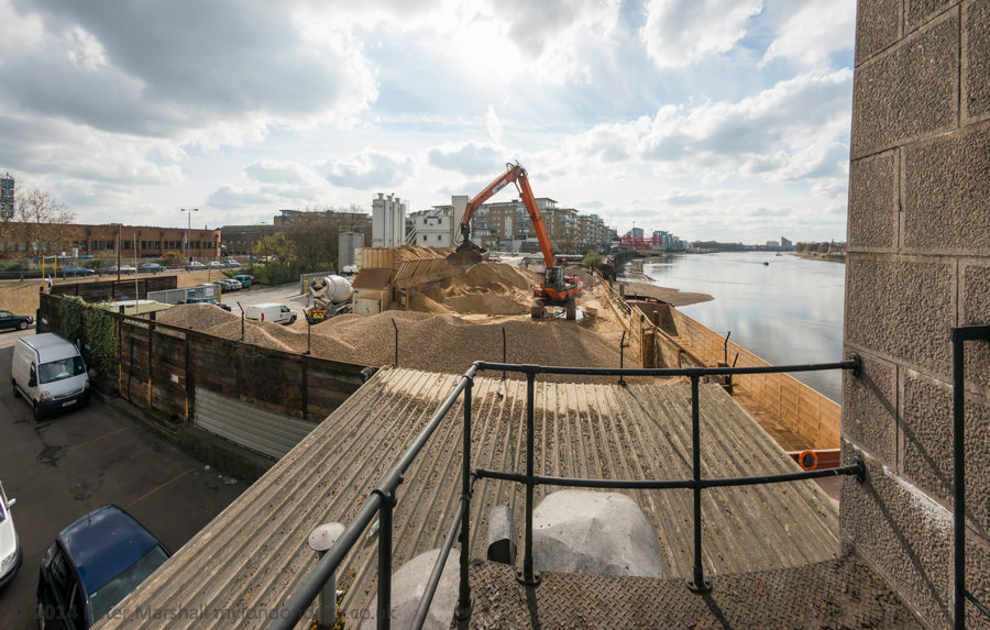
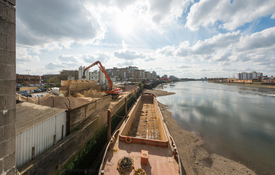
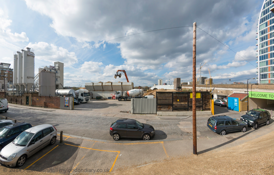
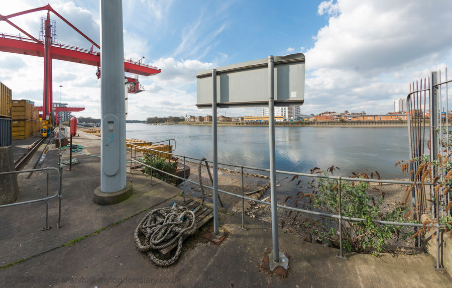
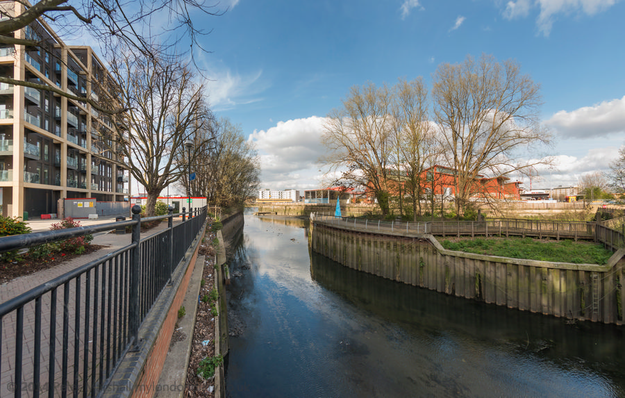
The flats are part of a new development on the former site of the Wandsworth Gasworks. And where I was standing to take this picture where there is now a riverside path leading to the River Thames was, back in 1990, part of the Shell Oil Terminal.


FlickrFacebookMy London DiaryHull PhotosLea ValleyParis
London’s Industrial HeritageLondon Photos

All photographs on this page are copyright © Peter Marshall.
Contact me to buy prints or licence to reproduce.


Yet More Wandle – 1990

Yet More Wandle: Continuing my walk on Sunday 4th March 1990 had begun at Clapham Junction in Battersea with St John’s Road & East Hill, Battersea – 1990 and the previous post to this was A Wandle Wander – 1990:

River Wandle, The Causeway, Wandsworth, 1990, 90-3b-25

I found it hard to drag myself away from this spot on the path beside the River Wandle where the previous post had ended and took several more pictures before moving on, including this one.

Tyres, River Wandle, The Causeway, Wandsworth, 1990, 90-3c-53

I didn’t move far, just a few yards further on before taking the picture above, which shows the same heap of tyres and the same covered pipe bridge – but from the other side. I think most of these pipe bridges date from the time the east side of the Wandle was occupied by the gas works.

River Wandle, The Causeway, Wandsworth, 1990, 90-3c-65

Much of the former gasworks site was then occupied by the concrete plant I wandered back and forth for some time taking pictures and cannot now remember the exact locations as the area has changed so much. This area is now a huge building site with a tall residential tower now going up.

River Wandle, The Causeway, Wandsworth, 1990, 90-3c-54

This is where the River Wandle and Bell Lane Creek rejoin, running to the right of this picture into the Thames just a few yards away. The tide was low and you can see there is little or no water running out from the Wandle with all the flow all going down Bell Lane Creek. The Shell Oil Terminal Site was in Osiers Road and this and adjoining sites have now been redeveloped with blocks of flats of various heights, the tallest around 15 storey. One gain from this is that there is now a walkway by the Wandle leading to the Thames; the previous diversion was not without interest – but had an overpowering strong smell of oil.

River Wandle, The Causeway, Wandsworth, 1990, 90-3c-55

Here I think I was looking roughly south I think over or through a fence at the north edge of the cement works where there is a cement lorry. I think this may be part of the works, possibly a water intake or perhaps a settling tank for water used for hosing down the lorries and plant, but that is simply guesswork. But as often with my pictures I did record a six-figure map reference – 257752.

River Wandle, The Causeway, Wandsworth, 1990, 90-3c-56

Also taken from The Causeway a few feet west from the previous image you can see the gasholder in the background – and at right the railway viaduct.

Finally I dragged myself away from the Wandle and made my way west to Point Pleasant where my next post on this walk will begin, coming back to those oil storage tanks beside the Wandle.


FlickrFacebookMy London DiaryHull PhotosLea ValleyParis
London’s Industrial HeritageLondon Photos

All photographs on this page are copyright © Peter Marshall.
Contact me to buy prints or licence to reproduce.


A Wandle Wander – 1990

A Wandle Wander – 1990: Continuing my walk on Sunday 4th March 1990 had begun at Clapham Junction in Battersea with St John’s Road & East Hill, Battersea – 1990 and the post before this was Court, Citadel, Gas & Brewery – 1990

River Wandle, Armoury Way, Wandsworth, 1990, 90-3b-34

The area between Armoury Way and the River Thames was and still is very much an industrial one. I think most of the pictures in this post, probably including this one were taken from The Causeway, a street that leads from the junction between Armoury Way and Dormay Street, running beside the west bank of the River Wandle. A dead end for vehicles you can walk along it to reach a footpath which leads to the path beside the Thames towards Putney – or if you turn east, to Smugglers Way. Here across the Wandle you can see a cement plant and cement lorries.

Bell Lane Creek, The Causeway, Wandsworth, 1990, 90-3c-42

Bell Lane Creek is the western of two mouths of the River Wandle and I think part of its original course though it was described as ‘a marshy area’ and might have had more channels. It was improved by the addition of a half lock from the Thames in the 1970s and apparently remains navigable from the River Thames an hour or two each side of high tide, though only as far as where I was standing to take this picture, next to a weir. The sluice gates here – which I photographed on another visit – have a bell on them inscribed ‘I AM RUNG BY THE TIDES’. The area to the right of the creek is Causeway Island.

To the left had once been the Wandsworth Royal Laundry and the creek had also extended further west to several wharves.

River Wandle, Railway Bridge, The Causeway, Wandsworth, 1990, 90-3b-35

Looking south up the Wandle under the railway bridge which carries the line from Reading and Windsor to Waterloo. Above it as left is the giant Wandsworth gasholder.

Railway Bridge, The Causeway, Wandsworth, 1990, 90-3c-51

The Staines and Windsor line is on a viaduct here, with three bridges. As well as one over Bell Lane Creek and this one, a few yards to the east is one built to carry the lines over the Wandsworth Cut – later called McMurray’s Canal – there is a very clear map from 1891 here.

This quarter-mile long canal was built in 1802 to link the Surrey Iron Railway to the Thames and had an entrance lock from the river a few yards east of the Wandle where the Wandsworth Solid Waste Transfer Station now is. The horsedrawn Surrey Iron Railway, the first public railway ceased operation in 1846 and the canal was sold to the owners of a nearby flour mill.

The mill was later owned by William McMurray who made paper from esparto grass brought from farms owned by his family in Spain and North Africa – and from the docks by barge to his Royal Paper Mills in Wandsworth. After a fire bankrupted the company, the canal was sold to the Wandsworth and District Gas Company in 1910. In the 1930s they filled it in and built over its route.

River Wandle, The Causeway, Wandsworth, 1990, 90-3b-23

A rather confusing array of bridges and pipe bridges across the Wandle just to the north of the railway bridge. At right past the parked concrete lorries is the Wandsworth Solid Waste Transfer Station.

Footpath, River Wandle, The Causeway, Wandsworth, 1990, 90-3c-63

A narrow footpath leads to the section of The Causeway at the west end of Smugglers Way. aAt right is the Waste Transfer Station and just getting into the picture at left a little of a large electrical substation.

River Wandle, The Causeway, Wandsworth, 1990, 90-3c-64

And from exactly the same position looking across the Wandle. I had probably intended to produce a panoramic image from these two exposures.

River Wandle, The Causeway, Wandsworth, 1990, 90-3b-26

And I too a third picture moving closer to the river at the same location.

I found this a fascinating area and continued to take pictures for some time – and will share a few more in a later post.


FlickrFacebookMy London DiaryHull PhotosLea ValleyParis
London’s Industrial HeritageLondon Photos

All photographs on this page are copyright © Peter Marshall.
Contact me to buy prints or licence to reproduce.


Carshalton Carnival, Merton Priory – 2004

Carshalton Carnival, Merton Priory: On Saturday 12th June 2004 I went to photograph the carnival in Carshalton and from there went on to an open day at Merton Priory, a scheduled ancient monument.


Carshalton Carnival

Carshalton Carnival, Merton Priory

It seems unclear when Carshalton Carnival first began, but it was certainly taking place in the 1930s, usually held on the second Saturday in June.

Carshalton Carnival, Merton Priory

By 2004 many other local carnivals were fading away but the event in Carshalton appeared to still be going strong, although there were fewer floats than I had expected and almost all the groups taking part seemed to be groups of children.

Carshalton Carnival, Merton Priory

Carnivals like this, organised by the local Rotary and Round Table, raise money for various charities and the Rotary had brought their Santa waving from the chimney of a very small mobile home. Carshalton’s Lavender Farm was represented by a bike-hauled trailer.

Carshalton Carnival, Merton Priory

The parade ended at the funfair taking place in Carshalton Park. I took a few pictures there too.

More pictures on My London Diary


Merton Priory Chapter House – Colliers Wood

Merton Abbey was one of the most important places in England from 1114 until Henry VIII dissolved it in 1538. The Abbey church was around the same size as Westminster Abbey and as fine a building as existing cathedrals such as Salisbury, but its fine stonework was taken down and used in other buildings, particularly Henry VI1I’s new Nonsuch Palace in nearby Cheam where building began the same year, though this in turn was demolished in 1683.

Merton Abbey was more important than Westminster or Canterbury. Here the first English laws, the eleven ‘statutes of merton’ were written in 1236, and its college established here moved to Oxford an became one of the three that started Oxford University in the 1260s.

The site remained derelict but part by the River Wandle became a calico printing works in 1724 using the power of a large waterwheel.

Alfred Liberty took over Littler’s Print Works here to print the fabrics for his Regent Street store, taking over the site completely in 1904 and using parts of it until 1977.

A little to the north in the Abbey site William Morris set up works in 1881 which produced decorated glass, printing fabrics and other goods until 1940. I don’t think anything remains of his works but there is a William Morris pub on the former Liberty site. And the world’s first public railway, the horse-drawn Surrey Iron Railway, ran through the site beside the River Wandle in 1804, taking goods to the Thames at Wandsworth.

Archaelogical investigations of the site between 1914-1920 established the floor plans of the former Abbey, uncovering its foundations. In 1959 a garden was created on the site of the main altar of the church and ‘given in perpetuity‘ to the people of Merton.

This now lies several feet below the surface of the car park of the Sainsbury’s ‘savacentre’ along with most of the rest of the huge church site, with just a little still present beneath the edge of the supermarket. Some parts of the original walls around the large Abbey site have survived.

A new dual carriageway, Merantun Way was built for the new traffic to the various shops, and the ruins of the chapter house were preserved in an enclosed area under this. Local volunteers had formed the Merton Priory Trust in 2003 and were holding an open day when I visited.

Back then the area under the road was rather dimly lit and I don’t think I took any pictures of the interior with its foundations. Cerrtainly I put none online. Now it has much better lighting and a new visitor centre with a small museum and is open on Summer Sundays to the public. You can see pictures on the IanVisits site. The Wandle Valley site shows pictures of some of the work being carried out and there is much more on the Merton Priory site.


FlickrFacebookMy London DiaryHull PhotosLea ValleyParis
London’s Industrial HeritageLondon Photos

All photographs on this page are copyright © Peter Marshall.
Contact me to buy prints or licence to reproduce.


Wandsworth Panoramas – March 2014

As a photographer I’ve long been interested in the difference between how we experience the world around us and how the camera records it. Some of those differences are obvious but others less so, and some we are seldom aware of.

Wandsworth Panoramas - March 2014

The camera records an image produced by its lens which follows strict optical rules which I learnt about long ago in my physics lessons, though real lenses deviate slightly from those ideal and perfect specimens in those science texts.

Wandsworth Panoramas - March 2014

The camera holds a film or sensor to record that image – and again does so following strict physical (and chemical for film) processes which may fail to record significant features and distort others to produce an essentially flat two-dimensional image. It may not even record colours but if it does they always to some extent arbitrary, as too are the tones.

Wandsworth Panoramas - March 2014

Those of us who grew up on film are perhaps more aware of this than the digital generations. We had to be aware of the differences in recording of, for example Ilford’s Pan F and Kodak’s Tri-X, and how these were affected by processing and printing, and of the rather unreal but different colour renditions of Kodachrome, Kodacolor, Ektachrome, Agfa, Ferraniacolor and the other colour film films, each with its own qualities. Though perhaps if we ever used Orwo film quality was not the right word for its purplish nature.

Wandsworth Panoramas - March 2014

Of course there are differences in the way digital cameras record colour, but these are rather smaller, and we can make use of software to make them match more closely or exaggerate the difference. Lightroom and Photoshop can make my Fuji files look very similar in terms of colour rendition to those from Nikon.

But our experience of a scene is very different, combining inputs from all of our senses, and it would be impossible to over-emphasise the subjective aspects. But even just visually it is still very different. While the lens cuts out all but a small rectangle in front of us, our eyes send information to the brain from a much wider field, much of it except from a small central section lacking in sharpness. Most of us have binocular vision, gathering this data from two eyes a short but significant distance apart, enabling us to see in depth. And our view is always dynamic, our eyes moving around, and as we swing our head around or up and down we have the sensation of moving through a static universe. Doing the same with a camera has a very different effect.

A standard lens – around 40 to 50mm on a full frame digital or 35mm film camera gives a similar idea of depth in its flat images to that we normally experience. With longer lens the effect of depth is reduced and by the time we get to really long lenses the images become flat patterns rather than appearing to represent a three dimensional scene. But what interested me more was what happened when the camera tried to represent a much wider angle of view than the standard, when the rectilinear rendering of normal lenses becomes impossible.

On Monday 14th of March I went for a walk with a painter friend who had brought her sketch book to introduce her to an area I thought she might find interesting. And I wanted to further explore some of the different ways of rendering very wide angles of view with digital cameras. I’d brought two Nikons with me, one fitted with a conventional wide-angle zoom which I used mainly at 16mm, close to the limit for such lenses (and I do have a wider lens which demonstrates this) and the other with a 16mm full-frame fisheye which fills the frame with an image which is 180 degrees across the diagonal.

While my friend stopped to make sketches I had time to make a series of images from similar locations. I kept warmer as I was moving around, but she fairly soon got cold, which was a good excuse to visit the pub which appears in some of these pictures, after which I took her back to the station where we had met and went back to take some more pictures on my own.

Back home I uploaded the images. Those from the conventional wide-angle zoom I’ve use as they were taken, with just the normal adjustments in Lightroom. But the fish-eye images I worked on with my panorama stitching software, PtGui, not to join images but to take the raw image data and process it it various different ways to produce cylindrical projections. If the camera was upright when the picture was taken, this will produce straight vertical lines for all upright elements. There are many different approaches to this which produce visually different results, some of which are common in mapping, such as Mercator.

Those I’ve found most useful are the equirectangular, Vedutismo and Transverse Vedutismo projections used in these examples.

More panoramic images from my walk on My London Diary at Wandsworth Panoramas.