Hall Place & River Darent

Hall Place & River Darent: More from my walks by the River Cray and Darent in September 1994. Firstly a couple of pictures from Hall Place, Bexley where the River Cray runs through the grounds of a magnificent Tudor Hall.

Park, River Cray, Bexley Hall Place, Bexley, 1994, 94-906-62

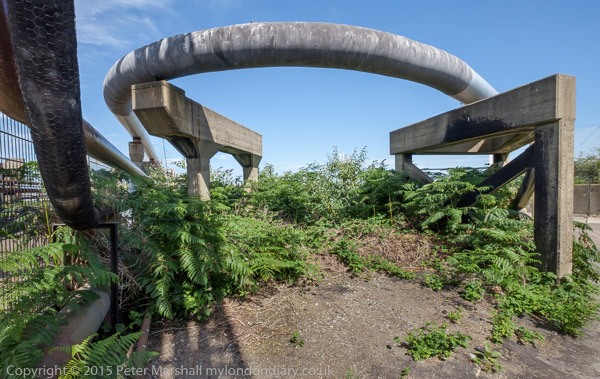
The gardens are open free of charge all year round, and are well worth a visit – and dogs, footballs, BBQs or fishing are not allowed, making it very peaceful. I can’t remember exactly where in the grounds this was, perhaps at the north close to the A2 where there is a flood channel marked on the map.

Hall Place, Bourne Road Bexley, 1994, 94-901-61

Although you can see the exterior of the Grade I listed country house for free, you can only go inside on pre-booked guided tours. I once went on one of these and possibly these pictures were taken on the same day, but I took no pictures inside the house.

The main house was built in two stages, the first in 1537 for Sir John Champneys, a wealthy merchant and former Lord Mayor of London with the fine flint and rubble walls in my picture. Some of the stone used in its construction was recycled from the ruins of the former Lesnes Abbey not far away in Abbey Wood.

When the house was sold to a second wealth London merchant, Sir Robert Austen in 1649, he decided to double its size, extending it in red brick. Later buildings including a lodge were added in the Victorian era. In the 1920s the last tenant of the hall, then owned by her wealthy American son-in-law Stephen Cox Brady, was the eccentric Lady Limerick who added some mock-Tudor interior features.

Brady died in 1928 and the house and gardens were sold to Bexley Council, but the eccentric Lady Limerick lived there as a tenant until her death in 1945. During the war the house was also in use by US soldiers who were involved in the decoding of German messages, part of the operation centred at Bletchley Park and had the code name Santa Fe.

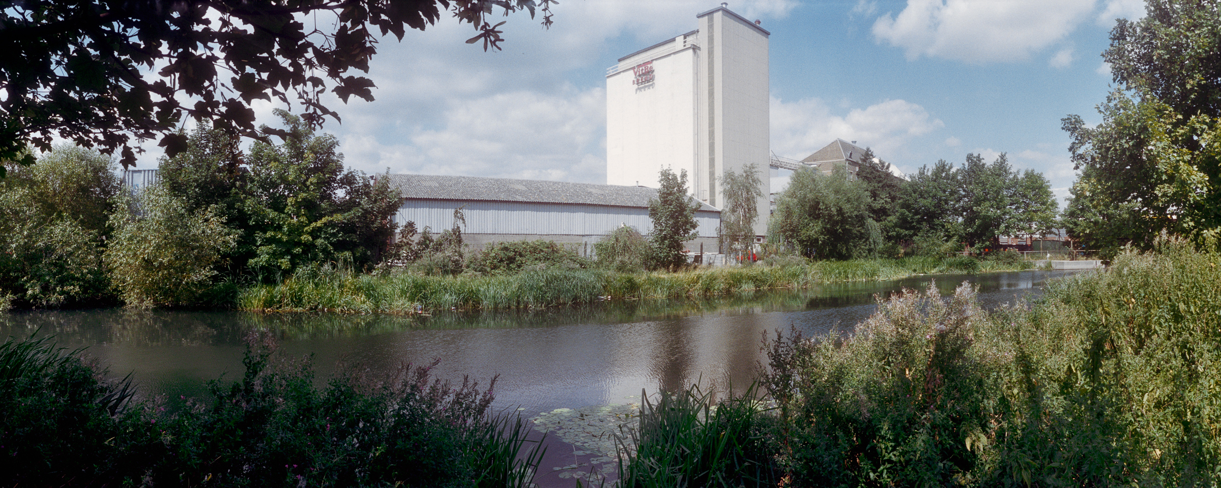
I think the next pictures were made a few days later.

Darent Industrial Park, Erith, Bexley, 1994, 94-912-23

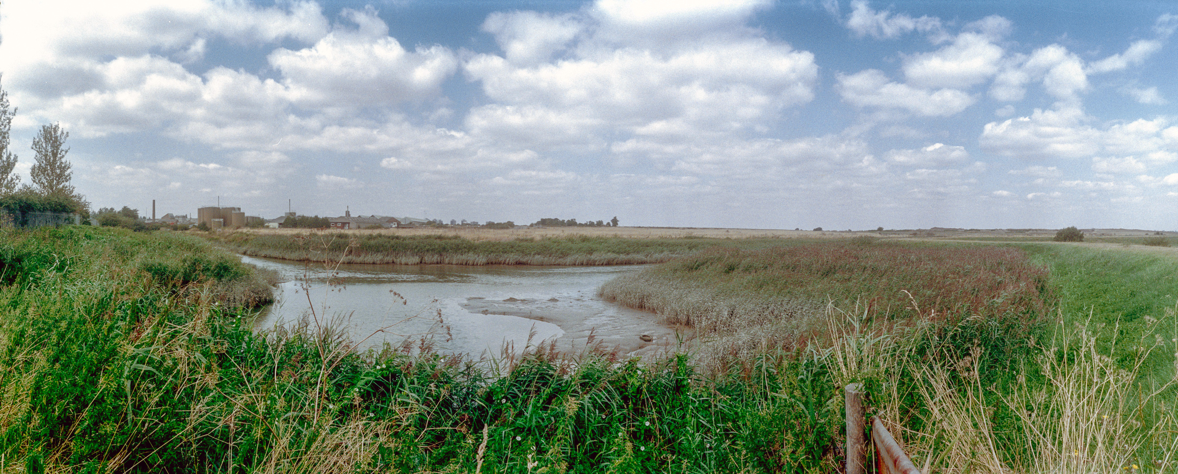
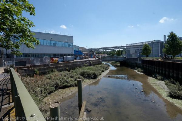
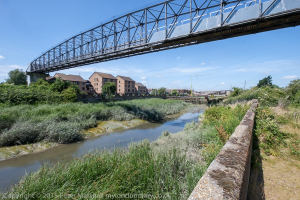
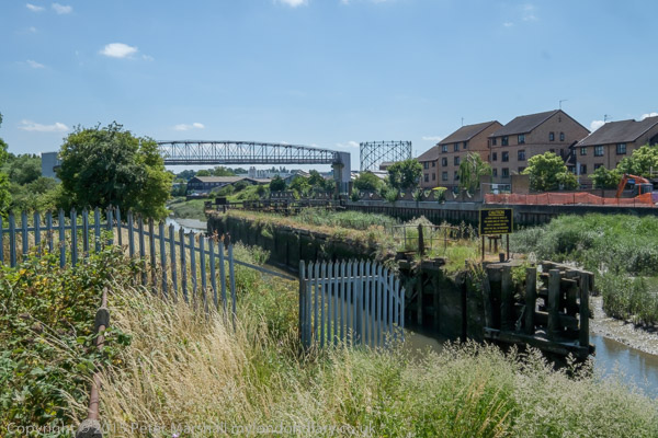
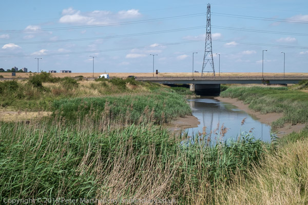
I’ve walked around beside the River Darent and on to the Thames and to Erith a number of times, and more recently on my folding bike. Usually I’ve begun my walk either at Slade Green or Barnes Cray stations, though I think I may once have done it in the opposite direction.

Darent Industrial Park, Erith, Bexley, 1994, 94-912-42

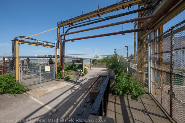
The land here is on the edge of the marshes and was marsh and grass land until the 1879s when the Thames Ammunition Works, later part of VickersArmstrong, was established here. During World War I it employed thousands, many of them women, working long hours in hazardous conditions. The site officially closed in 1962, having been run down for some years and became home to a number of smaller companies.

Darent Industrial Park, Erith, Bexley, 1994, 94-913-32
River Thames, Crayford Ness, Erith, Bexley, 1994, 94-913-42

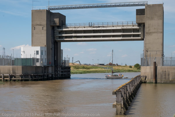
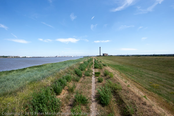
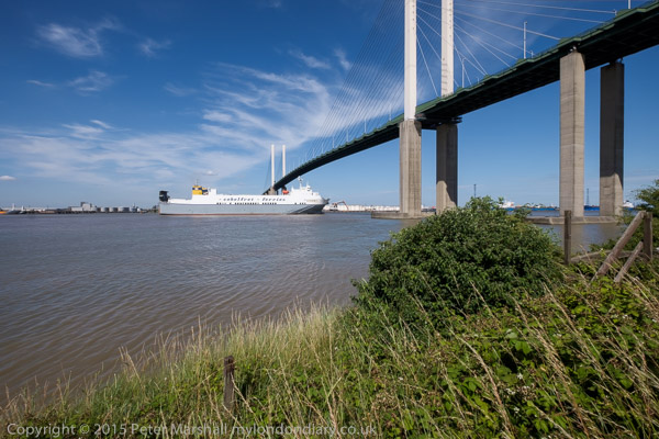
Taken from the low-lying ground immediately upstream of the confluence of the River Darent with the River Thames. At left is the QE2 bridge, with the chimney of Littlebrook Power station on the south bank – only finally demolished in 2019 though the plant had closed in 2015, and at right the Darent Flood barrier built in 1982. The riverside path runs along the top of the grassy bank at right.


FlickrFacebookMy London DiaryHull PhotosLea ValleyParis
London’s Industrial HeritageLondon Photos

All photographs on this page are copyright © Peter Marshall.
Contact me to buy prints or licence to reproduce.


The Cray Riverway – 1994

The Cray Riverway is a 10 mile long path which follow the River Cray from Foots Cray Meadows to the junction with the the River Darent and along side this to the River Thames and then into Erith. Back in 1994 I walked along most or all of it, paying several visits to the area as I was a photographer rather than a walker and liked to wander rather than stride out.

River Cray, Barnes Cray, Bexley, 1994, 94-904-53

I think I took two different swing-lens cameras on these walks, both a Japanese and a Russian model which produces very similar results in terms of angle of view (just a little over a third of the entire view around me) and quality. I used both on a sturdy Manfrotto tripod, mainly working from my eye level, and using a nine-inch carpenters’ spirit level to try to level the camera both from side to side and front to back as I found the built-in levelling insufficiently accurate (and I didn’t always get it quite right even with the larger level.)

River Cray, Barnes Cray, Bexley, 1994, 94-904-41

In 1994 I was processing my own colour negative film and I think at times the negatives suffered a little either from my inaccuracies or from chemical issues, and I find it hard to get the colour of some images exactly as I would like them. The rest of these pictures are from Flickr, but one I’ve worked on the one above again since I uploaded it there.

Footpath, River Cray, Barnes Cray, Bexley, 1994, 94-904-42

I’ve already featured some of these images on earlier posts, but here I’ll include a few different images.

Barnes Cray, Bexley, 1994, 94-904-43
Crayford Riverway, Barnes Cray, Bexley, 1994, 94-905-51
A2, River Shuttle, Pub, East Rochester Way, Bexley, 1994, 94-905-21

Some pictures by the River Darent in a later post, as well as more from Bexley.


FlickrFacebookMy London DiaryHull PhotosLea ValleyParis
London’s Industrial HeritageLondon Photos

All photographs on this page are copyright © Peter Marshall.
Contact me to buy prints or licence to reproduce.


Barnes Cray & the Cray – 1994

Barnes Cray & the Cray: Panoramas made with a swing-lens camera on a walk in September 1994 from Barnes Cray to Crayford Marshes in the London Borough of Bexley.

In 1750 Miles Barne, son of a wealthy London banker of the same name, inherited the large May Place Estate on the death of his father-in-law. Various members of the Barne family played important roles in the development of the area, with their names incorporated into Barnehurst and Barnes Cray.

Barnes Cray House had an interesting life not least when it was home to a farmer who went to the High Court to stop neighbouring land being used as a firing range by the company which became Vickers. Vickers eventually bought the house as a home for the man in charge of their Cray works, but when their factory moved away gave it to the local council who opened it as a maternity hospital. This closed in 1936 and the house was demolished.

River Cray, Crayford Flour Mill, Barnes Cray Bexley, 1994, 94-907-23

Industry came to the area in the Victorian era with a calico printing works using water from the River Wansunt, later making rubber goods, felt and finally making ‘Brussels Carpets’ – patterned carpets which have the loops of the pile uncut before being demolished in 1890. The Wansunt is a tributary of the River Cray which it joins close to here.

River Cray, Barnes Cray, Bexley, 1994, 94-904-61

The First World War led to a great expansion in the arms industry and Vickers built thousands of homes in Barnes Cray to house its huge workforce – at one point almost 15,000. The development was of good quality homes for workers with a nod to the ‘Garden Village’ vision. The development took the name Barnes Cray.

Crayford Flour Mill, Barnes Cray, Bexley, 1994, 94-904-32

An iron mill on the Cray was replaced in 1735 by a saw mill which in turn became a flour mill. In 1927 this began making Vitbe flour, with added wheatgerm to increase its Vitamin B levels, widely used by many bakereries including those of the Aerated Bread Co. In 1956 the company was renamed Vitbe Flour Mills Ltd and it was acquired by Associated British Foods in 1961.

Landfill site, Crayford Marshes, Barnes Cray, Bexley, 1994, 94-904-22
Crayford Marshes, Barnes Cray, Bexley, 1994, 94-904-11

I went for a lengthy walk on the Crayford Marshes, taking many panoramic images, but cannot remember the exact locations. Here is one of them but there are quite a few others on Flickr – you can browse this by clicking on this or other images in this post.

Crayford Marshes,  Barnes Cray, Bexley, 1994, 94-904-31
Crayford Marshes, Barnes Cray, Bexley, 1994, 94-904-31

FlickrFacebookMy London DiaryHull PhotosLea ValleyParis
London’s Industrial HeritageLondon Photos

All photographs on this page are copyright © Peter Marshall.
Contact me to buy prints or licence to reproduce.


Bexkleyheath & Crayford – 1994

Bexkleyheath & Crayford: I spent several days in mid-August in Bexley in south-east London visiting Bexleyheath, Crayford and Barnes Cray and some of the areas around, and returned to the area the following month. I think all the pictures in this post were made in August.

Crayford, Bexley, 1994, 94-812-45

Crayford obviously gets its name from a ford over the River Cray, the major tributary of the River Darent which it joins not far from here and short distance from where this flows into the Thames. Its name is thought to mean a fast flowing stream and it powered an number of mills on its route – including a paper mill at Crayford. The tidal creek is still navigable from the Thames to Crayford, and was apparently canalised in 1845. There were still barges serving the flour mill in the 1980s.

Crayford, Bexley, 1994, 94-812-33
Crayford, Bexley, 1994, 94-812-34
Crayford, Bexley, 1994, 94-812-35

Taken through the links of a fence.

The Frontier Post, Bar & Grill, Bexleyheath, Bexley, 1994, 94-812-21
Spitfire Hall, Air Training Corps, Swaisland Drive, Crayford, Bexley, 1994, 94-812-11
Sainsburys, Petrol Station, Roman Way, Crayford, Bexley, 1994, 94-812-12

I returned to Crayford and Barnes Cray the following month, making a number of colour panoramas as well as black and white picture pictures which I’ll post at some time later – or you can find them in my Flickr albums for 1994.


FlickrFacebookMy London DiaryHull PhotosLea ValleyParis
London’s Industrial HeritageLondon Photos

All photographs on this page are copyright © Peter Marshall.
Contact me to buy prints or licence to reproduce.


Darent Valley Path & Thames – 2015

Darent Valley Path & Thames: The route we took on Saturday 4th July 2015 was new to my wife and son, but one I’d taken quite a few times before, both on foot and on my Brompton, but this time I left the bike behind and walked with them.

Darent Valley Path & Thames - 2015
From Mill Pond Road, Dartford

Or rather more or less with them, as I often stopped or walked a few yards to one side or other to take pictures, and then had to scurry after them to catch up. Walking with a camera is very different from walking. My son does have a camera (one of the Fuji fixed lens X100 series) but takes far fewer pictures than me – and did much less running about.) But his captions are often rather more droll than mine, and seldom constrained by the 5W’s – Who What Where When Why.

Darent Valley Path & Thames - 2015
Footbridge across the Darent

It was a bad day for this walk, hot and sunny with virtually no shelter between Dartford and Greenhithe along the banks of the Darent and Thames. But I’d heard that there would be a boat sailing up Dartford Creek, a rare occasion at the time and decided it would be good to photograph it.

Darent Valley Path & Thames - 2015

This route is now one end of the Darent Valley Path, a 19 mile path which ends at Sevenoaks, most of which I’ve walked or cycled on other occasions, and the part beside the Thames is on the England Coast Path.

Darent Valley Path & Thames - 2015
Dartford Half-Lock

The Darent used to be navigable at least up as far as Dartford, where barges brought in and took out cargoes. Close to Dartford is a half-lock which holds back water above it when the tide goes out, long out of use but now slowly being restored to bring the waterway back into regular use.

A fixed low bridge impedes navigation. This bypass was built as University Way, but the University never came so they renamed it Bob Dunn Way

There used to be a lock which craft could go through when then the tide was high enough downstream, but that was replaced by a fixed barrier. Boats can still go through in either direction close to high tide when their is enough water for them to clear the sill.

The yacht arrived later than expected and I had to run back to photograph
it coming under the flood barrier. It was too late to get under the bridge on the same tide.

As well as the Darent, barges also went up the River Cray which joins the Darent downstream from the half-lock. This too is being brought back into leisure use.

Where the Darent meets the Thames

By the river in the centre of Dartford was the industrial estate dominated by the pharmaceutical manufacturing plant of Burroughs Wellcome who took over a former paper works here in 1889. In 1995 this became Glaxo Wellcome, the largest pharmaceutical company in the world. The works was wound down from 2008 by the then owners GlaxoSmithKline with manufacturing ending in 2013. Much of the site was empty by 2015 and now has large blocks of flats.

On the west side of Dartford Creek had been paper mills, but the last of these, owned by Wiggins Teape closed in 2009 and there was by 2015 housing on the site.

QEII bridge and Littlebrook Power station, River Thames, Dartford

When the third Dartford Bypass was built around 1988 barges were no longer bringing esparto grass and other raw materials for the paper works up the river and no thought was given to navigation. Boats that can lower masts or without them can creep under the road for a short time on a rising or falling tide when there is enough water to allow them to float but not high enough for the bridge to block their transit.

Riverside path at Littlebrook

Much of the land to the east of the creek was marshes, which made it a suitable location for the Wells fireworks factory, long closed. But I think it or an adjoining site was now in use for clay-pigeon shooting, and for much of this section of the walk we sounded under gunfire.

At the Littlebrook jetty

There had once been a pub, Longreach Terrace, and a ferry to Purfleet on the Thames close to the the mouth of Dartford creek, but both were long gone. It was here too that smallpox victims were brough ashore to the islolation wards of Orchard Hospital, demolished around 1975, part of the Joyce Green Hospital which was demolished around 2000.

The Purfleet to Zeebruge ferry goes under the QEII bridge

Further downstream on the banks of the Thames we passed Littlebrook power station – the final plant there, Littlebrook D, had ceased operation only four months earlier – before going under the Dartford QEII bridge and past Crossways Business Park. I had meant to climb up the hill to Stone Church, but missed the footpath and ended our walk in Greenhithe. But I was too tired anyway – and had stopped taking pictures on this last part of our walk.

More at Darent Valley Path & Thames.


FlickrFacebookMy London DiaryHull PhotosLea ValleyParis
London’s Industrial HeritageLondon Photos

All photographs on this page are copyright © Peter Marshall.
Contact me to buy prints or licence to reproduce.