St Peter’s to the Thames

St Peter’s to the Thames: The fifth post on my walk which began at Kew Bridge Station on 10th of December 1989. The previous post was Chiswick Waste, Stamford Brook, British Grove & St Peter’s Square.

St Peter's Church, Black Lion Lane, Hammersmith, Hammersmith & Fulham, 1989, 89-12c-35
St Peter’s Church, Black Lion Lane, Hammersmith, Hammersmith & Fulham, 1989, 89-12c-35

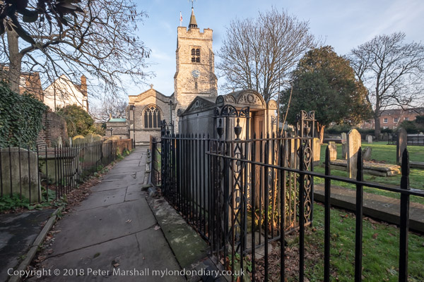
St Peter’s Church is at the south-east corner of St Peter’s Square on Black Lion Lane and is now uncomfortably close to the Great West Road, this section built well over a hundred years later in the late 1950s. In 1829 the church would have been surrounded by trees, meadows and market gardens with a pleasant walk to the nearby Thames. Now you need to seach for the subway to get across one of the busiest roads out of London.

The architect was locally born Edward Lapidge, whose father was an assistant to Capability Brown as a landscape gardener at Hampton Court. As well as a wider practice he also built other local churches at Hampton Wick and Putney. The Classical church building is Grade II* listed and William Morris who lived nearby had a hand in redecorating its interior in 1887.

Leaning Woman, Karel Vogel, North Verbena Gardens, Hammersmith, Hammersmith & Fulham, 1989, 89-12c-36

This 1959 concrete sculpture by Karel Vogel, (1897-1961) a Jewish Czech-born artist who fled here from the Nazis in 1938, was Grade II listed in 2016. It was commissioned by the London County Council’s Patronage of the Arts scheme when the Great West Road was being built through St Peter’s churchyard in 1959 “provide visual amenity in compensation for” this major road scheme. The sculpture, cast concrete over a metal framework, took Vogel over a year to complete and was extremely controversial in the local area.

By 2016 the sculpture had seriously deteriorated and Radio Prague reported in 2023 on its planned renovation at a cost of over £50,000. The restored statue now looking in grand shape was unveiled in July 2024.

Metropolitan Water Board, Hammersmith old pumping station, Great West Rd, Hammersmith, Hammersmith & Fulham, 1989, 89-12c-21

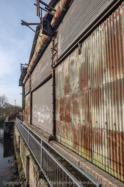
This 1909 building (described by some estate agents as Victorian) has now been converted into ‘exclusive’ flats.

Upper Mall, The Dove, Hammersmith, Hammersmith & Fulham, 1989, 89-12c-11

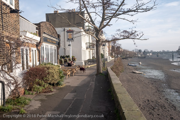
You can see the sign for The Dove pub which has its entrance on the footpath here at 19 Upper Mall. This Grade II listed public house is well worth a visit. It has probably been serving beer since the 1730s and was bought by Chiswick Brewery in 1796. Although a charming enough place its listing probably more reflects its stories and associations rather than any particular architectural merit. Of course as the very detailed The Dove, Hammersmith – a tiny mystery on Zythophile states its popularity has resulted in “most of the “facts” printed about it being demonstrably wrong.”

Also worth a visit is the William Morris Society Museum, just behind me as I made this picture in the lower floor of the house he lived in for the last 18 years of his life, renaming it as Kelmscott House. Doubtless he enjoyed the facilities of The Dove (then called The Doves, apparently by an error of the sign-maker) including the marbles game of bumblepuppy.

Hammersmith Pier, River Thames, Furnivall Gardens, Lower Mall, Hammersmith, Hammersmith & Fulham, 1989, 89-12d-61

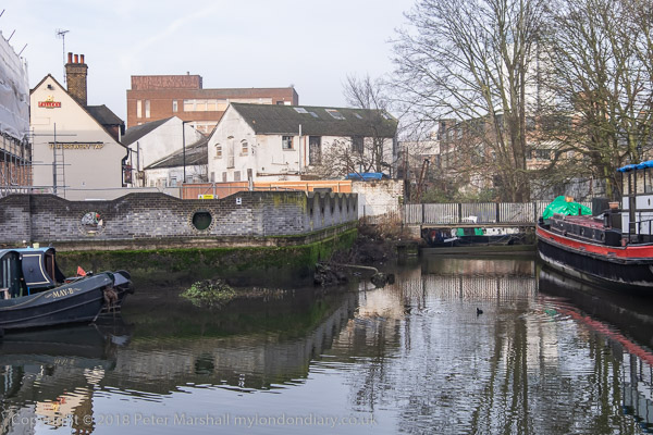
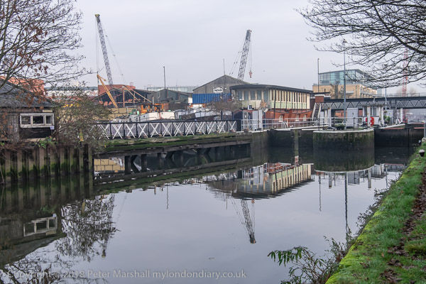
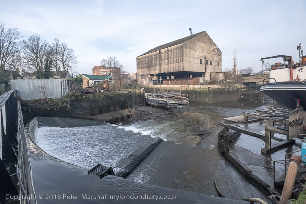
This pier is on the corner of Furnivall Gardens. Previously this had been mouth of Hammersmith Creek which ran north as far as King Street. The fishermen here were replaced by noxious industries in the nineteenth century, with brewery malthouses to its west and a lead mill on the east. The creek was filled in by Hammersmith council in 1936 and they built a new town hall across it which opened in 1939 – still there facing the Great West Road.

Wartime bombing removed the Phoenix Lead Mills and the Friends Meeting House with its burial ground and the area was opened as a public park, Furnivall Gardens, named for Frederick James Furnivall, one of the founders of the Oxford English Dictionary as well as Working Men’s College and the Hammersmith Rowing Club (now renamed after him) as well as the probable inspiration for ‘Ratty’ in the Wind in the Willows.

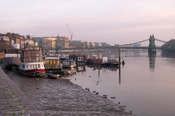
The pier here was opened at the same time as Furnival Gardens in 1951 for the Festival of Britain to enable people from the area to board steamers to take them to the Festival. After the end of the Festival there was little use for it. Eventually the PLA sold it to the owner of the Dove pub, and it was extended to provide more moorings.

River Thames, Furnivall Gardens, Lower Mall, Hammersmith, Hammersmith & Fulham, 1989, 89-12d-62

Beyond the moorings at Hammersmith Pier – Dove Pier you can see the southern end of Hammersmith Bridge and mansion blocks along Castelnau Road.

More from my walk in a later post.


FlickrFacebookMy London DiaryHull PhotosLea ValleyParis
London’s Industrial HeritageLondon Photos

All photographs on this page are copyright © Peter Marshall.
Contact me to buy prints or licence to reproduce.


Ellen MacArthur, Brian Haw & Ashura – 2005

Ellen MacArthur, Brian Haw & Ashura. On 20th February 2005 I froze on the riverside in Bermondsey waiting for Ellen MacArthur’s catamaran to come up-river to Tower Bridge after her 71 day voyage had made her the fastest solo sailor to sail around the world. Five years later “she set up the Foundation in her name to accelerate the transition to a circular economy“. I didn’t get any very good pictures as I was far to far away as she raised here arm to acknowledge the crowd that had gathered to welcome her – I needed a much longer telephoto than I’ve ever had.

Afterwards I took a little walk around the Bermondsey riverside before making my way back to Parliament Square where I took a pictures of the display there by Brian Haw’s Peace Campaign, now joined by promotional flags for the 2012 Olympic bid. There was more of this in Trafalgar Square too, where I dropped in briefly to see some of our pictures and warm up.

Finally at Marble Arch I photographed the start of the Ashura procession by Shi’ite Muslims. I didn’t stay too long as I was still cold and I was keen to get home and warm.

Here – with the usual minor corrections – is the piece I wrote in 2005 to go with the pictures on My London Diary:

Sunday was another bitter day, and I froze on Butlers Wharf waiting to see Ellen MacArthur aboard her catamaran as it was driven up to Tower Bridge and back from Greenwich, disappointingly not a sail in sight.

Ellen MacArthur is just visible, arm upraised in the centre of the picture

The crowds were not huge, but respectable, but like me, few could be bothered to go to Greenwich. The various press boats buzzing round the catamaran added a little interest, but made me glad I wasn’t on one.

I was more interested in taking some pictures along the riverside, then took the tube to Westminster to call in on Brian Haw, still in Parliament Square since 1st June 2001, with the government now cooking up a personal law against him.

The signs on the square are no augmented by a line of mute London 2012 flags, and along in Trafalgar Square (on my route to the National Gallery) was a giant tent and Olympian figure. Nobody can accuse London 2012 of not spending money on promoting their cause.
more pictures

Shi’ite Muslims in London were celebrating the stand of the grandson of the Prophet, Imam Hussain, who died a glorious martyr along with his small band of supporters at Karbala in Iraq, choosing death rather than dishonour, in the year 680. Ashura represents a key point of difference between Sunni and Shi’a traditions and Saddam Hussein rigidly prevented its observance in Iraq during his years in power.

more pictures


FlickrFacebookMy London DiaryHull PhotosLea ValleyParis
London’s Industrial HeritageLondon Photos

All photographs on this page are copyright © Peter Marshall.
Contact me to buy prints or licence to reproduce.


1995 Colour Part 4 – Around Dartford

1995 Colour Part 4 – Around Dartford: More of my panoramic images. These were taken in and around Dartford in Kent in March 1995 on a walk which took me from the centre of the town and along by the River Thames to an area close to the QEII Dartford Bridge. All these were taken on Sunday 19th March 1995. Dartford is a part of the Thames Gateway area around the Thames Estuary.

Dartford

Gasholder, Hythe St, Victoria Rd, Dartford, 1995, 95p03-531

I walked up Hythe Street and then turned right to a path that led me to a bridge across Dartford Creek.

Bridge, Dartford Creek, Nelsons Row, Dartford, 1995, 95p03-533

Dartford Creek is the tidal creek of the River Darent and was once important navigable creek to wharves in the centre of Dartford. Work has now been going on for years to restore the half-lock and make the creek navigable again. I made more panoramic images along the footpath beside the creek later in the year, but on my first visit was keen to get to the River Thames and left the Creek to walk up Joyce Green Lane and Marsh Street to the River Thames.

Littlebrook

Littlebrook Power Station, Dartford Bridge, QEII Bridge, River Thames, Dartford, 1995, 95p03-612

The first power station at Littlebrook was coal fired and opened in 1939 and was joined by a second in 1949 and a third in the 1950s with the final station Littlebrook D shown here opening in the 1980s. The earlier stations had been converted to burn oil by 1958 and were all decommisioned by 1981 when the final station began to be put into use. This continued to produce power until 2015 and was finally demolished in 2019. You can read much more detail on Wikipedia.

River Thames, Dartford Bridge, QEII Bridge, Dartford, 1995, 95p03-631

Google’s map now shows Littlebrook Beach as a ‘tourist attraction’ but I’m fairly sure I was the only person there on the day I made this picture.

Jetty, Littlebrook Power Station, Dartford Bridge, QEII Bridge, River Thames, Dartford, 1995, 95p03-643
Littlebrook Jetty, Dartford Bridge, QEII Bridge, River Thames, Dartford,  1995, 95p03-661
Littlebrook Jetty, Dartford Bridge, QEII Bridge, River Thames, Dartford, 1995, 95p03-661
National Power, River Thames, Dartford, 1995, 95p03-663

Crossways

As I walked along the path beside the river taking these and rather more black and white images I kept looking for a gate or gap in the fence betweent the riverside path and Crossways I could go through, but there was none. It was only when I got to Stone Marshes that I was able to leave the river and then walk along St Mary’s Road and into Crossways Business Park.

Warehouse, Crossways Business Park, Crossways, Dartford, 1995, 95p03-873

The area has been considerably expanded now, with a new major road to Greenhithe as well as new housing and commercial development.

Lake, Crossways Business Park, Crossways, Dartford, 1995, 95p03-733

The lake now has much new development around it, including a pub, The Wharf on Galleon Boulevard, close to where I made these pictures

Lake, Crossways Business Park, Crossways, Dartford, 1995, 95p03-721
Lake, Crossways Business Park, Crossways, Dartford, 1995, 95p03-723

I walked back into Dartford taking quite a few more black and white images but no more panoramas. The black and white pictures from this walk start here.


FlickrFacebookMy London DiaryHull PhotosLea ValleyParis
London’s Industrial HeritageLondon Photos

All photographs on this page are copyright © Peter Marshall.
Contact me to buy prints or licence to reproduce.


More Around the Meridian – 1995 Colour – Part 3

More around the Meridian – It’s seldom possible to actually walk for more than a few yards actually on the Greenwich Meridian in London and while planning my Meridian Walk I often wandered around considerably, having to make detours and also looking for the more interesting routes. So not all these images are exactly on the Meridian, but most were taken within a short distance from it.

Greenway, Abbey Lane, Abbey Rd, Stratford, Newham, 1995, 95p4-1151

When I began this project the Meridian was not marked on the Ordnance Survey or Street maps, and one of may first tasks was to get a ruler and pencil it on to them. In 1999 it was added to the OS maps of the area, but does not seem to be on the latest versions. In 1995 there were no smart phones with online maps and GPS which would have made things so much easier.

Greenway, Abbey Lane, Abbey Rd, Stratford, Newham, 1995, 95p4-1152

The Greenway was the recently rebranded path above the Northern Outfall Sewer which rans across East London from Hackney Wick to the sewage treatment plant at Beckton, going under the road here close the the bridge over Abbey Creek on the Channelsea River, where Abbey Lane becomes Abbey Road. You can see the bridge at the left of the picture.

Greenway, Channelsea River,  Stratford, Newham, 1995, 95p4-1153
Greenway, Channelsea River, Stratford, Newham, 1995, 95p4-1153

The Greenway is a great traffic-free cycle route for pedestrians and cyclists, running straight and level and this picture gives some evidence of that.

Channelsea River, Long Wall, Stratford, Newham, 1995, 95p4-1111

I’m not sure what this pipe was for, perhaps for taking gas across the river. Not far away on the other side of this tidal creek was one of the largest gas works in London – and you can still see its listed gasholders, though the view is likely to change soon with the site being redeveloped.

But behind me when I made this picture was the Abbey Mills sewage pumping station and on the edge of the creek below were the storm outfalls where sewage would be released after heavy rains. With the changing tides it would flow downstream a little and then could be taken miles upriver along the Prescott channel and the River Lea.

Gasholders, Leven Rd, Poplar, Tower Hamlets, 1995, 95p4-1332
Flats, East India Dock Rd, South Bromley, Tower Hamlets, 1995, 95p4-1321

I think the Meridian went through the centre of the taller gas holder at Poplar Gas works.

Flats, East India Dock Rd, South Bromley, Tower Hamlets, 1995, 95p4-1321

Another view with the gasholders in the background.

Clove Crescent, East India, DLR, South Bromley, Tower Hamlets, 1995, 95p4-1273

My pencilled line for the Meridian shows it going through both the water in the dock and the brick building at left which was the former Blackwall Power Station in both of these pictures.

Clove Crescent, East India DLR, South Bromley, Tower Hamlets, 1995, 95p4-1263

South of the East India Docks the line crosses the River Thames above and between the two bores of the Blackwall Tunnel, closer to the original western tunnel now used by northbound traffic. I couldn’t take photographs in the tunnel – though it was possible for those on foot to take a bus across, but these would have been rather boring in any case.

Blackwall Tunnel Entrance, Greenwich, 1995, 95p4-1672

This picture shows the southern entrance to the tunnel with its 1897 Grade II listed gatehouse by the London County Council’s Superintending Architect Thomas Blashill. In front of it a less ornate red and white striped arch with heigh and weight restriction signs and hangers to hit any overtall vehicles and hopefully prevent damage to the gatehouse.

Dorringtons, Blackwall Tunnel Southern Approach, Greenwich, 1995, 95p4-1551

One picture not I think actually on the Meridian but not far from it, taken from the long footbridge over the Blackwall Tunnel Southern Approach.

Riverside Path, Greenwich, 1995, 95p4-1762

My path continued south along the riverside path, with the Meridian going into the River Thames on the extreme left of this picture.

Riverside Path, Greenwich, 1995, 95p4-1742

I kept to the land continuing along a path I’ve walked many times and making a few more pictures.

Riverside Path, Greenwich, 1995, 95p4-1743

Like much of London’s riverside almost all of the industry has now gone, but some relics remain, though most of this part of my route is now lined by rather boring flats.

I rejoined the Meridian where it made landfall in Greenwich – where I made some of the pictures at the end of my earlier post.

More colour work from 1995 including some more panoramas in a later post.


FlickrFacebookMy London DiaryHull PhotosLea ValleyParis
London’s Industrial HeritageLondon Photos

All photographs on this page are copyright © Peter Marshall.
Contact me to buy prints or licence to reproduce.


London Walk January 2006

London Walk January 2006: I now have no idea why I spent around two and a half hours wandering around London on the afternoon of 20th January 2006, but the pictures tell the story of my route. These images are a selection from a rather larger number I actually made. [The pictures are larger than they appear in this post and you may download them, but like all pictures on this blog are copyright; they must be attributed if posted on social media and a licence is required for any commercial use.]

London Walk January 2006
© 2006, Peter Marshall

I suspect I was going to some evening event and simply took advantage of some fine weather to go up earlier and take some pictures. The first one shows some of the sculptural detail above the outpatients entrance of the former Royal Waterloo Hospital for Children and Women on Waterloo Road the roundabout close to the station, where I will have arrived by train.

London Walk January 2006
© 2006, Peter Marshall

I then walked on to Waterloo Bridge, pausing to take a picture of the National Theatre, with the roof of the film museum in the foreground.

London Walk January 2006
© 2006, Peter Marshall

There was an exhibition ‘after the wave’ on square pillars in front of the National Theatre which rather seemed to echo the shape of the building.

London Walk January 2006
© 2006, Peter Marshall

On Waterloo Bridge I took several pictures looking downstream across the River Thames, this one concentrating on the north bank and St Paul’s Cathedral.

© 2006, Peter Marshall

A wider view shows boats moored in the river and the skyline of London, now rather more crowded.

© 2006, Peter Marshall

Another with St Paul’s at the left .

© 2006, Peter Marshall

On Strand I photographed this lion and two Chinese men relaxing above Twinings, providers of tea to the Queen.

© 2006, Peter Marshall

And these fine fish on Lloyds Bank Law Court Branch at 222 Strand, then still open as a bank – it closed in 2017. It had been called the most beautiful bank in the country. The fish are presumably because this Grade II listed building was built in 1882 by Goymour Cuthbert and W Wimble for the Palsgave Restaurant for the Royal Courts of Justice opposite and was only taken over by Lloyds in 1894.

© 2006, Peter Marshall

Some fine ironwork and a beehive above the doorway to the bank.

© 2006, Peter Marshall

Above the doorway at 193 Fleet Street is this figure of statue of Kaled, the page of Byron’s Count Lara by Giuseppe Grandi, dating from 1872. More about it on Ornamental Passions.

© 2006, Peter Marshall

The building was built for pawnbrokers George Attenborough and Son in 1883 and has some fine sculptural detail including these winged lions, on either side of the wrought iron support from which originally the pawnbrokers three balls were hung. The Latin motto underneath is ‘Sub Hoc floresco‘, Under This I flourish.

© 2006, Peter Marshall

On each side of the clock of St Dunstan’s in the West on Fleet Street are the two mythical giants, Gog and Magog (Corineus and Gogmagog) described in the biblical book of Revelation as the allies of Satan against God when we come to the end of days, but also the guardians of London – and the City is surely on Satan’s side as the money laundering capital of the world. They strike the chimes for the clock here, said to be the oldest public clock in London.

My walk continued – and I’ll post some more from it at some later date. You can already see some of the pictures on My London Diary.


FlickrFacebookMy London DiaryHull PhotosLea ValleyParis
London’s Industrial HeritageLondon Photos

All photographs on this page are copyright © Peter Marshall.
Contact me to buy prints or licence to reproduce.


1995 Colour – Part 2 – Greenwich Meridian

1995 Colour – Greenwich Meridian: The second of a series of posts on my colour work, mainly in London, from 1995, 35 years ago and when I’d been working extensively with colour negative film for ten years, though still continuing to work with black and white.

Obelisk, Trig Point, Pole Hill, Chingford, Waltham Forest, 1995, 95p03-841

In 1992 I began making colour panoramas using a Japanese Widelux F8 swing lens panoramic camera – and later I used a Russian Horizon which gave similar results. Both worked with normal 35mm film but produced negatives that were a little under 60mm wide rather than the 36mm of normal cameras. Both use clockwork to swing the taking lens around a third of a circle exposing the film through a narrow slit behind the lens. The film was held in a curved path – again around a third of a circle – with the lens at the centre of the circle so that the lens to film distance remained constant.

Peacham Hall, King's Head Hill, Woodberry Way, Chingford, Waltham Forest, 1995, 95p03-411
Peacham Hall, King’s Head Hill, Woodberry Way, Chingford, Waltham Forest, 1995, 95p03-411

This arrangement avoided the change in distance from the lens to film that gives some stretching of the subject towards the edges of the frame – and begins to become very noticeable in ultra-wide lenses, particularly wider than around 18mm focal length on a 35mm camera.

95p03-552-Edit
Level Crossing, Highams Park, Waltham Forest, 95p03-552

Using the curved film plane avoids this distortion and enables a much wider field of view, while using a fairly moderate focal length – the Widelux has a 26mm f2.8 lens and gives negatives 24x56mm with a horizontal angle of view of 123 degrees.

Bridges, North Circular, Hale End Rd, Hale End, Waltham Forest, 1995, 95p03-463

But there is a downside. Creating the image in this way gives a curvature to objects which is unlike our normal vision which is particularly noticeable on any straight lines, though lines parallel to the axis the lens rotates around remain straight – so if you hold the camera level, verticals will remain straight. But other lines become curved with the effect increasing away from the image centre, giving what is often called a “cigar effect“.

Raglan Rd, Lea Bridge Rd, Whipps Cross, Waltham Forest, 1995, 95p4-373

This is a constraint which makes composition far more difficult using a swing lens camera, and was not helped by a rather poor viewfinder on the Widelux. Usually for landscape work I tried to visualise the effect of the curvature and chose a suitable camera position, levelled the camera on a heavy Manfrotto tripod using the spirit level on the camera top plate, lining the camera up using two arrows on the top plate to show the extent of the view (more accurately than the viewfinder) and then pressing the cable release to make the picture.

Stratford Bus Station, Great Eastern Rd, Stratford,, 1995, 95p4-922
Stratford Bus Station, Great Eastern Rd, Stratford, Newham, 1995, 95p4-922

For photographing events and some creative effects this is a camera you can use handheld, but you have to remember that even when using its fastest speed of 1/250 second the camera actually takes quite a lot longer to scan around the curved film.

Crowley's Wharf, River Thames, Greenwich, 1995, 95p4-672
Crowley’s Wharf, River Thames, Greenwich, 1995, 95p4-672

These pictures are from a project I began in 1995 with the approaching Millennium in mind. It seemed to me to make sense to carry out a project based on the Greenwich Meridian.

Greenwich Boating Pond, Park Vista, Greenwich, 1995, 95p4-1431

So I set about walking the Meridian, photographing it at various points in London and used some of these pictures in an attempt to get public funding for a Meridian Walk with some markers in pavements and a web site and publication. Panoramic images seemed a very appropriate format for illustrating the line.

Greenwich Meridian, Royal Observatory, Greenwich, 1995, 95p4-1242

Unfortunately my grant application as usual was unsuccessful, but I did go on to take some more photographs. In 2009 others produced a Greenwich Meridian Long Distance Path covering all of the Meridian in England from Peacehaven to Sand La Mere which of course goes through London and we also have The Line Sculpture Trail. Quite a few more Meridian markers were also added in London since I made this walk.

Many more panoramas from my Meridian project and other colour images from 1995 in the album 1995 London Colour.


FlickrFacebookMy London DiaryHull PhotosLea ValleyParis
London’s Industrial HeritageLondon Photos

All photographs on this page are copyright © Peter Marshall.
Contact me to buy prints or licence to reproduce.


Thames Path Panoramas – Vauxhall to Wandsworth 2014

Thames Path Panoramas: Back in January 2013 I had photographed and taken part in a rather less bloody re-enactment of the Epiphany bloody armed insurrection by Thomas Venner and fellow Fifth Monarchists against the re-imposition of the monarchy in 1661 being performed by Class War for film director Suzy Gillett. I’d tried hard to avoid getting in the way of the camera but do appear for a few seconds as the insurrection made its way to seize St Paul’s Cathedral.

Thames Path Panoramas

On Sunday 5th January, a year less a day later I and others involved were invited to a private afternoon screening of the film at the Cinema Museum close to the Elephant & Castle. As it was a fine day I went up some hours earlier to walk and photograph a little nearby section of the Thames Path.

Thames Path Panoramas

I’d been making panoramic photographs since the 1980s, at first by cutting and mounting together a few prints from black and white images. Back in 1991 I’d bought my first panoramic camera, a Japanese Widelux F8 with a lens that swings around while making a picture on 35mm film, held in a curve so that the centre of the lens remains at a constant distance from the film. Later I bought several more similar but much cheaper cameras made in Russia and a Chinese beast taking 120 film.

Thames Path Panoramas

These cameras all produced a very wide angle of view – around 120 or 130 degrees – but with a different perspective to “normal” cameras, with some characteristic curvature of objects. The normal rectilinear view stretches out objects at the edges of the frame and is only really usable up to around a 90 degree angle of view. Later I did work with a Hassleblad X-Pan camera and with a 30mm lens which gives a 94 degree horizontal view – around the maximum usable for a rectilinear view.

Thames Path Panoramas

Digital methods changed the game. At first I used a film scanner and software that enabled me to merge several scanned images. Then things became even easier when I shifted to a digital camera. For projects such as ‘The Secret Gardens of St John’s Wood‘ I combined up to around 8 different 12.3Mp digital images form a Nikon D300 to make very large prints with wide angles of view.

But by 2014 I was working with a Nikon D800E and it had occurred to me that there was a simpler solution with its 36.3Mp images. I could use the 16mm Nikon fisheye which gives 180 degree diagonal coverage filling the frame and then convert these images digitally from their fisheye projection to the more friendly cylindrical projection of my panoramic cameras.

I could now make panoramas almost as easily as taking any other images, capturing moving as well as static scenes with ease. For most panoramic images it is important to have the camera level, and the D800E had nice clear indicators that could be displayed in the viewfinder to ensure this, and with an f2.8 lens tripods became a thing of the past.

For these images I used the incredibly flexible PTGui software, but later found the simpler Fish-Eye Hemi plugin for Lightroom more convenient, though PTGui allows some interesting options. Unfortunately this plugin is no longer available, though I hope it or a similar plugin will be made available again. Using it you transform the images without any loss of image at the centres of both horizontal and vertical sides so you can visualise what will be in your final image when looking at the viewfinder while taking images.

Many more pictures at Thames Path Panoramas.


FlickrFacebookMy London DiaryHull PhotosLea ValleyParis
London’s Industrial HeritageLondon Photos

All photographs on this page are copyright © Peter Marshall.
Contact me to buy prints or licence to reproduce.


Brentford, Chiswick & Hammersmith – 2018

Brentford, Chiswick & Hammersmith: On Thursday 27th December 2018 we still had a lot of Christmas excess to walk off despite having made our normal Boxing Day walk the day before. But we had followed that with a second Christmas dinner.

Brentford, Chiswick & Hammersmith - 2018
‘Rule Britannia’ on a boat moored below Thames Lock at Brentford

This is still one of my favourite walks in West London and includes various stretches I’ve often walked over the years in one direction or the other, usually during the times of year when days are short and we don’t want to spend much time in travelling. And during the time between Boxing Day and New Year, rail travel is often something of a lottery with much of the network being shut down for engineering work.

Brentford locks were gauging locks so that tolls could be charged based on the weight of goods in barges. The flats here on a site between the River Brent and the canal have replaced large dockside sheds.

Even our short journey to Brentford was affected in 2018 and the usual direct train service to Brentford – our slow route to Waterloo – was not running. But we could take a train to Twickenham and go the rest of the way on the top deck of a bus, always one of the most interesting ways to travel in London. And the bus did take us more conveniently close to where I wanted to start this walk, at the bridge which takes Brentford High Street over the Grand Union Canal.

Brentford, Chiswick & Hammersmith - 2018
The road over the canal used to be the main route from London to the west and southwest before the Great West Road opened in 1925, and the canal linked the Thames to Birmingham.

Brentford used to be a rather dirty downmarket industrial and commercial centre, with sheds and warehouses, factories, docks on the canal and where this enters the Thames, a thriving market, a large gas works and more. It has changed dramatically in the last 40 or so years with much of its river and canal sides now filled with luxury flats. Parts of the old Brentford remain but more and more is disappearing, including some things in these pictures I made in 2018. I’ve been there a few times since and it remains an interesting walk.

Brentford, Chiswick & Hammersmith - 2018
A narrow section of the towpath beside a derelict shed

More on My London Diary at Brentford to Hammersmith. Here I’ll simply post a few images with captions from some of the key places along our route apart from the picture at the top of the post they follow roughly in the order I took them, though we did quite a bit of wandering around in Brentford.

Brentford, Chiswick & Hammersmith - 2018
A small dock in the middle of Brentford
Brentford, Chiswick & Hammersmith - 2018
The River Brent flows over the weir below the footbridge at centre left; at right, Thames Lock connects the canal to the tidal River Thames.
The River Brent from the footbridge over the weir.
Below Thames Lock the river comes back into the channel leading from the lock to the Thames.
A working boatyard at Dock Road on the River Brent
John’s Boat Works, Lot’s Ait with the bridge to it built in 2012
Hounslow Council and boat owners fought a long battle over the moorings at the gasworks site, but these boats were simply abandoned after the council’s victory.
Strand on the Green at low tide. It was warm enough to sit in the sun and eat our sandwiches
We walked through the gardens and out from the main gate to Chiswick House
The footpath to St Nicholas’s Church in Chiswick
River Thames looking back to Chiswick
River Thames and Hammersmith Bridge

In Hammersmith we took the District line to Richmond and then a train back home to tackle some of the leftovers from our Christmas lunch.

More on My London Diary at Brentford to Hammersmith.


FlickrFacebookMy London DiaryHull PhotosLea ValleyParis
London’s Industrial HeritageLondon Photos

All photographs on this page are copyright © Peter Marshall.
Contact me to buy prints or licence to reproduce.


Boxing Day Walk – 2014

Boxing Day Walk: Most years this century we have walked from Staines to Old Windsor for a family lunch, at first at my sister’s house, but more recently at a pub in Old Windsor where we have been joined by other members of the family. We are hoping to do the same today, though perhaps we might need to take a bus, a few of which are rumoured to be running, though I think likely to be cancelled at zero notice.

Boxing Day Walk - 2014
The Swanmaster statue had been moved earlier in 2014 to the riverside garden in Staines

It’s not a great distance, though in earlier years we often added a few miles to the more direct five or so to develop more of an appetite, and sometimes we had too when the path beside the River Thames was flooded.

Boxing Day Walk - 2014
Offices on a small riverside dock on the Surrey bank in Staines

On My London Diary you can read more about some of these walks, and in particular about our walk on Friday 26th December 2014, ten years ago, when I wrote about it in rather more detail than usual. Here I’ll just post a few of the pictures from that walk with some captions, mainly those I wrote back in 2014. The pictures follow the order of our walk.

Boxing Day Walk - 2014
The annual Boxing Day Challenge (if river flow allows) between Staines Boat Club and Burway Rowing Club
Boxing Day Walk - 2014
The more recent of the two bridges taking the M25 and A30 Staines Bypass across the river
Boxing Day Walk - 2014
A floating crane moored by the weir at Bell Weir Lock in water undisturbed by boats
The 1910 water intake to the Staines aqueduct takes water to reservoirs and treatment works.
Rosehearty has been moored here for years. The name is a town on the Moray Firth.
Dock at Bell Weir Boats in Runnymede
Houses on The Island in Wraysbury – many here were flooded in February 2014
The Thames at Runnymede, where we crazily swum in the buff when young after an evening in the Angler’s Rest Hotel. Then there was a diving board here too.
R G Bargee – most boat owners seem unable to resist a pun. We were almost there.
Another family at our destination.

Boxing Day Walk


FlickrFacebookMy London DiaryHull PhotosLea ValleyParis
London’s Industrial HeritageLondon Photos

All photographs on this page are copyright © Peter Marshall.
Contact me to buy prints or licence to reproduce.


XR at the BBC, Noahs Ark & Nine Elms – 2018

XR at the BBC, Noahs Ark & Nine Elms: On Thursday 21st December 2018 after photographing a protest at the BBC by the Climate Media Coalition over the BBC failures in presenting the climate emergency and their programmes which encourage climate wrecking activities I took a few pictures of the nearby Noah’s Ark Earth Rescue display before going to the US Embassy to cover a protest there. Unfortunately although I and the police made it on time the protesters failed to turn up. I took a walk around the area – London’s largest development taking a few pictures and when after an hour only a single protester and another photographer had arrived I went home.


Extinction Rebellion at the BBC – Broadcasting House

XR at the BBC, Noahs Ark & Nine Elms - 2018

Climate campaigners from Extinction Rebellion came to the BBC to tell it to stop ignoring the climate emergency and mass extinction taking place and promoting destructive high-carbon living through programmes such as Top Gear and those on fashion, travel, makeovers etc.

XR at the BBC, Noahs Ark & Nine Elms - 2018

The BBC had long misused its policy of impartiality to give huge prominence to a small group of climate deniers, largely fossil fuel lobbyists, to give them equal airtime to the warnings supported by the huge body of scientific evidence on global warming caused by our increasing consumption of coal, oil and gas with the associated rise in greenhouse gases in the earth’s atmosphere.

XR at the BBC, Noahs Ark & Nine Elms - 2018

The protest had been organised by environmental campaigner Donnachadh McCarthy and the Climate Media Coalition and they had brought with them mannequins wrapped in white sheets to represent the 27 climate victims from the Greek Village of Mati, burned alive by a wildfire. They were among a hundred people are known to have died in Greece in the fires caused by global warming. They set these out in front of the BBC for a vigil at the start of the protest

XR at the BBC, Noahs Ark & Nine Elms - 2018

Later there were angry protests at both entrances to the BBC site which which was closed off by barriers and security staff. It took a couple of minutes through the local streets to get between the two and I was at the other one where two protesters had superglued their hands, one to the steps and another to the door, when Donnachadh McCarthy attempted to climb over the security banners and was arrested.

XR at the BBC, Noahs Ark & Nine Elms - 2018
A woman spreads superglue on her hand on the steps in front of the police guarding an entrance to the BBC’s Wogan House.

You can read more about the protest along with many pictures and captions on My London Diary at Extinction Rebellion at the BBC.


Humanity Face Extinction – Great Portland St

The protest at the BBC was continuing when I walked towards the tube to travel to a protest sceduled at the US Embassy in Nine Elms and stopped to take a few pictures of the Noah’s Ark Earth Rescue display.

This was deserted probably as those usually here were all at the BBC protest. The display was a part of the “eco-warriors’ worldwide publicity campaign to save the South Pacific island nations from vanishing beneath the rising sea levels and offering genuine solutions to save humanity from being driven to extinction by global warming as a result of the burning of fossil fuels.”

More pictures at Humanity Face Extinction


Nine Elms Wander

I arrived at the US Embassy at the time given on the press release and the Facebook event page for a protest against Trump’s announcement of the withdrawal of US troops from Syria to find two police vehicles but no protesters.

After waiting around ten minutes I took a walk around the area, part of a huge redevelopment between the former Battersea Power Station and Vauxhall which I’d been watching for some years from the train as I came into London and had often photographed through the train windows.

Under the River Thames construction was also taking place for London’s new super-sewer, the 16 mile long Thames Tideway Tunnel expected to be fully operational in 2025 and the first major upgrade to London’s sewage systems since Bazalgette in 1875.

I went back to the embassy an hour after the protest was due to start. By now one man had arrived also looking for the protest, and a second photographer. I walked back up to Vauxhall Station to see if I could find any protesters on their way, but met none and so I caught the train home.

More pictures at Nine Elms Wander.


FlickrFacebookMy London DiaryHull PhotosLea ValleyParis
London’s Industrial HeritageLondon Photos

All photographs on this page are copyright © Peter Marshall.
Contact me to buy prints or licence to reproduce.