Purfleet & West Thurrock – 2003

Purfleet & West Thurrock: 20 years ago, on 22nd April 2003 I was still recovering from a heart attack and a little minor surgery. Delays and cancellations in the NHS are not new, and I’d spent several weeks in hospital waiting for the op, with three or four cancellations as emergencies bumped me off the list at short notice – one time I was even on a trolley on may way to theatre. Back then the major shortage, and one that seldom made the news, was of doctors and it still is, with the government still committed to doing little or nothing about it, even refusing to discuss the junior doctors claims.

Purfleet & West Thurrock

My actual operation, when finally it happened, went well, but 24 hours later I was an emergency too, collapsing the the ward toilet as my blood pressure dropped spectacularly thanks to a large dose of a exotic drug through a cannula incorrectly inserted by a junior doctor (the nurses were extremely scornful) and I was still far too weak when they released me home to join the million or more (including my son and wife) the protesting against the Iraq war the following day. I think I was more upset about that than my heart attack.

Purfleet & West Thurrock

My GP signed me off work for a few weeks (though most of my work was freelance and from home, and I was able to continue this) and prescribed aspirin and exercise along with a few other drugs to deal with my blood pressure, which I’ve been taking daily ever since, along with insulin for my diabetes, also diagnosed when I went into hospital. And thanks to the NHS, all this has cost me absolutely nothing. And after I was signed off as fit for work in March, though I was still very weak, I managed to go and photograph a couple of protests.

Purfleet & West Thurrock

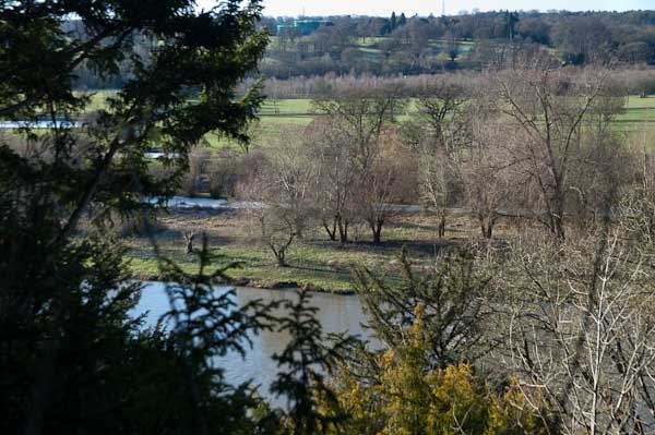
Walking was still for the first month or two just a little taxing, but after a couple of weeks I was fine on my Brompton, where I could take it easy later I went on some longish rides. And as it was a folding bike I could put it on trains and the underground to take me away for more distant starting points. And in April 2003 I went on rides from Dartford, Rainham and, on 22nd April 2003, to Purfleet, where I cycled along beside the Thames to West Thurrock and back.

Purfleet & West Thurrock

When I posted pictures of this and other rides on My London Diary, I noted “I didn’t get around to adding these other pictures from April 2003 until very much later, and haven’t got around to giving them captions.” And I wrote nothing about the ride at the time. All were taken on a Nikon D100 with a Nikon 24-85mm lens.

I travelled up to London on a Travelcard which covered a journey to any station in Zones 1-6, which meant the closest I could get to Purfleet was actually the station before, Rainham. Then it wasn’t possible to follow the riverside path from Rainham to Purfleet, which then ended at Coldharbour, so I had to cycle along the road to Purfleet through Wennington. The map now shows a riverside cycle path.

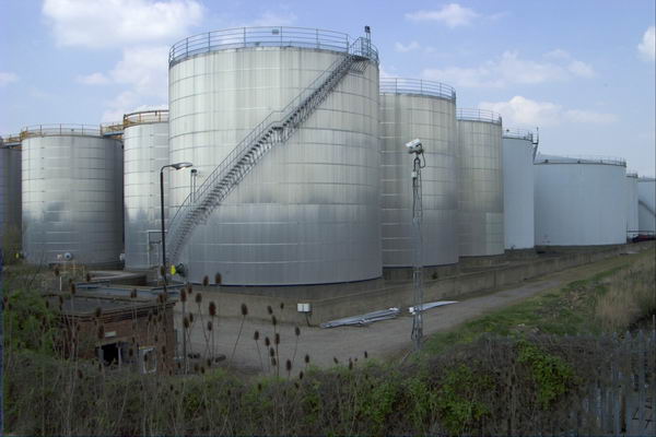
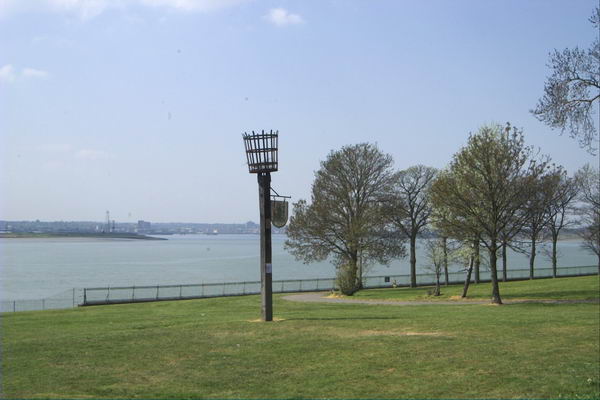
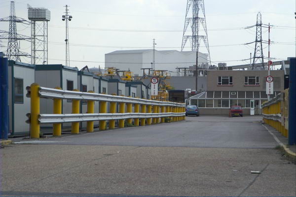
This part of the ride had little interest, other than passing some of the works for the Channel Tunnel Rail Link, where I took a few pictures before going down Tank Hill Rd to reach the riverside close to the Purfleet Armada Beacon.

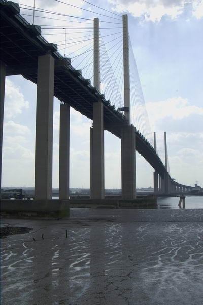
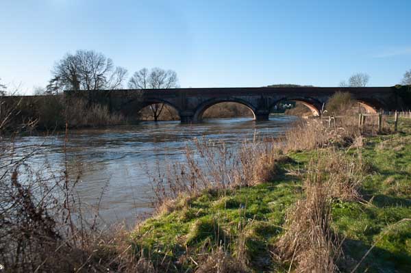
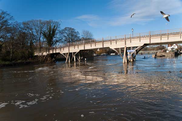
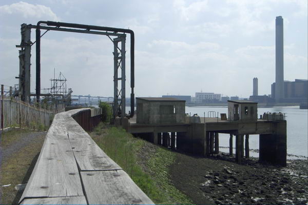
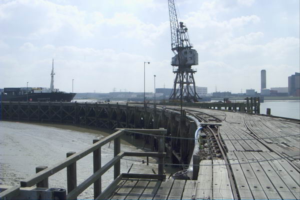
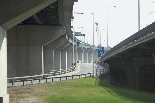
Navigation from there to West Thurrock (and on to Grays and the edge of Tilbury Docks on other occasions) was simply a matter of following the riverside path. But it was then an extremely interesting path, past various industrial sites and under the Dartford Bridge (and less noticeably over the Dartford Tunnel.

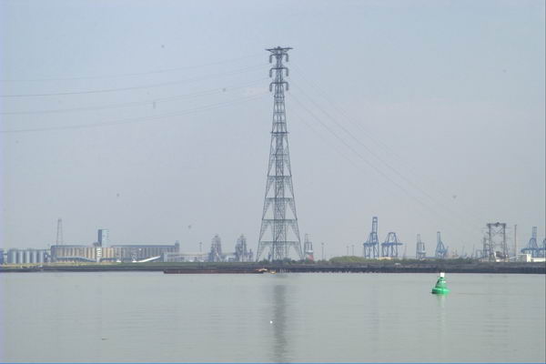
This is a wide and interesting stretch of the river, also crossed by a 400kV high voltage power line from Swanscombe, with the two 623ft pylons on each side being the tallest in Britain. The distance between the two towers is apparently 4,501 feet, around 0.85 miles or 1.37 km.

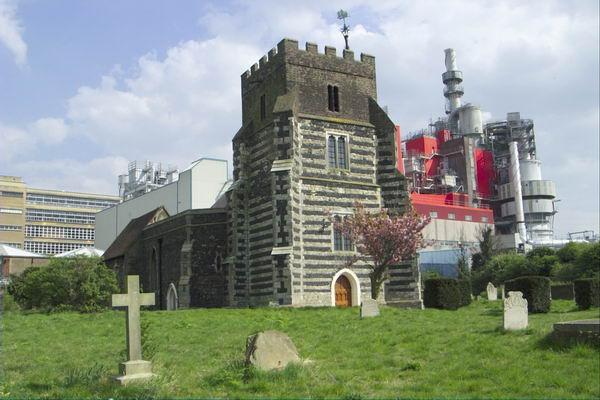
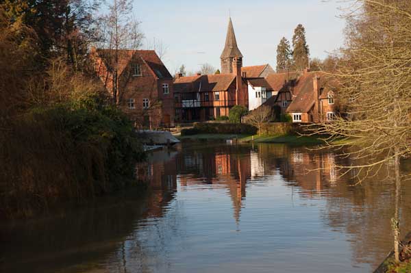
Pilgrims en route to Canterbury crossed the river from close by St Clement’s Church, taking to boat across to Swanscombe where the path up from the river is still the Pilgrims Road. But there was no boat available to me, so I turned inland into West Thurrock.

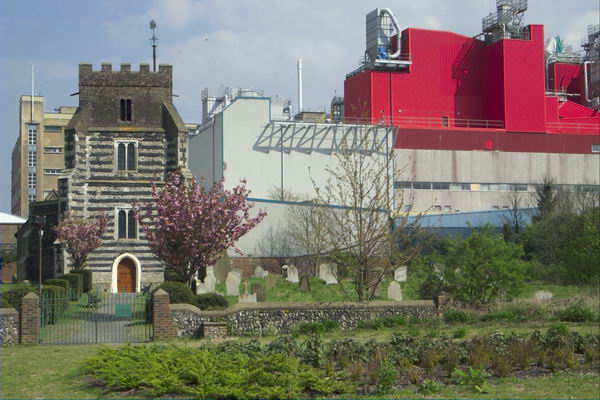
St Clement’s Church was Grade I listed in 1960 and parts at least are 13th century. It was used by a a youth unemployment scheme after regular services closed in 1977 and the interior was gutted, and after the project closed it was badly vandalised.

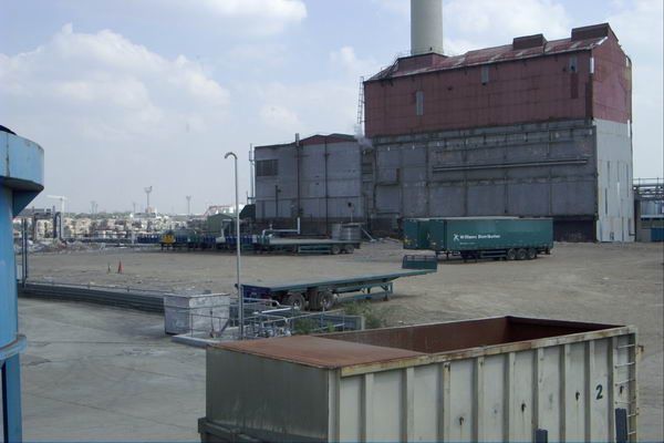
Dominating the church is the Procter & Gamble detergent factory begun here in 1940 and in 1987 when they were celebrating the company’s 150 years in business they took over the upkeep of the church which took 3 years to restore. The church, which was the location of the funeral in ‘Four Weddings and a Funeral’ is now open to the public once a month from April to September.

I can’t recall my route back along various roads to Rainham station, but there are a few pictures I took, mainly of the A13 and the Channel Tunnel Rail Link on My London Diary.

Cleaners, Bow Creek and Stirling Prize

Thursday 6th October 2016 was another of those varied days I love. I began with a lunchtime protest against victimisation and nepotism by cleaners, then went for a walk by Bow Creek before finally photographing a protest outside RIBA where the annual Stirling Prize presentation was taking place.


Cleaners demand ‘End Nepotism’ – 155 Moorgate

The Independent Workers Union CAIWU occupied the lobby of Mace’s headquarters building in Moorgate at lunchtime protesting noisily against cleaning contractor Dall Cleaning Services. I met the cleaners and supporters outside Moorgate station where they got out posters and a banner before marching quietly to pay an unannounced visit to Mace’s headquarters building where they walked into the lobby and started making a lot of noise.

They called for the reinstatement of two cleaners who they say were dismissed illegally without proper notice or other procedures being followed. They say that the cleaners have been dismissed simply to give jobs to members of the family of a Dall Cleaning Services supervisor.

After around 15 minutes a police officer arrived, but it was too noisy to hear what he was saying and the protest continued. He stood a little to the side and called for reinforcements, and as these arrived the protesters walked out to join those who had stayed outside and the protest continued on the pavement for another 20 minutes.

Police came to tell the protesters they were making a lot of noise, and were told that was the idea – they came here to do so and shame Mace and Dall Cleaning Services.

Eventually another officer who had been present at several previous CAIWU protests arrived and was told they would soon be stopping.

And after a couple more minutes, Alberto ended the protest with the usual warning “We’ll be back – and that’s a fact”.

More at Cleaners demand ‘End Nepotism’.


Limehouse, Bow Creek & Silvertown, London

I had the afternoon to fill before the next protest and it was a fine day so I decided it was time to take another trip to Bow Creek. I took the DLR from Bank to West India Dock to start my walk, and took the opportunity and a fairly clean train window to take a few pictures on my way there.

City Island is not quite an island

I walked over the Lower Lea Crossing, which provided a view of work which was now rapidly going ahead on ‘City Island’, where a loop in Bow Creek goes around what was previously the site of Pura Foods. This development had stalled with the financial crash in 2008 but was now in full swing.

From there I walked on along the elevated Silvertown Way, giving views of the surrounding area, before taking the DLR back to Canning Town, again taking advantage of a fairly clean train window on the ride.

Rather to my surprise, at Canning Town I found that the exist to the riverside walk was finally open. I think the walk here beside Bow Creek was constructed in the 1990s and I’d been waiting for around 20 years for this exit from the station to open and give access to it. I didn’t have as much time left as I would have liked but did make a few pictures.

For years there have been plans to create a walk from the path beside the Lea Navigation at Bromley-by-Bow to the Thames at Trinity Buoy Wharf, and the section as far as Cody Dock had opened a few years earlier – with the ridiculous name of ‘The Fatwalk’. It hasn’t really got any further yet, though at least it has been renamed as the ‘Leaway’.

More pictures – both panoramic and otherwise at Limehouse, Bow Creek & Silvertown.


ASH protest Stirling Prize – RIBA, Portland Place

Many of the protesters wore masks showing RIBA President Elect Ben Derbyshire

Architects for Social Housing (ASH) led a protest outside the Stirling Prize awards ceremony pointing out that one of the short-listed projects, Trafalgar Place, was built on the demolished Heygate Estate, which was ‘stolen from the people’ with hundreds of social housing tenants and leaseholders being evicted and the site sold at one tenth of its value to the developers.

 ‘Architecture is Always Political!’, a quote from Richard Rogers

Together with other housing protesters than held their own awards ceremony on the pavement in front of the RIBA building, awarding the ‘O J Simpson Award for getting away with murder’ to drMM Architects for this project, the first phase of Lendlease’s £1.5 billion Elephant & Castle redevelopment. This will replace 1214 social housing homes with few or no affordable homes.

There were no other contestants for the Ben Derbyshire Foot In Mouth Award than RIBA President Elect Ben Derbyshire but there was a vote to select which of five of his totally ridiculous statements by him about social housing should be the winner.

Among those at the protest were residents opposing the demolition of the Aylesbury estate, close to the Heygate, where Southwark Council are also demolishing social housing properties rather than carry out relatively low cost Aylesbury estate,that was voted for by the residents and could continue the useful life of these properties for many years.

Simon Elmer of ASH holds up the award for the ‘O J Simpson Award for getting away with murder’ awarded to drMM Architects and developers Lend Lease for Trafalgar Place

Estate demolition has a huge social and environmental cost and schemes like these in the borough of Southwark result in huge losses of social housing. But they provide expensive properties often sold largely to investors who will never live in them and large profits to the developers. Councils hope to share in these profits, but on the Heygate made huge losses, though some individuals involved have gained highly lucrative jobs.

More at ASH protest Stirling Prize.


Wansey St, Larcom St, Peabody & Heygate

My second post on my walk in Walworth on 8th January 1989. The start of this walk is
Elephant, Faraday, Spurgeon & Walworth Road

Wansey St, Walworth, Southwark, 1989 89-1a-14

Post-war Pritchard House (left) has been demolished but the house at 66 Wansey St in the right half of the picture is still there. Everything to its left has now gone with only the steps of No 68 remaining for a small new block of two social housing flats.

The street now continues through where Pritchard House was to Brandon Street and it is now part of the Larcom Street Conservation Area. No 66 probably dates from around 1860 and it and other houses on the street are probably part of the earliest development of the area.

Wansey St, Southwark, 1989 89-1a-15

66 Wansey St comes at the end of a long terrace – longer when built as there is a gap between 46 and 54 with a post-war infill block almost certainly following war damage. The house is the grandest of those surviving and the only one with a carriage entrance. The street then ended here, with Gurney St at right angles.

The area suffered heavily in the Blitz, with houses in the area being damaged or destroyed, including one of the greatest disasters of the bombing. Bombs hit nearby 6 Gurney St, close to the New Kent Road, damaging it and other houses on the last night of the Blitz, 10/11 May 1941, but it was only over a year later than a huge unexploded bomb that had been buried deep under the rubble, totally destroying 6 Gurney St and the two houses on each side and severely damaging many others in the surrounding area. 18 people were killed and 62 severely injures. This house on Wansey St was at the limit of broken glazing, over 200 yards away.

Kingshill,  Heygate Estate, Brandon St, Southwark, 1989  89-1a-16
Kingshill, Brandon St, Southwark, 1989 89-1a-16

This block was a part of the Heygate Estate, neglected and demonised by Southwark Council and eventually demolished to allow for development of the area largely as private housing mainly sold to overseas investors.

St Johns Institute,  Larcom St, Walworth, Southwark, 1989
St Johns Institute, Larcom St, Walworth, Southwark, 1989

Built around 1900 thanks to the efforts of the then vicar of nearby St John’s Church, the Rev. A W Jephson, this remains in use as a community centre. There is now a block of flats to its left.

Surgery, Heygate Estate, Rodney Rd, Southwark, 1989 89-1b-63

The Heygate Estate, one of the better planned council estates of its era was by designed by Tim Tinker and completed in 1974. Southwark Council saw an opportunity to profit from redeveloping the area and began a process of demonising the estate, which had been allowed to deteriorate. What had been social housing for around 3000 people provided only 82 socially rented homes in the new development, much of which was sold to overseas investors.

They ended up making a loss as having spent around £65 million on emptying it and scheming for its redevelopment against a strong campaign by residents they sold it to Lendlease for £50 million. However some councillors and officers are said to have done rather well out of it personally.

Chimney, Flats, Heygate Estate, Southwark, 1989 89-1b-64

Another view of the Heygate from the outside. Like many developments of its time a central boiler provided heating efficiently to all or many of the properties, though often inadequate maintenance meant such systems broke down.

I’m unsure of the purpose of this large open area or of the strange markings on it.

Peabody Flats, Rodney Rd, Larcom St, Southwark, 1989 89-1b-65

The overhead walkway from which I took this picture was a part of the Heygate Estate and demolished with it. Morris Court, the Peabody flats it shows are still there on the corner with Larcom St. The Peabody Walworth Estate was built around 1915 replacing slum housing and modernised in the 1980s. There are a number of blocks around a large central courtyard along Rodney Road, Content St and Wadding St.

Walkway, Heygate Estate, Rodney Rd, Southwark, 1989 89-1b-66

This is taken from another walkway on the estate. As a non-resident I found these rather easy to get lost on as they were not shown on my mpas, but although the estate had a bad reputation I never experienced any problems, and it was certainly pleasant to be away from cars which were often a hazard when taking pictures. But it would have possibly seemed more threatening late at night rather than on a Sunday morning.

Walkway, Playground, Heygate Estate, Southwark, 1989 89-1b-51

Another picture from one of the walkways around this corner of the Heygate Estate, which perhaps shows some of my confusion. It also shows a few of the many trees which had been planted in the area, which had just about come to maturity when the estate was demolished.

More from this walk through Walworth shortly.


Bank, London Bridge, Fish Island, Hackney Wick

Bank, Victoria Park, Fish Island, Hackney Wick: In 1988 I was still teaching a full timetable at the sixth-form and community college where I worked, but because I took an evening class on Tuesdays I was able to finish the week’s teaching at noon on Friday. As a union rep I had persuaded my members against national union advice to some deviations from the national conditions that suited the peculiar circumstances of the college and made such arrangements possible.

Most of the pictures I made back in 1988 were either taken during the college holidays – we kept more or less normal school terms – or at weekends, but at noon on some Fridays I would rush down to the caretakers stores where I kept my bike, pedal home furiously, dump the bike, pick up my camera bag and rush to the station for a train to London. Until the clocks went back at the end of October there was then time for a few hours walking and taking pictures – in late October sunset is around 5.45pm. I think the pictures in this post were probably taken on the last occasion that year that my journey was worthwhile.

Doorway, Bank Station, Bank, City, 1988 88-10d-25-Edit_2400
Doorway, Bank Station, Bank, City, 1988 88-10d-25

I didn’t make many pictures on this Friday afternoon – around 16 black and white frames and perhaps two or three in colour, perhaps partly because I broke my journey to make this picture. Rather than taking the train from Richmond to Homerton or Hackney Wick, I went up to Waterloo and took the Waterloo & City line to Bank. I’d some time earlier photographed this doorway at Bank station and had for reasons now unknown to me decided I needed another and different image. Possibly I’d been reminded of it when the earlier picture, a closeup of the three heads, was used on a bookjacket.

It perhaps took me a few minutes at Bank to find the doorway still there on King William Street on the side of the splendid Hawksmoor church of St Mary Woolnuth. Having make the single exposure shown here, I made my way to a bus stop for a No 8 bus to Bethnal Green and then walked up Grove Road to Victoria Park.

Old London Bridge, stone alcove, Victoria Park, Tower Hamlets, 1988 88-10d-26-Edit_2400
Old London Bridge, stone alcove, Victoria Park, Tower Hamlets, 1988 88-10d-26

I’d realised when I got home from my previous walk that I had not photographed the shelters which were stone alcoves from the Old London Bridge. That bridge, built in 1176-1209 had until 1760 been cluttered with houses and shops, leaving only a narrow path across the river. These were cleared in 1760-63, more than doubling the width of the bridge, and seven stone alcoves were installed along each side.

The bridge was demolished in 1831, but these alcoves were sold and two found there way to Victoria Park when it was opened in 1845. Another is in a courtyard at Guy’s Hospital and two ended up on an estate in East Sheen along with some of the balustrade, though only one now remains in the grounds of some 1930s flats at Courtlands, close to the 1st Richmond Scouts HQ.

Percy Dalton, Dace Rd, Hackney Wick, Tower Hamlets, 1990, 90-9h-46

From Victoria Park I walked across the footbridge over the East Cross Route to Hackney Wick, then turning south and making my way down Wansbeck Road to the Northern Outfall Sewer on Wick Lane. Steps there took me down to Dace Road and along to Old Ford Locks. Unfortunately although I took a few picture on the walk, none are among those I’ve digitised. So here’s one I took in 1990 on Dace Road of Percy Dalton’s peanut factory.

Loading Bay, Lock, Old Ford, Lea navigation, Tower Hamlets, 1988 88-10e-61-Edit_2400
Loading Bay, Lock, Old Ford, Lea navigation, Tower Hamlets, 1988 88-10e-61

I walked across the gates at Old Ford Lock and took a few pictures there, including this one of the loading bay at Swan Wharf.

Bridge, White Post Lane, Lea Navigation, Hackney Wick, Tower Hamlets, 1988 88-10e-62-Edit_2400
Bridge, White Post Lane, Lea Navigation, Hackney Wick, Tower Hamlets, 1988 88-10e-62

The I walked north on the towpath. Now there are two new bridges on this stretch, from Stour Road and Monier Road, but in 1988 the next crossing was at White Post Lane.

Bridge, White Post Lane, Lea Navigation, Hackney Wick, Tower Hamlets, 1988 88-10e-65-Edit_2400
Bridge, White Post Lane, Lea Navigation, Hackney Wick, Tower Hamlets, 1988 88-10e-65

At left is the splendid 1913-14 Queen’s Yard works, part of the Clarke, Nickolls & Coombs Ltd “Clarnico” sweet and chocolate factory, formerly the largest employer in the area. Much of their five works were damaged or destroyed by wartime bombing and this building needed some restoration. The company was bought by Trebor in 1969 and the works closed. The white building fronting the canal beyond the bridge was the cocoa bean roasting factory built around 1900.

I walked over the bridge and along to Hackney Wick station for a train to Richmond on my way home.


Manchester Revisited

Manchester Revisited – May 5th & 7th 2017

Manchester Revisited
Two canals (Bridgewater and Rochdale) and four railways exemplify Manchester’s contribution to the industrial revolution

Pictures here are from walks in Manchester on Friday 5th May 2017 and the following Sunday while passing through the city. It was a short visit to a city I had hardly returned to for around 45 years.

Manchester Revisited
A magic bus crosses the canal

Although I grew up on the western edge of London, I spent most of the years between when I was eighteen and twenty-five in Manchester, at first studying for a degree at Manchester University and later after a short break returning to work for my doctorate at the Institute of Science and Technology.

My school had recommended Manchester for my university course, and I made my first visit there as a day trip for interviews – a very long day as the journey each way took over five hours. I didn’t see a great deal of the city that day, but I was made two unconditional offers of places and my headmaster when told advised me to stop preparing for Oxbridge entrance exams and accept Manchester, which I did. It was a decision that changed my life in various ways.

Castlefield

My course was disappointing – long hours in the lab and largely tedious lectures by staff with no training and little idea of how to teach, keen to get back to their researches. Sitting at a bench with a small plaque informing me that ‘Rutherford first split the atom here’ in 1917 was little compensation for a physics lecturer who seemed unable to explain even the simplest of concepts, though fortunately I’d studied enough of the subject at school to get a decent grade – and the same was true of my other subsidiary, Maths where I passed a rather curious end-of-year exam with 108%.

Knott Mill

But my real study was in the University Union and in the city itself, though I did enough work in my final year to get a decent grade – and to turn down offers of employment from big pharma who I found far too interested in profit rather than human good and also from the government’s explosives research lab from where I got a very long handwritten letter from one of the scientists working there about the exciting research they were doing – but I decided I really didn’t want to spend my life making better bombs.

The old canal dock area became a conservation area in 1980 and an Urban Heritage Park in 1982

I did get turned down for one job I would really have liked, working in the labs at Kodak in Harrow. I was really not sufficiently middle-class for them – and not interested enough in photography – I’d had an interest but never really been able to afford to pursue it, and dropping my camera in a lake in 1966 hadn’t helped – it never really worked properly again. I ended up getting a job in a lab ten minutes walk from my old home, but it disappointed in almost every way but the salary – at least 50% more than my father had ever earned. It didn’t last, and six months later I was back in Manchester.

River Irwell

Two years later I got married, not in Manchester but in Hull. We were both students still and had little or no money and spent our honeymoon in Manchester, with a day out on the Derbyshire hills and a day coach trip to the Lake District. We lived for the next two years on the two first-floor rooms of a small terraced house in Rusholme, close to Manchester CIty’s Maine Road ground.

New Quay St Bridge – Salford coat of arms

We moved away for me to do a course in Leicester. I’d taught for a couple of terms before just to the north of Manchester, and tried at the end of the year to get another teaching job in Manchester, but failed, ending up moving to Bracknell, where I was offered housing in a new flat on one of the new estates.

After we moved away from Manchester I think I went back once for a conference there and a weekend in Didsbury in the 1990s but not really again until 2017. We were on our way to a weekend conference a few miles to the north, and took an early train to have a few hours to look around the city. Our train came into Piccadilly, and we took a walk along the Rochdale canal and the Bridgewater canal before walking back close to the River Irwell to the city centre to catch our bus.

Doves of Peace sculpture by Michael Lyons, Manchester Civil Justice Centre

Back in 1970, the canals were still largely working areas, or mainly disused but still largely closed to the public; you could walk along some towpaths, but they were rather lonely and forbidding places. Now things are very different.

Mechanics Institute – where the TUC, CIS and UMIST began

We had time for a shorter walk on our way home, but mainly spent that in the People’s History Museum. The following year, 2018 we made a similar journey, but with less time for a walk, and then came back to stay for several days at the start of August as a part of a couple of weeks in various places celebrating our 50th wedding anniversary – including a celebration with family and friends in Hull.

More pictures from Manchester in May 2017.


Old Ford, Hertford Union & Hackney

Old Ford, Hertford Union & Hackney

Gunmakers Lane, Hertford Union, canal, Old Ford, Tower Hamlets, 1988 88-8am-33-Edit_2400
Gunmakers Lane, Hertford Union, canal, Old Ford, Tower Hamlets, 1988 88-8am-33

The short street which goes across the canal on Three Colts Bridge probably got its name from the pub, the Gunmakers Arms, which stood opposite it 438 Old Ford Road on the west side of St Stephens Road – and perhaps there were once some guns made nearby. In April 1915 the pub was taken over by the East London Federation of Suffragettes, led by Sylvia Pankhurst, a more militant and working class breakaway from Women’s Social and Political Union who turned it into a day nursery and clinic.

The Connaught Works here on Old Ford Road was a furniture factory and is said to date from the 1920’s though it looks earlier and was extended to the east around 20 years later.

Gunmakers Lane, Hertford Union, canal, Old Ford, Tower Hamlets, 1988  88-8am-34-Edit_2400
Three Colt Bridge, Gunmakers Lane, Hertford Union, canal, Old Ford, Tower Hamlets, 1988 88-8am-34

This early 19th century cast iron bridge presumably dates from the building of the Hertford Union Canal which opened in 1830. It is Grade II* listed Scheduled Ancient Monument. A pub, the Old Three Colts, was close by at 450 Old Ford Rd from 1792 or earlier but was I think demolished a few years after WW2. St Stephens Road used to be called Three Colts Street, possibly because this pub was more or less at its end.

Victoria park Rd, Homerton, Hackney, 1988 88-8am-35-Edit_2400
Victoria park Rd, Homerton, Hackney, 1988 88-8am-35

The Three Colts Bridge leads to the Gunmakers Gate of Victoria Park, and I walked across the park to Victoria Park Road. This gothic fantasy of a building is now the Mossbourne Victoria Park Academy but was built in 1864-5 by Robert Lewis Roumieu as a French Protestant Hospital by a Huguenot charity, La Providence, who had decided to move out of earlier almshouses and hospital in Finsbury to a larger and more rural site here.

After WWII, La Providence moved to Rochester, selling the building to Roman Catholic nuns, the Faithful Companions of Jesus, and it reopened as the St Victoire Convent Girls’ Grammar School. When I made this picture it had become Cardinal Pole RC School and in 2014 was sold to be an academy school. The building is Grade II* listed.

Terrace Rd, Church Crescent, South Hackney, Hackney, 1988 88-8am-21-Edit_2400
Terrace Rd, Church Crescent, South Hackney, Hackney, 1988 88-8am-21

These Tudor-style group of cottages are thought to have been built in 1847-8 to designs by George Wales who was the architect of Monger’s almshouses further down Church Crescent. The other houses between the two sites are more classical in design but also thought to be by Wales.

They are Grade II listed and still there and look now rather neater, with the middle property of the Tudor three having had its brickwork cleaned and looking considerably brighter. It also appears to lack the variation in colour of the darker brickwork which I find more attractive, though perhaps it looks more like when it was newly built.

Terrace, Cassland Rd, Hackney, 1988 88-8am-25-Edit_2400
Hackney Terrace, Cassland Rd, Hackney, 1988 88-8am-25

This remarkable terrace at 20-54 Cassland Road overlooking Cassland Crescent is Grade II listed and was built from 1794 using funding from subscribers who made monthly payments over a period of four years, with the houses being allotted by ballot to a subscriber as each was built. All 18 were completed and occupied by 1801. This kind of co-operative funding of a development predates the earliest more conventional building societies.

James Taylor, gallery, Collent St, Hackney, 1988 88-8am-26-Edit_2400
James Taylor, gallery, Collent St, Hackney, 1988 88-8am-26

The James Taylor warehouse was built in 1893 in Collent Road, which was described by the James Taylor gallery as “Formerly a Victorian factory, china warehouse, squat and film location.” Around ten years ago it was transformed with the facade and front building on the site being retained, along with a long wall along the north almost to Cresset Road as a part of a complex redevelopment with up to 10 storeys containing 69 flats, office space and an underground car park.

I made a few more exposures around Well St and I think my walk probably ended on neaby Mare Street, where I photographed the Crown pub (not online) and then probably caught a train from Hackney Central.


Clicking on any of the pictures will take you to a larger version in my album 1988 London Photos, from where you can browse other images in the album.


Thames Path – Pangbourne – Cholsey

Whitchurch from the bridge from Pangbourne

Thames Path – Pangbourne – Cholsey: At the start of 2010 we were still walking sections of the Thames Path. On New Years Day we had walked from Reading to Pangbourne, and on the following day caught the train back to Pangbourne to begin our day’s journey there.

The Thames from the Thames Path along a hillside west of Whitchurch

We were heading to Cholsey, around 8 miles away, an easy distance suitable for a short day with over an hour’s rail travel at each end. Cholsey is a small village and has a railway station a little over a mile from the Thames Path with trains back to Reading from where trains run – if rather slowly – back to Staines.

Gatehampton Bridge

Pangbourne is a much larger village, and its station is a short walk from where we joined the Thames Path, and there were a few shops where we could buy some crisps and sweets to supplement the sandwiches in our bags and even a public toilet, so a very useful place to start a walk.

Before our walk really started we spent a little time in Pangbourne, visiting the parish church and photographing the Pang before rejoining the Thames Path at Whitchurch Bridge. Crossing the bridge takes you to Whitchurch, perhaps a prettier village than Pangbourne. Here the path takes quite a long detour away from the river bank and up on a hillside, with some extensive views through trees of the river and country to the south, before going back down to the riverside.

The railway line crosses the path and the river at Gatehampton Bridge, built by Brunel for the GWR main line in 1838 but the path stays on the north bank, passing between the tree-covered slopes of the Goring Gap, where the river cut through to seperate the Chilterns from the Berkshire Downs. Winter sun on the leafless bare branches was magical.

The bridge linking Goring on the north bank with Streatley on the south seems a rather primitive and temporary wooden structure, but has been here since 1923 when it replace the earlier bridge from 1837. Before then there had been both a ferry and a ford, though this was probably more often passable on horseback than on foot. It takes two bridges to reach Streatley from where the Thames Path proceeds westward on the south bank.

Streatley from Goring lock

At Streatley, a village until 1938 owned by the Oxfordshire brewers Morrell we visited the church and then set out on a partly underwater path by the river. December 2009 had been one of the wettest months on record and we began to doubt the wisdom of We thought about turning back and abandoning the walk, taking a train from Goring, but after seeing a walker paddle through towards us decided to continue.

Fortunately it was only a few inches deep, but despite our boots I think we all got wet feet. The day was around freezing, but walking kept our feet warm, and many of the smaller puddles along the rest of our route were frozen over, as well as the mud, and it was much easier to walk than had it been warmer.

The Beetle and Wedge at Mouslford looked very closed

A little further on the tow path moves from the south to the north bank, not a great problem in the past for craft being towed who could pole over to the other side, but more so for walkers, who need to take a path away from the river and along a main road for a mile or so leaving the path were it went down towards the Moulsford railway bridge and continuing to a footpath beside the railway to Cholsey station.

More pictures from this walk at Pangbourne – Cholsey and more from the previous day’s walk at Reading – Pangbourne. You can read my original post at Thames Path.


West India – North Dock 1988

The Ledger Building,  Hertsmere Rd, West India Docks, Poplar, Tower Hamlets, 1988 88-6c-52-positive_2400
The Ledger Building, Hertsmere Rd, West India Docks, Poplar, Tower Hamlets, 1988 88-6c-52

The Offices of the West India Docks an Hertsmere Rd at the west corner of what was the Import Dock of the West India Docks and were Grade I listed in 1950 together with the adjoining warehouses. They were built in 1803 , architect George Gwilt and converted to hold the dock ledgers by John Rennie, who added the portico in 1827.

In 2000 it was converted into a Wetherspoon pub, the Ledger Office and can be visited during normal opening hours and displays some information about the history of the docks which can be read while drinking a cheap pint.

Warehouses, Hertsmere Rd, West India Docks, Poplar, Tower Hamlets, 1988 88-6c-53-positive_2400
Warehouses, Hertsmere Rd, West India Docks, Poplar, Tower Hamlets, 1988 88-6c-53

These listed warehouses are now converted for various uses including the Museum of London Docklands which has both permanent and temporary displays on the history of the River Thames, the growth of Port of London and the docks historical link to the Atlantic slave trade, in which this building, a sugar warehouse, played an important role. Temporary exhibitions there have included some of my pictures including in the show ‘Estuary‘ celebrating the museum’s 10th anniversary in 2013

Warehouses, Hertsmere Rd, West India Docks, Poplar, Tower Hamlets, 1988 88-6c-55-positive_2400
Warehouses, Hertsmere Rd, West India Docks, Poplar, Tower Hamlets, 1988 88-6c-55

The area has been opened up by the removal of the dockside sheds and is now a popular tourist venue, though it has lost most of its previous allure. But it’s still an interesting area, both for the old and the new buildings.

Crane, West India Quay, Poplar, Tower Hamlets, 1988 88-6c-44-positive_2400
Crane, West India Quay, Poplar, Tower Hamlets, 1988 88-6c-44

Two dockside cranes remain on the side of the dock, close to West India Quay DLR station, perhaps left there to divert attention from a rather hideous hotel building to their north.

Bridge, West India Quay, Poplar, Tower Hamlets, 1988 88-6c-45-positive_2400

This picture taken I think from more or less underneath the DLR which goes across the North (Import) Dock gives some impression of the scale of the West India Docks , which I think when constructed in 1800-1806 were I think the largest enclosed high-security docks in the world – and a model for later docks elsewhere.

This dock now looks considerably smaller, with around half of its width taken up by a strange building on top of a new Crossrail station, looking to me rather like a woodlouse. Nothing in this picture remains except the listed dock wall at bottom left (and possibly the bollard on it.)

Bridge, West India Quay, Poplar, Tower Hamlets, 1988 88-6c-46-positive_2400

I think this bridge, built from what looks suspiciously like Meccano, was the Great Wharf Road Bridge, later replaced by what was intended as a more permanent structure as the Upper Bank Street Bridge. I can find no information about it on-line, but it appears to have a central lifting section with heavy counterweights in those four towers. That more permanent bridge was removed for the construction of the Crossrail station in 2012 and a new, much shorter bridge was built in five sections in Belgium by Hollandia and welded together in situ in, opening in 2020.

Docklands Light Railway, Poplar, Tower Hamlets, 1988 88-6c-32-positive_2400
Docklands Light Railway, Poplar, Tower Hamlets, 1988 88-6c-32

It was time to leave Docklands for home, and together with my two young assistants we got on the DLR, sitting right at the front of the train. This view from the front window as the train had just left Poplar Station and about to cross Aspen Way shows dockland cranes at left and St Anne’s Limehouse at right. Then DLR trains were single two-carriage units like the Stratford service in this picture.

This is the final part of posts here about my pictures from my walk around the docks on the Isle of Dogs in June 1988.

Click on any of the pictures to see a larger version in my album 1988 London Photos, from where you can browse the album. The pictures there are largely ordered by my negative reference numbers, which do not in detail reflect the order in which the pictures were taken used in the posts here.


Around Three Mills

House Mill, Clock Mill, Three Mills Island, Bromley-by-Bow, Newham, 1981 29q-15_2400
Three Mills

Three Mills Lane which runs from Hancock Road, a short walk from Bromley by Bow Underground station takes you across the Lea Navigation and Bow Creek to a remarkable ensemble of four of Newham’s listed buildings, including the Grade I listed House Mill from 1776, the early 19th century offices and the 1817 Clock Mill, with its 1753 Clock Tower. The fourth is easy to miss, as it is the stone setts and flagstones under your feet, dating back to the 19th century.

The Clock Mill, Three Mills Island, Bromley-by-Bow, Newham, 1981 29q-13_2400

Together they make a splendid early industrial landscape, though now a little hemmed in by rather more recent flats. When I photographed there in the 1980s and 1990s, the area around was full of largely 20th century industrial sites, mainly along the navigation, and a little still remains, particularly an impressive set of gas holders (seven Grade II listings) on the southern side of the Channelsea River at the former Bromley-by-Bow gas works (which also has listings for its bridge across the canal and Bow Creek as well as its war memorial and statue of Sir Corbet Woodhall.)

Three Mills Wall River, Stratford, Newham, 1981 29t-63p_2400
Three Mills Wall River

In more normal times the House Mill, which was saved from demolition in the 1970s and has been partially restored offers reasonably priced guided tours on Sundays from May to October and at some other times as well as hosting various events. The mill is a tide mill, and is on a site recorded in the Domesday Book, with foundations dating back to the end of the 14th century. It was able to generate power for 7-8 hours a day, though the output varied with the monthly changes in tides. Together with the Clock Mill it would grind an average of 125 tons of grain a week.

Works, Lea Navigation, Bromley-by-Bow, Tower Hamlets, 1981 29t-33_2400
Works, Lea Navigation, Bromley-by-Bow, Tower Hamlets, 1981

The towpath running south from Three Mills is on a narrow strip with the navigation on the west and Bow Creek to the west, and it leads down under railway bridges to Twelvetrees Crescent (where recent stairs now allow you to go on to the bridge and continue your walk beside Bow Creek) and under the bridge to Bow Locks where you can continue along the Limehouse Cut.

Railway bridge, Wharf, Lea Navigation, Bromley -by-Bow, Tower Hamlets, 1981 29t-61_2400
Railway bridge, Wharf, Lea Navigation, Bromley -by-Bow, Tower Hamlets, 1981
Bromley-By-Bow Gasworks, Imperial Gas Light and Coke Co, Bromley-By-Bow, Newham, 1981  29q-25-6_2400
Bromley-By-Bow Gasworks, Imperial Gas Light and Coke Co, Bromley-By-Bow, Newham, 1981
Lea Navigation, Twelvtrees Crescent, Bromley-by-Bow, Tower Hamlets, Newham, 1983 36v-02_2400 (2)
Lea Navigation, Twelvtrees Crescent, Bromley-by-Bow, Tower Hamlets, Newham, 1983

You won’t see the empty lighters on the navigation that were there when I walked along here in 1983, not long after commercial traffic ended. The large pipe across in front of the bridge would have carried gas from the Bromley gas works across to deliver gas to London west of the works. The listed bridge dates from 1872. Under it you can see the bridge which takes the path across Bow Locks and on to Gillender St or to the towpath beside the Limehouse Cut.

More on page 4 of River Lea – Lea Navigation. Click any of the images above to go to larger versions on my Flickr site.


All photographs on this and my other sites, unless otherwise stated, are taken by and copyright of Peter Marshall, and are available for reproduction or can be bought as prints.


Around Warton Road

Robbialac, Warton Rd, Stratford, Newham, 1983 35p-15_2400
Jenson and Nicholson, Robbialac Works, Warton Road, Stratford, London E15.

Jensen and Nicholson were the makers of Robbialac paints and had premises here on Warton Road, offices on the Goswell Rd and a further works in Stratford on Carpenters Rd. The business was started in 1821 at the Barbican by William Kingham and John Jenson became a partner in 1840, taking over the business in 1848. He was joined in 1856 by Wilfred Nicholson.

Following a fire which destroyed the company’s factory, Nicholson decided to move to Stratford Marshes and a few years later Nicholson took over the company, which continued to trade under the name Jenson and Nicholson Ltd. As well as Robbialac enamel paints for cars and home decoration, the company also made Copal varnishes and distributed Cuprinol wood preservatives. In 1960 they merged with Berger Paints forming Berger, Jenson and Nicholson who after various takeovers became a part of Crown Paints and were then acquired by the Dutch company Akzo Nobel. (Information from Grace’s Guide https://www.gracesguide.co.uk/Jenson_and_Nicholson.)

The name Robbialac came from the 15th century Italian ceramicist Luca Della Robbia, famed for his brightly coloured enamels and the word lacquer. The major Portuguese paint manufacturer Tinta Robbialac, founded in 1928, also uses it as a brand name.

Bridgewater Rd, Stratford, Newham, 1983 35q-12_2400
Bridgewater Rd, Stratford, Newham, 1983

The concrete bridge here is an early use of ferro-concrete I think had a plaque on it stating it had been built using the Hennebique system and certainly deserves preservation. I photographed it on various occasions and it survived the Olympics and was still present when I last visited the area, but I’m unsure if it will be retained in the future.

Waterworks River, Bridgewater Rd, Stratford, 1983 36m-62-positive_2400
Waterworks River, Bridgewater Rd, Stratford, 1983

The view looking south from the Bridgewater Road bridge along the Waterworks River to the Warton House on Stratford High St, and blocks of flats on the opposite side of the street off Abbey Lane, Albert Bigg Point and Aubrey Moore Point. The footpath on the bank at right was extremely overgrown and the gates to it were locked. At right is one of the many pylons that were taken down for the Olympics.

Carpenters Rd, Stratford, Newham, 1983 35p-51_2400
Carpenters Estate, Stratford, Newham, 1983

I am not sure of the exact location of this doorway with its interesting use of concrete. There were (and are) 3 point blocks on the Carpenters Estate and I think the one in the background here may be Dennison Point and this building may have been on the site now occupied by the Building Crafts College in Kennard Road which moved to a new building here in 2001.

Waterworks River, Railway Bridge, Stratford, Newham, 1983 35q-32_2400
Waterworks River, Railway Bridge, Stratford, Newham, 1983

I think this is from the footpath beside the Waterworks River looking north towards the bridge carrying the Eastern Region main line from Liverpool St across to Stratford. Possibly I had climbed down from Bridgewater Road as I think this path was closed at the time. The factory at right was on Warton Rd.

Waterworks River, Blaker Rd, Stratford, 1983 36m-52_2400
Waterworks River, view towards Blaker Rd from the Greenway, Stratford, 1983

The Waterworks River turns to the left in the distance to go under Stratford High St, with a channel going on under Blaker Rd to City Mill lock. The concrete pillar is part of the bridge carrying the Northern Outfall Sewer across the river and I wondered if the profuse fig tree growing here might be benefiting from some warmth from the sewage or possibly even be nourished by some leakage.

Kerry's, Greenway, Northern Outfall Sewer, Stratford, Newham, 1983 35v-23_2400
Kerry’s, Stratford 1983.

Kerry’s were a company that made and distributed a wide range of products, both those they made themselves and others branded with their name. In 1961 according to Grace’s Guide they were “Wholesale distributors to the motor, radio, electrical and cycle trades, also machine tool makers, specialising in centre lathes, boring mills, power saws, drills and special purpose machines” and even produced a light weight moped, the Capitano. Manufacturing moved to Basildon in the 1960s and the business was bought up and sold at the end of the decade.

Although Kerry’s address was Warton Road, I think the factory was actually rather closer to the Northern Outfall Sewer and reached over the bridge on Bridgewater Road.

More pictures on Flickr.


All photographs on this and my other sites, unless otherwise stated, are taken by and copyright of Peter Marshall, and are available for reproduction or can be bought as prints.