More City of London Panoramas – 1994

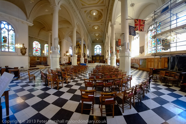
More City of London Panoramas: This is the final set of picturesI’ll post from those I made while working on a personal project on the City of London in July 1994. Of course I took many which I’ve not digitised, spending several days walking the City and making over 300 exposures. The camera I used makes negatives on standard 35mm film which are wider than normal and a ’36 exposure’ film only gets around 20 or 21 panoramic frames. Film loading is also trickier as the film has to go around a curve.

Each exposure took a few minutes to select a viewpoint, set up my tripod, level the camera, use a handheld lightmeter to check exposure and finally press the cable release. Most of those not uploaded are similar to those I have posted with just minor changes to the view.

London Bridge Walk, Tooley St, Borough High St, Southwark, 1994, 94-711-52

Not quite in the City, but made as I made my way from London Bridge Station to London Bridge along London Bridge Walk. The road in the background is Borough High Street which leads on to London Bridge and the City boundary is in the middle of the river. You can just see the pinnacles on the top of the tower of Southwark Cathedral.

After the operation of the Waterloo & City underground line from Network South East to London Underground in April 1994 I could no longer use my ‘London Terminals’ ticket on this route, and my cheapest journey became to go to London Bridge on this and walk across to the City.

This is one of a few pictures I had digitised but missed when I was uploading these images to Flickr.

High Walk, Wood St, City, 1994, 94-713-42

Another exposure from the highwalk at Wood Street, leading south along the east side of the street away from London Wall. In the centre of the picture is the City of London Police Headquarters, with two white police vans at bottom right. Steps lead down from the walkway to Wood Street but the highwalk also continued straight on at extreme left – though with more steps.

In the centre of Wood Street at right is the tower of St Alban Wood Street. The medieval church was destroyed in the Great Fire and rebuilt by Sir Christopher Wren. The church was largely destroyed in the Blitz in 1940. The tower remained and was Grade II* listed in 1950 and is now a private house; the remains of the rest of the church were demolished in 1965.

Lower Thames St, King William St, City, 1994, 94-711-12

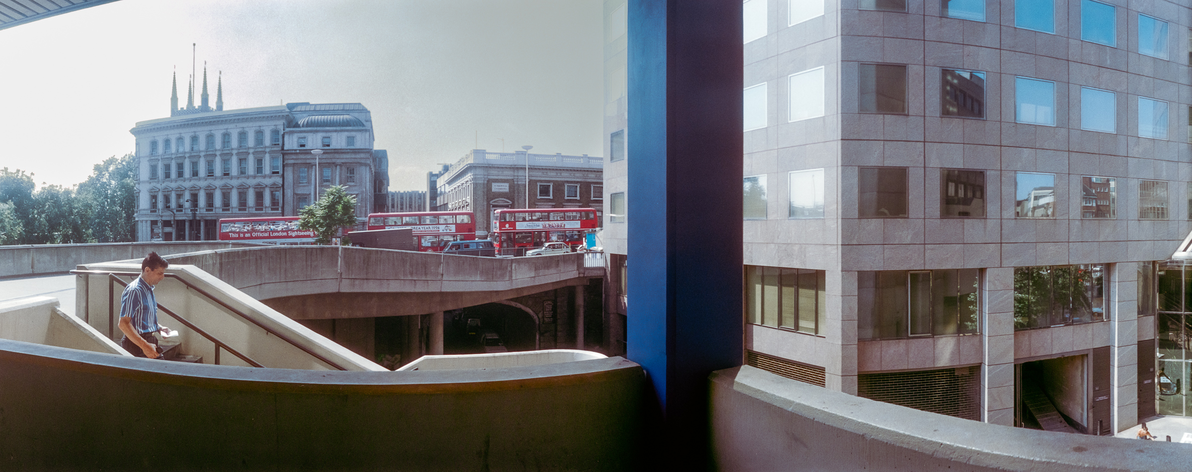
Again on my way from London Bridge Station to the centre of the City, this is made from where London Bridge joins to King William Street and goes across Lower Thames Street. You can see a highwalk bridge going across Lower Thames street a couple of hundred yards to the east, still there in 2025.

Until around 1970 Thames Street was a fairly narrow street, just wide enough to allow a single lane of traffic in both directions. It was then turned into a major road and divided at London Bridge into Lower and Upper Thames Street. At the left you can clearly see where older buildings were cut through to widen the road.

Bank Junction, City, 1994, 94-712-33

The heart of the City. I made the picture close to the corner of Mansion House Street and Princes Street with the Underground entrance on the corner. At left is a corner of the Bank of England and the main modern building towering above it is the Stock Exchange Tower, home to the Stock Exchange until 2004.

Towards the centre is the Royal Exchange, I think then still home to the International Financial Futures Exchange rather than just an upmarket shopping mall. Two buildings full of banks and insurance companies book-end Hawksmoor’s St Mary Woolnuth and at the extreme right is the edge of the Mansion House with a gilded lamp on its steps.

Milton Court, Silk Street, City, 1994, 94-713-21

Another section of highwalks ran from close to Moorgate Station to the Barbican Estate and these last four pictures show sections of this, which could also be accessed from Ropemaker Street. This northern section has now been lost.

Milton Court was designed by Chamberlin, Powell & Bon and built as a part of the Barbican development in 1959 for various City services – “a fire station, Coroner’s Court, mortuary, office of weights and measures and a civil defence school.”

It was arguably London’s most outstanding single post-war building and English Heritage wanted to list it in 2001, but the government’s Department of Culture, Media and Sport objected and in 2007 Secretary of State James Purnell granted it immunity from listing. In a sad act of cultural vandalism this remarkable building was demolished in 2008.

Milton Court, Silk Street, City, 1994, 94-713-12

The building which replaced Milton Court was also given the same name but is a much more bland modern structure. The bridge which linked to the northern section of highwalk disappeared.

The new 115m tall Milton Court is described on its builders Sir Robert McAlpine web site: “Climbing to 36 storeys, Milton Court redefines luxury living in the Square Mile. In addition to a graceful residential tower, the development is home to a spectacular new annexe to the Guildhall School of Music & Drama.” But to me it looks like just another tall city office block.

Highwalk, Ropemaker St, City, 1994, 94-715-52

This enclosed section of highwalk ran from Ropemaker Street to the bridge across Silk Street to the Speed Highwalk still there along the north side of Speed House.

Ropemaker St, Islington, City, 1994, 94-715-32

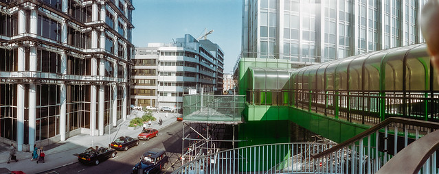
Remarkably I think none of the buildings in this picture looking east along Ropemaker Street has ssurvived. Even the building at left, Ropemaker Place, a 60m high block which I photographed while it was being built in 1986 and was completed in 1987 and which I thought was one of the more attractive modern buildings in (or rather a few feet outside) didn’t last long and was demolished only 18 years later in 2005.

More colour from 1994 in later posts.


FlickrFacebookMy London DiaryHull PhotosLea ValleyParis
London’s Industrial HeritageLondon Photos

All photographs on this page are copyright © Peter Marshall.
Contact me to buy prints or licence to reproduce.


Circle The City – 2014

Circle The City: On Sunday 18th May 2014 I accompanied my wife who was taking part in a sponsored walk around churches in the City of London to raise money for Christian Aid, part of the activities in Christian Aid Week. The 2025 Christian Aid Week ended yesterday (17 May 2025) but it isn’t too late to donate towards their work with local partners and communities in countries around the world “to fight injustice, respond to humanitarian emergencies, campaign for change, and help people claim the services and rights they are entitled to.”

Circle The City - 2014
Hawksmoor’s St Mary Woolnuth

Christian Aid is one of the better aid charities, currently working through local grass roots organisations in some of most vulnerable communities in 29 countries in Africa, Asia, the Middle East, Europe and Latin America and the Caribbean. They don’t give money to governments and the projects they support are organised and managed by local people – with robust procedures to ensure the money is spent effectively. Some of those they support are Christian but many are not – something which has led to some churches failing to support their work.

Circle The City - 2014
The crypt of All Hallows by the Tower
Circle The City - 2014
Minster Court, Mark Lane

Other churches have decided against supporting Christian Aid because of their political campaigning, “pressing for policies that can best help the poor…. All we care about is eradicating poverty and injustice and the causes of these.” Compared to some other large charities they are more efficient, with 84p in every pound donated “working for long-term change, responding to humanitarian emergencies and using our voice to call for global change“.

Circle The City - 2014
Gateway to “the churchyard of Saint Ghastly Grim”, St Olave Hart St.
St Olave Hart St
The Ship, Hart St

The event was extremely well organised, with those taking part getting maps and directions at St Mary-le-Bow on Cheapside where there was a service before the walk. People also collected red helium-filled balloons to carry on the walk, and some of these were tied to mark the route and the various points – mainly churches where marchers could get their sponsorship forms signed as they walked around which also had Christian Aid bunting.

A double Gherkin
Bevis Marks Synagogue is the oldest synagogue in Great Britain, built in 1701

Most of the churches were open for people to walk around and some had refreshments and toilets. It would have been hard to get lost, but some people have zero sense of direction and find it difficult to hold a map the right way up and my presence was helpful. But I had really gone along to keep my wife company – and of course to take some pictures, some of which appeared in her church magazine.

A yurt at the rear of St Ethelburga-the-Virgin within Bishopsgate

I’d visited most of the City churches before and photographed inside them, but there are a few that are seldom open to the public but opened up for the occasion, and I also took other pictures as we walked around. Most of them, even those of other buildings include other marchers and some of the churches were crowded with them. Those red balloons didn’t always improve my pictures, but I also ate more cake than on my other city walks.

Saint Sepulchre-Without-Newgate

There are many more pictures in the post on My London Diary at Christian Aid Circle the City.


FlickrFacebookMy London DiaryHull PhotosLea ValleyParis
London’s Industrial HeritageLondon Photos

All photographs on this page are copyright © Peter Marshall.
Contact me to buy prints or licence to reproduce.


Bank, London Bridge, Fish Island, Hackney Wick

Bank, Victoria Park, Fish Island, Hackney Wick: In 1988 I was still teaching a full timetable at the sixth-form and community college where I worked, but because I took an evening class on Tuesdays I was able to finish the week’s teaching at noon on Friday. As a union rep I had persuaded my members against national union advice to some deviations from the national conditions that suited the peculiar circumstances of the college and made such arrangements possible.

Most of the pictures I made back in 1988 were either taken during the college holidays – we kept more or less normal school terms – or at weekends, but at noon on some Fridays I would rush down to the caretakers stores where I kept my bike, pedal home furiously, dump the bike, pick up my camera bag and rush to the station for a train to London. Until the clocks went back at the end of October there was then time for a few hours walking and taking pictures – in late October sunset is around 5.45pm. I think the pictures in this post were probably taken on the last occasion that year that my journey was worthwhile.

Doorway, Bank Station, Bank, City, 1988 88-10d-25-Edit_2400
Doorway, Bank Station, Bank, City, 1988 88-10d-25

I didn’t make many pictures on this Friday afternoon – around 16 black and white frames and perhaps two or three in colour, perhaps partly because I broke my journey to make this picture. Rather than taking the train from Richmond to Homerton or Hackney Wick, I went up to Waterloo and took the Waterloo & City line to Bank. I’d some time earlier photographed this doorway at Bank station and had for reasons now unknown to me decided I needed another and different image. Possibly I’d been reminded of it when the earlier picture, a closeup of the three heads, was used on a bookjacket.

It perhaps took me a few minutes at Bank to find the doorway still there on King William Street on the side of the splendid Hawksmoor church of St Mary Woolnuth. Having make the single exposure shown here, I made my way to a bus stop for a No 8 bus to Bethnal Green and then walked up Grove Road to Victoria Park.

Old London Bridge, stone alcove, Victoria Park, Tower Hamlets, 1988 88-10d-26-Edit_2400
Old London Bridge, stone alcove, Victoria Park, Tower Hamlets, 1988 88-10d-26

I’d realised when I got home from my previous walk that I had not photographed the shelters which were stone alcoves from the Old London Bridge. That bridge, built in 1176-1209 had until 1760 been cluttered with houses and shops, leaving only a narrow path across the river. These were cleared in 1760-63, more than doubling the width of the bridge, and seven stone alcoves were installed along each side.

The bridge was demolished in 1831, but these alcoves were sold and two found there way to Victoria Park when it was opened in 1845. Another is in a courtyard at Guy’s Hospital and two ended up on an estate in East Sheen along with some of the balustrade, though only one now remains in the grounds of some 1930s flats at Courtlands, close to the 1st Richmond Scouts HQ.

Percy Dalton, Dace Rd, Hackney Wick, Tower Hamlets, 1990, 90-9h-46

From Victoria Park I walked across the footbridge over the East Cross Route to Hackney Wick, then turning south and making my way down Wansbeck Road to the Northern Outfall Sewer on Wick Lane. Steps there took me down to Dace Road and along to Old Ford Locks. Unfortunately although I took a few picture on the walk, none are among those I’ve digitised. So here’s one I took in 1990 on Dace Road of Percy Dalton’s peanut factory.

Loading Bay, Lock, Old Ford, Lea navigation, Tower Hamlets, 1988 88-10e-61-Edit_2400
Loading Bay, Lock, Old Ford, Lea navigation, Tower Hamlets, 1988 88-10e-61

I walked across the gates at Old Ford Lock and took a few pictures there, including this one of the loading bay at Swan Wharf.

Bridge, White Post Lane, Lea Navigation, Hackney Wick, Tower Hamlets, 1988 88-10e-62-Edit_2400
Bridge, White Post Lane, Lea Navigation, Hackney Wick, Tower Hamlets, 1988 88-10e-62

The I walked north on the towpath. Now there are two new bridges on this stretch, from Stour Road and Monier Road, but in 1988 the next crossing was at White Post Lane.

Bridge, White Post Lane, Lea Navigation, Hackney Wick, Tower Hamlets, 1988 88-10e-65-Edit_2400
Bridge, White Post Lane, Lea Navigation, Hackney Wick, Tower Hamlets, 1988 88-10e-65

At left is the splendid 1913-14 Queen’s Yard works, part of the Clarke, Nickolls & Coombs Ltd “Clarnico” sweet and chocolate factory, formerly the largest employer in the area. Much of their five works were damaged or destroyed by wartime bombing and this building needed some restoration. The company was bought by Trebor in 1969 and the works closed. The white building fronting the canal beyond the bridge was the cocoa bean roasting factory built around 1900.

I walked over the bridge and along to Hackney Wick station for a train to Richmond on my way home.