Filipino Health Workers, Coal Line, Tax Dodgers, Biafra & National Gallery – 2015

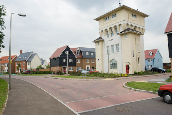
Filipino Health Workers, Coal Line, Tax Dodgers, Biafra & National Gallery: Ten years ago today, Saturday 30th May 2015, I began at the Daily Mail offices in Kensington where Filipino NHS workers were protesting about scandalous insults the rag had made, then went to Peckham to view the proposals for a linear park confusingly named and promoted as the ‘Coal Line’. From there I came back to central London for a UK Uncut banner drop on Westminster Bridge against tax dodgers, a Trafalgar Square protest by Biafrans and finally a rally there by staff on strike at the National Gallery.


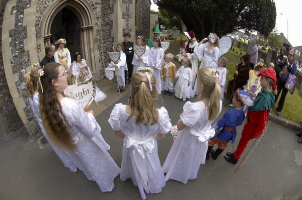
Filipino Nurses tell Daily Mail to apologise – Kensington

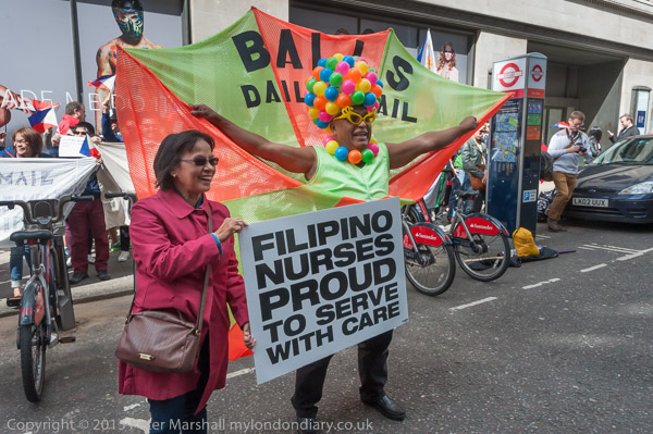
Filipino health workers came to protest atthe Daily Mail over its reporting of the Victoriano Chua case which insulted Filipino NHS workers as a whole despite the vital contribution they make to the NHS. The demand the Daily Mail apologise for its racist comments and recognise the contribution that they make.

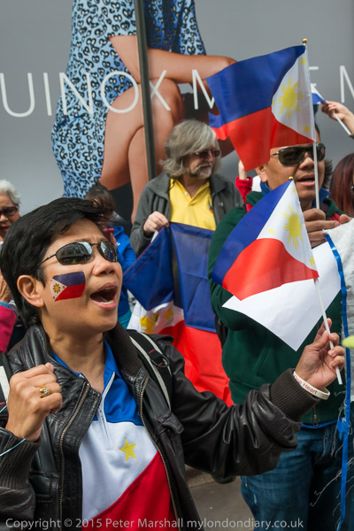
As a patient in intensive care in 2003 I had been very impressed by the care and attention I received from a Filipino nurse, and others when I was on the general ward had all been “competent, committed and caring” – along with those of other nationalities. We should be training more British nurses and improving conditions to keep them working for the NHS, but without staff from abroad at all levels the NHS would have collapsed long ago.

More pictures at Filipino Nurses tell Daily Mail apologise.


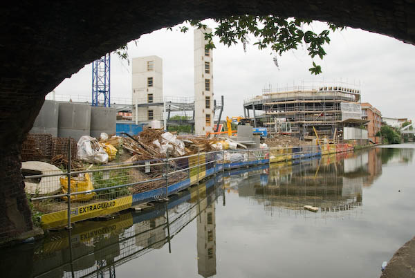
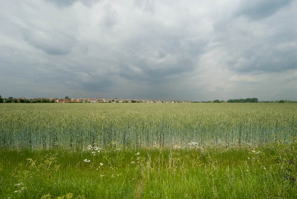
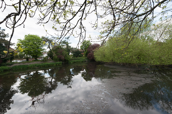
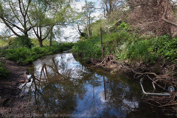
Walking the Coal Line – Peckham

The Chelsea Fringe festival began in 2012 as an unofficial fringe, an alternative gardens festival to the annual Chelsea Flower Show and has since become an international event. Anyone can take part so long as “it’s on topic, legal and interesting, it can go in the Fringe, no matter how outlandish or odd it may seem.” It is “unsponsored, unfunded, unbranded and wholly independent, with no medals or judging committees. It relies entirely on volunteer efforts and survives on its registration fees.

Rye Lane – the walk would start here opposite ZA Afro Foods and Peckham Rye Station

The Coal Line project began in 2014 and became a registered charity backed by many local people as well as TfL, Southwark Council, The Peckham Settlement, Sustrans and the Mayor of London for a 900 metre linear park linking Peckham Rye Station on Rye Land with Queens Road Peckham station.

Derek Jarman memorial garden

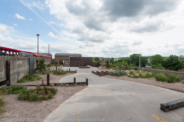
It seemed a good idea and would provide useful local short cuts for walkers and cyclists as well as a link in longer leisure walks at a relatively low cost. But its advocates over-hyped it tremendously, comparing it to the ‘High Line’ in New York.

Copeland Park

I wrote in 2015:

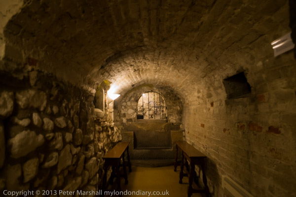
“More interesting than the Coal Line are both the Bussey Building in the former industrial estate Copeland Park and the multistorey car park. Saved from demolition by a locals, the Bussey Building, reached by an alley between shops in Rye Lane, houses small businesses, artists, faith groups, art spces and a rooftop bar.The multi-storey car park on its upper floors now has a cafe, a local radio performance space and another rooftop bar, next to the Derek Jarman memorial garden, as well as better views than the Bussey across Peckham and to central London.

Cossall Walk

Part of the Coal Line is already open to the public as a small nature reserve, left by the railway line after a scheme for a massive inner-ring road was fortunately abandoned. Its legacy is a hefty wall along part of the edge of the service road by the Cossall Walk line of flats.”

More from along the Coal Line and other parts of Peckham at Walking the Coal Line.


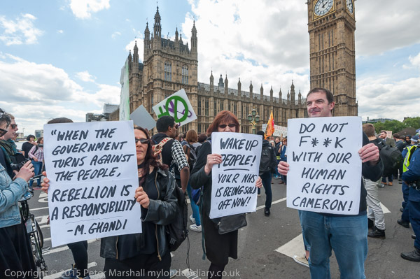
UK Uncut Art Protest – Westminster Bridge

Protesters at Waterloo – Rich get Richer, Poor Get Poor – Osborne and Cameron

UK Uncut supporters marched from Waterloo to Westminster Bridge where they spread a large piece of cloth on the roadway and painted a banner telling Parliament that collecting dodged taxes would bring in more than cutting public services.

Painting the banner on Westminster Bridge
The message on the banner was £12 bn more cuts £120 bn tax dodged – AUSTERITY IS A LIE’.

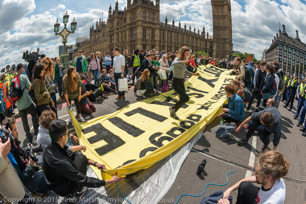
I had to run to the southern end of the bridge and then rush down the Albert Embankment to photograph the banner hanging from the bridge along with the smoke from flares. It was perhaps the least interesting photograph of the event and it would have been rather better had they put it over the opposite side of the bridge to have the Houses of Parliament as a background.

While this was happening on Westminster Bridge, there was another protest against Tory plans to repeal the Human Rights Act closer to Parliament which I was sorry to have missed, with just a few people still standing on the roadway.

More pictures at UK Uncut Art Protest.


Biafrans demand independence – Trafalgar Square

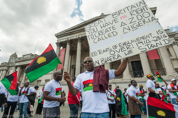
Biafrans had come to Trafalgar Square on the anniversary of their declaration of independence in 1967 which began a long and bloody civil war in which as well as those killed in fighting many Biafran civilians died of starvation.

Death follows Tony Blair of Britain

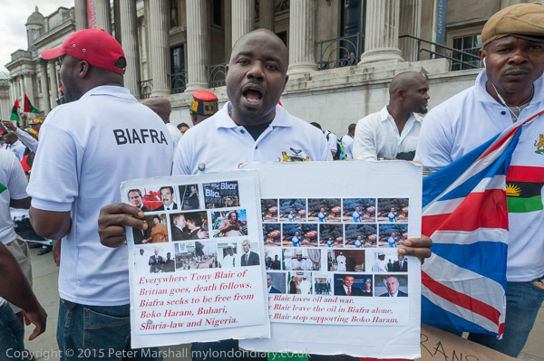
Biafrans say that the Igbo Kingdom of Nri lasted from the 10th century until 1911, although it was incorporated into Southern Nigeria by the 1884 Berlin Conference. Britain decided to unite Northern and Southern Nigeria in 1914 as the North was in financial difficulties.

Many at the protest wore t-shirts with Biafran flag and coat of arms and waved Biafran flags, still demanding independence for their country, as well as remembering those who died in the Ngerian-Biafran War.

More pictures at Biafrans demand independence.


Mass rally Supports National Gallery Strikers – Trafalgar Square

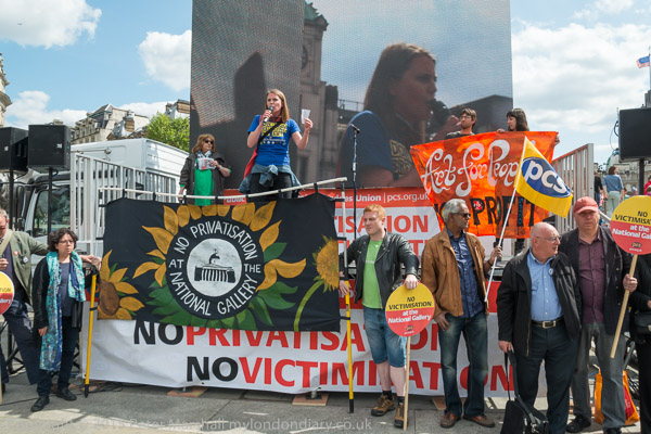
Workers at the National Gallery were on strike against plans to privatise staffing at the gallery and were supported at a rally with many trade unionists including speakers and in the body of the square.

They were also demanding the reinstatement of Candy Udwin, a PCS rep at the National Gallery, who had been sacked for her trade union activities over the privatisation. Speakers included PCS General Secretary Mark Serwotka and comedian and activist Kate Smurthwaite.

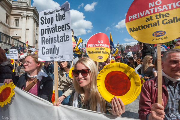
Exhibitions in the Sainsbury wing have already been guarded by privatised staff, and the security there is also run by the private company. At the end of the rally the crowd moved to protest at the Sainsbury Wing. Police stopped them entering the gallery and the doors were locked.

Many more pictures at Mass rally Supports National Gallery strikers.


FlickrFacebookMy London DiaryHull PhotosLea ValleyParis
London’s Industrial HeritageLondon Photos

All photographs on this page are copyright © Peter Marshall.
Contact me to buy prints or licence to reproduce.


West India Dock Road & Limehouse Cut – 1990

West India Dock Road & Limehouse Cut: My walk in Limehouse on Sunday 6th January 1990 continued. The previous post from this walk is Garford Street Limehouse – 1990. As usual you can click on the images here (except the panorama) to view larger versions on my Flickr pages.

Shops, West India Dock Road, Limehouse, Tower Hamlets, 1990, 90-1c-42

This area is close to the parish border of Limehouse and Poplar, but in popular imagination was certainly Limehouse, London’s first ‘Chinatown’. But by 1990 Chinatown had almost entirely moved to Soho, though a few elements remained, including the Peking Restaurant – though a few shops down the street is the Poplar Fish Bar.

Davey & Co, 88, West India Dock Road, Limehouse, Tower Hamlets, 1990, 90-1c-43

“In February 1885 Arthur Christopher Davey began a venture that throughout the 20th century evolved into a culture in the manufacture and supply of marine equipment. From humble beginnings in Leadenhall Street, the company soon moved to its famous address at 88, West India Dock Road, London E14, where it successfully traded for over 100 years.” The company is now based in Colchester.

Shops, West India Dock Road, Limehouse, Tower Hamlets, 1990, 90-1c-45

The Wah Ying Restaurant was another remanant of Chinatown – and you can see along the road the sign of the Peking Restaurant. In the distance are the warehouses of the West India Docks and beyond them the cranes building Cabot Square at Canary Wharf.

West India Dock Road was laid out at the same time as the West India Docks opened in 1802, a new road to give access to them, which was for many years a toll road. I think these buildings probably date from the 1870s or a little later after the tolls were removed.

The restaurant looks very much closed and the broken windows above suggest it was empty and derelict when I made this picture.

Blockage, Limehouse Cut, Limehouse, Tower Hamlets, 1990, 90-1c-46

The Limehouse Cut runs on a straight route through Poplar but curves around at its southern end. It was blocked here in 1990, possibly in connection with the building of the Limehouse Link tunnel between 1989 and 1993. But there was also work on the Cut around then, with the vertical guillotine gate on the north side of Britannia Bridge across the Commercial Road being removed.

Poplar Mods, graffiti, Railway Viaduct, St Anne's Church, Limehouse, Tower Hamlets, 1990, 90-1c-32
Poplar Mods, graffiti, Railway Viaduct, St Anne’s Church, Limehouse, Tower Hamlets, 1990, 90-1c-32

The tower of Hawksmoor’s St Annes Limeouse seen above the viaduct built for the London and Blackwall Railway and opened in July 1840, the second or third railway viaduct to be built in London, after the 1836 London to Greenwich viaduct and the the Hanwell viaduct, technically then outside London. The line went to Brunswick Wharf in Blackwall where passengers could board ferries and boats to other destinations down river or around the world.

I can tell you nothing more about Poplar Mods except that the graffiti tells us they are male “Hammers” fans. West Ham began life as a team for the workers of the last remaining shipbuilders in the area not far away on Bow Creek as the Thames Ironworks Football Club. From 1895 they played at Hermit Road in Canning Town, former home to Old Castle Swifts, Essex’s first professional team which had gone bankrupt, They became West Ham United in 1900 and moved to Plaistow, before in 2004 uniting with the Boleyn Castle football club and moving to their Upton Park ground where they stayed until 2016.

Limehouse Cut, Railway viaduct, Limehouse, Tower Hamlets, 1990, 90-1c-21

I think the next few pictures I made were taken from the block of flats immediately to the east of Limehouse Cut, Kiln Court, a medium rise block built as part of the Barley Mow Estate for the GLC in 1965-8. Back in 1990 many blocks still did not have security doors and it was possible to easily access shared areas.

Here you can see the Cut and the DLR viaduct across the north side of Limehouse Dock with its bridge and the Roman Catholic Church of Our Lady Immaculate & St Frederick on the corner of Island Row and Commercial Road.

I think the buildings on the far bank of Limehouse Cut were temporary offices and accommodation for the building of the Limehouse Link tunnel. The site is now occupied by housing at the end of Island Row.

Limehouse Cut, Limehouse Dock, Railway viaduct, Limehouse, Tower Hamlets, 1990, 90-1c-23

In this picture you can see across to Limehouse Dock with the Hydraulic Accumulator Tower next to the DLR viaduct at the right. At the left is the temporary blockage on the Limehouse Link.

Limehouse Cut, Limehouse Dock, Railway viaduct, Limehouse, Tower Hamlets, 1990, 90-1c-24

Sliding my shift lens to the left gave a view a little further towards the south and shows a little more of the Cut past the blockage and in the distance a small glimpse of the River Thames. This image was taken to create a panorama together with 90-1c-23:

Limehouse Cut, Limehouse Dock, Railway viaduct, Limehouse, Tower Hamlets, 1990, 90-1c-23-24

More from Limehouse Cut in the next post on this walk.


FlickrFacebookMy London DiaryHull PhotosLea ValleyParis
London’s Industrial HeritageLondon Photos

All photographs on this page are copyright © Peter Marshall.
Contact me to buy prints or licence to reproduce.


More Colour From New Charlton – 1995

More Colour From New Charlton: I think all of these pictures were taken in May 1995, the panoramic examples being made using a swing lens panoramic camera, probably the Horizon 202 from the Krasnogorsky Mechanicheskiy Zavod (KMZ) factory in Krasnogorsk near Moscow. This uses clockwork to rotate a 28mm f2.8 lens around a little over 120 degrees, keeping the lens to film distance constant by having the film in a curve around the axis of rotation. The camera made negatives 58mm long and 24mm tall on normal 35mm film, giving around 20 exposures from a normal ’36 exposure’ cassette.

Willoughby Way, New Charlton, Greenwich, 1995, 95p5-671

The film was exposed though a rotating slit behind the lens and different shutter speeds were obtained by altering the slit width. There were only two rotation speeds and for the faster speeds – 1/60 s, 1/125 s, and 1/250 s – the rotation took around a thirtieth of a second, enabling me to use the camera without a tripod.

Thames Path, Lombard Wall, New Charlton, Greenwich, 1995, 95p5-662

The lens focus was fixed and I think I usually worked at f8 which meant everything from a few metres away to infinity was sharp. The camera had a spirit level as by keeping the camera level vertical lines were rendered straight in the image. Horizontal lines away from the centre of the image become curved as you can see in some of these images, and care in composition was needed to stop these effects dominating the pictures.

Mudlarks Way, New Charlton, Greenwich, 1995, 95p7-161

The image quality was much the same as that from my several times more expensive Japanese Widelux f8 swing lens camera, but the Horizon had a useable viewfinder and was easier to use handheld. Though I think for most of my walks back in 1995 I was still carrying a rather large, heavy and solid Manfrotto tripod. I liked it because it could hold the camera absolutely steady at my eye level – and unless there was good reason not to do so I always preferred to view from that height.

Andrews Sykes,  New Charlton, Greenwich, 1995, 95c5-832
Andrews Sykes, New Charlton, Greenwich, 1995, 95c5-832

But I was also photographing with more conventional cameras, and usually had two Olympus OM4 bodies, one with black and white and the other with colour negative film. Although I had a fairly full range of lenses, the great majority of the pictures were made using an Olympus 35mm shift lens.

Bugsby's Way, New Charlton, Greenwich, 1995, 95-5o-66, 1995, 95c5-825
Bugsby’s Way, New Charlton, Greenwich, 1995, 95-5o-66, 1995, 95c5-825

In particular this allowed me to place the horizon in the images below or above the centre of the frame without tilting the camera which would have resulted in converging or diverging verticals. As well as shifting the optical elements up and down the lens mount allowed the lens to move to either side which also gave more control over framing.

Works, Mudlarks Way, New Charlton, Greenwich, 1995, 95c5-823

This area beside the Thames was then almost entirely industrial with aggregate wharves and some commercial premises. On other occasions I took more pictures along the riverside path which in the following year became a part of the Thames Path.


FlickrFacebookMy London DiaryHull PhotosLea ValleyParis
London’s Industrial HeritageLondon Photos

All photographs on this page are copyright © Peter Marshall.
Contact me to buy prints or licence to reproduce.


London’s Canal Walk: 2007

London’s Canal Walk: On Saturday 26th May 2007 I walked across London together with my wife and older son on canal towpaths from Mile End in the east to Old Oak Lane in the west, from where we made the short walk to Willesden Junction for a train towards home.

London's Canal Walk: 2007
There is a great deal of new building next to the Regents canal

I’d walked and cycled along many shorter sections of these canals before, but this was the first time I’d done the whole roughly 12 miles in a single stretch. Most of the way we kept to the towpaths, but there are two tunnels around which we had to detour on roads, and a few places where walking along a road was more convenient than using the tow path, particularly around Little Venice.

London's Canal Walk: 2007
The Hereford Union runs into the Regents Canal in Bethnal Green just beyone here

Probably the definitive book on English canals was written by a photographer, Eric de Maré, (1910 – 2002), one of a now largely forgotten generation of British photographers, and illustrated with many of his fine photographs, as well as some by others. He was one of the finest architectural photographers of the mid-20th century and also someone whose popular Penguin book ‘Photography’ published in 1957 introduced many of us to the history, techniques and aesthetics of the medium. Others since have looked better on the coffee table but have lacked his insight.

London's Canal Walk: 2007
By Cambridge Heath Road, Empress Coaches and the gas holders

de Maré and his first wife lived on a canal boat for some years and travelled around 600 miles along them while writing and taking the pictures for the book ‘The Canals of England’ published by Architectural Press in 1950 which remains the definitive publication on our canals, though in some obvious ways outdated. The canals – which had played an important part in the war effort – had been nationalised under the National Transport Act on 1st January 1948 and part of the book is an impassioned plea for the UK’s transport policies to be revised to update the system and make fuller use of our great canal heritage.

London's Canal Walk: 2007

But of course that didn’t happen, thanks to huge road transport lobby, and instead of canals similar to some in the continent we got motorways. The canals were encouraged to bring commercial traffic to an end, and with a few isolated examples most was finished by 1970 with the canals being given over to leisure use.

Not that de Maré was against leisure use and his work actively promoted this for many of England’s narrow and more rural canals as well as making an argument based on the commercial possibilities of schemes such as the ‘Cross or Four River Scheme’ proposed earlier by a 1906 Royal Commission for wide high volume commercial canals linking Bristol, Hull, Liverpool and London with the Midlands cities of Birmingham, Nottingham and Leicester.

London's Canal Walk: 2007

The book came out in a second edition in 1987 and copies of both are available reasonably priced secondhand – my copy of the first edition with a handwritten dedication from de Maré was at some point marked by a bookseller’s pencil for 6d but I think I paid just a little more. I can find no individual website showing more than a small handful of his pictures – though you can see many by searching for his images online.

It’s still interesting to walk along by the canals in London, and easy to do in smaller sections – or to add a little at either end should you want to and perhaps walk from Limehouse to Southall or Brentford. I didn’t write much about the walk in 2007, but I’ll end with what I did write back then – with the usual corrections.

On Saturday I accompanied Linda and Sam on a walk along some of London’s canals, from Mile End on the Regent’s Canal and along that to join the Grand Union Paddington Branch at ‘Little Venice’, and west on that to Willesden Junction.

When I first walked along the Regents Canal I had to climb over gates and fences to access most of it. The towpath was closed to install high voltage lines below it, but even the parts that were still theoretically open were often hard to find and gates were often locked. The public were perhaps tolerated, but not encouraged to walk along them.

Now everybody walks along them and there are those heritage direction posts and information boards that I’ve rather come to hate. And from this weekend, you no longer even theoretically need a licence to cycle the paths – though mine is still in my wallet, several years since I was last asked to show it.

Now, as walkers, the constant cycle traffic on some sections has become a nuisance. And although most cyclists obey the rules, riding carefully, ringing bells and where necessary giving way, we did have to jump for safety as one group chased madly after each other, racing with total disregard for safety.

But for the rain – the occasional shower at first, later settling in to a dense fine constant downpour, it would have been a pleasant walk.

Many more pictures on My London Diary


FlickrFacebookMy London DiaryHull PhotosLea ValleyParis
London’s Industrial HeritageLondon Photos

All photographs on this page are copyright © Peter Marshall.
Contact me to buy prints or licence to reproduce.


Garford Street Limehouse – 1990

Garford Street Limehouse: My walk in Limehouse on Sunday 6th January 1990 continued. The previous post from this walk is Around Emmett Street, Limehouse 1990. As usual you can click on the images here to view larger versions on my Flickr pages.

Garford St, Limehouse, Tower Hamlets, 1990, 90-1c-65

Garford Street is variously described as in Limehouse, Westferry and Poplar, although estate agents seem to prefer Canary Wharf, which is certainly isn’t, though fairly close by. Back in 1990 I think most of us thought it was Limehouse.

The 1994 LCC Survey of London deals with it in a chapter Limehouse Hole: The inland area. This tells us that a John Garford in the early 19th century had a wharf on the Thames at its western end on Emmett Street. Since the building of the Limehouse Link tunnel and the new route of Westferry Road for the Canary Wharf redevelopment it now starts around 200 yards to the east on Westferry Road. Its other end is still at the West India Dock Road.

I think the junction here is a part of the lost area on the north side of Garford Street. The chimney in the background is a remnant of the Lion Works, established here in “1896-7 by James Walker & Company, steam packing makers,” later Lion Packings Ltd who made “Patent metallic packing” here until around 1926. “The site was cleared for public housing in 1938–9” but as you can see the chimney survived until 1990.

Garford St, Limehouse, Tower Hamlets, 1990, 90-1c-51

Another view just a few yards from the previous image shows some large cable drums from AEI Gravesend. A notice tells those waiting for MOT tests at the Austin Rover garage where to queue.

Garford St, Limehouse, Tower Hamlets, 1990, 90-1c-53

This derelict warehouse building still has the remains of a hoist to the first floor entrance above its main door. There is now new housing on this site just to the west of the DLR railway bridge on the north side of the street.

Constables Cottages, Garford St, Limehouse, Tower Hamlets, 1990, 90-1c-54

These early 19th century houses on the south side of Garford St are Grade II listed.

Greig House, Garford St, Limehouse, Tower Hamlets, 1990, 90-1c-56

Greig House, Garford St, Limehouse, Tower Hamlets, 1990, 90-1c-56

Greig House, Garford St, Limehouse, Tower Hamlets, 1990,
Built 1902-3 as accommodation for officers from Scandinavian ships docked in London it was taken over in 1930 as a Salvation Army hostel, and later used to house male alcoholics and more recently as a residential detoxification centre for men and women with drug or alcohol problems. Grade II listed along with the cottages on Garford St.

Greig House, Garford St, Limehouse, Tower Hamlets, 1990, 90-1c-41

Greig House, Garford St, Limehouse, Tower Hamlets, 1990, 90-1c-41

A second view of Greig House which shows some of the buildings of the West India Dock on Hertsmere Road in the background as well as the cranes building parts of Canary Wharf around Cabot Square. You can read much more about this and the associated buildings on the Lost Hospitals of London site.

From here I walked across the West India Dock Road in Poplar where my next post on this walk will begin.


FlickrFacebookMy London DiaryHull PhotosLea ValleyParis
London’s Industrial HeritageLondon Photos

All photographs on this page are copyright © Peter Marshall.
Contact me to buy prints or licence to reproduce.


Thames Gateway – Essex 2007

Thames Gateway – Essex: I didn’t write much about my bike ride in south Essex on 24th May 2007, though the pictures on My London Diary tell the story of my route. I began at Rainham on the edge of Greater London in the London Borough of Havering.

It wasn’t a linear ride but one where I went back and forth rather extensively exploring some of the areas.

Next came the village of Aveley, where the Old Ship has a pub interior “of Outstanding National Importance” but I didn’t go inside.

I photographed the Mar Dyke at North Stifford along with a number of houses, some thatched and cycled around the Stifford Green estate on site of Stepney Boys Home built around ‘The Tower’. This had been an approved school and then a community home until it closed in 1994.

Next came Chafford Hundred, an area where chalk was extensively quarried from 1874 until the last quarry closeed in 1976. In 1986 a proposal by Blue Circle Industries, West Thurrock Estates and Tunnel Holdings to build 5,000 homes on derelict land was approved and the first were completed in 1989.

Parts of the area were still in industrial use in 2007 and there is a nature park with extensive lakes and ditches.

Lion Gorge, Chafford Hundred

From there I cycled a little deeper into Grays before going to Orsett Fen and Orsett and Horndon on the Hill which has a rather fine old pub I also didn’t go inside. Cycling and beer really don’t mix well with modern traffic.

There are more impressive ancient buildings, a reminder of the wealth that once came from the wool trade.

I made my way via Bulphan towards Upminster where I could use my railcard to start my journey home.


Here is the short text I wrote back in 2007 – with the usual corrections. The cost of the ticket I bought then is now £15.30 – an increase of around 9% above inflation – another of the costs of privatisation.

Thursday I bought an expensive ticket – just up from £6.60 to £7.90 – for a one-day railcard for Greater London from Staines, and put my folding bike aboard the train, changing to reach Rainham, Essex, (L B Havering) on the furthest edge of London from where I live.

Don’t let anyone tell you Essex is flat. O boring. Over a few hundred yards you can move from idyllic thatched cottages to post-industrial dereliction; from dramatic man-made scenery with lakes and chalk gorges to densely packed modern housing estates. From farms owned by city millionaires to council tower blocks.

Most of my winding route took me through Thurrock, one of the major growth sites of the Thames Gateway area.

There are many more images from this ride on My London Diary, beginning here.


FlickrFacebookMy London DiaryHull PhotosLea ValleyParis
London’s Industrial HeritageLondon Photos

All photographs on this page are copyright © Peter Marshall.
Contact me to buy prints or licence to reproduce.


Around Emmett Street, Limehouse 1990

Around Emmett Street, Limehouse: My walk in Limehouse on Sunday 6th January 1990 continued. The previous post from this walk is Three Colt Street & Limekiln Dock – 1990.

Datakeep, Emmet St, Limehouse, Tower Hamlets, 1990, 90-1b-13
Datakeep, Emmett St, Limehouse, Tower Hamlets, 1990, 90-1b-13

You won’t find Emmett Street on a map of Limehouse now. It ran from the southern end of Three Colt Street to meet West Ferry Road a few yards to the north of the Limehouse Entrance and Limehouse Basin the the West India Docks. Along its west side were a number of wharves – Taylor’s Wharf, Aberdeen Wharf, River Plate Wharf etc, the dry docks of Limekiln Dockyard and Limehouse Dry Dock and a dock at Aberdeen Wharf. This area was Limehouse Hole and included Limehouse Stairs from which a ferry once ran to Rotherhithe from what later became called Limehouse Pier.

Milligan St, Limehouse Causeway, Limehouse, Tower Hamlets, 1990, 90-1b-15

Dundee Wharf, Aberdeen Wharf and the River Plate Wharf were were all part of the Dunbar Wharves. They ran regular twice weekly services to Scotland as well as importing goods from around the world – including meat from Argentina, and Oxo cubes were at one time wrapped here.

Datakeep, River Thames, Milligan St, Emmett St, Limehouse, Tower Hamlets, 1990, 90-1b-16

Emmett Street had at some time been known as Limekiln Hill – and West Ferry Road was earlier Bridge Road. These names were still used on the 1870 OS map, although The Survey of London says it was known as Emmett Street about 1830.

Datakeep, Emmett St, Limehouse, Tower Hamlets, 1990, 90-1c-63

The land in this area was owned by the Emmett family who began selling it off in 1809 but their name remained on the street until it was completely obliterated with the building of the Limehouse Link Tunnel shortly after I made these pictures.

Datakeep, Emmett St, Limehouse, Tower Hamlets, 1990, 90-1c-64

Much of the area had been cleared earlier by wartime bombing and the some large warehouses were rebuilt in the following years. The remaining 1870s warehouses were demolished in 1971-2 and the rest destroyed for the building of the road tunnel and Canary Riverside including Westferry Circus. You can read a detailed and well-illustrated article Limehouse Hole by Mick Lemmerman on the Isle of Dogs web Site.

Datakeep set out to provide secure storage for computer backup tapes in the largest warehouse in the area, formerly use for tea and coffee. The company later stored all kinds of things, including a 1935 vintage Bentley and offered a wide range of services to companies for their stored items.

More from Limehouse in a later post.


FlickrFacebookMy London DiaryHull PhotosLea ValleyParis
London’s Industrial HeritageLondon Photos

All photographs on this page are copyright © Peter Marshall.
Contact me to buy prints or licence to reproduce.


Circle The City – 2014

Circle The City: On Sunday 18th May 2014 I accompanied my wife who was taking part in a sponsored walk around churches in the City of London to raise money for Christian Aid, part of the activities in Christian Aid Week. The 2025 Christian Aid Week ended yesterday (17 May 2025) but it isn’t too late to donate towards their work with local partners and communities in countries around the world “to fight injustice, respond to humanitarian emergencies, campaign for change, and help people claim the services and rights they are entitled to.”

Circle The City - 2014
Hawksmoor’s St Mary Woolnuth

Christian Aid is one of the better aid charities, currently working through local grass roots organisations in some of most vulnerable communities in 29 countries in Africa, Asia, the Middle East, Europe and Latin America and the Caribbean. They don’t give money to governments and the projects they support are organised and managed by local people – with robust procedures to ensure the money is spent effectively. Some of those they support are Christian but many are not – something which has led to some churches failing to support their work.

Circle The City - 2014
The crypt of All Hallows by the Tower
Circle The City - 2014
Minster Court, Mark Lane

Other churches have decided against supporting Christian Aid because of their political campaigning, “pressing for policies that can best help the poor…. All we care about is eradicating poverty and injustice and the causes of these.” Compared to some other large charities they are more efficient, with 84p in every pound donated “working for long-term change, responding to humanitarian emergencies and using our voice to call for global change“.

Circle The City - 2014
Gateway to “the churchyard of Saint Ghastly Grim”, St Olave Hart St.
St Olave Hart St
The Ship, Hart St

The event was extremely well organised, with those taking part getting maps and directions at St Mary-le-Bow on Cheapside where there was a service before the walk. People also collected red helium-filled balloons to carry on the walk, and some of these were tied to mark the route and the various points – mainly churches where marchers could get their sponsorship forms signed as they walked around which also had Christian Aid bunting.

A double Gherkin
Bevis Marks Synagogue is the oldest synagogue in Great Britain, built in 1701

Most of the churches were open for people to walk around and some had refreshments and toilets. It would have been hard to get lost, but some people have zero sense of direction and find it difficult to hold a map the right way up and my presence was helpful. But I had really gone along to keep my wife company – and of course to take some pictures, some of which appeared in her church magazine.

A yurt at the rear of St Ethelburga-the-Virgin within Bishopsgate

I’d visited most of the City churches before and photographed inside them, but there are a few that are seldom open to the public but opened up for the occasion, and I also took other pictures as we walked around. Most of them, even those of other buildings include other marchers and some of the churches were crowded with them. Those red balloons didn’t always improve my pictures, but I also ate more cake than on my other city walks.

Saint Sepulchre-Without-Newgate

There are many more pictures in the post on My London Diary at Christian Aid Circle the City.


FlickrFacebookMy London DiaryHull PhotosLea ValleyParis
London’s Industrial HeritageLondon Photos

All photographs on this page are copyright © Peter Marshall.
Contact me to buy prints or licence to reproduce.


Ray-Jones & London May Queen – 2005

Ray-Jones & London May Queen: The very first London May Queen event I photographed was on Saturday 14th May 2005. Previously I had thought that such events had died out years earlier. They had been recorded in the late 1960s and 1970s by photographers including the late Tony Ray-Jones whose work in his book ‘A Day Off‘ published posthumously in 1974 (and earlier publications in Creative Camera magazine and elsewhere) had a great influence on myself and other young photographers in the UK.

Ray-Jones & London May Queen - 2005
The Queen’s carriage is pulled by the Girls Brigade. All photographs here by Peter Marshall

Ray-Jones had won a scholarship to the USA to study design at Yale in 1961 and there he had been greatly influenced by the work of Robert Frank in his book ‘The Americans’ published in France in 1958 and in the USA the following year as well as the work of a younger generation of American photographers Frank’s work had inspired. After Yale Ray-Jones worked for several years in the USA and attended workshops with the legendary art directory Alexey Brodovitch.

Ray-Jones & London May Queen - 2005

He returned to the UK and as well as taking photographs promoted his US-acquired views on photography with an evangelistic fervour. In this he found an ally in the Bronx-born photographer John Benton-Harris, another ‘Brodovitch Boy’ who had settled in London – who I later became friends and worked with. After Ray-Jones died tragically young from Leukaemia in 1972 it was Benton-Harris who made the prints that were used in ‘A Day Off’, printed very much in the style of the time.

Ray-Jones & London May Queen - 2005

Among the several images in the ‘Summer Carnivals’ section of the book were several from May Queen festivals, including a large group photograph of over twenty young girls all wearing crowns in front a maypole. The caption ‘May Queen gathering, Sittingbourne, still used on the Getty site, 1968′ was incorrect (as were some others as the photographer was no longer alive and they were captioned by others.) Possibly the least characteristic image of the book it was actually from the crowning of the 1968 London May Queen on Hayes Common in the London Borough of Bromley.

Ray-Jones & London May Queen - 2005

From two of my close photographic friends following in the footsteps of Ray-Jones and Benton-Harris photographing English Carnivals with an Arts Council grant I found that these events were still taking place and I decided to find out more. It was hard to find information but I was finally able to find the date and time of the 2005 crowning.

I arrived at Hayes Common with some trepidation. Since Ray-Jones had taken his pictures there had been several decades of warnings from the government and media over “stranger danger” and panic over men pointing cameras at young girls was rife. Although this was a public event, before taking any pictures I went to find the organisers and explained what I hoped to do. I had for some years been part of a group of photographers, London Documentary Photographers, organised by Mike Seaborne at the Museum of London and had ID from them as well as a Press card which, unusually for me, wore visibly on my jacket for the event. This possibly wasn’t a good idea as the organisers were worried that some of the older girls taking part might be embarassed to have their pictures in the local press. They were less worried about me posting them on the web or elsewhere.

The children – many girls but with a few brothers among them – were almost all eager to have their pictures taken, and their mothers (and there were a few fathers too) were also happy to have a record of the day. From this first event I got requests to photograph other events in the London May Queen cycle the following year and for years later, though I was often busy elsewhere and unable to do so.

A few days after the event I put the pictures on-line with a long explanation about the event and an invitation to the mothers to ask me if I had other pictures of their children and for larger files they could use to make prints. I’d also given out copies of my business card to many of thembut made it clear I would be happy to provide digital images without charge.


Here – with minor corrections – is what I wrote in 2005.

Merrie England and London May Queen Festival
Hayes Common and Hayes Village, Kent, 14 May 2005

The ‘Merrie England And London May Queen Festival’ was founded by a master at Dulwich School, Joseph Deedy in 1913, making this year’s festival the 93rd. [Later I was told he was from Whitelands College where John Ruskin had started a May Queen festival in 1881 – still continuing at Roehampton University as a May Monarch.]

The tradition of May Queens is much older, coming from pre-Christian times, as the Goddess Of The Spring, who the Romans called Flora. It was a traditional time for young women to come to the villages from the farms to find a husband, and the maypole is a symbol of virility.

Deedy’s folklorique version is rather different from this with an uplifting script, still read by the participants as a part of the festival. Some of the texts are on the back of the signs carried by the attendants of the London May Queen, the ‘Joy Bells Of Merrie England’ representing ‘Music’, ‘Company’, ‘Beauty’, ‘Light’…

The London May Queen is also attended by ‘The Prince Of Merrie England‘ (also female) along with the Fairy Queen, Bo-Peep and Robin Hood. The event is also attended by a couple of dozen ‘Realm Queens’ each also with her attendants: a Prince, Banner Bearer, Crown Bearer, Pages, Fairies and Flower Girls, from half a dozen to twenty or more girls, all dressed in the particular Realm Colours and with their own Realm Flower. At its peak in the 1920s and 1930s there were 120 realms with well over a thousand children taking part in the event on Hayes Common.

The various positions are decided entirely by seniority in the organisation – children can join when they are three and continue until their sixteenth birthday. Many of the mothers I talked to at this and later May Queen events had been May Queens or taken part in the ceremony in their childhood; one of the organisers was May Queen in 1932 and her grandchildren were taking part in 2005.

As well as the Hayes festival, there is another a week earlier in Beckenham, where most of the realm queens are crowned. The queens and realms also take part in other fêtes and carnivals, take flowers to the elderly and attend flower services in churches in their areas. Almost all the realms come from the surrounding areas in surburban Kent and Surrey (now mainly in Greater London.)

The children process, [in their realms in alphabetical order] from the Common to Hayes village, where there is a short ceremony, ‘Little Sanctum’ outside the village church.

The procession then continues around Hayes, returning to the Common. This is rather a long walk for some of the younger children.

Back at the Common there is a short ceremony using Mr Deedy’s words read by the Fairy Queen, Bo-Peep, Robin Hood and others, before the London May Queen is crowned by the Prince Of Merrie England. The realm queens are then presented to the London May Queen, and have their pictures taken as a group in front of the maypole [as in that Ray-Jones picture.]

The London May Queen then goes around the field with her main attendants as Flora, with baskets of flowers which she throws to the realm children.This is followed (after the rather lengthy raffle draw) by dancing round the maypole in a fairly energetic and undisciplined fashion.


FlickrFacebookMy London DiaryHull PhotosLea ValleyParis
London’s Industrial HeritageLondon Photos

All photographs on this page are copyright © Peter Marshall.
Contact me to buy prints or licence to reproduce.


Ravensbourne Walk – 2012

Ravensbourne Walk: On Sunday 13th May 2012 I decided to take a walk alongside one of London’s rivers, the Ravensbourne. It isn’t one of London’s best-known rivers and perhaps lacks the glamour of the so-called ‘lost rivers’.

The Ravensbourne still flows largely above ground, and its final tidal section before it enters into the Thames is the rather better-known Deptford Creek, once an important industrial area. It also once powered a number of mills along its length.

I’d decided not to begin at its source at Caesar’s Well in Keston but to join it around 4 miles to the north at Bromley where I could join it by a short downhill walk from Bromley South station. The area around Bromley has several culverted sections of the river and it emerges from one of these into a lake at the west of Church House Gardens, disappearing again for a short section before coming into the open in parkland in Martins Hill Open Space north of Glassmill Lane.

It then goes underground for around a quarter of a mile before appearing again along the edge of a golf course, but non-members have to walk along Ravensbourne Avenue before seeing it again at the bridge under Farnaby Road.

From there on the river flows in the open through Beckenham Place Park and I could walk beside it or close to it, having to weave my way through various roads in an estate here. Just to the east of the river on Brangbourne Road is a large council estate with blocks named after various rivers, mostly I think London Rivers, and a block on the corner with Old Bromley Road is Ravensbourne.

After a small green area on the corner of Bromley Rd and Beckenham Hill Rd which it then goes under to feed a large pond at Homebase. The map I was using for the walk shows this as a stream with a weir in the middle. Part was once the mill pond for Lower Mill, a corn mill (which was at different times a mustard mill and a cutlery mill) on the corner of Southend Lane. Upper Mill stood roughly here on the corner of Beckenham Hill Rd.

Overlooking the pond at Hoomebase I photographed the sculpture The Whisper, Andre Wallace 1984 and the church hall opposite. The river leaves the pound overground, emerging into the open again a couple of hundred yards on as it goes under Watermead Lane where it runs between houses and flats. You can follow this on a back-street but I took the more interesting route along the Bromley Road.

Allerford Rd

At Randlesdown Road it flows into the Catford Trading Estate, then goes under Fordmill Rd just north of the railway bridge. Shortly after here it joins what is usually called its largest tributary, the River Pool, though I think this is usually a larger river than the Ravensbourne, though shorter before continuing under Catford Road next to Catford Bridge Station.

It was a hot day, and I had done rather more walking around than the relatively short route taken by the river, and I was tired. I had intended to walk on to Lewisham or perhaps even Deptford, but abandoned my plans and caught a train here.

More pictures on My London Diary at Ravensbourne.


FlickrFacebookMy London DiaryHull PhotosLea ValleyParis
London’s Industrial HeritageLondon Photos

All photographs on this page are copyright © Peter Marshall.
Contact me to buy prints or licence to reproduce.