Crouch End & Upper Holloway – 1989

The final post on my walk on Sunday 19th November 1989 which had begun in Highgate. You can read the previous part at A Reservoir, Flats, a Cockerel and a Café.

Gateway, Albert Mansions, Crouch Hill, Crouch End, Islington, Haringey, 1989 89-11i-61
Gateway, Albert Mansions, Crouch Hill, Crouch End, Haringey, 1989 89-11i-61

I walked down Haslemere Road and then turned down Vicarage Path, following this to Crouch Hill.

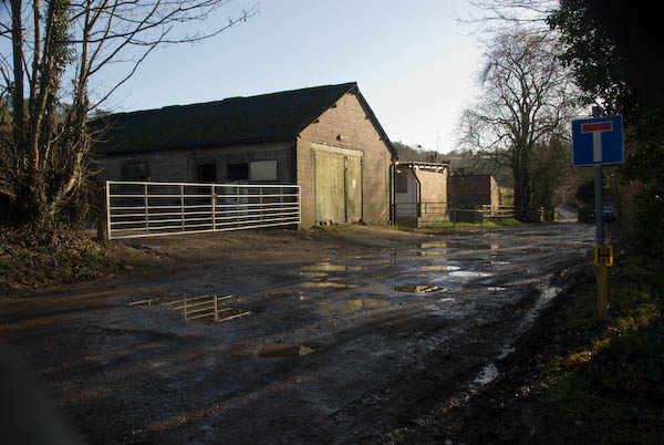
Albert Mansions, described by various estate agents as “a hidden gem in Crouch Hill” dates from 1903. Although the driveway is clearly marked ‘PRIVATE residents only‘, Vicarage Path goes past the building and emerges at the side of the left gatepost in my photograph. I clearly found this gateway more interesting than the actual mansion building where three and four bedroom leashold flats now sell for approaching a million.

House, Heathville Rd, Highcroft Rd, Crouch End, Islington, 1989 89-11i-64
House, Heathville Rd, 6, Highcroft Rd, Crouch End, Islington, 1989 89-11i-64

I walked down Crouch Hill and turned west down Ashley Rd. When I reached Highcroft Road I saw an interesting roof a short distance down and walked up to take this picture. Taken from just across the street it rather fails to show clearly the pyramidal cap to the roof, which is more evident in the previous frame (not on-line) taken of the row along this side of the street. But does give a good idea of the architectural detailing, including a fancily written date which I can’t quite read but is perhaps 1897 or 9 and a rather striking head – I wondered who was the model for this intense face. I’m rather suprised that this building does not appear to be locally listed

House, Highcroft Rd, Crouch End, Islington, 1989 89-11i-65

This locally listed house at 3 Highcroft Road was built in 1875 as the vicarage to St Mary’s Church opposite, and has rather fine porch with a somewhat ecclesiastical look. Like many of the large vicarages provided for Victorian clerics who were expected to have large families and servants I imagine it was sold off some years before I made the picture.

Houses, Hornsey Rise, Upper Holloway, Islington, 1989 89-11i-66

I returned to Ashley Road, walking past St Mary’s church without photographing it. Most of our Anglican churches seem to have been photographed time after time from the Victorian period on, not least because many vicars with time on their hands took up photography as a hobby. I seldom chose to add to the multitude.

There is a line of similar fine houses between Ashley Road and Shaftestbury Road, at 2-20 facing Elthorne Park, but I chose to photograph these because of the wall with its sculptures and irorwork in front of what I think was 6 Hornsey Rise. The wall and ironwork are still there but the figures next to the pavement have long gone. At the right of the picture you can see the Shaftesbury Tavern.

House, Hornsey Rise, Upper Holloway, Islington, 1989 89-11i-53

Hornsey Rise was developed from 1848, although it only got the name almost 40 years later replaceing the different names of various short lengths such as this. This picture gives a closer view of one of the two ornamental gates and the house , with the doorway to number 4 at the right of the image.

The Shaftesbury Tavern, Shaftesbury Rd, Hornsey Rise, Upper Holloway, Islington, 1989 89-11i-54

This pub at 534 is the last building on Hornsey Road, which becomes Hornsey Rise beyond Shaftesbury Rd. According to its local listing it “was built in 1858, by speculative builder Thomas Beall, as the area around it began to be developed. It is a handsome well-preserved building with contrasting brickwork in red and London stock, and pilasters and arches at the upper storey level.

I choose to photograph not the main pub building but its “1897 addition” on Shaftesbury Rd. However CAMRA states that the pub itself was built “in 1897 with rich wood and glasswork, so typical of the golden age of pub-building.” Looking at the pub exterior I am inclined to believe them and the current building probably replaced or significantly altered Beall’s. As they also state, “The pub was restored in 2014 from a ‘very tired’ state by the small pub chain Remarkable Restaurants Ltd“.

Shops, Fairbridge Rd, Hornsey Rd, Upper Holloway, Islington, 1989 89-11i-55

I continued walking down Hornsey Road I photographed this handsome late Victorian building at 471 Hornsey Rd on the corner with Fairbridge Road. Then it was a timber merchant with T C TIMBER on the first floor corner blind window and a rather jaunty-looking painted figure of a town crier in ancient dress looking like a poor piece of advertising clip-art in that above it on the second floor. The shop is now Hornsey Carpets and that figure now looks very washed out and on the first floor is some strange image I make no sense of.

Kokayi, Supplementary School, Hanley Rd, Upper Holloway, Islington, 1989 89-11i-56

Further down Hornsey Road I went down Hanley Road where I photographed the doorway of the Kokayi Supplementary School. A charity of this name was later registered in 1997 “To advance the education of children and young people particularly children and young people of African and Afro-Caribbean descent by the provision of a supplementary school: By the provision of advice and guidance in matters concerning their education and career development; And by such other charitable ways as the charity through its trustees may from time to time decide.” The charity was removed in 2014 as it had ceased to function.

I was at the end of my walk and made my way to Finsbury Park Station. It was several weeks before I was able to go out and take photographs again.


FlickrFacebookMy London DiaryHull PhotosLea ValleyParis
London’s Industrial HeritageLondon Photos

All photographs on this page are copyright © Peter Marshall.
Contact me to buy prints or licence to reproduce.


1995 Colour – Part 1

1995 Colour – Part 1: The first of a series of posts on my colour work, mainly in London, from 1995, 35 years ago and when I’d been working extensively with colour negative film for ten years, though still continuing to work with black and white.

1995 Colour - Part 1
Car Wash, St Paul’s Cray, Bromley, 1995, 95c01-122

Although I’d always taken both colour and black and white photographs since I began in photography, black and white had dominated my work. It was still the serious side of photography in the 1970s; almost all gallery shows then were black and white, and most publications were still only printed in monochrome, including photographic magazines, although some occasionally had a few colour pages.

1995 Colour - Part 1
Frost & Smith, Accident Repairs, Cray Rd, Bexley, 1995, 95c01-123

And back then, almost all professional colour was taken using colour slide film such as Ektachrome and Kodachrome. Films were mainly sold inclusive of processing and you sent away your exposed film and a few days later s box of slides came back through the post. Professionals might use Ektachrome and take it to a lab for processing, but that worked out more expensive, though you could get the results in an hour or so.

1995 Colour - Part 1
St Paul’s Cray, Bromley, 1995, 95c01-132

I was interested in colour but in the early years took far fewer colour images, largely because of the cost, though I did cut this down by buying colour film in bulk and home processing, though this needed much tighter control of time and temperature than black and white and the results were not always quite as they should have been.

1995 Colour - Part 1
Hi-Q, Tyres, Sevenoaks Way, St Paul’s Cray, Bromley, 1995, 95c01-133

Most photographers at the time felt that colour negative film was only for amateurs, but two things changed that for me. One was my frustration with transparency film which simply could not handle many of the high contrast scenes I was interested in, giving impenetrable shadows where I wanted detail and the second was seeing some prints produced by another photographer, printed on Fuji paper.

1995 Colour - Part 1
Opticians, Walthamstow, 1994, Waltham Forest, 95c01-141

There was a clarity about the colours that this paper gave when compared with Kodak, Agfa and the others, but the other great advantage was that there was little or no colour shift with exposure. This meant that I could dodge and burn prints with a similar creative control to working with black and white.

Chinese Takeaway, Hoe St, Walthamstow, 1994, 95c01-155

Some time early in 1985 I made the decision to switch entirely from transparency to negative for all of my personal colour work.

Belvedere, Bexley, 1994, 95c01-161

This post is the first of a number which will show some of my colour images from 1995.

Belvedere, Bexley, 1994, 95c01-163

These pictures were all made in December 1994 or January 1995 with some 1994 images only being processed in January 1995.

War Memorial, Callender’s Cables, Church Manorway, Belvedere, Bexley, 1994, 95c01-165

I’ll publish more in later posts, perhaps also including some of the colour panoramas I made. There is much more of my colour work on film in a number of Flickr albums.


FlickrFacebookMy London DiaryHull PhotosLea ValleyParis
London’s Industrial HeritageLondon Photos

All photographs on this page are copyright © Peter Marshall.
Contact me to buy prints or licence to reproduce.


Thames Path Panoramas – Vauxhall to Wandsworth 2014

Thames Path Panoramas: Back in January 2013 I had photographed and taken part in a rather less bloody re-enactment of the Epiphany bloody armed insurrection by Thomas Venner and fellow Fifth Monarchists against the re-imposition of the monarchy in 1661 being performed by Class War for film director Suzy Gillett. I’d tried hard to avoid getting in the way of the camera but do appear for a few seconds as the insurrection made its way to seize St Paul’s Cathedral.

Thames Path Panoramas

On Sunday 5th January, a year less a day later I and others involved were invited to a private afternoon screening of the film at the Cinema Museum close to the Elephant & Castle. As it was a fine day I went up some hours earlier to walk and photograph a little nearby section of the Thames Path.

Thames Path Panoramas

I’d been making panoramic photographs since the 1980s, at first by cutting and mounting together a few prints from black and white images. Back in 1991 I’d bought my first panoramic camera, a Japanese Widelux F8 with a lens that swings around while making a picture on 35mm film, held in a curve so that the centre of the lens remains at a constant distance from the film. Later I bought several more similar but much cheaper cameras made in Russia and a Chinese beast taking 120 film.

Thames Path Panoramas

These cameras all produced a very wide angle of view – around 120 or 130 degrees – but with a different perspective to “normal” cameras, with some characteristic curvature of objects. The normal rectilinear view stretches out objects at the edges of the frame and is only really usable up to around a 90 degree angle of view. Later I did work with a Hassleblad X-Pan camera and with a 30mm lens which gives a 94 degree horizontal view – around the maximum usable for a rectilinear view.

Thames Path Panoramas

Digital methods changed the game. At first I used a film scanner and software that enabled me to merge several scanned images. Then things became even easier when I shifted to a digital camera. For projects such as ‘The Secret Gardens of St John’s Wood‘ I combined up to around 8 different 12.3Mp digital images form a Nikon D300 to make very large prints with wide angles of view.

But by 2014 I was working with a Nikon D800E and it had occurred to me that there was a simpler solution with its 36.3Mp images. I could use the 16mm Nikon fisheye which gives 180 degree diagonal coverage filling the frame and then convert these images digitally from their fisheye projection to the more friendly cylindrical projection of my panoramic cameras.

I could now make panoramas almost as easily as taking any other images, capturing moving as well as static scenes with ease. For most panoramic images it is important to have the camera level, and the D800E had nice clear indicators that could be displayed in the viewfinder to ensure this, and with an f2.8 lens tripods became a thing of the past.

For these images I used the incredibly flexible PTGui software, but later found the simpler Fish-Eye Hemi plugin for Lightroom more convenient, though PTGui allows some interesting options. Unfortunately this plugin is no longer available, though I hope it or a similar plugin will be made available again. Using it you transform the images without any loss of image at the centres of both horizontal and vertical sides so you can visualise what will be in your final image when looking at the viewfinder while taking images.

Many more pictures at Thames Path Panoramas.


FlickrFacebookMy London DiaryHull PhotosLea ValleyParis
London’s Industrial HeritageLondon Photos

All photographs on this page are copyright © Peter Marshall.
Contact me to buy prints or licence to reproduce.


Around the Olympic Site – January 2007

Around the Olympic Site: Thursday 4th January, 2007 looked like being a pleasant enough day for a bike ride around the area where preparations were getting into full swing for the London 2012 Olympics to see how things were going in the area. So I wrapped up warm and put my folding bike on the train to make my way to Stratford.

Around the Olympic Site
Clays Lane travellers site, Park Village and Clays Lane estate

Most of the central area of the site was already closed off to the public, but I was able to cycle to various parts of the perimeter and take photographs, though I was disappointed to find large areas where nothing was yet taking place already fenced off. From Stratford I went around in an anti-clockwise direction and on My London Diary you can read a fairly long piece about where I went and my opinions about what was happening.

Around the Olympic Site
Eastway Cycle Circuit now fenced off

It was becoming more and more clear that many of those who lived and worked in and around the area were being very shabbily treated, with nothing being allowed to stand in the way of the Olympic juggernaut. People were being lied to, promises being made and then abandoned.

Around the Olympic Site
Bully Fen Wood is Community Woodland no more

Probably the worst case of this was with the 430 residents of the Clays Lane Housing Co-Operative who were first promised they would be rehoused in conditions “as good as, if not better than” their present estate but were later told “at least as good as in so far as is reasonably practicable.”

Around the Olympic Site
Everything on Waterden Road was later demolished

The tenants there had already suffered from their cooperative estate with its strong community being transferred against their wishes to Peabody Housing following an adverse Housing Corporation inquiry, losing their mutual status. After their eviction under the Olympic Compulsory Purchase Order (CPO) they were dispersed and many found they were having to pay much higher rents and living in worse conditions in places that lacked any of the feeling of community of Clays Lane.

Carpenters Lock and part of the closed area

I’d hoped to visit the Eastway Cycle Circuit and the Bully Fen nature Reserve, but both were fenced off, as were some of the footpaths I had hoped to cycle down, resulting in some fairly lengthy detours. Some of the closures claimed to be “temporary” – but some were still closed ten years later.

Samuel Banner, inventor of white spirit, founded the company in 1860. It relocated to Teeside

I commented “Parliament smooths the way for the Olympic Delivery Authority at the expense of people and environment, enabling them to slough off the inconvenience of democracy and justice. The situation for some of the local people – particularly those living in Clays Lane – can only be described as Kafkaesque.”

Huge areas were being flattened

I rode down Marshgate Lane and went onto the Greenway and then returned and went on to Hackney Wick, pausing to eat my sandwich lunch in a sheltered suntrap by the lock on the Hertford Union Canal before riding on the Greenway, turning back where this was blocked and coming back to the Lea Navigation towpath and on to Stratford High Street.

Bridge over Pudding Mill River to Marshgate Lane, Stratford Marsh.

From here I was able to go along a short length of footpath next to the Waterworks River before returning to the Greenway on the other side of the High Street, past some more areas covered by the CPO.

Bow Back River. Both sides in the foreground are part of the CPO area

By now the light was beginning to fade, but I rode on to Canning Town and took a brief look (and some rather dark pictures) of the Pura foods site then being demolished before riding over the Lower Lea Crossing to the station for the Jubilee Line back to Waterloo.

Parts of Pura Food had yet to be demolished.

Many more pictures begin a short scroll down the January 2007 page of My London Diary.


FlickrFacebookMy London DiaryHull PhotosLea ValleyParis
London’s Industrial HeritageLondon Photos

All photographs on this page are copyright © Peter Marshall.
Contact me to buy prints or licence to reproduce.


Westhumble & Ranmore Common 2011

Westhumble & Ranmore Common, Surrey – 30th December 2011

Westhumble & Ranmore Common 2011
The Pilgrims Way – and lower down the valley the railway from Guildford to Dorking

On Friday we went for another walk on the North Downs in Surrey, in a popular area for walking. In Summer it can get rather crowded with walkers but on a rather dull and damp winter’s day, even though many would have been still away from work over their Christmas break, relatively few were out walking the downs.

Westhumble & Ranmore Common 2011
Leladene and blue plaque to Fanny Burney

The second picture I made on the walk was this one of Leladene with its blue plaque to Fanny Burney. Leladene, later renamed to Camilla Lacey was for some years the home of Burney (1752 – 1840) who came to live there after her marriage to one of the exiles from the French revolution who had made Mickleham their home, General Alexandre d’Arblay. As well as being one of the most notable authors of her age she was also for four years ‘keeper of the robes’ to Queen Charlotte, the wife of George III.

Westhumble & Ranmore Common 2011
Norbury Park Saw Mill

In 2010 I wrote a brief description of the walk, although I seem to have missed out a line or so when I copied it to My London Diary so I’ve needed to do a little rewriting to make sense of one part of it. So I’ll rewrite it a little rather than simply copying here.

The weather wasn’t great and days are so short at this time of year, so we decided not to go to far for a walk, and did a roughly ten-mile circuit from Box Hill & Westhumble station.

Westhumble & Ranmore Common 2011
Roaringhouse Farm

It was dry when we started, with some very muddy paths, though parts of the path were sheltered by the trees as we went along through Druids Grove.

Thatched bridge at Polesden Lacy

Many of the old yews (some perhaps 2000 years old) have now been blown down in gales but there are still quite a few on each side of the path. From there we walked past the Albury Park sawmills and on through Polesden Lacy, passing under it’s thatched bridge.

The Causeway, Polesden Lacy

The steep track down from where we crossed from the North Downs Way to the Pilgrim’s Way a couple of hundred feet lower down the slope was a greasy mud slide, but we picked up some hefty sticks to help us keep upright, and from then on the way was easy going, with just a short uphill scramble to join the North Downs Way to take us back to Westhumble.

Hogden Lane

The light, never good, was fading as we walked above the Denbies vineyard and it was getting dark by the time we reached the station around 4.15pm.

I first got to know this area a little as a boy in the 1950s. I had got my first two-wheeler bike to replace an earlier tricycle on my sixth birthday and by the time I was 9 or 10 was going out for longish rides on a slightly larger replacement, sometimes with one or two friends, but for longer rides mainly on my own.

Denbies vineyard

One of those rides I made quite a few times took me across the River Thames at Hampton Court then on south through the ‘Scilly Isles’ roundabout and on to Leatherhead and the the A24 to Box Hill, around 20 miles each way.

My routes were carefully planned with the help of the “One Ihch” Ordnance Survey map. Generally I looked for the shortest way even when it meant cycling along busy major roads like the A3 though the final stretch along the A24 Mickleham bypass built in 1937-8 to Box Hill was on one of the few roads in the UK with a separate cycle path.

Box Hill and Westhumble station – and a long wait for the train with no seats in the dry on the up platform. It had been a good walk, though the views would have been better in clearer weather.


FlickrFacebookMy London DiaryHull PhotosLea ValleyParis
London’s Industrial HeritageLondon Photos

All photographs on this page are copyright © Peter Marshall.
Contact me to buy prints or licence to reproduce.


North Downs & the M25 – Woldingham 2007

North Downs & the M25: We had our elder son staying with us over the Christmas break and by the 29th the trains in our area were almost working normally and we decided to have a walk on the North Downs.

I didn’t write a lot about it on-line, though some of the pictures have captions, but here is the complete text from My London Diary other than those.

A couple of days later we took a walk on the North Downs at Woldingham. It was pretty enough, but for much of the walk we could hear and see the M25.

Though we were walking along rather less busy roads – the sign here says ‘Public Bridleway. No Four Wheel Vehicular Access.’

Wikipedia begins its entry on the village with “Woldingham is a village and civil parish high on the North Downs between Oxted and Warlingham in Surrey, England, within the M25, 17.5 miles (28.2 km) southeast of London.”

Which isn’t a great deal of help to those of us who have only the vaguest idea of where Oxted and Warlingham are, but this is a part of what I think of as “deepest Surrey“, a few miles out past Croydon. We live in a very different part of the county with few large houses and virtually free of horses and on the other side of the Thames which doesn’t really belong in the county – and until the 1960s was Middlesex, the county which once included London and our town is still a part of it.

There is a steep escaprment on the Southern edge of the North Downs

This year today engineering work on the railway means there would be no way to get to Woldingham by train, but back in 2007 – and at normal times of the year now – it’s a relatively short journey, with a change at Clapham Junction we could be there in around an hour and a quarter. So even with the short December days there would still be plenty of time to walk around ten or twelve miles before it gets dark and be home in time for dinner.

I can’t remember the route we took, but this was a circular walk from Woldingham station Both the first and last pictures I made that day were at Church Farm, just a quarter of a mile south from the station. It’s probably not a walk I would recommend unless for some reason this section of the M25 was closed, as almost everywhere you can hear the noise of the traffic along it.

My shadow taking a picture in the churchyard of St Agatha’s Woldingham, first recorded in 1270

It’s probably not a walk I would recommend unless for some reason this section of the M25 was closed, as almost everywhere you can hear the noise of the traffic along it. There seemed to be some long traffic jams, with cars moving hardly any faster than us.

The final picture I made on the walk. More on My London Diary at North Downs & M25.


FlickrFacebookMy London DiaryHull PhotosLea ValleyParis
London’s Industrial HeritageLondon Photos

All photographs on this page are copyright © Peter Marshall.
Contact me to buy prints or licence to reproduce.


Churches, Flats, Houses & a Pineapple – Highgate 1989

Churches, Flats, Houses & a Pineapple: More from my walk in Highgate on Sunday 19th November. You can read the previous part at Almshouses, Museum, Hospital & Shops – Highgate 1989

St Augustine of Canterbury, Church, Archway Rd, Highgate, Haringey, 1989 89-11g-46

This large Anglican church on Archway Road is immediately to the south of the fine parade of shops which ended the previous post. It always looks to me more like a Catholic Church than an Anglican one, probably because of the sculptural decoration on and above its doorway, and my impression seems to be correct.

The church is a product of three leading members of the Art Workers Guild, a body founded in 1994 promoting the ideas of William Morris and the Arts and Crafts movement. It was begun in 1888 by John Dando Sedding (1838 – 1891), one of the Guild’s founders in 1886-7 its second master and the west front shown here was completed in 1916 by his chief assistant Henry Wilson (1864–1934) with the Calvary added then by J Harold Gibbons (1878 – 1957.)

The church describes itself as a “friendly Anglo Catholic parish church” and has recently “due to theological convictions regarding the catholicity and sacramental integrity” of its mission asked to be removed from the care of Dame Sarah Mullally the Bishop of London and has been transferred to the See of Fulham which has a male Bishop.

Houses, Cholmeley Park area, Highgate, Haringey, 1989 89-11g-21

I walked up Archway, and photographed the Winchester Tavern (not on line) at 206 before turning west down Cholmeley Park where I think I took this picture of a 1930s suburban house with a circular window beside the door and a rounded bay with Crittal windows. I think I felt it was a rather typical building rather than anything exceptional, something I tried to include in my project.

Flats, 55, Cholmeley Park, Highgate, Haringey, 1989 89-11g-23

But these flats are clearly unusual, and the facade here was the entrance to the building set up here by the Santa Claus Society in 1890 or 1900 (sources differ) to provide 20 long-term convalescent beds for children with hip and spinal diseases.

The hospital became part of the NHS and was closed in 1954. It was converted by the London County Council in 1954 to provide hostel accommodation for 31 men suffering from tuberculosis who had “reached their maximum degree of improvement under hospital treatment but who cannot be discharged because they are homeless.”

Pineapple, Waterlow Park, Highgate, Camden, 1989 89-11h-65

Waterlow Park on a hillside below Highgate Village is one of London’s finest parks and when in the area I’ve often had a short rest in it, finding a suitable spot to eat my sandwiches.

This fine example of a pineapple is beside some steps in the park and I think is one of those produced by Eleanor Coade, who ran Coade’s Artificial Stone Manufactory, Coade and Sealy, and Coade in Lambeth, London, from 1769 until her death in 1821.This hard-wearing architectural material is virtually weatherproof. Coade Stone was produced by a secret process involving double firing of stoneware which died with her final business partner in 1833. It has been revived in recent years by Coade, a company “born due a lack of skilled craftsman capable of restoring the original Coade stone sculpture.”

Pineapples were a common architectural decoration in Georgian and Victorian times, symbolising wealth and fine taste.

Cloisters Court, Cromwell Avenue, Highgate, Haringey, 1989 89-11h-51

I came out of Waterlow Park and crossed Highgate Hill to Highgate Presbyterian Church on the corner between Cromwell Avenue and Hornsey Lane. Designed by Potts, Sulman & Hennings, a fairly short-lived partnership from 1885 to 1891 between Arthur William Hennings, Edward Potts and Sir John Sulman (who left for Australia in 1885) in a Gothic Revival style was completed in 1887. In 1967 it became Highgate United Reformed Church and was converted into flats as Cloisters Court in 1982.

Flats, Hornsey Lane, Haringey, 1989 89-11h-42

This fine terrace is at 57-71 Hornsey lane and I think dates from around 1900, probably the late 1890s, and is joined at its west end to a slightly grander central block at 39 at extreme left of the picture, (where are 41-55?) with Linden Mansions continuing to the west to the former church on the corner of Hornsey Lane.

My walk continued down Hornsey Lane – more in a later post.


FlickrFacebookMy London DiaryHull PhotosLea ValleyParis
London’s Industrial HeritageLondon Photos

All photographs on this page are copyright © Peter Marshall.
Contact me to buy prints or licence to reproduce.


Brentford, Chiswick & Hammersmith – 2018

Brentford, Chiswick & Hammersmith: On Thursday 27th December 2018 we still had a lot of Christmas excess to walk off despite having made our normal Boxing Day walk the day before. But we had followed that with a second Christmas dinner.

Brentford, Chiswick & Hammersmith - 2018
‘Rule Britannia’ on a boat moored below Thames Lock at Brentford

This is still one of my favourite walks in West London and includes various stretches I’ve often walked over the years in one direction or the other, usually during the times of year when days are short and we don’t want to spend much time in travelling. And during the time between Boxing Day and New Year, rail travel is often something of a lottery with much of the network being shut down for engineering work.

Brentford locks were gauging locks so that tolls could be charged based on the weight of goods in barges. The flats here on a site between the River Brent and the canal have replaced large dockside sheds.

Even our short journey to Brentford was affected in 2018 and the usual direct train service to Brentford – our slow route to Waterloo – was not running. But we could take a train to Twickenham and go the rest of the way on the top deck of a bus, always one of the most interesting ways to travel in London. And the bus did take us more conveniently close to where I wanted to start this walk, at the bridge which takes Brentford High Street over the Grand Union Canal.

Brentford, Chiswick & Hammersmith - 2018
The road over the canal used to be the main route from London to the west and southwest before the Great West Road opened in 1925, and the canal linked the Thames to Birmingham.

Brentford used to be a rather dirty downmarket industrial and commercial centre, with sheds and warehouses, factories, docks on the canal and where this enters the Thames, a thriving market, a large gas works and more. It has changed dramatically in the last 40 or so years with much of its river and canal sides now filled with luxury flats. Parts of the old Brentford remain but more and more is disappearing, including some things in these pictures I made in 2018. I’ve been there a few times since and it remains an interesting walk.

Brentford, Chiswick & Hammersmith - 2018
A narrow section of the towpath beside a derelict shed

More on My London Diary at Brentford to Hammersmith. Here I’ll simply post a few images with captions from some of the key places along our route apart from the picture at the top of the post they follow roughly in the order I took them, though we did quite a bit of wandering around in Brentford.

Brentford, Chiswick & Hammersmith - 2018
A small dock in the middle of Brentford
Brentford, Chiswick & Hammersmith - 2018
The River Brent flows over the weir below the footbridge at centre left; at right, Thames Lock connects the canal to the tidal River Thames.
The River Brent from the footbridge over the weir.
Below Thames Lock the river comes back into the channel leading from the lock to the Thames.
A working boatyard at Dock Road on the River Brent
John’s Boat Works, Lot’s Ait with the bridge to it built in 2012
Hounslow Council and boat owners fought a long battle over the moorings at the gasworks site, but these boats were simply abandoned after the council’s victory.
Strand on the Green at low tide. It was warm enough to sit in the sun and eat our sandwiches
We walked through the gardens and out from the main gate to Chiswick House
The footpath to St Nicholas’s Church in Chiswick
River Thames looking back to Chiswick
River Thames and Hammersmith Bridge

In Hammersmith we took the District line to Richmond and then a train back home to tackle some of the leftovers from our Christmas lunch.

More on My London Diary at Brentford to Hammersmith.


FlickrFacebookMy London DiaryHull PhotosLea ValleyParis
London’s Industrial HeritageLondon Photos

All photographs on this page are copyright © Peter Marshall.
Contact me to buy prints or licence to reproduce.


Boxing Day Walk – 2014

Boxing Day Walk: Most years this century we have walked from Staines to Old Windsor for a family lunch, at first at my sister’s house, but more recently at a pub in Old Windsor where we have been joined by other members of the family. We are hoping to do the same today, though perhaps we might need to take a bus, a few of which are rumoured to be running, though I think likely to be cancelled at zero notice.

Boxing Day Walk - 2014
The Swanmaster statue had been moved earlier in 2014 to the riverside garden in Staines

It’s not a great distance, though in earlier years we often added a few miles to the more direct five or so to develop more of an appetite, and sometimes we had too when the path beside the River Thames was flooded.

Boxing Day Walk - 2014
Offices on a small riverside dock on the Surrey bank in Staines

On My London Diary you can read more about some of these walks, and in particular about our walk on Friday 26th December 2014, ten years ago, when I wrote about it in rather more detail than usual. Here I’ll just post a few of the pictures from that walk with some captions, mainly those I wrote back in 2014. The pictures follow the order of our walk.

Boxing Day Walk - 2014
The annual Boxing Day Challenge (if river flow allows) between Staines Boat Club and Burway Rowing Club
Boxing Day Walk - 2014
The more recent of the two bridges taking the M25 and A30 Staines Bypass across the river
Boxing Day Walk - 2014
A floating crane moored by the weir at Bell Weir Lock in water undisturbed by boats
The 1910 water intake to the Staines aqueduct takes water to reservoirs and treatment works.
Rosehearty has been moored here for years. The name is a town on the Moray Firth.
Dock at Bell Weir Boats in Runnymede
Houses on The Island in Wraysbury – many here were flooded in February 2014
The Thames at Runnymede, where we crazily swum in the buff when young after an evening in the Angler’s Rest Hotel. Then there was a diving board here too.
R G Bargee – most boat owners seem unable to resist a pun. We were almost there.
Another family at our destination.

Boxing Day Walk


FlickrFacebookMy London DiaryHull PhotosLea ValleyParis
London’s Industrial HeritageLondon Photos

All photographs on this page are copyright © Peter Marshall.
Contact me to buy prints or licence to reproduce.


Crackers & Paper Hats

Crackers & Paper Hats: A Happy Christmas to you all.

Perhaps this is not the most obvious of Christmas pictures, but if you’ve pulled a cracker and put on a paper hat you have enjoyed the legacy of Tom Smith, whose wife and company are remembered in this memorial.

Martha Smith Memorial Water Fountain, Finsbury Square, Finsbury, Islington, 1992, 92-10e-33

This water fountain states it was ‘Erected and presented to the Parish of St Luke by Thomas and Walter Smith (Tom Smith and Co) to commemorate the life of their mother, Martha Smith, 1826 – 1898.’

Thomas J Smith (1823-1869) invented the Christmas Cracker in 1847 and the company made enough from their sales and the paper crowns introduced into them by his son Walter to move to premises in Finsbury Square where they remained until 1953. The fountain dedicated to their mother was erected by Thomas’s sons Tom and Walter in 1898.

You can still buy Tom Smith crackers both in the UK and the USA and the company has “been the proud holder of a Royal Warrant to The Monarch since 1906” – including our current king, and you can view their catalogue online which also includes gift wrap, display units and tags, gift bags and cards. You can get some of them from various charities in boxes of six at around a pound a cracker as well as in various shops. However I suspect those they produce to be pulled around the royal Christmas dinner table are considerably more expensive.

On another site you can read a fairly detailed story of how the cracker came about – and my short summary based on this and Wikipedia.

Tom Smith began work as a small boy in a “a bakers and ornamental confectioners shop in London, selling sweets such as fondants, pralines and gum pastilles” and enjoyed making new “new, more exciting and less crude designs in his spare time.

In his teens he set up his own shop in Goswell Road, Clerkenwell selling wedding cake ornaments and confectionery and on a trip to Paris in search of novel ideas in 1840 found the ‘bonbon‘, a sugared almond wrapper in a twist of tissue paper, and he began making and selling these in London. He had the idea of increasing sales by adding love messages in the wrappers.

Chemist Edward Charles Howard had discovered silver fulminate in 1800 and in 1802 Luigi Valentino Brugnatelli found a “a safe way of using it in amusements and for practical jokes.” I think schoolboys made use of it ever since (as I did) to put a trace on schoolmasters chalks to make a small explosion when they write on the board. I imagine whiteboard markers have made this obsolete.

Again according to Wikipedia, Smith bought the design and formula for the “snap” in his crackers from a chemist called Tom Brown who had worked for the Brocks Fireworks company. Smith added these to the now rather larger bonbons and sold them first as ‘Bangs of Expectation‘, later as “Cosaque (French for Cossack)”, but they became known popularly as ‘crackers’.

It was his son Walter, who took over the business after his father’s death in 1869 who first produced the cracker as we know it now, adding trinkets and paper hats, and these enjoyed a huge success, enabling him to move the business to much larger premises near this monument in Finsbury Square. In the 1890s it had 2000 employees and it remained there until 1953 when the company merged with Caley Crackers, then owned by toffee manufacturer John Mackintosh & Sons Ltd. The new joint company operated under the name of Tom Smith’s.

The picture to the memorial which celebrates both Walter’s mother and father is one of over 35,000 pictures, mainly of London, though also some of Paris, Hull and elsewhere. You can search the collection to find pictures of particular interest or browse the albums. As always, comments there are welcome on any of my pictures.


FlickrFacebookMy London DiaryHull PhotosLea ValleyParis
London’s Industrial HeritageLondon Photos

All photographs on this page are copyright © Peter Marshall.
Contact me to buy prints or licence to reproduce.