Thames Path – Pangbourne to Cholsey

I grew up not far from the Thames, though rather more of my young days were spent playing in and around one of its tributaries, the River Crane both in the wilder areas of Hounslow Heath and to the north and in the rather tamer Crane Park, where I caught tiddlers, sticklebacks which were destined to die in jam jars, and learnt that small boys on bicycles were faster than irate whistle-blowing park keepers.

Thames Path - Pangbourne to Cholsey

But the river was there, a formidable barrier protecting us in Middlesex from the wilds of Surrey, though we occasionally crossed it on bridges and ferries, perhaps to go to Kew Gardens in search of plant specimens. This was before the days of garden centres, and my father, a keen gardener carried scissors in his waistcoat pocket and would occasionally take a small cutting from gardens as we walked past or visited, or find seeds. Gardeners where we lived didn’t buy seeds – they saved them and swapped them with others.

Thames Path - Pangbourne to Cholsey

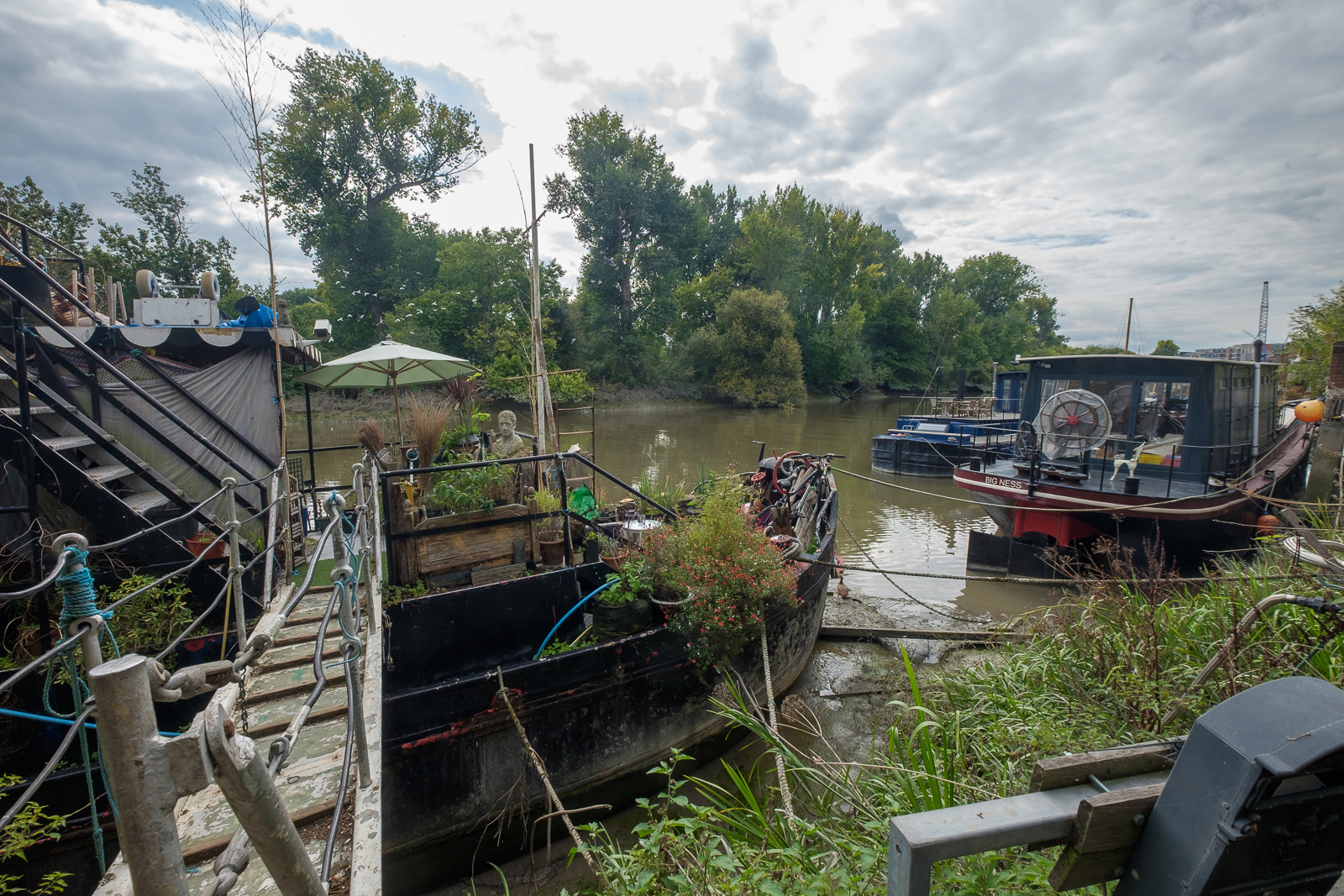
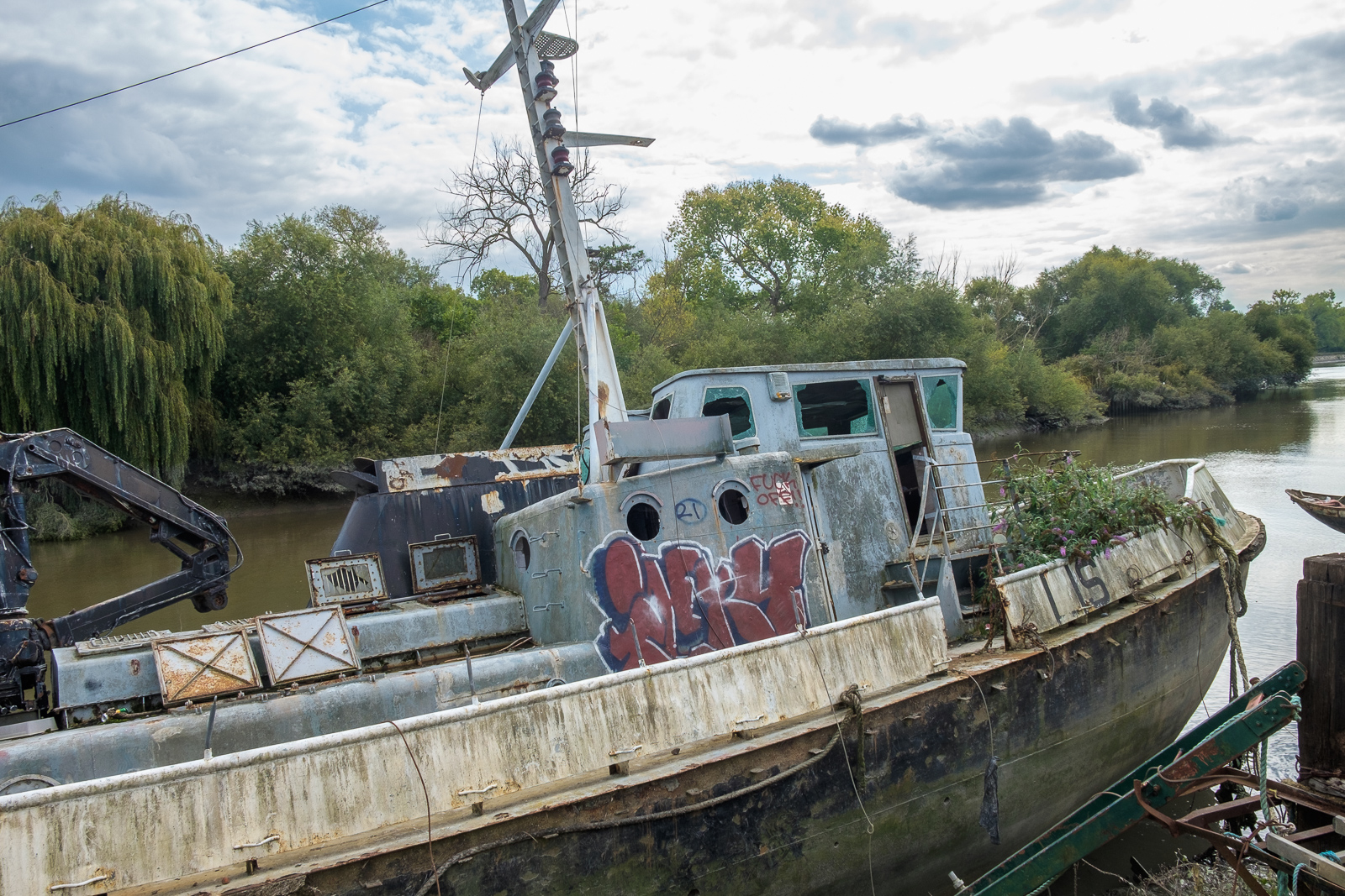
And the Thames was the river where I learnt to swim, if only badly, with a paddling pool and a swimming area with a springboard in the riverside park, The Lammas. Later I learnt to row at Isleworth, in a heavyweight Sea Scout boat – and we swam there too, despite the filthy oily state of the mud and water.

Thames Path - Pangbourne to Cholsey

Older and wiser I kept to the riverside paths, walking them both in Middlesex and Surrey and also out to the east of London, sometimes taking my family with me, but also on walks with other photographers and on my own. And when plans were being made in the 1980s for a Thames Walk I made a few suggestions on the proposed path of what in 1989 became the Thames Path.

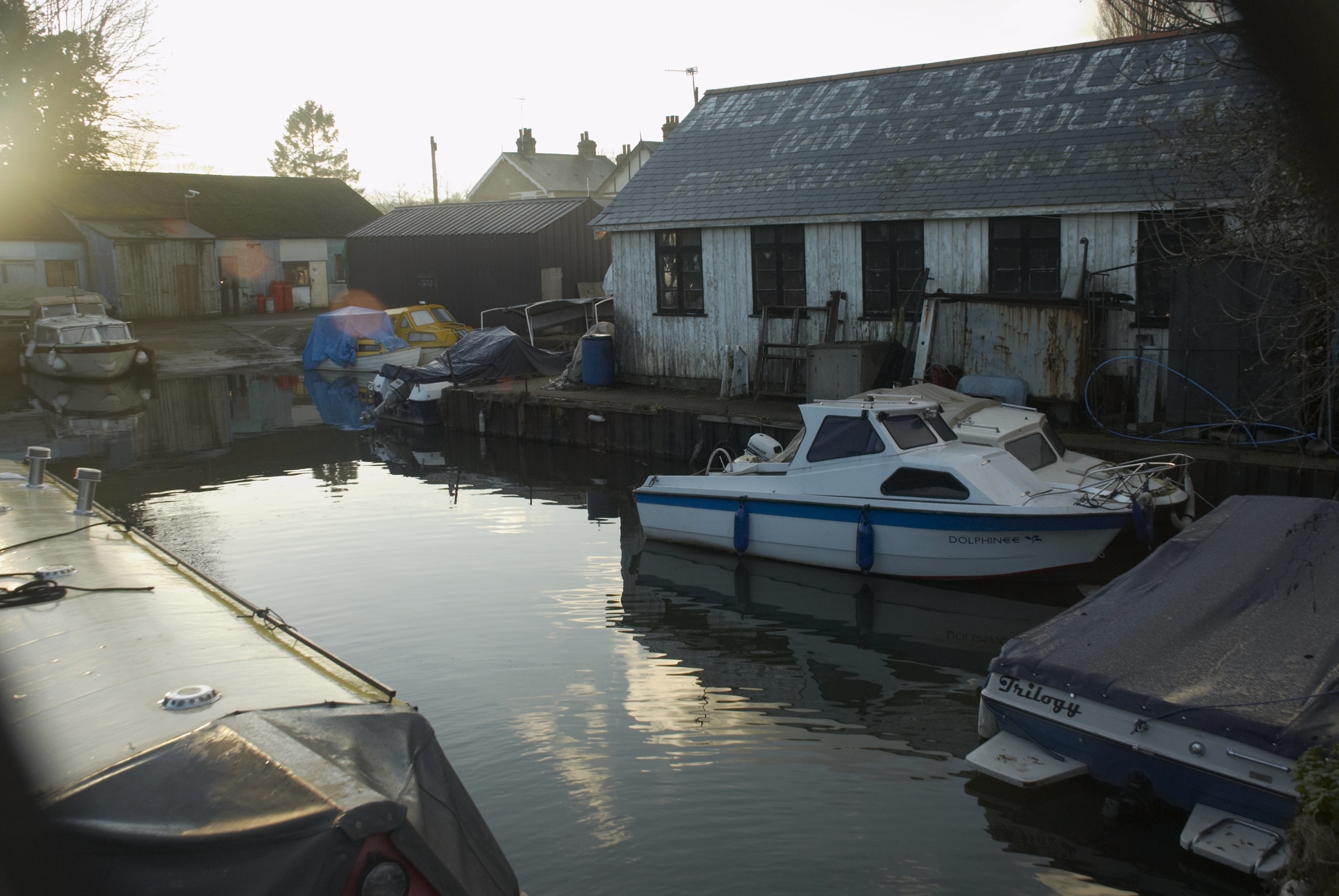
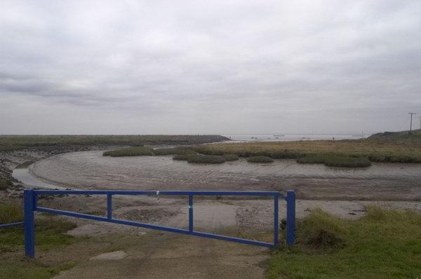
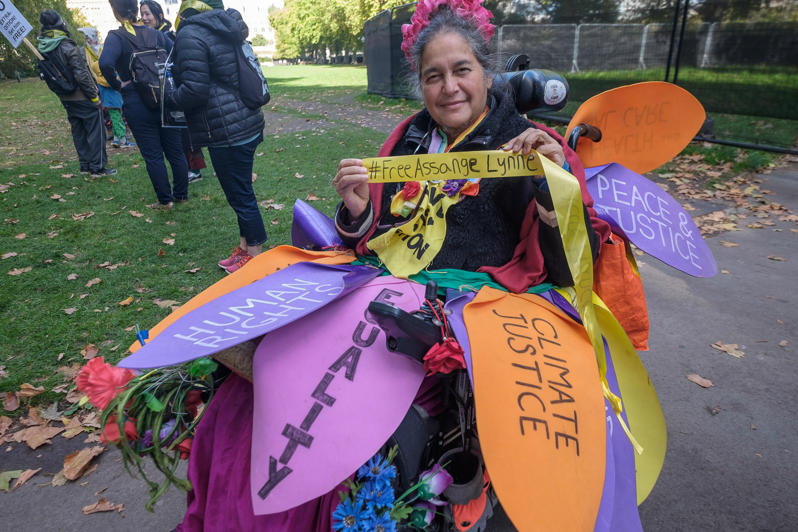
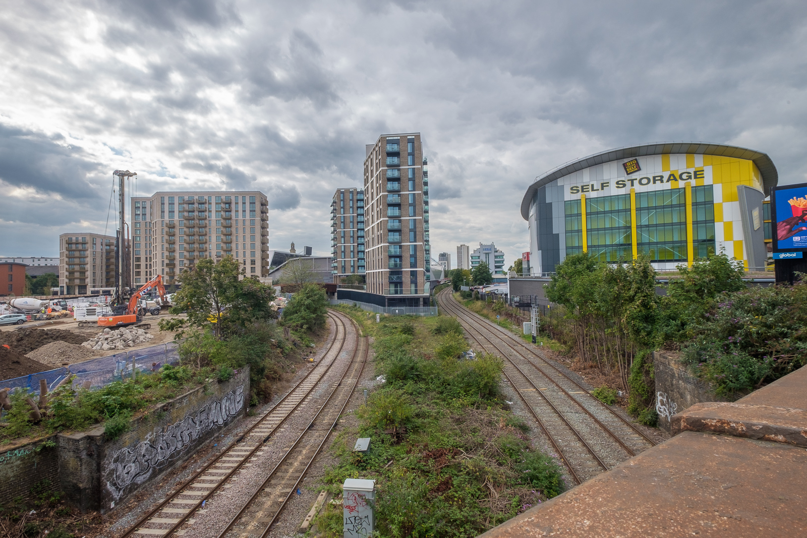
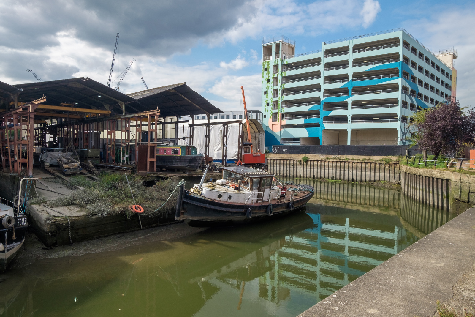
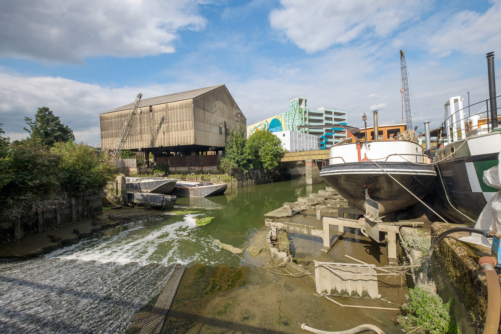
Far more of the river in London is now accessible to the public than back in the 1970s and 80s when much of the riverside was still a working area, though many of the wharves were derelict. But as I found when I joined a small group led by a Tower Hamlets official with responsibility for footpaths, parts of the path on the north bank were still not always easy to access, with developers and residents erecting gates and barriers and making some parts appear private. Some years later The Guardian in 2015 published Privatised London: the Thames Path walk that resembles a prison corridor which showed that little had changed.

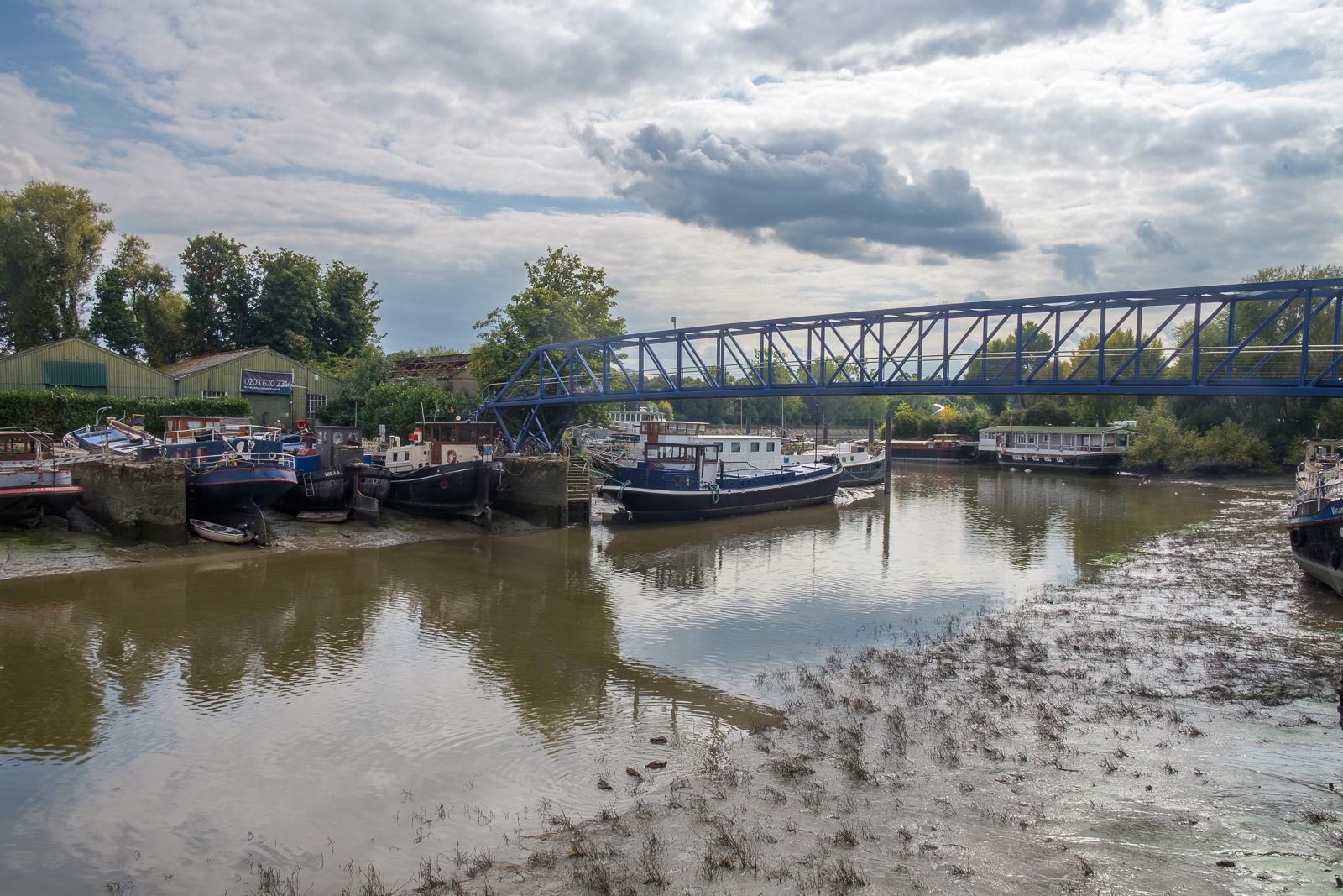
But like many others, my family has now walked the Thames Path, from the Thames Barrier at Charlton to the source in Gloucestershire, as well as some way to the east along both shores. Most of the path proper is readily accessible by public transport and can be done as a series of one-day walks, travelling and returning from from our home in Staines or from London. But for the final three days of walking we had to spend a couple of nights in hotels on the route.

At Streatley the path goes through a small lake

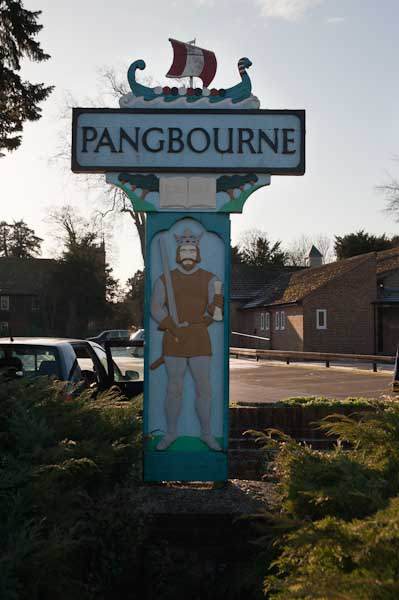
At the start of 2010, we spent both New Years Day and January 2nd walking two short sections of the walk, from Reading to Pangbourne on Friday 1st and returning to Pangbourne on the Saturday to walk to Cholsey. Both Cholsey and Pangbourne have stations with trains to Reading, so access was easy, although Cholsey station is over a mile from the Thames Path.

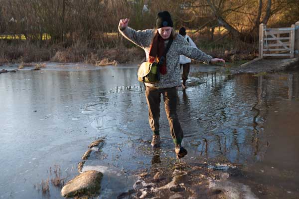
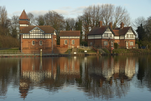
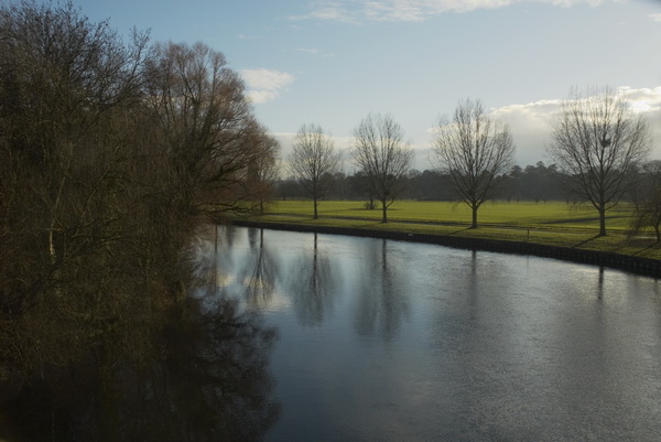
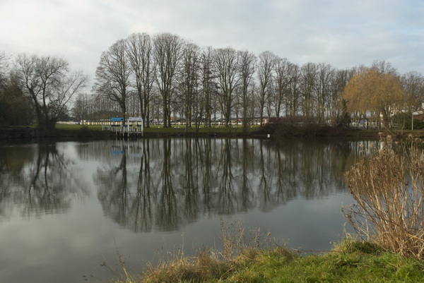
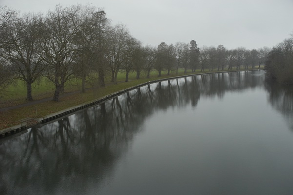
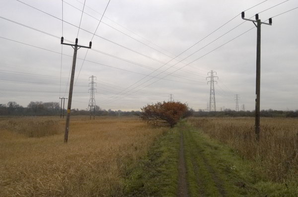
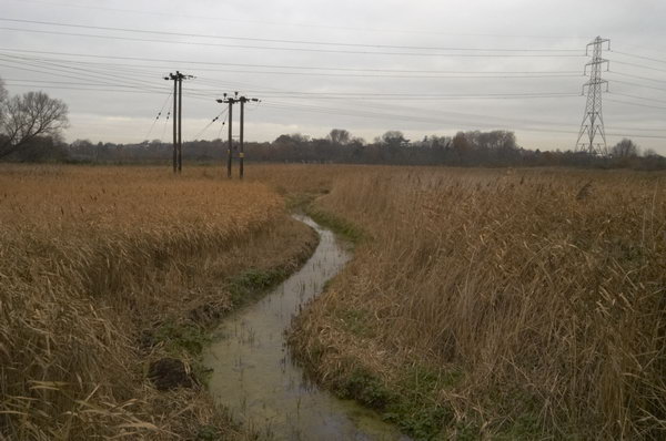
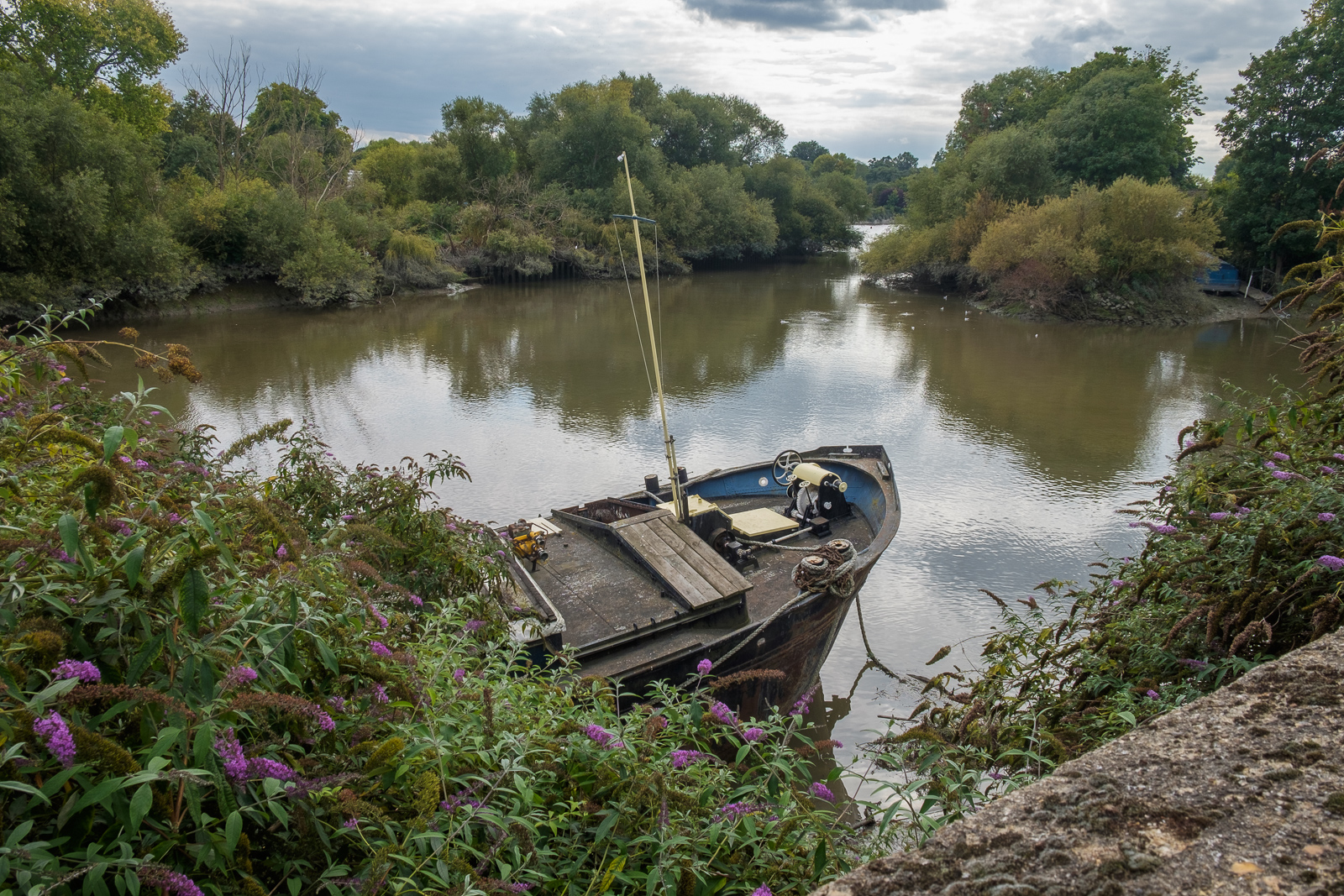
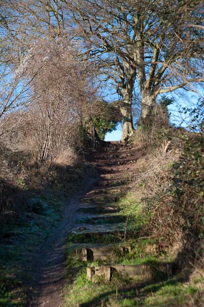
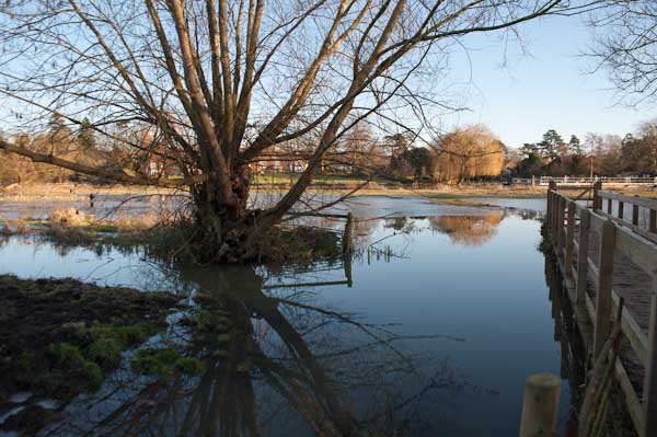
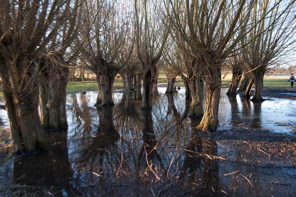
The pictures here are all from Saturday 2nd January, on what is perhaps the most scenic stretch of the Thames Path. It was a bitterly cold day, which was perhaps as well, as the parts of this section would have been very muddy and a little flooded. But the mud was frozen and most of the ice on the flooded parts was thick enough to take our weight. It was more pleasant walking across the ice than it would have been wading through the few inches of mud and freezing water, almost certainly just deep enough to overtop my walking boots.

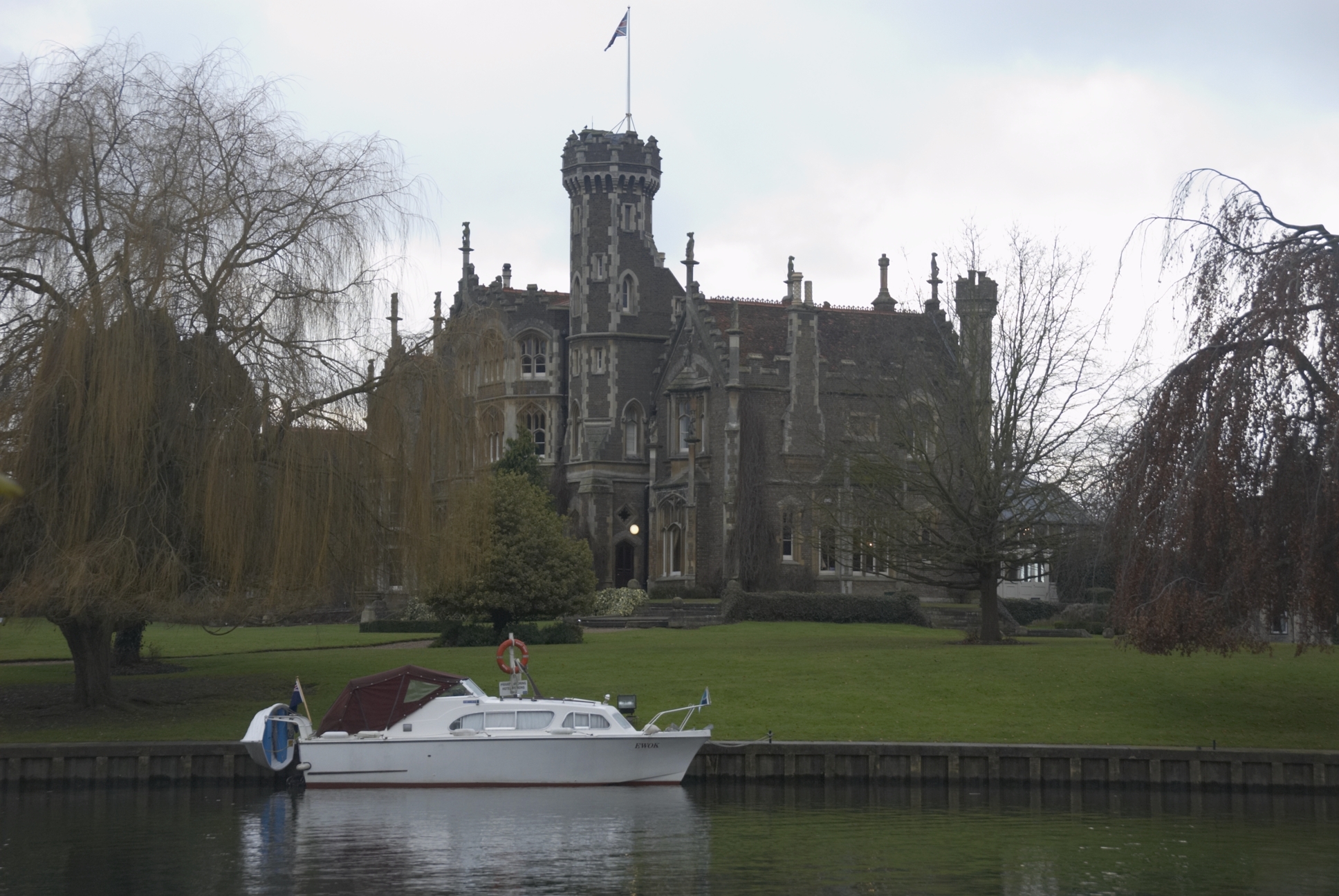
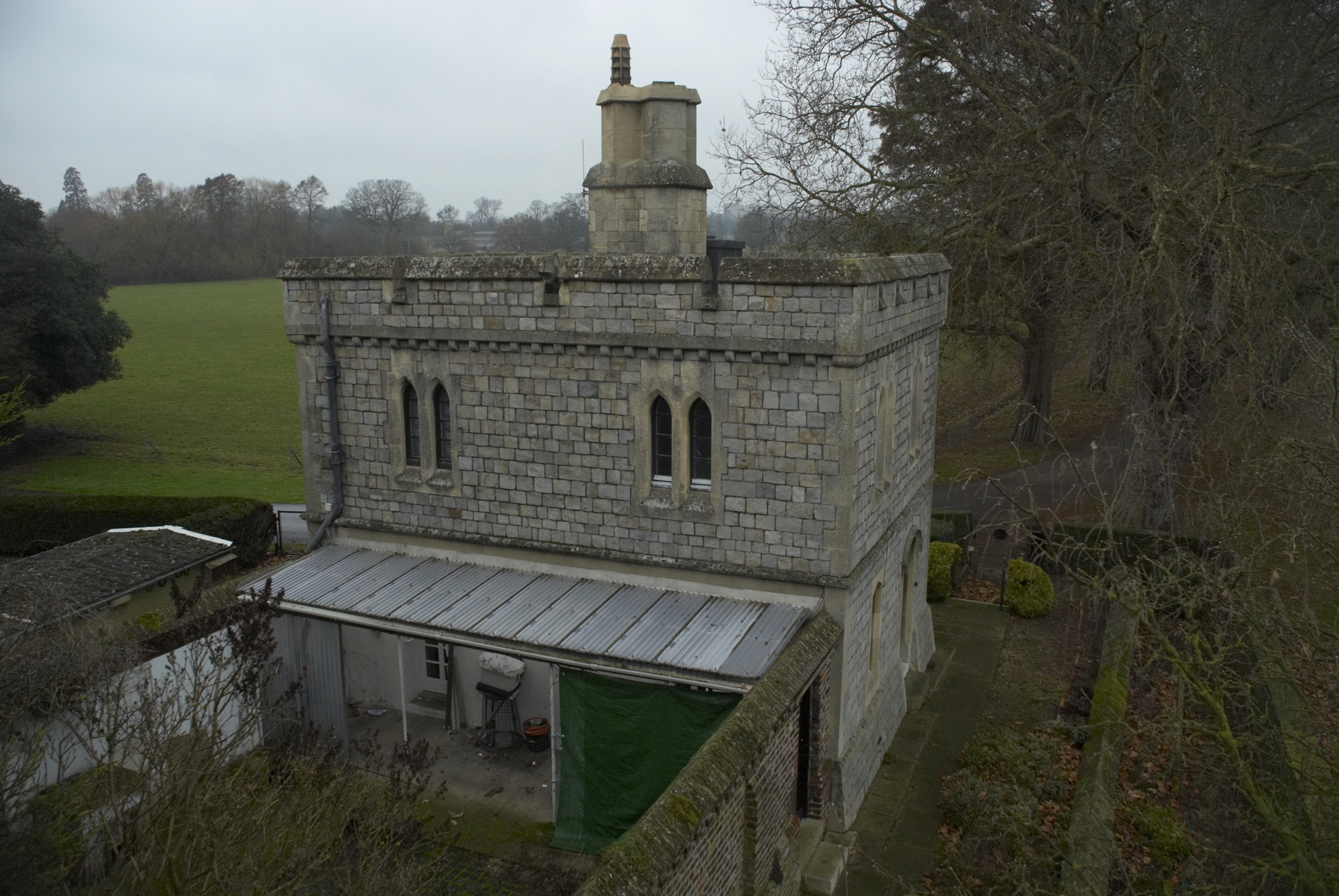
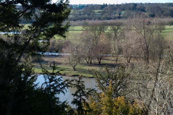
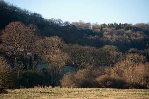
At the start of the walk from Pangbourne, after crossing the river the path climbs a little up a ridge, with occasional views through the trees across the valley. It then goes down to the riverside again, passing under one of Brunel’s fine brick bridges for the GWR to the Goring Gap, where the Thames runs between wooded hills. Goring itself is the kind of place I like to avoid, though I’m sure it has its charms, but I’ve always seen it as a kind of playground for the self-satisfied rich. We crossed the river to Streatley on the south side, a village owned by Oxford Brewery owners the Morrell family until they sold it in in 1938. They had protected it from development.

It was here that we found the worst flooding on the path, and almost took one look at a gate leading on to a lake and turned round – we could have ended our walk here and returned to Reading from Goring station. But eventually we decided the water couldn’t be too deep and perhaps the ice might hold our weight and we went on. I think we all got wet feet.

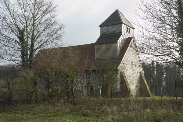
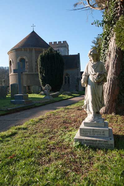
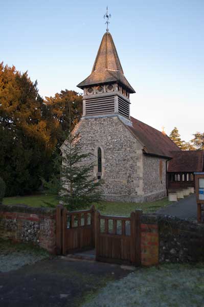
There were more icy bits on the rest of the walk, but nothing quite so bad, and we continued our walk along the Thames Path. Unfortunately at Moulsford the path leaves the river – the towpath switches to the opposite bank, and although this is a Ferry Lane, the ferries are long gone. Moulsford would be a pleasant enough village were it not on the A329, and the one kilometre trek along this relatively busy road was tedious, though we did make a short diversion to see the parish church.

Our walk along the Thames Path ended when this left the road to return to the river, but we had further to go before turning off onto a footpath on our way to Cholsey station, adding another mile to our walk.

More on My London Diary at Thames Path including our walk on the previous day from Reading to Pangbourne.


Boxing Day Walks (and Rides)

Boxing Day Walks (and Rides)
Waterworks, Wraysbury

Our Boxing Days here have followed a similar pattern for a few years now, at least in those years where we’ve stayed at home rather than visiting family elsewhere. We get up, have breakfast and then get ready to go out for a walk. We walk from our home to a mid-day meal with my sister and other family members, in recent years at a pub close to where she lives. Then a leisurely wander to her house for tea. And rather later going home, though so far we’ve not had to walk back.

Boxing Day Walks (and Rides)
Boatyard at Runnemede

Partly we walk because there is little if any public transport on Boxing Day. We could cycle, but the roads are more rather more dangerous than usual thanks to motorists with a higher than usual alcohol level, and also because I like to have a glass or two myself with my boxing day lunch, though it would be easy to do the journey almost entirely off-road. Perhaps this year we will cycle, the weather forecast isn’t too bad.

Boxing Day Walks (and Rides)

The walk is at least five miles. In the past we used to often take longer and sometimes hillier routes to give us a little more exercise. Now we sometimes stop on the way for coffee at one of the few cafés that are open. The walk helps to get up an appetite for another large meal after our minor over-indulgences the previous day. Years ago we often went out for another walk before our late afternoon tea, but others in the family are now too old for this.

Oakley Court

St Mary Magdalene, Boveney,

Of course I take a camera with me, and take pictures on the way, as well as sometimes some family pictures during the meal and after, though these I seldom share outside the family as they have very little interest for others.

Windsor Racecourse

So earlier I spent some time looking for my pictures from boxing day walks in earlier years to post today. These pictures come from a rather longer journey on 26th December 2005, when we cycled a few miles further along the River Thames than necessary before turning back for our lunch.

Home Park from Albert Bridge

I first posted some pictures from this walk on My London Diary in 2005. Although that post describes it as a walk, from the distances involved and the EXIF times we must have been on our bikes. And had a very late lunch.

This is a slightly different collection; all pictures were made with a Nikon D200 DX format DSLR.


Stanford-le-Hope and Mucking

Stanford-le-Hope and Mucking

December 2004 was not a great month for weather and it shows in the pictures than I took along the Thames estuary in Essex on Saturday 4th December. But perhaps they are appropriate for the landscape although were I to go back to the RAW files I took – using the Nikon D100 and mainly the then groundbreaking Sigma 12-24mm wideangle zoom – and reprocess them with more recent conversion software they might be a little less drab.

Stanford-le-Hope and Mucking

I took my folding Brompton with me on the train, although much of the route I took was on footpaths. Bromptons are not great off-road bikes and I was probably wheeling it quite a lot of the time, but it carried the weight of my gear in its front bag and let me go quickly along some of the less interesting parts of my route.

I’m not sure if it was on this ride or on another in this part of Essex where the chain came off thanks to an excessive amount of mud and became somehow locked out of place between the frame and some other part, locking the rear wheel completely. I struggled for perhaps 10 minutes to free it without success and had almost become resigned to having to carry it some miles to the nearest station, a rather daunting prospect as together with cameras etc it was a rather unwieldy 40lbs or so.

Stanford-le-Hope and Mucking

Fortunately I was saved by a stranger who came along the path and rather stronger than me managed to pull the trapped link free – though getting his hands covered in oil and mud to do so. I was extremely grateful, thankful and rather embarrassed at the mess he was in, though handing him my oily bike rag to wipe the worst off. It’s great that some people at least will go out of they way to come to the aid of others.

As well as some of the pictures as I posted them at the time, I’ll also put on the text I wrote then on My London Diary, where you can see more pictures. I’ve edited the text slightly, mainly to restore normal capitalisation which makes it rather easier to read.

December started a drab month, with little light, but the forecast for Saturday 4th suggested the mist and cloud would clear, so I set off for Stanford-le-Hope. Single or return asked the ticket seller, I wouldn’t want to stay there I told him.

From the station I turned left and then south towards Mucking and the river. Disappointingly the church in Mucking is now a private house, and the churchyard only open by arrangement. The footpath led through a nature reserve, the largest bog of its type in England, and then turned past a large complex of unfilled gravel pits towards Mucking Creek.

Names on maps can have a fascination, and Mucking Marshes, Mucking Flats, Mucking and Mucking Creek were places I needed to see. In good light they would have been great, but on a dull grey day they lacked sparkle.

The footpath led along the riverside towards Corringham and Shell, but disappointingly the bridge across a small creek had disappeared. There was an unmarked detour along the goods line, but not the same. I returned to Stanford-le-Hope splashing through huge puddles in the rutted lane. One of its few claims to fame is as the home of writer Joseph Conrad, but the cottage in which he lived is surrounded by a high fence and there is little to see.


My London Diary – December 2004

Human Chain Around Parliament – Free Assange!

Last Saturday, 8th October 2022, I photographed a protest in London against the imprisonment and possible extradition of Julian Assange, currrently held in the UK’s maximum security jail at Belmarsh.

Human Chain Around Parliament - Free Assange!

Assange’s “crime” was to publish documents about US war crimes in Afghanistan, Iraq and elswhere, making documents downloaded by Chelsea Manning, making them available after suitable redaction to protect the individuals concerned to the world’s press and to the public on WikiLeaks. Wikipedia has a good and fairly detailed entry on him which most of the details here come from.

Human Chain Around Parliament - Free Assange!

If extradited to the US he would be put on trial in a area where the jury would be composed of people from an area with strong connections to the US security services who will already have pre-judged him as guilty. His sentence is likely to amount to 175 years in a US maximum security jail, probably in isolation and never to be freed.

Human Chain Around Parliament - Free Assange!

In 2010 Sweden issued an extradition warrant for him on allegations of sexual misconduct, which were widely seen as a pretext to enable him to be extradited from Sweden to face criminal charges in the USA. When in 2012 he lost his fight against extradition to Sweden he jumped bail to take refuge in the Ecuadorian Embassy in London, where he lived in highly restricted accomodation until 2019.

A new government in Ecuador decided to end his asylum in the embassy and invited police in to arrest him in April 2019; he was then sentenced to 50 weeks in jail for breaching his bail. The Swedish sexual charges against him were dropped later in the year, but the USA immediately began proceedings to extradite him to face trial under the US 1917 Espionage Act.

The decision to use this Act has been widely criticised in the press and elsewhere as being an attack on the First Amendment to the United States Constitution, which guarantees press freedom. And if Assange is guilty then it seems clear that the editors of the newspapers that published the revelations he made in publising the Baghdad airstrike Collateral Murder video, the Afghanistan war logs, the Iraq war logs and other material could also be prosecuted. Even my publishing the link to the video could be a crime.

Assange’s sentence was completed in September 2019, but he was kept in jail because of the US extradition claim. He had been visited earlier by Nils Melzer, the United Nations special rapporteur on Torture and Other Cruel, Inhuman or Degrading Treatment or Punishment, who, as quoted on Wikipedia found “in addition to physical ailments, Mr Assange showed all symptoms typical for prolonged exposure to psychological torture, including extreme stress, chronic anxiety and intense psychological trauma.”

After a protracted hearing including much medical evidence, a judge on 4 January 2021 ruled that Assange could not be extradited to the USA on grounds of mental health and the suicide risk in a US prison cell. The USA appealed the decision, and Assange remained in jail. The High Court rejected much of the medical evidence, believed the US lies of fair treatment made and found in favour of the USA on 10 December 2021.

In April his extradition was formally approved in court and referred to Home Secretary Priti Patel, who approved it in June. But the legal battle continues with a new appeal. Essentially Assange has now been locked up for 10 years. Wikileaks has continued his work in releasing information in his absence. The continuing persecution by both the UK and USA for revealing their war crimes seems spiteful and malicious.

On Saturday 8th October I photographed a protest in London by around 10,000 people who formed a human chain calling for Assange to be freed and not to be extradited around the Houses of Parliament, crossing the river on Westminster Bridge and returning across Lambeth Bridge, a distance of a little over two kilometres.

It’s difficult to know how many took part, but there seemed to be enough people to join hands, with quite a few to spare in some parts where people were shoulder to shoulder and some to spare. The organisers had thought they would need around 5,000 so I think it was probably rather more than that; estimates I’ve seen range from 3,000 to 12,000. But as well as those present in person, many unable to get to Londonwere represented by yellow sashes with their names on them.

When I arrived people were tying these to the railings around the Houses of Parliament, but police came to remove them, handing them back to the protesters. They said nothing was allowed to be fixed to the railings. Many of the protesters held or wore the sashes for the protest, and although I don’t often take part in the protests I’m photographing, most of these pictures were taken by me with a sash reading ‘#Free Assange Monique Dits Belgium‘ around my neck.

At around 1.30, rather later than planned people were told to link hands and they chanted ‘Free Assange’ and other slogans for a few minutes. I’d chosen to be on Lambeth Bridge for this as I could then take photographs with the Houses of Parliament seen across the Thames in the backgound.

After taking some there I made my way along the rest of the chain back to Parliament, on my way passing John McDonnell being interviewed by a videographer. Normally I would have stopped to talk to him, but by now I was rather tired, still suffering a little from my booster jab the previous day and I carried on, past a small crowd of people with video and still cameras three or four deep around Jeremy Corbyn. But I’d decided he wasn’t really the story and carried on. I’ve photographed him enough times over the many years I’ve known him.

You can see more of the pictures I made in the album Human Chain Around Parliament Says Free Assange.


Kew, Brentford, Syon & Isleworth Walk

Part 2 Syon and Isleworth

Kew Bridge, Brentford, Syon & Isleworth

A public footpath, now also on the Thames Path, leads from Brentford across Syon Park to Isleworth. Its a longish stroll with parkland on one side and at times just a high wall on the other, but does pass several historic buildings, though you would need to pay the entrance fee to the gardens and great conservatory to see most of them well. The estate is still privately owned and permission is needed for any filming and photography within the park.

Entry is free to the garden centre, and we went in to look at some of the buildings inside as well as to use the toilets. They also have a cafe and restaurant but we didn’t stop. Much of the garden centre was once the Riding School.

I wasn’t feeling well as we walked though here – still perhaps suffering from the virus which I’d had a couple of weeks earlier. So I didn’t feel much like taking pictures as we walked though. But I hadn’t found much I thought worth photographing on previous walks through here, expect for the view of Zion House. This is on the flight path into Heathrow, and there is an aircraft in my picture coming in to land there.

Kew Bridge, Brentford, Syon & Isleworth

In my teens I was a Sea Scout in Isleworth, or rather a Senior Scout, and we theoretically went boating in the Thames here, though I think rather rarely. But this was also another route into Kew Gardens, with Church Ferry going across the names from by the corner of Parke Street and Church St. I also remember coming here to paddle and possibly even swim in the river, though it was pretty polluted back in the 1950s.

Kew Bridge, Brentford, Syon & Isleworth

Isleworth was also the place where I drank my first pint of beer, which I think cost 1s/5d or around 7p. Not at the London Apprentice, which we thought of as a rather snooty place for the nobs, but at a small pub further down Church Street which had few problems with serving under-age drinkers. It’s no longer there.

Kew Bridge, Brentford, Syon & Isleworth

We made it into the London Apprentice, sitting outside by the river for a drink, though still feeling ill I stuck to tonic. One of my colleagues found an excellent real ale, which I looked at longingly. It was a very pleasant place with a good atmosphere and friendly bar staff, so we stayed for another, and then thought the menu seemed fine and had a meal.

Kew Bridge, Brentford, Syon & Isleworth

Finally we made it out of the pub and continued along Church St to the Duke of Northumberland’s River, perviously known as the Isleworth Mill Stream. There were several mills which relied on the stream, including one close to here said in 1845 (by which time there were also a couple of steam engines on site) to be the largest flour mill in England, Kidd’s Mill. This section of the river was built in the late 15th century for Syon Abbey, before the Northumberland’s built their house on the abbey site, and brought water from the River Crane at Whitton to augment a small stream which ran into the Thames at Isleworth.

Kew Bridge, Brentford, Syon & Isleworth

But the River Crane couldn’t provide a sufficient and reliable supply of water, and in 1530 a new section of the river was dug from Longford to take water from the River Colne. This merges with the Crane close to Baber Bridge on the edge of Feltham, though there are then separate channels across Hounslow Heath and through Crane Park before the eastern section of the river diverges. I played around, paddled and fished in much of this as a boy.

Kew Bridge, Brentford, Syon & Isleworth

The walkway beside this small river on its last few yards into the Thames was closed, but a nearby alley took us to to the riverside opposite Isleworth Ait. At Swan Street we made a brief detour to admire the Grade II listed Old Blue School built in 1842 and now converted into expensive flats, before returning to the riverside. The tide was low and there was almost no water in places here, and we watched as a man left work at the boatyard and walked across the mud to his works van parked by the river.

Kew Bridge, Brentford, Syon & Isleworth

We continued through a small park area, once part of the grounds of the Catholic Convent Nazareth House, until the Thames Path we had been following took us out onto Richmond Road. Here we left the Path, turning right onto Richmond Road and then going down Queen’s Terrace to Kings Terrace, walking north to turn down Byfield Road.

Kew Bridge, Brentford, Syon & Isleworth

Where this turns to the left we stopped to admire the small 1885 Elizabeth Butler almshouses, almost missing behind us the finely decorated May Villas from a similar era before taking the alley to Twickenham Road. Here next to the bus stop where our walk ended was the house with its blue plaque informing us ‘VINCENT VAN GOGH the famous painter lived here in 1876.” The bus came before I had time to make a photograph. It will still be there the next time I’m in Isleworth.


Kew, Brentford, Syon & Isleworth Walk

Part 1 – Kew Bridge and Brentford

My walk a few days ago in September 2022 began at Kew Bridge Station. I’d come half an hour before I was due to meet my two companions to take a short walk around one of the newer parts of the area before meeting them for a longer walk to Isleworth.

Lionel Road runs north of the railway up to meet the Great West Road. It used to be a rather run down area with railway sidings on one side and a few old commercial buildings and works to the north. The last time I’d walked down here on my way to Gunnersbury Park in 2018 the whole area had been a building site, but now is home to Brentford FC, currently doing pretty well in the Premier League.

Brentford was my local team when I was a kid, and several members of the award-winning under-11 team I played for at left back on went on to play for them at their old ground (and at Chelsea.) One of the other patrol leaders from my scout group stayed there until he retired, though I never met him after I hung up my woggle, but read his obit in the local rag.

Past there I came to the Great West Road, a 1930s dual carriageway with cycle tracks I sometimes used further west on my way home from school. In the 1980s or 90s I photographed most of the remaining Art Deco factories along it, though the bulldozers got to some first. Now it reminds me of J G Ballard’s novels, particularly ‘Crash’, set around the area we both lived in, with the elevated M4 above the older modern road.

A new Brentford of tall blocks has sprouted here, though more land remains to be built on. A little-used rail line goes through it, the Kew Curve, with Brentford’s stadium replacing the sidings and cattle pens to its west, with new building on the east in what was Brentford Market. It moved to this site in 1893 after the Brentford Local Board had bought the 2 acre site from the Rothschild estate because market trading in the area around the Express Tavern immediately south of the station which had developed informally away from Brentford’s traditional market in Market Place had become a public nuisance. The site was extended in 1905 and then covered land now part of the Chiswick Roundabout. The market moved to the edge of Southall in 1974 as the new Western International Market and the Fountains Leisure Centre was built on part of the site, with the rest staying derelict for years.

My maternal grandfather, then a market gardener in Feltham, would drive his cart with produce to Brentford Market in the early years of the last century, past the house in Hounslow where my father, then a young boy, used to see him driving past. Around twenty years later when he became engaged to my mother he found out who he was.

I met my two colleagues and we walked together down by the west side of Kew Bridge to the Thames. To our right was where the Kew Bridge Ecovillage had squatted from June 2009 until May 2010, now occupied by 164 flats, a business centre, gym and pub.

The Hollows runs west between riverside moorings and recent blocks of luxury flats, eventually returning us to Brentford High St, and a park beside the river now called Watermans Park. This was the site of Brentford Gas Works which straddled the High Street here and was a great attraction when we took the bus through it in my childhood, usually on our way to Kew Gardens. Entrance then was only an old penny, and it was a cheap outing for families in the area. My father would have his scissors in his pocket and perhaps take the odd small cutting to grow in our garden. Rather cheaper than garden centres.

But if you were lucky as the bus drove slowly down the usually congested street, one of its Intermittent Vertical Retort would open sending a wall of red hot coke to the ground, quite an amazing site as we peered from the top deck. It almost made up for the smell.

A gas works had been set up here and began production in 1821, first supplying has for lighting the turnpike to Kensington, but later serving large areas around. Later other gas works were set up in Southall and then elsewhere as demand continued to rise. in 1926 the Brentford gas company became a part of the Gas Light and Coke Co which later became British Gas plc. Brentford Gas Woks closed in 1963 and the riverside buildings were demolished in 1965 though the large gasholder remained until 1988.

All than now remains of the gas works are some of the substantial posts of the gas works jetty, where colliers once brought in coal. There has been a long battle over the rights to moorings here between boat owners and Hounslow Council with boat owners claiming that the foreshore here belongs neither to the council nor to the PLA but to the Bishop of London, and refusing to abide by various eviction notices. Most have now moved but some derelict boats remain.

Brentford Ait runs along the centre of the river here. It was bought in the late 19th century by the Crown who planted trees on it to hide the gas works from visitors to Kew Gardens on the opposite bank. A few yard upstream is Lot’s Ait, where the Thames Steam Tug and Lighterage Company Ltd set up a boatyard in 1920 – most of the Thames lighters were built there. The boatyard closed in the 1970s, but was reopened in 2012 when a new footbridge was constructed to it.

As well as the park, the Watermans Arts Centre was also built on the gasworks site. We walked between it and the river, and continued on the riverside path, past the bridge to Lots Ait and recent blocks of flats. There are new moorings around here too.

A small spit of land leads from the bottom of Ferry Lane (more new flats) to an artwork by the riverside. I’m not quite sure what to make either of Liquidity or another similarly decorated column not far away, but it could provide a useful windbreak in bad weather. This was where once a ferry ran across to Kew Gardens.

We followed the Thames Path around a small dock, on what was the site of the Thames Soap Works and then continued along the side of the River Brent which flows into the Thames here, continuing along this beside the winding river past another boatyard to Brentford High Street.

A few yards along we turned left down Dock Road to Thames Lock, past a huge mural and the other end of the boatyard, to Thames Lock, the southern end of the Grand Union Canal. Here we took the path beside the north side of the canal, leading across a bridge over the Brent to Johnson’s Island and Catherine Wheel Road.

The mural, on the side of a multi-story car park had included a giant kingfisher, and I’d joked saying this was the only kingfisher we’d see in Brentford. But as we walked across the bridge over the River Brent and stopped to take pictures, perched on the top of a post there was one, still only for a second before flying out of sight. By the time I’d raised my camera to my eye it was gone, though since I had and extreme wideangle lens it would hardly have been visible, just a few more colourful pixels.

I’d planned to walk along Brent Way and rejoin the canal towpath, but the whole of this area is now a huge building site, and instead we walk along the High Street to the canal bridge. I couldn’t bring myself to walk down to the Gauging Lock preserved there, though I’ve done so several times before, but the changes to the area, now with a marina, flats and hotel made me feel too sad; we simply stood on the bridge and looked for a while before moving on.

Part 2 will continue the walk from here to its end in Isleworth. You can see more pictures from the walk in a Facebook album.


Twickenham Riverside – December 1988

River Thames, Eel Pie Lisand, bridge, The Embankment, Twickenham, Richmond, 1988 88-12a-51-Edit_2400
River Thames and bridge to Eel Pie Island, The Embankment, Twickenham 1988 8812a-51

Twickenham Riverside – December 1988
I was teaching on Tuesday 13th December 1988, and together with a colleague took a group of photography students from the college to Twickenham, possibly to view an exhibition at the Orleans House Gallery, or perhaps just as a photographic outing.

My first thought when I looked at the contact sheet today was that it could be for the show I helped to organise there in 1988, city news urban blues…. It had been an interesting show, with images from ten of us who were part of a group called Framework, each showing their own group of pictures – those exhibiting were Carol Hudson, Peter Jennings, Terry King, myself, Tony Mayne, Derek Ridgers, John RJ Taylor, Laurence Ward, Randall Webb and Anton Williams. Terry was the main organiser and I worked with him to keep the group running.

But on checking I find that show was rather earlier in the year and I think we were just taking college students to a reasonably safe and interesting area a short train journey away where they could first be taken for a walk to suitable locations around the riverside and parks and then be left to work unsupervised taking pictures while their tutors probably took a lunch hour rest in a riverside pub.

It was surprisingly difficult to get some students to actually take photographs, so we arranged outings such as this where we would provide a suitable location and brief to make sure even they had some material to work with in the darkroom. They were all required to make at least 36 exposures so they had a film (black and white of course) to develop and make prints. Some students made sure they had time to get to a pub too, though there were enough in Twickenham for them to avoid the same as their two tutors.

River Thames, The Embankment, Twickenham, Richmond, 1988 88-11f-55-Edit_2400
River Thames, The Embankment, Twickenham, Richmond, 1988 88-11f-55

But I did take some pictures myself during the outing, and here are a few of them. I took two versions of this image, looking upriver from the west end of the Embankment, one with the new Minox GTE and the second I think with a Leica M5 using the 35mm Summilux f1.4 lens. The image above is with the Minox, which had a MC Minoxar 35mm/2.8 lens and is just a little sharper, though the difference might well be in the exact focus distance chosen. But though the Minox was incredibly small and light – the smallest 35mm full-frame camera ever made, it could deliver exceptional results.

River Thames, Twickenham, Richmond, 1988 88-12a-32-Edit_2400
River Thames, Twickenham, Richmond, 1988 88-12a-32

You can still launch boats at Twickenham, where at the junction of Church Land and Riverside a roadway leads down into the river. When the tide is low you can walk down this and get a view downriver. On the right boats are moored by Eel Pie Island and in the centre of the image you can just see Richmond Hill between the trees.

And although there is a footbridge across to Eel Pie Island as shown in the top image of this post, residents still need to keep tide tables handy, as the Twickenham Embankment end of the bridge still floods on those days when the moon aligns with the sun at full and new moon to give Spring Tides.

River Thames, The Embankment, Twickenham, Richmond, 1988 88-12a-36-Edit_2400
River Thames, The Embankment, Twickenham, Richmond, 1988 88-12a-36

The balustrade is around what is now Champion’s Wharf Play Beach, and the wall is around the end of the riverside section of York House Gardens and a part of the archway leading through to this is just visible. The previous picture showed the narrow sloping pebbles above the waterline which I walked out on to take this picture.

Surprisingly I don’t appear on this occasion to have walked through York House Gardens and didn’t photograph the ‘Naked Ladies’ or Italian Fountain just through that gateway and on the left, but continued along Riverside, taking a few pictures of the houses beside it before reaching the splendid building of the White Swan pub.

You can now drink The Naked Ladies, the bestselling beer produced by Twickenham Brewery, a 4.4% golden ale made with Herkules, Celeia and Chinook hops and CAMRA’s 2019 Champion Golden Ale of London. But the brewery only opened in 2004, and Naked Ladies was first launched in 2013, so I can’t recall if or what I drank there in 1988. But I have enjoyed it at the White Swan and elsewhere more recently.

River Thames, Twickenham, Richmond, 1988 88-12a-15-Edit_2400
River Thames, Twickenham, Richmond, 1988 88-12a-15

Before going in a pub we did go down to the riverside a little along from the White Swan, and I made several pictures of this boat covered in vegetation. Apart from this it seemed in quite usable condition and was still firmly moored. The Thames here is still tidal, though the Richmond half-lock downstream stops the water entirely flowing out.

River Thames, Twickenham, Richmond, 1988 88-12b-64-Edit_2400
River Thames, Twickenham, Richmond, 1988 88-12b-64

A second picture in much the same area shows a smaller boat in rather cleaner condition, firmly moored and roped down on the mud. In the background at right is the white house on the corner of Lebanon Park and Riverside. This is where Twickenham Ferry used to run across the Thames to Ham House, passing just downstream of Eel Pie Island.

The ferry was licensed by the owners of Ham House, the Dysart family (and sometimes known as Dysart’s Ferry) and the first written mention of it was in 1652. I last went across with my father to see Ham House in the mid-1970s, not long before it ceased operation. There had for some years been a dispute about its right of way on this slipway. I took the photograph below in 1979 when the river was flooded and there were boats moored there which were those used for the ferry in better weather to row people across and there were still notices for waiting passengers still on the fence.

Twickenham Ferry, River Thames flooding at Twickenham, Richmond, 1979
Twickenham Ferry, River Thames flooding at Twickenham, Richmond, January 1979

My contact sheet from December 1988 shows we walked further on, with pictures of moored boats close to where the still operational Hammerton’s Ferry, a Johnny-come-lately from 1908, still runs when weather and water conditions allow. An on one of these frames (not digitised) a small figure by the water’s edge stands taking a photograph, with the balding head of my teaching colleague, another Peter. This was where I made my final image of the day, after which I strongly suspect we made our way back towards a riverside pub before meeting our students for the train back to college.


Warehouses, Boats and Biscuits – Bermondsey 1988

Warehouses, Boats and Biscuits – Bermondsey 1988 continues the walk on 30th October 1988 which my previous post, Bermondsey Wall – St Saviour’s and Chambers Wharf 1988 left at Chambers Wharf.

Bermondsey Wall West, Bermondsey, Southwark, 1988 88-10p-51-Edit_2400
Bermondsey Wall West, Bermondsey, Southwark, 1988 88-10p-51

I walked back to the eastern end of Bermondsey Wall West in 1988, where the road had been cut in two in the 1930s by the building of the giant Chambers Wharf cold store. This shows the warehouses to the east of East Lane on the river side of the street. On the https://maps.nls.uk/view/101201658 1896 OS Town plan this was named as Vestry Wharf, which had a dock, and beyond it East Lane Wharf.

I can’t remember if the East Lane Stairs leading down to the foreshore were still open here in 1988. They are Grade II listed and still exist but are now behind a locked gate and look unsafe. Vestry Wharf was opened in 1874 and the vestry – then the local authority – used it and East Lane Wharf to ship out refuse collected in the area. The dock there was previously a dry dock.

These buildings have now been replaced by modern buildings and when I walked around here in 2019 it was possible to walk out to a riverside patio here, the street now ends at the Thames super-sewer works on the former cold store site.

88-10p-55-Edit_2400
Bermondsey Wall West, Bermondsey, Southwark, 1988 88-10p-55

Taken from roughly the same spot as the previous image but facing in the opposite direction along Bermondsey Wall West, so the range of buildings on the right of the picture are on the river side.

The warehouses on the left of the street – of which only a small corner is in my picture have been replaced by a modern building, while the row along the left still at least look fairly similar, although there has been extensive refurbishment between the street and the river wall. I think these are all now a part of the Tempus Wharf redevelopment, though in 1896 they were Brunswick Wharf (Grade II listed as Chambers Wharf at 29), Seaborne Coal Wharf and an unnamed wharf closest to camera. East Lane Stairs went down beside the wall of this wharf at the extreme right of the image, though I think they may have been closed by a gate, as otherwise I would probably have gone down them.

George Row, Bermondsey Wall West, Bermondsey, Southwark, 1988 88-10p-56-Edit_2400
George Row, Bermondsey Wall West, Bermondsey, Southwark, 1988 88-10p-56

Prominent on the left is St Saviour’s House on the corner of George Row and Bermondsey Wall West, written about in a previous post on this walk. The three or four storey 20th century building at the centre has now been replaced by a block of flats, River View Heights, a modern gated development with 24-hour porterage on the former site of Slate Wharf.

Closer to camera, the street name is handwritten as Chambers Wharf, though this was and is Chambers Street. The site is now occupied by a modern brick building. You can see from the wall in the picture that this building predates Chambers St, cut through here when Bermondsey Wall was split in two by the huge Chambers Cold Store in the 1930s.

I can’t read the notice on the wall entirely. At the top I think it has two words, the first ‘Daily’ but the second illegible. Under that are two sails and the word ‘Mailboat’ and below more clearly ‘COLLECTION CENTRE’. Perhaps the top line once read ‘Daily Mail’, and this advertised a mail service for sailors moored at the wharves nearby, some of which served vessels from the North of England and the continent – and once the cold store opened further afield.

Moorings, Jacobs Island, River Thames, Tower Bridge, Bermondsey, Southwark, 1988 88-10p-45-Edit_2400
Moorings, Jacobs Island, River Thames, Tower Bridge, Bermondsey, Southwark, 1988 88-10p-45

Back in 1988 there were only two boats moored at what are variously known as the Downings Road, Reeds Wharf or Tower Bridge Moorings off Jacobs Island, close to the mouth of St Saviour’s Dock. By the last time I was there this had grown to a cluster of around 40 houseboats and a few smaller vessels stretching around 165 metres downstream from the narrow access at the corner of Bermondsey Wall West and Mill Street.

The ancient moorings were bought by architect Nicholas Lacey in the 1980s and he “is committed to maintaining their historical usage” as moorings. The interconnected boats have a series of roof gardens and there is a stage for cultural and arts events. They also still provide temporary moorings for other boats.

Southwark Council fought a long an mostly legal battle to get rid of the barges, issuing eviction orders in 2003 and 2004. They were rebuffed by London Mayor Ken Livingstone who told Southwark that moorings fitted in with the London Plan and that these ones were broadly acceptable to long as appropriate amenity and environmental safeguards were in place. It was probably a great disappointment to Labour Southwark Council’s property developer friends, but welcome to most Londoners who like the colour the moorings provide.

New Concordia Wharf, Mill St, Bermondsey, Southwark, 1988 88-10p-41-Edit_2400
New Concordia Wharf, Mill St, Bermondsey, Southwark, 1988 88-10p-41

In 1988 there was no Thames Path – it was approved in 1989 but only opened in 1996, and the bridge across the mouth of St Saviour’s Dock only built in 1995. Instead I turned down Mill Street to photograph the splendid chimney and warehouses of the nicely preserved New Concordia Wharf.

Built as a St. Saviour’s Flour Mill in 1882, the mill had to be rebuilt after a fire twelve years later. These Grade II listed premises were converted to residential use in 1981-3, one of the earliest warehouse conversions in the area.

Office Entrance, W & R Jacobs, Biscuit Manufacturers, Wolseley St, Bermondsey, Southwark, 1988 88-10p-34-Edit_2400
Works, W & R Jacobs, Biscuit Manufacturers, Wolseley St, Bermondsey, Southwark, 1988 88-10p-34

I’d previously photographed the OFFICER and WORKERS entrances to the former biscuit factory of W & R Jacobs on Wolseley St, but this time took a picture of the entire frontage. Jacobs had at least two factories in the area as well their main works in Aintree, Liverpool, and on the wall it also names Manchester and Dublin where the brothers William and Robert moved to shortly after founding the business in Waterford in 1851. This factory was an extension of their earlier works in 1907 and has been demolished. The building at the end of the street on the right of picture is still there.

I’d long been confused over this building being in Wolseley St but the next street to the north off of Mill St being Jacob Street – getting its name from that of the area, Jacob’s Island. Biscuits were also made in Jacob St but for dogs, by Spillers.

Workers Entrance, W & R Jacobs, Biscuit Manufacturers, Jacob St, Bermondsey, Southwark, 1988 88-10p-21-Edit_2400
Workers Entrance, W & R Jacobs, Biscuit Manufacturers, Jacob St, Bermondsey, Southwark, 1988 88-10p-21

The Workers entrance was rather small on the previous image, so I took another picture of it.

Tower Finishers, Mill St, Bermondsey, Southwark, 1988 88-10p-24-Edit_2400
Tower Finishers, Mill St, Bermondsey, Southwark, 1988 88-10p-24

Tower Finishers is on the corner of Mill St and Wolseley St, and its address is I think 1 Wolseley St. The street got its name from the Field Marshall parodied as a ‘modern major general’ in the Pirates of Penzance. “Field Marshal Garnet Joseph Wolseley, 1st Viscount Wolseley, KP, GCB, OM, GCMG, VD, PC (4 June 1833 – 25 March 1913)”, had many victories in Canada, West Africa and Egypt and modernised the British Army and was Commander-in-Chief from 1895-1900. For a time the phrase “everything’s all Sir Garnet” became a common way of saying everything was in order.

Tower Finishers were cutter makers and printing trade finishers. The building is still on the corner, very much tidied up and I suspect rather different behind its exterior wall.

My 1988 walk around Bermondsey will continue in a later post.


Bermondsey Wall – St Saviour’s and Chambers Wharf 1988

Bermondsey Wall – St Saviour’s and Chambers Wharf 1988 continues from the previous post Bermondsey – Rubber, Antiques, Murals & A Martyr 1988

88-10o-24-Edit_2400
Sr Saviour’s House, Tower Bridge, Bermondsey Wall West, Bermondsey, Southwark, 1988 88-10o24

I walked up George Row, following what had been the main course of the River Neckinger to Bermondsey Wall and St Saviour’s House, where I made one of my favourite images of London. The building, as No 21 Bermondsey Wall West, gets a short mention in Southwarks St Saviours Dock Conservation area appraisal from 2003 which notes it “has recently been restored and extended, losing some of its character“, though perhaps the main loss has been of its view of Tower Bridge with all that is now visible being the street side of modern riverside luxury flats.

Information I’ve been able to find on-line tells me only what the eye can see (though not all in my picture) which is that it has a “white rendered wall punctuated only by a large door with a classical segmental pediment, and a simple circular window above it.” It obviously gets its name from St Saviour’s Monastery and from its appearance I think was possibly a Catholic institution of some nature. When I posted on-line a view showing the rear of this building (since obscured by an extension) in 1983 a year or two ago I wrote:

“Google maps describes St Saviour’s House as a ‘Religious institution’ and it looks rather like a convent or convent school but it appears now to be expensive flats – around £1m for 2 bed – and one estate agent describes it as a ‘warehouse conversion’.

The road by St Saviour’s House is still narrow and with a slight curve rather like that in the picture, possibly originally following the bank of the river or a tidal canal. The front of St Saviour’s House is on George Row, where the River Neckinger ran, with a bridge over it here. The tidal canals had water let in every few days to for the mill immediately to the west, and the Neckinger, the Thames, St Saviour’s Dock and a canal alongside Wolseley St (then London St) formed the boundaries of the slum notorious in the early 19th century as Jacob’s Island, used by Dickens in Oliver Twist.

River Thames, Tower Bridge, Pier, Bermondsey Wall West, Bermondsey, Southwark, 1988 88-10o-26-Edit_2400
River Thames, Tower Bridge, Pier, Bermondsey Wall West, Bermondsey, Southwark, 1988 88-10o26

Much of the riverside here is now full of luxury flats and is private here. On Bermondsey Wall West there is an area where you can look out along the river to Tower Bridge but a new block on the end of the older warehouses restricts the view.

Bermondsey Wall West, Bermondsey, Southwark, 1988 88-10o-12

This warehouse block, now converted to flats and offices as Tempus Wharf is still there at 29 Bermondsey Eall West, just to the east of the junction with Flockton St. This five storey warehouse dating dating from 1865-70 and is Grade II listed as Chambers Wharf, a rather confusing name as there was a much larger building known as Chambers Wharf a short distance to the east.

88-10o-14-Edit_2400
Bermondsey Wall West, Bermondsey, Southwark, 1988 88-10o-14

On the 1896 OS Town plan this is named as Brunswick Wharf. It was built on the former site of Murrell’s Wharf as a granary. Later it was combined with the Seaborne Coal Wharf next door on the east as Sterling Wharf for paper and card. Chambers bought up many of the wharves along here in the 1930s and erected their large cold store (demolished in 2008-9) a little to the east. I think the name Tempus Wharf is just a little bit of Latin added to give it a little more class.

Bermondsey Wall West, Bermondsey, Southwark, 1988 88-10o-15-Edit_2400
Bermondsey Wall West, Bermondsey, Southwark, 1988 88-10o-15

A more distant view of the east side of St Saviour’s House from Bermondsey Wall West shows the large area of blank white rendered flat wall. In the redevelopment this was stepped out into George Row and perforated with windows and garage doors, with only a short section of the original now visible. It also gives an impression of the state of the area back in 1988

88-10p-03-Edit_2400
Robson Road Haulage, Chambers St, Bermondsey, Southwark, 1988

This building and the taller ones behind were a part of the Chambers Wharf Cold Stores site.

88-10p-64-Edit_2400

When Chambers Wharf and Cold Stores Ltd built their giant cold stores in the 1930s they were in a vaguely Deco style, but those parts rebuilt after wartime bomb damage were rather plainer. The buildings were huge, and resulted in the closing of a section of Bermondsey Wall, dividing it into West and East, with the frontage here on Chambers St. The river frontage had 3 berths and there were frequent services from the continent bringing meat and other perishable goods here. It closed as a cold store in the 1980s and was briefly used as a gold bullion & document store.

Various plans were put forward for its redevelopment, including as a heliport for London, which the graffiti here, ‘BUILD YOUR HELIPORT IN YOR BACK GARDN NOT OURS’ shows was not welcome in the area and a strong local campaign by CHOP saw an end to that proposal. Finally planning permission was given for a residential development. The cold stores were demolished around 2008 but progress on the site has been held up by the Thames Tideway Tunnel super-sewer works for which it it a major site.

88-10p-65-Edit_2400
Chambers Wharf, Chambers St, Bermondsey, 1988 88-10p-65

A final picture for this post of another part of the Chambers Wharf site, still with its sign. I turned around and walked back to Bermondsey Wall West, where the next post on the walk will begin.


Swan Upping – River Thames

Laleham 2001

I’d lived five minutes walk from the River Thames for around 35 years before I first saw the Swan Upping, as it takes place in the third week of July, a time when I was always at work.

The flotilla in Penton Hook Lock, 2001

The Uppers begin their journey in Sunbury Lock Cut in the morning and come along my stretch of the river around lunchtime, before they stop for lunch at the Swan Hotel close to Staines Bridge. In the afternoon they journey on towards Windsor, where in ROmney Lock they stand in their boats to drink a loyal toast. Their journey continues upriver for the next four days, ending at Abingdon Bridge on Friday.

It was on the 16th July 2001 than I was first free to view the event, and I got on my bike to wait for them to reach Chertsey Bridge around 11.30am. Back then I was still photographing on film, and most of the pictures I made were on a Hassleblad X-Pan.

2001

I think my pictures from that day give a pretty clear account of how the uppers work to surround the swans and their cygnets and then capture them, lifting them onto the river bank so the cygnets can be weighed and measures and given a quick health check. The swan upping is nowadays seen as “an important element of wildlife conservation” rather than seen as a mostly ceremonial event, though it retains some elements of the ceremony.

I talked to an elderly man with a bicycle who was an important part of the event, going ahead of the swan uppers to find swans with cygnets. Although there are hundreds if no thousands of swans on our stretch of river, there are seldom more than 3 or four breeding pairs. I think Eric was a retired public schoolmaster who took a week to cycle along the towpath with crushed digestive biscuits to lure these pairs into suitable spots on the riverbank where the uppers boats could bring them to land.

Measuring cygnets, Staines 2001

I cycled behind him following so always to be in the right spot, but in more recent years he hasn’t been around and the proceedings haven’t been quite so convenient to photograph. In more recent years it has been just the Queen’s Swan Warden in a little dinghy with an outboard a short distance ahead of the rowers who spots the cygnets and gives the traditional call ‘All up!’

Children from a local school wait for the uppers to arrive. Staines 2001

But things don’t really change much year to year and I think I’ve probably taken more pictures of swan upping than anyone needs to. Though when I began the afternoons were always a little less under control after a visit to The Swan, while a ban on drinking in the middle of the day came in a few years later. I might just stroll down to say hello to the uppers as they get to Staines, and if so I’ll have a camera with me, but I won’t really be bothering to take pictures of the event. The last time I did so was in 2013, but the last year I covered it seriously was in 2010 – when I went with them all the way to Windsor to photograph the loyal toast in Romney Lock and the Vintners and Dyers uppers saluting the Royal Uppers a little further downstream.

Digestive biscuits keep the swans by the bank as the boats surround them. Staines 2001

Back then I wrote a little about the history:

It was Henry II who first stole the swans in 1186, declaring that any birds found wild were his. Swans were too much of a delicacy for the common people; later laws prevented anyone except the wealthy from keeping them. These were further tightened in 1486, from when a licence was required from the crown to keep them, and special swan courts set up to administer harsh penalties for those who broke the swan laws.

A myth that Richard the Lionheart (Richard I, 1189-1199) had brought the first mute swans back from Cyprus (or Turkey) was used as a justification for these actions. Licence holders were required to identify their swans by special marks cut into their beaks – there were almost a thousand different marks in the sixteenth century. This became done in an annual ceremony known as ‘swan upping’ which was probably designed mainly to remind the people of the power of the swan owners and the penalties for those who killed swans – up to 1895 you could be sentenced to seven years imprisonment with hard labour, and earlier it had meant transportation and probable death.

The crown still claims all swans on open water, but only exercises this on the main part of the Thames above London. Two of the London livery companies, the Vintners and the Dyers also have licences on this water, and although the swan is no longer eaten at their feasts, having been ousted in public taste by the considerably uglier turkey. One Cambridge college, St John’s, retains the right to serve swan at its banquets though I don’t know if they still do so.

My London Diary – 2001

The 2001 account continues on another couple of pages. In other years I’ve taken more pictures, and the quality of the colour has greatly improved since I moved to digital.

If you want to see the upping this year you will find the approximate times on The Queen’s Swan Marker’s page. It begins on Monday 18th July.