On My Brompton in Essex: On Thursday 26th August 2004 I went for a ride on my Brompton in Essex on the north bank of the Thames, in an area sometimes known as the Thames Gateway. If anyone doesn’t know, the Brompton is one of the best folding bikes around, with 16 inch wheels, folding quickly to a fairly small package which can be carried onto trains and buses. I don’t ride it so much now, as I find it rather heavy to carry, particularly when loaded with my camera gear.
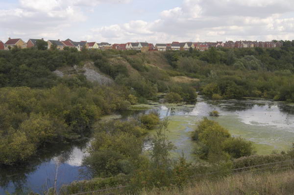
Chafford Hundred, Grays, Essex
I bought the Brompton at the end of 2002, and spent a lot of time riding it for exercise on doctor’s orders during recovery from a minor heart problem at the start of 2003. It coincided with the purchase of my first digital camera capable of professional results, the 6.1Mp Nikon D100 DSLR.
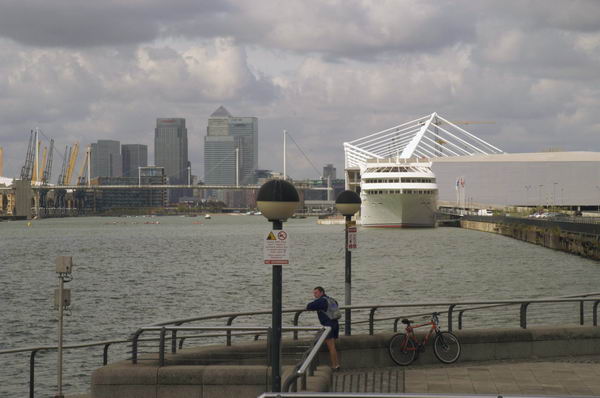
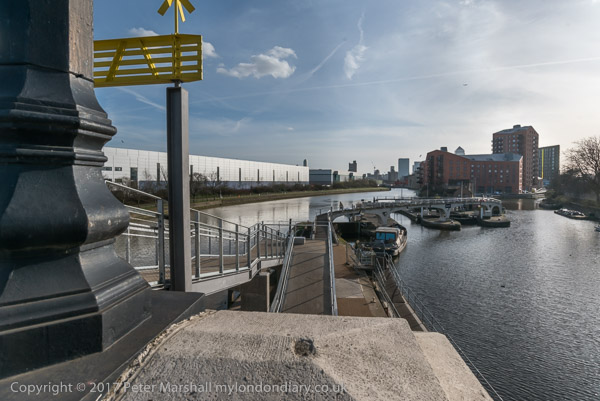
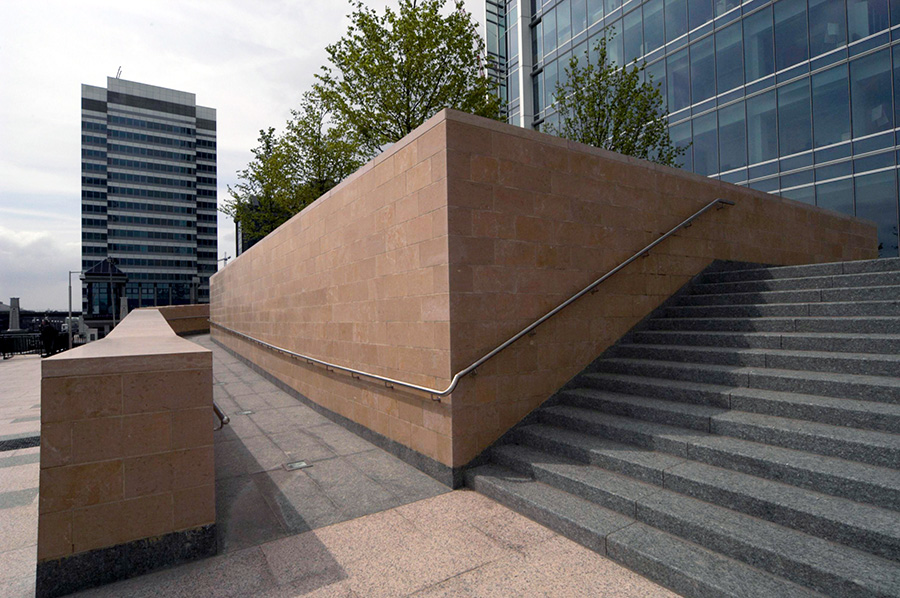
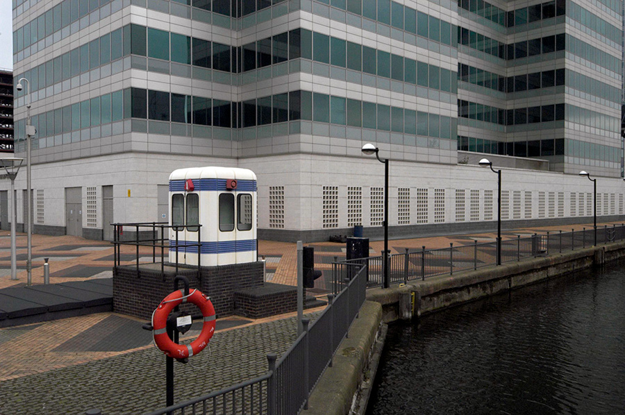
Royal Victoria Dock
For a year or two I worked with both digital and film, particularly because at the start I had only one Nikon lens, a 24-85mm zoom, giving an equivalent on the DX format camera to 36-128mm on full-frame, but I used a range of wider lenses on film. By 2004 I had added the remarkable Sigma 12-24mm (18-36mm equiv) to my bag, and many of the pictures I made that day were taken with that lens. I think it was the first affordable ultra-wide zoom, and certainly the results on DX format were very usable.
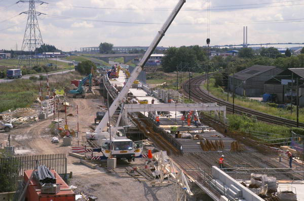
Channel Tunnel Rail link under construction at Purfleet
As well as the Nikon I also had a film camera, a Russian Horizon 202 swing lens panoramic camera. You can see some of the pictures I made with this among those on the Thames Gateway (Essex) section on the Urban Landscapes site.
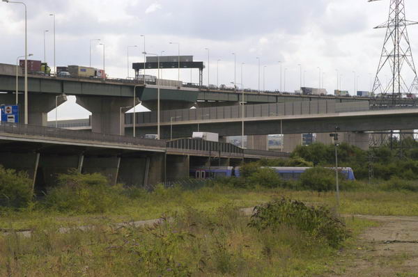
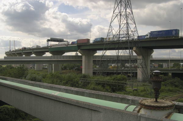
Dartford Bridge and Channel Tunnel rail link, Thurrock
I began taking pictures that day at Victoria Dock in Canning Town, having taken the Brompton on the train to Waterloo and then the Jubilee Line there, before cycling to West Ham station to catch the C2C rail service to Rainham, all on a Travelcard. It’s something of a blow that TfL now intends to discontinue the Travelcard, which provided relatively cheap and simple travel for most of my photography.
Here is what I wrote about the day back in August 2004 – with minor corrections, particularly changing to normal capitalisation.
I like to make good use of my Travelcards, so Rainham, the last station out of Fenchurch St in zone 6 is a good destination. I pointed the Brompton first to Purfleet, to take a look at the state of play on the high-speed rail link, and also a new development in the old chalkpits, then on towards the Dartford bridge.
The Bridge Act obliges the operators to transport cycles and pedestrians across free of charge, and I cycled up the path towards it to claim this right, before changing my mind and deciding i didn’t want to go to the other side. Instead I took the new road through the West Thurrock Marshes industrial area and on to St Clements church, now a nature sanctuary, in the middle of a detergent factory.
It’s a quiet and pleasant place to eat sandwiches, though the smell of the perfuming agent is pervasive. There I planned a route largely along side roads, cycle paths and footpaths to Upminster, taking in Chafford Hundred, South Ockenden and Belhus Park and woods. It made a pleasant ride, though I had to make a few detours, and the B isn’t too stable on slimy mud, so some paths made for interesting riding, with the added pleasures of bramble thorns and nettles.
My London Diary
All of the pictures on this post were taken on the Nikon D100. There are a quite a lot more on My London Diary.
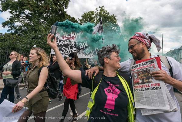
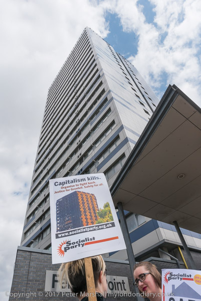
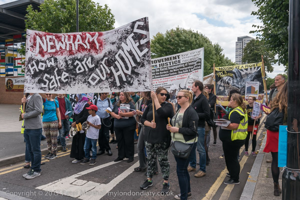
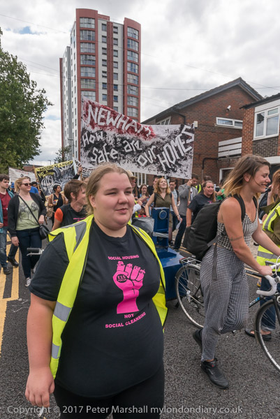
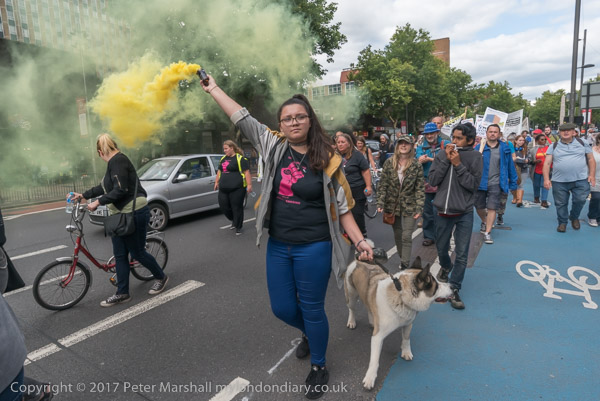
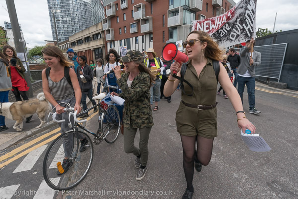
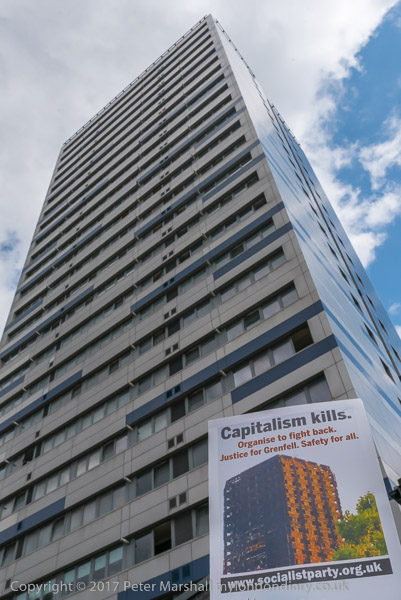
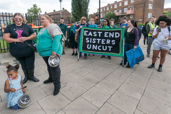
Fire Risk Tower Blocks – On Saturday 12 August 2017 Focus E15 Mothers led a march from Ferrier Point in Canning Town to a rally at Tanner Point in Plaistow pointing out the danger of these two blocks with the same cladding as Grenfell Tower, and then on to the Carpenters Estate in Stratford demanding safe homes, not social cleansing in East London.
The May 2022 Fire Risk Assessment of 119-205 Butchers Road, Canning Town conducted for Newham Council was obtained by a Freedom of Information request and can be downloaded. The 11 floor block of 43 flats has a single staircase and then had 86 people sleeping there.
The report by Phoenix Green Group declared the likelihood of fire to be ‘Medium’ but the potential consequences would be ‘Extreme Harm’ and gave the building a ‘Substantial’ fire risk rating, stating that urgent action should be taken and listing what was needed. I can find no information on Newham Council’s web site of whether this has been done, or of other council properties which might still be needing urgent action.
The block on Butchers Road was not one of those visited on the march led by Focus E15 Mothers in their march around Canning Town and Plaistow to the Carpenters Estate in Stratford. This had begun at Ferrier Point in Forty Acre Lane, Canning Town around 5 minutes walk away, a rather taller 23 storey block with dangerous ACM cladding like that on Grenfell Tower.
The cladding on Ferrier Point was replaced with non-combustible cladding in 2019. Otherwise there would have been a very different story when fire broke out on a 12th floor flat there around 6pm on 22nd June 2020. By the time the Fire Brigade arrived at 6.22pm around 150 residents had left the building and the LFB had the fire under control by 7.45pm. Six people required treatment for smoke inhalation, one in hospital the others treated on the spot by London Ambulance staff.
Tanner Point in Plaistow was another stop on the march where residents were extremely worried as this also had fire-risk ACM cladding. Along with that on Nicholls Point, a little off the march route, this was also replaced in 2018-9.
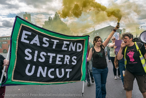
The march was organised and led by the Stratford-based Focus E15 housing campaign but supported by other groups, including the Socialist Party, East End Sisters Uncut, the One Housing campaign, Movement for Justice, Whitechapel Anarchist Group, the Revolutionary Communist Group and local residents, including those from the blocks with dangerous cladding.
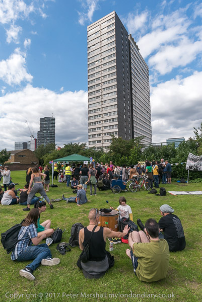
The march ended on the Carpenters Estate in Stratford, a once popular estate with over 400 empty homes which Newham’s Labour council largely emptied of people over 10 years ago and intended to demolish and sell off. Here there was a ‘hands around the Carpenters Estate’ solidarity event against decanting, demolition and social cleansing.
Events like this put pressure on Newham Council to speed up the removal of unsafe cladding from its taller tower blocks, but it seems there are still fire safety issues in other blocks that it owns. Years of actions by Focus E15 and others have stopped Newham selling off the Carpenters Estate and they are now going ahead with regeneration plans although these unfortunately lack the real commitment to social housing that the area so desperately needs.
London Sawmills, Bow Creek, East India Dock Rd, Canning Town, Newham, 1989 89-4b-15
I walked back a few yards to the west along the East India Dock Road and made this picture looking south down Bow Creek, again showing the stacked timber on the wharf. The closer of the two bridges visible was I think just a pipe bridge, probably to carry gas from the nearby gasworks from Poplar to Canning Town, and has since been removed.
The second bridge is a Dock Road Foot Bridge, more commonly called the Blue Bridge (a name it shares with several others in London), though it also carries pipes and is still in place. I think it was intended to provide a route for people living in South Bromley to Canning Town station, and it leads to a bridge taking the footpath over the DLR, but unfortunately this has been almost permanently locked. It has been at least partly rebuilt since I made this picture
Hidden by this bridge a few yards further downstream and fenced off is another bridge, Canning Town Old Railway Bridge, long disused which was built to carry a single rail track over the river.
Pipe Bridge, Bow Creek, Tower Hamlets, Newham, 1989 89-4c-61
I walked on across Bow Creek and took this picture of the pipe bridge. As you can see it was well fenced off and although there were steps up and a footway across I could not access this.
All this brickwork on the Middlesex side of the river has gone, I think when the road bridge here was widened and a link road provided to the Limehouse Link tunnel but the brick abutment remains on the Essex side. The bridge was built to give sufficient clearance for navigation.
Pipe Bridge, Bow Creek, Tower Hamlets, Newham, 1989 89-4c-63
At the centre of the river I had crossed from Newham into Tower Hamlets. My street atlas names this area as South Bromley, but I don’t think anyone now knows where that is, as there is no station of that name, the DLR having decided on East India instead.
A few yards on along waste ground I made another picture showing the pipe bridge and the river, before turning back to the East India Dock Road. I made two exposures and I wonder if I may have chosen the wrong one to digitise as it is just slightly unsharp.
London Sawmills, Bow Creek, East India Dock Rd, Canning Town, Tower Hamlets, 1989 89-4c-65
Across the water you can see much of the planks produced by the sawmill on the wharf, as well as stacks on a further wharf downriver between the building around 50 yards away on land but half a mile downstream round what is now the Bow Creek Ecology Park. Behind the cut timber you can see part of the Pura Foods edible oils factory on the opposite bank of the invisible river, and above that the top of the flood barrier across the river on the other side of the factory.
Timber was for many years a major industry on Bow Creek and along the Lea Navigation, as the Surrey Docks just across the Thames was mainly a timber dock, with large timber ponds. Boats and barges would have brought huge trunks to sawmills such as this, and the cut timber was also mainly transported further on by barge.
Pura Foods, Bow Creek, Tower Hamlets, 1989 89-4c-52
I walked further east and used a short telephoto lens to make this image of Pura Foods. Their factory processing vegetable oils here at Orchard Place had grown considerably over the years, as had the smells from it, and many locals were pleased when the factory moved out in 2006.
Almost all of my pictures at this time were taken with a 35mm lens, giving a moderate wide angle view. The Olympus Zuiko lens I used was unusual in being a shift lens, allow me to move the optical elements relative to the film to give additional control over the perspective. It made it possible for example to photograph taller buildings without tilting the camera which would have resulted in verticals that converged.
Lens design has improved considerably since, and so have our expectations of lenses. Many of my pictures made then have a lack of critical sharpness at the corners which we would now find unacceptable. Digital imaging in particular means we now routinely look at images on a much larger scale on screen than the prints we used to make.
West Ham Power Station, Bow Creek, East India Dock Rd, Newham, 1989 89-4c-55
I crossed to the other side of the busy East India Dock Road, going along Wharfside Road under it, and made this view looking north up Bow Creek. As you can see the West Ham Power Station was then being demolished. This was the last in a number of power stations on the site since 1904, when West Ham Council built one here to power its trams. This was West Ham B, built in 1951 and it used coal brought up Bow Creek as well as coke from the neighbouring Bromley Gas Works.
Power production at the station dropped off from the late 1960s and it closed in 1983. By 1989 its two 300ft cooling towers had already been demolished and the rest of the station was following.
West Ham Power Station, Bow Creek, East India Dock Rd, Newham, 1989 89-4c-56
A second view shows more of the Newham (or Essex) bank south of the main power station building and the closer parts are again full of stacked timber.
Newham Council together with Tower Hamlets has plans for a number of new bridges in the area providing links across Bow Creek, at Lochnagar St, Poplar Reach near to Cody Dock and Mayer Parry connecting the Leven Road former gasworks site to roughly where the old power station was, now the SEGRO industrial park.
It had been a short and interesting walk and I made my way to Canning Town station for the slow journey home. Canning Town is much easier to get to since the Jubilee Line opened at the end of 1999.
I only had time for a short walk on Friday 7th April 1989, cycling home furiously from the college where I was teaching at noon as I had no afternoon classes, picking up my camera bag and rushing to catch a train into London.
Canning Town, where I was heading, was on the other side of London and not then the easiest of places to get to before the DLR and Jubilee lines were completed. My journey involved a slow transit around North London on the line from Richmond on the North London Line to the old Canning Town station immediately north of the A13 East India Dock Road, next to Stephenson Street.
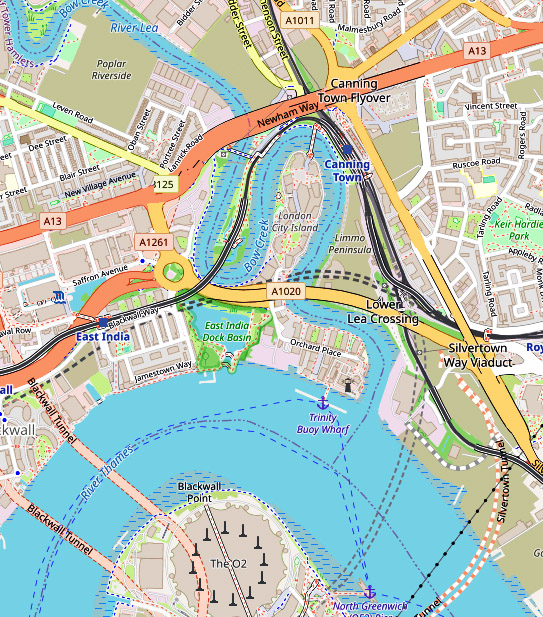
If you are not familiar with the geography of this area, a small clip from OpenStreetMap, slightly enhanced, will help. The East India Dock Road on this map is labelled Newham Way, which is here a flyover above the road itself. The former station I used was just to the north of this. Pura Foods was inside the loop which is now London City Island and there was no bridge across the river at the top of the bend.
A subway close to the station entrance took me to the other side of this busy road, where I had a view of Bow Creek, northern end of its loop dominated by Pura Foods, looking across waste ground where the DLR would shortly run. The flood barrier on Bow Creek became redundant when the Thames Barrier was built.
I moved slowly west along the East India Dock Road, stopping to take occasional images. There was a considerable amount of waste including old tires dumped here, but it was also a working industrial area, with workers cars parked alongside the river.
Essex Wharf, Bow Creek, Pura Foods, East India Dock Rd, Canning Town, Newham, 1989 89-4b-26
The main business on this side of the river appeared now to be the sawmill, though I also photographed the sign board for Haughton Engineering, but I’m unsure whether they were still in business.
It seemed to me an area which cried out for some panoramic images, and I took a set of three overlapping handheld pictures – the left of the set above – intending to combine them – which back then would have involved cutting and pasting the three together, but later I found I couldn’t quite get them to match up. Even when it became possible to do this digitally I found I hadn’t quite made these precisely enough.
It was experiences like this that led me a couple of years later to save up and buy a proper panoramic camera – I think the first one cost me around a month’s wages.
London Sawmills, Bow Creek, Wharfside Rd, Canning Town, Newham, 1989 89-4b-13
I continued walking west, the road on a low viaduct giving me a good view of the area to the south, coming to a timber yard where Bow Creek flowed into the area, going down south towards Orchard Place before turning north to go back towards the East India Dock Road where I had taken the earlier images.
London Sawmills, Bow Creek, East India Dock Rd, Canning Town, Newham, 1989 89-4b-15
I’ll post about the second and final part of this short walk later.
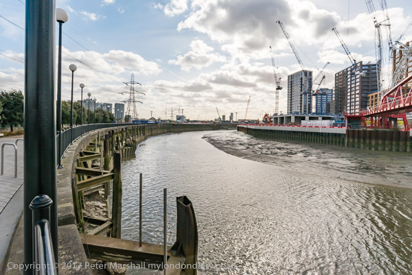
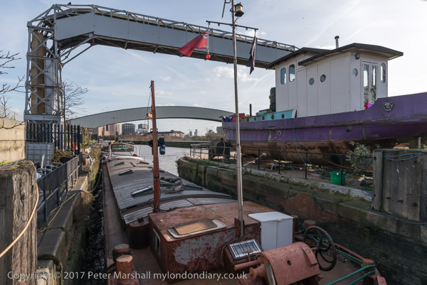
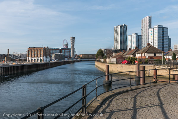
On Thursday 2nd March 2017 I had a meeting at Cody Dock about my photographic exhibition there later in the year. The weather forecast was good and promised me a day with blue sky and some clouds, perfect for my photography, particularly for some panoramas, where a clear blue sky or sullen grey overcast are both killers, so I rushed to get on an earlier train than I needed for the meeting to give time to take a walk along a part of Bow Creek before the meeting.
Years earlier there had been plans for a walk beside Bow Creek all the way from where it meets the Thames at Trinity Buoy Wharf up to the Stratford to join the tow path beside the Lea Navigation, but so far only some separate sections have materialised. The original plans envisaged two bridges taking the path across Bow Creek, and although a competition was organised (and won) for designs for one of these, neither had been built, largely because the money wasn’t there.
This section of the Leawalk has yet to open
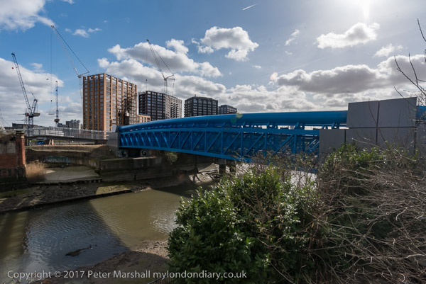
Instead the plans were changed to make use of existing bridges, but vital riverside sections remain closed, either because of existing users of the land refusing access or because of new developments taking place in the area. One such development, that of London City Island has recently provided a new bridge which allows an alternative route to the mouth of the creek.
The red bridge built for London City Island
Part of the problem has probably been that the walk is along the boundary of two local authorities, Tower Hamlets and Newham, with sections in both.
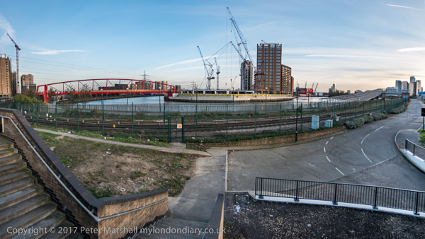
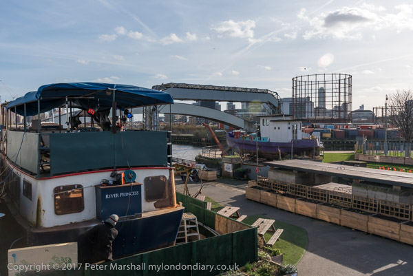
Cody Dock
I walked one section before the meeting, but came to a locked bridge which led to a fairly lengthy detour, and ended up with me having to run along the West India Dock Road to catch the DLR to get to the meeting in time.
Cody Dock
There is currently no path between that road and Cody Dock which would have been a faster route for me. Instead I took the DLR from Canning Town one stop to Star Lane, from where a walk through an industrial estate took me to Cody Dock.
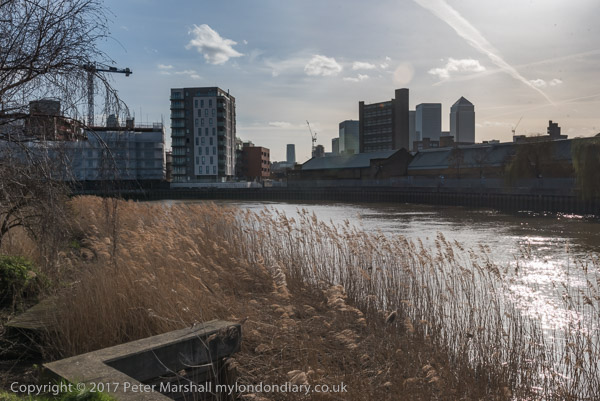
After the meeting I was able to rejoin the riverside path, now renamed the Leaway after I and many others made fun of its previous title as the Fatwalk, and made my way to Stratford.
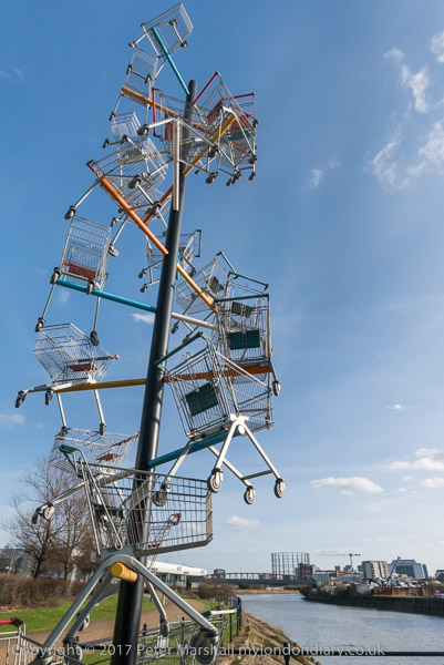
One of the works on ‘The Line’
On my way I was pleased to find a newly opened link from Twelvetrees Crescent (named after a Mr Twelvetrees who built a bridge there to his factory) to the footpath between the river and the Lea Navigation, enabling me to avoid the rather nasty detour between here and the path via the horrendously busy Blackwall Tunnel Approach road.
This part of the Leaway is now walked much more, not least because if forms part of of ‘The Line’ sculpture trail, which rather roughly follows the Meridian from Greenwich to Stratford. But those following this still have, like me, to take the DLR or walk along busy and dusty roads from Canning Town to Cody Dock.
There was still plenty of daylight left by the time my wanderings took me to the DLR Stratford High Street station, where I entrained back to Canning Town for a few more pictures which both lack of time and the position of the sun had made impossible before my meeting. Then it was back to the station for the Jubilee Line back to central London.
In the now over four years since the disastrous Grenfell Tower fire in June 2017 there has been little change and no reckoning, with a tediously slow inquiry taking place that began by shifting blame unfairly onto the firefighters but is at last making clear some of the deliberate failures by local government, manufacturers and installers of the fatal cladding and others with a complete disregard for the safety of those living in the tower.
Cladding was not of course the only issue, and there were many other failings that led to the terrible loss of life. Most basic was the attitude of governments of both parties towards health and safety issues, describing essential safety regulations as “red tape” and dismantling what were essential checks to increase the profitability of builders and developers and reduce the liabilities of building owners. It was a system that needed reforming and strengthening, perhaps learning from practice in other countries to provide effective control and not abandoning to commercial whim.
Most of what has emerged in the inquiry only reinforces what was already made clear from informed reports – such as that by Architects for Social Housing – within weeks of the fire, adding truly shameful detail to the broader outline. It surely should have come out in courts within months of the fire and some of those responsible might well be behind bars and companies charged with massive fines, and the main point of the inquiry seems to be to prevent the course of justice.
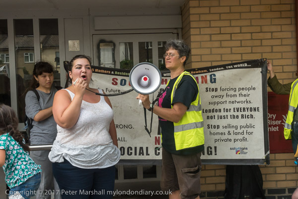
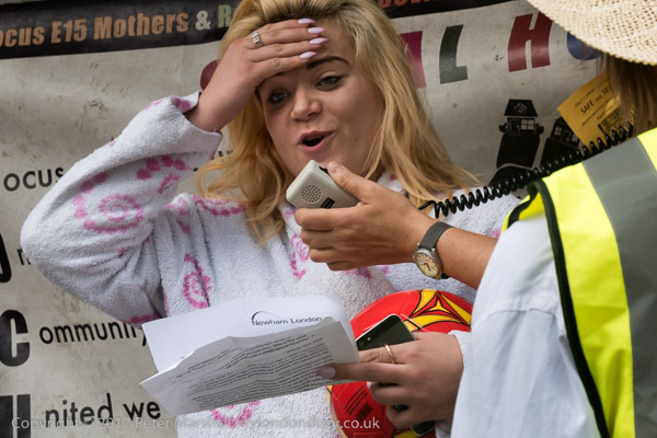
A resident of Tanner Point speaking
Local authorities and building owners have been forced to inspect their high-rise properties, and the government has provided at lest some of the money it promised to replace unsafe cladding in the public sector. But little has been done for those living in private blocks who are still living in fear and now pay increased charges for extra fire safety provisions. A parliamentary briefing paper estimates the total cost of replacement of unsafe cladding at around £15m, and so far government has come up with a third of that. Government policy has changed from the initial promise to fund “remediation of historical safety defects, to a suggestion that leaseholders should be protected from unaffordable costs” and even the provision for a low interest scheme to ensure they would not pay more than £50 a month has failed to materialise despite the promise in the current Building Safety Bill.
In August 2017, a number of tower blocks in the London borough of Newham were found to have unsafe cladding. Housing activists Focus E15 Mothers led a demonstration putting pressure on the council to act urgently to make the blocks safe. The council came to a decision the following month to remove the cladding though work to do so only began in April 2018.
The march began at Ferrier Point in Canning Town, with other groups including East End Sisters Uncut, Movement for Justice, the Socialist Party, the Revolutionary Communist Party, One Housing campaigners and Whitechapel Anarchists joining Focus E15 and some tower block residents.
From there they marched to Tanner Point in Plaistow North for a longer rally outside, including some speeches from tower residents. Then came another long march to Stratford and the Carpenters Estate.
The Carpenters Estate was a popular estate, close to Stratford station and the town centre, and was viewed by the council as a prime opportunity for highly profitable redevelopment schemes, wanting to demolish the estate which is well-planned and in good condition. Focus E15 led opposition that in 2013 ended plans for UCL to set up a new campus here and have constantly urged the council to bring back people to the estate where despite a critical housing shortage in the borough, 400 good homes had been kept empty for over 10 years. The march ended with a ‘hands around the Carpenters Estate’ solidarity event against decanting, demolition and social cleansing.
All photographs on this and my other sites, unless otherwise stated, are taken by and copyright of Peter Marshall, and are available for reproduction or can be bought as prints.
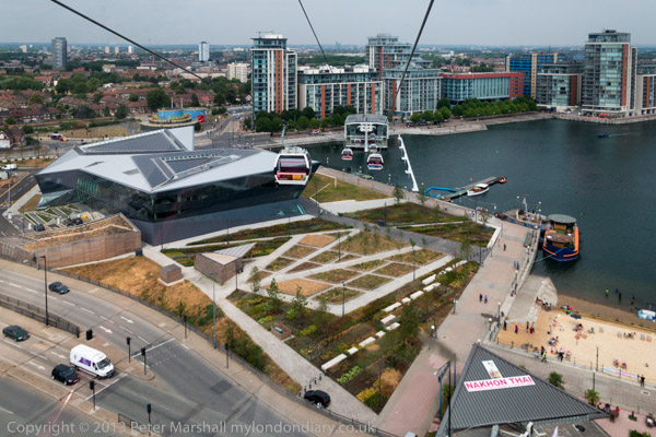
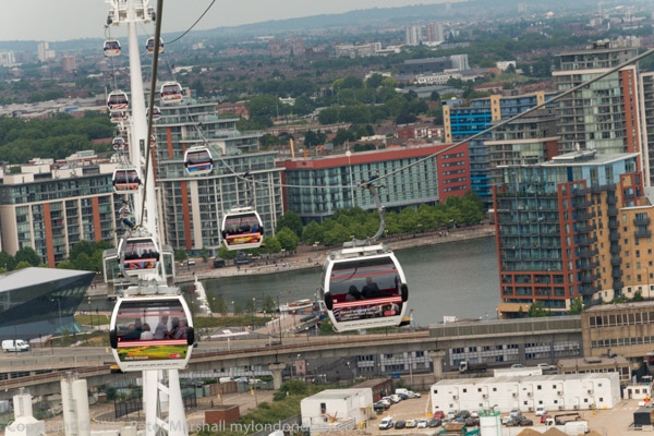
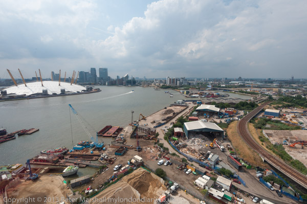
Eight years ago I took a couple of rides on the Emirates Air Line, better known thanks to London blogger Diamond Geezer as the ‘dangleway’ and posted a number of the pictures that I took from it.
As I pointed out then, “in transport terms its a joke, a slower and more expensive route on almost any possible journey“, but to my surprise this joke is still running eight years later despite huge losses, and my exhortation “if you’ve not taken a ride don’t leave it too long” was then misplaced. Though given the effects of the virus on air travel it may not last much longer, but perhaps the extensive developments on the south bank on the Greenwich Peninsula and the replacement of industrial sites by housing on the north bank, together with the move of the Greater London Authority to the Crystal at the north end of the route by the end of the year may provide a few more customers.
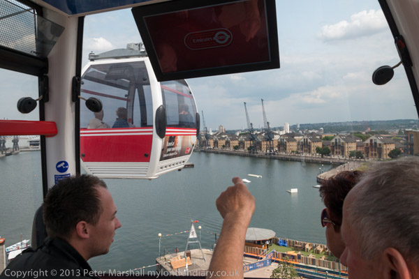
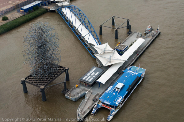
One advantage of the current situation is that, according to the TfL web site “Only one passenger is allowed per cabin, unless a household or group is travelling together” so you can be sure of having it to yourself, or chosing those you want to travel with. The poor people in the picture above had to share a ride with me.
I think there were notices in the cabins telling you to remain in your seats during the short journey, but clearly I didn’t entirely obey these, but there was no one around to see. Perhaps there might be safety issues if a full cabin of Sumo wrestlers began to throw themselves around but I don’t think my careful movements were any problems.
The service runs weekdays days from 7am to 11pm, stopping an hour later on Fridays and Saturdays and opening later at weekends. It also stops in very strong winds and thunderstorms, though one London reporter made a story out of using it this January as storm Christoph was approaching. His photographs don’t really support his story of being buffeted around by the wind but I imagine there was some tangible swinging motion. When there is any real danger it closes – and that happens around a hundred times a year. There are also some closures for maintainence.
My journeys were both smooth and rather quiet, and the ride seemed much shorter then the 10 minutes it took. A single journey costs £4, more or less the same as in 2013. I generally avoid air travel, but I imagine the carbon footprint of this short journey is quite low.
Back in 2013 I commented “it should be promoted as one of London’s cheaper and more interesting tourist attractions, giving a rather better view than the helter-skelter on the Olympic site at around a tenth of the cost, and with the added attraction of motion in three dimensions.” It has so far only attracted a few more discerning tourists, some of whom are doubtless also following London’s public art trail, The Line and get an unusual view of Antony Gormley’s Quantum Cloud on their ride.
All photographs on this and my other sites, unless otherwise stated, are taken by and copyright of Peter Marshall, and are available for reproduction or can be bought as prints.
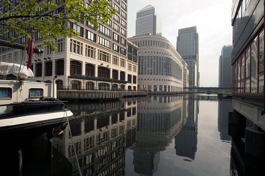
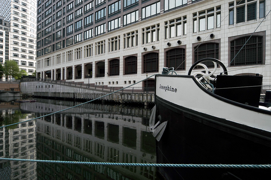
I hope those who came with me on the workshop I led around a part of London’s Dockland 17 years ago found it stimulating. For me it was a familiar walk, but I think most of the others were seeing the area for the first time. One of the instructions for the workshop some will have found difficult was not to bring a tripod, as these were and are red rags to the security staff who closely patrol the Canary Wharf estate. We had no problems with security on this workshop, though I have had confrontations on other occasions – including being once escorted off the estate.
I think I had been asked to run the workshop for London Independent Photography, though I’m not sure. On My London Diary I put a short text about the event and some pictures that I made during it. I’ve corrected the spelling and capitalisation of the original, otherwise it is exactly as written, probably deliberately in part ungrammatically.
May 9 found me taking a group of photographers for a walk around some parts of London’s docklands. we started at the centre of this ‘crime of the century’. I still don’t quite understand why a Conservative government felt so at odds with the City of London that it decided to set up offshore competition in the Enterprise Zone.
The feeding frenzy that ensued, trousering public property and tax breaks into the private pocket at an unprecedented rate.
The long-term consequence has been a distorted development with few real buildings of distinction but some expensively finished tat, and a lack of overall planning. I’m not sure that London would benefit from gaining the Olympics for which it is currently bidding, but if it fails, probably part of the reason will be the docklands debacle.
We started below the obscene gesture towards the old city, at least clear about its symbolism, then took the DLR down to Crossharbour with its silly bridge, walking back to the wharf and taking the Jubilee to Canning Town. then back alongside the Lea (still waiting for that riverside walkway) to East India Dock Basin and along by the Thames, where a galleon appeared in front of the dome.
Docklands has continued to change since 2004, but it remains a largely lost opportunity to develop what had become the redundant area for the benefit of the people as a whole rather than to enrich a few.
Back in 2004 I was still working with my first DSLR, the Nikon D100 for which had recently bought the Sigma 12-24mm lens and on this DX format camera this gave effective focal lengths of 18-36mm. The smaller format also avoids the weaker corners of this extreme wide-angle zoom (I think the first of its type) and within the smaller field it was remarkably distortion-free. There are a few more pictures on My London Diary – including that galleon – some rendered rather dully by the RAW software of the time – I’ve improved the rendering of those included in this post.
All photographs on this and my other sites, unless otherwise stated, are taken by and copyright of Peter Marshall, and are available for reproduction or can be bought as prints.
At the end of 1991 I finally bought my first panoramic camera, a Japanese Widelux F8 which I couldn’t really afford. It was a camera that took around 21 pictures on a 36 exposure film, with the film curved around a part of a cylindrical path with the lens pivoting around the centre of the cylinder.
The lens is a 26mm f2.8, though it needs to be stopped down to around f8 for most pictures as the camera is fixed focus at around 6 ft and only gets sharp at infinity when stopped down. Winding on the film winds up a clockwork motor and returns the lens to its starting position. On pressing the shutter the lens swings around through about 140 degrees, exposing the film through a slit at its back which swings across close to the film. It has 3 shutter speeds, 1/15, 1/125, and 1/250th, but even at the fastest speed it still takes rather longer to actually complete the exposure.
The design keeps lens to film distant constant – at around 26mm – right to the edge of the film across a negative 24mm x 56mm. If this was flat, the distance to the corner would be more like 40mm and so objects at the edges get stretched to around 1.5 times actual size. This camera eliminates this distortion, but at the expense of introducing its own which you can see in these pictures. This becomes particularly noticeable in the curvature of most straight non-vertical lines.
In particular, horizons become curved unless the camera is kept absolutely level. The pictures of Bow Creek were made with the camera on a sturdy tripod and with the help of a spirit level. There is one on the top plate of the camera, but I found a larger separate one more useful.
Although the angle of view is often stated as 140 degrees this is perhaps misleading and I think probably is the angle across the diagonal. Rather more useful is the horizontal angle of view, which I think is just slightly over 120 degrees. Theoretically it would be possible to create a full 360 degree view in three exposures, but practically it needed four, though I don’t think I ever succeeded on the few occasions I tried to make one.
Later I made many more panoramas here and around London, particularly with a similar Russian camera, the Horizon or Horizont which was rather more convenient to use, as well as a few with a much larger medium format version. I also used a Hassleblad X-Pan, a nice camera which was panoramic only in format, with a similar negative size, 58x24mm, but using rectilinear lenses which can’t acheive a really wide angle of view.
The whole area has changed so much since 1983 that I find it very confusing to locate the exact locations of many of the pictures that I took, and I’ve occasionally got some of the captions wrong. Often the only way I can be sure is by carefully studying other pictures that I took where I am sure of the location.
The building at the centre of the above image can be seen in one of the pictures posted yesterday, and is clearly on Victoria Dock Road, this section of the road completely obliterated in the construction of the Docklands Light Railway and the Canning Town transport interchange. Victoria Dock Road now begins on the other side of Silvertown Way. The picture above was taken from somewhere near the flood barrier.
The warning light for the flood barrier was some way to the north, where the river bends around close to the East India Dock Road. At the left of the notice is a pub the East India Dock Road, long demolished, but both pylons are still there, along with the Newham Way flyover.
I think this picture was taken roughly where the Lower Lea Crossing now goes across Bow Creek and the river bends around to the east.
It is difficult to pinpoint the locations of these views taken on the same day as I walked down beside Bow Creek towards the Thames. The pylon visible here was on the north-east corner of the East India Dock Basin next to Orchard Place and has since been removed. The chimney is a small mystery as I think this is Brunswick Wharf power station which had two chimneys – but I may have carefully lined them up so one is hidden behind the other. In 1983 the station was still in use and only decommissioned in 1984.
Things are much clearer as the River Thames comes into view, and the creek swings around yet again towards the south. The power station across the river is the Blackwall Point Power Station on a site close to where the Millennium Dome was later built.
There was then still a railway line leading down to Thames Wharf, and this was still an industrial area. Things are rather busier not with these sheds still in use and the whole area here is now covered by piles of steel stocks as you can see from satellite images on Google.
Across Bow Creek I got a good view of London’s only lighthouse, at Trinity Buoy Wharf. Some years later I was to visit this site on various occasions for several art projects, including a show in which a few of my pictures of Bow Creek were part of the display. And with the late lamented London Arts Cafe I came to a picnic on the riverside and sat in the lighthouse to listen for a few minutes to Jem Finer’s Longplayer which began its thousand year performance here at midnight on the 31st of December 1999. But until 1988 it was still owned by Trinity House and busy maintaining buoys.
Thames Wharf on the River Thames was a busy industrial site which back then seemed mainly to be dealing in scrap metal, and I had to walk around a few heaps to make my way along the river. Although I rather felt I was trespassing, no one approached me. Security was far less strict back then.
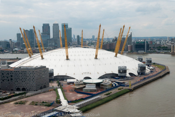
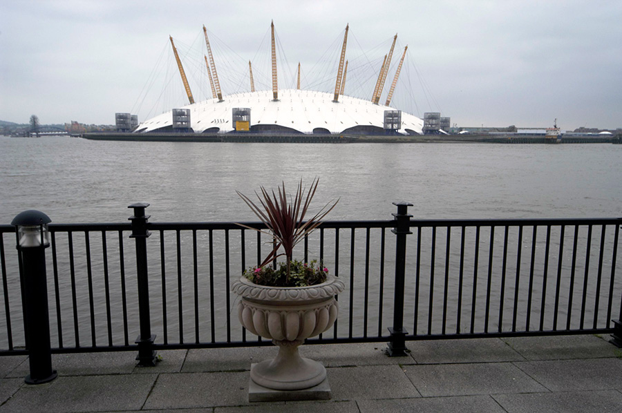
This was around the limit of my walk and having taken my pictures – you can see a few more on Flickr – I walked back up Dock Road to Silvertown Way. I doubt if you can follow much of my walk today, but you do get a good overhead view of the area from the dangleway, London’s cable car across the Thames from North Greenwich to Victoria Dock. But don’t wait too long, as the sponsorship deal with the Emirates Air Line ends in 2022 and the future of this hugely loss-making service must be in doubt.
All photographs on this and my other sites, unless otherwise stated, are taken by and copyright of Peter Marshall, and are available for reproduction or can be bought as prints.