A Couple, Shops, Shakespeare and a Green Man

A Couple, Shops, Shakespeare and a Green Man is the fourth post on my walk in Kennington and Brixton on Sunday 6th May 1989. The posts began with Hanover, Belgrave, Chapel, Shops, Taxis. The previous post was Loughborough Estate, Angell Town & A Garage – 1989

Couple, Loughborough Jct, Lambeth, 1989 89-5d-11
Couple, Loughborough Junction, Station, Lambeth, 1989 89-5d-11

I turned right at the end of Ridgway Road onto Loughborough Road and walked under the railway bridge to the junction with Coldharbour Lane, turning east and walking a few yards under another bridge to the station entrance. Outside the station which was then closed at the weekends were a young couple who saw my cameras and asked me what I was photographing. We had a short talk and then they asked me to take their picture.

The Flower Box, Coldharbour Lane, Loughborough Jct, Lambeth, 1989 89-5d-12

A few yards further on I was back to the small parade of shops in front of the alley leading to the Celestial Church of Christ where I had made some photographs a month earlier.

I don’t know how long The Flower Box had been closed, but clearly it was some time, although I could still read its faded signage, ‘FLOWERS FOR EVERY OCCASION’ and ‘SAY IT WITH FLOWERS’.

Perhaps surprisingly this building with the triple decoration at left is still standing at No 208, now a Chinese takeaway, with the demolished shop at right under the hoarding rebuilt and now serving Caribbean Cuisine.

Shops, Coldharbour Lane, Loughborough Jct, Lambeth, 1989 89-5d-13
Shops, Coldharbour Lane, Loughborough Jct, Lambeth, 1989

My next picture came just a couple of yards away, when a young man riding a bike emerged from the alley. I could see him coming as the shop at left had been demolished. I was rather surprised that the two floors above, hidden by the hoarding were still standing as there didn’t appear to be very much holding them up.

Shops, Coldharbour Lane, Loughborough Jct, Lambeth, 1989 89-5d-15

I turned around and walked back westwards along Coldharbour Lane which bends southwards under more railway lines before almost immediately swinging west again, creating the narrow space for this building between viaduct and road. That end wall of the property is only six bricks wide – around 4ft 6inches, though the building widens out further away.

This block is still there, looking perhaps a little better than when I made this picture. The first floor window on the end wall has been bricked up. It appears to be leaning a little in my picture because I did not have the camera level.

Jubilee Terrace, Shakespeare Rd, Loughborough Jct, Lambeth, 1989 89-5d-16
Jubilee Terrace, Shakespeare Rd, Loughborough Jct, Lambeth, 1989

Shakespeare Road runs south here and I walked a short distance down it to photograph Jubilee Terrace. The road was obviously named for William S, and as the plaque states, Jubilee Terrace was built in 1887, the year of Queen Victoria’s Golden Jubillee, 50 years after her accession on 20 June 1837. It was the occasion for her to start making public appearances again after a long period of isolation following the death of her husband in 1861.

I think these were built as a terrace of houses in conjunction with the business premises to the north shown in the next picture. The houses at both ends and the central pair are three-storey while the others only have two.

Shakespeare Business Centre, Shakespeare Rd, Loughborough Jct, Lambeth, 1989 89-5e-62

At the north end of Jubilee Terrace and joined to it, this was built as commercial premises for Osborne and Young corn merchants, with an entrance for horse-drawn vehicles at its centre. Later it became known as Coldharbour Works.

You can read more about the history of the building on Brixton Buzz, including the rather surprising finding underneath that underneath the blank boards of the shopfronts at right were those you can now see on the building for bird seed specialists B.O.Y, Brinkler, Osborne & Young, including the original owners of the premises – B.O.Y were apparently in business here from around 1932 until they were taken over around 1974.

Houses, Anna French, Fabrics, Lace, Wallpaper, Shakespeare Rd, Loughborough Jct, Lambeth, 1989 89-5e-63

The southern end of Jubilee Terrace and in the yard of Coldharbour Works behind the shop of Anna French, Fabrics Lace Wallpapers in what I assume was one the store of the corn merchants. Anna French started a company in Scotland in 1976 to make her designs and is one of the best-known wallpaper and fabric designers. The company is now part of Thibaut, the oldest US company in wallpaper and fabrics.

Anna French moved to smaller premisess in Hinton Rd and the building is now Kings College Hospital Therapies Department

The Green Man, Coldharbour Lane, Loughborough Jct, Lambeth, 1989 89-5e-64

The Green Man on the corner of Coldharbour Lane and Hinton Road had been at the edge of one of the pictures I’d taken on an April walk, but here in a picture taken looking from the end of Belinda Rd it is in the centre of the picture and we can see its name and pub sign.

It closed in 2003, not because it was unprofitable, but because it was too popular with drug dealers and petty criminals and was asked to close. There had been a pub of that name on the site since before 1800, but this building dates from 1881. In 2016 the building, now a skills zone and careers advice centre, was given a Shimmer Wall Green Man artwork on the second floor above its entrance.

There will be further posts on this walk later.


A Submarine, Flats, Pub, Dog, Ducks & Milkmaid

A Submarine, Flats, Pub, Dog, Ducks & Milkmaid is the final post on my walk on Friday afternoon, May 5th 1989. The previous post was Around Camberwell New Road – 1989

Camberwell Submarine, boiler room, Akerman Rd, Lambeth, 1989 89-5b-35

I crossed over Camberwell New Road to the southern side, turned own Vassall Road and then left into Langton Road. I’ve not digitised the one picture I took of a house here, nor the single image I made in Lothian Road, but I continued further south along here, lured by the sight of an unusual object in the centre of Akerman Road.

Two vertical concrete towers rose up from a more organic looking low concrete body. Later I was to learn that this was known as the Camberwell Submarine.

Camberwell Submarine, boiler room, Akerman Rd, Lambeth, 1989 89-5b-21

I had no idea what this structure was, though clearly it was providing ventilation for some below ground installation. Was it Lambeth’s nuclear bunker, perhaps an underground city? Was there some secret tunnel underneath – though the nearest Underground line was well over a mile away. Later I looked it up to find others had made similar speculations to mine, but of course the real purpose is rather more prosaic.

This is the visible structure of the below ground Myatt’s Fields North Boiler House designed by Michael Luffingham in the mid-seventies for Lambeth Council, and described at the time as Hollamby’s submarine after his boss, borough architect Ted Hollamby. An attempt was made to get it listed ten years ago but failed.

Camberwell Submarine, boiler room, Akerman Rd, Lambeth, 1989 89-5b-23

I could only walk around the outside of the submarine and although it had doors at each end, both were locked. In 2007, Mike Urban of Urban75 was photographing it and was invited inside by a maintenance worker and his post reveals some of the hidden secrets of the interior.

Flats, Akerman Rd, Lambeth, 1989 89-5b-26

These are some of the flats on the Myatt’s Fields North which were heated by the submarine. The estate later got a very poor reputation and much was demolished and replaced in controversial redevelopment in 2014, mentioned in a previous post.

Loughborough Hotel, Evandale Rd, Brixton, Lambeth, 1989 89-5b-14

I turned down Evandale Road and walked down to the Loughborough Hotel on the corner with Loughborough Road. The earliest record of a pub here – on the corner with what was then Cromwell Rd – was in 1864, and it was built on the site of Loughborough House which was demolished in 1854. This had been the Manor House of Lambeth Wick, home to the 1st Baron Loughborough, Henry Hastings. He had been given his title in 1643 for fighting for the Royalists in the English Civil War and returned to live here after a period of exile in 1661.

In 1900 the hotel was replaced by this splendid new building, designed as an entertainment palace with a large ballroom on the first floor. The name ‘Hotel’ simply meant it was a posher establishment than an inn, and it never had rooms where people could stay.

The nature of entertainment at the hotel changed from the late 1960s as did the local population. The Island Disco, a South Pacific Island themed disco opened in 1967 and various other night clubs followed including the legendary Latin and African music club, the Mambo Inn. There were drag nights too from !969.

All this finished in 2005, when the upstairs room s were turned into flats. The ground floor pub finally closed in 2007 and the former bar is now a café and possibly at times an art gallery.

Fiveways, Loughborough Rd, Akerman Rd, Brixton, Lambeth, 1989 89-5b-15

I turned east along Loughborough Road and made my way to Fiveways, the junction with Akerman Road, Lilford Road and Fiveways Road. This shows the house on the corner with Akerman Raod, which has since been considerably refurbished. This was once the end of a long terrace from the Loughborough Hotel with ground floor shops, but those at this end and some others have been converted to residential.

Dog, Ducks & Milkmaid, Lilford Rd, Camberwell, Lambeth, 1989 89-5c-62

I continued along Lilford Road, where at number 15 I photographed this small menagerie. I’m pleased to see that the ducks are still there on the short pillars at the front door, though now looking a little worn, but the milkmaid and dog have gone.

Auto Stores, Camberwell Rd, Camberwell, Southwark, 1989 89-5c-63
Auto Stores, Camberwell, Southwark, 1989 89-5c-63

By now it was getting a little late and I was getting hungry and I made my way quickly along Knatchbull Road towards Camberwell Green to catch a bus back to Waterloo for my train home. I only took this one last picture, though I’m not sure exactly where it was taken around Camberwell Green, though my contact sheet says Camberwell Road.

This is the third and final post on the walk which began with Naked Ladies, 3 Doors & A New Walk. But two days later I was back again on a new walk in South London which I’ll write about shortly


London Loop – Uxbridge to Moor Park

London Loop - Uxbridge to Moor Park
Spot the path

London Loop – Uxbridge to Moor Park: Monday May 29th 2006 was the Late May Bank Holiday for that year, the day which replaced the Whit Monday Bank holiday in 1968, though at first for a trial 5 year period, only becoming a final replacement in 1971. Unlike Whitsun it came in a regular place, saving us having to do esoteric calculations to find the date o0f Easter, and then add on 50 days for Pentecost. This year, 2023, the Late May Bank Holiday actually falls on Whit Monday, but that isn’t usual. Though some people still call it Whit when it isn’t.

London Loop - Uxbridge to Moor Park

We had decided to go on a walk on the bank holiday, and we had been following the various stages of the London Loop, a kind of walkers M25 around the outskirts of London. The section we had reached began at Uxbridge and ended at Moor Park.

London Loop - Uxbridge to Moor Park

Although the M25 has made journeys around London much easier for those in cars, there is no equivalent for public transport. I live only 8 miles as the crow flies from Uxbridge station it took us a train, two buses and well over an hour to get there.

London Loop - Uxbridge to Moor Park

From then on it was fairly plain sailing, or rather walking, though much of the first half of our route was on the towpath of the Grand Union Canal. We covered section 12 which ends in Harefield and section 13 which goes on to Moor Park. The two add up to around nine and a half miles, with another mile or to the station at each end. The two links give maps and details and also short notes on points of interest in the walks, so I don’t need to add to them.

We didn’t have these pdfs, but a copy of the book about the whole loop published five years earlier. Perhaps some things had changed but I think the directions given were at times in any case rather too vague to be useful. However the small reproductions of the OS Maps it contains soon let us work out the correct path. Nowadays of course you can get the maps and route guides on your phone, which can also tell you exactly where you are. Unless like me a few years ago when you get lost in a dense forest where there is no GPS (and no phone signal.)

On My London Diary right at the bottom of the May 2006 page there is a short text about the day which includes “most of it was pretty boring, far too much green. The book giving the route is pretty hopeless in places too, which is perhaps why there were parts of it that very few people seem to have found, with badly overgrown paths” and also points out that back in 2006, the London Loop was still “an almost unsigned footpath route“. I think the waymarks are now much improved.

The piece concludes with what should have been a link to the pictures simply reading “coming shortly” though there is a previously unlinked page with a set of them. The next page and the rest of the pictures are still missing. But probably I had decided the 25 that are there are enough to give a good impression for the walk.. I’ve uploaded just one extra to go with this post.


Camberwell & Myatt’s Fields

My walk on Sunday 9th April 1989 continued. The previous post was Hairdressers, Mansions, Baptists, Tiles and Greeks.

Escort Parts Centre, Camberwell Station Rd, Camberwell, Southwark, 1989 89-4i-43

Camberwell Station Road runs south from Camberwell New Road alongside the railway line, and along its west side are a number of small businesses in the railway arches, almost all garages of some kind.

The Escort Parts Centre was on the corner with Camberwell New Road and remained in business here until around 2010. The premises are now covered with graffiti and look derelict. The number 344 does not appear to be for either street and I think is some numbering for the arches in the viaduct.

Sacred Heart of Jesus, RC Church, Camberwell, Southwark, 1989 89-4i-32

The Roman Catholic Church of the Sacred Heart is in Knatchbull Road, just past the railway bridge and is on a dramatic scale, towering above the railway viaduct.

The Grade II listing text states it was built in 1952-8 from designs by D Plaskett Marshall in a moderne style, reminiscent of the inter-war churches of Cachemaille-Day. According to Wikipedia, “Nugent Francis Cachemaille-Day (1896–1976), often referred to as NF Cachemaille-Day, was an English architect who designed some of the most “revolutionary” 20th-century churches in the country.

Again according to Wikipedia he designed his first church in Northenden in 1936-7 and by 1963 had been responsible for at least 61, many Grade II listed. Because of its location it is difficult to get a picture of this one which provides a good overall impression.

Tyre Fitting Bay, Camberwell Station Rd, Camberwell, Lambeth, 1989 89-4i-36

This was little further down Camberwell Station Rd which hasn’t had a passenger station since 1916 , though if you go down far enough you can still see the former station building, now occupied by a motorbike repair shop.

Camberwell station opened in 1862 on the London, Chatham and Dover Railway’s line into Blackfriars from Herne Hill. After the closure for passengers it remained in use for goods until 1964. The goods yard is now a housing estate.

Various schemes this century have looked at the reopening of the station but all so far have been abandoned.

Houses, Myatts Fields area, Camberwell, Lambeth, 1989 89-4i-25
Houses, 22-24, Flodden Rd, Myatts Fields, Camberwell, Lambeth, 1989 89-4i-25

I walked back up to Camberwell New Road and took three pictures of terraces there ( not on-line) before going down County Grove. These houses are 22 and 24 Flodden Road. On my map the Southwark-Lambeth boundary runs down the middle of the road, making these in Lambeth.

The Survey of London states that this area was bought from Sir Edward Knatchbull in 1770 by Hughes Minet, the grandson of a French Hugenot refugee, but it was only after the railway was opened in 1863 that it was developed to meet the demand this generated for small suburban houses. Builders obtained leases from the Minet family who were public-spririted landlords and provided a church and the Minet library and also closely controlled the building ensuring a mix of house sizes. In 1889 William Minet gave the 14.5 acres to the London County Council for a permanent open space, Myatt’s fields.

Houses, Myatts Fields area, Camberwell, Lambeth, 1989 89-4i-11
Upstall St, Myatts Fields, Camberwell, Lambeth, 1989 89-4i-11

The Metropolitan Public Gardens Association spent around £10,000 to lay it out as a park to the designs of Fanny Wilkinson, a suffragette and one of the first women to be a professional landscape designer. The new park was named for Joseph Myatt, a well-known market gardener who produced a number of then famous strawberry varieties including Eliza, British Queen and Deptford Vine at his nursery in Deptford. His son James Myatt brought the business to the fields here.

Joseph also experimented with various varieties of rhubarb, hoping that he could get people to eat this together with strawberries, but this proved rather less successful, though rhubarb did become popular later.

Lambeth Council became the freeholder of the Minet estate in 1968.

Paulet Rd, Camberwell, Lambeth, 1989 89-4i-12

Lambeth Council redeveloped a large stretch along the west side of Paulet Road in the early 1970s. Although the long terrace blocks of the Paulet Road Estate are in a modern style they have a similar scale to the Victorian terraces opposite and were built using yellow stock bricks and slates like them. But they still look like monolithic slabs rather than the repeating units of the earlier houses.

Paulet Rd, Camberwell, Lambeth, 1989 89-4i-13

The side and rear of one of the blocks on the Paulet Road Estate. I think that these stairs lead up to the front doors of the upper level flats. These buildings are some of relatively few modern buildings in the Minet Conservation Area designated in 1980.

Provision Shop, Lilford Rd, Camberwell, Lambeth, 1989 89-4i-15

The south end of Paulet Road ends at Lilford Road and I turned east along it, going under the railway again. I think this shop just a little to the east of the railway bridge was at No 106 and has been converted into a private residence and is no longer recognisable. There are many fewer small corner shops now.

My walk will continue in a later post. The first part my walk on Sunday 9th April 1989 is at Peckham and East Dulwich 1989.


Buildings, Dancers, Gym and a Bison

This is the final part of my walk around King’s Cross after the walk led by the Greater London Industrial Archeology Society finished on Saturday 8th April 1989. The previous post was Goods Way, Gasholders & St Pancras.

Stanley Buildings, Stanley Passage, Cheney Rd, King's Cross, Camden, 1989 89-4h-61
Stanley Buildings, Stanley Passage, Cheney Rd, King’s Cross, Camden, 1989 89-4h-61

I was clearly in no hurry to get home and spent some time wandering around the area taking pictures. In this post they are in the order that I made them, along with some others, mainly near duplicates, but I haven’t kept to this in posting them to the album.

This block of flats was built 1864-5 by the Improved Industrial Dwellings Company, architect Matthew Allen. They were grade II listed five years after I made this picture and have been retained in the fairly comprehensive development around them, being incorporated after considerable rebuilding around 2014 into a modern office development.

The listing text decribes them as part of a group with the “King’s Cross Gasholders, Goods Way and Barlow’s great shed to St Pancras Station, Euston Road” and “in addition an important part of a dramatic Victorian industrial landscape.” Unfortunately this is no longer the case, and it is now simply an addendum to a modern development.

Gasholder, Cheney Rd, Battlebridge Rd, King's Cross, Camden, 1989 89-4h-62
Gasholder, Cheney Rd, Battlebridge Rd, King’s Cross, Camden, 1989 89-4h-62

Here and in the next picture we see a landscape and portrait view of a nearby part of that “dramatic Victorian industrial landscape”, now gone and replaced by modern blocks

89-4h-64-Edit_2400
Gasholder, Cheney Rd, Battlebridge Rd, King’s Cross, Camden, 1989 89-4h-64-Edit_2400

I made the landscape format view first, but then decided that it was probably better to include the top of the gasholder.
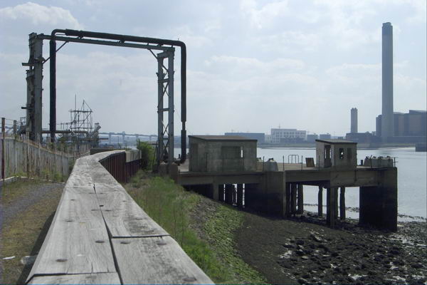
German Gymnasium, Cheney Rd, King's Cross, Camden, 1989 89-4h-65
German Gymnasium, Cheney Rd, King’s Cross, Camden, 1989 89-4h-65

The German Gymnasium on the south side of Clarence Passage was also built in 1964-5, paid for by the German Gymnastics Society and London’s German community and it had its front entrance on Pancras Road. It was one of the first venues used by the National Olympian Association for its first games in 1866.

Dancers, Mural, Stanley Buildings, Pancras Rd, King's Cross, Camden, 1989 89-4h-56
Dancers, Mural, Stanley Buildings, Pancras Rd, King’s Cross, Camden, 1989 89-4h-56

My favourite mural in London, on the side of this block of flats. I don’t know when this disappeared. The ‘preserved’ building has a huge featureless brick wall facing Pancras Road which could do with something like this to liven it up.

German Gymnasium, Cheney Rd, King's Cross, Camden, 1989 89-4h-42
German Gymnasium, Cheney Rd, King’s Cross, Camden, 1989 89-4h-42

Although this building was Grade II listed in 1976, part of its western end was demolished for the construction of St Pancras International, with a new end wall being built in matching fashion. The building is now in use as a restaurant and bar.
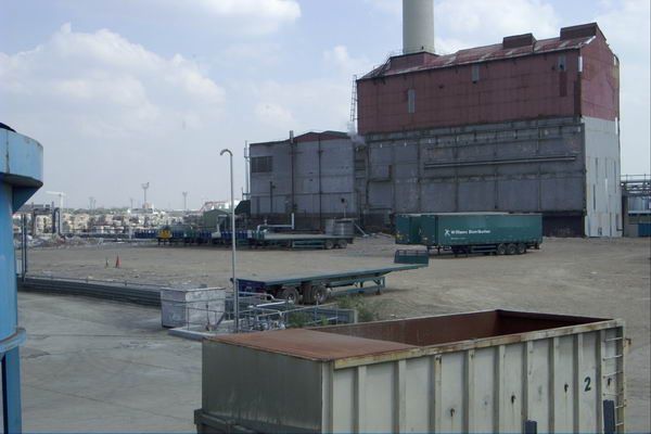
Culross Buildings, Kings Cross Station, King's Cross, Camden, 1989 89-4h-43
Culross Buildings, Kings Cross Station, King’s Cross, Camden, 1989 89-4h-43

I had wandered here to the side of the Motorail terminal at King Cross, where you used to be able to drive your car onto a train and sleep in a bunk bed all the way to Edinburgh or Aberdeen. This was the first such service, I think dating from the 1950s by British Rail, who set it up as Car Sleeper Limited, but it was soon joined by a network of similar services serving other stations and distant destinations, with London terminals at Olympia, Paddington and Euston.
As the motorway network grew, demand for motorail decreased, and I think the service from Kings Cross ended around the time I made this picture.

Culross Buildings, Kings Cross Station, King's Cross, Camden, 1989 89-4h-44
Culross Buildings, Kings Cross Station, King’s Cross, Camden, 1989 89-4h-44

Another image from somewhere around the north of King’s Cross Station where I had wandered.

Great Northern Hotel, Pancras Rd, King's Cross, Camden, 1989 89-4h-45
Great Northern Hotel, Pancras Rd, King’s Cross, Camden, 1989 89-4h-45

Back on Pancras Rd I walked to the eastern side of the Great Northern Hotel facing King’s Cross Station to take this picture of the main facade. The area in front of the hotel is now covered by the extended station building from 2008. The building was a part of Lewis Cubitt’s plans for the station, built in 1854 and Grade II listed in 1984. The slightly less impressive convex rear of the building is still fully visible on Pancras Rd.

Ox, Pancras Rd, King's Cross, Camden, 1989 89-4h-46
Ox, Pancras Rd, King’s Cross, Camden, 1989 89-4h-46

This rather threadbare beast was for some years a feature of Pancras Road, and although I’ve called it an Ox I think it was really a Bison. I think it was there simply to draw attention to the shop behind, or perhaps just to make it easier to find. Perhaps someone will be able to post more about it in a comment?

A short distance down the road was the Underground entrance at which my walk ended and my journey home began.

The first post on this walk was Kings Cross, St George’s Gardens & More

Purfleet & West Thurrock – 2003

Purfleet & West Thurrock: 20 years ago, on 22nd April 2003 I was still recovering from a heart attack and a little minor surgery. Delays and cancellations in the NHS are not new, and I’d spent several weeks in hospital waiting for the op, with three or four cancellations as emergencies bumped me off the list at short notice – one time I was even on a trolley on may way to theatre. Back then the major shortage, and one that seldom made the news, was of doctors and it still is, with the government still committed to doing little or nothing about it, even refusing to discuss the junior doctors claims.

Purfleet & West Thurrock

My actual operation, when finally it happened, went well, but 24 hours later I was an emergency too, collapsing the the ward toilet as my blood pressure dropped spectacularly thanks to a large dose of a exotic drug through a cannula incorrectly inserted by a junior doctor (the nurses were extremely scornful) and I was still far too weak when they released me home to join the million or more (including my son and wife) the protesting against the Iraq war the following day. I think I was more upset about that than my heart attack.

Purfleet & West Thurrock

My GP signed me off work for a few weeks (though most of my work was freelance and from home, and I was able to continue this) and prescribed aspirin and exercise along with a few other drugs to deal with my blood pressure, which I’ve been taking daily ever since, along with insulin for my diabetes, also diagnosed when I went into hospital. And thanks to the NHS, all this has cost me absolutely nothing. And after I was signed off as fit for work in March, though I was still very weak, I managed to go and photograph a couple of protests.

Purfleet & West Thurrock

Walking was still for the first month or two just a little taxing, but after a couple of weeks I was fine on my Brompton, where I could take it easy later I went on some longish rides. And as it was a folding bike I could put it on trains and the underground to take me away for more distant starting points. And in April 2003 I went on rides from Dartford, Rainham and, on 22nd April 2003, to Purfleet, where I cycled along beside the Thames to West Thurrock and back.

Purfleet & West Thurrock

When I posted pictures of this and other rides on My London Diary, I noted “I didn’t get around to adding these other pictures from April 2003 until very much later, and haven’t got around to giving them captions.” And I wrote nothing about the ride at the time. All were taken on a Nikon D100 with a Nikon 24-85mm lens.

I travelled up to London on a Travelcard which covered a journey to any station in Zones 1-6, which meant the closest I could get to Purfleet was actually the station before, Rainham. Then it wasn’t possible to follow the riverside path from Rainham to Purfleet, which then ended at Coldharbour, so I had to cycle along the road to Purfleet through Wennington. The map now shows a riverside cycle path.

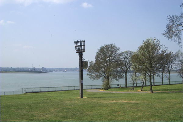
This part of the ride had little interest, other than passing some of the works for the Channel Tunnel Rail Link, where I took a few pictures before going down Tank Hill Rd to reach the riverside close to the Purfleet Armada Beacon.

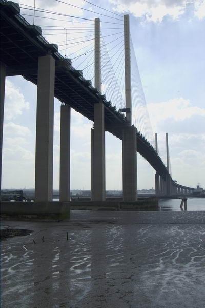
Navigation from there to West Thurrock (and on to Grays and the edge of Tilbury Docks on other occasions) was simply a matter of following the riverside path. But it was then an extremely interesting path, past various industrial sites and under the Dartford Bridge (and less noticeably over the Dartford Tunnel.

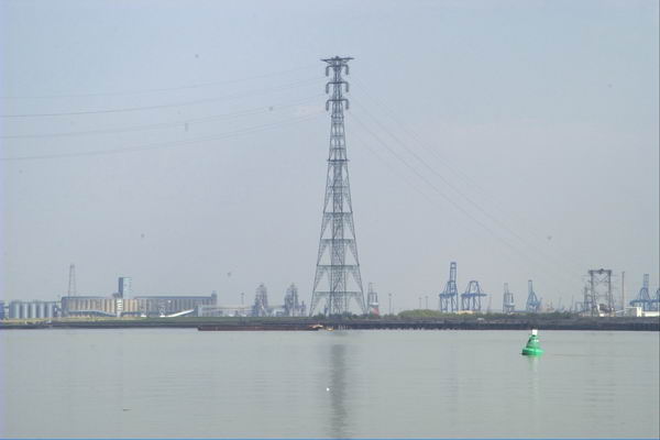
This is a wide and interesting stretch of the river, also crossed by a 400kV high voltage power line from Swanscombe, with the two 623ft pylons on each side being the tallest in Britain. The distance between the two towers is apparently 4,501 feet, around 0.85 miles or 1.37 km.

Pilgrims en route to Canterbury crossed the river from close by St Clement’s Church, taking to boat across to Swanscombe where the path up from the river is still the Pilgrims Road. But there was no boat available to me, so I turned inland into West Thurrock.

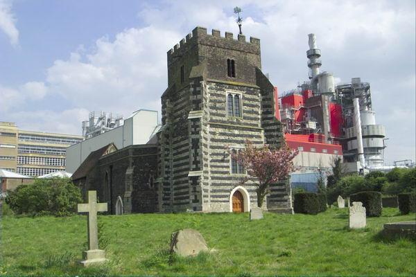
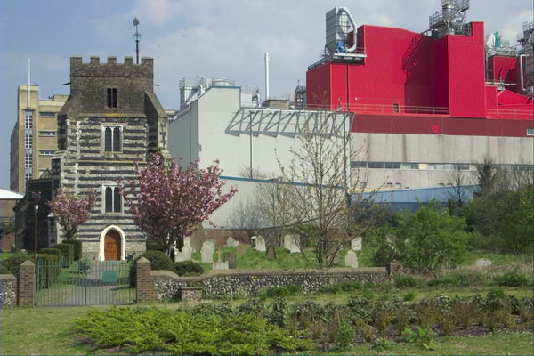
St Clement’s Church was Grade I listed in 1960 and parts at least are 13th century. It was used by a a youth unemployment scheme after regular services closed in 1977 and the interior was gutted, and after the project closed it was badly vandalised.

Dominating the church is the Procter & Gamble detergent factory begun here in 1940 and in 1987 when they were celebrating the company’s 150 years in business they took over the upkeep of the church which took 3 years to restore. The church, which was the location of the funeral in ‘Four Weddings and a Funeral’ is now open to the public once a month from April to September.

I can’t recall my route back along various roads to Rainham station, but there are a few pictures I took, mainly of the A13 and the Channel Tunnel Rail Link on My London Diary.

The Source of the Thames

The Source of the Thames
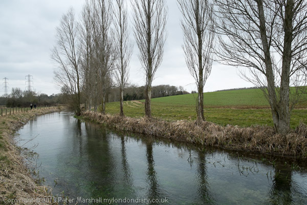
Thames Head – where the river is first visible

The Source of the Thames: Ten years ago today we were engaged on a very different walk to those I’ve been writing about in recent posts on my wanderings in London in 1989. Together with my wife and elder son we were about to complete our walk along the length of the Thames Path which had begun a couple of years earlier.

The Source of the Thames
Cricklade

Of course I’d walked along by parts of the Thames in and around London, out to Windsor and towards Reading and to the east all the way to rather remoter regions on the estuary beyond the end of the route over the years in piecemeal fashion, but around 2010 we’d bought a guide to the Thames Path and began walking and marking off sections in an organised way.

The Source of the Thames

The National Trails site says the path is 185.2miles (298 km) from its source in the Cotswolds to Woolwich. The path was first proposed in 1947 but it was only 49 years later that it was officially opened in 1996, though I’d walked a few sections and made some minor suggestions after the Ramblers released a draft for consultation a few years earlier.

Ashton Keynes

Some physical improvements needed to be put in place, with several footbridges needed to cross the river where ferries had long ceased operation, and there were also many negotiations with riverine land owners, angling groups and local authorities to allow access. Not all these were successful, and there are still lengths of the route which are less than optimal in the upper reaches of the river.

Neigh Bridge Country Park

According again to the site, the trail is “Easy to reach by public transport”, but that is only partly true. Even below Oxford there are some sections a mile or two from the nearest station or bus stop which adds significantly at one or both ends of a day’s walk, and once you get much past Oxford things become more difficult or impossible, certainly for those of us coming from the London area.

Old Mill Farm

The last reliable and reasonably frequent bus route from Oxford back in 2013 took us to Hinton Waldrist, a small village a mile or two from the path, and our day walks had ended there. For the final section my son had booked us into two nights accommodation on route between there and the source, at Buscot and Cricklade and we returned home at the end of our third day of walking from Kemble Station, a mile and a half from the source.

We had decided to make the walk in the week after Easter Sunday, which in 2013 was on March 31st and had begun on the Tuesday. On Thursday 4th April 2013 we left our hotel in Cricklade by 9am and after a short look around the town began the final day of our 3 day walk.

It was a cold day and there was still ice on some of the puddles. Our route guide – David Sharp’s ‘The Thames Path’ – told us we had 19.7km to walk to the source, but we had to do a little further as there was a diversion: “The Thames has changed course and is now flowing over the Trail, just inside Gloucestershire” a notice with a helpful map told us – and another 2.5km to the station. The guide was otherwise excellent, but would have been rather easier to follow had we been walking down-river as it suggested and described rather than in the opposite direction.

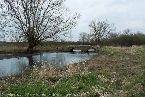
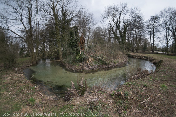
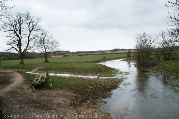
On My London Diary I described our route and day in some detail so I won’t repeat that here, and there are over 80 pictures from the day in the account. Perhaps some of them are a little misleading as I used a fisheye lens and made the river look as if it turns considerably more than its already rather twisty route. The were some long and rather boring sections too on which I took no pictures.

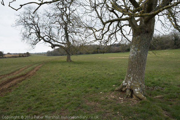
There was no river on the final section

Scenically this is one of the less interesting of the Thames Path sections, but it was important to complete the walk, even if the final section was completely dry. It was bitterly cold and would have been more enjoyable in warmer weather even though we were well wrapped up – and needed to take a short rest in a pub in Ashton Keynes in the middle of the day to warm up before continuing.

The dry spring – though Spring had been wet

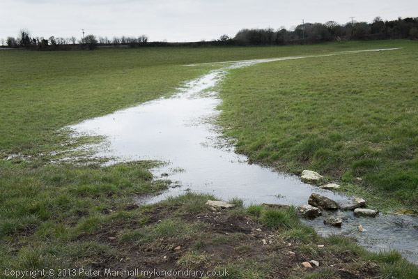
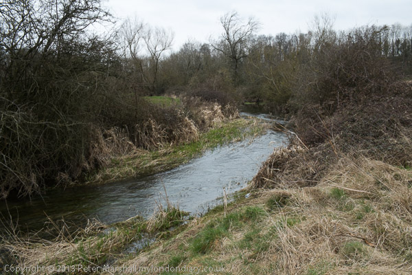
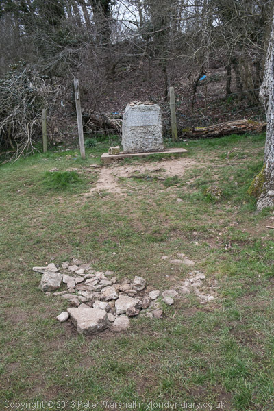
The source was something of an anti-climax. What is supposedly a spring with a stone marking it erected there by the Thames Conservators. I don’t know when water was last seen there, and others I know who have walked the river have all found it dry. The best I could find for some distance down the hill was a blue pipe on the grass – but there was nothing flowing from that either. There were some deep puddles in the mud by a gate some way down, and a larger one in the grass just above Thames Head, but it was only below the Fosse Way (A433) at Thames Head that a small stream became visible.

Kemble

We walked to Kemble station to find we had just missed a train and it was 50 minutes to wait for the next. There was what looked like a cosy waiting room but it was locked. It was far too cold to stand and wait on the windswept platform so despite our aching legs we went for a walk around Kemble before catching the first of three trains for our journey home.

More about the three days of our walk on My London Diary:

Thames Path: Cricklade to the Source
Thames Path: Buscot to Cricklade
Thames Path: Shifford to Buscot

King’s Cross Road – 1989

My walk around King’s Cross on Saturday 8th April 1989 continues in this post. The previous part was Winged Lions, A School, Thameslink, Wine, Buses

Kings Cross Road, Lorenzo St, King's Cross, Camden, 1989 89-4d-32
Kings Cross Road, Lorenzo St, King’s Cross, Islington, 1989 89-4d-32

140-142 King’s Cross Road on the corner with Lorenzo Street had a distinct style to it, with the two oval windows and some interesting brickwork. British History Online states “This five-storey office block is largely of 1991 but incorporates the front and side elevations of a tenement building of 1888” and the view from where I made this picture is still much as it was before the rebuilding.

The two terracotta panels facing Lorenze Street are still there and together give the date of AD 1888. The BHO article suggests the architect was probably W. Youlle who was the architect for a similar building on Pentonville Road. The ground floor was occupied by shops – bricked up and fly-posted in my picture – with rooms and a toilet on each of the upper floors.

Almost legible in my picture is a line of text above what had been a shopfront on Lorenzo Street which appears to read ‘B R E E D O M E T E R S’ though some letters are unclear and part obscured by the no-entry sign. Perhaps someone will be able to clear up this mystery.

Leeke St, King's Cross, Camden, 1989 89-4d-33
Leeke St, King’s Cross, Camden, 1989 89-4d-33

The buildings at 5-11 Leeke St have become the offices for the Paul Hamlyn Foundation, established by Paul Hamlyn in 1987; after his death in 2001 this became one of the largest independent grant-making foundations in the UK. At left is a doorway with the date 1890 and an arm in armour holding the butt of a broken spear, the Irish Foster family crest for the Foster Parcel Express Co. The conservation area document describes it as “a microscope emblem”.

Kings Cross Road, King's Cross, Camden, 1989 89-4d-35
Kings Cross Road, King’s Cross, Camden, 1989 89-4d-35

These buildings are still there but their uses have changed and the café is now a property management company. The fine block at 150-158 was being refurbished in 1989 and is now home to an advertising agency.

Again British History Online is informative and suggests it was a speculative development. Built in 1902–3 with what it describes as a ” mildly ambitious” facade, it says that 154 and 156 had goods hoists and winches, though there is no sign of them in my picture.

Kings Cross Road, King's Cross, Camden, 1989 89-4d-36
Kings Cross Road, King’s Cross, Camden, 1989 89-4d-36

Again the BHO article linked above tells us that this was built as an office, workshops and stabling in 1899–1900 and was from many years occupied by J J Connelly who probably built it. The wide doorway at left was for horses with a ramp leading up to stables on the upper floor. It was apparently still being refurbished when I made this picture as offices for Community Service Volunteers. The structure is still there but looks rather different as the striped window shades have been removed and the frontage painted a uniform white.

The taller building at right was the Mary Curzon Hostel for Women, built in memory of his wife for Lord Curzon in 1912-3 to provide inexpensive hostel accomodation for working women. Again there is a fuller description in the BHO article. When it was taken over by the LCC in 1955 it was renamed the Susan Lawrence Hostel.

Dodds the Printers, Kings Cross Road, King's Cross, Camden, 1989 89-4d-24
Dodds the Printers, King’s Cross Road, King’s Cross, Camden, 1989 89-4d-24

Dodds the Printers had these shopfronts at 193-5 on King’s Cross Road for many years and their signage shown looked like something from a different age in 1989. From around 2013 the shopfronts have been put to other uses but the printers still appear to be in business at the rear of the premises down St Chad’s Place, the alley through the doorway in this picture. I’d taken a few photographs in this alley in 1986, which show the signs for Dodds on the back of their property.

Kings X Radio Cars, Kings Cross Road, Kin Pentonville Rd, King's Cross, Islington, Camden, 1989 89-4d-11
Kings X Radio Cars, Pentonville Rd, King’s Cross, Islington, 1989 89-4d-11

I turned left onto Pentonville Road, and took a picture of these shops on the north side of the road, all of which are now a Pizza Restaurant, though not the same Italian snack bar as in my picture.

There is still a clock high more or less in the same position though that blank wall has now got four windows. The rectangular clock permanently at three minutes past four which had I think once advertised a businness here has been replaced by a slightly bulky circular one which appears to change with the hours.

I walked a few yards west and tuned right up Caledonian Rd where the next post on this walk will begin. The first post on this walk was Kings Cross, St George’s Gardens & More.


Kings Cross, St George’s Gardens & More

The day after my short trip to Canning Town the weather was again looking good and so on Saturday 8th April 1989 I was out again walking and taking pictures. This time my starting point was King’s Cross St Pancras Underground Station (not then International.)

Kings Cross, Lighthouse, Pentonville Rd, Gray's Inn Rd, Islington, Camden, 1989 89-4c-41
Kings Cross, Lighthouse, Pentonville Rd, Gray’s Inn Rd, Islington, Camden, 1989 89-4c-41

Immediately on coming out of the station I crossed the Euston Road and took a photograph looking across the busy junction between Pentonville Road and Grays Inn Road. Later this was to be transformed into the death trap for cyclists it now is, after the road engineers were told to ignore cyclists in planning the junction, and I’ve photographed a number of protests there. In the past ten years at least three cyclists have been killed and 15 seriously injured here.

Back in 1989 before the redesign it was almost certainly safer, as traffic here was usually moving rather more slowly – and in my picture I think is at a complete standstill.

The building at the centre of the image is the famous “lighthouse” whose presence has invited a litany of stories, almost all empty fabrication and speculation. But it seems that it was built between 1875 and 1885 to promote Netten’s Oyster Bar then doing a roaring fast food service at street level. Later the block became home to one of London’s best known jazz record stores, Mole Jazz, which opened at 374 Gray’s Inn Road in July 1978 – and I became one of its early customers, though I had given up buying records long before it closed in 2004.

The lighthouse seems in decent condition in my picture, but more recently deteriorated and became covered in graffiti. The building has recently been refurbished as the Lighthouse King’s Cross office space, with a top floor bar and roof terrace around the lighthouse itself.

Kings Cross Station, Euston Ed, Camden, 1989 89-4c-42

I turned around and took another picture, looking back at Kings Cross Station across Euston Road. The view here remained much the same until around 2021 when the more recent buildings in front of the 1851-2 station building, designed by Lewis Cubitt, the younger brother of both Thomas Cubitt responsible for much of London’s nineteenth century housing and William Cubitt, another important developer, who gave his name to Cubitt Town on the Isle of Dogs and later served two consecutive terms as Lord Mayor of London.

The station building is Grade I listed, and the recent changes have I think greatly improved it.

St George's Gardens, Sidmouth St, Camden, 1989 89-4c-32
St George’s Gardens, Sidmouth St, Camden, 1989 89-4c-32

There are many parts of London which it is hard to assign a name to, and the one I was walking around on this Saturday was one of them. My street atlas calls it ‘St Pancras’, I think it is part of Camden’s King’s Cross Ward, and when I’ve often walked across it from Tavistock Square I’ve always thought of it as Bloomsbury. Wikipedia has a rather lengthy discussion which says in part “Bloomsbury no longer has official boundaries and is subject to varying informal definitions, based for convenience“.

St George’s Gardens began in 1713-4 as a joint burial ground for St George-the-Martyr, Holborn (in Queen’s Square, now known as St George’s Holborn) and St George’s Bloomsbury and still has a line of stones marking the division of the area between the two churches, both of which had run out of space for burial in their churchyards. It was one of the earliest London burial sites situated away from the churches it served.

St George's Gardens, Sidmouth St, Camden, 1989 89-4c-34
St George’s Gardens, Sidmouth St, Camden, 1989 89-4c-34

But people kept on dying, and where buried here, mainly in unmarked graves. By 1885 there was no more room, and it was closed for burials. As a consecrated burial ground it could not be built on and burial grounds such as this were fast becoming the only open spaces in central London. “Campaigners including Miranda Hill and the Kyrle Society and Octavia Hill fought to create ‘outdoor sitting rooms’ to ‘bring beauty home to the poor’. St George’s Gardens were opened in 1884.”

St George's Gardens, Sidmouth St, Camden, 1989 89-4c-33
St George’s Gardens, Sidmouth St, Camden, 1989 89-4c-33

I made ten pictures here, of which three are online. The Friends of St George’s Gardens say that by 1997 the gardens were very run down, though I don’t think this is apparent in my pictures which show neatly cut grass and generally well-tended areas. The Friends were formed in 1994 when they say there had been a “prolonged period of neglect” and the gardens have been restored since then, with a lottery grant in 2001 and other and continuing work by the Friends.

Houses, Frederick St, Camden, 1989 89-4c-12

Frederick Street was one of those developed by Thomas Cubitt and Numbers 48-52 date from 1815-1821, a few years earlier than some of the other Grade II listed houses on the street. Before making this picture I’d also photographed (not online) on of his terraces in Ampton Street, parallel and a few yards to the south. Both run east from Greys Inn Road, where in later years I often visited the NUJ offices on the corner with Acton Street.

Royal National Throat, Nose and Ear Hospital Swinton St, Camden, 1989 89-4c-16
Royal National Throat, Nose and Ear Hospital Swinton St, Camden, 1989

Walking north up Greys Inn Road past the NUJ offices (now at ground floor Bread&Roses @ The Chapel Bar) the next corner a few yards on is Swinton Street, and a few yards down there is this five floor frontage of the Royal National Throat, Nose and Ear Hospital towering above the fairly narrow street.

This hospital remained in use until March 2020, when it was closed a few months earlier than planned due to Covid-19. Until then it was still offering inpatients ear, nose and throat (ENT) and oral surgery, sleep diagnostics and allergy day case services.

The hospital had been set up in 1874 as the Central London Throat and Ear Hospital by two doctors who had previously worked at the first specialist throat hospital in the country, the Hospital for Diseases of the Throat in Golden Square.

The hospital’s original building was begun on the Grays Inn Road in 1875, and various other buildings and wards were later added, with the hospital eventually covering a large site between here and Wicklow St. This rather odd building on Swinton Street was the Nurses’ Home, built in the 1930s.

More about my walk in later posts.


More From Bow Creek, April 1989

The second part of a short walk by Bow Creek on Friday 7th April 1989. The first part is at Bow Creek, East India Dock Way, April 1989.

London Sawmills, Bow Creek, East India Dock Rd, Canning Town, Newham, 1989 89-4b-15

I walked back a few yards to the west along the East India Dock Road and made this picture looking south down Bow Creek, again showing the stacked timber on the wharf. The closer of the two bridges visible was I think just a pipe bridge, probably to carry gas from the nearby gasworks from Poplar to Canning Town, and has since been removed.

The second bridge is a Dock Road Foot Bridge, more commonly called the Blue Bridge (a name it shares with several others in London), though it also carries pipes and is still in place. I think it was intended to provide a route for people living in South Bromley to Canning Town station, and it leads to a bridge taking the footpath over the DLR, but unfortunately this has been almost permanently locked. It has been at least partly rebuilt since I made this picture

Hidden by this bridge a few yards further downstream and fenced off is another bridge, Canning Town Old Railway Bridge, long disused which was built to carry a single rail track over the river.

Pipe Bridge, Bow Creek, Tower Hamlets, Newham, 1989 89-4c-61

I walked on across Bow Creek and took this picture of the pipe bridge. As you can see it was well fenced off and although there were steps up and a footway across I could not access this.

All this brickwork on the Middlesex side of the river has gone, I think when the road bridge here was widened and a link road provided to the Limehouse Link tunnel but the brick abutment remains on the Essex side. The bridge was built to give sufficient clearance for navigation.

Pipe Bridge, Bow Creek, Tower Hamlets, Newham, 1989  89-4c-63
Pipe Bridge, Bow Creek, Tower Hamlets, Newham, 1989 89-4c-63

At the centre of the river I had crossed from Newham into Tower Hamlets. My street atlas names this area as South Bromley, but I don’t think anyone now knows where that is, as there is no station of that name, the DLR having decided on East India instead.

A few yards on along waste ground I made another picture showing the pipe bridge and the river, before turning back to the East India Dock Road. I made two exposures and I wonder if I may have chosen the wrong one to digitise as it is just slightly unsharp.

London Sawmills, Bow Creek, East India Dock Rd, Canning Town, Newham, 1989 89-4c-65
London Sawmills, Bow Creek, East India Dock Rd, Canning Town, Tower Hamlets, 1989 89-4c-65

Across the water you can see much of the planks produced by the sawmill on the wharf, as well as stacks on a further wharf downriver between the building around 50 yards away on land but half a mile downstream round what is now the Bow Creek Ecology Park. Behind the cut timber you can see part of the Pura Foods edible oils factory on the opposite bank of the invisible river, and above that the top of the flood barrier across the river on the other side of the factory.

Timber was for many years a major industry on Bow Creek and along the Lea Navigation, as the Surrey Docks just across the Thames was mainly a timber dock, with large timber ponds. Boats and barges would have brought huge trunks to sawmills such as this, and the cut timber was also mainly transported further on by barge.

Pura Foods, Bow Creek, Tower Hamlets, 1989  89-4c-52
Pura Foods, Bow Creek, Tower Hamlets, 1989 89-4c-52

I walked further east and used a short telephoto lens to make this image of Pura Foods. Their factory processing vegetable oils here at Orchard Place had grown considerably over the years, as had the smells from it, and many locals were pleased when the factory moved out in 2006.

Almost all of my pictures at this time were taken with a 35mm lens, giving a moderate wide angle view. The Olympus Zuiko lens I used was unusual in being a shift lens, allow me to move the optical elements relative to the film to give additional control over the perspective. It made it possible for example to photograph taller buildings without tilting the camera which would have resulted in verticals that converged.

Lens design has improved considerably since, and so have our expectations of lenses. Many of my pictures made then have a lack of critical sharpness at the corners which we would now find unacceptable. Digital imaging in particular means we now routinely look at images on a much larger scale on screen than the prints we used to make.

West Ham Power Station, Bow Creek, East India Dock Rd, Newham, 1989 89-4c-55

I crossed to the other side of the busy East India Dock Road, going along Wharfside Road under it, and made this view looking north up Bow Creek. As you can see the West Ham Power Station was then being demolished. This was the last in a number of power stations on the site since 1904, when West Ham Council built one here to power its trams. This was West Ham B, built in 1951 and it used coal brought up Bow Creek as well as coke from the neighbouring Bromley Gas Works.

Power production at the station dropped off from the late 1960s and it closed in 1983. By 1989 its two 300ft cooling towers had already been demolished and the rest of the station was following.

West Ham Power Station, Bow Creek, East India Dock Rd, Newham, 1989 89-4c-56

A second view shows more of the Newham (or Essex) bank south of the main power station building and the closer parts are again full of stacked timber.

Newham Council together with Tower Hamlets has plans for a number of new bridges in the area providing links across Bow Creek, at Lochnagar St, Poplar Reach near to Cody Dock and Mayer Parry connecting the Leven Road former gasworks site to roughly where the old power station was, now the SEGRO industrial park.

It had been a short and interesting walk and I made my way to Canning Town station for the slow journey home. Canning Town is much easier to get to since the Jubilee Line opened at the end of 1999.