The Source of the Thames

The Source of the Thames
Thames Head – where the river is first visible

The Source of the Thames: Ten years ago today we were engaged on a very different walk to those I’ve been writing about in recent posts on my wanderings in London in 1989. Together with my wife and elder son we were about to complete our walk along the length of the Thames Path which had begun a couple of years earlier.

The Source of the Thames
Cricklade

Of course I’d walked along by parts of the Thames in and around London, out to Windsor and towards Reading and to the east all the way to rather remoter regions on the estuary beyond the end of the route over the years in piecemeal fashion, but around 2010 we’d bought a guide to the Thames Path and began walking and marking off sections in an organised way.

The Source of the Thames

The National Trails site says the path is 185.2miles (298 km) from its source in the Cotswolds to Woolwich. The path was first proposed in 1947 but it was only 49 years later that it was officially opened in 1996, though I’d walked a few sections and made some minor suggestions after the Ramblers released a draft for consultation a few years earlier.

Ashton Keynes

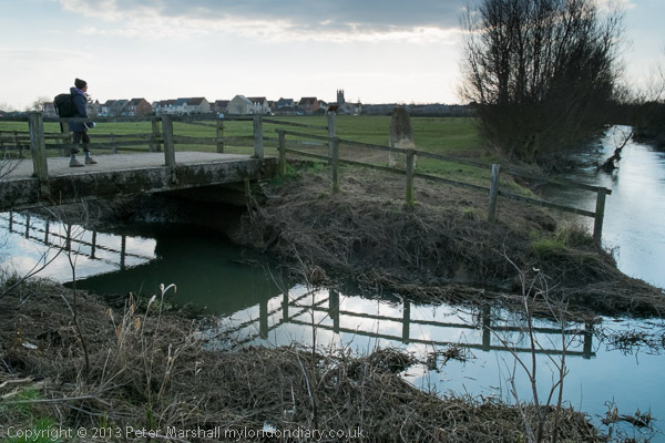
Some physical improvements needed to be put in place, with several footbridges needed to cross the river where ferries had long ceased operation, and there were also many negotiations with riverine land owners, angling groups and local authorities to allow access. Not all these were successful, and there are still lengths of the route which are less than optimal in the upper reaches of the river.

Neigh Bridge Country Park

According again to the site, the trail is “Easy to reach by public transport”, but that is only partly true. Even below Oxford there are some sections a mile or two from the nearest station or bus stop which adds significantly at one or both ends of a day’s walk, and once you get much past Oxford things become more difficult or impossible, certainly for those of us coming from the London area.

Old Mill Farm

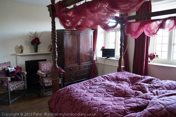
The last reliable and reasonably frequent bus route from Oxford back in 2013 took us to Hinton Waldrist, a small village a mile or two from the path, and our day walks had ended there. For the final section my son had booked us into two nights accommodation on route between there and the source, at Buscot and Cricklade and we returned home at the end of our third day of walking from Kemble Station, a mile and a half from the source.

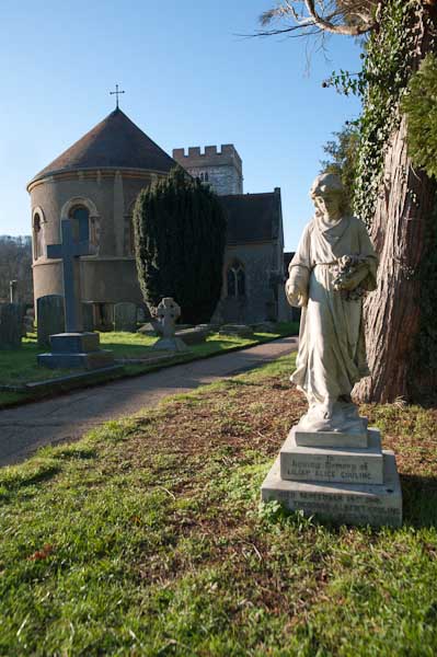
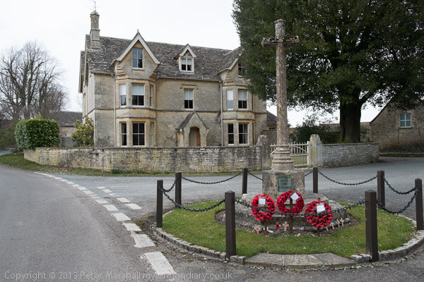
We had decided to make the walk in the week after Easter Sunday, which in 2013 was on March 31st and had begun on the Tuesday. On Thursday 4th April 2013 we left our hotel in Cricklade by 9am and after a short look around the town began the final day of our 3 day walk.

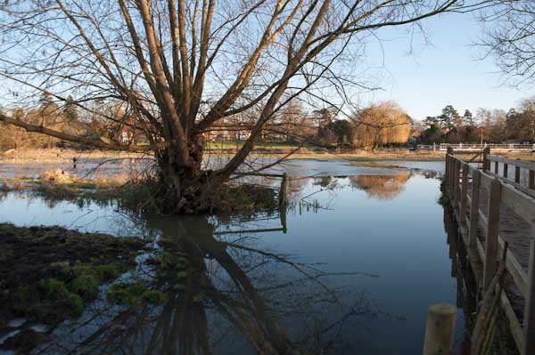
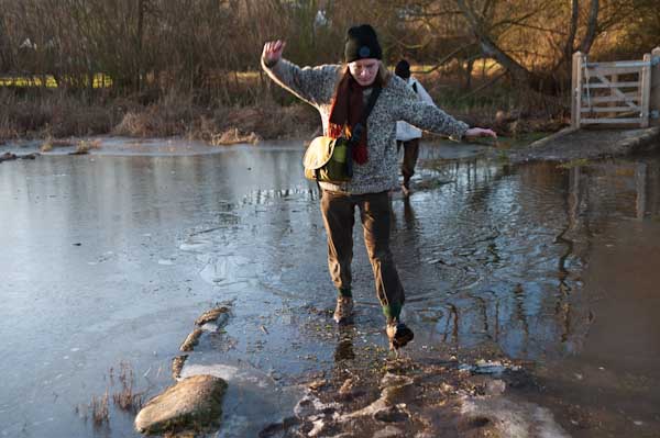
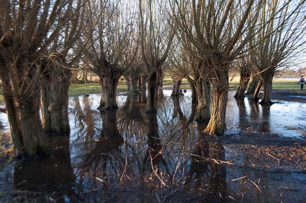
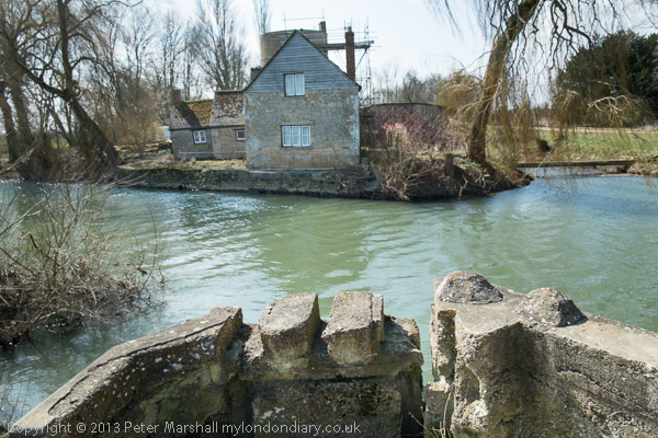
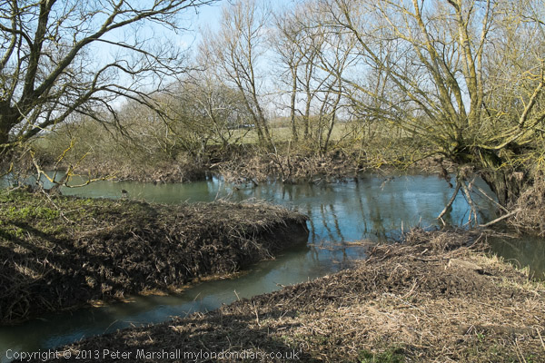
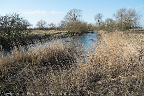
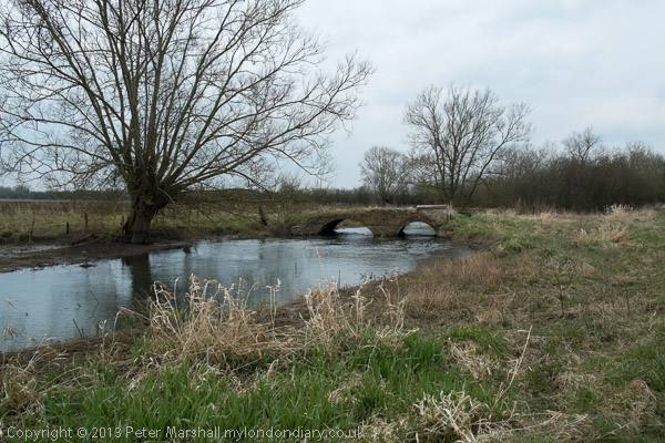
It was a cold day and there was still ice on some of the puddles. Our route guide – David Sharp’s ‘The Thames Path’ – told us we had 19.7km to walk to the source, but we had to do a little further as there was a diversion: “The Thames has changed course and is now flowing over the Trail, just inside Gloucestershire” a notice with a helpful map told us – and another 2.5km to the station. The guide was otherwise excellent, but would have been rather easier to follow had we been walking down-river as it suggested and described rather than in the opposite direction.

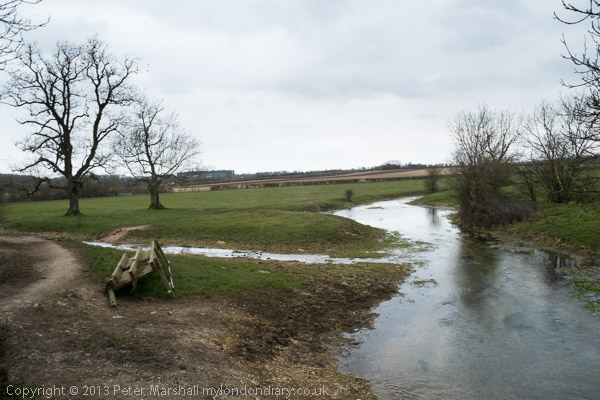
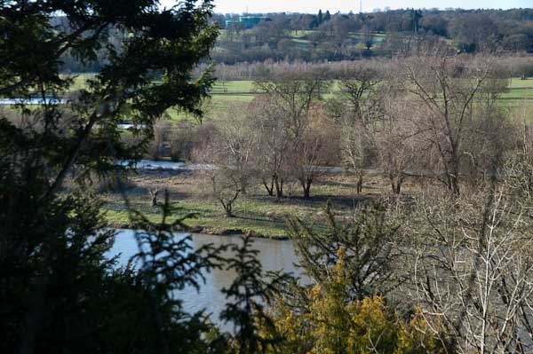
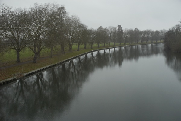
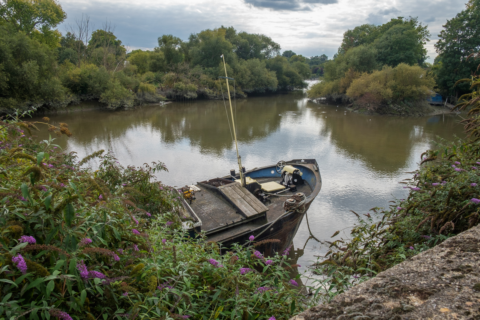
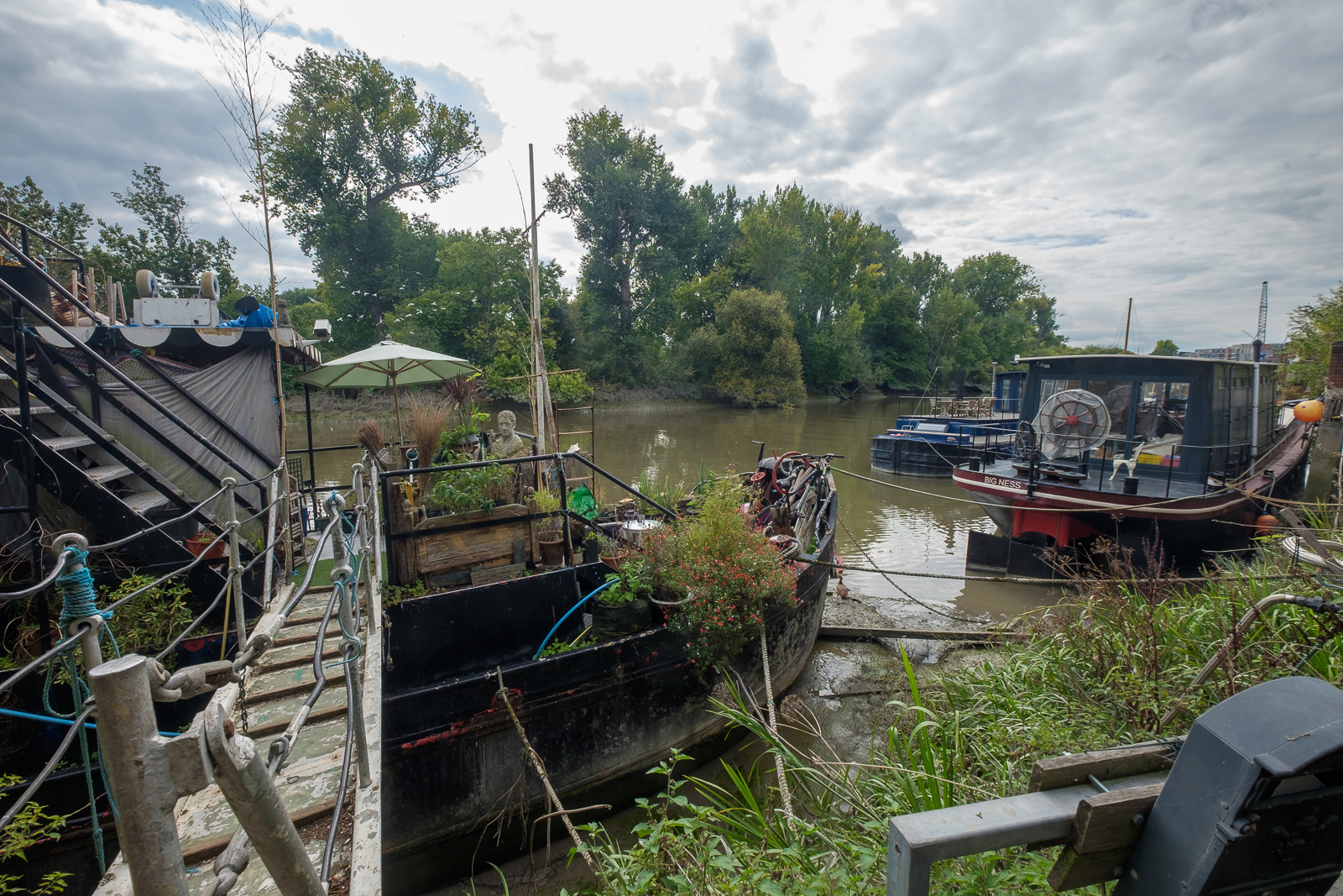
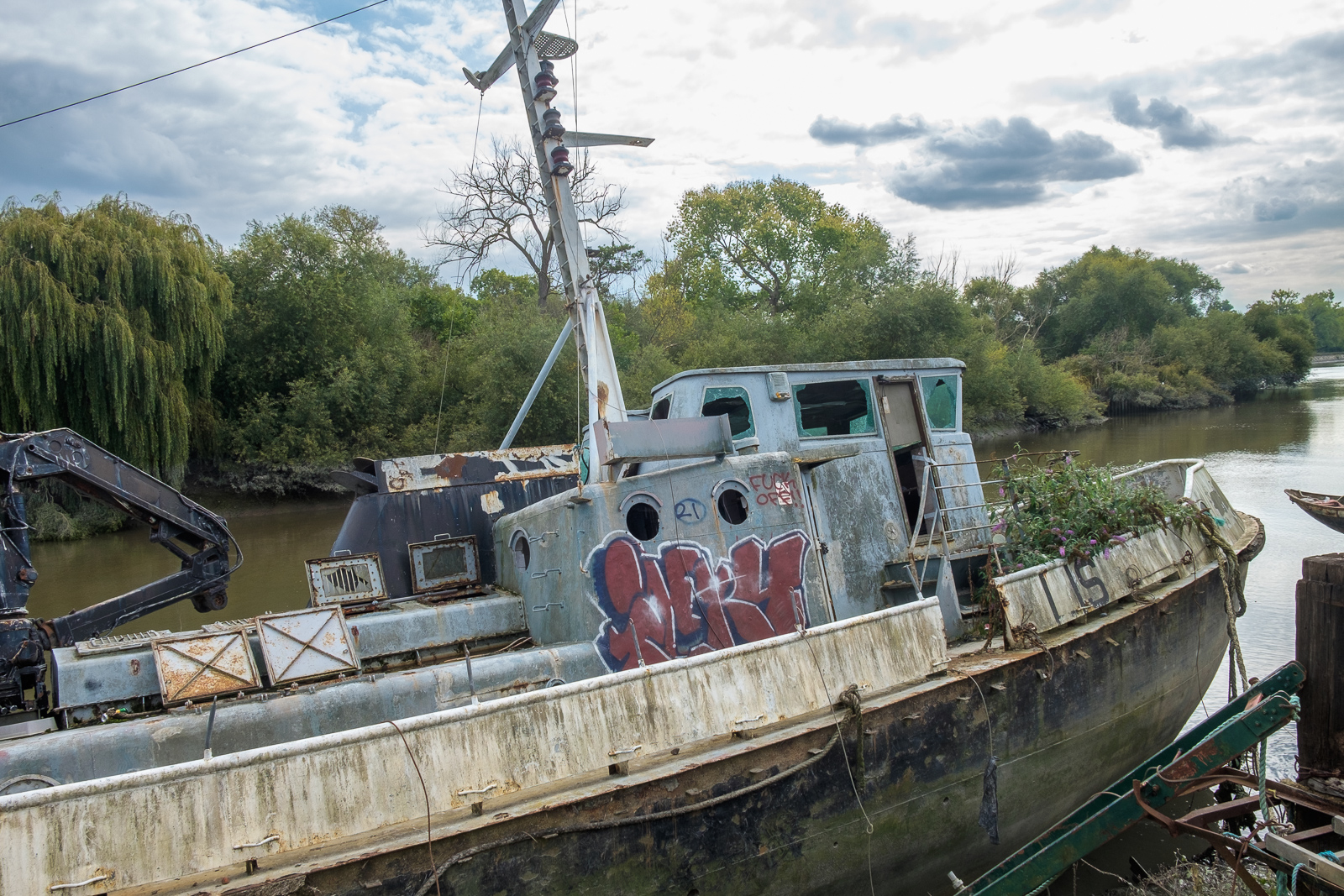
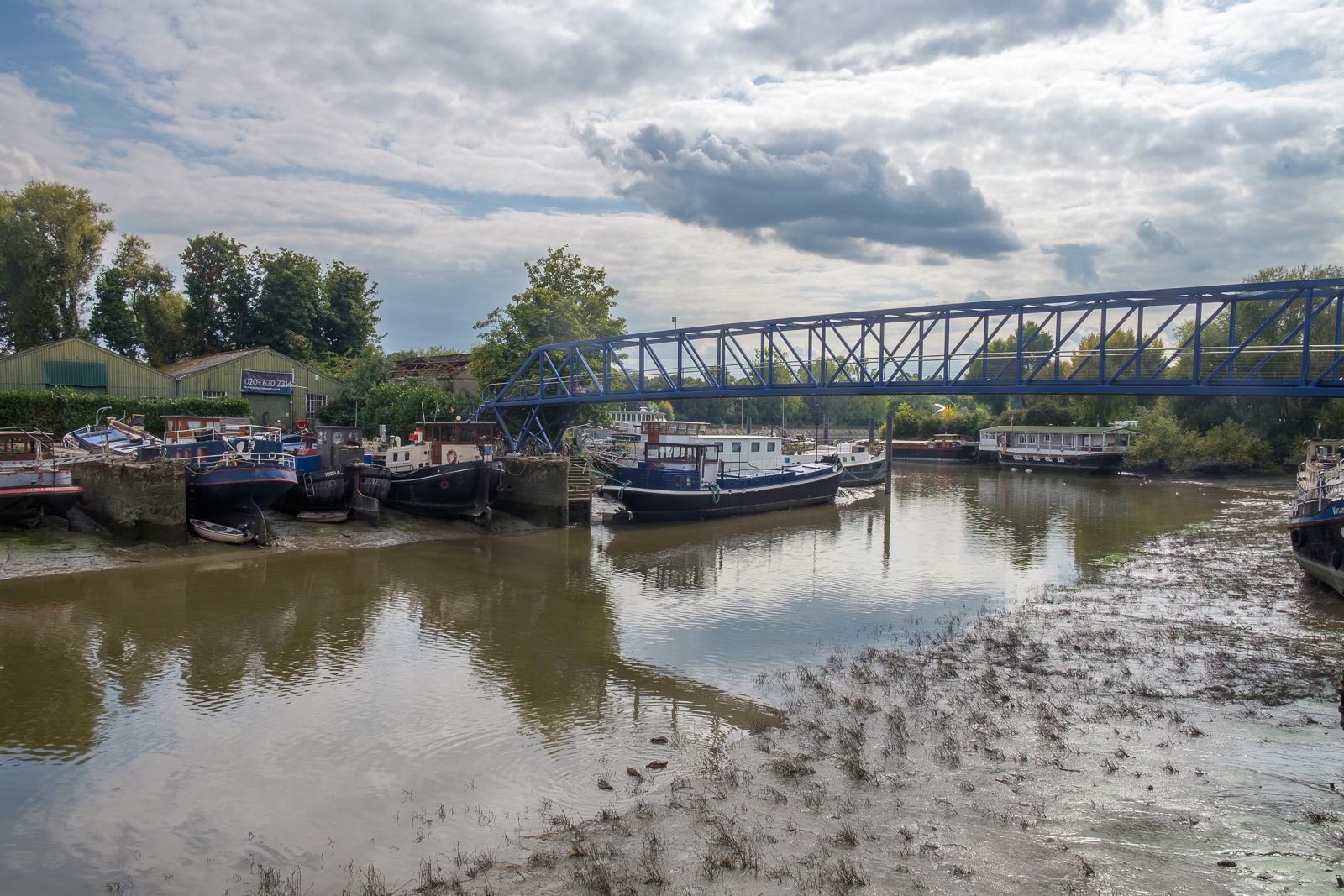
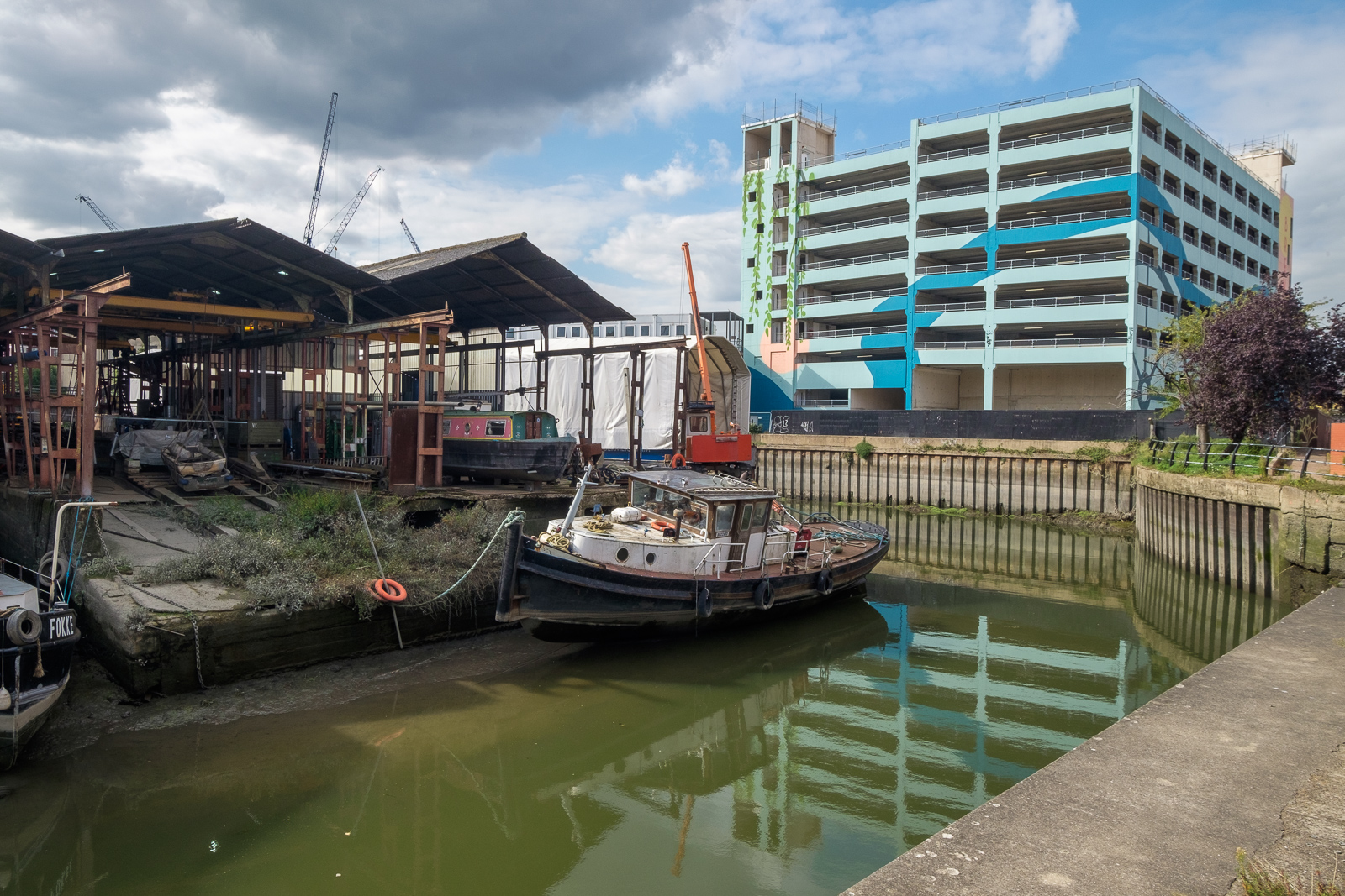
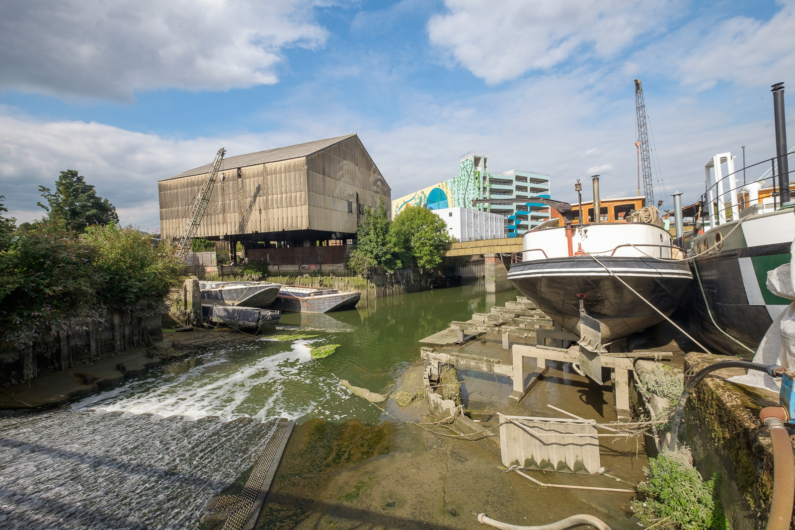
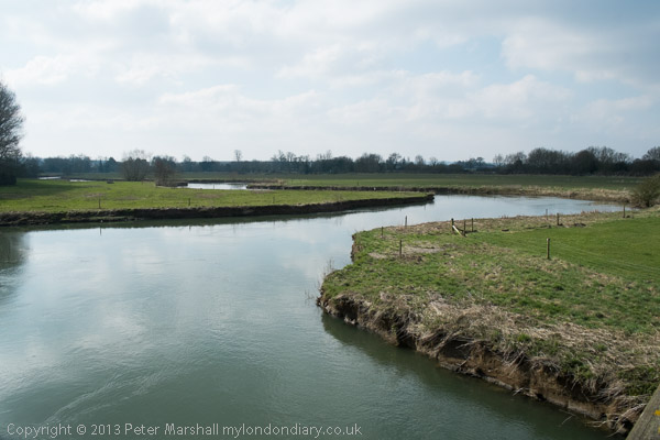
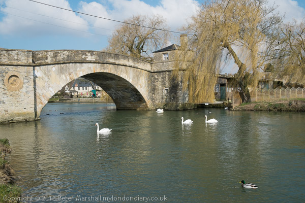
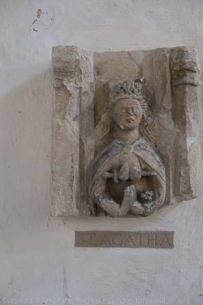
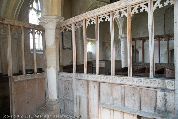
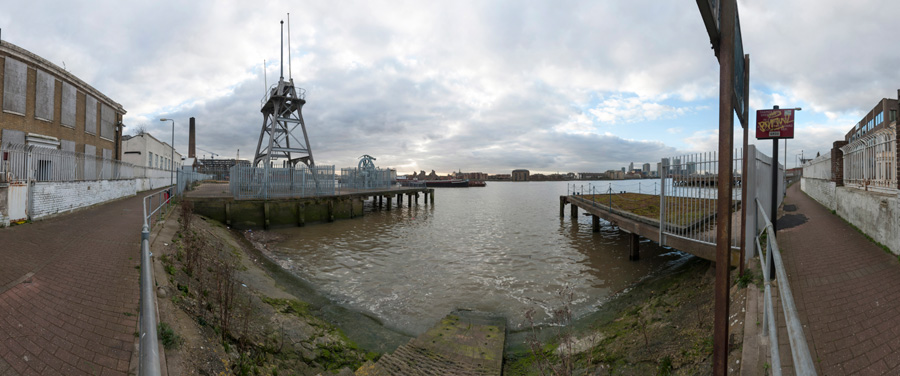
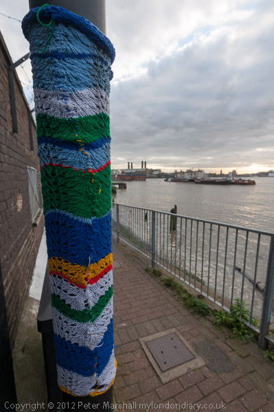
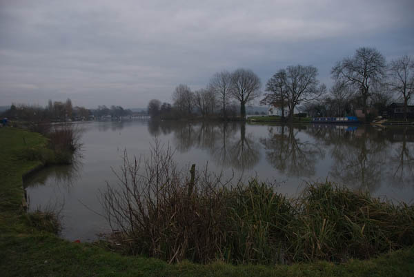
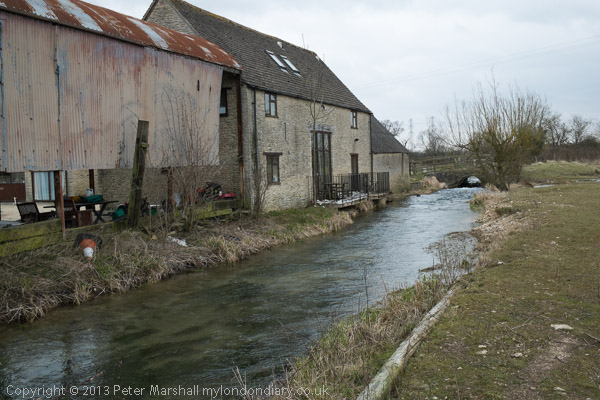
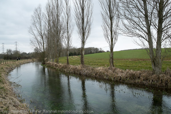
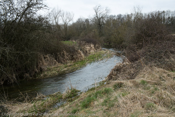
On My London Diary I described our route and day in some detail so I won’t repeat that here, and there are over 80 pictures from the day in the account. Perhaps some of them are a little misleading as I used a fisheye lens and made the river look as if it turns considerably more than its already rather twisty route. The were some long and rather boring sections too on which I took no pictures.

There was no river on the final section

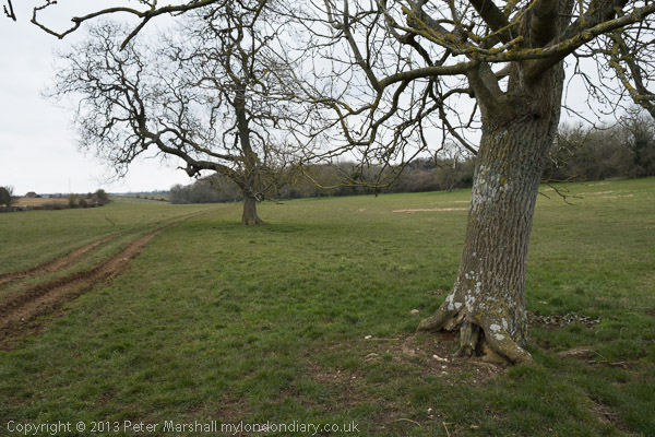
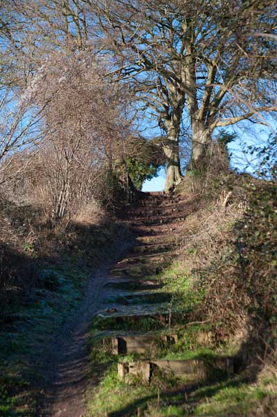
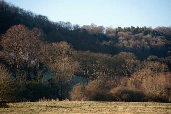
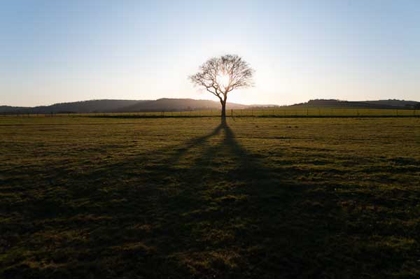
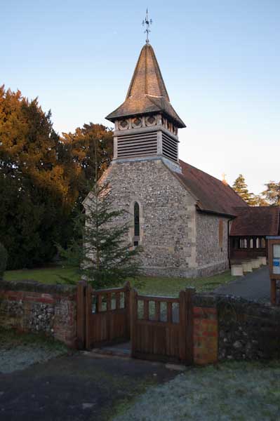
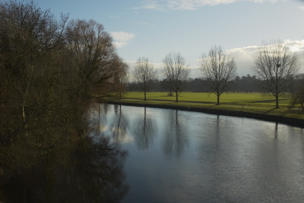
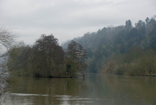
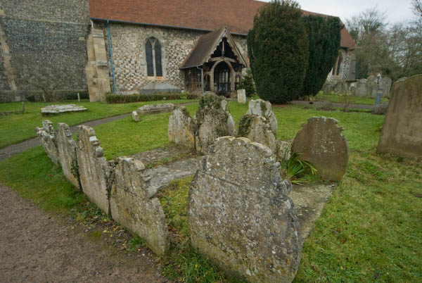
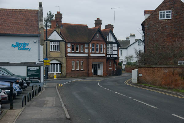
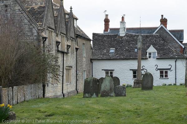
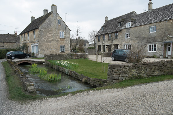
Scenically this is one of the less interesting of the Thames Path sections, but it was important to complete the walk, even if the final section was completely dry. It was bitterly cold and would have been more enjoyable in warmer weather even though we were well wrapped up – and needed to take a short rest in a pub in Ashton Keynes in the middle of the day to warm up before continuing.

The dry spring – though Spring had been wet

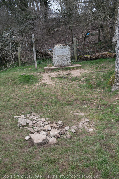
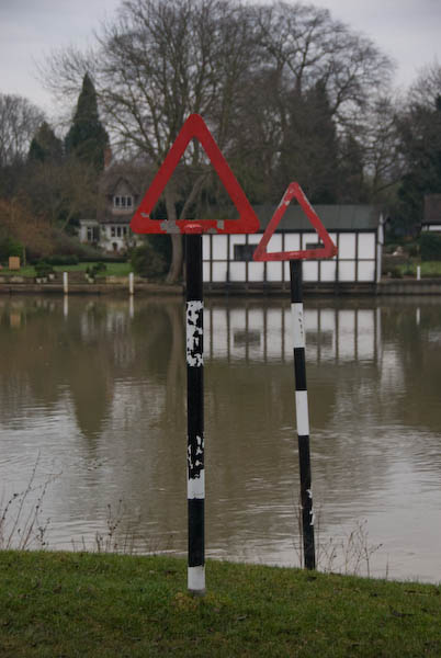
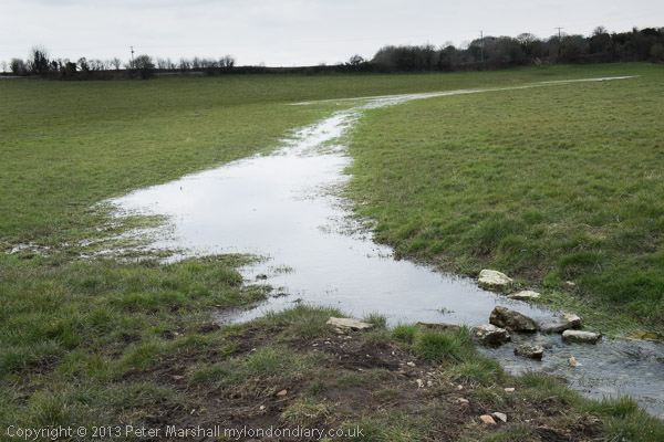
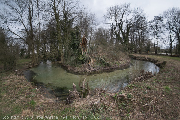
The source was something of an anti-climax. What is supposedly a spring with a stone marking it erected there by the Thames Conservators. I don’t know when water was last seen there, and others I know who have walked the river have all found it dry. The best I could find for some distance down the hill was a blue pipe on the grass – but there was nothing flowing from that either. There were some deep puddles in the mud by a gate some way down, and a larger one in the grass just above Thames Head, but it was only below the Fosse Way (A433) at Thames Head that a small stream became visible.

Kemble

We walked to Kemble station to find we had just missed a train and it was 50 minutes to wait for the next. There was what looked like a cosy waiting room but it was locked. It was far too cold to stand and wait on the windswept platform so despite our aching legs we went for a walk around Kemble before catching the first of three trains for our journey home.

More about the three days of our walk on My London Diary:

Thames Path: Cricklade to the Source
Thames Path: Buscot to Cricklade
Thames Path: Shifford to Buscot

Brandt and Battersea – 2023

Brandt and Battersea - 2023

Last Tuesday – 10th January 2023 – I went for a walk with a couple of friends, both photographers. The pictures here were all taken by me on our walk. We met at Tate Britain where the exhibition on Bill Brandt was entering its last few days – it finishes tomorrow, 15th January. We hadn’t bothered to go before as all three of us were very familiar with Brandt’s work – and had seen previous and larger and better exhibitions. I think both the others had heard him talking about his work, we had all watched him on film and all owned several of his books, had in various ways studied his work and taught about it. I’d also published some short pieces about him when I wrote about photography for a living. We didn’t really feel a need to go to another show, but it was free and it fitted in with a couple of other things we wanted to do.

Brandt and Battersea - 2023

While its good that the Tate was honouring one of Britain’s finest photographers, we all found the show disappointing, both for the rather odd selection of works and prints and for some of the writing on the wall. Much of Brandt’s best work was missing, and it was hard to see why some images were included, and some prints also seemed to be of rather poor quality. Possibly this show reflects the failure of almost all British museums in the past to take collecting photography seriously – or perhaps a lack of real appreciation of photography by the Tate.

Brandt and Battersea - 2023

Brandt began his work in an era when photographs were seldom put on walls for anything other than illustrative purposes – there was no art market in photography. His work was largely produced for book projects and for magazine commissions, and he made prints largely for the platemakers who would prepare the plates for printing. To see the real object of his work you have to look not at the ‘original prints’ but at their reproduction in books and magazines. The strongest point in this show was the glass cases in which some of these were situated. But while we were there few of the other visitors to the show paid them more than a passing glance, instead filing reverently around the spaced out prints on the wall, pausing to pay homage at each of them before moving to the next.

I found it a disappointing show, and if you missed it you didn’t miss much. Far better to spend your time on his 1977 book, Shadow of Light for an overall view of his work, still available second-hand at reasonable prices. And should you want to know more about the man and his influences (neither of which the Tate show concerned itself with) Paul Delany’s Bill Brandt – A Life provides more information than anyone could ever want.

We left the gallery, crossing Atterbury Road to examine Henry Moore’s Two Piece Reclining Figure No. 1 in a small courtyard of Chelsea College Of Art and Design before proceeding to pay a courtesy visit to the Morpeth Arms which proved more to our taste than the Tate Show.

Refreshed we made our way across the river to Vauxhall to meet the Thames Path, following this upriver to Battersea Power Station. Much building work is still going on, including the construction of the Thames ‘Super Sewer’ and there is a lack of signs to show the way in the area close to the power station, but soon we found a side entrance to the recently opened interior.

I’d visited and photographed the interior years ago when it was derelict and was interested to see what the architects had done with it. Basically it is now an upmarket shopping mall full of shops selling goods and services that might appeal to the idle rich and wealthy tourists. It also has a cinema, an expensive lift up one chimney to a viewing platform from which we have already seen countless similar views, and, perhaps the only useful thing so far as I was concerned, toilets.

The architects have retained the huge scale of the two turbine halls, but the higher areas of them are now cluttered with huge hanging mock strings of giant fairy lamps and baubles, which failed to appeal to me. It was only at one that an uncluttered wall of windows really took me back to the atmosphere of the original.

The earlier of the two turbine halls was remarkable for its art deco decorative details – the later hall plain and utilitarian. Although at least some of the deco detail has been retained (or recreated) it no longer seems to have the impact it had formerly, perhaps because do the much higher lighting levels, perhaps because of the hanging distractors. But it remains an impressive building.

I’d left my two younger but less active companions to rush around and see the whole building, going up as high as I could while they stayed lower down. By the time we found each other again they had seen enough and were fed up with the place, and we left to the riverside terrace, walking along to catch a bus on Queenstown Road. It was dusk on a dull and damp day and we made our way to a cheap meal at a rather cosy pub in Battersea for a glass or two of wine and a remarkably cheap meal before walking to Clapham Junction for our three different trains home.


Thames Path – Pangbourne to Cholsey

I grew up not far from the Thames, though rather more of my young days were spent playing in and around one of its tributaries, the River Crane both in the wilder areas of Hounslow Heath and to the north and in the rather tamer Crane Park, where I caught tiddlers, sticklebacks which were destined to die in jam jars, and learnt that small boys on bicycles were faster than irate whistle-blowing park keepers.

Thames Path - Pangbourne to Cholsey

But the river was there, a formidable barrier protecting us in Middlesex from the wilds of Surrey, though we occasionally crossed it on bridges and ferries, perhaps to go to Kew Gardens in search of plant specimens. This was before the days of garden centres, and my father, a keen gardener carried scissors in his waistcoat pocket and would occasionally take a small cutting from gardens as we walked past or visited, or find seeds. Gardeners where we lived didn’t buy seeds – they saved them and swapped them with others.

Thames Path - Pangbourne to Cholsey

And the Thames was the river where I learnt to swim, if only badly, with a paddling pool and a swimming area with a springboard in the riverside park, The Lammas. Later I learnt to row at Isleworth, in a heavyweight Sea Scout boat – and we swam there too, despite the filthy oily state of the mud and water.

Thames Path - Pangbourne to Cholsey

Older and wiser I kept to the riverside paths, walking them both in Middlesex and Surrey and also out to the east of London, sometimes taking my family with me, but also on walks with other photographers and on my own. And when plans were being made in the 1980s for a Thames Walk I made a few suggestions on the proposed path of what in 1989 became the Thames Path.

Far more of the river in London is now accessible to the public than back in the 1970s and 80s when much of the riverside was still a working area, though many of the wharves were derelict. But as I found when I joined a small group led by a Tower Hamlets official with responsibility for footpaths, parts of the path on the north bank were still not always easy to access, with developers and residents erecting gates and barriers and making some parts appear private. Some years later The Guardian in 2015 published Privatised London: the Thames Path walk that resembles a prison corridor which showed that little had changed.

But like many others, my family has now walked the Thames Path, from the Thames Barrier at Charlton to the source in Gloucestershire, as well as some way to the east along both shores. Most of the path proper is readily accessible by public transport and can be done as a series of one-day walks, travelling and returning from from our home in Staines or from London. But for the final three days of walking we had to spend a couple of nights in hotels on the route.

At Streatley the path goes through a small lake

At the start of 2010, we spent both New Years Day and January 2nd walking two short sections of the walk, from Reading to Pangbourne on Friday 1st and returning to Pangbourne on the Saturday to walk to Cholsey. Both Cholsey and Pangbourne have stations with trains to Reading, so access was easy, although Cholsey station is over a mile from the Thames Path.

The pictures here are all from Saturday 2nd January, on what is perhaps the most scenic stretch of the Thames Path. It was a bitterly cold day, which was perhaps as well, as the parts of this section would have been very muddy and a little flooded. But the mud was frozen and most of the ice on the flooded parts was thick enough to take our weight. It was more pleasant walking across the ice than it would have been wading through the few inches of mud and freezing water, almost certainly just deep enough to overtop my walking boots.

At the start of the walk from Pangbourne, after crossing the river the path climbs a little up a ridge, with occasional views through the trees across the valley. It then goes down to the riverside again, passing under one of Brunel’s fine brick bridges for the GWR to the Goring Gap, where the Thames runs between wooded hills. Goring itself is the kind of place I like to avoid, though I’m sure it has its charms, but I’ve always seen it as a kind of playground for the self-satisfied rich. We crossed the river to Streatley on the south side, a village owned by Oxford Brewery owners the Morrell family until they sold it in in 1938. They had protected it from development.

It was here that we found the worst flooding on the path, and almost took one look at a gate leading on to a lake and turned round – we could have ended our walk here and returned to Reading from Goring station. But eventually we decided the water couldn’t be too deep and perhaps the ice might hold our weight and we went on. I think we all got wet feet.

There were more icy bits on the rest of the walk, but nothing quite so bad, and we continued our walk along the Thames Path. Unfortunately at Moulsford the path leaves the river – the towpath switches to the opposite bank, and although this is a Ferry Lane, the ferries are long gone. Moulsford would be a pleasant enough village were it not on the A329, and the one kilometre trek along this relatively busy road was tedious, though we did make a short diversion to see the parish church.

Our walk along the Thames Path ended when this left the road to return to the river, but we had further to go before turning off onto a footpath on our way to Cholsey station, adding another mile to our walk.

More on My London Diary at Thames Path including our walk on the previous day from Reading to Pangbourne.


Boxing Day Walks (and Rides)

Boxing Day Walks (and Rides)
Waterworks, Wraysbury

Our Boxing Days here have followed a similar pattern for a few years now, at least in those years where we’ve stayed at home rather than visiting family elsewhere. We get up, have breakfast and then get ready to go out for a walk. We walk from our home to a mid-day meal with my sister and other family members, in recent years at a pub close to where she lives. Then a leisurely wander to her house for tea. And rather later going home, though so far we’ve not had to walk back.

Boxing Day Walks (and Rides)
Boatyard at Runnemede

Partly we walk because there is little if any public transport on Boxing Day. We could cycle, but the roads are more rather more dangerous than usual thanks to motorists with a higher than usual alcohol level, and also because I like to have a glass or two myself with my boxing day lunch, though it would be easy to do the journey almost entirely off-road. Perhaps this year we will cycle, the weather forecast isn’t too bad.

Boxing Day Walks (and Rides)

The walk is at least five miles. In the past we used to often take longer and sometimes hillier routes to give us a little more exercise. Now we sometimes stop on the way for coffee at one of the few cafés that are open. The walk helps to get up an appetite for another large meal after our minor over-indulgences the previous day. Years ago we often went out for another walk before our late afternoon tea, but others in the family are now too old for this.

Oakley Court

St Mary Magdalene, Boveney,

Of course I take a camera with me, and take pictures on the way, as well as sometimes some family pictures during the meal and after, though these I seldom share outside the family as they have very little interest for others.

Windsor Racecourse

So earlier I spent some time looking for my pictures from boxing day walks in earlier years to post today. These pictures come from a rather longer journey on 26th December 2005, when we cycled a few miles further along the River Thames than necessary before turning back for our lunch.

Home Park from Albert Bridge

I first posted some pictures from this walk on My London Diary in 2005. Although that post describes it as a walk, from the distances involved and the EXIF times we must have been on our bikes. And had a very late lunch.

This is a slightly different collection; all pictures were made with a Nikon D200 DX format DSLR.


Kew, Brentford, Syon & Isleworth Walk

Part 2 Syon and Isleworth

Kew Bridge, Brentford, Syon & Isleworth

A public footpath, now also on the Thames Path, leads from Brentford across Syon Park to Isleworth. Its a longish stroll with parkland on one side and at times just a high wall on the other, but does pass several historic buildings, though you would need to pay the entrance fee to the gardens and great conservatory to see most of them well. The estate is still privately owned and permission is needed for any filming and photography within the park.

Entry is free to the garden centre, and we went in to look at some of the buildings inside as well as to use the toilets. They also have a cafe and restaurant but we didn’t stop. Much of the garden centre was once the Riding School.

I wasn’t feeling well as we walked though here – still perhaps suffering from the virus which I’d had a couple of weeks earlier. So I didn’t feel much like taking pictures as we walked though. But I hadn’t found much I thought worth photographing on previous walks through here, expect for the view of Zion House. This is on the flight path into Heathrow, and there is an aircraft in my picture coming in to land there.

Kew Bridge, Brentford, Syon & Isleworth

In my teens I was a Sea Scout in Isleworth, or rather a Senior Scout, and we theoretically went boating in the Thames here, though I think rather rarely. But this was also another route into Kew Gardens, with Church Ferry going across the names from by the corner of Parke Street and Church St. I also remember coming here to paddle and possibly even swim in the river, though it was pretty polluted back in the 1950s.

Kew Bridge, Brentford, Syon & Isleworth

Isleworth was also the place where I drank my first pint of beer, which I think cost 1s/5d or around 7p. Not at the London Apprentice, which we thought of as a rather snooty place for the nobs, but at a small pub further down Church Street which had few problems with serving under-age drinkers. It’s no longer there.

Kew Bridge, Brentford, Syon & Isleworth

We made it into the London Apprentice, sitting outside by the river for a drink, though still feeling ill I stuck to tonic. One of my colleagues found an excellent real ale, which I looked at longingly. It was a very pleasant place with a good atmosphere and friendly bar staff, so we stayed for another, and then thought the menu seemed fine and had a meal.

Kew Bridge, Brentford, Syon & Isleworth

Finally we made it out of the pub and continued along Church St to the Duke of Northumberland’s River, perviously known as the Isleworth Mill Stream. There were several mills which relied on the stream, including one close to here said in 1845 (by which time there were also a couple of steam engines on site) to be the largest flour mill in England, Kidd’s Mill. This section of the river was built in the late 15th century for Syon Abbey, before the Northumberland’s built their house on the abbey site, and brought water from the River Crane at Whitton to augment a small stream which ran into the Thames at Isleworth.

Kew Bridge, Brentford, Syon & Isleworth

But the River Crane couldn’t provide a sufficient and reliable supply of water, and in 1530 a new section of the river was dug from Longford to take water from the River Colne. This merges with the Crane close to Baber Bridge on the edge of Feltham, though there are then separate channels across Hounslow Heath and through Crane Park before the eastern section of the river diverges. I played around, paddled and fished in much of this as a boy.

Kew Bridge, Brentford, Syon & Isleworth

The walkway beside this small river on its last few yards into the Thames was closed, but a nearby alley took us to to the riverside opposite Isleworth Ait. At Swan Street we made a brief detour to admire the Grade II listed Old Blue School built in 1842 and now converted into expensive flats, before returning to the riverside. The tide was low and there was almost no water in places here, and we watched as a man left work at the boatyard and walked across the mud to his works van parked by the river.

Kew Bridge, Brentford, Syon & Isleworth

We continued through a small park area, once part of the grounds of the Catholic Convent Nazareth House, until the Thames Path we had been following took us out onto Richmond Road. Here we left the Path, turning right onto Richmond Road and then going down Queen’s Terrace to Kings Terrace, walking north to turn down Byfield Road.

Kew Bridge, Brentford, Syon & Isleworth

Where this turns to the left we stopped to admire the small 1885 Elizabeth Butler almshouses, almost missing behind us the finely decorated May Villas from a similar era before taking the alley to Twickenham Road. Here next to the bus stop where our walk ended was the house with its blue plaque informing us ‘VINCENT VAN GOGH the famous painter lived here in 1876.” The bus came before I had time to make a photograph. It will still be there the next time I’m in Isleworth.


Kew, Brentford, Syon & Isleworth Walk

Part 1 – Kew Bridge and Brentford

My walk a few days ago in September 2022 began at Kew Bridge Station. I’d come half an hour before I was due to meet my two companions to take a short walk around one of the newer parts of the area before meeting them for a longer walk to Isleworth.

Lionel Road runs north of the railway up to meet the Great West Road. It used to be a rather run down area with railway sidings on one side and a few old commercial buildings and works to the north. The last time I’d walked down here on my way to Gunnersbury Park in 2018 the whole area had been a building site, but now is home to Brentford FC, currently doing pretty well in the Premier League.

Brentford was my local team when I was a kid, and several members of the award-winning under-11 team I played for at left back on went on to play for them at their old ground (and at Chelsea.) One of the other patrol leaders from my scout group stayed there until he retired, though I never met him after I hung up my woggle, but read his obit in the local rag.

Past there I came to the Great West Road, a 1930s dual carriageway with cycle tracks I sometimes used further west on my way home from school. In the 1980s or 90s I photographed most of the remaining Art Deco factories along it, though the bulldozers got to some first. Now it reminds me of J G Ballard’s novels, particularly ‘Crash’, set around the area we both lived in, with the elevated M4 above the older modern road.

A new Brentford of tall blocks has sprouted here, though more land remains to be built on. A little-used rail line goes through it, the Kew Curve, with Brentford’s stadium replacing the sidings and cattle pens to its west, with new building on the east in what was Brentford Market. It moved to this site in 1893 after the Brentford Local Board had bought the 2 acre site from the Rothschild estate because market trading in the area around the Express Tavern immediately south of the station which had developed informally away from Brentford’s traditional market in Market Place had become a public nuisance. The site was extended in 1905 and then covered land now part of the Chiswick Roundabout. The market moved to the edge of Southall in 1974 as the new Western International Market and the Fountains Leisure Centre was built on part of the site, with the rest staying derelict for years.

My maternal grandfather, then a market gardener in Feltham, would drive his cart with produce to Brentford Market in the early years of the last century, past the house in Hounslow where my father, then a young boy, used to see him driving past. Around twenty years later when he became engaged to my mother he found out who he was.

I met my two colleagues and we walked together down by the west side of Kew Bridge to the Thames. To our right was where the Kew Bridge Ecovillage had squatted from June 2009 until May 2010, now occupied by 164 flats, a business centre, gym and pub.

The Hollows runs west between riverside moorings and recent blocks of luxury flats, eventually returning us to Brentford High St, and a park beside the river now called Watermans Park. This was the site of Brentford Gas Works which straddled the High Street here and was a great attraction when we took the bus through it in my childhood, usually on our way to Kew Gardens. Entrance then was only an old penny, and it was a cheap outing for families in the area. My father would have his scissors in his pocket and perhaps take the odd small cutting to grow in our garden. Rather cheaper than garden centres.

But if you were lucky as the bus drove slowly down the usually congested street, one of its Intermittent Vertical Retort would open sending a wall of red hot coke to the ground, quite an amazing site as we peered from the top deck. It almost made up for the smell.

A gas works had been set up here and began production in 1821, first supplying has for lighting the turnpike to Kensington, but later serving large areas around. Later other gas works were set up in Southall and then elsewhere as demand continued to rise. in 1926 the Brentford gas company became a part of the Gas Light and Coke Co which later became British Gas plc. Brentford Gas Woks closed in 1963 and the riverside buildings were demolished in 1965 though the large gasholder remained until 1988.

All than now remains of the gas works are some of the substantial posts of the gas works jetty, where colliers once brought in coal. There has been a long battle over the rights to moorings here between boat owners and Hounslow Council with boat owners claiming that the foreshore here belongs neither to the council nor to the PLA but to the Bishop of London, and refusing to abide by various eviction notices. Most have now moved but some derelict boats remain.

Brentford Ait runs along the centre of the river here. It was bought in the late 19th century by the Crown who planted trees on it to hide the gas works from visitors to Kew Gardens on the opposite bank. A few yard upstream is Lot’s Ait, where the Thames Steam Tug and Lighterage Company Ltd set up a boatyard in 1920 – most of the Thames lighters were built there. The boatyard closed in the 1970s, but was reopened in 2012 when a new footbridge was constructed to it.

As well as the park, the Watermans Arts Centre was also built on the gasworks site. We walked between it and the river, and continued on the riverside path, past the bridge to Lots Ait and recent blocks of flats. There are new moorings around here too.

A small spit of land leads from the bottom of Ferry Lane (more new flats) to an artwork by the riverside. I’m not quite sure what to make either of Liquidity or another similarly decorated column not far away, but it could provide a useful windbreak in bad weather. This was where once a ferry ran across to Kew Gardens.

We followed the Thames Path around a small dock, on what was the site of the Thames Soap Works and then continued along the side of the River Brent which flows into the Thames here, continuing along this beside the winding river past another boatyard to Brentford High Street.

A few yards along we turned left down Dock Road to Thames Lock, past a huge mural and the other end of the boatyard, to Thames Lock, the southern end of the Grand Union Canal. Here we took the path beside the north side of the canal, leading across a bridge over the Brent to Johnson’s Island and Catherine Wheel Road.

The mural, on the side of a multi-story car park had included a giant kingfisher, and I’d joked saying this was the only kingfisher we’d see in Brentford. But as we walked across the bridge over the River Brent and stopped to take pictures, perched on the top of a post there was one, still only for a second before flying out of sight. By the time I’d raised my camera to my eye it was gone, though since I had and extreme wideangle lens it would hardly have been visible, just a few more colourful pixels.

I’d planned to walk along Brent Way and rejoin the canal towpath, but the whole of this area is now a huge building site, and instead we walk along the High Street to the canal bridge. I couldn’t bring myself to walk down to the Gauging Lock preserved there, though I’ve done so several times before, but the changes to the area, now with a marina, flats and hotel made me feel too sad; we simply stood on the bridge and looked for a while before moving on.

Part 2 will continue the walk from here to its end in Isleworth. You can see more pictures from the walk in a Facebook album.


Old Father Thames – Buscot to Cricklade

Old Father Thames – Buscot to Cricklade Nine years ago on Wednesday 3rd April 2013 I was walking the Thames Path with my wife and elder son, who had planned a three day walk along the upper reaches of the river as a birthday present for my wife. Her birthday is in the depths of winter but we thought the start of April might have better weather.

Old Father Thames - Buscot to Cricklade
St John the Baptist at Inglesham, saved by William Morris from the threat of Gothicist ‘restoration’

We’d walked the lower parts of the Thames path and further out towards the estuary in a number of day walks, travelling by public transport to suitable starting points and back home at the end of the day. This had got us as far as Duxford, a short walk from the end of a bus route to Hinton Waldrist, 9 miles southwest of Oxford, west of where public transport to places close to the river is sparse and journey times from home too long.

Old Father Thames - Buscot to Cricklade
The room next to ours at Buscot Manor; ours was plainer but very comfortable

So we had booked two nights accommodation to allow us to complete the walk, ending at the source which is close to Kemble station from where trains would take us home via Swindon and Reading.

Old Father Thames - Buscot to Cricklade
Meanders make the journey longer

On Tuesday we had set off early to take the train to Reading where we changed for Oxford and then found the bus to Hinton Waldrist. By the time we got within five miles of the village we three and the driver were the only passengers. It had been just below zero when we set out but had warmed up a little and the sun was shining as our walk began. You can read more about the days walk and see pictures at Thames Path: Shifford to Buscot. I’d finished the day in which we had walked around 15 or 16 miles totally exhausted, but a good soak in a hot bath had eased some of my aches and pains.

Old Father Thames - Buscot to Cricklade
Old Father Thames

Wednesday we were up early for breakfast, having slept well at Buscot Manor, though we hadn’t paid the extra for a room with a four-poster, though I did take a photograph of one. Breakfast, shared around a large table with the other guests, was enormous and it was hard to get up from the table and begin our walk.

Old Father Thames - Buscot to Cricklade
Ha’penny Bridge in Lechlade

Being gluttons for punishment as well as at the table we started the day by deliberately going in completely the wrong direction to make a tour of the village, now largely owned by the National Trust before rejoining the Thames Path.

Old Father Thames - Buscot to Cricklade
St Agatha in St Lawrence’s Church, Lechlade

At St John’s Lock we found Old Father Thames, made in 1854 for the Crystal Palace and later moved to Thames Head but relocated here as protection against vandalism. At Lechlade, this is the highest lock on the Thames, which is theoretically navigable as far as Cricklade, though few boats now go beyond the Halfpenny Bridge in Lechlade.

Old Father Thames - Buscot to Cricklade
The entrance to the Severn & Thames Canal

We spent some time in Lechlade, buying sandwiches for our lunch, then looking around the church before my companions mutinied and dashed into a tea-shop and I had to follow them. We wasted some time there before we walked out and carried on towards Inglesham. The area around here was perhaps the highlight of the whole walk, but our delay in Lechlade meant we couldn’t stop long enough to properly examine the mouth of the River Coln and entrance to the Thames and Severn Canal and the first bridge over the canal on our way. The canal was abandoned in 1927 though parts have now been restored.

Old Father Thames - Buscot to Cricklade
St John the Baptist, Inglesham

The real gem of the walk is the Church of St John the Baptist at Inglesham, a splendid medieval survival thanks to the efforts of William Morris, who along with his pre-Raphaelite friends founded the Society for the Protection of Ancient Buildings (SPAB) or ‘Anti-Scrape’ to oppose the gothicisation of buildings such as these. But past here the walk deteriorates, with a mile and a half beside a busy road and a further 2 mile road walk “offering no scenic attraction at all“.

Old Father Thames - Buscot to Cricklade
A rare glimpse of the Thames , our first since Inglesham

It might have been better if the Thames Path had taken a detour along the Thames and Severn Canal. As the Rambler’s Association noted in their 1977 Survey, the county councils “suggested a new footpath creation to follow the river from Lechlade to Cricklade but objections, primarily from farmers and anglers, led to the abandonment of this concept.” They comment that the Thames path here “is in places so dull or dangerous that it begs the question whether objections from landowning or angling interests should always be allowed to override the need for providing a simple public amenity.”

Old Father Thames - Buscot to Cricklade

It’s only in the final mile or three into Cricklade that the walk comes alive again, rejoining the river and giving a glimpse of what the Thames Path in this region should be. We made our way to the White Hart, the principal inn at Cricklade since the time of Elizabeth I, though our room was in a modern extension at its rear. There was still just a little time to explore the town, basically a single street, before settling down to a decent Indian meal a short distance from the hotel.

Old Father Thames - Buscot to Cricklade
Cricklade seen across a meadow from the path

You can read about the final day of the walk, where there were detours due to flooding and flurries of snow in a bitter wind before we reached the end, on my London Diary. Here are the links to all three days of our walk, which I’m glad we did then as I don’t think I could make it now.

Thames Path: Cricklade to the Source
Thames Path: Buscot to Cricklade
Thames Path: Shifford to Buscot


A Threatened Hospital, Riverside Walk, Syria & Mali

A Threatened Hospital, Riverside Walk, Syria & Mali – pictures from nine years ago on February 15th 2013.

Fight to Save Lewisham Hospital Continues

My work began at a lunchtime rally opposite Lewisham Hospital where the whole local community is fighting to save their hospital with both a legal challenge and further mass demonstrations including a ‘Born in Lewisham Hospital’ protest a few weeks later. Parts of the hospital across the main road are in the picture.

People were appalled by then Health Minister Jeremy Hunt’s decision to accept the proposals for closure, and to ignore the mass protests by local residents. Not only are the proposals medically unsound and will lead to patient deaths, but they also represent short-term thinking that will result in a huge waste of public funds.

Lewisham was a sucessful and financially sound hospital and had received sensible public investment to provide up to date services, and the services to be cut will have to be set up again at other hospitals. Closing Lewisham would not only incur high costs, but would waste the previous investment in its facilities.

Closure was only considered because of huge debts inherited when it was merged into a group which had earlier made a disastrous PFI (private finance initiative) agreement to build a new hospital a few miles away. Both the hospital group and Jeremy Hunt had been shown to be telling lies about the scope and cost of the replacement A&E and maternity facilities which would be needed if Lewisham were closed.

The well-attended protest was organised by the Save the Lewisham Hospital campaign which was raising funds for a legal challenge as well as a new poster and leaflet campaign and the forthcoming mass demonstration. But this was not just a campaign for Lewisham, but one that is vital for the whole of the NHS. Behind the speakers was a banner for the South-East London ‘Save Our Local NHS Hospitals’ campaign quoting Nye Bevan: ‘The NHS will last as long as there are folk left with the faith to fight for it.‘ They certainly had the faith in Lewisham.

Fight to Save Lewisham Hospital Continues


Thames Path Greenwich Partly Open

Here’s what I wrote back in 2013:

I had some time to spare between protests and it was a nice day, around 10 degrees warmer than we’d been having and sunny, so I decided to take a bus to North Greenwich and walk along the Thames Path, having heard that parts of it had re-opened. The weather changed a little and there were some dramatic skies.

There is still a section of the walk that is closed, a giant building site where Delta Wharf once was up to Drawdock Road, but on each side of this the walk is open. although the council sign on the footpath leading from Tunnel Avenue still indicates it is closed. At the river the path north is blocked, but you can walk south to Greenwich.

A panorama – the same path in opposite directions at both sides

At first the walk goes alongside a giant manmade landscape of sand and gravel, like some alien planet – and behind the conical hills the Dome and the gas holder, with occasional lighting towers and cranes add to the scene. Most of this is behind tall fences, but fortunately these have gaps between the posts allowing you to see and photograph. Years ago the path here went through a working container dock, the Victoria Deep Water Terminal, with yellow lines marking the route, though occasionally it was blocked by crane operations, and we waited rather than have heavy containers overhead. There are a couple of my pictures of this and others from the riverside path in the 1980s on my London’s Industrial Heritage site.

Beyond there the riverside path seems rather empty, with many structures having dissappeared, including the huge concrete silo I photographed. But something new has appeared, ‘guerilla knitting’ on some of the trees and posts along the path.

Many more pictures at Thames Path Greenwich Partly Open on My London Dairy


Stop Western Intervention in Syria & Mali

It was the 10th anniversary of the march by 2 million against the Iraq war, Stop the War organised a small protest at Downing St calling for a stop to Western intervention in Mali and Syria and against the possible attack on Iran.

Many on the left feel that the failure of that huge protest to actually prevent the UK taking part in the invasion of Iraq showed a failure in the leadership of Stop The War to make any quick and efffective action to follow it up. Stop The War have also failed to convince the public at large with their more recent campaigns against intervention in Libya and now against the support being given to the Free Syrians and the Mali government. As the upper picture shows there were some supporters of the Assad regime, from a small left group, the Communist Party of Great Britain (Marxist-Leninist), taking part in the protest. Almost certainly the great majority of supporters of Stop The War while against UK military intervention would like to see more support being given in other ways to the Syrian rebels.

Stop Western Intervention in Syria & Mali


Thames Path – Pangbourne – Cholsey

Whitchurch from the bridge from Pangbourne

Thames Path – Pangbourne – Cholsey: At the start of 2010 we were still walking sections of the Thames Path. On New Years Day we had walked from Reading to Pangbourne, and on the following day caught the train back to Pangbourne to begin our day’s journey there.

The Thames from the Thames Path along a hillside west of Whitchurch

We were heading to Cholsey, around 8 miles away, an easy distance suitable for a short day with over an hour’s rail travel at each end. Cholsey is a small village and has a railway station a little over a mile from the Thames Path with trains back to Reading from where trains run – if rather slowly – back to Staines.

Gatehampton Bridge

Pangbourne is a much larger village, and its station is a short walk from where we joined the Thames Path, and there were a few shops where we could buy some crisps and sweets to supplement the sandwiches in our bags and even a public toilet, so a very useful place to start a walk.

Before our walk really started we spent a little time in Pangbourne, visiting the parish church and photographing the Pang before rejoining the Thames Path at Whitchurch Bridge. Crossing the bridge takes you to Whitchurch, perhaps a prettier village than Pangbourne. Here the path takes quite a long detour away from the river bank and up on a hillside, with some extensive views through trees of the river and country to the south, before going back down to the riverside.

The railway line crosses the path and the river at Gatehampton Bridge, built by Brunel for the GWR main line in 1838 but the path stays on the north bank, passing between the tree-covered slopes of the Goring Gap, where the river cut through to seperate the Chilterns from the Berkshire Downs. Winter sun on the leafless bare branches was magical.

The bridge linking Goring on the north bank with Streatley on the south seems a rather primitive and temporary wooden structure, but has been here since 1923 when it replace the earlier bridge from 1837. Before then there had been both a ferry and a ford, though this was probably more often passable on horseback than on foot. It takes two bridges to reach Streatley from where the Thames Path proceeds westward on the south bank.

Streatley from Goring lock

At Streatley, a village until 1938 owned by the Oxfordshire brewers Morrell we visited the church and then set out on a partly underwater path by the river. December 2009 had been one of the wettest months on record and we began to doubt the wisdom of We thought about turning back and abandoning the walk, taking a train from Goring, but after seeing a walker paddle through towards us decided to continue.

Fortunately it was only a few inches deep, but despite our boots I think we all got wet feet. The day was around freezing, but walking kept our feet warm, and many of the smaller puddles along the rest of our route were frozen over, as well as the mud, and it was much easier to walk than had it been warmer.

The Beetle and Wedge at Mouslford looked very closed

A little further on the tow path moves from the south to the north bank, not a great problem in the past for craft being towed who could pole over to the other side, but more so for walkers, who need to take a path away from the river and along a main road for a mile or so leaving the path were it went down towards the Moulsford railway bridge and continuing to a footpath beside the railway to Cholsey station.

More pictures from this walk at Pangbourne – Cholsey and more from the previous day’s walk at Reading – Pangbourne. You can read my original post at Thames Path.


Thames Path: Maidenhead – Marlow

Thames Path: Maidenhead – Marlow – A New Year’s Eve Walk

Back in 2007 our New Year’s Eve walk was a little more distant than we will attempt this year, though we started from the same place. This year public transport will be rather less available and less reliable than it was 14 years ago, thanks only partly to Covid which this year will put many train and bus drivers into isolation at short notice.

Maidenhead

But we’ve seen an increasing trend over recent years to close various rail lines for engineering works over all of our holiday periods, and travelling anywhere on New Year’s Eve had begun increasingly to resemble Russian Roulette. I can’t understand why the railways now seem to need so many more closures for repairs than they used to; perhaps less work is now carried out overnight.

Ray Mill Island behind Boulters Lock, Maidenhead

We spent a few years walking the Thames Path, from the Estuary beyond its official ending to the source, taking the route in short sections, perhaps ten or twelve miles at a time, with the start and finish determined by where trains and buses could take us until we were some way west of Oxford. It was only for the final three days from Hinton Waldrist to Kemble we had to spend a couple of nights staying at Buscot and Cricklade.

Protected by Laser Security

But to get to Maidenhead we had to take a train to Windsor & Eton Riverside, run from there to Windsor Central to take the train to Slough where we could change for the train to Maidenhead. And after our walk to Marlow we could catch a train back to Maidenhead, another to Slough and then Windsor. At least on the return journey we had time to walk for the connection. It worked in 2007, but the chances of 4 trains running without any cancellations in the early evening of New Years Eve 2021 seem low.

Cliveden woods and River Thames

The section from Maidenhead to Marlow is only around 8 miles, though as usual we made a few detours on the way to explore some of the places it took us through. As the pictures show, the day was a dull one and I left the pictures making that clear rather than try to brighten them up.

Cookham Parish Church

The pictures on My London Diary are generally in the order of the route, and the captions there give some information about the walk. On the introductory page I wrote a very short text, and here it is in full (with the odd typo corrected):

The Thames path between Maidenhead and Marlow is quite picturesque, but full of evidence of how the rich get rich by theft. Anyone attempting to tow their boat will find that large sections of the towpath are now fenced in as private property. For walkers, the lack of access opposite Cliveden is annoying – you can really only see this part of the Thames from the river.

Maidenhead – Marlow
The Stanley Spencer Gallery is in the former chapel at the centre of the old village of Cookham

Parts of the route were familiar to me from earlier walks, and I’d recommend doing this walk on a day of the year when the Stanley Spencer Gallery in Cookham is open – and there are also several pubs worthy of some attention where I wasn’t allowed this time to linger.

I think these paired triangles which are navigational transit markers, placed in pairs a set distance apart for craft to time how long they take between them and thus calculate their speed.

On Marlow Bridge I photographed the seals which state SIGIL DE DESBRO and back in 2007 I invited people to e-mail me to explain these. Sigil is simply an archaic word for a seal or pictorial symbol, from the Latin ‘sigillum’. De for ‘of’ comes from the Norman invasion and Desbro is a shortened form of Desborough, one of the three Chiltern Hundreds which dates back to pre-Norman times, though then made up of a number of smaller hundreds.

But by the time the bridge was built the hundreds were largely or entirely historical, and the Chiltern Hundreds last had a real steward in the sixteenth century. In 1624 it was made illegal for Members of Parliament to retire from office, and still are appointed as either ‘Crown Steward and Bailiff of the Chiltern Hundreds’ or of the Manor of Northstead as a legal fiction enabling them to do so.

Marlow Bridge and Church

The name Desborough came back into use in 1905 when William Henry Grenfell who had been an MP for 25 years and made is home in Taplow was sent to the House of Lords as the 1st Baron Desborough. For 35 years he was President of the Thames Conservancy Board and was responsible for the Desborough Cut, a navigational shortcut on the Thames between Walton and Weybridge which, together with the island it created were named after him.

Looking back towards Bourne End

Given there is little or no commercial traffic on the Thames the creation of the cut now seems rather pointless. Although it saves around 1.2 km on the route, the longer passage is far more interesting. But it was perhaps more a scheme to create jobs for men in the depression than anything else.

More at Maidenhead – Marlow.