More from Narrow Street – 1990: My walk in Limehouse on Sunday 6th January 1990 continued. The previous post from this walk is Around Narrow Street, Limehouse – 1990
It was hard not to take picture after picture on Narrow Street, particularly as I was aware much was soon to disappear, and I made over 20 exposures, though I’ve digitised less than half of these, and I’ll only post a few of these as some of the others are rather similar or at least overlap in terms of subject. This view shows some of the same buildings from the picture that ended the previous post, but from a slightly different viewpoint. Most including all in this view ,were demolished shortly afterwards.
My previous post told the story of Duncan Dunbar and his son of the same name who built up a huge shipping empire based around Dunbar Wharf but sold off at his death in 1862. The four warehouses at 136, 136½, 138, 140 were Grade II listed in 1973 and some at least were still in various commercial use back in 1990.
Until the 1970s it was a working wharf – E W Taylor, a lighterage company had begun using it for oversize cargo in 1857 – and the company also “became experts in the warehousing and fumigation of the botanicals used in making gin.” The company, now part of Dunbar Wharf Holdings Limited, acquired Dunbar Wharf in the 1940s.
All the remaining properties in Dunbar Wharf have now been converted into flats and you can read online about the 2020 renovation of one of the 1790s warehouse buildings into “a beautiful residence by the Thames.”
Barlow and Sons Auto Repairs were at 144 Narrow Street and offered their auto repairs with the aid of some really king-size spanners. This building was replaced in 1997 by Creek House.
These buildings were demolished shortly after I made these photographs for the development of the Limehouse Link tunnel and were then replaced by modern flats with a vaguely pastiche frontage. Their demolition enabled archaeological investigation of the site of Joseph Wilson and Company’s Limehouse Porcelain Manufactory operating here from 1745-8.
St Dunstan’s Wharf, Narrow St, Limehouse, Tower Hamlets, 1990, 90-1b-44
St Dunstan’s Wharf at 142 Narrow Street is also Grade II listed and has survived. Together with the listed buildings of Dunbar Wharf it backs onto Limekiln Dock. Above the doorway is its name and a floral decoration together with what appears to be a large pair of blacksmiths’ tongs, the pincers used by St Dunstan to grab the together with another tool I don’t recognise.
Along is bottom are the initials W & G.G and the date 1878. Gardner & Gardner, hay & straw salesmen, are listed at this address as well as in Spread Eagle Yard in Whitechapel High Street. The listing text states this is on a metal plate, but it looks more like terracotta in my picture. Apparently the building was also used as a store for materials including juniper berries and flowers used to make gin.
I was more or less at the end of Narrow Street and my walk will continue along Three Colt Street in another post.
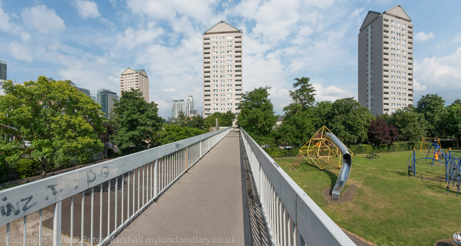
From Northey Street I turned right into Brightlingsea Place, another street name still there in Limehouse although little of its buildings remain. The exception is Faraday House, a five storey block built by Stepney Borough Council in 1931 as a part of their Limehouse Fields slum clearance scheme. Much of the area to the east was also destroyed in the war, apparently by a V2 rocket and was finally cleared and excavated for the Limehouse Link Tunnel. It is now a public park, Ropemakers Field.
On the west side of Brightlingsea Place was the Limehouse Power Station (also known as Stepney Power station) built in 1907, decommissioned in 1972 and demolished.
Parts of the power station were still in place in 1990 and a notice on the gates at right confirm this is Stepney Transforming Station and warn of the danger of 66,000 volts. But Stepney – and Limehouse – was now undergoing a very different transformation.
The House They Left Behind, Ropemakers Fields, Narrow Street, Limehouse, Tower Hamlets, 1990, 90-1a-24
The pub, The House They Left Behind, at the entrance to the cleared area between Brightlinsea Place and Ropemakers Fields a few yards north of Narrow Street was indeed the only building left standing in this area. At 27 Ropemaker’s Fields built in 1857 it had previously been called The Black Horse and was on the edge of the Barley Mow Brewery Site. After several further name changes and becoming a bar/restaurant it closed around 2010 and is now residential.
An Instagram post by londondeadpubs tells the interesting story of the stabbing there in 1998 of “Christopher Dunhill, heir to the vast Dunhill tobacco (and, weirdly, cufflinks) fortune” who was then a resident there and “helping out at the oyster bar“. He had earlier in 1987 been convicted of drug dealing but somehow only served 15 months in prison and “today he appears to be CEO of a Bahamian financial company.” But do read the full post.
To the east are these tower blocks of the Barley Mow Estate on Oak Lane, seen here from Ropemakers Fields. These blocks were built on the Barley Mow Brewery site and were built around 1967 for the London County Council using the same “Large Panel System” which failed in the Ronan Point disaster in 1968.
Reports led to additional strengthening work on Brewster and Malting House, but it was decided to demolish Risby House as it would be adversely affected by the contruction of the Limehouse Link Tunnel.
This was one of the best-known lighterage firms on the river until the business was closed down in 1973 by ‘Dolly’ Fisher on her 79th birthday. In its heyday had around a hundred barges on and nine tugs on the river.
Dorothea Woodward Fisher and her husband William, a lighterman who she had married over the protests of her family had formed the company with only £20 and one barge. And when her husband died in the 1960s she took over the running of it – and was described by many on the river and in a 1972 BBC documentary as ‘Mother Thames‘.
Dunbar Wharf on Narrow Street backs onto Limekiln Dock. Duncan Dunbar came to Limehouse from Scotland and made a fortune as a brewer and wine merchant, leaving his son – also Duncan Dunbar – sufficient to found a shipping business in 1827. By 1842 he had 11 ships and in the next 20 years ordered another 42.
As well as trading in various goods iuncluding wine and spirits, Dunbar’s ship’s made 37 voyages taking convicts to Australia and were troop carriers for the Crimean War. When he died in 1862 his estate was worth £2 million. His family then sold up all of the business. Apparently one of his former ships, the Edwin Fox is a museum attraction in New Zealand.
Limehouse Basin and Limehouse Cut: More pictures from my walk around Limehouse on on 6th January 1990. The previous post from this walk is Ratcliff Highway and Limehouse Basin – 1990.
The Limehouse Cut is London’s oldest canal, opened in 1770 to provide an easier route from the Lea Navigation, an important river for transporting grain into London from the agricultural areas to north in Hertfordshire. Used from the Bronze age and later by Viking raiders, alterations had been made to improve navigation on the River Lee since at least 1190 and was later followed by various Acts of Parliament. The first river lock in England was built on it at Waltham Abbey in 1577, but it was only the the River Lee Navigation Act 1767 that really began its modernisation.
Part of the work made under the 1767 Act when the navigation was surveyed John Smeaton was the suggestion to dig of the Limehouse Cut, allowing boats to avoid the treacherous and winding tidal lower reaches of Bow Creek on their way to the River Thames. The actual surveyor when the work began was his assistant Thomas Yeoman. It was a considerable short cut as it emerged into the river to the west of the long haul around the Isle of Dogs.
The original canal was narrow and had to be later widened and improved and it was only in the Victorian era that it was finally in something like its final state. The canal until 1968 entered directly into the Thames though Limehouse Lock in front of the row of small houses in these pictures, but it also had a basin, Limehouse Basin, at its southern end.
The first Limehouse Basin was at first simply a basin at the end of the Limehouse Cut, dug out by 1795. It had an island in it and on its bank was a a sawmill driven by a windmill, built a little earlier when sawmills were still widely thought to be illegal in England. It was attacked and the machinery destroyed by rioters – including hand-sawyers – in 1768. Restored the following year it closed around 35 years later. A lead mill opened on the island soon after and the company only ceased to exist in 1982. Victory Place is built on the site of this original Basin, and the old streets Island Row and Mill Place to its north are still there.
The Limehouse Cut was in 1854 linked to the Limehouse Basin of the Regent’s Canal which had opened in 1820 as the Limehouse Lock needed to be repaired. But this link was opposed by the boatmen from the Lee and Stort who fought a legal battle and in 1864 it was filled in and the site built on. It was not until over a hundred years later in 1968 that a new link – only 200 metres long – was made and Limehouse Lock finally closed.
The Limehouse Cut runs on a straight route through Poplar but curves around at its sourthern end. It was blocked here in 1990, probably in connection with the buildilng of the Limehouse Link tunnel between 1989 and 1993. But there was also work on the Cut around then, with the vertical guillotine gate on the north side of Britannia Bridge across the Commercial Road being removed.
Northey Street still has a bridge over the remains of the old route of the Limehouse Cut to Limehouse Lock, but all of the buildings including wharves and works on the banks of the Cut have now been replaced by modern development. The tower blocks beyond are on Oak Lane, and I think in the distance are cranes working on developments on the Isle of Dogs around Canary Wharf.
Ratcliff Highway and Limehouse Basin: My first photographic walk in 1990 came at the end of the Christmas and New Year season on 6th January 1990 when I returned to Limehouse for another walk. I’d taken quite a few pictures there back in 1984 and I thought it was time for another extensive visit. Getting there was easier now that the DLR ran to Limehouse. I left the station and walked down Branch Road.
Obviously not built as a Scout HQ, but something rather more official, and this was built in 1898 as the Stepney Borough Coroner’s Court.
Branch Road was apparently earlier called Horseferry Branch Road and led to a ferry across the Thames here – and Branch Road still leads to a road called Horseferry Rd. An ancient ferry ran from Ratcliff Cross Stairs and would have taken horses and carts as well as people across to Rotherhithe. You can still go down to the foreshore here from Narrow Street down the Grade II listed stairs but of course there is no ferry. The listing is probably more for the historic interest of the site – the stairs themselves are are relatively modern concrete replacement and the ancient causeway here apparently disappeared around 2000.
Tubular Barriers, The Queens Head, The Highway, Limehouse, Tower Hamlets, 1990, 89-12d-34
At 491 The Highway – formerly known as Ratcliffe Highway – close to the corner with Butcher Row – the Queens Head pub to the right of this view – was demolished soon after I made this picture in 1990, along with the rest of these buildings. At the left is a sign for the Limehouse Link tunnel, built between 1989 and 1993 and I think this was a storage yard for the work. The western end of the tunnel is a short distance to the east.
Another part of the Tubular Barriers site on The Highway which I think I photographed mainly for the graffiti ‘ELECTROCUTE MURDOCH’ on its wall. I think this was at the corner with Butcher Row. Though the company name also made me think of the Mike Oldfield album Tubular Bells.
There had been a particularly bitter and hard fought (sometimes literally) fight over the opening of Murdoch’s News International print works at Wapping in 1986, following the dismissal of all 6000 of the print workers at the previous Fleet Street hot metal print plant.
Works, 503-9, The Highway, Limehouse, Tower Hamlets, 1990, 89-12d-25
Control of the development of the Docklands areas was in 1981 taken away from the local authorities and given to the London Docklands Development Corporation (LDDC) a quango agency set up by Margaret Thatcher’s Secretary of State for the Environment, Michael Heseltine. Although this resulted in a faster regeneration of the area this was largely driven by the interests of global capital and often went against the interests and needs of the local communities. This whole area was demolished around 1990. I did wonder if the three-storey building might be a former pub.
Works, 503-9, The Highway, Limehouse, Tower Hamlets, 1990, 89-12d-12
Notices on the shop-front at right read
‘DOCKLANDS LOCAL PLUMBERS & ELECTRICIANS
CAN THE LDDC LEGALLY STEAL OUR LAND? 57 MEN TO LOSE THEIR JOBS’
The LDDC had wide ranging powers and legalised thefts such as this. It was an area in need of redevelopment and the LDDC got this moving at pace, but it would have been far better to have found ways to retain former businesses and provide more social housing and other community assets.
Considerable building work was taking place around the lock linking Limehouse Basin to the River Thames.
This is the ship lock and there had once been two narrower barge locks a short distance west. The ship lock was built slantwise to make for and easier entry by larger ships (up to 2000 tons) from the river and was a part of its enlargement in 1869. The lock had two compartments with three gates. In 1990 the outer gates to the Thames were still in place (in pictures not yet digitised) but no longer in use and the other two replaced by this much narrower single lock, suitable for the smaller vessels now using the Basin as a Marina.
A building for Limehouse Waterside and Marina on the corner of the 1869 Ship Lock and Limehouse Basin. Running across on the opposite side of the water is London’s third oldest railway viaduct, built in 1840 for the London and Blackwall Railway and now in use for the DLR.
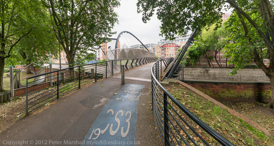
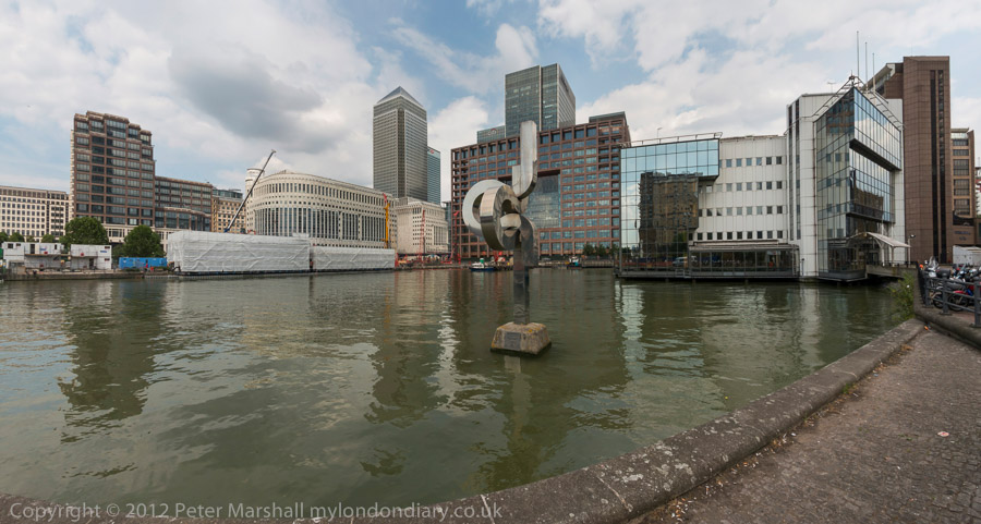
Cycling Around the Isle of Dogs: Tuesday June 24th 2014 was a nice Summer day in London. Not too hot, with a maximum in the low twenties, and with a blue sky tempered by some nice clouds and just a few light showers to cool me down. For me it was an ideal day for a bike ride and also for making some panoramic images.
It was a while since I’d been to the Isle of Dogs, and there had been quite a few changes around there in recent years, so after an early lunch I put my folding bike on the train and made my way to Limehouse.
It wasn’t really a bike ride, more just using the bike to carry me and my camera around the area, stopping on my way to make well over two hundred panoramic images in the roughly two and a half hours it took me to get to Island Gardens, opposite Greenwich for the train home. Later I worked on these images, selecting around 90 to put on-line – a higher than usual proportion. But I do rather more thinking about panoramic images and they require rather more care, particularly to get the camera absolutely level to keep the horizon straight.
I posted them in two groups, Limehouse pans and Millwall – Isle of Dogs pans. All the images were converted using the PT Gui software implementation of the Vedutismo perspective (also called Panini) made popular by Canaletto and other Italian cityscape painters in the 18th century which allows a more realistic representation of extreme angles of view – something like 147 degrees horizontally in these images. These would be impossibly stretched towards the edges in a normal rectilinear view, which only works up to around 90 degrees.
You can see any of these images larger on the links given to My London Diary at the end of this post, or by right-clicking on any of them and selecting to view them. Rather than write more about the ride here, I’ll quote from one of the posts there:
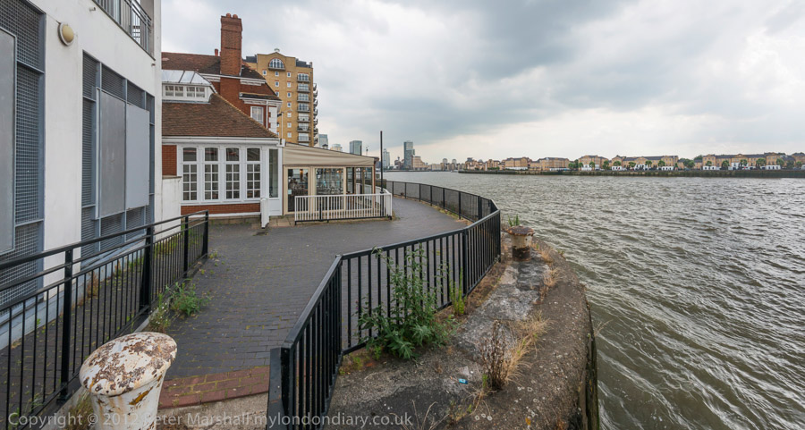
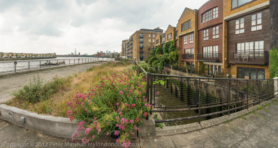
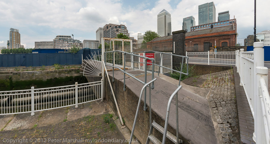
When I first walked these streets there was virtually no access to the riverside, with wharf after wharf between Westferry Rd and the river until you came to the park (Sir John McDougall Gardens.) A footbridge led from the Barkantine estate – built to replace a heavily bombed area of densely-packed small houses. South of this you again walked along the busy street until there were a few empty wharves around the south of the Isle of Dogs.
Now you can walk mainly along the riverside, with only one working area blocking the path. But there are several other places where you have to divert, including one wall dividing social housing from its wealthy neighbours. There was also a temporary diversion in one area, though it wasn’t clear why.
Further on are fine views across the river to Greenwich, along with further diversions from the riverside, where several earlier developments did not include riverside walks.
The Thames is too wide here for a panorama to work well without some foreground interest, or cropped to a very narrow strip. At the end of the ride, I did make a few pictures from Island Gardens across the river with a rather longer lens. These are in a separate post, also linked below.
More pictures continuing my walk on 31st July 1988 – the previous post is Bow Common to West India Dock Road, so this returns to close to where that started. Like most of my walks it was more about exploring a neighbourhood than getting anywhere.
East India Dock Rd, Poplar, Tower Hamlets, 1988 88-7s-61
East India Dock Road was built as its name suggests when the East India Docks were opened in 1806 to provide a more direct and less congested route than Poplar High Street to them from the end of the Commercial Road, also then recently built in Limehouse. It is now part of the A13 and this section in Poplar has in turn been largely bypassed by the Limehouse Link and Aspen Way opened in 1993. Traffic was still very heavy along it in 1988.
The picture with rubbish on the pavement and gutters, a small rather derelict shop to let gave a picture of a run-down area which contrasted with the word Wonderful on what seems a rather faded fabric on a restaurant at right. Buddleia is growing in front of the billboard, always a sign of dereliction. Interestingly the the advert is for a low alcohol lager, hardly a thing back then when most drivers on the streets after closing time were drunk, although the breathalyser had come in back in twenty-one years earlier. But even the introduction of Kaliber in 1986 had not really galvanised the market – but low alcohol beers are now a massive growth area, and some are even drinkable.
There is still a Chinese restaurant in the building at the right of this picture, and rather surprisingly that small shack is still in place in front of Amory Place, now a minicab office.
Chun Yee Society, East India Dock Rd, Birchfield St, Poplar, Tower Hamlets, 1988 88-7s-62
There are still traces of London’s first Chinatown in Limehouse, which began in the area around 1900, but the centre of the Chinese community had moved to Soho in the 1950s, partly because of extensive bomb damage in Limehouse, but also because of dirt-cheap rents in an area with a bad reputation where few then wanted to live in central London.
Chun Yee Society, East India Dock Rd, Birchfield St, Poplar, Tower Hamlets, 1988 88-7s-63
The house on the corner of Birchfield St still has the sign for the Chun Yee Society – Chinese School on Sundays over its doorway. not along with a larger and newer version with fewer Chinese characters. Like many similar societies it began as a Tong, variously described as a criminal gang or a semi-masonic bortherhood, and organised various festivals including those commemorating the dead. Founded in 1906 it was a shelter for Chinese sailors as well as providing a Chinese Sunday school for children and is now largely an old peoples centre. Possibly some of the games of dominoes may have got a little out of hand, but the criminality was largely in the mind of Sax Rohmer, his readers and the sensationalist press.
St Mary & St Joseph, Catholic Church, Upper North St, Poplar, Tower Hamlets, 1988 88-7s-51
The Roman Catholic Church of SS Mary and Joseph, Poplar impresses mainly by its scale. Built in 1951-4, its architect Adrian Gilbert Scott (1882-63) was the brother of the better-known Sir Giles Gilbert Scott, both from a distinguished family of architects. I always think of it as an ecclesiastical version of Battersea Power Station, without the chimneys but with a rather odd green pyramid on its roof, but that’s rather unfair as it is a very individual design, sometimes described as Byzantine jazz gothic.
According to the Grade II listing text this is a camel arch, and a similar arch appears at the top of the main windows, supposedly inspired by Persian buildings. The church replaced one on the site behind me as I made the picture which was destroyed by bombing – the site is now a Catholic school. I think I chose an interesting viewpoint, but one that needed a slightly wider lens and a more upright photographer.
The second of these LCC temporary buildings has a sign proclaiming it as ‘LANSBURY WORKS OFFICE’ and giving its address in Brabazon St. The street got its name not from the huge white elephant civil airliner that made a few flights in the 1950s before it and the project was scrapped in 1953, but from the 1882 founder of the Metropolitan Gardens Association, the 12th Earl of Meath, Lord Brabazon.
Work began on the layout of the London County Council’s Lansbury Estate in 1949 on a large area devastated by wartime bombing, and its best-known feature, Chrisp Street Market was built the following year and became an integral part of the 1951 Festival of Britain. But construction of the estate continued for many years and was only said to be completed in 1982, by which time it had been transferred first to the GLC and then Tower Hamlets. Since 1998 it has been owned by Poplar HARCA.
But as this picture shows, this part was still not completed in 1988. The large 11-storey tower block Colebrook House with 42 flats was part of the Barchester Street Scheme by the LCC Architects department and completed in 1957-8, named after a shop built at nearby Blackwall Yard. Brabazon St now has a small park to the left of my picture and a row of neat two-story houses along the right side.
Bow Common Bridge, an iron bridge replacing the earlier bridge here in 1929, is where Upper North Street meets Bow Common Lane across the Limehouse Cut and the factory building here on the north-west side has now been replaced by a block of offices and flats built in 2008-2011, with the 13 storey Ingot Tower at one corner of the largely five storey development. This large site alongside the Limehouse Cut was formerly a chemical works between the Cut and Thomas St (now Thomas Road.)
Phoenix Business Centre, Limehouse Cut, Upper North St, Poplarm Bow, Tower Hamlets, 1988 88-7s-55
Wikipedia recounts that this area had become popular with chemical manufacturers as they could discharge waste into the Cut, and this bridge from at least 1819 was known as Stinkhouse Bridge and the area around became a huge fire risk, culminating in a great fire in 1866. The bridge was also a popular choice for suicides, with a local coroner in 1909 noting he had held over 50 inquests on them there. As Wikipeida comments ‘ In a derisory attempt to enhance its image it was renamed Lavender Bridge.’ But the old name stuck at least until the 1950s.
The Phoenix Business Centre on the north east corner of the bridge has also been demolished and replaced by tower blocks around 2008-2010.
The Sanitas Company Ltd, Council Depot, Watts Grove, Bow, Tower Hamlets, 1988 88-7s-44
The Sanitas Company Limited proudly put their name across the top of their 1914 building in Watts Grove, and it remained written in stone (or at least render) for a hundred years until the building was demolished and replaced by a rather blander building completed in 2017, part of a large development on Watts Grove and the new Pankhurst Avenue.
Previously the site stretching down to Yeo Street annd Glaucus Street had been occupied as it was when I made this photograph as a council depot by various of Tower Hamlet’s Councils municipal services (latterly Veolia.)
The Sanitas Company Limited was a local company which specialised in disinfectant and soap-based products. So far as I’m aware they had no connection with other and now better known companies using the name Sanitas, the Latin for Health.
My walk will continue in a later post.
Clicking on any of the pictures will take you to a larger version in my album 1988 London Photos from where you can browse the album.
Bow Common Lane, Bow Common, Tower Hamlets, 1988 88-7r-35
Although this image is labelled as being on Cantrell Road in my very skeletal notes written small in black ink on the contact sheet, it is actually still there next to the railway on the west side of the gasworks site in Bow Common Lane.
This fairly substantial house is on the edge of the gas works site mentioned in the previous post and I wondered if it might have been a part of this development, perhaps a manager’s house. The gasholder was removed in 2016-7
Bow Common, Tower Hamlets, 1988 88-7r-21
I’m fairly sure that Turnbull & Son Builders were not on Cantrell Road as my notes suggest, but certainly somewhere in Bow Common, possibly on Bow Common Lane, Devons Road or St Paul’s Way which were on my route. Little of the older industry in the area now remains.
Bow Common, Tower Hamlets, 1988 88-7r-23
Again there is a frustrating lack of information on the contact sheet, possibly because I was lost. So I’m unsure of the location of this detached Victorian house, but I think it may have been on Turners Road which I went down on my way to Clemence St.
Finally a location I can be sure of, as the block in the background has two signs on it. ‘No Ball Games’ is on not helpful, but over the entrance way just above the thighs of what looks to me a naked rudimentary female figure I can read ‘Gatwick House’.
Although Trevor Tennant (1900-80) entitled this ‘play sculpture’ Gulliver it still looks female to me. It is described in The Buildings of England London: East as “in Festival of Britain Spirit”, though it looks vaguely Henry Moore to me. Tennant in taught at various art colleges including Camberwell School of Art (1930-4). The sculpture commissioned by the LCC for the Locksley Estatew was probably installed when the block was built in 1954-6 and by the time I photographed it was deteriorating – perhaps due to some rather more robust physical play than anticipated. It was originally at the centre of a large sandpit with the base buried in the sand. I suspect the sand was removed after being too often used as a toilet for dogs, a common fate with sandpits in public places.
A gloomy building by a gloomy canal, close to St Anne’s Church which towers above the tree at right. This building at the rear of a ‘dangerous structure’ on Commercial Road opposite the church is still standing, though the lower structures to the right have been demolished. I think this is 777 Commercial Road, a former sail loft, part of the Grade II listed run of buildings here. According to the listing, 777 dates from 1893-4 and was designed by Marshall & Bradley and built by J.H. Johnson for Caird and Rayner. The site is now ‘Sailmakers’ a mixed-use development which will retain the building frontage.
The Flood barrier on the Limehouse Cut presumably became redundant after the building of the Thames Barrier. On the other side of Commercial Road you can see both St Anne’s Church over a billboard and Limehouse Town Hall.
The Empire Memorial Sailors’ Hostel, now called The Mission Building, was built in 1924 to house some of the many sailors in the city needing lodgings. Money to fund it came from an appeal organised largely by women from across the British Empire to save these men who might otherwise have spent the night and their earnings in the company of the oldest profession. They appealed for the funds to build it as a memorial to the 12,000 merchant seamen who were killed in the Great War.
The Grade II listed building originally had 205 single rooms (cabins) and appears to have been designed to the demands of a committee whose members advocated differing styles. It was enlarged in 1932 along Salmon Lane to meet the huge demand, but as the docks closed became a hostel for the homeless. It closed in 1985, presumably not because of any lack of homeless people but because of the cost of housing them, and in 1994 was sold off to a developer who converted it to a gated and portered residential development.
4-12 West India Dock Road, Limehouse, Tower Hamlets, 1988 88-7r-14
A little of the old West India Dock Road, this row of shops is now long gone. The large Grade II listed building at right is still there, built as the Passmore Edwards Sailors Palace, the Headquarters of the British And Foreigh Sailors Society in 1901, with a grand frontage including a crowned Britannia holding on each shoulder a strangely morphed galleon and child. The side view here is rather more utilitarian.
Sail Makers, Ships Chandlers, 11, West India Dock Rd, Limehouse, Tower Hamlets, 1988 88-7r-16
A sign over the door for Pastel Print shows its use in 1988, when local demand for sails, candles and other marine equipment has shrunk to zero. A plaque near the apex of the facade states ‘ERECTED AD.1860’. I think it has now been made into flats and offices retaining the facade.
The next part of my walk, going back into Bow and on towards Bromley-by-Bow will continue in a later post.
Clicking on any of the pictures will take you to a larger version in my album 1988 London Photos from where you can browse the album.
Poplar To Limehouse 1988 – my walk continued on the East India Dock Road.
East India Dock Rd, Poplar, Tower Hamlets, 1988 88-7q-51
From the posters in the window this was clearly a video rental store, a relatively new thing back in 1988 – the first Blockbuster Video store only opened in Dallas, Texas in 1985. Home video recording only began to be popular after the introduction of Betamax in 1975, followed in 1977 by VHS (along with other formats.) By 1988 VHS had become the dominant format.
But my attention was caught by the notice on the door, ‘NO DOGS OR BIKES ALLOWED’ with a very small ‘Thankyou’ and the two bikes (I think a BMX and a racer) flung down on the pavement outside unlocked by their two young owners.
Poplar Labour Party, East India Dock Rd, Poplar, Tower Hamlets, 1988 88-7q-53
Poplar Labour Party, led by George Lansbury, gained control of Poplar Borough Council in 1919. Poplar was one of the poorest areas of the country and so rateable values there were low. With councils then being responsible for supporting the unemployed and poor, council rates thus had to be set at a much higher level than in wealthy boroughs, which was clearly unfair on boroughs like Poplar who had so many more people needing support. Their rates were the highest in London, twice as high as in the wealthy borough of Kensington.
Poplar Labour had come into office to make changes, to provide greater support for the poor, to set a higher minimum wage for council workers and to pay women equally to men. When a demand from government came in 1921 to increase contributions for cross-London authorities Poplar council refused to pay, instead voting to use the money for the local poor. The authorities took them to court, and 30 councillors marched there with two thousand supporters. All of the councillors were sentenced to prison, where one of the six women, Minnie Lansbury, died, only 32.
Public outcry with large demonstrations and some riots – and other councils following Poplar’s lead – led to the councillors being released with an Act being rushed through Parliament to make the system more fair, with richer boroughs contributing more and the poorer less.
Their protest had clearly been illegal, but was clearly justified, and it led to a much-needed reform. It’s a lesson which still has relevance, particularly with such current matters as statues and the Government’s Police, Crime, Sentencing and Courts Bill.
Richard Green, statue, Poplar Baths, East India Dock Rd, Poplar, Tower Hamlets, 1988 88-7q-54
The statue of Richard Green still stands outside Poplar Baths, a Grade II listed building from 1933, replacing an earlier baths from 1852. The baths were largely to provide washing facilities when few homes had bathrooms in this poor area of the city. As well as ‘slipper baths’ there were also vapour baths, showers and laundry facilities. The new baths in 1933 was a huge building including these facilities and two swimming pools, the larger of which could be covered over and used as a dance hall, theatre and sports hall.
The baths reopened in 1947 after the war despite considerable damage and was closed and converted into a training centre in 1988. My picture from 1988 shows a board advertising the support of the London Docklands Development Corporation in providing disabled access.
The building later became derelict but after a strong local and national campaign for its restoration work began on its redevelopment in 2014 and it reopened again as Poplar Baths Leisure Centre and Gym, along with 100 new homes, in 2016.
Richard Green (1803-63) was a local shipowner, shipbuilder and philanthropist, supporting a Sailors’ Home, schools, an orphanage and hospitals in the area, some of which had been founded by his father, George Green. His Blackwall Yard built many ships for the East India Company and for trade with Australia and China. His company, R & H Green in 1919 joined with Silley Weir as R. and H. Green and Silley Weir, with large premises at the Royal Albert dry docks and others and continued in business until sold to become a part of the government owned River Thames Shipbuilders in 1977.
George Green School, East India Dock Rd, Sturry St, Poplar, Tower Hamlets, 1988 88-7q-43
George Green (1767-1849) was the father of Richard Green whose statue with his dog still sits outside Poplar Baths. George married the boss’s daughter and made the reputation of the Blackwall Shipbuilding Yard, building many whalers.
As well as this school dating from 1828 on the East India Dock Road the older Green also endowed schools in Chrisp Street and Bow Lane. The current huilding from 1883 is part of Tower Hamlets College. George Green School in new buildings on Manchester Road became the secondary school for the Isle of Dogs with its first comprehensive intake in 1975.
The War memorial to the children of Upper North Street School is https://britishlistedbuildings.co.uk/101065215-war-memorial-to-the-children-of-upper-north-street-school-poplar-ward Grade II* listed and includes the inscription: ‘IN MEMORY OF/ 18 CHILDREN/ WHO WERE KILLED/ BY A BOMB/ DROPPED FROM A/ GERMAN AEROPLANE/ UPON THE L.C.C./ SCHOOL UPPER/ NORTH STREET/ POPLAR ON THE/ 13TH OF JUNE 1917./ ALFRED H. WARREN O.B.E./ MAYOR/ J. BUTEUX SKEGGS,/ TOWN CLERK. ‘
There is a fuller story at the link above about the first mass German raid on London by Gotha bombers on 13 June 1917 which killed 162, including these 18 children mainly aged 5 or 6. At least 37 other children at the school were among the 432 injured by the raid.
St Mathias, church, Woodstock Terrace, Poplar, Tower Hamlets, 1988 88-7q-45
St Mathias Church is also Grade II* listed, with a number of Grade II listed monuments. Poplar’s oldest church, it was built in 1766 as the Chapel of the East India Company, and became St Mathias as a parish church in 1866. You can see the company’s arms in the roof, and allegedly its columns came from wrecks of the Spanish Armada.
The exterior of the church was altered and enlarged by Teulon in 1875. The church closed in 1976 and was restored for community use by the LDDC in 1990.
Built in 1902–3 as an officers’ annexe to the Scandinavian Sailors’ Temperance Home, founded by Swedish Free Church missionary Agnes Hedenstrom (1849–1928) who began her mission in the East End in the 1870s, opening the home here in 1888. The mission was taken over by the Salvation Army in 1930.
This was I think the last picture I took on my way to Westferry station where I returned a couple of days later for another walk – and the subject of a later post.
Click on any image to see a larger version in my album 1988 London Photos from where you can browse other images.
This post starts where my previous post on the walk left off, on Emmett Street, no longer present, a victim of both the Limehouse Link tunnel and the edge of the Canary Wharf development at Westferry Circus. I think it this was taken just a little further south than the previous picture and the view between buidlings with several cranes is to the luxury flats being built on the Limehouse bank of the Thames.
A little further south on Westferry Road, with the high dock wall at the left and Cascades Tower, designed by the architects Campbell, Zogolovitch, Wilkinson and Gough (CZWG) in the distance ahead. This unusual block of luxury flats built in 1985–88 was the first private high rise block in Docklands. Going down Westferry Road was entering a huge building site – and the graffiti on the bus shelter states WORLDEXIT (though its actually where a bus would take you back into the world.) When built the flats were almost impossible to sell or rent and Tower Hamlets council let them to teachers at £17 a week. Now they are rather more expensive, at around £400 per week for a one bed flat, and selling for around £500,000 and no teachers can afford to live there.
I think the slight rise in the road, which also bends slightly is possibly the former Limehouse Basin entrance and this section of Westferry Road was perhaps what had previously been Bridge Road.
George Baker & Sons (Millwall) Ltd, builders and joiners, were according to the Survey of London only at this site from 1985 until it was cleared in 1987-8. But the name here looks older and this is the remains of a fairly elegant three-storey building, a photograph of which from 1987 is in the Survey of London. It was built on what was then Emmett St in the 1860s for Thomas Dominick James Teighe and Frederick Smith, sailmakers and ship-chandlers, and from 1902 to the early 1980s occupied by Fitch & Son, provision merchants.
Westferry Rd, Isle of Dogs, Tower Hamlets, 1988 88-7p-53
Considerable building work taking place close to Westferry Circus, with Cascades Tower visible in the distance.
South Dock Entrance, Westferry Rd, Isle of Dogs, Tower Hamlets, 1988 88-7p-41
Sand and gravel works on the north side of the former South Dock Entrance, with a view across the River Thames to Columbia Wharf in Rotherhithe.
Westferry Rd, Isle of Dogs, Tower Hamlets, 1988 88-7p-43
A bus stop at left on Westferry Road, the Island Car Service, much needed as the bus service was poor and unreliable and Timber Merchant John Lenanton & Sons Ltd on the corner of Manilla St, with the Anchor & Hope public house part visible at the right edge, and behind one of the towers of the Barkantine Estate. The car service was in the shop at 31 which for many years was Wooding’s newsagents. The Anchor & Hope had been opened since at least the 1820s, and possibly as it until recently stated on its frontage was established 1787. The building is still there though it closed as a pub in 2005. It was extensively refurbished for residential use in 2015 and the ground floor later became a gym.
Ming St, Limehouse, Tower Hamlets, 1988 88-7p-44
I walked back north to Ming St in Poplar, part of London’s first Chinatown, and renamed to reflect this in 1938 when many of London’s streets were renamed to avoid confusion – previously it had been since 1820 one of many King Streets. This was part of the Limehouse of Sax Rohmer‘s racist imaginings of opium dens and crime in his 18 book Dr Fu Manchu series, begun in 1913 and continued after Rohmers death by his biographer and assistant Cay Van Ash.
His work brought wealthy upper-class slum-tourists to the area, where they perhaps enjoyed meals in restaurants such as Wah Ying, but they will have found little evidence of Fu Manchu and his team of assassins, human traffickers and drug traders of the dreaded Sci-Fan secret society. Chinatown was one of the more law-abiding areas of the East End, and the Chinese certainly more law abiding than most.
Ming St, Limehouse, Tower Hamlets, 1988 88-7p-45
The Peking was another remnant of the Chinatown past, mostly now moved away to Soho, though there is still a Chinese restaurant on the East India Dock Road, along with the Chun Yee Society. Dockland Light Railway trains now run across the bridge in the distance. The building at right with a dome was Charlie Brown’s pub on West India Dock Road. All this is now demolished.
The White Horse, pub, Saltwell St, Poplar High St, Poplar, Tower Hamlets, 1988 88-7p-46
Going east along Ming St takes you to Poplar High St, and on the corner of Saltwell St where the High Street begins you can still see a large white horse on top of a wooden post, though it seems rather smaller now than in my picture, and is closer to the street corner. There had been a White Horse pub on this site since 1690 though I think the building in this picture is probably from the 1920s when it was taken over by Truman’s Brewery. They sold it in 2003 and it was demolished and replaced by a block of flats. According to the Lost Pubs Project, “In 1740 it was, scandalously, run by a Mr & Mrs Howes, both of whom were actually female. ”
The horse was Grade II listed in 1973 and has the shortest listing text I’ve come across: “C18 wooden carving of a white horse on post in forecourt.” The lower part of the sign with the pub name fell down and has been removed, but the horse has been repainted since my picture.
Click on any of the images to see a larger version in my album 1988 London Photos from where you can browse the album.
St Anne’s Church, Limehouse, Tower Hamlets, 1988 88-7o-32
Church, Pyramid, Star of the East – More Limehouse My walk around Limehouse came back to the area I think of as its heart, close to St Anne’s Church, one of the Queen Anne Churches built after the 1711 Act of Parliament and consecrated in 1730. St Anne’s is one of the six London churches by Nicholas Hawksmoor along with St Alfege’s Greenwich, St George’ Bloomsbury, Christ Church, Spitalfields, St George in the East Wapping andhis only church in the City of London, St Mary Woolnoth.
St Anne’s Churchyard, St Anne’s Passage, Limehouse, Tower Hamlets, 1988 88-7o-34
I turned my back on the church to photograph the entrance gate to the churchyard.
Limehouse Pyramid, St Anne’s Church, Limehouse, Tower Hamlets, 1988 88-7o-36
The church has featured in many books and publications, including the work of psychogeographers and other more esoteric and mystical writers, and seems to have a special place in the works of believers in ley lines. I’ve not read or seen the film ‘Dark Lines Of London’, but a web page claims to give “Factual Information That Provides the Backdrop to the Story” and includes descriptions and photographs of 10 sites, all from centuries after that in which the story is set, along “a real ley line” one of which is this “Wisdom Of Solomon” Pyramid.
THE 4TH CONFERENCE of the Situationist International was held in London, at a secret address in the East End, 24-28 September 1960, seventeen months after the Munich Conference (April 1959). The situationists assembled in London were: Debord, Jacqueline de Jong, Jorn, Kotányi, Katja Lindell, Jörgen Nash, Prem, Sturm, Maurice Wyckaert and H.P. Zimmer. In fact, to ensure that the proceedings were kept well away from any contact with London journalists or artistic circles, the conference took place at the British Sailors Society hall in Limehouse, “an area famous for its criminals”.
Internationale Situationniste #5
Star of the East, Commercial Rd, Limehouse, Tower Hamlets, 1988 88-7o-23
Built in the early 19th century and Grade II listed the Star of the East was serving beer at least from 1845. More recently the building had deteriorated and closed as a pub around 2010, was reopened a couple of years later but closed again in 2016. The pub was then taken over and refurbished by the Old Spot Pub Co, who run around a dozen pubs re-opening again in 2019.
Star of the East, Commercial Rd, Limehouse, Tower Hamlets, 1988 88-7o-11
You can read more about its recent transformation and see some photographs from London Pub Explorer. I’ve yet to return to see for myself. Back in 1988 part of the building was a separate restaurant, but I think the pub now occupies the whole building. The refurbishment appears to have kept at least some of the original interior features.
Three Colt St, Limehouse, Tower Hamlets, 1988 88-7o-14
Three Colt St, which has St Anne’s Church at its northern end is one of the oldest roads in the area, part of the route from Limehouse to Stepney and first recorded in 1362. In the Victorian era it was flanked by a number of shops and was something of a middle-class enclave surrounded on both sides by extreme poverty. Little remains from those times. The building here is the former London and Blackwall Railway station, probably dating from the opening of the railway in 1840. The station closed in 1926, but the line remained in use for goods traffic until the 1960s. When the line was reused for the Docklands Light Railway in 1987, Westferry station was built around 300 yards to the east.
Not only this building but the street that it was in have disappeared since I made this picture. Emmett St was at the end of Three Colt St, roughly where the Limehouse Link tunnel entrance is now. Construction of the tunnel began in November 1989 and the project was officially opened in May 1993, at £293,000,000 the most expensive per mile road scheme ever built in the UK, a huge public subsidy to the Canary Wharf redevelopment.
When Mucho Macho released ‘The Limehouse Link’ in 1998 it had one of my pictures wrapped around both the CD and the 12″ LP, where it looked rather more impressive. But this image was from Poplar – and this is the full image from the Urban Landscapes web site and doesn’t show the Limehouse Link at all.
Clicking on any of the black and white images above will take you to a larger version in my 1988 London Photos from where you can browse the album.