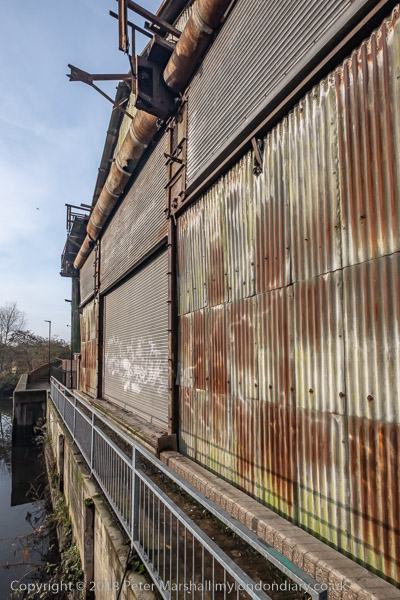
Kew Bridge & Gunnersbury 1989: I didn’t get our for a walk again in 1989 until the 10th of December, probably partly because of the weather with drizzle, mist, fog and some very cold days. But it was just a little warmer and I decided to go out. But at this time in London sunset is before 4pm and so I decided to take pictures fairly close to home so I could make an earlier start. Kew Bridge station is only around a half hour journey from my home.

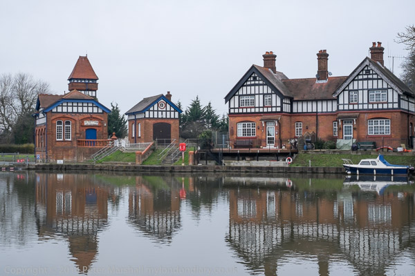
I made my first picture from the footbridge in the station taking me to the station exit. As you can see the station buildings were in pretty poor condition. The view includes the local landmark water pumping tower and the top of the engine house of Kew Bridge Engines, opened as a remarkable museum in 1975 (now renamed as London Museum of Water & Steam) and the tower blocks further down Green Dragon Lane. Six 23 storey blocks were built here as the Brentford Towers Estate in 1968 to 1972 by the London Borough of Hounslow.
Green Dragon Lane apparently got its name from a 17th century pub but there appears to be no record of where this was, though there are or were around 40 other pubs of that name elsewhere in the country. The name is usually thought either to have come from the Livery Badge worn by servants of the Herbert family, the Earl of Pembroke, which showed a bloody arm being eaten by a dragon or a reference to King Charles II’s Portuguese Catholic queen, Catherine of Braganza whose family badge was the Green Wyvern.
Kew Bridge station gets rather crowded at times now, as Brentford’s new football stadium is next door.

I walked up to Gunnersbury Avenue where on the north-east corner of the Chiswick roundabout was this magnificently derelict former works of Spenklin Ltd. They appear to have made Power-operated work clamping devices and other engineering tools including boosters, clamps, cylinders and hydraulic ram heads. The company name was a contraction of Spencer Franklin. I think the next factory along – demolished by the time I took this – had been Permutit water softeners.
I think this building probably dates from around 1925 when the Brentford Bypass – soon better known as the Great West Road – was opened. The roundabout here came later along with its flyover in 1959.

A closer view of the entrance with its boards showing it had been acquired by Markheath Securities PLC a London property developer, though 49 per cent owned by The Adelaide Steamship Co Ltd. They appear to have been responsible for several developments in the area and to have made Section 106 contributions to Hounslow Council for improvements to nearby Gunnersbury Park.

My memory – often false – tells me that this was on the west side of Gunnersbury Avenue (the North Circular Road) to Spenklin House and I think is probably from the same era. At least it is clear what the business of the National Tyre Service was and the building has a rather fine squad of Michelin men.

Quite a long walk along Chiswick High Road took me to Acton Lane where I took this picture on the corner of Chiswick Road. A station was built here in 1879 when the District Railway was extended from Turnham Green to Ealing Broadway, but clearly that in the distance here is from the 1930s.
On the corner we have a rather unremarkable post-war building but with some rather remarkable Christmas decorations. The long shop front is now divided into separate shops.

A closer view of Chiswick Park Station, one of many characteristic stations by architect Charles Holden for London Underground and built in 1931-2. Holden’s first complete Underground stations were built on the Northern Line southern extension from 1926, but he later designed many more. This station remains almost as it was built and shares its features with many of his others. It was Grade II listed in 1987.

The interior of the tall drum-shaped ticket hall with a shop, Midas Gold Exchange at right. Useful signs above the exit tell the way to buses and to Acton Green, while the lower advertising panels are all for Underground posters. The Underground were pioneers in various ways in advertising – not least in the tall tower at this and other stations whose main if not only purpose was to carry their branding with the trade-mark roundel and station name.
I think the brick building at left which I think housed the ticket office was perhaps a later addition to the building which otherwise has been altered little.
To be continued.
Flickr – Facebook – My London Diary – Hull Photos – Lea Valley – Paris
London’s Industrial Heritage – London Photos
All photographs on this page are copyright © Peter Marshall.
Contact me to buy prints or licence to reproduce.