Baisakhi Mela, Bengali New Year – 1998

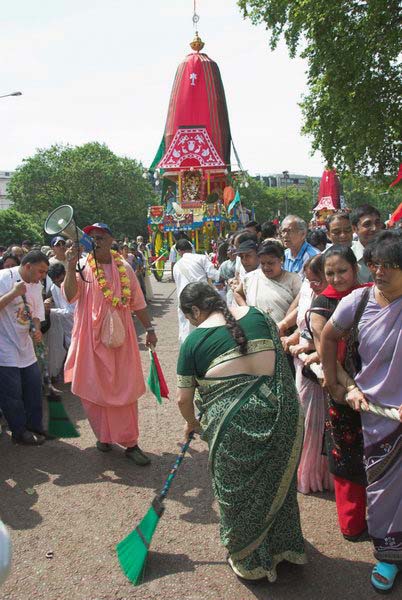
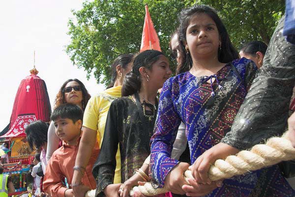
Baisakhi Mela, Bengali New Year: Back in May 1998 I went to the celebrations of the New Year taking place in a crowded Brick Lane and photographed the people on the streets, mainly in black and white and a few in colour.

Baisakhi Mela, Bengali New Year, Brick Lane, Spitalfields, Tower Hamlets, 10 May, 1998, 98-513-66

I’ve recently digitised the more interesting of these pictures and have posted 35 black and white and a few colour pictures on Flickr.

Baisakhi Mela, Bengali New Year, Brick Lane, Spitalfields, Tower Hamlets, 10 May, 1998, 98-512-46
Baisakhi Mela, Bengali New Year, Brick Lane, Spitalfields, Tower Hamlets, 10 May, 1998, 98-515-62

Of course I was then working with film. I can’t remember exactly which two cameras I was using that day, but I think most likely one would have been my favourite Minolta CLE with a 28mm lens. Minolta had previously worked with Leica to produce the Leica CL, a more compact Leica using Leica M lenses, but for some reason two companies had parted company for the improved version of this, which came out under Minolta’s name. Perhaps its improved metering made it seem too modern for Leica.

Baisakhi Mela, Bengali New Year, Brick Lane, Spitalfields, Tower Hamlets, 10 May, 1998, 98-512-14

The Minolta 28mm M-fit lens was a fine performer, actually out-performing its Leica equivalent. Sadly I had to bin it years later as fungus growth within it had damaged some of the internal glass beyond repair when I had hoped to use it with an appropriate adaptor on a Fuji digital camera.

Baisakhi Mela, Bengali New Year, Brick Lane, Spitalfields, Tower Hamlets, 10 May, 1998, 98-513-41

Konica were another company that produced a modernised rangefinder Leica, the Hexar RF using their version of the Leica M-mount which accepted all Leica lenses. The viewfinder was perhaps not quite as bright as a Leica, but was better for 28mm lenses, and it not only had a good autoexposure system but also motorised wind-on of film and rewind. But that only came out a in 1999 after these pictures were made, when it became my ‘Leica’ of choice.

Baisakhi Mela, Bengali New Year, Brick Lane, Spitalfields, Tower Hamlets, 10 May, 1998, 98-514-51

Probably the black and white images were made with an earlier Konica camera, the Hexar F, a 35mm fixed-lens, fixed focal length autofocus camera. Film loading, advance and rewind was motorised and automatic. It wasn’t promoted much in the UK, and I had to order mine from the USA, I think in 1993. The 35mm lens was superb, but I did have some self-made probelms with this camera, mainly due to my fingers. It was all too easy for them to wander over the exposure senor on the front of the body, causing extreme over-exposure, and I often managed to get greasy fingerprints on the front of the lens which had no lens hood.

Baisakhi Mela, Bengali New Year, Brick Lane, Spitalfields, Tower Hamlets, 10 May, 1998, 98-514-31
Baisakhi Mela, Bengali New Year, Brick Lane, Spitalfields, Tower Hamlets, 10 May, 1998, 98-515-12
Baisakhi Mela, Bengali New Year, Brick Lane, Spitalfields, Tower Hamlets, 10 May, 1998, 98-516-46

Brick Lane was full of sound for the Baisakhi Mela, but both the Minolta CLE and the Hexar F were quiet in operation and the Hexar even had a ‘silent’ mode that made it hard for even me to know if I had taken a picture – so I seldom used it. Many of those in these pictures would have been immersed in the event and so unaware that I was taking their photographs, though others were and were clearly happy to be photographed.

Baisakhi Mela, Bengali New Year, Brick Lane, Spitalfields, Tower Hamlets, 10 May, 1998, 98-512-52

The picture above is the first black and white picture from the Mela in the album, and clicking on it will take you to Flickr where you can then go through all 35 black and white pictures.


FlickrFacebookMy London DiaryHull PhotosLea ValleyParis
London’s Industrial HeritageLondon Photos

All photographs on this page are copyright © Peter Marshall.
Contact me to buy prints or licence to reproduce.
Goodbye to Wandsworth – 1990

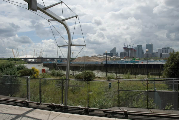
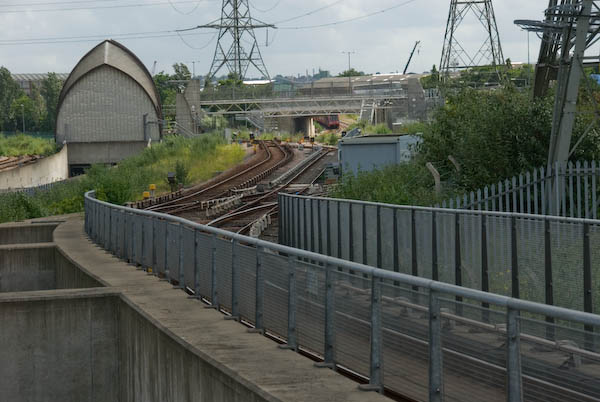
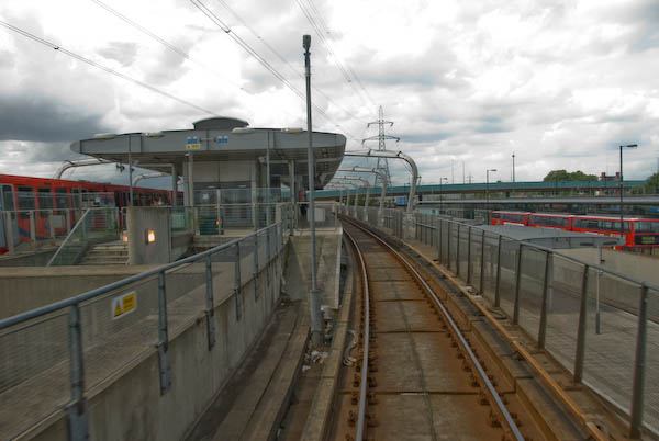
Goodbye to Wandsworth – 1990: The final post on my walk on Sunday 4th March 1990 which had begun at Clapham Junction in Battersea with St John’s Road & East Hill, Battersea – 1990. The previous post on this was walk was Point Pleasant and the Thames.

It wasn’t of course the last time I went to Wandsworth – I was even back there a couple of weeks ago, walking through the same areas, though much of it now hardly recognisable.

West Hill Primary, School, Broomhill Rd, Wandsworth, 1990, 90-3c-25

The school building is locally listed and its address is 5 Merton Road, but this is the view from Broomhill Road.

London Theatre School, Chapel Yard, Wandsworth, 1990, 90-3c-26

On a second image I made of this building I can just about make out the inscriptions on the frontage as at left ‘Erected 1573, Enlarged 1685 and on the right ‘Repaired 1809 – 31, Rebuilt 1882’. You can read all four plaques lower on the building on the London Remembers site.

This is Wandsworth Chapel and possibly the site was first used by Huguenots, though perhaps only rather later than this. Another plaque lower down mentions a Dutch congregation but from 1713-87 this was the ‘French Church.’ Later from 1809 it was Congregational and a plaque states they continued to use it for mission work until 1939 after moving to a new church on East Hill in 1860. Its history reflects the many immigrants who settled in Wandsworth and set up industries along the Wandle using its water and the power it could generate.

The current building with a hall which could hold 500 people opened in 1883 and is locally listed. Since housing the London Theatre School it became the National Opera Studio.

Pizza Delivery, Scooters, Wandsworth High St, Wandsworth, 1990, 90-3e-65

Pizza Delivery began in the UK in the mid-1980s, but back in 1990 you had to phone for a pizza, with on-line ordering only becoming widespread in the late 1990s. It was still fairly unusual in 1990 and HIPPO PIZZA with this row of five scooters ready and waiting for a call was something of a pioneer.

Entrance, Car Wash, Wandsworth High St, Wandsworth, 1990, 90-3e-66

‘Welcome, Please Drive In’ for a ‘Guaranteed Complete Clean’. At at right someone sits waiting. There is still a ‘HAND CAR WASH’ here on the High Street.

Gas Holder, Armoury Way, Wandsworth, 1990, 90-3e-51

I walked up Ram Street again to Armoury Way and took a few more pictures of the gas holder – which I’ve written more about in earlier posts about this walk.

Gas Holder, Armoury Way, Wandsworth, 1990, 90-3e-53

I think I then looked at my watch and hurried to Wandsworth Town Station taking no more pictures to catch a train rather than have to wait another half hour for the next one.

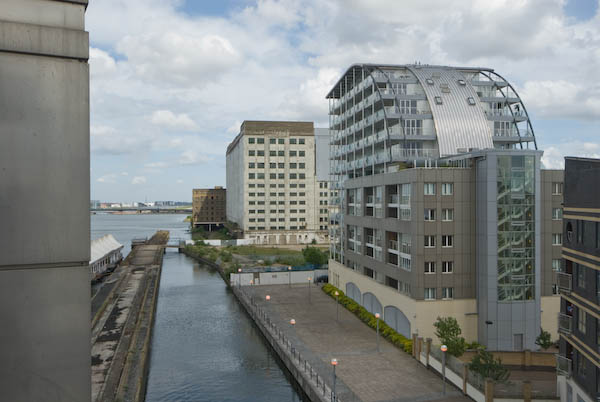
Finally, here is just one picture from the area I made on my last visit in April 2026, looking across where Bell Lane Creek and the River Wandle join. On ‘The Spit’ is a sculpture, ‘Sail’, by Sophie Horton placed there in 2003, financed by the Wandsworth Challenge Partnership. It was inspired by the sail of a dinghy, though I don’t think these have ever sailed up here. But perhaps in the new Wandle Riverside they will.

The flats are part of a new development on the former site of the Wandsworth Gasworks. And where I was standing to take this picture where there is now a riverside path leading to the River Thames was, back in 1990, part of the Shell Oil Terminal.


FlickrFacebookMy London DiaryHull PhotosLea ValleyParis
London’s Industrial HeritageLondon Photos

All photographs on this page are copyright © Peter Marshall.
Contact me to buy prints or licence to reproduce.

Atos Kills Disabled People – 2011

Atos Kills Disabled People - 2011
Protesers say Atos Kills Disabled People

Atos Kills Disabled People: On Monday 9th May 2011 I photographed a London protest in a ‘National Week of Action Against Atos Origin‘ organised by disability activists, claimant groups and anti-cuts campaigners and supported by over 50 groups around the country.

Atos Kills Disabled People - 2011

There were around a hundred people, many with disabilities at the protest when I arrived outside the offices of Atos Healthcare in Triton Square, London. The coalition government was replacing Incapacity Benefit by Employment and Support Allowance (ESA). Atos were being paid by the government to carry out computer-based tests to assess whether disabled people were capable of working. Many people clearly unable to work were being labelled as ‘fit to work’ and their benefits stopped.

The tests were designed to misrepresent the situation of claimants, not recording their actual responses to questions but giving the people carrying them out a choice of stock phrases. Often the replies chosen did not properly reflect the situation of the claimant.

Atos Kills Disabled People - 2011

A report commissioned by the government had found that Atos was not carrying out the tests properly, but their contract was still renewed. Many of those carrying out the tests were not qualified doctors, and are only allowed a short time to reach a decisions on what are often complex cases. They were also set clear targets for the proportion of claimants they must fail.

Atos Kills Disabled People - 2011

The design of the tests and the way they were being applied clearly discriminated against those suffering from mental illness and those with intermittent or fluctuating conditions. Many who are failed and refused ESA go to appeal and after some months a majority get their benefits restored – only to have them taken away again by another round of Atos testing. This cruel system had led to a number of those who had been refused benefits taking their own lives.

Among the groups taking part in the action were Disabled People Against Cuts, London Coalition Against Poverty, Mad Pride, Right to Work, Winvisible and Solidarity Federation.

Atos Kills Disabled People - 2011

Many disabled people are unable to travel to protests like this because of their disability and the failure of our Underground and train systems to provide support for disabled travel. The support needed is still very patchy and often unreliable. As well as physical protests such as this, there were also on-line protests taking place during the week of actiona.

Atos Kills Disabled People - 2011

Other disabled people fear taking part in protests might prejudice their Atos assessments with assessors concluding if they were fit to protest they are fit to work. If better support was provided more would be keen and able to do so.

You can read more about the protest on My London Diary and see more pictures at Disabled Protest Calls Atos Killers


Southbank Centre

Urban Fox sitting on the edge of the gallery

On my way home from the protest I stopped and took some pictures here.

More at Southbank Centre.


FlickrFacebookMy London DiaryHull PhotosLea ValleyParis
London’s Industrial HeritageLondon Photos

All photographs on this page are copyright © Peter Marshall.
Contact me to buy prints or licence to reproduce.

Rain Hit May Queen Festival – 2010

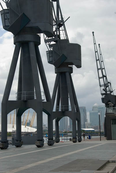
Rain Hit May Queen Festival: Saturday 8th May 2010 was a day of cold rain in southeast London, and the organisers of the London May Queen Festival had to abandon the usual procession by several hundred girls around the village of Hayes.

Instead the ceremonies went on in a crowded Hayes Village Hall, though there was room only for the London May Queen’s retinue, the 26 realm queens and small groups of their attendants, along with their family members. I’d photographed a number of previous events had been invited by one of the mothers to come and take photographs.

Photography was a little of a challenge as the light was fairly low and rather mixed, with cloudy daylight coming through the windows of the hall and long fluorescent tubes coming down from the roof of the hall. Though I did take some pictures by available light, the great majority of these were made using flash as the main source. Fortunately the Nikon SB-800 Speedlight with its i-TTL through the lens metering was an incredible advance on older flash systems and performed (with a little help from me) admirably.

Because we were packed into the hall, most of the time I was working very close to at least some of the people I was photographing and using my Nikon wide-angle zoom. This creates problems with uneven lighting – a person 1 metre away from the flash will receive 9 times the light of someone 3 metres away.

The main hall didn’t have a ceiling I could use to bounce light from (I could in some side rooms), but I did have a small diffuser and sometimes was able to angle the flash away from the near subject to give greater illumination on people further away. Edge fall-off from flash is normally a problem in wide-angle pictures, but sometimes you can put it to use.

I wasn’t the only photographer

Nowadays it is far easier to apply some compensation for uneven lighting in post-processing, but then it was still rather tedious and I don’t think I did so on any of these. As usual I took all pictures as RAW images, adjusting them in software (Lightroom) for contrast, colour balance and exposure. I think all are uncropped; it isn’t a religion for me, but I do like to get things framed right when I expose.

In my account on My London Diary for 2010 at Merrie England & London May Queen I give a fairly detailed description of the day. You can find out more about the history of the event and the texts of the event in earlier posts (or in the preview of my book London’s May Queens) and pictures of the event as it took place in fine weather in other years including 2005 elsewhere on this site.


FlickrFacebookMy London DiaryHull PhotosLea ValleyParis
London’s Industrial HeritageLondon Photos

All photographs on this page are copyright © Peter Marshall.
Contact me to buy prints or licence to reproduce.


Barnes Cray & the Cray – 1994

Barnes Cray & the Cray: Panoramas made with a swing-lens camera on a walk in September 1994 from Barnes Cray to Crayford Marshes in the London Borough of Bexley.

In 1750 Miles Barne, son of a wealthy London banker of the same name, inherited the large May Place Estate on the death of his father-in-law. Various members of the Barne family played important roles in the development of the area, with their names incorporated into Barnehurst and Barnes Cray.

Barnes Cray House had an interesting life not least when it was home to a farmer who went to the High Court to stop neighbouring land being used as a firing range by the company which became Vickers. Vickers eventually bought the house as a home for the man in charge of their Cray works, but when their factory moved away gave it to the local council who opened it as a maternity hospital. This closed in 1936 and the house was demolished.

River Cray, Crayford Flour Mill, Barnes Cray Bexley, 1994, 94-907-23

Industry came to the area in the Victorian era with a calico printing works using water from the River Wansunt, later making rubber goods, felt and finally making ‘Brussels Carpets’ – patterned carpets which have the loops of the pile uncut before being demolished in 1890. The Wansunt is a tributary of the River Cray which it joins close to here.

River Cray, Barnes Cray, Bexley, 1994, 94-904-61

The First World War led to a great expansion in the arms industry and Vickers built thousands of homes in Barnes Cray to house its huge workforce – at one point almost 15,000. The development was of good quality homes for workers with a nod to the ‘Garden Village’ vision. The development took the name Barnes Cray.

Crayford Flour Mill, Barnes Cray, Bexley, 1994, 94-904-32

An iron mill on the Cray was replaced in 1735 by a saw mill which in turn became a flour mill. In 1927 this began making Vitbe flour, with added wheatgerm to increase its Vitamin B levels, widely used by many bakereries including those of the Aerated Bread Co. In 1956 the company was renamed Vitbe Flour Mills Ltd and it was acquired by Associated British Foods in 1961.

Landfill site, Crayford Marshes, Barnes Cray, Bexley, 1994, 94-904-22
Crayford Marshes, Barnes Cray, Bexley, 1994, 94-904-11

I went for a lengthy walk on the Crayford Marshes, taking many panoramic images, but cannot remember the exact locations. Here is one of them but there are quite a few others on Flickr – you can browse this by clicking on this or other images in this post.

Crayford Marshes,  Barnes Cray, Bexley, 1994, 94-904-31
Crayford Marshes, Barnes Cray, Bexley, 1994, 94-904-31

FlickrFacebookMy London DiaryHull PhotosLea ValleyParis
London’s Industrial HeritageLondon Photos

All photographs on this page are copyright © Peter Marshall.
Contact me to buy prints or licence to reproduce.

Bexkleyheath & Crayford – 1994

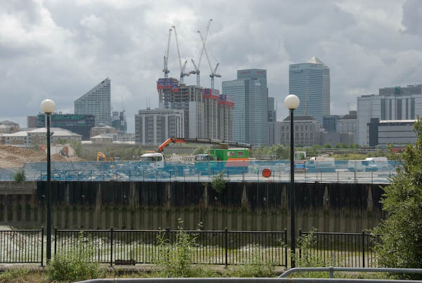
Bexkleyheath & Crayford: I spent several days in mid-August in Bexley in south-east London visiting Bexleyheath, Crayford and Barnes Cray and some of the areas around, and returned to the area the following month. I think all the pictures in this post were made in August.

Crayford, Bexley, 1994, 94-812-45

Crayford obviously gets its name from a ford over the River Cray, the major tributary of the River Darent which it joins not far from here and short distance from where this flows into the Thames. Its name is thought to mean a fast flowing stream and it powered an number of mills on its route – including a paper mill at Crayford. The tidal creek is still navigable from the Thames to Crayford, and was apparently canalised in 1845. There were still barges serving the flour mill in the 1980s.

Crayford, Bexley, 1994, 94-812-33
Crayford, Bexley, 1994, 94-812-34
Crayford, Bexley, 1994, 94-812-35

Taken through the links of a fence.

The Frontier Post, Bar & Grill, Bexleyheath, Bexley, 1994, 94-812-21
Spitfire Hall, Air Training Corps, Swaisland Drive, Crayford, Bexley, 1994, 94-812-11
Sainsburys, Petrol Station, Roman Way, Crayford, Bexley, 1994, 94-812-12

I returned to Crayford and Barnes Cray the following month, making a number of colour panoramas as well as black and white picture pictures which I’ll post at some time later – or you can find them in my Flickr albums for 1994.


FlickrFacebookMy London DiaryHull PhotosLea ValleyParis
London’s Industrial HeritageLondon Photos

All photographs on this page are copyright © Peter Marshall.
Contact me to buy prints or licence to reproduce.

More Thames Path – 2011

Charlton to Belvedere

More Thames Path - 2011

Charlton to Belvedere
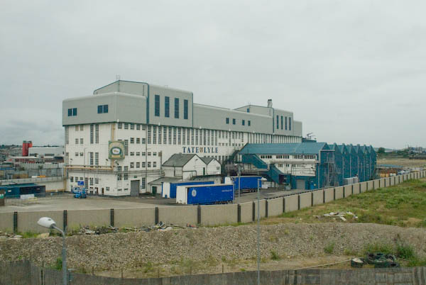
The view upriver from Charlton with the Thames barrier, Dome and Canary Wharf

Charlton to Belvedere: On Monday 25 April 2011 I went with my wife and elder son on a walk from Charlton Station to Belvedere. They walked but I rode on my folding Brompton bike as I was still suffering from plantar fasciitis and walking any distance became too painful.

More Thames Path - 2011

Charlton to Belvedere
A derelict pub in Charlton

As a cyclist any pressure is on the ball of the foot, with no weight at all on the heel and arch where the pain can be intense. Gel insoles help a little for walking and I was still managing to photograph events, but longer – and faster – walks were still completely out of the question for me.

More Thames Path - 2011

Charlton to Belvedere
Tate & Lyle in Silvertown

I’d been to see my doctor who was sympathetic and told me that physiotherapy might help, but given the waiting list for appointments the pain would probably have gone away before I got one. But there were exercises that could help – and after I had spent a few months rolling a baked bean tin back and forth under my heal while having breakfast the pain did eventually go away.

More Thames Path - 2011

Charlton to Belvedere
Warspite Rd/Bowater Rd SE18

The bike was a great idea. Linda and Sam were fast walkers and intent on getting to our destination, while as a photographer I kept stopping and sometimes wandering a little to one side to get into the right position to take pictures. Then I would see them a couple of hundred yards ahead and would need to run to catch up. So much easier on the bike.

More Thames Path - 2011

Charlton to Belvedere

I took advantage of my bike to make some longer than normal diversions, at one stage cycling down a road to reach the river where there was no riverside path but riverside steps. I had a scary moment here, walking out on a ledge to get a better view I lost my balance and began to shake uncontrollably in front of a 10 foot drop onto the concrete steps and rubble of the foreshore. Fortunately I managed instead to grab hold of a rail behind me and after holding it for a few seconds steady myself enough to edge back to safety. I was only too aware of a history of photographers falling to their deaths while ‘getting a better view’.

More Thames Path - 2011

Charlton to Belvedere
Recent flats on the former Royal Dockyard at Woolwich

Eventually I stopped shaking and was able to get back on my bike and hurry after the others. And no, I didn’t tell them what had happened and they still won’t know about it unless they read this.

We were on the John Burns, named after the great trade unionist and Labour politician who called the Thames ‘liquid history’.

At Woolwich we took a ride across on the Free Ferry. Folding the Brompton I could walk past the ‘No Bicycles’ sign and go below deck with the others. I’d hoped we could return by the tunnel, but it was closed so we had a short walk in North Woolwich and a second ferry ride.

Coming back to Woolwich I kept on the vehicle deck. Bikes get to ride off before the cars.

When the Thames Path was declared a National Trail and then opened in 1996 it ended at the Thames Barrier. Our walk in 2011 began at Charlton station so only the first short section was on that and beyond we were walking the Thames Path Extension. I had previously walked all of this route, and further on as far as Cliffe. If you have the stamina you can now continue all the way to the Isle of Grain though a bike would really be a good idea. Perhaps one day I’ll do it.

The Royal Arsenal site, once an official secret is now a tourist destination, complete with various sculptures, including Peter Burke‘s Assembly
There are glimpses of the river and these waste transfer barges though trees and over bushe and Beckton on the opposite bank
One of the larger tributaries of the Thames is the treated outfall from Beckton sewage works at left. close to Barking Creek
Waste incinerators and the Bazalgette pumping station
The Romanesque Crossness Southern Outfall Works opened in 1865, pumping sewage out when the tide would take it seawards
Part of the more utilitarian 1950s sewage treatment plant at Crossness
The 1998 sludge incinerator, an elegant swan-like metal structure
Looking downstream to silos at Rainham

On this ‘walk’ I gave up here and cycled to Belvedere station to get home for a meeting in the evening, while the two walkers continued to the Darent and then walked back to Slade Green station.

Many more pictures on My London Diary from the walk and the ferry at More Thames Path.


FlickrFacebookMy London DiaryHull PhotosLea ValleyParis
London’s Industrial HeritageLondon Photos

All photographs on this page are copyright © Peter Marshall.
Contact me to buy prints or licence to reproduce.

Point Pleasant and the Thames – 1990

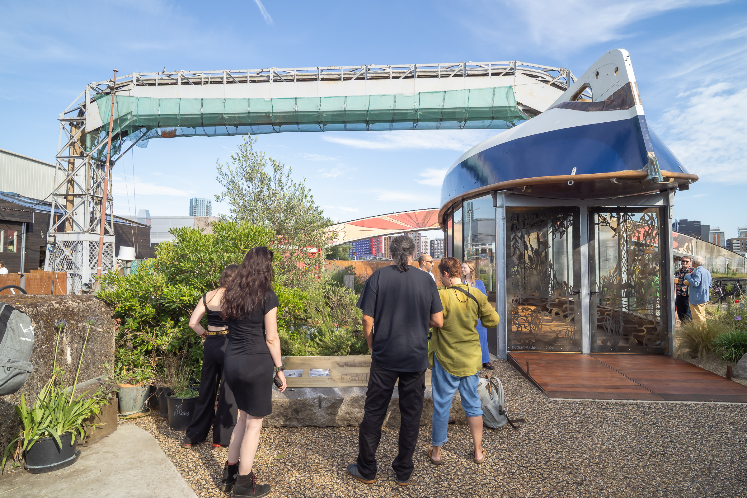
Point Pleasant and the Thames: Continuing my walk on Sunday 4th March 1990 had begun at Clapham Junction in Battersea with St John’s Road & East Hill, Battersea – 1990 and the previous post to this was Yet More Wandle.

Prospect Cottages, Point Pleasant, Wandsworth, 1990, 90-3c-43

I get a fleeting view of these cottages as my train goes past between Putney and Wandsworth Town at ‘Point Pleasant Junction’ which still connects the National Rail lines with the District Line to Wimbledon. The bridge over the lines was closed in 1987 as unsafe and partly demolished, though the piers remain and the remaining link made bi-directional. It is now only used by excusions and some empty trains – but I was on a train that took this route during an emergency deviation quite a few years ago.

I don’t know how Point Pleasant got its name, though it seems to date back as long as the street existed. Perhaps it was simply lead to a pleasant view of the River Thames.

I think these cottages are present on the earliest maps of the area I have seen from the early years of the 19th century, though its hard to be sure and they may have replaced earlier cottages on the site. Surprisingly the 14 cottages do not appear to be even locally listed.

Works, Point Pleasant, Wandsworth, 1990, 90-3c-44

But Point Pleasant was long an industrial area. According to Ediths Street’s  Edward Barker set up an ironworks here in 1634 making small articles such as frying pans and to have been a major arms supplier to the Civil War. His site was sold to Gatty and Waller in 1771 and they set up a chemical works distilling vinegar and producing other chemicals.

The Union Brewery opened here in 1820 and closed in 1920. Richard Seligman set up the Aluminium Plant and Vessel Co. a specialist aluminium welding business, on part of the brewery site in 1920 and his works eventually covered most of Point Pleasant, moving out to Crawley in 1952. I think this factory, built in two stages, was a part of those works.

Point Pleasant, Wandsworth, 1990, 90-3c-45

Redevelopment of the whole area was just beginning in 1990, and although it started well – and even received a Housing Design award in 2005, later developments have been considerably higher and far less sympathetic.

Prospect House, Point Pleasant, Wandsworth, 1990, 90-3c-32

There is one Grade II listed property in the area, this house built for a local businessman in 1805-6 who probably did enjoy a pleasant view. It is listed as an excvellent example of domestic Georgian architecture. Just down the road is a locally listed pub which I failed to photograph or to visit. Then I think it was then a Watney’s pub, The Foresters Arms, but shortly after, when its resident cat went missing and then returned was renamed ‘The Cat’s Back’. Taken over by Harvey’s in 2011 it is now apparently a pub worth visiting both for the beer and its now quirky interior. Perhaps time for me to revisit Point Pleasant!

River Thames, from, Wandsworth Park, Wandsworth, 1990, 90-3c-34

The riverside view downsteam from close to Point Pleasant. Certainly interesting but I don’t think I would describe it as pleasant. Moorings now obscure much of the view.

Oil Storage tanks, Osiers Rd, Wandsworth, 1990, 90-3c-35

The Shell Oil terminal on Osiers Road, an area marked on old maps as a marsh with tidal channels on the corner of the River Wandle and River Thames. Doubtless before Shell it had willows, perhaps harvested for wicker baskets etc.

The site is now crowded with much taller blocks of flats, including a 21 storey tower, with 275 homes. At least it no longer reeks of oil, though I think I could still smell it faintly when I walked around the new riverside path here shortly after it opened.

Still one more set of pictures from this long walk to come.


FlickrFacebookMy London DiaryHull PhotosLea ValleyParis
London’s Industrial HeritageLondon Photos

All photographs on this page are copyright © Peter Marshall.
Contact me to buy prints or licence to reproduce.


Woolwich Riverside and Royal Artillery

Woolwich Riverside and Royal Artillery: More pictures from my walk around Woolwich in August 1994

Waste Land, Woolwich Church St, Woolwich Ferry, River Thames, Woolwich, Greenwich, 1994, 94-807-42

This area, previously occupied by engineering works, has now been redeveloped with a luxury development of tall housing blocks on Mast Quay, “A magnificent crafted living space with panoramic views of the River Thames.”

Entrance, Woolwich Foot Tunnel, Woolwich, Greenwich, 1994, 94-809-13

As well as getting a free ferry, Woolwich also got a foot tunnel under the River Thames, opened by the London County Council in 1912. The tunnel is just over 500 meters long and remains delightfully cool on hot summer days.

Many cyclists also use the tunnel despite bylwws prohibiting cyclists. Electronic signs were installed in 2016 which used a computerised system to measure traffic and messaged ‘No cycling allowed‘ in red at busy times but ‘Please consider pedestrians‘ in green when the tunnel was fairly empty. Greenwich council was in favour of changing the bylaws to legalise this, but Tower Hamlets refused and the system was discontinued. Many cyclists still ride.

The tunnel provides a useful route across the river, particularly when the ferry is out of action, but most times I’ve used it one of both of the lifts at each end have not been working. I’ve never counted the steps but there are rather a lot of them, particularly when going up.

River Thames, Woolwich, Greenwich, 1994, 94-809-21

Downstream from the ferry in what in 1994 was I think an open area, once the site of Woolwich Power Station, demolished in 1978-9 though the coaling jetty in this picture is still there. There is still a riverside walk but most of the site is now occupied by tall blocks of flats.

River Thames, Woolwich, Greenwich, 1994, 94-809-22

A bridge here links the former coaling jetty with the riverside path.

From Riverside Path, Woolwich, Greenwich, 1994, 94-809-33
Steps from Riverside Path, Woolwich, Greenwich, 1994, 94-809-33

This area is now covered by tall flats, though there is a small segment of parkland with fountains.

Mural, Thames Barrier, Woolwich, Greenwich, 1994, 94-812-65

I cannot remember exactly where I found this mural of the Thames Barrier in Woolwich and I think it was soon demolished.

Royal Artillery Memorial, St George's Garrison Church, Grand Depot Road, Woolwich, Greenwich, 1994, 94-812-52
Royal Artillery Memorial, St George’s Garrison Church, Grand Depot Road, Woolwich, Greenwich, 1994, 94-812-52

Built for the garrison in 1862-3 it was hit by a V1 flying bomb in 1944 and the church was largely destroyed by fire. In 1970 more of the building was demolished but a canopy roof added to protect the apse and its polychromatic Victorian brick and decorations, with a memorial garden added in the former nave. It was listed in 1973. In 2011 it was transferred out of military ownership and since then there has been some restoration work, partly lottery funded.

Cannon, Royal Artillery Barracks, Woolwich, Greenwich, 1994, 94-808-32

The barracks was the home of the Royal Artillery from 1776 until 2007. Its 1,000 foot long Georgian frontage is said to be the longest in Europe if not the world. Since 2007 most of it has been rebuilt behind this, and in 2016 the Ministry of Defence announced plans for all army units to move out by 2028.

The cannon is the “17.75-ton Bhurtpore gun, captured by Field Marshall the Viscount Combermere after the 1826 siege of Bhurtpore” and brought here in 1828. When the Royal Artillery moved out they took this and four other cannons with them, doubtless a vital part of our country’s defence.

More from 1994 to come.


FlickrFacebookMy London DiaryHull PhotosLea ValleyParis
London’s Industrial HeritageLondon Photos

All photographs on this page are copyright © Peter Marshall.
Contact me to buy prints or licence to reproduce.


Crowning of the Hayes Realms – 2008

Hayes, Bromley

Crowning of the Hayes Realms - 2008
The procession around Hayes

Hayes in the south-east corner of Greater London in the London Borough of Bromley is at the centre of a tradition that goes back over a hundred years, the London May Queen. At its height in the inter-war period this attracted great publicity and was filmed by Pathé News for showing in cinemas around the country – you can watch some of those films on their site.

Crowning of the Hayes Realms - 2008
The event began in a local school

I came to the May Queens from the posthumous book of photographs by British photographer Tony Ray-Jones ‘A Day Off’, published in 1974 soon after his tragically early death which contained a handful of his pictures from May Queen festivals taken in the late 1960s.

Crowning of the Hayes Realms - 2008

One of these, not one of his better photographs and I wondered why it had made the book, was ”May Queen Gathering, Sittingbourne, 1968‘, which shows around 30 young women all wearing crowns in three rows in front of a maypole. I wasn’t impressed by his picture but thought it seemed an intriguing event to photograph. The location in the caption (written after his death by a colleague) was corrected in a later publication and he had taken it at the annual London May Queen festival at ‘Hayes, Kent’ in London.

Crowning of the Hayes Realms - 2008

The London May Queen festival still follows the design and pattern laid down at its inception by schoolmaster Joseph Deedy in 1913. The Hayes festival at which the London May Queen is crowned is simply the peak of a series of events by various May Queen ‘realms’ each with their own May Queens and retinues from various communities in this area of south and south-east London.

Crowning of the Hayes Realms - 2008
Each realm has its own colour and flower

I’ve often written at greater length about the organisation including several posts on this site such as Ray-Jones & London May Queen – 2005. My work with the May Queens was encouraged by a major London museum who promised me a show – but this was cancelled at the last minute for financial reasons, I think a victim of the 2008 financial crisis. I had hoped we would bring out a book to accompany the show, but in the end I self-published this, bringing out a second edition with minor corrections in 2012, a year before the crowning of London’s 100th May Queen.

The London May Queen at this event

The book preview at the link above shows the whole book, including my fairly lengthy texts and over 70 pictures, mainly from London May Queen.

Crowning the Hayes May Queen
The Hayes Common May Queen is crowned
Then came the Hayes Village May Queen

Although the event may seem rather quaint with queens, pages and other positions in the realms, the activities are designed to be fun for the young girls but also to develop their confidence and self reliance. And there are teas with cake.

Some girls drop out as they get older, and progress through the various levels of the realms and of the London May Queen group to which the realm queens move up is determined solely by seniority in the organisation.

Altogether for the project I took over 12,000 pictures, adding a few more when I was later invited back to photograph her crowning by one of the later May Queens. All the pictures with this post are from 19th April 2008 in Hayes.

More pictures from the Crowning of the Hayes Realms.


FlickrFacebookMy London DiaryHull PhotosLea ValleyParis
London’s Industrial HeritageLondon Photos

All photographs on this page are copyright © Peter Marshall.
Contact me to buy prints or licence to reproduce.