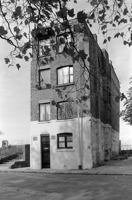
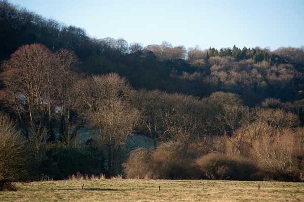
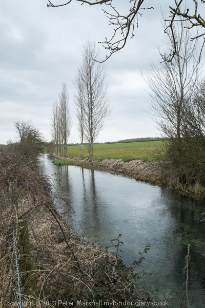
December 2004 was not a great month for weather and it shows in the pictures than I took along the Thames estuary in Essex on Saturday 4th December. But perhaps they are appropriate for the landscape although were I to go back to the RAW files I took – using the Nikon D100 and mainly the then groundbreaking Sigma 12-24mm wideangle zoom – and reprocess them with more recent conversion software they might be a little less drab.
I took my folding Brompton with me on the train, although much of the route I took was on footpaths. Bromptons are not great off-road bikes and I was probably wheeling it quite a lot of the time, but it carried the weight of my gear in its front bag and let me go quickly along some of the less interesting parts of my route.
I’m not sure if it was on this ride or on another in this part of Essex where the chain came off thanks to an excessive amount of mud and became somehow locked out of place between the frame and some other part, locking the rear wheel completely. I struggled for perhaps 10 minutes to free it without success and had almost become resigned to having to carry it some miles to the nearest station, a rather daunting prospect as together with cameras etc it was a rather unwieldy 40lbs or so.
Fortunately I was saved by a stranger who came along the path and rather stronger than me managed to pull the trapped link free – though getting his hands covered in oil and mud to do so. I was extremely grateful, thankful and rather embarrassed at the mess he was in, though handing him my oily bike rag to wipe the worst off. It’s great that some people at least will go out of they way to come to the aid of others.
As well as some of the pictures as I posted them at the time, I’ll also put on the text I wrote then on My London Diary, where you can see more pictures. I’ve edited the text slightly, mainly to restore normal capitalisation which makes it rather easier to read.
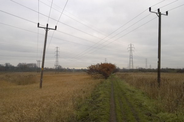
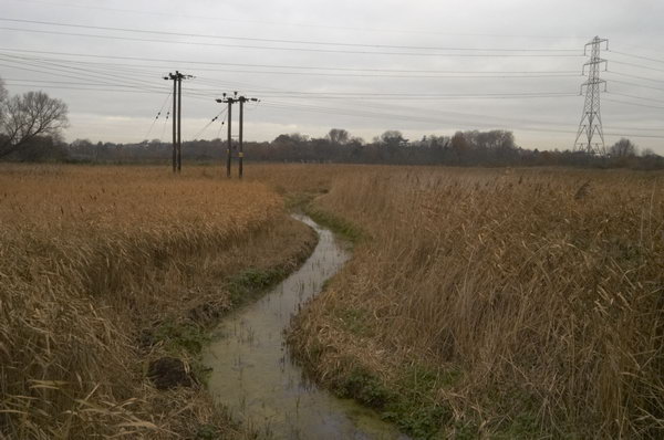
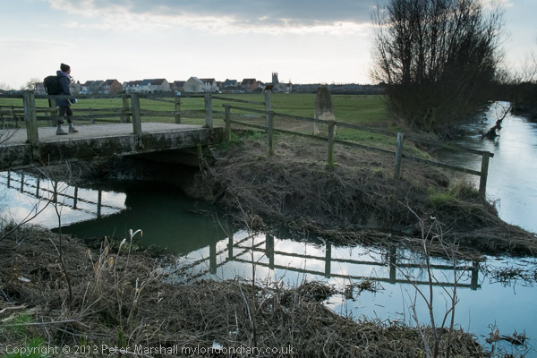
December started a drab month, with little light, but the forecast for Saturday 4th suggested the mist and cloud would clear, so I set off for Stanford-le-Hope. Single or return asked the ticket seller, I wouldn’t want to stay there I told him.
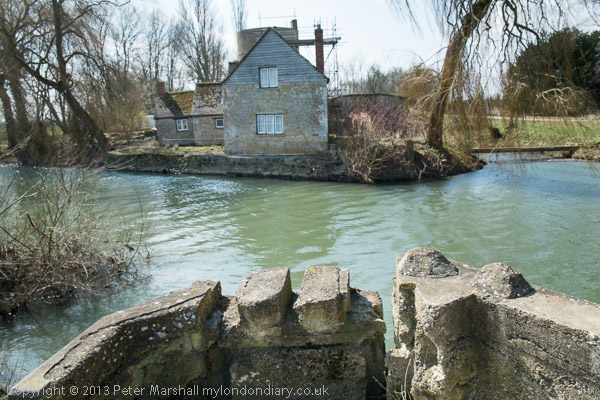
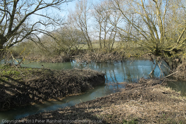
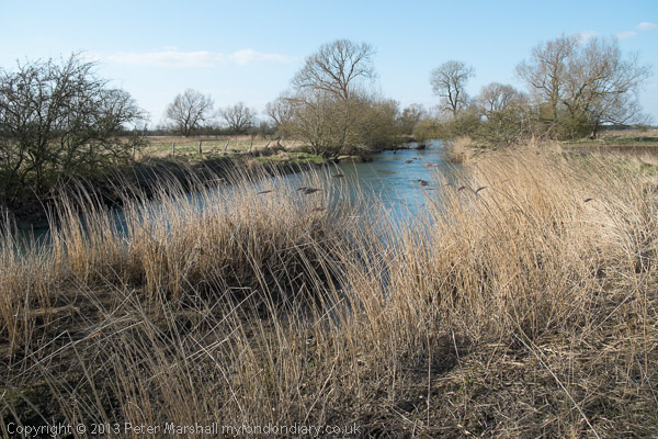
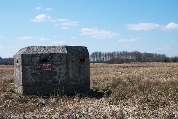
From the station I turned left and then south towards Mucking and the river. Disappointingly the church in Mucking is now a private house, and the churchyard only open by arrangement. The footpath led through a nature reserve, the largest bog of its type in England, and then turned past a large complex of unfilled gravel pits towards Mucking Creek.
Names on maps can have a fascination, and Mucking Marshes, Mucking Flats, Mucking and Mucking Creek were places I needed to see. In good light they would have been great, but on a dull grey day they lacked sparkle.
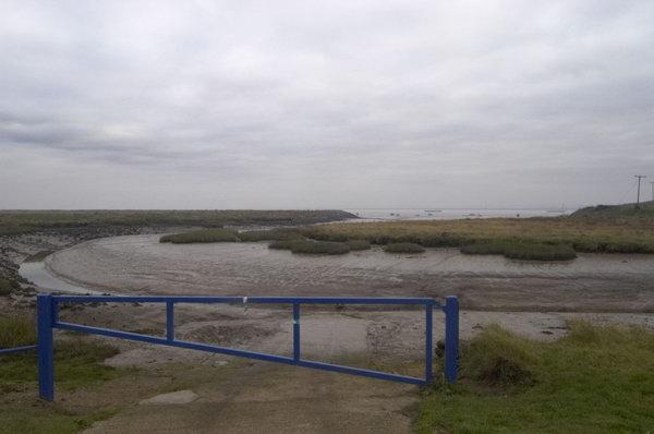
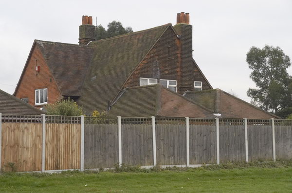
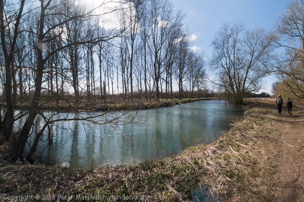
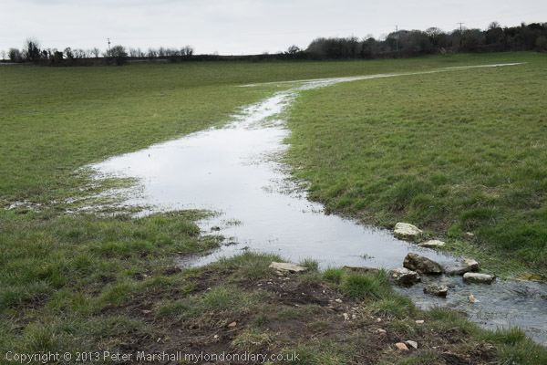
The footpath led along the riverside towards Corringham and Shell, but disappointingly the bridge across a small creek had disappeared. There was an unmarked detour along the goods line, but not the same. I returned to Stanford-le-Hope splashing through huge puddles in the rutted lane. One of its few claims to fame is as the home of writer Joseph Conrad, but the cottage in which he lived is surrounded by a high fence and there is little to see.
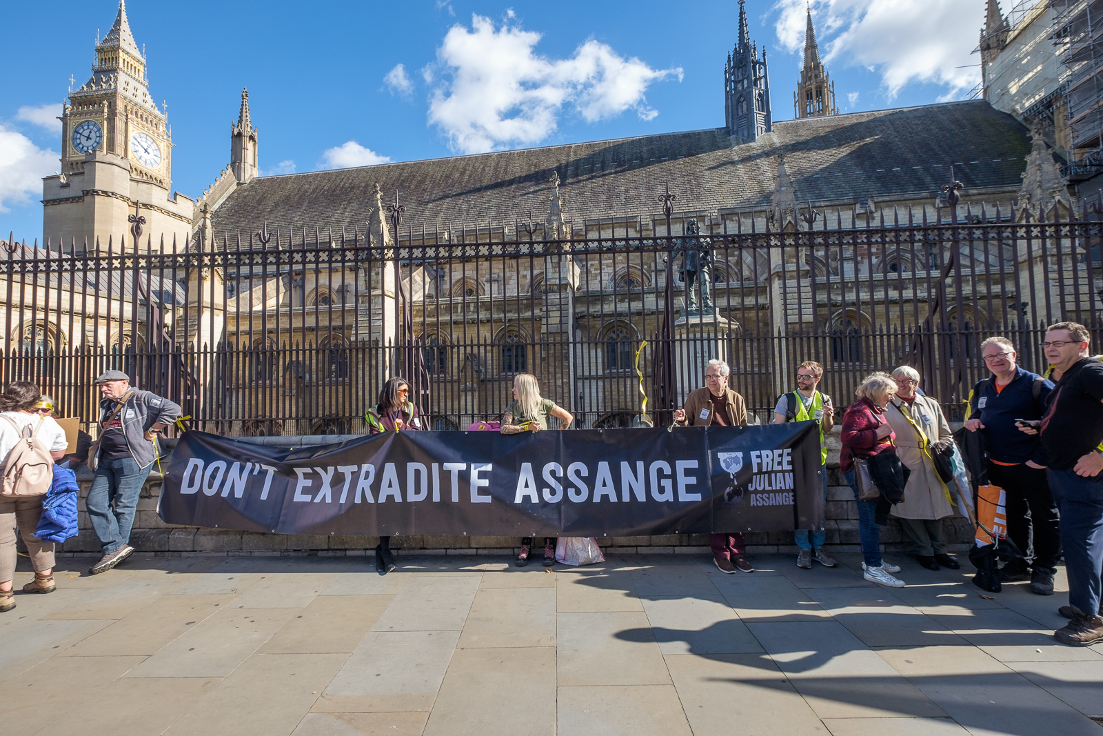
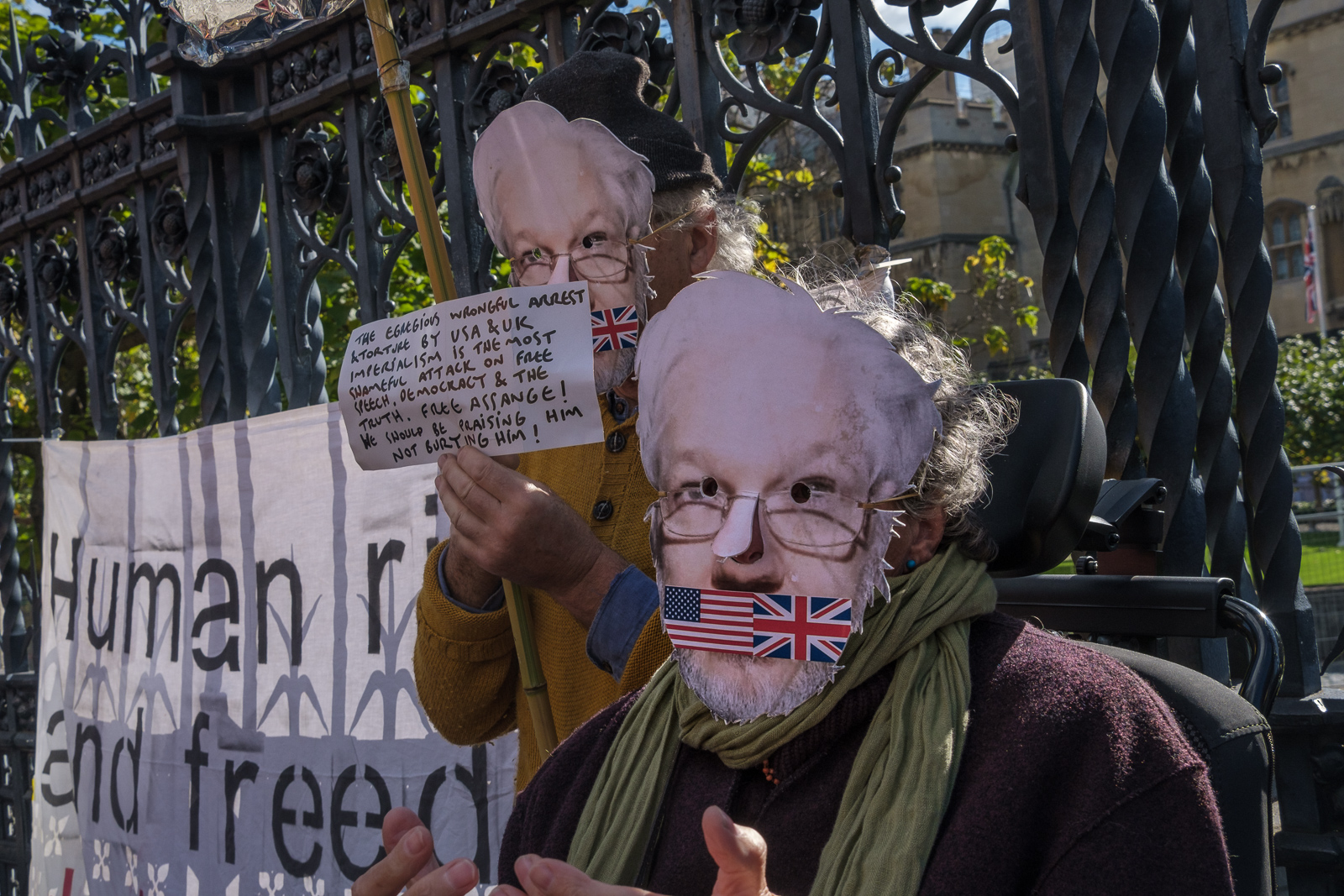
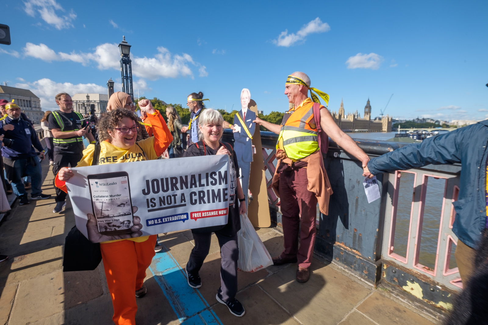
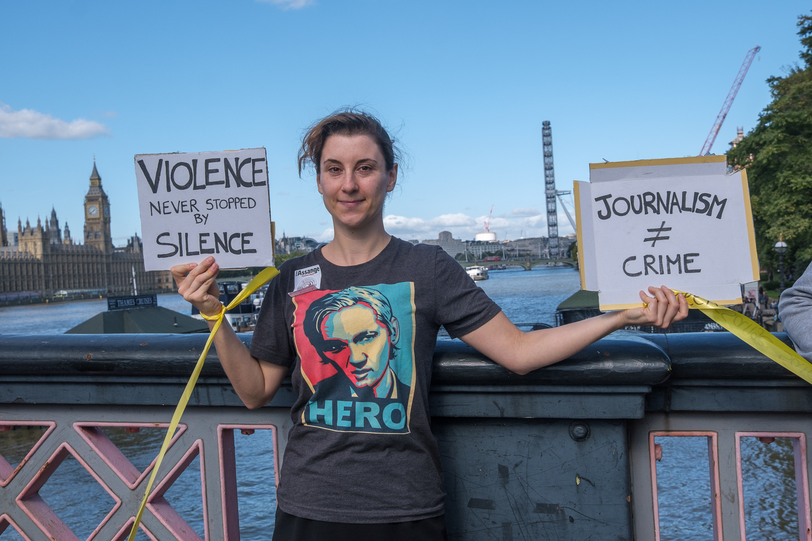
Last Saturday, 8th October 2022, I photographed a protest in London against the imprisonment and possible extradition of Julian Assange, currrently held in the UK’s maximum security jail at Belmarsh.
Assange’s “crime” was to publish documents about US war crimes in Afghanistan, Iraq and elswhere, making documents downloaded by Chelsea Manning, making them available after suitable redaction to protect the individuals concerned to the world’s press and to the public on WikiLeaks. Wikipedia has a good and fairly detailed entry on him which most of the details here come from.
If extradited to the US he would be put on trial in a area where the jury would be composed of people from an area with strong connections to the US security services who will already have pre-judged him as guilty. His sentence is likely to amount to 175 years in a US maximum security jail, probably in isolation and never to be freed.
In 2010 Sweden issued an extradition warrant for him on allegations of sexual misconduct, which were widely seen as a pretext to enable him to be extradited from Sweden to face criminal charges in the USA. When in 2012 he lost his fight against extradition to Sweden he jumped bail to take refuge in the Ecuadorian Embassy in London, where he lived in highly restricted accomodation until 2019.
A new government in Ecuador decided to end his asylum in the embassy and invited police in to arrest him in April 2019; he was then sentenced to 50 weeks in jail for breaching his bail. The Swedish sexual charges against him were dropped later in the year, but the USA immediately began proceedings to extradite him to face trial under the US 1917 Espionage Act.
The decision to use this Act has been widely criticised in the press and elsewhere as being an attack on the First Amendment to the United States Constitution, which guarantees press freedom. And if Assange is guilty then it seems clear that the editors of the newspapers that published the revelations he made in publising the Baghdad airstrike Collateral Murder video, the Afghanistan war logs, the Iraq war logs and other material could also be prosecuted. Even my publishing the link to the video could be a crime.
Assange’s sentence was completed in September 2019, but he was kept in jail because of the US extradition claim. He had been visited earlier by Nils Melzer, the United Nations special rapporteur on Torture and Other Cruel, Inhuman or Degrading Treatment or Punishment, who, as quoted on Wikipedia found “in addition to physical ailments, Mr Assange showed all symptoms typical for prolonged exposure to psychological torture, including extreme stress, chronic anxiety and intense psychological trauma.”
After a protracted hearing including much medical evidence, a judge on 4 January 2021 ruled that Assange could not be extradited to the USA on grounds of mental health and the suicide risk in a US prison cell. The USA appealed the decision, and Assange remained in jail. The High Court rejected much of the medical evidence, believed the US lies of fair treatment made and found in favour of the USA on 10 December 2021.
In April his extradition was formally approved in court and referred to Home Secretary Priti Patel, who approved it in June. But the legal battle continues with a new appeal. Essentially Assange has now been locked up for 10 years. Wikileaks has continued his work in releasing information in his absence. The continuing persecution by both the UK and USA for revealing their war crimes seems spiteful and malicious.
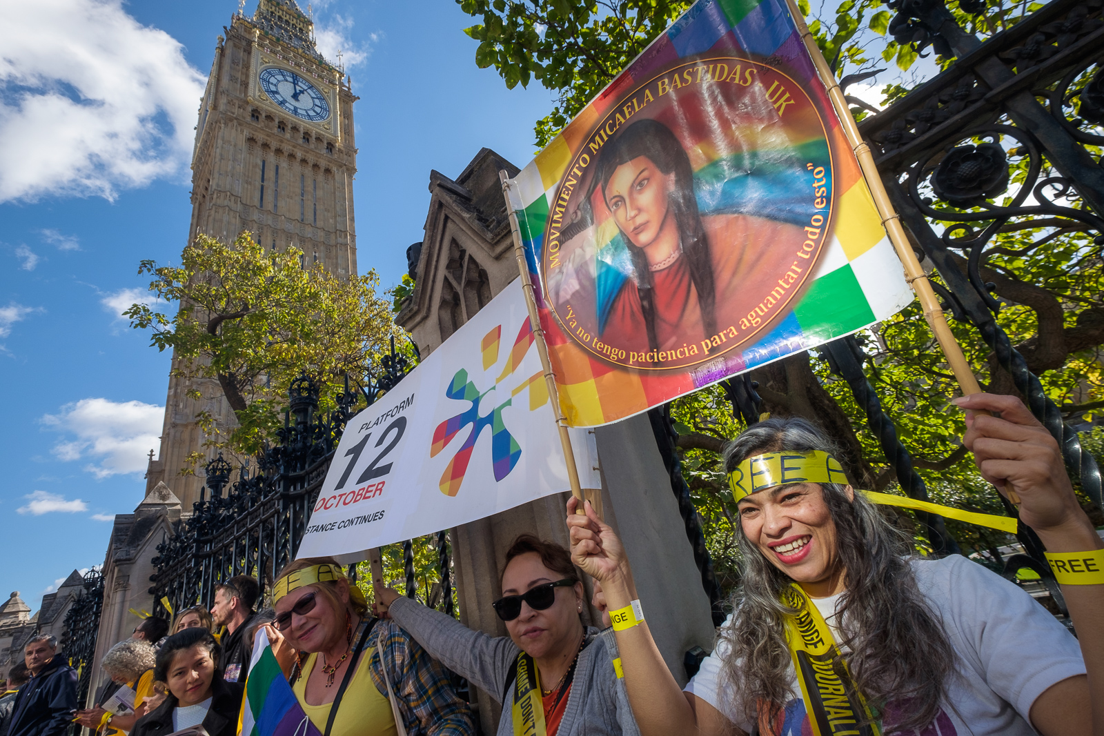
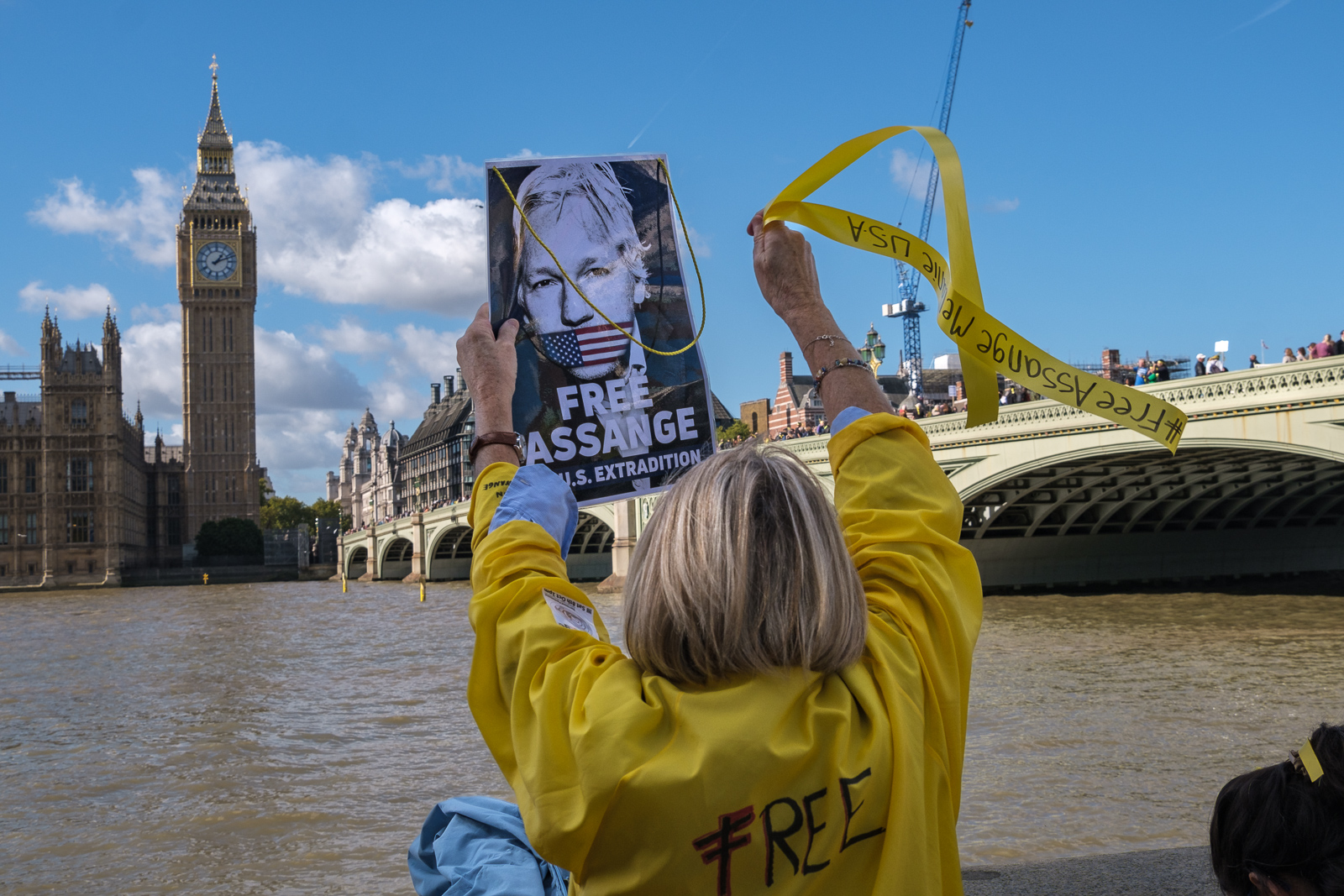
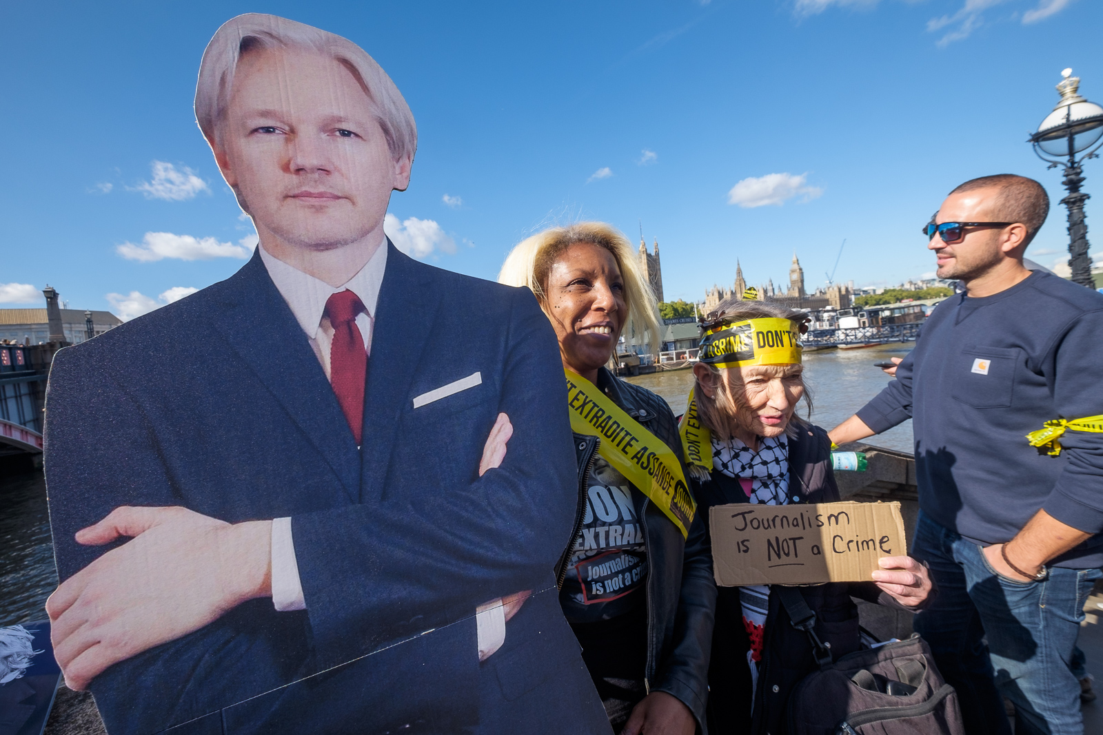
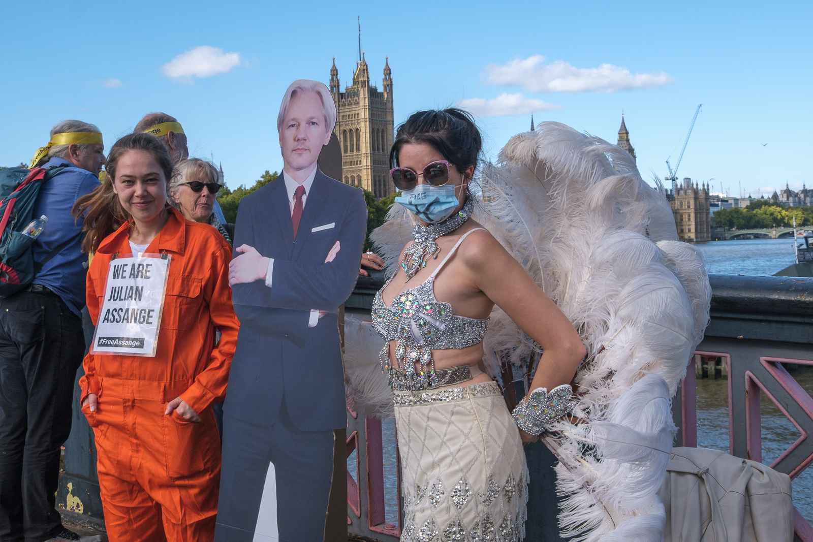
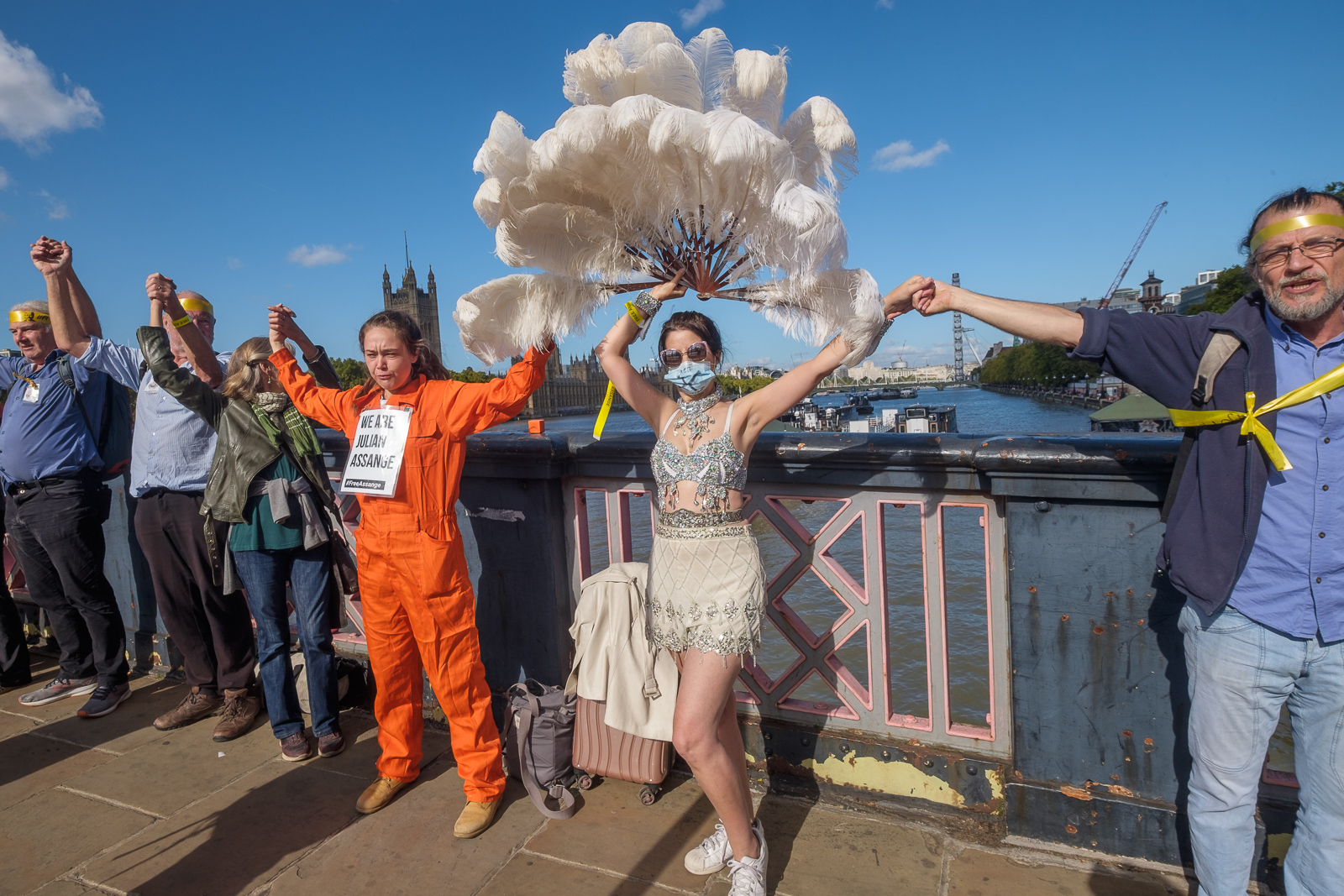
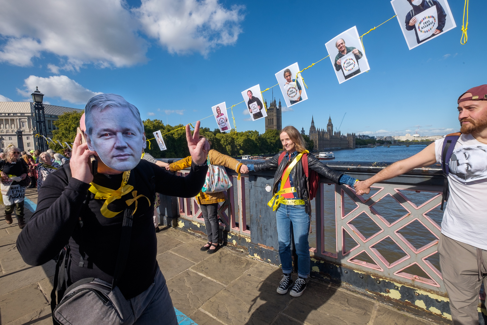
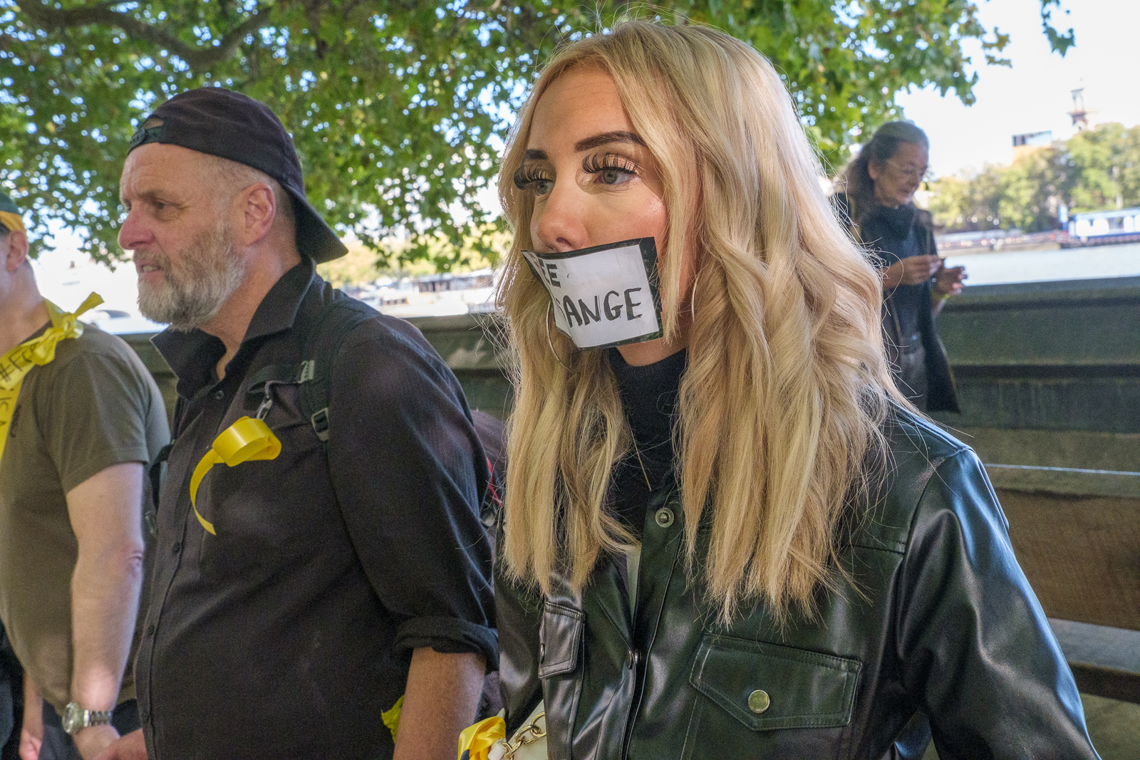
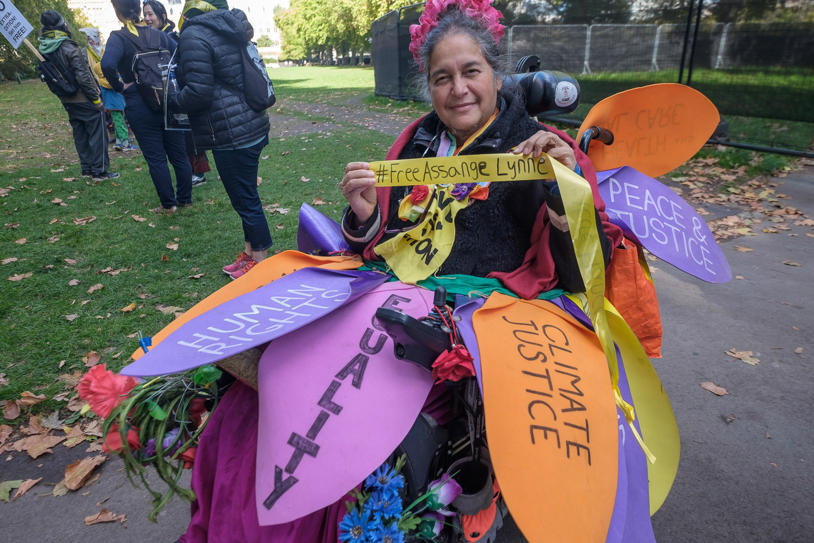
On Saturday 8th October I photographed a protest in London by around 10,000 people who formed a human chain calling for Assange to be freed and not to be extradited around the Houses of Parliament, crossing the river on Westminster Bridge and returning across Lambeth Bridge, a distance of a little over two kilometres.
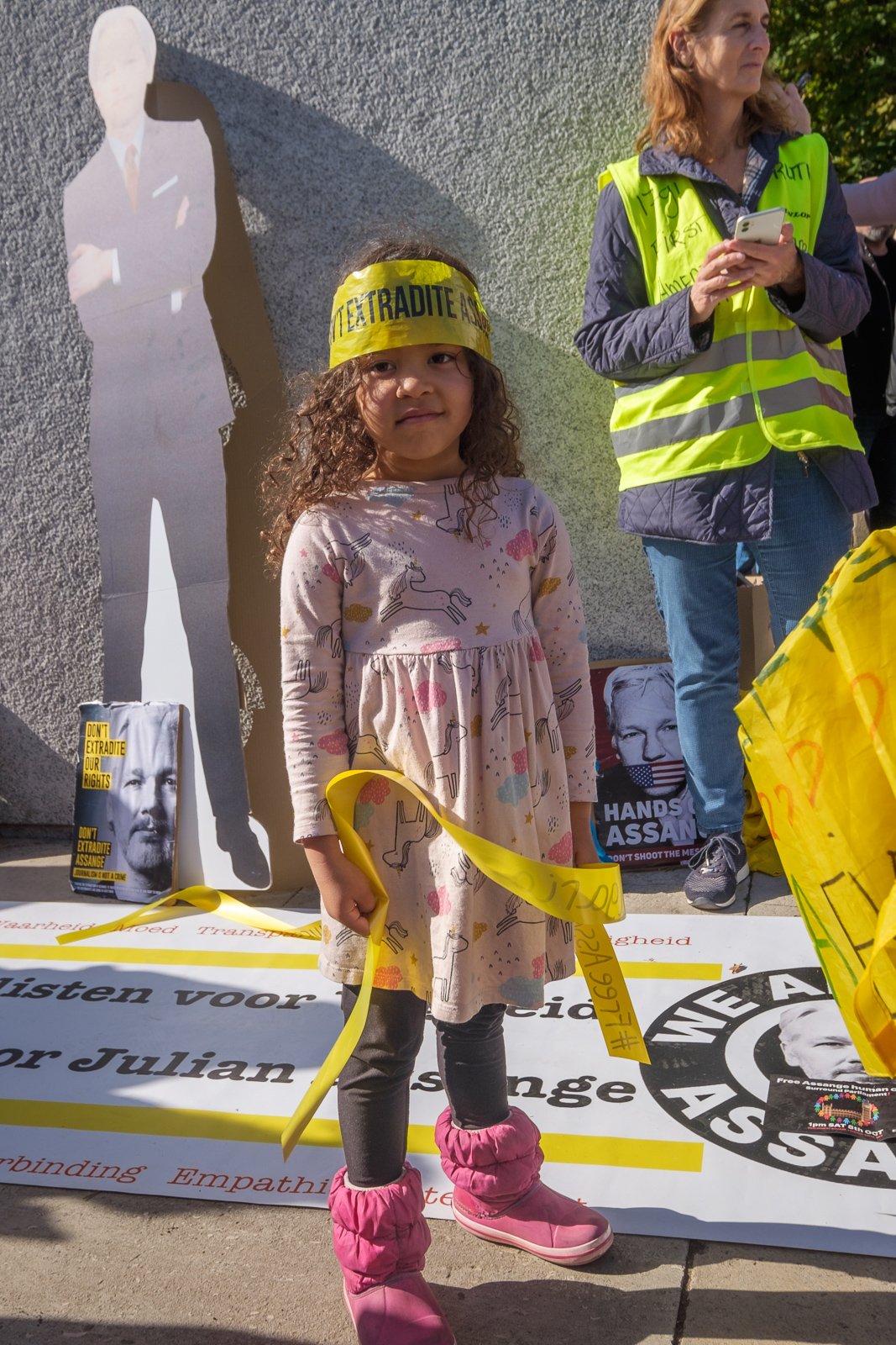
It’s difficult to know how many took part, but there seemed to be enough people to join hands, with quite a few to spare in some parts where people were shoulder to shoulder and some to spare. The organisers had thought they would need around 5,000 so I think it was probably rather more than that; estimates I’ve seen range from 3,000 to 12,000. But as well as those present in person, many unable to get to Londonwere represented by yellow sashes with their names on them.
When I arrived people were tying these to the railings around the Houses of Parliament, but police came to remove them, handing them back to the protesters. They said nothing was allowed to be fixed to the railings. Many of the protesters held or wore the sashes for the protest, and although I don’t often take part in the protests I’m photographing, most of these pictures were taken by me with a sash reading ‘#Free Assange Monique Dits Belgium‘ around my neck.
At around 1.30, rather later than planned people were told to link hands and they chanted ‘Free Assange’ and other slogans for a few minutes. I’d chosen to be on Lambeth Bridge for this as I could then take photographs with the Houses of Parliament seen across the Thames in the backgound.
After taking some there I made my way along the rest of the chain back to Parliament, on my way passing John McDonnell being interviewed by a videographer. Normally I would have stopped to talk to him, but by now I was rather tired, still suffering a little from my booster jab the previous day and I carried on, past a small crowd of people with video and still cameras three or four deep around Jeremy Corbyn. But I’d decided he wasn’t really the story and carried on. I’ve photographed him enough times over the many years I’ve known him.
From Southwark Park Schools which ended the previous post on this walk, Rotherhithe New Road & Southwark Park Schools, I walked a few yards up Southwark Park Road to the corner with Banyard Road, where I photographed the taxi office (still there but changed from A-Z Star Cars to 5 Star Cars) with the pub on the opposite corner, the Southwark Park Tavern, now closed and converted to residential around 2003.
There was a pub around here, the Green Man, possibly on this site before Southwark Park opened in 1869 but I think this building probably came shortly after the park was opened, and is opposite the Carriage Drive leading into the park.
Unfortunately I haven’t yet digitised this picture, nor one of rather plain two-storey terrace on Banyard Rd or an image showing a play area in the park. I hurried through the park to the Jamaica Road gate at its north, crossing to make my way to Kings Stairs Gardens and the River Thames.
River Thames, Downstream, Rotherhithe, Southwark, 1988 88-10l-63
The two jetties visible here I think have now gone and there is certainly no line of lighters as in this picture, and there is one striking new building on the riverfront.
River Thames, Downstream, Rotherhithe, Southwark, 1988 88-10l-65
A second picture taken with a short telephoto lens from almost exactly the same place shows the central area more clearly, with new flats being built on Rotherhithe St.
Wapping, River Thames, Rotherhithe, Southwark, 198888-10l-51
Looking across the Thames downstream, with Free Trade Wharf at the extreme right and just to the left the cylinder ventilation shaft of the Rotherhithe tunnel in the King Edward Memorial Park. Both Metropolitan Wharf and New Crane Wharf are covered iwth scaffolding.
Wapping, River Thames, Rotherhithe, Southwark, 1988 88-10l-52
Part of St John’s Wharf and King Henry’s Wharves seen across the River Thames.
Wapping, River Thames, Rotherhithe, Southwark, 1988 88-10l-53
More of St John’s Wharf, including one of the earlier warehouse conversions and the Grade II listed Wapping Police Station, built 1907-10, Metropolitan Police architect John Dixon Butler. At extreme left is a part of Aberdeen Wharf built in 1843–4 by the Aberdeen Steam Navigation Company.
Wapping, River Thames, Rotherhithe, Southwark, 1988 88-10l-54
The end of Aberdeen Wharf is at the right edge of this picture, and at its left the Wapping Police Boatyard, an unnecessarily ugly building opened in 1973. The new building in the centre of the picture also seems something of an eyesore, at least at its ends.
Wapping, River Thames, Rotherhithe, Southwark, 1988 88-10l-55
Continuing up-river from the Police Boatyard are St Thomas Wharf, Pierhead Wharf, Oliver’s Wharf – the first warehouse in Wapping to be converted into luxury flats in 1972 – and Wapping Pierhead, with houses designed by Daniel Alexander in 1811 and the main entrance to London Docks.
Bermondsey, River Thames, Rotherhithe, Southwark, 1988 88-10l-41
Looking upriver on the south bank with Tower Bridge at the extreme right and Guy’s Hospital tower just left of centre. Cherry Garden Pier is at left.
Silver Jubilee, marker, EIIR, River Thames, Rotherhithe, Southwark, 1988 88-10l-43
There is still a marker for the Queen’s Silver Jubilee here but it looks far less impressive than this rugged stonework I photographed in 1988. London has also gained quite a few tall buildings, but the view along the river remains clear and you can still see the dome of St Paul’s Cathedral.
41 Rotherhithe St, now apparently 1 Fulford St at least according to Google Maps, was the offices of lighterage company Braitwaite & Dean, where their lightermen would come to collect their weekly wage. Apparently it was known locally as the Leaning Tower of Rotherhithe, though the building’s lean is more apparent from across the river than in my picture.
It was left more or less alone on this stretch of the river with just the Angel pub equally isolated a few yards upriver after Bermondsey council bought many of the buildings in 1939 to create a park, with wartime bombing continuing the demolition job. There was some temporary housing by the river when I first walked along here in the early 1980s, but that soon disappeared.
My walk in Bermondsey continued – more about it in a later post.
Brompton around Swanscombe 2015 – Late in 2002 I bought a Brompton folding bicycle, something I’d been considering for years, but the cost had put me off. I can’t remember exactly what it cost me then, but with a few essential bits and pieces it was around £700 – allowing for inflation now equivalent to around £1200. Bromptons (hereafter just B’s) now start at £850, even better value. In an interview a year or two later with a photographic magazine I was asked “What is your favourite photographic accessory?” and my answer, “My B” wasn’t what was expected.
I wasn’t new to cycling – I’d got my first two-wheeler back in 1951 and had owned and used bikes since then, but this was my first folding bike and was bought as a photographic accessory to enable me to explore areas in outer London and the outskirts where public transport was often in scarce supply.
I’d hoped also it would be a convenient way to get around when photographing various events in the centre of London, but soon gave up on that idea as finding safe places to leave it appeared impossible. Bs are idea for bike thieves. Relatively high value and much in demand, they can be stowed away in a car boot in seconds. And even the sturdiest bike lock can only hold up the well-equipped criminal for less than a minute.
Locking and leaving isn’t really an option unless you can keep it in sight or in a secure place. Office workers can keep them in cloakrooms or under their desks, but when your place of work is the street you have a problem.
For cycling close to home I still had the full-size Cinelli that my eldest brother had given me as a birthday present back in 1958, and despite being dirty, dilapidated and having suffered much downgraded with more robust and heavier wheels and tyres still rolling well. But the huge advantage of the B was that it could be folded and taken on trains, underground and even buses at any time, enabling me to make rides from places which were too far away for me to cycle to.
I made my first such journey back in January 2003, taking the train to Erith, a little over 30 miles away, and then spent a few hours cycling “around the town and along the Thames, Darent and Cray before braving the Dartford bypass and striking off along Joyce Green Lane before returning to catch the train home from Slade Green.” Much of that cycling was along footpaths and other poor surfaces and tiring enough – and at one point I almost collapsed trying to lift the B over a stile. I couldn’t understand why, as even with my photographic gear in the front bag it was probably less than 15kg. A week or two later I found out the reason, having a relatively mild heart attack at home which required some minor surgery to put a stent into a blocked artery.
As soon as I could walk, my doctor told me I had to exercise, and soon I was taking a series of rides from home on the B over much of the nearby country. It was much easier to mount and dismount than a normal men’s bike, having no crossbar. Scattered through My London Diary are pictures from a number of bike rides, mainly made on the B. On a bike you can stop almost anywhere and don’t need a place to park, and the ease of getting on and off makes a B ideal. At times I’ve also used it, parked against a wall to stand on, one foot on the saddle and the other on the handlebars, but it can roll away and leave you unsupported.
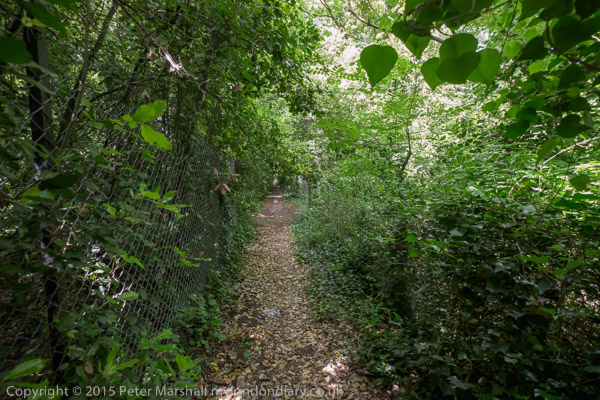
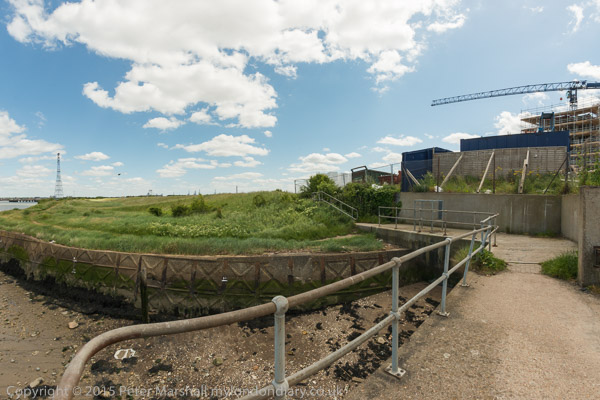
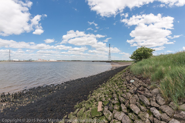
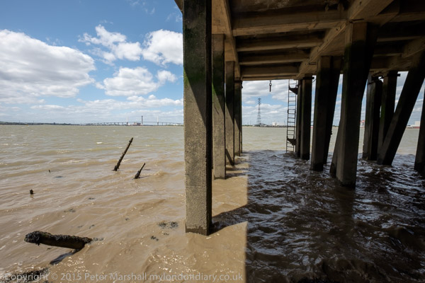
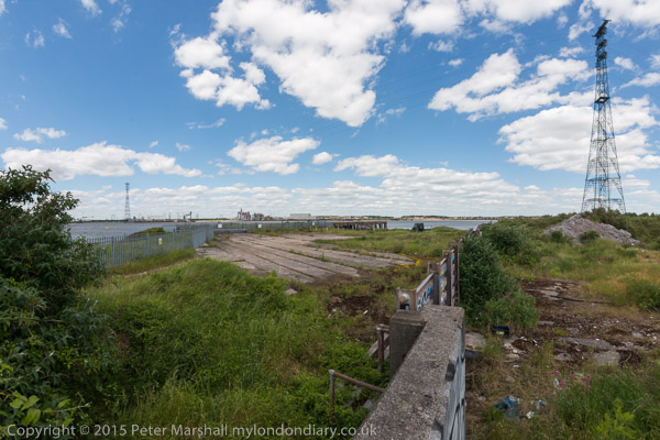
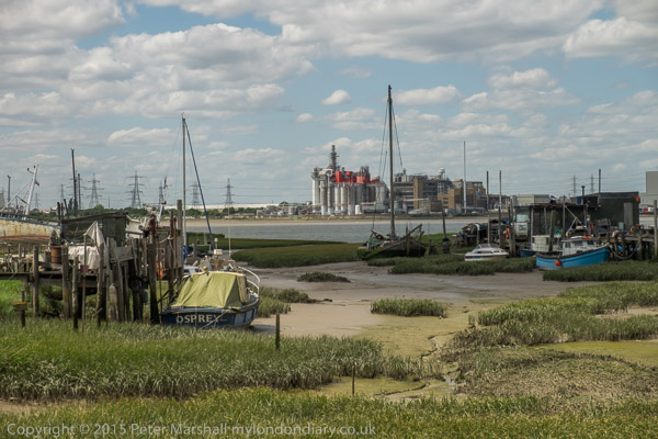
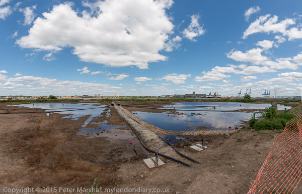
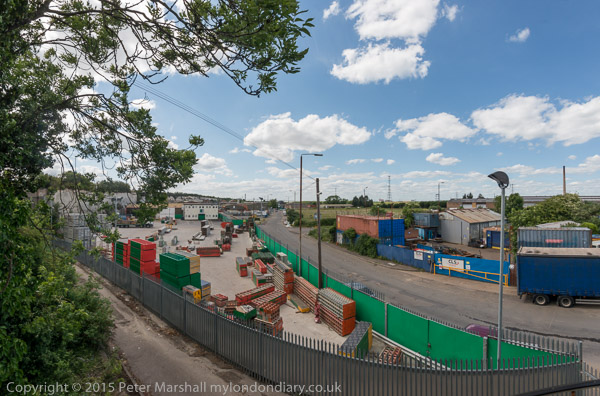
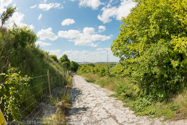
My trip around Swanscombe on Saturday 6th June was one such ride, taken while the area was under threat from development as the Paramount London theme park (and it still is though this now seems less likely.) It was an area I’d photographed on a number of occasions since the 1980s and knew reasonably well. In the 1970s, together with neighbouring Stone, Greenhithe, Swanscombe and Northfleet was the largest cement producing area in Europe, mainly run by Blue Circle. But by the time I first visited that production was centred at Northfleet, and the works at the other sites had largely disappeared or were very run down, and the Swanscombe works had ceased production although the site only finally closed in 1990. Northfleet continued for some years into this century, but nothing now remains – except of course the huge quarry areas with their chalk cliffs.
The post Swanscombe on My London Diary gives more of the history of the area, and also includes a fairly complete description of the route I took on Saturday 6th June 2015, so I won’t repeat that information here. The B isn’t a great off-road bike – and impossible in muddy conditions – but is fine on reasonable footpaths but I might had had to get off an push in some places. One of the paths I mention, Lovers Lane, is now a wide road beside a new housing estate but otherwise the area is much the same as it was in 2015 except there are now notices that some of the areas are private property.
The area is also well described in the many pictures, many of which were made with a very wide horizontal and vertical angle of view. Although not panoramic in format they are panoramic in their scope.
Old Father Thames – Buscot to Cricklade Nine years ago on Wednesday 3rd April 2013 I was walking the Thames Path with my wife and elder son, who had planned a three day walk along the upper reaches of the river as a birthday present for my wife. Her birthday is in the depths of winter but we thought the start of April might have better weather.
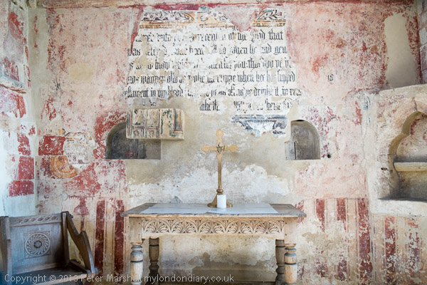
St John the Baptist at Inglesham, saved by William Morris from the threat of Gothicist ‘restoration’
We’d walked the lower parts of the Thames path and further out towards the estuary in a number of day walks, travelling by public transport to suitable starting points and back home at the end of the day. This had got us as far as Duxford, a short walk from the end of a bus route to Hinton Waldrist, 9 miles southwest of Oxford, west of where public transport to places close to the river is sparse and journey times from home too long.
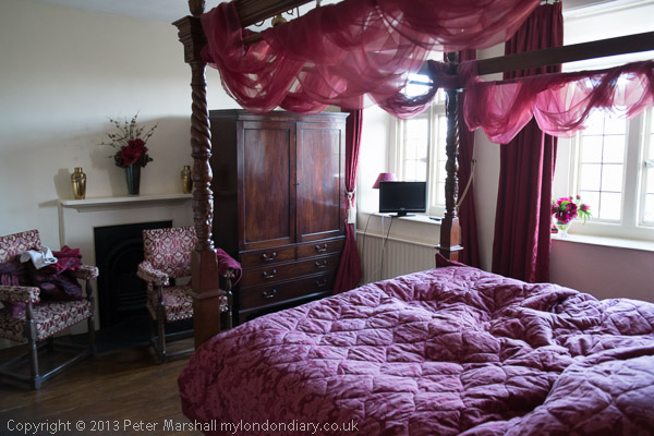
The room next to ours at Buscot Manor; ours was plainer but very comfortable
So we had booked two nights accommodation to allow us to complete the walk, ending at the source which is close to Kemble station from where trains would take us home via Swindon and Reading.
Meanders make the journey longer
On Tuesday we had set off early to take the train to Reading where we changed for Oxford and then found the bus to Hinton Waldrist. By the time we got within five miles of the village we three and the driver were the only passengers. It had been just below zero when we set out but had warmed up a little and the sun was shining as our walk began. You can read more about the days walk and see pictures at Thames Path: Shifford to Buscot. I’d finished the day in which we had walked around 15 or 16 miles totally exhausted, but a good soak in a hot bath had eased some of my aches and pains.
Old Father Thames
Wednesday we were up early for breakfast, having slept well at Buscot Manor, though we hadn’t paid the extra for a room with a four-poster, though I did take a photograph of one. Breakfast, shared around a large table with the other guests, was enormous and it was hard to get up from the table and begin our walk.
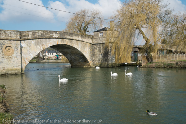
Ha’penny Bridge in Lechlade
Being gluttons for punishment as well as at the table we started the day by deliberately going in completely the wrong direction to make a tour of the village, now largely owned by the National Trust before rejoining the Thames Path.
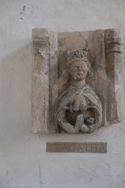
St Agatha in St Lawrence’s Church, Lechlade
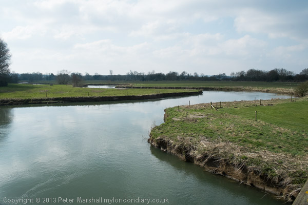
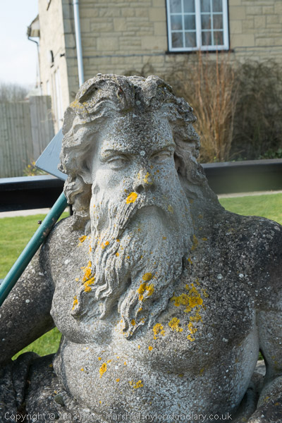
At St John’s Lock we found Old Father Thames, made in 1854 for the Crystal Palace and later moved to Thames Head but relocated here as protection against vandalism. At Lechlade, this is the highest lock on the Thames, which is theoretically navigable as far as Cricklade, though few boats now go beyond the Halfpenny Bridge in Lechlade.
The entrance to the Severn & Thames Canal
We spent some time in Lechlade, buying sandwiches for our lunch, then looking around the church before my companions mutinied and dashed into a tea-shop and I had to follow them. We wasted some time there before we walked out and carried on towards Inglesham. The area around here was perhaps the highlight of the whole walk, but our delay in Lechlade meant we couldn’t stop long enough to properly examine the mouth of the River Coln and entrance to the Thames and Severn Canal and the first bridge over the canal on our way. The canal was abandoned in 1927 though parts have now been restored.
St John the Baptist, Inglesham
The real gem of the walk is the Church of St John the Baptist at Inglesham, a splendid medieval survival thanks to the efforts of William Morris, who along with his pre-Raphaelite friends founded the Society for the Protection of Ancient Buildings (SPAB) or ‘Anti-Scrape’ to oppose the gothicisation of buildings such as these. But past here the walk deteriorates, with a mile and a half beside a busy road and a further 2 mile road walk “offering no scenic attraction at all“.
A rare glimpse of the Thames , our first since Inglesham
It might have been better if the Thames Path had taken a detour along the Thames and Severn Canal. As the Rambler’s Association noted in their 1977 Survey, the county councils “suggested a new footpath creation to follow the river from Lechlade to Cricklade but objections, primarily from farmers and anglers, led to the abandonment of this concept.” They comment that the Thames path here “is in places so dull or dangerous that it begs the question whether objections from landowning or angling interests should always be allowed to override the need for providing a simple public amenity.”
It’s only in the final mile or three into Cricklade that the walk comes alive again, rejoining the river and giving a glimpse of what the Thames Path in this region should be. We made our way to the White Hart, the principal inn at Cricklade since the time of Elizabeth I, though our room was in a modern extension at its rear. There was still just a little time to explore the town, basically a single street, before settling down to a decent Indian meal a short distance from the hotel.
Cricklade seen across a meadow from the path
You can read about the final day of the walk, where there were detours due to flooding and flurries of snow in a bitter wind before we reached the end, on my London Diary. Here are the links to all three days of our walk, which I’m glad we did then as I don’t think I could make it now.
Thames Path – Pangbourne – Cholsey: At the start of 2010 we were still walking sections of the Thames Path. On New Years Day we had walked from Reading to Pangbourne, and on the following day caught the train back to Pangbourne to begin our day’s journey there.
The Thames from the Thames Path along a hillside west of Whitchurch
We were heading to Cholsey, around 8 miles away, an easy distance suitable for a short day with over an hour’s rail travel at each end. Cholsey is a small village and has a railway station a little over a mile from the Thames Path with trains back to Reading from where trains run – if rather slowly – back to Staines.
Gatehampton Bridge
Pangbourne is a much larger village, and its station is a short walk from where we joined the Thames Path, and there were a few shops where we could buy some crisps and sweets to supplement the sandwiches in our bags and even a public toilet, so a very useful place to start a walk.
Before our walk really started we spent a little time in Pangbourne, visiting the parish church and photographing the Pang before rejoining the Thames Path at Whitchurch Bridge. Crossing the bridge takes you to Whitchurch, perhaps a prettier village than Pangbourne. Here the path takes quite a long detour away from the river bank and up on a hillside, with some extensive views through trees of the river and country to the south, before going back down to the riverside.
The railway line crosses the path and the river at Gatehampton Bridge, built by Brunel for the GWR main line in 1838 but the path stays on the north bank, passing between the tree-covered slopes of the Goring Gap, where the river cut through to seperate the Chilterns from the Berkshire Downs. Winter sun on the leafless bare branches was magical.
The bridge linking Goring on the north bank with Streatley on the south seems a rather primitive and temporary wooden structure, but has been here since 1923 when it replace the earlier bridge from 1837. Before then there had been both a ferry and a ford, though this was probably more often passable on horseback than on foot. It takes two bridges to reach Streatley from where the Thames Path proceeds westward on the south bank.
Streatley from Goring lock
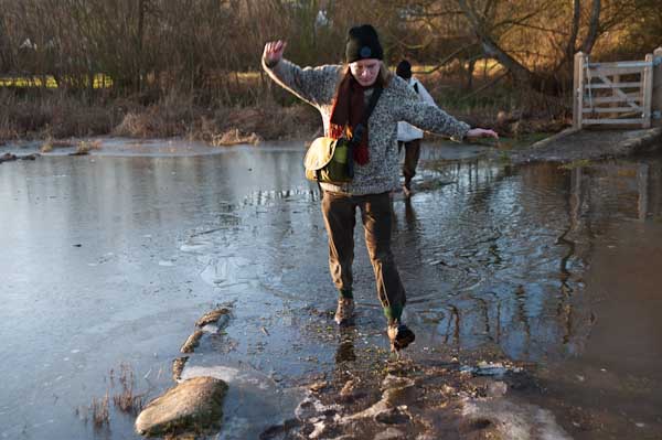
At Streatley, a village until 1938 owned by the Oxfordshire brewers Morrell we visited the church and then set out on a partly underwater path by the river. December 2009 had been one of the wettest months on record and we began to doubt the wisdom of We thought about turning back and abandoning the walk, taking a train from Goring, but after seeing a walker paddle through towards us decided to continue.
Fortunately it was only a few inches deep, but despite our boots I think we all got wet feet. The day was around freezing, but walking kept our feet warm, and many of the smaller puddles along the rest of our route were frozen over, as well as the mud, and it was much easier to walk than had it been warmer.
The Beetle and Wedge at Mouslford looked very closed
A little further on the tow path moves from the south to the north bank, not a great problem in the past for craft being towed who could pole over to the other side, but more so for walkers, who need to take a path away from the river and along a main road for a mile or so leaving the path were it went down towards the Moulsford railway bridge and continuing to a footpath beside the railway to Cholsey station.
Boxing Day Pictures I took in earlier years – mainly on our normal annual walks from Staines to Old Windsor. It’s a family tradition, a walk we’ve made most yearssince we moved here in 1974, though not always taking the same route. This year is one of the few years we won’t be making it.
2010
2011
2012
2013
2014
2015
2016
2017
2018
2019
2020
There are more pictures from all of these walks – except that in 2020 – on My London Diary. Click on the picture for any of the other years to go to more about the walks and more pictures.
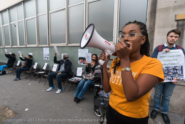
Most embassies are in the most expensive parts of London, with a large number around Belgrave Square and others in Mayfair. Eritrea’s is in Islington and I can only recall once having been to a protest outside it. There should be more, particularly by jounalists, as Eritrea, a one-party state ruled by presient Isais Afwerki since independence in 1993, has one of the worst human rights records and, according to Reporters Without Borders, has the worst press freedom in the world. In 2001 all independent media in the country were banned and politicians and ten leading journalists were arrested and thrown into isolation without charge, without trial and without contact with the outside world. Nobody knows their whereabouts and only four were thought to be still alive in 2017.
Those still alive are still in jail and have now been held for 20 years, along with other journalists imprisoned since then. Very little is known about most of them with no official information being released, other than government denials that some have been tortured, which are widely disbelieved. They are held in jails where torture is commonplace. In December 2020, 28 Jehohova’s witnesses, some of whom had been in jail for 26 years were released, raising hopes of the families of journalists, but there have been no further releases.
On Thursday 21st September 2017 there were 12 chairs set out at the protest across the street from the Eritrean Embassy, one four each of the journalists jailed in 2001, with photographs of them all. Protesters sat on four of the chairs, representing those thought still to be alive.
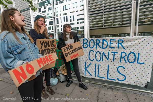
I went to another protest about deaths in prisons, this time in the UK. It was called at short notice after a Chinese man in Dungavel immigration detention centre. This followed the death earlier this month at Harmondsworth detention centre of a Polish man who took his own life after the Home Office refused to release him despite the courts having granted him bail. There have been thirty-one deaths in immigration removal centres since 1989.
Britain is the only EU country which holds refugees and asylum seekers to indefinite detention, and both official reports and media investigations have criticised the conditions at these immigration prisons. The protest outside the Home Office called for an end to immigration detention, which is inhumane and makes it difficult or impossible for asylum cases to be fairly assessed.
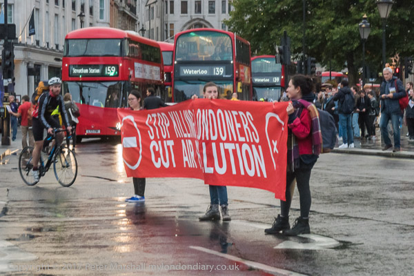
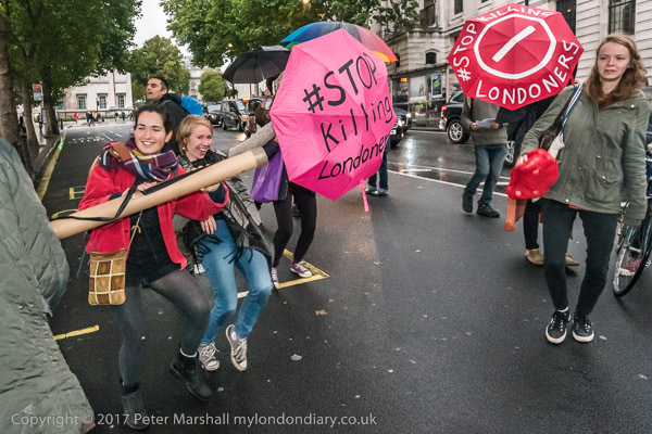
Stop Killing Londoners blocked traffic briefly in a carefully planned operation in Trafalgar Square, which involved the simultaneous stopping of traffic at all five entrances to the road system. As in previous events, it was a token block, holding up traffic for less time than it gets halted by congestion on some busy days, and around ten minutes after it began they moved off the road, returning a few minutes later for a short ‘disco protest’, dancing on the road on the east side of the square for a few minutes until police asked them to move.
The protest was to publicise the illegal levels of air pollution in the capital which result in 9,500 premature deaths and much suffering from respiratory disease. It was one of a series of similar protests in various areas of London.
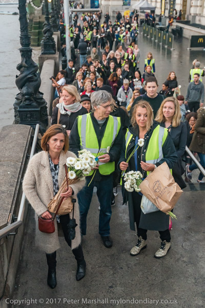
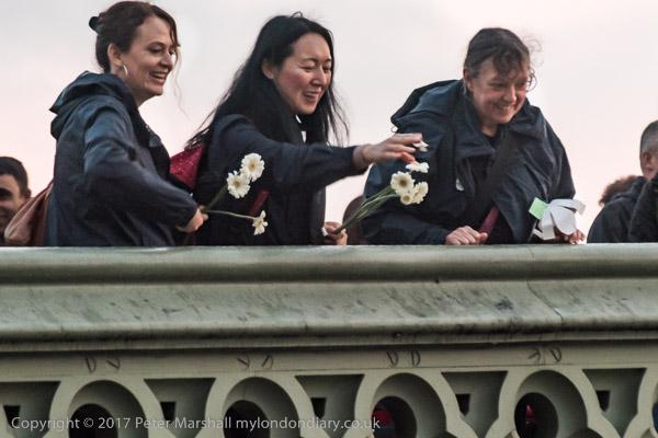
I hurried down from Trafalgar Square to Westminster Bridge, going across it just in time to meet the World Peace Day Walk as several hundred campaigners walk arrived having walked beside the Thames from Borough Market carrying white flowers. The London Peace Walk was one of a number takeing place in Barcelona, Paris and other cities around the world on World Peace Day.
The marchers wore black and walked in silence to grieve for the recent loss of precious life due to violence in all forms, including terrorist, state, corporate, domestic. They stated that there can be no peace without justice, equality and dignity for all and that “We stand together against the forces of hate and division – for peace.” At the end of their march they went onto Westminster Bridge and threw flowers and petals into the Thames.
All photographs on this and my other sites, unless otherwise stated, are taken by and copyright of Peter Marshall, and are available for reproduction or can be bought as prints.
One of the many things I ought really to do is to put together a book of my pictures of the Thames Path. Of course quite a few others have done so, but I think mine would provide a slightly different view.
I think I’ve walked every section of it over the years, parts of it many times, though there may possibly be a few yards I’ve missed actually in London where there are routes on both sides of the river. I’ve also gone rather further east on both banks, as the Thames Path stops rather prematurely at the Thamea Barrier while the paths continue.
I’ve never quite been to the mouth of the Thames, traditionally marked at various places including the the Nore sandbank, Yantlet Creek – where the City put up the London Stone, and though I cycled to Leigh-on-Sea in 2005 I think I missed the Crow Stone.
Most of the sections of path upstream from Windsor I’ve walked on various days with my family. As far as a little above Oxford it’s fairly easy to travel by public transport to the start of a day’s walk and back from the end, but above that there are few buses and no stations until you get close to the source. So the final (or initial) 60-70 km had eluded us.
In 2013, my elder son planned the expedition to complete the route, booking bed and breakfast for the three of us at Buscot and Cricklade so we had three days to walk. On the Tuesday following Easter, two trains (both running late) took us to Oxford, despite Easter Holiday engineering works still in operation and we took the bus to Hinton Waldrist. For the last five miles we were the only passengers and the bus had a problem in the village squeezing past a parked tractor.
We were still a couple of km away from the Thames Path, but the sun was out and despite being rather close to zero it was good walking weather. The map and guide book said there was still a ford across an old stream of the river at Duxford which would have saved us some walking, but there had been considerable rain in previous weeks and it was clearly impassable; even on the longer way round we occasionally needed to detour around flooded sections of path.
We just made it for a late lunch before the pub at Tadpole Bridge stopped serving, having seen only one other person on the first five miles or so of our walk. It was good to have a pint, though the food suffered from the restaurant’s aspirations, and service was fast. The river winds considerably around here and I think we walked at least twice as far as a crow might fly to get to Radcot and from there on to Kelmscott where we again paused. We were a day early for the first opening of the Manor there, perhaps as well as we didn’t have time to appreciate it, but we did visit William Morris’s grave and the local pub before continuing our slog to Buscot Manor, an interesting and welcoming place to spend the night.
The following morning after a very large breakfast with other guests we made a short tour of the village before continuing along the Thames Path towards Lechlade, where I was forced to waste time snared into a tea shop by my companions. Eventually we made it and walked on past the start of the Thames and Severn canal to the Church of St John the Baptist at Inglesham, a splendid medieval survival thanks to the efforts of William Morris, who along with his pre-Raphaelite friends founded the Society for the Protection of Ancient Buildings (SPAB) or ‘Anti-Scrape’ to oppose the gothicisation of buildings such as these.
Then came the worst section of the Thames Path, a mile or so on the verge of the busy A361 followed by another couple along a bridle path and country lanes out of sight of the river. Between Inglesham and Castle Eaton there is no real Thames Path – except for a couple of hundred yards beside the river in the 4 or 5 mile stretch. Though except for the A361 it is a decent country walk. The route does run beside the river from Castle Eaton to Cricklade where we made for the oldest and poshest pub, the White Hart where we were booked. And after finding our room found a good Indian restaurant not far away.
After a disappointing breakfast we took a short walk around Cricklade before continuing our journey. Flooding in the area meant the path had been diverted but it wasn’t a bad diversion and we were soon walking with the river through a land almost entirely covered by unfilled gravel pits, something there is no shortage of close to home. These cover the land east and west of the charming village of Ashton Keynes, west of which it’s hard to decide where the river actually flows. According to the Thames Path Guide, the Thames follows several coursed through Ashton Keynes, though some distance further up you do walk beside a decent small river.
Past the A 329 the river rather peters out, and by the time we reached Thames Head on the A 433 Fosse Way all that was left was damp grass. Across the road we struggled up a small hill to the official source, a dry spring that is marked by a stone placed here by the Thames Conservators. From here it was downhill to Kemble Station and a long wait for a train to Swindon, where we changed for Reading and then another train home.
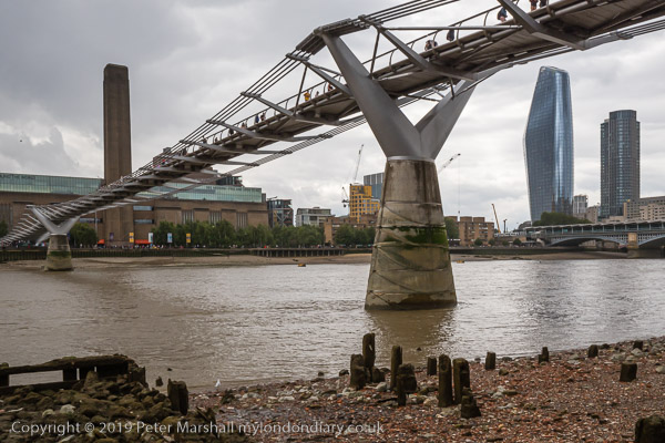
The area by St Andrew-by-the-Wardrobe, an Anglican church a few hundred yards south of St Paul’s Cathedral fascinated me when I first walked by it in the 1970s, and of course I’ve tried to photograph it over the years with various success, though mainly failure.
This picture, taken from the steps up to a locked door into the church is one that I found impossible on colour film, with the gloomy alley – with a light on even in the middle of the day when I took this picture contrasting with the more brightly lit street with The Cockpit pub. But the day was overcast, reducing the contrast and the digital camera coped well, though needing some dodging and burning in Lightroom to give the results here.
I didn’t go into the church though I have been inside on at least one previous occasion, just following an Indian Orthodox service there, when the atmosphere was thick with incense. The site has an interesting history, with a church here for perhaps a thousand years or more, though the first written mention is in 1170 or . It became part of an ancient royal residence, Baynard’s Castle, and in 1361 Edward III or Edward IV moved his royal clothes and arms from the Tower of London to a more handy site in a building close by.
Like most of London it was destroyed in the Great Fire of 1666, and was rebuilt in 1695 to one of the simplest and last of Christopher Wren’s many church designs. Although it now looks ancient, it was mostly destroyed again by German bombing in 1940 and rebuilt and reconsecrated in 1961, with most of its internal decor being salvaged from previously demolished Wren churches. Among the memorials on its walls is a modern carved wood one for William Shakespeare, a parishoner for 15 years.
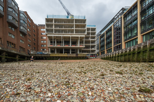
From the church I crossed Queen Victoria St and made my way down to the riverside walkway. There was an extremely low tide and I went down the steps onto the foreshore, which here is sand and shingle with many remains of wooden posts.
I walked the short distance along to Queenhithe, a historic monument as London’s first dock though the Roman and Saxon docks are now all buried beneath the mud and stones or hidden behind the visible more modern river walls and the area is surrounded by rather boring modern offices.
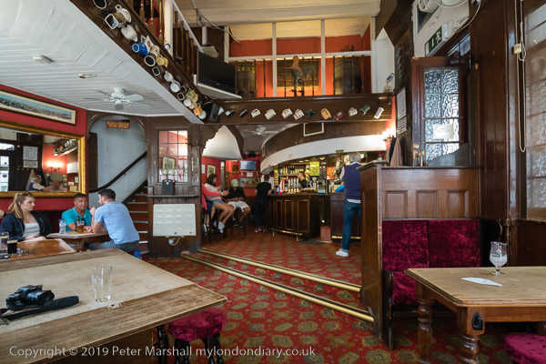
I went back and up onto the riverside walkway and then made my way to meet with friends for a short walk through the city, on which I took a few more photographs. One of the places we visited was where I had begun taking pictures, and this time we went inside The Cockpit on St Andrews Hill opposite the church, one of London’s smaller and more fascinating places.
Although the text for it’s grade II listing states tha the building is ca 1860, but the interior is in part older. The pub claims to have been established in 1787 and to have been rebuilt in 1842 and that it was once Shakespeare’s home – and certainly it is on the corner of Ireland Yard where he is known to have lived.
The interior is literally a ‘cockpit’ and the bar and seating is on the very floor where the pair of gamecocks, equipped with razor-sharp metal spurs would be set to fight to the death while gamblers looked on from the balcony above. Cock-fighting was banned in England and Wales by the Cruelty to Animals Act 1835 and the last fight in this pub was said to have been in 1849. Apparently there are still some illegal fights in the UK.
All photographs on this and my other sites, unless otherwise stated, are taken by and copyright of Peter Marshall, and are available for reproduction or can be bought as prints.
There are no adverts on this site and it receives no sponsorship, and I like to keep it that way. But it does take a considerable amount of my time and thought, and if you enjoy reading it, please share on social media. And small donations via Paypal – perhaps the cost of a beer – would be appreciated.