EDL Stopped, Musicians at Arms Fair, Silvertown – 2013

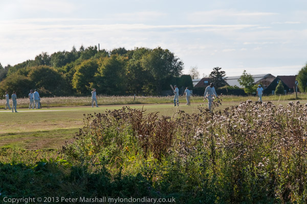
EDL Stopped, Musicians at Arms Fair, Silvertown: On Saturday 7th September 2013 after photographing the EDL attempting to march into Tower Hamlets and the people coming out to stop them I went on to the Excel Centre in Newham where East London Against Arms Fairs were holding a Musical Protest against next weeks DSEi arms fair. And on my way home I took more pictures.


EDL Try To March Into Tower Hamlets

EDL Stopped, Musicians at Arms Fair, Silvertown:
Whitechapel says ‘Take Your HATE Elsewhere’

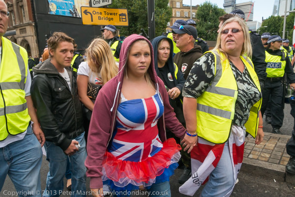
I started the day in Bermondsey were around a thousand EDL supporters were gathering for a march across Tower Bridge to Aldgate High St.

EDL Stopped, Musicians at Arms Fair, Silvertown:

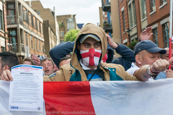
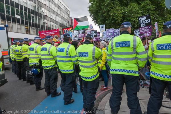
Police had laid down very strict conditions for the march, specifying the exact route and timings and more, which where specified on A4 sheets they handed out to protesters and were also broadcast every few minutes from a loudspeaker van where the marchers were gathering.

EDL Stopped, Musicians at Arms Fair, Silvertown:

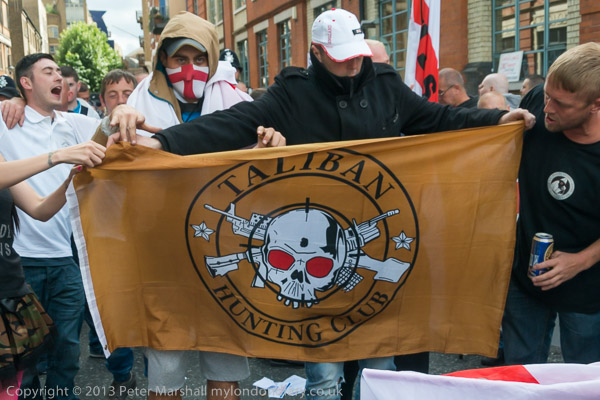
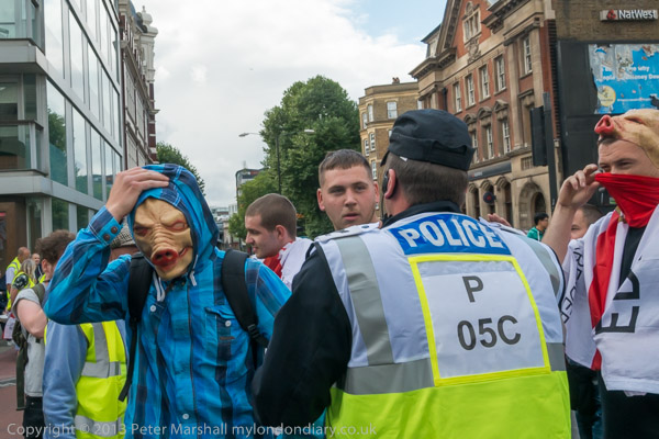
There was a very strong police presence on the streets with police on all sides around the marchers and some mingling with them. The EDL were also on their best behaviour, with many posing for photographs. A couple who arrived in pig’s head masks were forced by police to remove them and hand them over.

EDL Stopped, Musicians at Arms Fair, Silvertown:

There was still a great deal of racism and hate in the comments that were being made and when the march got under way the majority took up the usual Islamophobic chants including “Allah, Allah, who the f**k is Allah“.

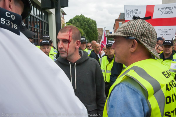
There were a small number of anti-fascist protesters in the area, and police tried to keep them well away from the march, although EDL stewards who led away one man with a bleeding face from the crowd alleged he had been hit by a bottle thrown from across the road.

As the march set off, police moved photographers well away, and police handlers with dogs walked in advance of the marchers. Later I was able to get a little closer.

After crossing Tower Bridge I saw red smoke in the distance coming from the ground in front of a row of police vans in Mansell St and rushed there to find a group of around 50 anti-fascist protesters, mainly dressed in black, with red and black flags and a few with Unite Against Fascism placards.

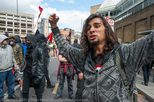
The EDL march stopped for a couple of minutes opposite them and the two sides shouted insults at each other with the police keeping them well apart before the march moved on to Aldgate High Street without further incident. I later heard that the anti-fascists here had been kettled for some hours before many of them were arrested.

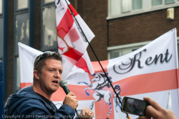
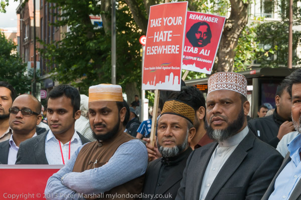
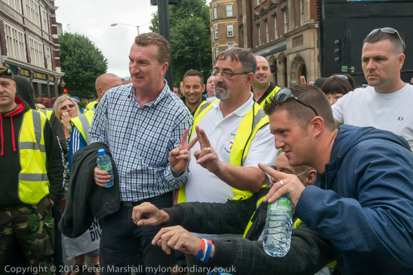
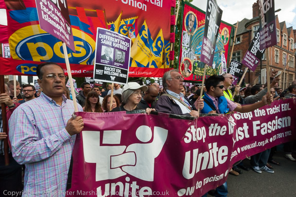
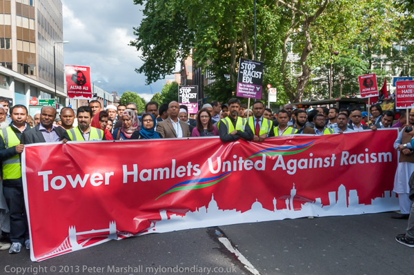
I photographed Tommy Robinson addressing the rally, then made my way to where a counter-protest was being held by the community of Tower Hamlets, united in opposing the EDL. I had to go through several lines of police, showing my Press Card. A few officers refused to let me through, but I was able to walk along the line and make my way through.

As I commented, “It was a remarkable change in atmosphere from the feeling of hate and Islamophobia that filled the air with gestures and chanting from the EDL to the incredible unity and warmth of the several thousands largely from the local community who had come out to oppose them and make a statement based around love and shared experience of living in Tower Hamlets with people of different backgrounds and religion.”

There was clearly a determination in Whitechapel, as there was in the 1930s at the Battle of Cable Street which had taken place not far away of a community that had decided that ‘They shall not pass’. And although most had come to protest peacefully, had the police not kept the two sides well apart, the EDL would have been heavily outnumbered by local youths angry at their presence.

I’d left the EDL rally before Tommy Robinson was arrested for incitement, apparently for suggesting that people break some of the restrictions that police had imposed on the EDL march and rally. The police presence had prevented any large outbreaks of public disorder and although the EDL were up in arms over the arrest of their leader had protected them from a severe beating.

More on My London Diary at:
Tower Hamlets United Against the EDL
Anti-Fascists Oppose EDL
EDL March returns to Tower Hamlets


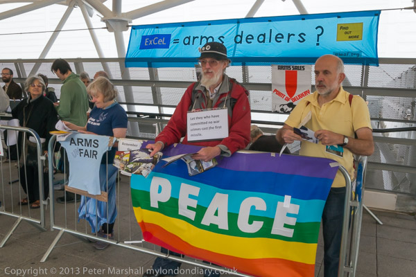
Musical Protest against Arms Fair – Excel Centre, Custom House

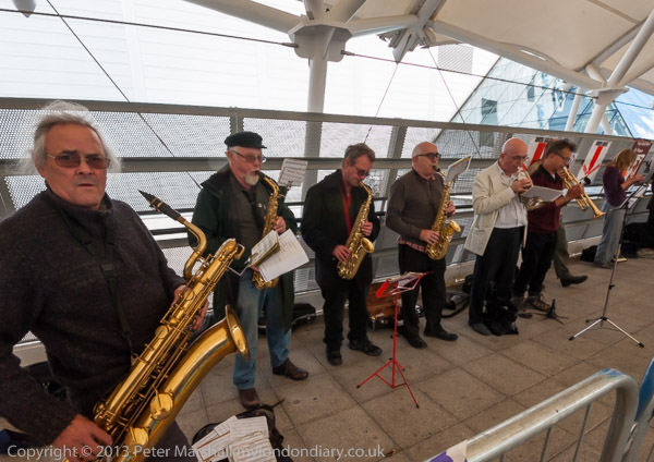
I didn’t stay long in Whitechapel but took the tube and bus to Custom House where on the walkway leading the the ExCel Centre East London Against Arms Fairs (ELAAF) were holding a Musical Protest against next weeks DSEi arms fair with a big band and singers and others handing out leaflets opposing the event.

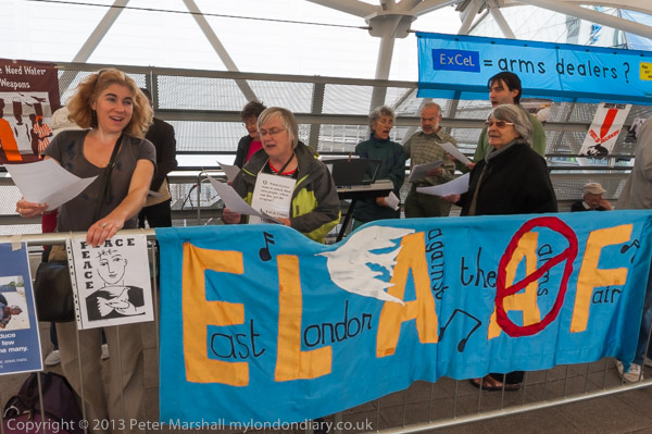
THe DSEi arms fair, held every other year at the ExCel Centre in London Docklands attracts buyers from all over the world, including those from many countries with oppressive regimes. It’s a showcase for the weapons they need to continue to oppress their populations and to wage war on their neighbouring states and others.

There were more and larger protests in the following week against the arms fair.

More at Musical Protest against Arms Fair.
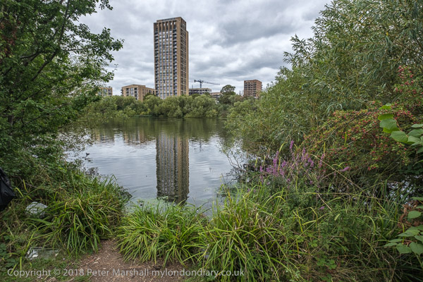
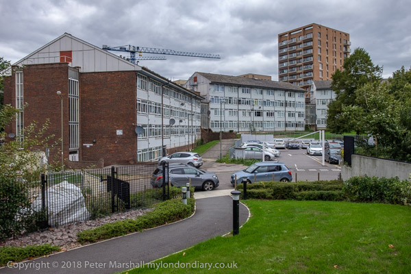
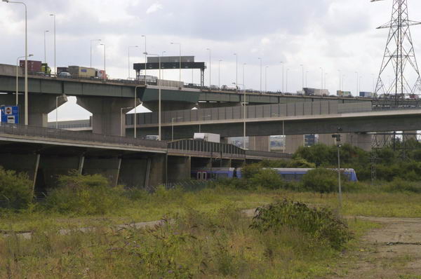
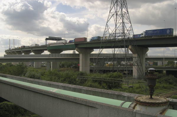
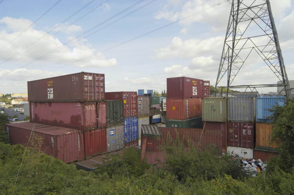
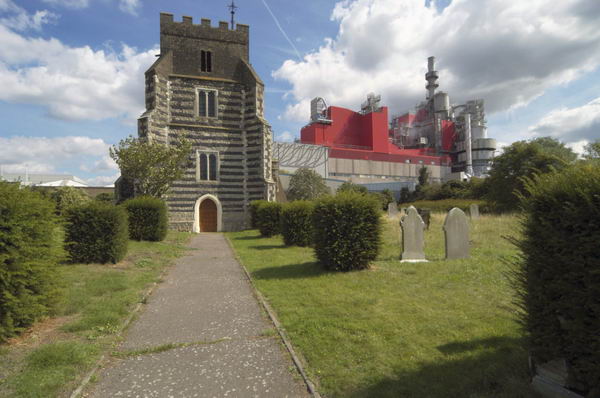

Silvertown

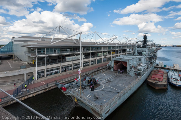
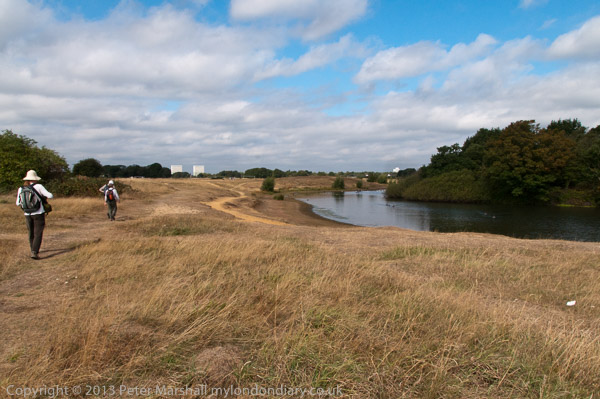
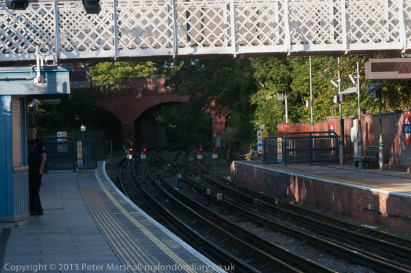
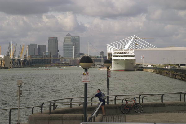
Although the DLR wasn’t running on the branch leading to Custom House, there were trains running on the branch through Silvertown and I walked to there across Victoria Dock on the high-level bridge, taking a few photographs.

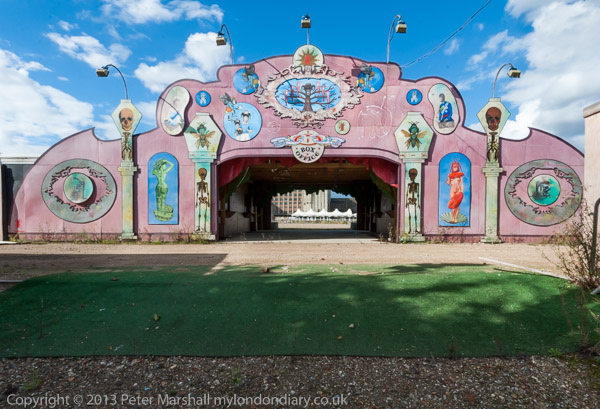
The gates to the London Pleasure Gardens which had closed recently only a few weeks after its opening were locked but I was able to take pictures through the gates. I walked on to the elevated Pontoon Dock DLR station and made some panoramas from there before catching a train.

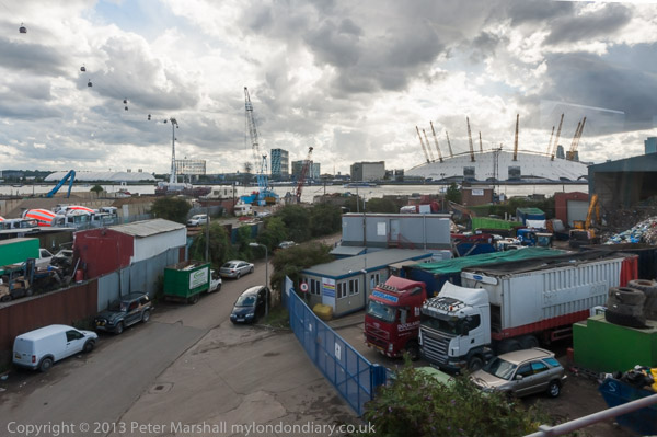
For once the DLR train had a very clean window and I took advantage of this to take some more pictures on the way to Canning Town where I changed to the Jubilee line.

More pictures: Silvertown


Bon Marche, Police, Acre Lane and Tate

Bon Marche, Police, Acre Lane and Tate: My walk which began in Clapham on Sunday 4th June 1989 continues in Stockwell. It began with Light & Life, Pinter and Stockwell Breweries and the previous post was More Stockwell Green & Mary Seacole.

240-250 Ferndale Rd, Brixton, Lambeth, 1989 89-6a-61

Possibly before going to Stockwell Green, perhaps even at some point on my previous walk I made some more pictures around the centre of Brixton. Unfortunately film doesn’t come with meta-data and my memory is not as reliable as EXIF data, but these pictures were certainly made around the end of May or beginning of June 1989 and so I’ll share them here.

240-250 Ferndale Rd on the corner with Stockwell Ave, just a few yards back from Brixton Road was built in 1905-6 as an annexe of Bon Marche department store, later becoming Post Office with council offices on the upper floor. You can see a post office sign at the left of my picture. A photograph in the Lambeth Archives taken around 1975 show it as offices for Christian Aid and it was later home to the Refugee Council. The ground floor more recently became Canova Hall, a restaurant and the building was revived as The Department Store, “to create a series of collaborative workspaces supported by an evolving hub of creative, retail and community uses“.

Edmundsbury Estate, Ferndale Rd, Brixton, Lambeth, 1989 89-6a-64

This estate was complete in 1929 for the London County Council as Ferndale Court to house police officers in the City of London Police, but converted into council flats managed by Lambeth Council in 1979 when one of the blocks was demolished to leave a public open space. They were designed by Sidney Perks, who was surveyor to the City of London from 1908 before being appointed as its architect in 1928.

Adjoining the site to the east was the City of London Police Sports Club ground, now the Ferndale Community Sports Centre.

Acre Lane Mouldings Ltd, Acre Lane, Brixton, Lambeth, 1989 89-6a-52

A board illustrates the range of skirting architraves and cornices the company could supply, ‘Quality Mouldings for That Finishing Touch!‘.

Acrelane Timber Ltd is still at this site in Brixton and can perhaps still supply some similar items. A previous frame, not yet digitised shows a little of the frontage offering heating and plumbing supplies.

In my father’s workshop, a very large shed with store rooms and work benches at the back of his family house in Hounslow, long sold off and demolished, I was intrigued as a child by many of the old tools used around the start of the 20th century which included a range of moulding planes used to produce shaped mouldings such as this, used in his father’s cart building business. Back when my elderly aunts moved out around 1970 there was little interest in things like this and I imagine they ended up in landfill, though I’ve since viewed far less impressive ranges in museums.

Lambeth Town Hall, Acre Lane, Brixton Hill, Brixton, Lambeth, 1989 89-6a-54

I turned back along Acre Lane to the junction with Brixton Road where I photographed the grandiose Lambeth Town Hall, complete with a banner advertising an event about child benefit taking place on June 2nd, as well as a sign about going to Lambeth Debtline for debt advice.

Grade II listed Lambeth Town Hall was built in 1905-8, designed by Septimus Warwick and H Austen Hall in what is described as a modified Baroque style, and was further raised and extended 1935-8. I think the clock tower looks like some strange parody, an ornament which doesn’t really belong but has somehow thrust itself up through the ceiling of the main building and flowered extravagantly, reminding me of an amaryllis.

Tate Bust, Tate Library, Brixton Oval, Brixton, Lambeth, 1989 89-6a-55

This area was a pleasant garden before being destroyed by Lambeth Council to produce a windswept waste to discourage local people gathering here. It hasn’t really worked, just become less comfortable with oddly placed fixed chairs and the wind certainly rushes through the renamed Windrush Square. I think I might have come here in 1989 to sit and eat my sandwich lunch.

Henry Tate was born in 1819 in Lancashire, the son of a Unitarian minister, and set up a successful grocery business with six shops in the Liverpool area before going into partnership with sugar refiner John Wright there in 1859. When this partnership came to an end he founded Henry Tate & Sons with his sons Alfred and Edwin.

Tate introduced new more efficient refining techniques for the production of white sugar, and his business expanded and in 1878 he opened a large refinery at Silvertown still producing sugar now.

Fountain, Tate Library, Brixton Oval, Brixton, Lambeth, 1989 89-6a-56

Tate was an employer who took care of his workers and supported many educational projects including free libraries in Streatham, Balham, South Lambeth and Brixton as well as hospitals. After he had built and opened a gallery on Millbank and presented his art collection to the nation he was told Queen Victoria would be offended if yet again he refused a title, and he became a baronet in 1898, a year before his death.

The business was merged with that of Abram Lyle & Sons in 1921, probably causing Tate to turn in his grave, as he had despised Lyle, not least for the way he treated his workers.

Reliance Arcade, Electric Avenue, Brixton, Lambeth, 1989 89-6a-41
Reliance Arcade, Electric Lane, Brixton, Lambeth, 1989 89-6a-41

The Art Deco Reliance arcade was built into an exiting Georgian house and other buildings between Brixton Road and Electric Lane in 1923-5, its Egyptian style terracotta inspired by the 1922 discovery of Tutankhamun’s tomb.

Home to around 30 businesses it was since 2014 this Grade II listed arcade was on English Heritage’s at risk list but was renovated in 2019-20. There are some good pictures from this time by Mike Urban on Brixton Buzz from before and close to the end of the renovation.

My account of this walk will continue in a later post.


Epping Forest Centenary Walk

Epping Forest Centenary Walk 2009: London is in some ways a ‘green city’ with over 3,000 parks of varying sizes within the boroughs which make up Greater London. These range from pocket handkerchief areas to large commons and royal parks such as the roughly 2500 acre Richmond Park.

Epping Forest Centenary Walk
Wanstead Flats

London Mayor Sadiq Khan supported London being designated as the world’s first National Park City in 2019 and announced plans to increase the amount of ‘green space’ to 50%. This isn’t a huge target as according to the capital’s environmental records centreRoughly 47% of Greater London is ‘green’; 33% of London is natural habitats within open space according to surveyed habitat information and an additional 14% is estimated to be vegetated private, domestic garden land.”

Epping Forest Centenary Walk
One of the Montague Road Estate flats had misssiles on its roof for the Olympics

In order of size, starting with the largest they categorise this as Other Urban Fringe, Parks And Gardens, Natural And Semi-natural Urban Greenspace, Green Corridors, Outdoor Sports Facilities, Unknown and amenities with other minor contributions. Some 22% is classified as Green Belt which gives some quite strong protection against development, though my borough is currently proposing to build on a little of it.

Epping Forest Centenary Walk
The walk goes on a bridge across the North Circular Road

The protection of green spaces in and around London has a long history, back to the Norman conquest when kings set up royal hunting grounds convenient to their palaces in Westminster and further afield. These were called forests, though most were mainly open land rather than full of trees; the name was a legal term meaning only the king had the right to hunt deer in them. One of the larger areas, established by Henry II in the 12th century was Epping Forest, part of an even larger Forest of Essex.

Epping Forest Centenary Walk
Memorial to a famous evanglalist Gypsy Rodney Smith born in a bender here

Enclosures began to threaten the future of the forest at the start of the 19th century when around a third of the remaining forest was allowed to be privatised for building development and farming by the lords of various manors in the forest. By 1870 around two thirds of the forest had been enclosed.

Warren Pond

By this time many people had become worried about the loss of the commons, particular after neighbouring Hainault Forest had been sold off by the Crown, the trees removed and the area turned into poor agricultural land. More and more people were coming out from London during their free times to enjoy the green spaces in the outskirts and preservation societies were set up.

Queen Elizabeth’s Hunting Lodge

The City of London became involved after it bought land at Manor Park for the City of London Cemetery. Traditonally the city had organised Easter Monday stag hunts in the forest, but they now became commoners with the right to graze animals, and began legal actions agaimst lords of the manor who had enclosed forest land. Eventually Acts of Parliament allowed them to purchase the forest manors and an court in 1874 ruled that all enclosures made since 1851 were illegal.

Under the Epping Forest Act 1878 the forest ceased to be a royal forest and became managed by the City – as it still is. The Crown lost its right to venison and commoners lost some of their rights too, but the City Conservators were obliged to “at all times keep Epping Forest unenclosed and unbuilt on as an open space for the recreation and enjoyment of the people.”

The preservation of Epping Forest was the first major victory in Europe for the modern environmental movement. Four years later it was endorsed by Queen Victoria, who although it was no longer royal but in the hands of the City of London, nevertheless stated “It gives me the greatest satisfaction to dedicate this beautiful forest to the use and enjoyment of my people for all time“.

On the 100th anniversary of the Epping Forest Act in 1978, the Friends of Epping Forest began a annual series of anniversary walks from along a route they established from Manor Park Station to Epping. The Friends were originally formed to oppose the routing of London’s orbital M25 through the Forest, leading to it being put in a tunnel. But they have been less successful in opposing some other breaches of the 1878 Act, and in 1989-94 a large section of the south of the forest was lost to build the M11 link road, and during the London 2012 Olympics a temporary police station was allowed to be built on Wanstead Flats.

Epping Station at the end of our walk

I walked the Epping Forest Centenary Walk with some of my family and a friend on Bank Holiday Monday 31 August 2009, and you can download a leaflet including a map (though I’d advise also having the OS Explorer 174) of what has now been renamed the Epping Forest Big Walk. According to this it is 14.1 miles (22.7km) but we managed to walk rather further, possibly partly because we got a little lost at times. Of course you can do the walk in stages rather than all on the same day. If you want to walk with others you can join the free Big Walk this year on Sunday 17th September 2023 to be led by experienced guides!


More Carnival – Children’s Day 2009

More Carnival – Children’s Day: On Sunday 30th August 2009 I spent a few hours in Notting Hill and took a lot of pictures – here are just a few of those I liked. I can’t remember why I didn’t get around to putting them on line in 2009, but I only remembered them again in 2014 when August bank holiday was so wet I stayed home and didn’t go to carnival.

More Carnival - Children's Day 2009
Liquid Gold. I think it washed off me without too much difficulty
More Carnival - Children's Day 2009

I thought again this year about going to Notting Hill for Children’s Day when it is a little less crowded than the Monday. But there was engineering work on the railway with no trains from my station for over a week, only rail replacement buses.

More Carnival - Children's Day 2009

It would still have been possible to make the journey, or to take a bus and then the Underground, but having to do so on both the outward and homeward journey would add considerably to my journey times. I decided my trip to Notting Hill wasn’t essential.

More Carnival - Children's Day 2009

I’ve taken enough pictures of Carnival over the years since 1990 to satisfy me for my lifetime, and it’s hard to find anything really new.

Though I do regret having been put off from going to Notting Hill before 1990 by the media coverage which concentrated on the few violent incidents and painted a picture of street violence and mayhem. It’s really more of a huge outbreak of celebration.

There was a huge tightly packed crowd dancing to Sancho Panza

And I did photograph some children, though its clear my mind was largely on other things.

Many more pictures at Notting Hill – Children’s Day.


Capital Ring – South Kenton to Hendon

Capital Ring – South Kenton to Hendon: Monday 27th August 2018 was August Bank Holiday, which for many years meant if I was in London I was in Notting Hill for the carnival. But I think the last time I went was in 2012, when I went on Children’s Day and then wrote “either I’m getting too old for it, or perhaps carnival is changing, and this year I found it a little difficult. So I went on the Sunday, stayed around three hours and didn’t really want to return for the big day. So I didn’t.

Capital Ring - South Kenton to Hendon
Welsh Harp and West Hendon Waterside

Since then I’ve been out of London in several years and in the others I’ve thought about going to carnival again, but decided instead to go out for a family walk. And in 2018 with my wife we walked the section of the Capital Ring from South Kenton Station to Hendon Station.

Capital Ring - South Kenton to Hendon

The walk itself is only 6.2 miles, but walking to the station at the end and the kind of wanderings that all photographers indulge in it got a little longer. I’m not the kind of walker for whom a walk is a route march from A to B, but rather someone who likes to go where his eyes lead him in search of interesting views and places.

Capital Ring - South Kenton to Hendon

Unlike some sections of the Ring which are almost all woods, fields and trees this one has a wide range of different areas, all of some interest, beginning with South Kenton Station itself, the Windermere pub next door and the whole area of 1930s development.

Capital Ring - South Kenton to Hendon

I don’t think my two pictures of The Church of the Ascension really do this interesting 1957 building by J Harold Gibbons justice, but they do give some idea of how unusual it is.

We had the guide to the whole walk around London by Colin Saunders which saves having to carry maps and gives usually clear route descriptions as well as a few snippets of interesting information – such as the fact that this pond on the top of Barn Hill was a part of a huge landscaping project by Humphrey Repton, much of which was covered by housing in the 1920s and 30s and includes Wembley Stadium.

From here we were a little let down by the walk instructions and ended up wandering around a little lost in Fryent Country Park, but eventually with the help of the map and a little guesswork found the correct exit.

The walk continues through a number of suburban streets, not without some interest, eventually coming to Church Walk. Kingsbury does of course have some remarkable architecture but this lies some distance off the route. Fortunately I’ve photographed it on other occasions.

There are two St Andrew’s churches a short distance apart. The ‘new’ church is rather larger and was actually built around six miles away in Wells Street Marylebone in 1844-7 and moved here stone by stone in 1931-3. I haven’t posted a picture of this Grade II* building by S Daukes as it just seemed to me another Victorian gothic church. Probably I would have been more impressed had it been open and I could have seen the interior. A short distance away is the old St Andrew’s, a rather more quaint building with a Grade I listing, dating from the 12th-13th century though with some 19th century restorations.

St Andrews Old Churchyard, now left to nature as a ‘Site of Borough Importance for Nature Conservation‘ is also full of interest, with no less than five Grade II listed monuments and tombstones including this one for “Timothy Wetherilt (d.1741). Portland headstone with upper relief of cherubs amid rays, set between auricular scrolls below an upper cornice enriched with egg and dart mouldings.”

A short walk (with some deviation to a garden centre for its toilets) took us to the Welsh Harp – Brent Reservoir, built in 1835 to supply water for the Regents Canal which had opened in 1820. It got its name from a nearby pub and both pub and lake were for many years a popular leisure destination for Londoners. In 1948 the rowing events for the Olympics were held here, while for 2012 Eton College provided its Dorney Lake, completed in 2006 costing the college £17 million, though we paid through Olympic funding for the finish tower, a new bridge and an upgraded approach road and more.

At the east shore of the lake was Barnet Council’s West Hendon Estate, sold off to developers and now West Hendon Waterside. The pleasant and well-loved council estate with 680 homes in decent condition was sold for a quarter of its value to Barratt who describe it as “170 hectares of beautiful green surroundings overlooking the Welsh Harp reservoir” (see top picture.) Some of the council estate was still occupied, overshadowed by new towers with a crane looming over. The development will result in more homes, but few will be social housing, and the so-called affordable properties are beyond reach of the current residents, with many probably bought and left empty by overseas property investors.

We walked past what was an impressive 1930s cul-de-sac when I photographed it in 1993, but a little less so now as the distinctive metal windows with curved glazing on the bays have been replace by double glazing, though this must make the occupants rather more comfortable.

We walked on to Hendon, stopping for an ice-cream at Hendon Park Cafe, “the first kosher park café to open up in the UK” and admiring Hendon Park Holocaust Memorial Garden and the buildings arond Hendon’s Central Circus before catching a train on our way home.

More pictures on My London Diary at Capital Ring: South Kenton to Hendon.


On My Brompton in Essex – 2004

On My Brompton in Essex: On Thursday 26th August 2004 I went for a ride on my Brompton in Essex on the north bank of the Thames, in an area sometimes known as the Thames Gateway. If anyone doesn’t know, the Brompton is one of the best folding bikes around, with 16 inch wheels, folding quickly to a fairly small package which can be carried onto trains and buses. I don’t ride it so much now, as I find it rather heavy to carry, particularly when loaded with my camera gear.

On My Brompton in Essex
Chafford Hundred, Grays, Essex

I bought the Brompton at the end of 2002, and spent a lot of time riding it for exercise on doctor’s orders during recovery from a minor heart problem at the start of 2003. It coincided with the purchase of my first digital camera capable of professional results, the 6.1Mp Nikon D100 DSLR.

On My Brompton in Essex
Royal Victoria Dock

For a year or two I worked with both digital and film, particularly because at the start I had only one Nikon lens, a 24-85mm zoom, giving an equivalent on the DX format camera to 36-128mm on full-frame, but I used a range of wider lenses on film. By 2004 I had added the remarkable Sigma 12-24mm (18-36mm equiv) to my bag, and many of the pictures I made that day were taken with that lens. I think it was the first affordable ultra-wide zoom, and certainly the results on DX format were very usable.

On My Brompton in Essex
Channel Tunnel Rail link under construction at Purfleet

As well as the Nikon I also had a film camera, a Russian Horizon 202 swing lens panoramic camera. You can see some of the pictures I made with this among those on the Thames Gateway (Essex) section on the Urban Landscapes site.

On My Brompton in Essex
Dartford Bridge and Channel Tunnel rail link, Thurrock

I began taking pictures that day at Victoria Dock in Canning Town, having taken the Brompton on the train to Waterloo and then the Jubilee Line there, before cycling to West Ham station to catch the C2C rail service to Rainham, all on a Travelcard. It’s something of a blow that TfL now intends to discontinue the Travelcard, which provided relatively cheap and simple travel for most of my photography.

Here is what I wrote about the day back in August 2004 – with minor corrections, particularly changing to normal capitalisation.

I like to make good use of my Travelcards, so Rainham, the last station out of Fenchurch St in zone 6 is a good destination. I pointed the Brompton first to Purfleet, to take a look at the state of play on the high-speed rail link, and also a new development in the old chalkpits, then on towards the Dartford bridge.

The Bridge Act obliges the operators to transport cycles and pedestrians across free of charge, and I cycled up the path towards it to claim this right, before changing my mind and deciding i didn’t want to go to the other side. Instead I took the new road through the West Thurrock Marshes industrial area and on to St Clements church, now a nature sanctuary, in the middle of a detergent factory.

It’s a quiet and pleasant place to eat sandwiches, though the smell of the perfuming agent is pervasive. There I planned a route largely along side roads, cycle paths and footpaths to Upminster, taking in Chafford Hundred, South Ockenden and Belhus Park and woods. It made a pleasant ride, though I had to make a few detours, and the B isn’t too stable on slimy mud, so some paths made for interesting riding, with the added pleasures of bramble thorns and nettles.

My London Diary

All of the pictures on this post were taken on the Nikon D100. There are a quite a lot more on My London Diary.


More Stockwell Green & Mary Seacole

My walk which began in Clapham on Sunday 4th June 1989 continues in Stockwell. The first and previous part was Light & Life, Pinter and Stockwell Breweries.

Combermere Rd, Stockwell, Lambeth, 1989 89-6b-51

The decorations at right are on the fine frontage of The Marquess of Lorne pub. The Grade II listing for this mentions is fine terracotta window surrounds and these panels in green, gold and brown glazed tiles. The pub has the address 51 Dalyell Rd, but this side is in Combermere Rd. The Marquis of Lorne is a title given to the eldest son and heir of the Duke of Argyll (in full Marquis of Kintyre and Lorne.) The decoration on the building includes the name of the Licensee in 1881 although a licence for the pub was refused ten years earlier. CAMRA note that as well as the fine Victorian exterior decoration much of the inter-war interior refitting remains.

Probably the pub name dates from 1878 when John George Edward Henry Douglas Sutherland Campbell, later 9th Duke of Argyll but then Marquess of Lorne was made Governor General of Canada. He was married to Princess Louise, fourth daughter of Queen Victoria, who has a rather fine pub named after her in Holborn.

The decoration on 20 Combermere Road at left has also survived. This is a Laundromat and dry cleaners.

Hargwyne St, Stockwell, Lambeth, 1989 89-6b-52

A street of solidly built late Victorian houses. Their plain elegance is relieved by leaf decoration on three sides of the the first floor windows and dentillation above the ground floor bays. A boy plays with a ball outside in this quiet street. I can’t find any explanation of the street name.

Shops, Brixton Station Rd, Brixton Rd, Brixton, Lambeth, 1989 89-6b-53

I made a detour into the centre of Brixton, probably to use the public toilets in Brixton Market, taking a picture of the block of shops on its north side between Brixton Road and Beehive Place, before returning to Combermere Road. I made more pictures in Brixton the same day on another camera, either on this detour or later in my wanderings on the day but I can’t now remember which – I’ll include these in one of the later posts on this walk.

Stockwell Depot, Combermere Rd, Stockwell, Lambeth, 1989 89-6b-42

Another view of the former Waltham’s Brewery in Combermere Road which was for many years a Lambeth Council Depot and has since been replaced by housing. Although I wasn’t able to view the interior, this seemed to me to be a good example of a relatively early industrial building, few of which have survived.

New Queens Head, pub, Stockwell Rd, Stockwell, Lambeth, 1989 89-6b-43

The pub is still there on Stockwell Road, a short distance east of the corner of Combermere Road, and still looks similar though it has lost the ‘New’ and is now longer a Courage pub. The name board between the two first floor windows is gone, now just dull brown empty paintwork and the ground floor paint is all over, no longer emphasising the panels and door and window frames. It used to look rather smarter. Perhaps the beer is better.

Perhaps surprisingly this building is Grade II listed, described as a “Building of Regency appearance with alterations.” The listing states it is included for group value and my picture shows some of that group.

Mary Seacole Mural, Stockwell Green, Stockwell Rd, Stockwell, Lambeth, 1989 89-6b-44

I moved a few feet west to include a better view of the Mary Seacole mural on the west corner of Combermere Road. Not only has the mural now gone, so has the building on which it was painted.

Mary Seacole (1805 – 1881) was born in Jamaica, her father a Scots soldier and mother a free Creole. She became a nurse and a doctor using natural herbs, learning her skills from her mother who ran a house looking after injured soldiers. In 1854 she applied to the War Office to go as a nurse to the Crimean War (1853-6) but was rejected as she had no formal training. So she made her own way there.

In the Crimea she met Florence Nightingale who refused to let her work in the hospital there, so she set up her own British Hotel near Balaclava to look after sick and recovering officers, also going to nurse wounded soldiers on the battlefield, sometimes under fire.

In the Crimea, ‘Mother Seacole’ gained a reputation among the soldiers rivalling that of Florence Nightingale. She returned to England after the war in poor health and destitute, but thousands who knew what she had done for our soldiers set up a festival and collection for her in 1857. At the time William Russell who had been in Crimea as War correspondent for The Times wrote “I trust that England will not forget one who nursed her sick, who sought out her wounded to aid and succour them, and who performed the last offices for some of her illustrious dead.”

But somehow, probably because of her colour, Mary Seacole more or less disappeared from our history books, and this mural and a memorial garden close to where she was buried in St Mary’s Cemetery in Kensal Green were part of a campaign to revive the memory and reputation of this “Black lady of compassion” and Black history in general.

In 2016 a memorial statue to her was erected in the grounds of St Thomas’s Hospital, the first in the UK to a named black woman. There was opposition to the erection of a statue to her, led by the the Nightingale Society.

More pictures from my walk on 4th June 1989 in a later post.


Light & Life, Pinter and Stockwell Breweries

Light & Life, Pinter and Stockwell Breweries: A week after my previous walk I returned to South London to take more pictures on Sunday 4th June 1989. I began my walk from Clapham High Street.

Landor Rd, Clapham, Lambeth, 1989 89-6b-61

Landor Road, originally named ‘Stockwell Private Road’ but changed at some date before 1912, possibly after the well-known English writer Walter Savage Landor (1775-1864) runs from close to Clapham North Station to Stockwell Green. I made my first picture roughly halfway between the two at the corner with Hubert Grove. A group of five men standing around a car on the opposite side of the road had probably attracted my attention but I clearly did not want to attract theirs.

Many of the shops here have since been converted to residential use.

Light & Life Full Gospel Fellowship, 105-11 Landor Rd, Stockwell, Lambeth, 1989 89-6b-62

A row of four terrace houses here had been converted into the General HQ of the Light & Life Full Gospel Fellowship, and notices gave a full list of activities including Sunday Schools, Divine Worship, Gospel Meeting, Bible Study and Prayer but also Sewing, Cooking, Baking, Musical Rehearsals, Table Tennis , Darts and Snooker. The centre also housed a play group on Monday to Fridays and a Youth Club on Thursday evenings.

A message says ‘COME AND ENJOY YOURSELF – THIS IS NOT A BLACK CHURCH. WE DO NOT PREACH A BLACK GOSPEL – JESUS IS LORD’.

The Fellowship is still continuing its mission there, though with new noticeboards, blinds replacing curtains and a new coat of paint.

Kimberley Rd, Landor Rd, Stockwell, Lambeth, 1989 89-6b-63

I can’t read the notices in the shop window of 127 Landor Road, but I think they might have indicated that the shop had closed. It was perhaps about to be converted to its current residential use.

Looking down Kimberley Road there are two tall blocks of flats, but from my camera position only one is visible, I think Pinter House on Rhodesia Road, one of three blocks in the Grantham Road Estate. 1890s terraced houses there were destroyed by wartime bombing and the site was used for prefabs. Planning for these towers began in the early 1960s under the Metropolitan Borough of Lambeth, but by the time they were completed in 1968-9 they were a part of the London Borough of Lambeth Council.

The three blocks were all named after modern play writers – in this case Harold Pinter. The block was designed by the deputy borough architect George Finch and system built; this 62m high block contains around 92 flats and maisonettes. The flats were refurbished in 2000-2001 after they became managed by Hyde Southbank Homes and now look rather different.

St Andrew's, Church, CofE, Landor Rd, Stockwell, Lambeth, 1989 89-6b-64
St Andrew’s, Church, CofE, Landor Rd, Stockwell, Lambeth, 1989 89-6b-64

St Andrew’s Stockwell Green in Landor Rd was built as a chapel in 1767 but there were later additions and the exterior was rebuilt by H E Roe in this Romanesque style in 1867. Vestries and the Lady Chapel were then added in the 1890s.

The building beyond the church was a large post-war bottle store which was replaced in 2010 by the perhaps deliberately rather bland Oak Square development. This had been a brewery site since 1730 and had been taken over as Hammertons Stockwell Brewery in 1868. It was sold to Watneys in 1951 and they used it as bottling stores.

Two Boys, Landor Rd, Stockwell, Lambeth, 1989 89-6b-65

I find it hard to positively identify this street corner though I think it must be than of Dalyell Road, where Landor Road meets Stockwell Green. The building at left is the now-demolished bottle store, and on it you can read the name THE QUADRANT. The corner is occupied by a giant billboard, and shop appears to have fruit in its window, a sack of potting compost on the ground outside and to sell ice cream.

House, 21, Combermere Rd, Stockwell, Lambeth, 1989 89-6b-66

This is a rather unusual detached house on Combermere Road and I think from my picture that it may have been built or later used as a shop. This is a very mixed street and there was nothing like this anywhere along its length.

It is still there, though the windows have been replaced with something looking rather sturdier and the door has a wrought iron grille.

Stockwell Depot, Combermere Rd, Stockwell, Lambeth, 1989 89-6b-56

Rhodes’ Brewery – Stockwell’s other brewery – took water from an artesian well on this site and was bought by Edward Waltham in 1851. His British Brewery or Half Guinea Ale Brewery in Stockwell Green produced Half Guinea Ale and London Brown Stout at 2/6d per dozen bottles; you paid an extra 6d for the mysteriously named ‘S N’ Stout. It many have stood for ‘Nourishing Stout’, something they also sold as Butler Brand Nourishing Stout.

Back in the 1940s or 50s, my mother, then languishing in hospital, was prescribed a daily bottle of Guinness. As a lifelong total abstainer she refused to drink the demon alcohol, but her Irish nurse had no such qualms.

The buildings probably dated from before 1851. The Lion Brewery bought the company in 1906 and for many years this site was a council depot. It has now been replaced by housing.

To be continued…


Shoreditch and South Africa

Shoreditch and South Africa: Saturday 21st August 2004 was a fine day for a carnival parade in Shoreditch and a South African festival, part of the Coin Street Festival in Bernie Spain Gardens by the River Thames near Waterloo, just on the Lambeth side of the border with Southwark.

Shoreditch and South Africa

Here with a little correction and capitalisation (back in 2004 My London Dairy was firmly lowercase) and brief introductions is the text I wrote, which you can find some way down the August 2004 page. Below I’ll give links to the pages with more pictures from each event.


Shoreditch Parade, Hoxton

Shoreditch and South Africa

The parade was a part of the Shoreditch Festival and took place not in what we now normally call Shoreditch but a little to the north in Hoxton. Hoxton and Haggerston were historically part of Shoreditch and they were all part of the Shoreditch Metropolitan Borough until the 1965 reorganisation took them into the London Borough of Hackney. The park were the parade began is Shoreditch Park, off the New North Road just a short distance south of the Regent’s Canal.

Shoreditch and South Africa

Saturday turned out fine for the Carnival Parade in Shoreditch, starting from the park and going round through the Hoxton Street market. Apart from the shire horses from Wandsworth Brewery it was very much a community-based event, and had obviously generated a lot of interest and effort.

Shoreditch and South Africa

Part of the Shoreditch festival, its the first parade there for many years, and seemed to me to be a great success. Some of the kids really loved being photographed, and I was pleased I was using digital and didn’t have to worry about using up film.

More pictures from the Shoreditch Parade


Coin Street Festival: Viva South Africa – Bernie Spain Gardens

I left the parade as it left Hoxton Street market, and ran for a bus to points south, going to Bernie Spain gardens where there was a South African festival.

The music was great, but the wine was disappointing, really a waste of the chance to show what South Africa has to offer, and too expensive for the very little glasses that were on offer.

I had to leave before some of the more interesting sounding groups made the stage, but there were some nice dancers, and the audience was starting to join in.

More pictures from Viva South Africa


The Heart of Brixton

The Heart of Brixton continues the account of my walk on Sunday 28th May 1989. The previous post was Sunlight, Trinity, Town Hall & Granada and the walk began with Lavender Hill & Wandsworth Rd – 1989.

D Bess, Bakery, Brighton Terrace, Brixton, Lambeth, 1989 89-5l-21

Was this a Caribbean bakers? D Bess, The Best Bakery. The building is still there at 12-14 Brighton Terrace, trimmed off rather more neatly at the right, modernised and used as an NHS clinic for Lambeth Drug & Alcohol Service, with an extra floor added on top.

Brighton Terrace is one of the older streets in Brixton and was present by the time of the first Skeleton Town plans surveyed by the Ordnance survey in 1848-1851 and by 1870 was lined with smallish houses on both sides, none of which have survived.

At a guess this building dates from around the start of the 20th century but I can find no information about when it was built or its occupiers before it became D Bess Bakery.

A Robson & Sons, 20-22 Brighton Terrace, Brixton, Lambeth, 1989 89-5l-22

A Robson & Sons at 20-22 Brighton Terrace tell us that they are ‘Manufacturers and Rewinders of Replacement xxxxxures Stators and Rotors’ – I think the illegible word must be Armatures, but the state of the sign suggests they were no longer in business at this address. There is still a company in the same business, Robson & Francis Rewinds Ltd, in the Vale Industrial Park in Streatham who call themselves UK Specialists in Rewind & Reconditioning Armatures, Field Coils & Motors and I wonder if this is its successor.

20-22 Brighton Terrace still bears some resemblance to this rather charming small factory building, perhaps dating from the 1930s, but is now the same height as the flats at right of the picture to which it is joined, having four floors rather than the two in my picture. But it still has the same wavy roof line.

Tunstall Hall, Carlton Hall, BrixtonLodge, Bernay's Grove, Lambeth, 1989 89-5l-23
Tunstall Hall, Carlton Hall, Brixton Lodge, Bernay’s Grove, Lambeth, 1989 89-5l-23

Tunstall Hall at the left of the picture was built around 1860 and at one time was storage for Morleys Department Store on Brixton Road, whose rear entrance is just across the street. The central building is Carlton Hall – Bernay’s Grove was originally called Carlton Grove but renamed before 1912. All these buildings apparently became an engineering works in the mid-20th century.

The house at right, 1 Bernays Grove dates from the 1820s and is Grade II listed. It was one of the villas which then lined Brixton Road, set back from it with long front gardens, later built over.

Carlton Hall and No 1 was in 1889 the Carlton Club, the hall used for religious services only, and from 1905 to 1909 Brixton Synagogue. In 1989 it was a Carlton Hall Community Centre. Tunstall Hall is now an architects studio.

The Railway Hotel, Brixton Station, Atlantic Rd, Brixton, Lambeth, 1989 89-5l-25

The London, Chatham and Dover Railway opened Brixton and South Stockwell Station in 1862 taking commuters from what was then a fairly affluent suburb to Victoria, with a further line to Blackfriars opening in 1864. The population of Brixton rapidly expanded. Atlantic Road was laid out in the late 1860s following the railway viaduct and many smaller properties soon appeared. But wealthier residents in the villas along Brixton Road moved out and shops and commercial premises were rapidly built in their place covering their long front gardens.

The Railway Hotel, Electric Avenue, Atlantic Rd, Brixton, Lambeth, 1989 89-5l-26
The Railway Hotel, Brixton Station, Atlantic Rd, Brixton, Lambeth, 1989 89-5l-25

The Railway Hotel has a conveniently located plaque bearing the date 1880 it was built in a finely ornamented neo-Gothic style surmounted by an octagonal clocktower. What can’t be read on my picture is the text underneath the date, LAID BY ANNIE ALLEN, who was its first licensee.

Still the Railway Hotel when I took these pictures, it was renamed Brady’s Bar in the 1990s and became an important music venue, played by Jimi Hendrix, The Clash as well as more local bands such as Alabama 3.

The pub closed in 1999 and was squatted and vandalised. Lambeth Council compulsorily purchased the building, but resisted various local campaigns to turn it into a community asset, selling it off to the highest bidder in 2013. The top floors were converted to flats and the ground floor became a Mexican restuarant, which closed in 2020. It reopened later as DF Tacos. The whole area is under threat from a comprehensive development scheme.

Stairway, Brixton Station, Atlantic Rd, Brixton, Lambeth, 1989 89-5l-13-Edit

I think these old wooden stairs have now been replaced by metal, but I can’t work out exactly where I was standing. They go up to platform level and going above the platforms is the line leading towards Denmark Hill which now carries the Overground but has no stop at Brixton. There used to be an East Brixton station on that line but about a quarter of a mile further on, at Barrington Road, but this closed in 1976.

Brixton’s British Rail stations became less important after the opening of the Victoria Line to Brixton in 1971.

89-5l-14-Edit
Shops, Electric Avenue, Brixton, Lambeth, 1989 89-5l-14

Back in 1989 there was virtually no Sunday trading before the Sunday Trading Act 1994 and I took the opportunity to photograph the normally bustling market street of Electric Avenue when it was almost empty.

This was one of London’s most elegant shopping streets when it was first built in 1885-8 and it was one of the first market streets to be lit by electricity. And around 1890 canopies were erected along both sides of the street so that shoppers could keep dry if it rained.

In 1989 I was surprised to see that these canopies had been removed, perhaps to give more space for the street market. The council I think blamed wartime damage, but it seemed a very thin excuse when they had continued to stand for over 40 years. The street has since been further damaged by partial redevelopment, and more is likely.

Brixton Station, Atlantic Rd, Brixton, Lambeth, 1989 89-5l-15

These huge pillars carry the railway line over the top of Brixton Station. Behind is one of the railway arches which for years were home to many small businesses that served the area well. In 2015 Network Rail decided to close and refurbish the arches over a year – and any traders that wanted to return would be faced with a 350% increase in rents.

The Save Brixton Arches Campaign was set up to oppose the changes, organising a number of public protests which had very wide popular support in the area. Despite this Lambeth Council decided to go ahead with Network Rail and most of the traders went out of business.

Many of the arches have now re-opened, but not with the useful and down-to-earth shops that people in Brixton had used for years, providing useful goods cheaply. When I last walked along Atlantic Road and Brixton Station Road many were still empty. Brixton has lost a large chunk of its heart.

And it was here at the centre of Brixton that the photographs from my walk on 28th June 1989 ended, though I think I will have walked back to Acre Lane to catch my bus back to Clapham Junction.