Spratt’s, Far Famed Cakes and Bromley by Bow

Spratt’s, Far Famed Cakes and Bromley by Bow. My walk on 31st February 1988 was coming to an end as I made my way towards Bromley-by-Bow District Line station to begin my journey home. You can see the previous part at Lansbury, Brownfield, Teviot and St Leonards Road.

Footbridge, Railway, Spratt's Patent, Clutton St, Poplar, Tower Hamlets, 1988 88-7t-15-positive_2400
Footbridge, Railway, Spratt’s Patent, Clutton St, Poplar, Tower Hamlets, 1988 88-7t-15

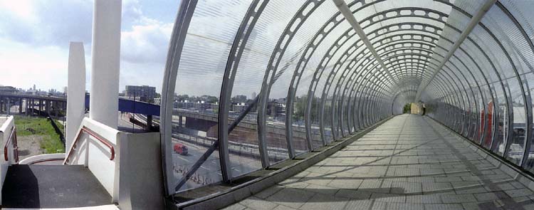
St Leonard’s Road beyond Langdon Park becomes Uamvar St, an odd name whose origin I can’t find. It used to be a little west of its current route and I think with St Leonard’s Road used earlier to be Bow Lane. I soon turned left onto Clutton St and climbed onto the footbridge over the railway. The bridge has now been replaced by a metal structure on which it would be rather harder to write ‘Happy Birthday’ and ‘I Love You’.

The railway line here carries the Docklands Light Railway line from Poplar to Stratford, but had been a part of the North London Railway (founded in 1846 as the East and West India Docks and Birmingham Junction Railway.) The Spratt’s Patent Limited Offices Fenchurch St are still there, with an entrance from Fawe St.

Farfamed Cake Company, Fawe St, Footbridge, Poplar, Tower Hamlets, 1988 88-7t-16-positive_2400
Far Famed Cake Company, Fawe St, Footbridge, Poplar, Tower Hamlets, 1988 88-7t-16

The Far Famed Cake Company began in 1881, and was bought by Fitch Lovell in 1950. They merged it with another company to form Hales Trent Cakes in 1962. In 1974 this was bought by Lyons. The factory had employed around 320 people. I think this site is now occupied by a large new block of flats with some shops on Morris Road.

Spratt's Patent Limited, Fawe St, Poplar, 1988 88-8a-62-Edit_2400
Spratt’s Patent Limited, Fawe St, Poplar, 1988 88-8a-62

Separated by a long yard from the block of Spratt’s Patent beside the DLR is another block of Spratt’s Patent Limited, still there and now the A B Fine Art Foundry.

Foresters Arms, pub, St Leonards Road , Poplar, Tower Hamlets, 1988 88-8a-63-Edit_2400
Foresters Arms, pub, St Leonards Road , Poplar, Tower Hamlets, 1988 88-8a-63

The Foresters Arms at 253 St Leonards Road, on the corner with Clutton St, a former Charrington & Co pub closed in 2004 and was sold. It was extended and converted to 6 flats in 2005. There had been a pub on this site since before 1856. It still has an address on St Leonards Road lthough my map calls the road huere Uamvar St.

Limehouse Cut, Blackwall Tunnel Northern Approach, Bromley-by-Bow, Tower Hamlets, 1988 88-8a-64-Edit_2400
Limehouse Cut, Blackwall Tunnel Northern Approach, Bromley-by-Bow, Tower Hamlets, 1988 88-8a-64

I continued my walk up Uamver St and on to the Blackwall Tunnel Northern Approach, and this picture was taken beside Tweed House, part of which can be seen at the extreme left. The buildings in the centre have now been replaced by a lower-rise redevelopment but that visible above the wall at the right of the picture is still there.

This section of the Limehouse Cut towpath was then rather overgrown and little used. It is now much busier, with a new floating section taking the path from Bow Locks under the busy tunnel approach road.

Nursery, Flats, Blackwall Tunnel Northern Approach, Bromley-by-Bow, Tower Hamlets, 1988 88-8a-52-Edit_2400
Nursery, Flats, Blackwall Tunnel Northern Approach, Bromley-by-Bow, Tower Hamlets, 1988 88-8a-52

I photographed this mural on a nursery and clinic in the flats beside the Blackwall Tunnel North Approach close to Devas St. This was part of the Coventry Cross West Estate, built by the LCC in the early 1950s as an addition to their 1935 Coventry Cross Estate. The name Coventry Cross came from a long-closed pub in the area since 1690 – at 68 St Leonards Street in 1861. The estate passed to the GLC and then TOwer Hamlets before after consultation and vote they joined Poplar HARCA.

From here is was a short distance to the end of my walk at Bromley-By-Bow District line station – from where I began my next walk in early August 1988

This had been an good walk for me and I hope readers will have found the pictures and text about them interesting. There are some more pictures from it in my album 1988 London Photos including some from earlier in the day at Petticoat Lane, in Whitechapel and Tower Hamlets cemetery before I started the walk proper.


Lansbury, Brownfield, Teviot and St Leonards Road

Lansbury, Brownfield, Teviot and St Leonards Road. My previous post in the series on this walk, Back to Poplar in 1988 contained information about George Lansbury, a leading politician in Poplar and around from when first elected as an MP in 1910 to his death in 1940. From 1932-35 leader of the Labour Party he was forced to resign because he stuck to his principles.

Lodore St, Poplar, Tower Hamlets, 1988  88-7t-45-positive_2400
Lodore St, Poplar, Tower Hamlets, 1988 88-7t-45

Because of its closeness to the docks and the River Thames Poplar had been one of the worst hit areas by bombs from German Zeppelins and bombers in World War I, but suffered far great damage in WW2, with almost a quarter of the buildings in the area being destroyed.

Redvelopment of the area after the war was slow, although part was finished in time to be included as the Live Architecture Exhibition section of the 1951 Festival of Britain, development of the whole of the area designated as the Lansbury Estate, between the East India Dock Road, Burdett Road, Limehouse Cut, and the North London railway line was only completed in the 1980s. The area at the south-east of this was developed by the GLC as an eastern extension to Lansbury, now known as the Brownfield Estate, designated in 1958.

By then its nature had changed with the original and highly praised plans begun under Patrick Abercrombie in 1943 and carried forward by Frederick Gibberd and the LCC Architect’s Department for the Festival being greatly modified, particularly after the Conservative Government which came to power in 1950 altered the housing priorities to provide more homes – which meant more high-rise.

From the GLC, the Lansbury estate passed to Tower Hamlets Council and was badly affected by Thatcher’s ‘right to buy’ and other policies against council housing. Much was transferred in 1988 to Poplar HARCA.

Balfron Tower, Willis St, Poplar, Tower Hamlets, 1988  88-7t-46-positive_2400
Balfron Tower, Willis St, Poplar, Tower Hamlets, 1988 88-7t-46

The iconic block of Balfron Tower is one of three – Balfron Tower, Carradale House
and Glenkerry House – listed blocks by architect Erno Goldfinger on the Brownfield Estate and dates from 1965-8. His development of Carradale House was held back so displaced local residents could be housed in Balfron and it was comleted in 1967-8, with Glenkerry House by Goldfinger’s studio being completed in 1972-5.

Goldfinger and his wife lived in one of the flats in Balfron for 8 weeks after completion. Balfron passed from Tower Hamlets to Poplar HARCA in 2007, promising residents to refurbish the building and re-house them there. They reneged on that promise, converting the block to luxury flats sold at market prices.

St Leonard's Arms, St Leonard's Rd, Poplar, Tower Hamlets, 1988  88-7t-32-positive_2400
St Leonard’s Arms, St Leonard’s Rd, Poplar, Tower Hamlets, 1988 88-7t-32

The St Leonard Arms at 162 St Leonards Rd is said to have closed in 1988 and was later converted to flats, probably in 2002. It had been there at least since 1861, when its address was 17 Wilson Terrace and St Leonard’s Road was then Bow Lane. In my picture from 1988 it looks as if it had closed some time earlier.

At the left the Grade II listed St Michael and All Angels, built 1864-5 is undergoing extensive building work – probably part of its conversion to flats as St Michael’s Court.

Five Ways Mission, War Memorial, St Leonard's Rd, Poplar, Tower Hamlets, 1988  88-7t-33-positive_2400
Five Ways Mission, War Memorial, St Leonard’s Rd, Poplar, Tower Hamlets, 1988 88-7t-33

Close to the church is an impressive war memorial with the “Christ with one hand raised in blessing and the other holding a wreath above the head of a kneeling warrior in the armour of a crusader“, sculptor A R Adams erected in 1920 with funds from a public “appeal, a football match and tickets for a special matinee performance at the queen’s theatre, high street on Saturday 24 April 1920“.

On the opposite side of the road is the former Fiveways Mission and a car hire service. This building is now smartened and extended at right as private housing.

Five Ways Mission, St Leonard's Rd, Poplar, Tower Hamlets, 1988  88-7t-34-positive_2400
Five Ways Mission, St Leonard’s Rd, Poplar, Tower Hamlets, 1988 88-7t-34

A closer, head-on view of the properties at 161-165 St Leonard’s Rd, with some light flare.

St Leonard's Rd, Bright St, Poplar, Tower Hamlets, 1988  88-7t-36-positive_2400
St Leonard’s Rd, Bright St, Poplar, Tower Hamlets, 1988 88-7t-36

A view of from the side of the two properties and the adjoining former London Cooperative Society with a fading and crumbling advertisement for BALSAM for COUGHS and Colds (perhaps the word FRIARS’ had already gone.) Above the shuttered frontage is the word HEADACHES.

St Leonard's Rd, Bright St, Poplar, Tower Hamlets, 1988  88-7t-22-positive_2400
St Leonard’s Rd, Bright St, Poplar, Tower Hamlets, 1988 88-7t-22

On the side of the building is a giant sign for the TEVIOT FESTIVAL, OPEN TO ALL and an arrow pointing in its direction. I also photographed this sign in colour. Much of this area was redeveloped as the Teviot Estate, which is now being redeveloped by Poplar HARCA. It is now often called Langdon Park, a green area at the end of Bright St where there is a newish DLR station.

Teviot Festival, Bright St, Poplar, 1988TQ3881-001

My walk will continue in a later post.


Bromley-by-Bow – July 1988

Bromley-by-Bow – July 1988. My previous post on my walk on Sunday 31st July 1988 ended at Watts Grove off Devons Road, and I spent some time exploring the area around here and in Bow Common and Bow.

All Hallows, Church, Devons Rd, Bow, Tower Hamlets, 1988 88-7s-45-positive_2400
All Hallows, Church, Devons Rd, Bow, Tower Hamlets, 1988 88-7s-45

The church of All Hallows on Devons Road was funded by the Clothworkers’ Company who got the money from the site of All Hallows Staining, demolished except for its tower in 1873. That tower, now Grade I listed, is still there just off Mark Lane, next to St Olave’s Church Hall. They paid for a church by architect Ewan Christian, completed in 1874. Unfortunately this was badly damaged by bombing, and only its core remained in the new church on the site by A P Robinson completed in 1955 in an ‘Early Christian’ style. The church has its address on Blackthorn St and is not yet listed.

Shops,  Devons Rd, Bow, Tower Hamlets, 1988 88-7s-46-positive_2400
Shops, Devons Rd, Bow, Tower Hamlets, 1988 88-7s-46

There was still a tyre shop, though no longer J R Tyres, at 119 Devons Road in 2021, though I think this end of the row of shops is currently being rebuilt. Some years since I made this picture this shop had previously been rebuilt, its ground and upper floor losing their late Victorian frontage.

The Widow's Son, The Bun House, pub, Devons Rd, Bow, Tower Hamlets, 1988 88-7s-32-positive_2400
The Widow’s Son, The Bun House, pub, Devons Rd, Bow, Tower Hamlets, 1988 88-7s-32

The Widow’s Son has the distinction of being the only listed building in the South Bromley Ward of Tower Hamlets, though I suspect its Grade II* listing reflects the legend associated with it – of the widow’s son who joined the Navy to fight Napoleon and wrote telling his mother he would be home for Easter and told her to cook a hot cross bun and have it waiting for him. He never came, but every year on Good Friday she baked a fresh bun for him, and a large collection was found hanging in a net from the ceiling beams of her cottage after her death.

The Widow’s Son, commonly known as the Bun House, was built on the site of her cottage, and the net containing the buns, was hung above the bar, with a sailor from the Navy adding another each year on Good Friday. From some time in the 1990s the buns were baked and supplied by Mr Bunn’s Bakery, a family-run business a few miles away in Chadwell Heath.

The pub was built around 1848, and its single bar largely retains its fittings from around the 1870s. It closed and was put up for sale in 2016, but was reopened in time for Bun Day in 2017 and was refurbished with new kitchens in 2019 and is more a pub/restaurant. I think it reopened after a further temporary closure due to Covid, but haven’t been able to check personally.

Joe's Auto Spares,  Cantrell Rd, Bow, Tower Hamlets, 1988 88-7s-34-positive_2400
Joe’s Auto Spares, Cantrell Rd, Bow, Tower Hamlets, 1988 88-7s-34

Joe’s Auto Spares were in a railway arch immediately west of the Cantrell Road Bridge, where there are still businesses in the arches, though many are now being priced out as railway arches – such as those in the centre of Brixton – are redeveloped and re-let at much higher rents.

Railway, bridge, gasholder, Cantrell Rd, Bow, Tower Hamlets, 1988 88-7s-35-positive_2400
Railway, bridge & gasholder, Cantrell Rd, Bow, Tower Hamlets, 1988 88-7s-35

I walked into the southern end of Tower Hamlets Cemetery Park to take a wider view showing the railway bridge and Joe’s Auto Spares, with one of the two remaining gasholders of Bow Common Gasworks behind. The gasholders, long redundant, were only demolished a few years ago and the site is now a development of around 1450 homes, a new sixth form centre, some commercial uses and a new area of open space.

Car spares, Cantrell Rd, Bow, Tower Hamlets, 1988 88-7s-36-positive_2400

I couldn’t resist taking another picture of the scrapyard beside the railway which has featured in a previous post. The site is now a part of the Tower Hamlets Cemetery Park.

Demolition, Fairfoot Rd, Bromley, Tower Hamlets, 1988 88-7s-21-positive_2400
Demolition, Rounton Rd, Bromley, Tower Hamlets, 1988 88-7s-21

Walking back towards the east I came to Rounton Road, where a row of late Victorian houses was being demolished. I think the tower block just visible in the background is probably Gayton House just off of Knapp Rd. The whole area around Rounton Road has been redeveloped.

Lozinski Ltd, Rounton Rd, Bow, Tower Hamlets, 198888-7s-22-positive_2400
Lozinski Ltd, Rounton Rd, Bow, Tower Hamlets, 198888-7s-22

Lozinki Ltd, an engineering company helpfully give their address as Rounton Ropad, Bow, and their site is now Miami Car Wash. Through the railway brdige you can see Navenby Walk. The tree is also still there.

H Barnett & Co, Rounton Rd, Bow, Tower Hamlets, 1988 88-7s-23-positive_2400
H Barnett & Co, Rounton Rd, Bow, Tower Hamlets, 1988 88-7s-23

The railway bridge, as well as the brick building are still there but the writing on the wall for H Barnett & Co, as well as the Vehicle Spares sign have gone and the wall and street sign both replaced. The building, obviously much altered by the brickwork, is a sub-station for the railway with a bridge carrying cables across to the tracks at its rear.

I still had a lot of wandering to do – so there will be further posts from my walk around Bow.


More Poplar 1988

More Poplar 1988 continues my walk Limehouse, Isle of Dogs & Poplar.

Chaplain’s house, East India Company, Poplar High St, Poplar, Tower Hamlets, 198888-7p-31-positive_2400
Chaplain’s house, East India Company, Poplar High St, Poplar, Tower Hamlets, 198888-7p-31

The Survey of London has a long story about this house at 115 Poplar High Street, now a private residence oddly called Meridian House and built together with 26 new almshouses by the East India Company in 1801-2. They had first set up almshouses in Poplar for disabled and retired employees and their widows and orphans in1626, built partly using money seized from the estate of Hugh Greete after his death in 1619. Greete had been discovered to have been swindling the company while trading Indian diamonds and they seized his assets.

The old almshouse was demolished in 1802 replaced by the new buildings. After the Crown took direct control of India in 1858 the government took over these buildings as Poplar Marine Hospital, selling all except the chaplain’s house, burial ground and chapel to Poplar District Board of Works in 1866. They demolished the almshouses to become Poplar Recreation Ground.

The chapel became the Church of St Matthias with the Chaplains house as its vicarage – and it was further enlarged in the following years. When St Matthias was closed in 1976 the house was sold to become a private residence.

Former District Board of Works Offices, Poplar High St, Woodstock Terrace,  Poplar, Tower Hamlets, 1988 88-7p-32-positive_2400
Former District Board of Works Offices, Poplar High St, Woodstock Terrace, Poplar, Tower Hamlets, 1988 88-7p-32

This Grade II listed building from 1869-70 for the Poplar District Board of Works was the result of a competition for designs which attracted 43 entries and considerable controversy when the prize went to Walter Augustus Hills (c1834–1917) and Thomas Wayland Fletcher (1833–1901) of Bow, both former assistant surveyors to the board. One architectual magazine at the time described it as ‘terribly ugly’. They were obliged to cooperate with the second place pair of Arthur and Christopher Harston over a final design. Once constructed the building was found to have various problems, not least that in the boardroom ‘reverberation was so excessive as to make the speaker almost incomprehensible’.

Various alterations were made and in 1900 the building became the town hall of the new Metropolitan Borough of Poplar, who extended it and then replaced it in 1038 by a new town hall in Bow. It continued in various uses by the council and in 1987 became the Borough of Tower Hamlets’s Directorate of Housing.

Poplar High St, Poplar, Tower Hamlets, 1988 88-7p-34-positive_2400
Poplar High St, Poplar, Tower Hamlets, 1988 88-7p-34

This small paved area is just off the High St between Norwood House and Holmsdale House and the block in the centre of the picture is Constant House on Harrow Lane, built by Poplar Council in 1936-7designed by the Borough Engineer and Surveyor, Rees J Williams. Both Holmsdale and Constant House were rehabilitated in 1986-7, with more work in recent years. Norwood House was added in the late 1960s and this paved area looks as if it may date from then.

Holmsdale House,  Poplar High St, Poplar, Tower Hamlets, 1988 88-7p-36-positive_2400
Holmsdale House, Poplar High St, Poplar, Tower Hamlets, 1988 88-7p-36

A similar style block to Constant House, also built for Poplar Council in 1937-8, designed by Rees J Williams.

The Resolute, pub, Harrow Lane, Poplar, Tower Hamlets, 1988 88-7p-21-positive_2400
The Resolute, pub, Harrow Lane, Poplar, Tower Hamlets, 1988 88-7p-21

Built in 1937 on the corner of Poplar High St and Harrow Lane, to replace an earlier pub the Resolute survived until closed and demolished in 2011. The pub on this site was The Harrow from 1797 (or earlier) until renamed the Resolute Tavern around 1881.

The best-known ship of this name was fitted out for arctic service at nearby Blackwall Yard in 1850 and made several trips to the Arctic searching for the lost expedition of Sir John Franklin who had been searching for a North West Passage. Finally the Resolute got stuck in ice and was abandoned in May 1854, the crew escaping across the ice to a relief fleet.

The ship was found drifting by an American whaler over a thousand miles from where she was abandoned in September 1855 in perfect order and was sailed back to New London, Connecticut, arriving on Christmas Eve. Eventually she was bought by the US Congress, refitted and sailed back to be presented to Queen Victoria and rejoining the navy. The Resolute was retired from the Navy in 1879, possibly at the time the pub was renamed. Some of her timbers were then used to create a substantial desk presented by Queen Victoria to US President Rutherford B. Hayes in 1880. Moved out for some years it has been back in use by most presidents in the Oval Office since being replaced there by Jimmy Carter.

East End Snooker and Social Club, East India Dock Rd, Poplar, Tower Hamlets, 1988 88-7q-01-positive_2400
East End Snooker and Social Club, East India Dock Rd, Poplar, Tower Hamlets, 1988 88-7q-01

This club was at 253 East India Dock Road and has since been converted into Poplar Central Mosque.

Blackwall Tunnel Approach, Poplar, Tower Hamlets, 1988 88-7q-65-positive_2400
Blackwall Tunnel Approach, Poplar, Tower Hamlets, 1988 88-7q-65

The crunched rear end of D814 VRG presumably had its match on the front end of A506 DMX, but at least it appeared that there were no casualites in the collision at the north end of the Blackwall Tunnel, viewed by me from Poplar High St. A sign a little down the road says ‘Welcome to Tower Hamlets‘ though I think most of the tunnel is in the borough. At left is the unmistakable profile of Erno Goldfinger’s Balfron Tower, built in 1965-6 for the GLC and recently stolen from its residents by Poplar HARCA housing association and sold as luxury housing.

Follett St Seamen's Mission, Follett St, Poplar, Tower Hamlets, 1988 88-7q-66-positive_2400
Follett St Seamen’s Mission, Follett St, Poplar, Tower Hamlets, 1988 88-7q-66

Just on the edge of the elaborate interchange between the East India Dock Road and the Blackwall Tunnel Approach is this small Seamen’s Mission, built in 1898 a Christ Church House and a part of the St Frideswide’s Mission House Conservation Area, but this building only locally listed. The mission here was set up by members of Christ Church College Oxford who in 1881 decided to support missions in the East End. Now converted into six flats.

My 1988 walk in Poplar will continue in a later post.


Church, Pyramid, Star of the East – More Limehouse

St Anne's Church, Limehouse, Tower Hamlets, 1988 88-7o-32-positive_2400
St Anne’s Church, Limehouse, Tower Hamlets, 1988 88-7o-32

Church, Pyramid, Star of the East – More Limehouse
My walk around Limehouse came back to the area I think of as its heart, close to St Anne’s Church, one of the Queen Anne Churches built after the 1711 Act of Parliament and consecrated in 1730. St Anne’s is one of the six London churches by Nicholas Hawksmoor along with St Alfege’s Greenwich, St George’ Bloomsbury, Christ Church, Spitalfields, St George in the East Wapping andhis only church in the City of London, St Mary Woolnoth.


St Anne's Churchyard, St Anne's Passage, Limehouse, Tower Hamlets, 1988  88-7o-34-positive_2400
St Anne’s Churchyard, St Anne’s Passage, Limehouse, Tower Hamlets, 1988 88-7o-34

I turned my back on the church to photograph the entrance gate to the churchyard.

Limehouse Pyramid, St Anne's Church, Limehouse, Tower Hamlets, 1988  88-7o-36-positive_2400
Limehouse Pyramid, St Anne’s Church, Limehouse, Tower Hamlets, 1988 88-7o-36

The church has featured in many books and publications, including the work of psychogeographers and other more esoteric and mystical writers, and seems to have a special place in the works of believers in ley lines. I’ve not read or seen the film ‘Dark Lines Of London’, but a web page claims to give “Factual Information That Provides the Backdrop to the Story” and includes descriptions and photographs of 10 sites, all from centuries after that in which the story is set, along “a real ley line” one of which is this “Wisdom Of Solomon” Pyramid.

Princes Lodge, Commercial Rd, Limehouse, Tower Hamlets, 1988  88-7o-22-positive_2400
Princes Lodge, Commercial Rd, Limehouse, Tower Hamlets, 1988 88-7o-22

THE 4TH CONFERENCE of the Situationist International was held in London, at a secret address in the East End, 24-28 September 1960, seventeen months after the Munich Conference (April 1959). The situationists assembled in London were: Debord, Jacqueline de Jong, Jorn, Kotányi, Katja Lindell, Jörgen Nash, Prem, Sturm, Maurice Wyckaert and H.P. Zimmer. In fact, to ensure that the proceedings were kept well away from any contact with London journalists or artistic circles, the conference took place at the British Sailors Society hall in Limehouse, “an area famous for its criminals”.

Internationale Situationniste #5

Star of the East, Commercial Rd, Limehouse, Tower Hamlets, 1988  88-7o-23-positive_2400
Star of the East, Commercial Rd, Limehouse, Tower Hamlets, 1988 88-7o-23

Built in the early 19th century and Grade II listed the Star of the East was serving beer at least from 1845. More recently the building had deteriorated and closed as a pub around 2010, was reopened a couple of years later but closed again in 2016. The pub was then taken over and refurbished by the Old Spot Pub Co, who run around a dozen pubs re-opening again in 2019.

Star of the East, Commercial Rd, Limehouse, Tower Hamlets, 1988  88-7o-11-positive_2400
Star of the East, Commercial Rd, Limehouse, Tower Hamlets, 1988 88-7o-11

You can read more about its recent transformation and see some photographs from London Pub Explorer. I’ve yet to return to see for myself. Back in 1988 part of the building was a separate restaurant, but I think the pub now occupies the whole building. The refurbishment appears to have kept at least some of the original interior features.

Bate St, Three Colt St, Limehouse, Tower Hamlets, 1988  88-7o-14-positive_2400
Three Colt St, Limehouse, Tower Hamlets, 1988 88-7o-14

Three Colt St, which has St Anne’s Church at its northern end is one of the oldest roads in the area, part of the route from Limehouse to Stepney and first recorded in 1362. In the Victorian era it was flanked by a number of shops and was something of a middle-class enclave surrounded on both sides by extreme poverty. Little remains from those times. The building here is the former London and Blackwall Railway station, probably dating from the opening of the railway in 1840. The station closed in 1926, but the line remained in use for goods traffic until the 1960s. When the line was reused for the Docklands Light Railway in 1987, Westferry station was built around 300 yards to the east.

Emmett St, Limehouse, Tower Hamlets, 1988 88-7o-16-positive_2400
Emmett St, Limehouse, Tower Hamlets, 1988 88-7o-16

Not only this building but the street that it was in have disappeared since I made this picture. Emmett St was at the end of Three Colt St, roughly where the Limehouse Link tunnel entrance is now. Construction of the tunnel began in November 1989 and the project was officially opened in May 1993, at £293,000,000 the most expensive per mile road scheme ever built in the UK, a huge public subsidy to the Canary Wharf redevelopment.

When Mucho Macho released ‘The Limehouse Link’ in 1998 it had one of my pictures wrapped around both the CD and the 12″ LP, where it looked rather more impressive. But this image was from Poplar – and this is the full image from the Urban Landscapes web site and doesn’t show the Limehouse Link at all.


Clicking on any of the black and white images above will take you to a larger version in my 1988 London Photos from where you can browse the album.


Abbey Rd, South & West Hampstead – 1988

Rowley Way, South Hampstead, Camden, 1988 88-6d-54-positive_2400
Rowley Way, South Hampstead, Camden, 1988 88-6d-54

Camden council bought the Alexandra Road estate, part of the Eyre estate in North London and their architect Neave Browne designed this ziggurat style terrace in 1968, but construction only began in 1972. Browne saw the design, with vehicles restricted to the basement level as a better solution than tower blocks, which had been discredited by the Ronan point collapse and other problems. Family flats with small gardens opened onto the walkway at ground level, with smaller flats stepped back above them, so all got good light and air. The height of the 8 storey block at left gave some protection to the rest of the estate from the noise of the main West Coast railway line from Euston.

I had wrongly titled this Langtry Walk, which runs at the south of this estate a few yards away with a single lower row of flats by Browne built on similar principles. The name Langtry walk refers to royal mistress Lily Langtree, nicknamed “The Jersey Lily”, who, as local historians Dick Weindling and Marianne Colloms have shown had no connection with the area but was co-opted by a resident whose house in Alexandra Road was to be demolished for the new estate.

The estate was Grade II* listed in 1993, remarkably early in its life and the first post-Second World War council estate and one of very few public housing schemes to acheive this status.

Snowman House, Casterbridge, Abbey Rd, Camden, 1988 88-6d-55-positive_2400
Snowman House, Casterbridge, Abbey Rd, Camden, 1988 88-6d-55

This photograph was made from Abbey Road, with the back of Rowley Way at the right of the picture. Snowman House at left is on Abbey Road and Casterbridge at the corner of this and Belsize Rd and both are in Camden Council’s Abbey Estate. Both were approved in 1965 and building completed in 1967. They have 20 storeys above ground and are 59.4m tall – about 195 feet.

Snowman House, Casterbridge, Abbey Rd, Camden, 1988 88-6d-42-positive_2400

A bridge across Abbey Road connects the Casterbridge tower with another Abbey estate building, Emminster, which has a parade of shops at ground level. Both the 8 storey Emminster and another block, Hinstock, are scheduled for demolition to make way for new affordable homes to be built, and improvements to the road layout. This bridge was still there in April 2021, but will presumably soon be gone.

Finchley Rd, Camden, 1988 88-6d-35-positive_2400
Finchley Rd, Camden, 1988 88-6d-35

I walked back towards Kilburn Grange Park and then to West End Lane, and then across to FInchley Road. On my contact sheet this row of heraldic figures on the front garden wall of a house is labelled ‘Finchley Rod’, but it may have been a few yards down a side turning.

The Alcove Cafe, Finchley Rd, Camden, 1988 88-6d-36-positive_2400
The Alcove Cafe, Finchley Rd, Camden, 1988 88-6d-36

The Alcove Cafe was in a part of the former station entrance for the Finchley Road (Midland) station which first opened as Finchley Rd & St John’s Wood in 1868. Around 1905 a row of seven shops and offices named Midland Crescent was added to the entrance on the west side of FInchley Road. The station closed in 1927 but the shops remained, being demolished in the early 1990s for the building of the O2 Centre here. Various planning, finanacial and other problems held up the new building which finally opened in 1998.

Neasden Electronics, Tandoori Cottage, Finchley Rd, Camden, 1988 88-6d-21-positive_2400
Neasden Electronics, Tandoori Cottage, Finchley Rd, Camden, 1988 88-6d-21

Neasden Electronics was roughly opposite the former station, and these buildings have now been replaced by a hotel.

Broadhurst Gardens, South Hampstead, Camden, 1988 88-6d-22-positive_2400
Broadhurst Gardens, South Hampstead, Camden, 1988 88-6d-22

I walked down towards Swiss Cottage turning briefly into Broadhurst Gardens to make a picture of the rear of the St John’s Court flats on FInchley Rd, built in 1937-8, architect T P Bennett, with the lower three floors for the department store John Barnes, with five floors above housing 96 flats. In 1940 the store became part of the John Lewis Partnership. It closed as a department store in 1981 and the ground floor are now occupied by Waitrose.

Swiss Cottage, South Hampstead, Camden, 1988 88-6d-24-positive_2400
Swiss Cottage, South Hampstead, Camden, 1988 88-6d-24

I made a couple of photographs of new office buildings at Swiss Cottage.

Swiss Cottage, South Hampstead, Camden, 1988 88-6d-25-positive_2400

Swiss Cottage, South Hampstead, Camden, 1988 88-6d-25-positive_2400
Swiss Cottage, South Hampstead, Camden, 1988 88-6d-25

And then went on the photograph Ye Olde Swiss Cottage, a Grade II listed Samuel Smiths pub originally built as an alpine-style chalet and called The Swiss Tavern.

Ye Olde Swiss Cottage, Finchley Rd, Camden, 1988 88-6d-26-positive_2400
Ye Olde Swiss Cottage, Finchley Rd, Camden, 1988 88-6d-26

Various dates for the building of the chalet can be found on the web, including both 1804 and 1840. Possibly CAMRA may be more reliable given the nature of the building, which they state “was built in 1830 by T Redmond and it stood next to a toll gate; travellers would stop at the tavern while waiting to pay their fees. There had been a gabled building on the site called Lausanne Cottage said to have been used by Charles II as a hunting lodge and their may have been an earlier pub called the Swiss Tavern.”

I didn’t pop in for a pint of ‘Old Brewery Bitter’ (and probably it wasn’t then on tap) but continued my walk – and will do so in a later post.


Click on any of the pictures to go to a larger version on the album 1988 London Photos from where you can browse the whole album. Pictures there are usually in file name order which differs from the order in which they were taken.


Around Kilburn Square – 1988

Kilburn Square, Kilburn High Rd, Brondesbury Rd, Kilburn, Brent, 1988 88-6c-21-positive_2400
Kilburn Square, Kilburn High Rd, Brondesbury Rd, Kilburn, Brent, 1988 88-6c-21

My next visit to Kilburn came in June 1988 and I began my walk from Kilburn Park station on the Bakerloo line. I took a couple of pictures in Cambridge Ave, but nothing exciting and then walked up Kilburn High Road to Kilburn Square.

Kilburn Square, Kilburn High Rd, Brondesbury Rd, Kilburn, Brent, 1988 88-6c-22-positive_2400
Kilburn Square, Kilburn High Rd, Brondesbury Rd, Kilburn, Brent, 1988 88-6c-22

Kilburn Square was built in the 1960s for Willesden Municipal Borough Council with a 17 storey high rise with 85 flats and four low rise blocks with a shopping centre and market area in a wide pavement in front of them on Kilburn High Rd. Work began on the tower block in 1961. The estate replaced Victorian terraced houses in the square.

Kilburn Square, Kilburn High Rd, Brondesbury Rd, Kilburn, Brent, 1988 88-6c-25-positive_2400
Kilburn Square, Kilburn High Rd, Brondesbury Rd, Kilburn, Brent, 1988 88-6c-25

These pictures are from the front block of the estate, the shops fronting Kilburn High Rd. It was designed to have shops on the first floor, but these were never very successful. They could be reached by steps or a long slope. This shows the tower on the estate behind the shops.

Kilburn Square, Kilburn High Rd, Brondesbury Rd, Kilburn, Brent, 1988 88-6c-26-positive_2400
Kilburn Square, Kilburn High Rd, Brondesbury Rd, Kilburn, Brent, 1988 88-6c-26

The management of the estate behind the shops passed to a Tenant Management Organisation in 1994 following the Right to Manage Legislation. Currently Brent Council is still consulting on plans to add infill housing to the estate, and appears to be taking some of the residents views into consideration. Although it’s sad to lose green space, if infill is done sensitively its better than the comprehensive demoltion of many estates across London which always result in a loss of social housing.

Kilburn High Rd, Kilburn, Brent, 1988 88-6c-11-positive_2400
The Cock Tavern, Kilburn High Rd, Kilburn, Brent, 1988 88-6c-11

The Cock Tavern at 125 Kilburn High Road has a plaque stating it was licenced in 1486 and rebuilt in 1900 and was a Truman pub. It was later owned by Greene King and from 2009-11 was also home to a theatre on the first floor, but this had to close as the staircase was found to be unsafe. It was sold in 2016 and closed in 2019, reopening in January 2020 as The Juniper. The building is locally listed by Brent Council.

Quex Rd, Camden, 1988 88-6c-13-positive_2400

This estate office in Quex Road appeared have something of an obstacle course to enter, apparently designed to eliminate access for any disabled clients. I think there was probably a slope down behind the front gates then two sets of steps to the entrance.

The Earl Derby, Priory Park Rd, Kilburn, Brent, 1988 88-6c-15-positive_2400
The Earl Derby, Priory Park Rd, Kilburn, Brent, 1988 88-6c-15

The Earl of Derby dates from around 1869 at 155 Kilburn High Road. Having been called the Golden Egg for some years it reopened in 2013 and was described as a gastro pub under a shorter version of its original name, simply Earl Derby. It claims to be home to the cheapest pint in London, and in 2020 some beers were £2.00 a pint.

The side of the pub shown is on Priory Park Rd, and the block further down the road is Ryde House, designed by Willesden Borough Council Architect’s Department and built in 1964.

Sadly the wrought iron entrance at the left of the pub has been lost in alterations to the side of the pub. I hope it has been preserved somewhere.

Click on any image to go to a larger version in my album 1988 London Photos from where you can browse the other images in the album.


FlickrFacebookMy London DiaryHull PhotosLea ValleyParis

London’s Industrial HeritageLondon Photos

All photographs on this page are copyright © Peter Marshall. Contact me to buy prints or licence to reproduce.


North Pole & Heron Quay

The North Pole, Manilla Street, Millwall, Tower Hamlets, 1988 88-6b-22-positive_2400
The North Pole, Manilla Street, Millwall, Tower Hamlets, 1988 88-6b-22

Continuing my walk around the West India Docks I walked down from Marsh Wall to Manilla St, where I think you can still find The North Pole, a beer house built in the 1860s, on the corner at No 74. It closed as a pub in 2014, and I suspect the building’s days are numbered.

Cuba St, Millwall, Tower Hamlets, 1988 88-6b-23-positive_2400
Cuba St, Millwall, Tower Hamlets, 1988 88-6b-23

Nothing, or almost nothing in this picture of Cuba St has survived the redevelopment of this street on the fringe of the West India Docks. In the far distance you can just make out the distinctive frontage of the building on the corner of Cuba St and Westferry Road, the first few feet of which have been incorporated into a modern red-brick block and is now an Indian Restaurant. It seems to be much more than the usual facade, with the older building integrated into the development, Regatta Point, which is on a rather smaller scale than much of the new building, only 5 storeys of shops with flats above.

Docklands Enterprise, Wendy Ann Taylor, Sculpture, Heron Quays, Marsh Wall, Tower Hamlets, 1988 88-6b-24-positive_2400
Docklands Enterprise, Wendy Ann Taylor, Sculpture, South Dock, Marsh Wall, Tower Hamlets, 1988 88-6b-24

Wendy Ann Taylor, born 1945 claims to have been as one of the first artists of her generation to “take art out of the galleries and onto the streets”’ and has made a number of sculptures around London and in several of the new towns. This sculpture was commissioned by the LDDC and the Docklands Business Club and dates from 1987. It is still in place, although everything in the background of this picture has been replaced by newer and much taller developments. I took the shape emaphasised in my picture and repeated at right angles in her work as representing the river around the Isle of Dogs and the vertical as enterprise reaching for the sky.

Heron Quay, DLR, Middle Dock, West India Docks, Tower Hamlets, 1988 88-6b-14-positive_2400
Heron Quay, DLR, South Dock, West India Docks, Tower Hamlets, 1988 88-6b-14

You can still just about see the DLR as it goes across South Dock here but Heron Quay station is now completely engulfed in tall office blocks, the water now looking enclosed rather than open as it was. The distant gasholder at right at Greenwich has also now gone, though long invisible from here.

Heron Quay, West India Docks, Tower Hamlets, 1988 88-6c-63-positive_2400
Heron Quay, South Dock, West India Docks, Tower Hamlets, 1988 88-6c-63

I think it is a long time since any boats were moored here.

Heron Quay, West India Docks, Tower Hamlets, 1988 88-6c-65-positive_2400
Heron Quay, West India Docks, Tower Hamlets, 1988 88-6c-65

This picture is looking along Middle Dock, with the north side of the buildings, long demolished, of Heron Quay at right.

I continued my walk to the North Dock – and a few pictures in a later post.

Click on any of the pictures to see a larger version in my album 1988 London Photos, from where you can browse the album. The pictures there are largely ordered by my negative reference numbers, which do not in detail reflect the order in which the pictures were taken used in the posts here.


Another Chelsea Walk – 1988

Church Of The Ñazarene, Grant Rd, Battersea, Wandsworth, 1988 88-5j-54-positive_2400
Church Of The Ñazarene, Grant Rd, Battersea, Wandsworth, 1988 88-5j-54

I returned for another walk in Chelsea, taking the train to Clapham Junction and taking a few pictures on my short walk to the bus stop of the Church Of The Ñazarene close to the north entrance to the station on Grant Road. The church, a twelve-sided building by Green Lloyd Adams was built in 1970 on the edge of the Winstanley Estate, developed by Battersea Council in the 1960s. The lettering on the ramp ‘JESUS SAID I AM THE WAY’ is designed for maximum size rather than typographical nicety.

Currently extensive building work is being carried out to considerably extend the church, though its future may be threatened if Crossrail 2 goes ahead. Of the two pictures I made I preferred a view across the small area with seats to a cleaner architectural view also included in the album.

Falcon Rd, Battersea, Wandsworth, 1988 88-5j-55-positive_2400
Falcon Rd, Battersea, Wandsworth, 1988 88-5j-55

On the bus I took advantage of an unusually clean front window on the upper deck to take a photograph of Falcon Road with the Queen Victoria pub. Also apparently known as ‘Spikey Hedghog’ the pub which had been there since the 1860s closed permanently in 1999 and was demolished to build the 8 flats of St Luke’s Court.

The picture also includes a falcon – both image and text on the side of a lorry. Elsewhere you can read a short post Falcon Road – a Memory of Battersea by someone who grew up living in the pub which gives an idea what the area was like, probably in the 1950s.

Beaufort St, Chelsea, Kensington & Chelsea, 1988 88-5j-45-positive_2400
Beaufort St, Chelsea, Kensington & Chelsea, 1988 88-5j-45

I got off the bus in Beaufort St in Chelsea and photographed this doorway there before walking along Cheyne Walk. Although the door is on Beaufort St, this is Belle Vue Lodge with the address 91 Cheyne Walk. It gets a lengthy mention in the Survey of London, first published in 1913 which suggests it dates from before 1771. It states that in 1829 it was occupied by “Luke Thomas Flood, who was a great benefactor to the parish. He was evidently a friend of the historian, for he addressed some lines to him, which conclude with the halting line ‘Sweet Chelsea shall ever live in thee.’ Flood Street was named after him, and his benefactions are celebrated at the parish church by a service on January 13th,—’Flood’s Day.'”

Houseboats, River Thames, Chelsea Embankment, Chelsea, Kensington & Chelsea, 1988 88-5j-32-positive_2400
Houseboats, River Thames, Chelsea Embankment, Chelsea, Kensington & Chelsea, 1988 88-5j-32

I walked across Cheyne Walk to make a photograph over the roofs of houseboats at the moorings, looking towards Chelsea Harbour and at left the Rank Hovis flour mills at Battersea and the Battersea Rail bridge. Then I think only used by goods trains this now carries frequent services of the London Overground as well as Thameslink trains.

Cheyne Walk, Chelsea, Kensington & Chelsea, 1988 88-5j-33-positive_2400
Cheyne Walk, Chelsea, Kensington & Chelsea, 1988 88-5j-33

I took a picture of houses in Cheyne Row. That at left is No 104 with two blue plaques, for the artist Walter Greaves (1846-1930) and Anglo-French ‘Poet, essayist and historian’ Hilaire Belloc (1870-1953) whose poem Jim (who ran away from his Nurse and was eaten by a Lion) ends with the famous lines:
‘And always keep ahold of nurse
For fear of finding something worse.’

No 104 doesn’t get a mention in the Survey of London, but No 100 at right of the picture is part of Lindsey House which it suggests was “rebuilt much in its present external form by the third Earl of Lindsey in 1674” but then divided into separate houses as 95-100 around 1775. It gets a very long entry.

Beaufort St, Chelsea, Kensington & Chelsea, 1988 88-5j-22-positive_2400
Beaufort St, Chelsea, Kensington & Chelsea, 1988 88-5j-22

I walked back up Beaufort St, passing a long row of frontages with identical garden ornaments which I think is Beaufort Mansions, though the gardens now have hedges. I think these mansion flats probably date from around 1890.

Shop window, Kings Rd, Chelsea, Kensington & Chelsea, 1988 88-5j-23-positive_2400
Shop window, Kings Rd, Chelsea, Kensington & Chelsea, 1988 88-5j-23

I was on my way to take a few more photographs on the King’s Road, including a several shop interiors. I think the name of the shop is on the wall at left, part hidden, Pineapple.

More pictures from this walk in a later post.


Click on any of the images above to go to a larger version in my album 1988 London Photos from where you can browse other images in the album.


Kensington Gore and More 1988

Royal College Of Organists, Kensington Gore, Kensington & Chelsea, 1988 88-4d-61-positive_2400
Royal College Of Organists, Kensington Gore, Kensington & Chelsea, 1988 88-4d-61

I’m not a great fan of organs, an instrument generally used in churches to overpower the combined forces of both choir and congregation and to glorify the immense ego of the organist intent on world domination. I think my mental predictive text tends to replace the ‘rg’ with an ‘n’, both words concerning an excessive interest in organs. Of course they can be played with sensitivity, or so I’m told. Visually organs often add interest to church interiors, and this building seems to me to perfectly express the idea of the organ, visually punning on those pipes and also having a ridiculous showoffiness.

Queen Alexandra's House,  Kensington Gore, Kensington & Chelsea, 1988 88-4d-62-positive_2400
Queen Alexandra’s House, Kensington Gore, Kensington & Chelsea, 1988 88-4d-62

Queen Alexandra’s House nearby also has a musical theme, but is considerably more restrained. It was founded in 1884 by Sir Francis Cook Bar to provide accommodation for women students at the Royal College of Music, Royal College of Art and the Royal College of Science, and apparently still serves a similar but wider purpose. Queen Alexandra is I think largely forgotten now. She was born in 1844 as Princess Alexandra Caroline Marie Charlotte Louise Julia of Schleswig-Holstein-Sonderburg-Glucksburg, a relative of Queen Victoria, and moved up the scale when a conference of Austria, France, Prussia, Russia and the United Kingdom made her dad King of Denmark in 1863 and her brother became King of Greece.

But by this time, Queen Victoria had decided her heir Albert Edward needed a wife and although she wasn’t the first choice (and he was enjoying one of his many affairs that continued after his marriage) the two were married in 1863. When Victoria died, Albert became King Edward VII and she became Queen Alexandra. Both as Princess of Wales and Queen she carried out many royal duties and supported many charities – including the one that set up this house, and was a keen photographer, issuing a book of her photographs, Queen Alexandra’s Christmas Gift Book, to raise money for charity in 1908.

Queen's Gate Gardens, South Kensington, Kensington & Chelsea, 1988 88-4e-22-positive_2400
Queen’s Gate Gardens, South Kensington, Kensington & Chelsea, 1988 88-4e-22

Rolls-Royce DYR6 enjoys a suitably elevated position in front of some suitably grand housing in Queen’s Gate Gardens. The development of 127 houses and 51 stables around the square is said to have been a model for later Victorian Garden Squares. The grand design of the houses was probably laid down by the Commissioners for the Exhibition of 1851 who purchased a large slab of South Kensington, parts of which were used for the various museums etc.

St Stephen's Church Hall, Emperor's Gate, Kensington, Kensington & Chelsea, 1988 88-4e-34-positive_2400
St Stephen’s Church, Emperor’s Gate, Kensington, Kensington & Chelsea, 1988 88-4e-34

This is not St Stephen’s Church which is on the corner of Gloucester Road and Southwell Gardens, but on the continuation of that road on the opposite side of Grenville Place in Emperor’s Gate and is St Stephen’s Church Hall. I think it may have been actually in use as a church when I made the photograph, but now is a health centre, a hall for hire and has a kindergarten.

This area was sold by Lord Kensington to the Metropolitan warily way in 1867 and lies just to the east of the junction where the Circle Line parts company with the District, known as the ‘Cromwell Curve’. The railway let this South Kensington Baptist Chapel be built here in 1868-9, and in 1873 it became English Presbyterian – and they added this porch. Around 1930 it became the Russian Orthodox Church in Exile.

Middle-class housing was developed here in 1871-3. Initially the developers wanted to name this Alexandra Gate (after the Princess of Wales), but this was vetoed by the authorities and they came up with Emperor’s Gate, possibly a reference to the German Emperor – another of our royal family. The Survey of London says the mews behind the road on the south side, adjoining the railway was named McLeod’s Mews after “Sir Donald McLeod, a local resident and ex-Lieutenant-Governor of the Punjab, who died in November 1872 after attempting to board a moving train at Gloucester Road Station, falling between train and platform and suffering fearful mutilation.”

Eldon Rd, Kensington, Kensington & Chelsea, 1988 88-4e-52-positive_2400
Eldon Rd, Kensington, Kensington & Chelsea, 1988

Eldon Rd, Kensington, Kensington & Chelsea, 1988 88-4e-55-positive_2400
Eldon Rd, Kensington, Kensington & Chelsea, 1988 88-4e-55

Eldon Road with its urns, lion and unicorn and at the top St George and a dragon comes at the west end of a short and rather plainer brick terrace, apparently built in 1852. But I’ve been unable to find out more about it. Eldon Road is a short street with a rather eclectic selection of houses as well as Christ Church Kensington. Hardy Amies (1909-2003) lived four doors along the road from 1961 to 1979 at 17b Eldon Road, not surprisingly making a number of alterations to the fabric.

Kensington Court Place, St Alban's Grove, Kensington, Kensington & Chelsea, 1988 88-4e-64-positive_2400
Kensington Court Place, St Alban’s Grove, Kensington, Kensington & Chelsea, 1988 88-4e-64

The Builders Arms is still a pub of sorts, now a gastropub with an extensive and fairly expensive menu and craft ales on tap while I think when I took this picture it was a local where crisps and nuts and pork scratchings probably were the main foods on offer. Similarly although there is a shop opposite, it is no longer a launderette but considerably more upmarket where you can buy a pearl and jade harmony necklace for a mere £3,800. I think you now have to take your washing quite out of the area.

Clicking on any of the images will take you to the album 1988 London Photos with larger versions of these pictures and from where you can browse through over 1300 more pictures from the many I made in London that year.


All photographs on this and my other sites, unless otherwise stated, are taken by and copyright of Peter Marshall, and are available for reproduction or can be bought as prints.