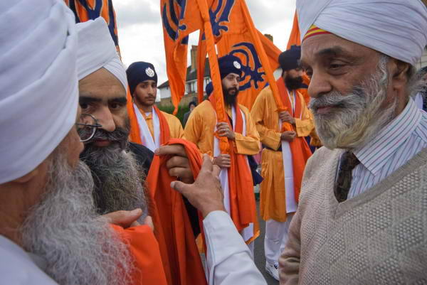
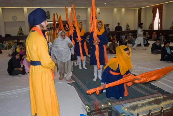
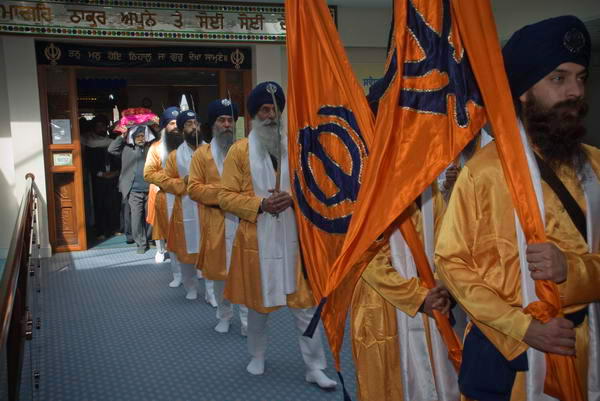
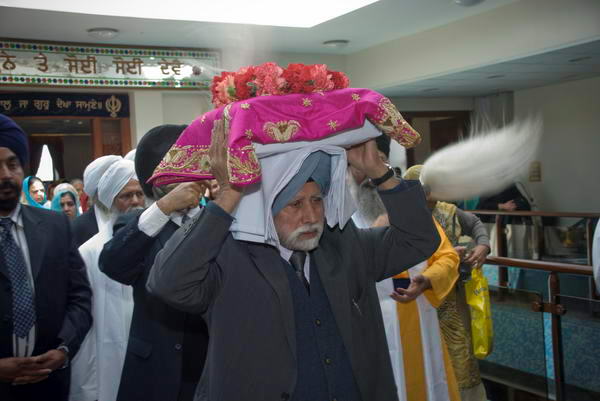
Vaisakhi is the traditional New Year and harvest festival of the Punjab in India and Pakistan and gained added significance for Sikhs, the majority population in the area when at Vaisakhi in 1699 Guru Gobind Singh, the 10th Guru, founded the Sikh nation with the establishment of the Khalsa Panth.
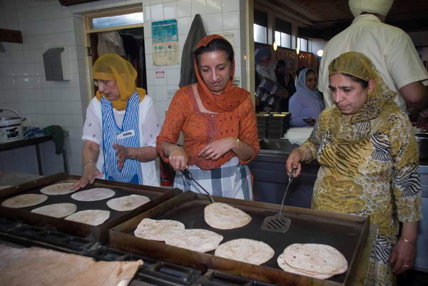
Vaisahki is actually the 13th or 14th of April each year, but the festival is celebrated over several weeks at different Gurdwaras. You can read more about Vaisakhi and see some of my earlier pictures from various Nagar Kirtan (Sikh processions) on My London Diary posts from 2004, 2005, 2006 and 2007 and although they follow a similar pattern there are differences. In Hounslow the event seemed to me to have more active participation by women and girls than in some of the others.
I’d previously photographed the celebrations at most of of the Gurdwaras around London as a part of a larger project on religious celebrations in London, but had somehow missed out on covering the festival in Hounslow.
I’d always enjoyed photographing Vaisahki as the Sikhs were always very hospitable – I was made very welcome and guided and encouraged to take photographs and Hounslow was no exception. I wrote a fairly long description of the event on My London Dairy and included some of my personal history in the area where I – and my father – grew up.
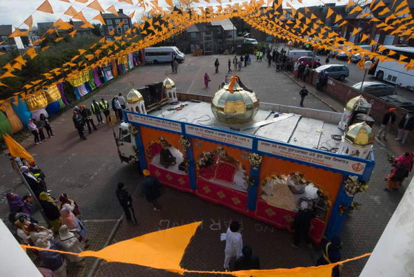
The procession began at the Gurdwara Sri Guru Singh Sabha which was built on the site of the dye factory where I had my first full-time job – and where many of the shop-floor workers were Sikh. On the route various people had set up stalls offering free food and soft drinks to everyone in the procession – and I enjoyed their hospitality, but was soon too full to be able to accept more.
It went along streets that were very familiar to me, past the clinic where I was weighed and measured as a baby and my mother was given free orange juice and cod-liver oil (which I didn’t thank them for.) Past the nursery school, Major Drake Brockman’s Academy, from which I was expelled aged 4, past the school my father left in 1913 at the age of 14 (though he wouldn’t recognise it now) on to the Gurdwara Guru Nanak Nishkam Sewak Jatha where the procession halted for more celebrations before continuing back to its starting point.
Woolwich to New Charlton Panoramas: Continuing my occasional series of colour images from 1995 – I think this is the eleventh post – with some colour panoramas made in May 1995 on a walk from Woolwich to New Charlton.
River Thames, Church Hill, Woolwich, Greenwich, 1995, 95p5-342
My walk had begun when I got off the train at Woolwich Arsenal on my way back from Dartford on May 7th and I think these pictures were made that afternoon as I walked from there to another station keeping close to the River Thames. But I did but return to Woolwich the following Sunday, May 14th and some of these pictures could have been made then.
A path leads up from the roundabout at the start of Woolwich Church Street to Church Hill and St Mary Magdalene Church, built on a spur of high ground leading out towards the river. Originally this ground went rather closer to the Thames, but much of it was quarried for sand though the digging had to stop at the church. Although the present church dates only from 1727-39 there had been a church on this site since the 9th century if not earlier and it was probably a much earlier site of settlement.
The road in front of the church, Church Hill, gives a splendid panoramic view of the Thames. In 1995 you could still see the remains of Woolwich’s riverside industry, but by the time I photographed here again in 2000 all had gone and the area was empty and derilect. Now it is filled with four tall blocks of flats and some other housing.
Former Woolwich Dockyard Dry Docks, Europe Rd, Woolwich, Greenwich, 1995, 95p5-343
Woolwich Dockyard was the Navy’s most important dockyard for many years and ships were built here from 1512 to the Victorian era. By then it had become too small for the new ships and the Royal Dockyard closed in 1869. Parts remained in industrial use and a large area was bought by Greenwich Council in the 1960s where they built the Woolwich Dockyard Estate in the 1970s – part at the left of this picture. I think this is the Grade II listed Graving Dock.
Ernest Bevin, Ferry Boat, River Thames, Woolwich, Greenwich, 1995, 95p5-332
Taken on the Woolwich Dockyard Estate this shows one of the old dry docks and at a mooring in the Thames the Woolwich Ferry Ernest Bevin. You can just see part of the south ferry terminal in the centre of the image.
The ferry across the Thames became a free ferry run by the LCC in 1889 – two days after they had replaced the Metropolitan Board of Works who had organised and funded it. A number of public bridges had been built to make crossing the river in West London easy and free and it had been decided that there must also be a free crossing in East London. The Ernest Bevin was one of three ferries in the third generation of ships which came into operation in 1963 and it was replaced in 2019. All have been named after local figues and Bevin was elected as MP for Woolwich East in 1950.
These point blocks, close to Woolwich Dockyard Station were built for Greenwich Council are St Mary’s Towers, one of the more successful housing schemes of the late 50s and early 60s, opened by Princess Margaret in 1961. They remain now still in good condition and popular.
River Thames, Woolwich, Greenwich, 1995, 95p5-472
Back to the River Thames and another cleared area of the former Dockyard with a view across the river to Tate & Lyle’s Silvertown works.
River Thames, Warspite Rd, Woolwich, Greenwich, 1995, 95p5-433
Another former dockyard area still in industrial use. I think this is Thameside Wharf on Harrington Way. Some of the buildings here were once part of the Siemens Brothers Telegraph Works factory established in 1863 and became Thameside studios for artists around 1990.
Bugsby’s Way, New Charlton, Greenwich, 1995, 95p5-521
Bugsby’s Way took its name from this part of the River Thames known from around 1830 as Bugsby’s Hole or Bugsby’s Reach which probably got its name from this once “marshy area to the south of Blackwall Point where executed criminals were formerly hung in chains.” As E.W.Green suggested in 1948, ‘bug‘ was the old British (ancient Welsh) word for ‘spook’ or ghost, and what could be a better place to meet with ghouls. Bugsby’s Way was built across this marshy area by the London Borough of Greenwich in 1984.
Beatle Line Ltd, Bugsby’s Way, New Charlton, Greenwich, 1995, 95p5-511
Another picture from Bugsby’s Way. The Beatle Line perhaps got its name from the later meaning of ‘bug’, perhaps from a different Anglo-Saxon root, at first simply meaning beatle, though later coming into popular use for a wider range of species – including the famous moth found by Grace Hopper and colleagues in the Mark II computer at Harvard University in 1947.
Redbridge 1995 Colour: Redbridge is one of the boroughs in the north-east of London and not one that I visit very frequently. The only major town in the borough is Ilford, and had they called the borough that more people would know where it is.
North Circular, Mll, River Roding, South Woodford, Redbridge, 1995, 95p4-2073
Instead they named it after an area in the suburbs of Ilford, which got its name from a red brick bridge over the River Roding. It stood out as most other bridges were stone and shades of white. The bridge was demolished in 1921 but the name stuck.
Industrial Estate, Roding Lane South, Woodford Green, Redbridge, 1995, 95p4-2063
Much of the borough is covered by suburban sprawl, particularly from the interwar years, but significant parts of Essex’s Epping Forest remain, and where the red bridge once stood is now a huge road junction where the North Circular Road (here the South Woodford to Barking Relief Road) intersects with the A12 Eastern Avenue. And a little further north is Charle Brown’s Roundabout where the North Circular and other roads lead to the M11 in a complex interchange. The name came from the landlord of a pub, The Roundabout, demolished in 1972 to build M11 slip roads, and has no link to the more famous Limehouse pub.
Industrial Estate, Roding Lane South, Woodford Green, Redbridge, 1995, 95p4-2051
The extension of the Central Line of the London Underground system to here – the Hainault Loop – was held up by the Second World War but opened in 1947 with some fine stations including https://en.wikipedia.org/wiki/Gants_Hill_tube_station Gants Hill whose underground concourse between the platforms is often said to be inspired by the Moscow Metro.
North Circular, Mll, River Roding, South Woodford, Redbridge, 1995, 95p4-2043
It was designed by Charles Holden, better known for his 1930s stations on the Piccadilly and other lines, and who was doubtless responsible in part for the advice given to Moscow in the early 1930s. In turn London Transport produced a report on the Moscow system and decided to build an underground Underground station on similar lines, designed by Holden.
Unlike his earlier stations, Gants Hill is almost entirely underground, with its ticket hall below the Gants Hill roundabout on Eastern Avenue. The line follows Eastern Avenue to the station after Gants Hill, Newbury Park where it comes to the surface and turns north until it exits the borough of Redbridge at Grange Hill.
Subway, North Circular, Gants Hill, Redbridge, 1995, 95p7-342
I think all the the pictures I made in 1995 were made on walks beginning and ending either at Ilford (on the District line) or stations on the Central Line, including South Woodford, Redbridge and Gants Hill.
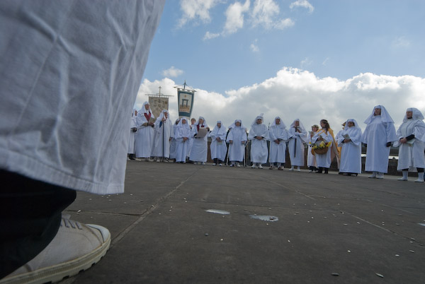
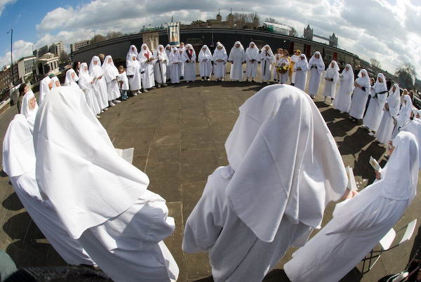
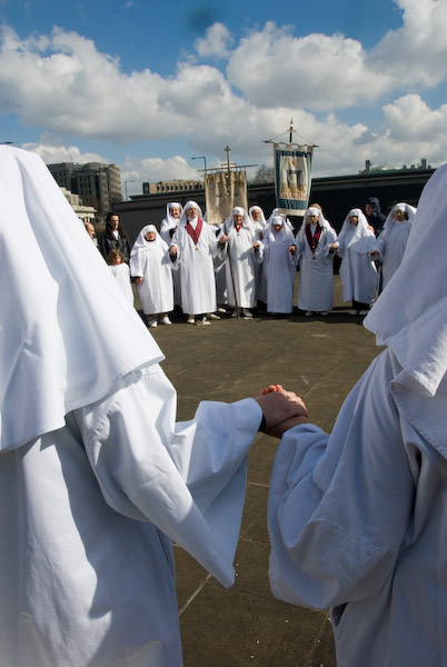
Spring Time for Druids: in 2007 the Spring Equinox was on 21 March, though I think in most years it is a few hours earlier on the 20th. Yesterday, in 2025 it apparently came at 9.01am, though for me it had come around ten days earlier when a patch of my garden was deep in flowering crocuses (or crocus or croci.) And for weather forecasters Spring starts on March 1st.
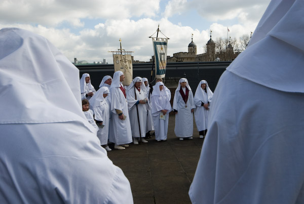
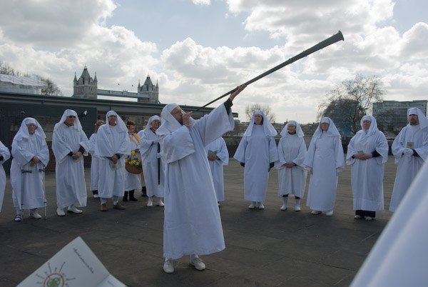
Later in the day The Druid Order will have come out at 12 noon yesterday at Tower Hill Terrace, but I didn’t feel moved to go to join them. I photographed their ceremonies on several years, both there and at the Autumn Equinox on Primrose Hill, and also published some more detailed reports (having done some research in the Mount Haemus lectures and other sources) with some of my pictures of later events.
The pictures here are from March 21st 2007, the first time I had attended a Druid ceremony and I then knew very little about them, and my comments on My London Diary perhaps reflect this. But the pictures I made were rather similar to those I made in later years and as with some other events I no longer feel I have anything new to say and no longer go.
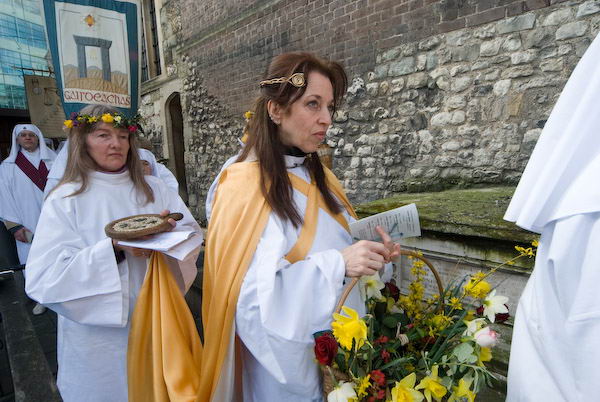
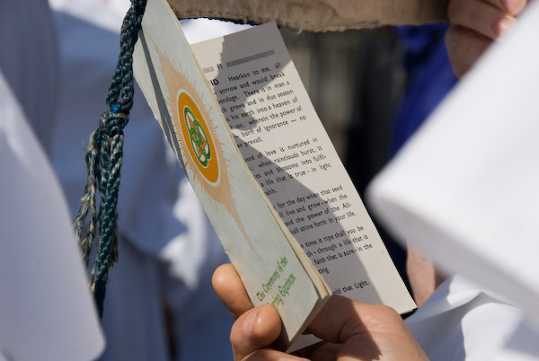
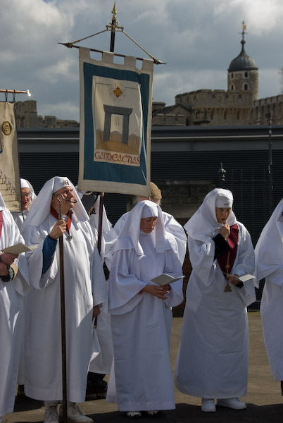
I think druids might say their ceremonies were timeless, and certainly The Druid Order still use the order of service which they invented and printed aproaching a hundred years ago and I think the banners they carry and the other items used have a similar inter-war history. But I understand they only began this anunual event at Tower Hill in 1956.
We have very little real evidence of the druids of the distant past in our country, though I think their ceremonies may well have involved rather more bloodthirsty sacrifices than the current rather anodyne public festivities.
But here are some of my thoughts from this first encounter back in 2007:
It was in some ways impressive, with their white robes, but rather to staid and measured for my taste. Celebrations need to be done with much more joy. This had more the feeling of a funeral – despite the white dress.
There was an air of dusty scholarship, of dull Victorian scribes trying to major on gravitas in the Order of Service, and a sermon of mumbled though possibly worthy boredom. Hard to imagine William Blake as chief druid of this tribe, I’m sure they must have done things differently in his days.
I’m not sure how far back these celebrations go at Tower Hill. Modern Druidry revived in the eighteenth century, partly as archaeologists re-discovered sites such as Stonehenge and Avebury and asked themselves what went on there. What relationship the rites they came up with bear to those of pre-Christian times is impossible to know (though one suspects rather little.)
My pictures on My London Diary (link at bottom of this post) are in the order they were taken and together with the captions give a fairly detailed account of the event, although I think I did it a little better in some later years.
William Blake was among a long list named in the ceremony as a former druid. According to the article A Note on William Blake and the Druids of Primrose Hill there is no evidence for the claims that William Blake was a druid or chief druid, although he may have known some who did take part the annual rituals on the hill which were begun by some Welsh Bards in 1792 claiming that their Bardic traditions “had preserved the true esoteric lore of the Druids.”
Back inside the church hall, where I left them and went in search of a cup of tea.
In fact Blake commented negatively on Druids in his writing and images, particularly objecting “to reported Druid practices of ritual human sacrifice, and forced submission to priestly rites and rituals.“
More pictures and captions from the 2007 The Druid Order: Spring Equinox on My London Diary
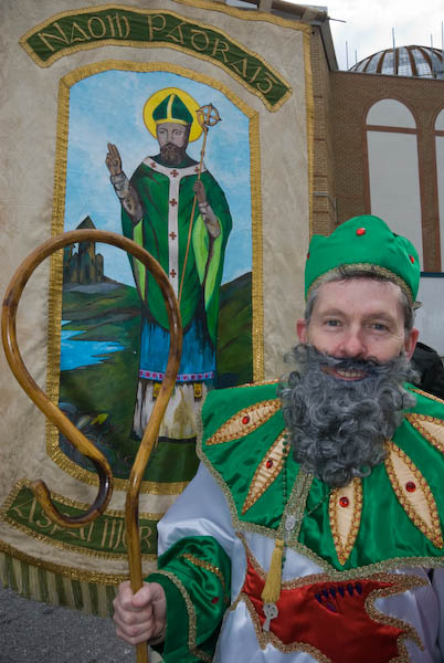
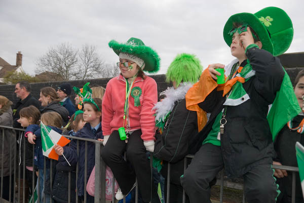
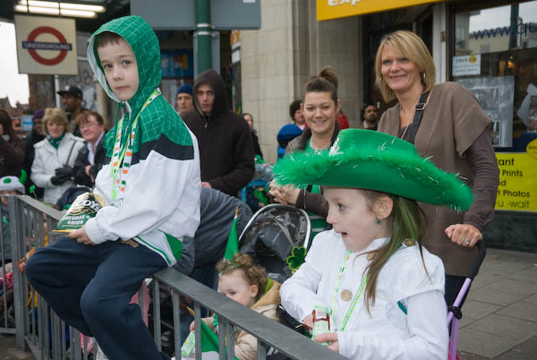
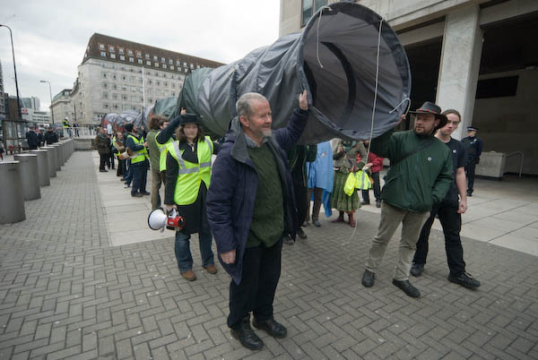
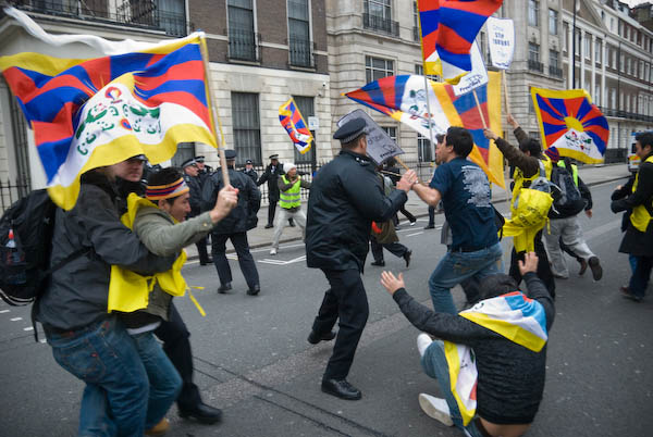
St Patrick’s Day – 2008: A parade in Willesden on Monday March 17th 2008 celebrated St Patrick’s Day. I came to it from a protest by the all-Irish environmental and social justice movement Gluaiseacht against the Corrib Gas Project in Mayo outside the Shell Centre, and had to rush away for a protest by Tibetans at the Chinese Embassy.
Brent St Patrick’s Day Parade – Willesden Green
Brent is one of London’s more diverse boroughs and has a large population of Irish and Anglo-Irish residents, particularly in what was sometimes called “County Kilburn“. As a borough it promoted various events to celebrate and unite its different communities, and among them I think was the only London borough to have its own St Patrick’s Day Parade.
Or it did until government cuts in funding to local authorities which hit particularly hard on boroughs like Brent meant it could no longer afford to support these community events.
London does now celebrate St Patrick’s Day with a march and event in Trafalgar Square on the nearest Sunday to the day itself, and I photographed the first of these, promoted by then London Mayor Ken Livingstone in 2002, though I only put a few black and white images on to My London Diary.
But the parade in Brent, though often involving some of the same people and floats was always a more interesting and intimate event, with the large local element giving it greater authenticity and I was sorry to see it go.
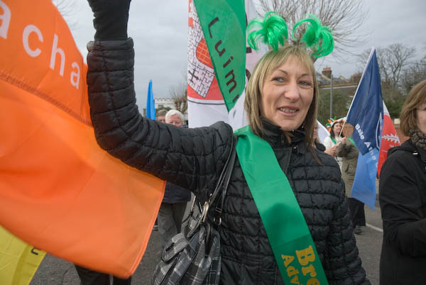
Local people came to view the parade, some waiting patiently on the pavement, others spilling out of packed bars drinks in hand as it arrived.
Local schools got involved, with children of all ethnicities becoming involved – and their families coming to watch.
I went to where the march was to start, at an Islamic Centre close to Willesden Green Underground Station, where the streets were most crowded and followed the procession as it made its way to the library in High Road Willesden where there were various musical performances and a bit of a funfair.
St Patrick was there of course, with the Mayor of Brent and others leading the parade. People walked with flags of the Irish counties (or at least the 26 of the 32 that are in the Republic of Ireland.)
I had to rush away shortly after the parade began to cover another protest.
All-Irish environmental and social justice movement Gluaiseacht were in London for the weekend, and on St Patrick’s Day itself gathered outside the Shell HQ at Waterloo, bringing with them a very large pipeline.
The protest was over the Corrib Gas Project in Mayo in the north-west of Ireland, which the Irish Government has given at a knock-down price to Shell, Statoil and Marathon. It’s a project estimated to be worth over 50 billion Euros, but the Irish people will hardly benefit from the profits – and Shell gets the largest share.
Even worse the people in Mayo will suffer from the pollution around an inland refinery and a high pressure pipeline that will endanger local communities. Protests in Ireland have led to innocent people being jailed.
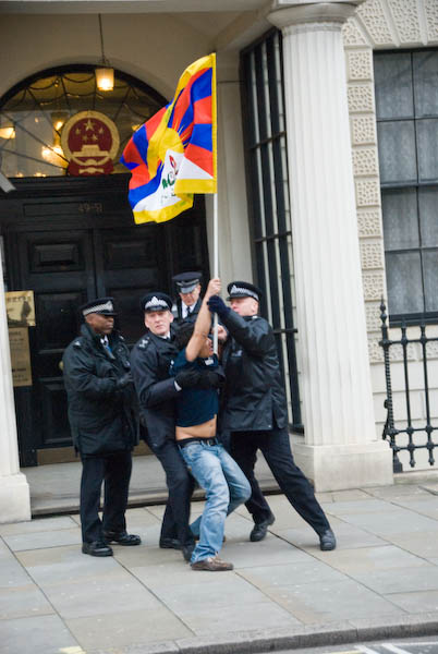
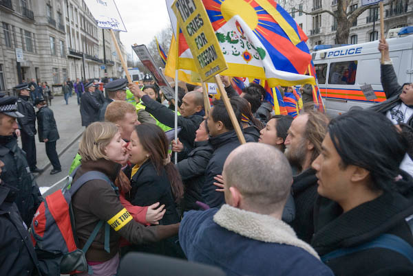
According to the Chinese Authorities, they “exercised restraint” in dealing with the Lhasa protests, using only non-lethal weapons and only killing 13 innocent civilians. Monday afternoon’s demonstration in Portland Place opposite the Chinese Embassy was timed to coincide with the midnight deadline in Lhasa for protesters to surrender.
After protesting for around an hour on the opposite side of the wide dual carriageway, one man jumped over the barriers and rushed across towards the embassy door waving a Tibetan flag. Others followed and police were unable to stop them.
The stewards from the protest tried to get them to make back and were eventually able to persuade them with some gentle pushing to make back to the central island in the road where the protest continued, with some of the protesters sitting down.
Eventually police reinforcements arrived and after failing to persuade them them to move an officer read out something over a loudspeaker. The protest was too noisy for me to hear it, but I think it was a warning that the protesters would be arrested if they didn’t go back to the pavement. The stewards then persuaded everyone to move back to the pavement to continue their vigil, and I went home.
Dartford 1995 Again – Panoramas: Part 9 of my occasional series on colour pictures I made in 1995.
Victoria Industrial Park, Victoria Rd, Dartford, 1995, 95p5-252
I enjoyed another walk in Dartford on Sunday May 7th 1995, beginning by taking black and white pictures of buildings around the centre before walking out to the northwest along Victoria Road.
Philips Norman, Cash & Carry, Victoria Rd, Dartford, 1995, 95p5-251
I went on to photographing in the industrial areas between Burnham Road and the Dartford Creek – the tidal River Darent.
Here I was able to make my way down to the west bank of the river and make more pictures.
River Darent, Riverside Wharf, Dartford, 1995, 95p5-121
At this wharf there had once been a fairly small dock which had been filled in but its gates were still there. I think it had perhaps been a dry dock used for ship repairs,
Dartford, 1995, 95p5-133
I think this is a site cleared for the development of a large housing estate, now on Lawson Road and Eleanor Close.
Dartford, 1995, 95p5-153
This long, empty road was University Way, a northern by-pass for Dartford, named in hope of a university that never arrived. Bob Dunn had been a Tory junior education minister who had campaigned for this development. MP for Dartford from 1979 to 1997 when he lost his seat to Labour, he died in 2003, only 56, and the road was renamed in his honour.
The bridge that takes Bob Dunn Way across the Darent was not built with navigation in mind, and makes it difficult for boats of any size to proceed up to Dartford. There has been for some years work being carried out to encourage navigation here, but boats have to look carefully at the tide tables to pass under the bridge. The Dartford and Crayford Creek Trust was founded in April 2016 to work to improve the navigation.
Roundabout, Hythe St, Victoria Rd, Dartford, 1995, 95p5-363
I walked back much the same way to this roundabout and went up Hythe Street in the centre of this picture.
River Darent, Nelsons Row, Dartford, 1995, 95p5-243
Hythe Street tok me to Nelson’s Row where I was able to cross the River Darent. There is also a public slipway here, cleared in recent years by volunteers.
Pipe Bridge, Riverside Path, River Darent, Dartford, 1995, 95p5-232
A few houses on the opposite bank are in Kenwyn Road. Past them you can see the derelict half lock which keeps some water in upstream when the tide flows out. Volunteer have put in considerable work to improve this lock in recent years and to revive navigation on Dartford Creek. In the distance is the Dartford Paper Mills site – closed in 2009 the site has been redeveloped.
Half Lock, Riverside Path, River Darent, Dartford, 1995, 95p5-223
Boats can navigate through the lock when the tide is high enough for them to get over the cill of the lock which holds back sufficient water for the river to be navigable upstream to the centre of Dartford.
Dartford Fresh Marshes, Dartford, 1995, 95p5-361
I turned around here and walked back to Dartford and the station. I’d made an early start to the day on the first train into London and there was still time to stop off on the way home and take a few pictures in Woolwich where I intended to return the following week.
I wrote this post some months ago but when I tried to publish it none of the pictures appeared. They seem to be working now, though I’m keeping my fingers crossed.
Poor Little Overlooked Images: I’m often asked “Is it worth putting images on Flickr?” My answer is it depends on why you take pictures, what you photograph and what you expect to get out of it.
Ionic Temple, lake and obelisk, Chiswick House Gardens, Chiswick, 1977 10c103
To state what I think is obvious, I don’t make a living out of Flickr, though I do get the occasional sale because people have found my pictures through it. It’s actually getting a little embarrassing now, as I shut down my business after Covid and I think I’m going to have to re-open it due to increasing sales.
Cheshire St, Tower Hamlets, 86-4r-23
But what I’ve always wanted to do is to share my images with other people, and Flickr is certainly doing that. When I was writing this some months ago there were over 45,000 views of my pictures on Flickr in a single day, and many days there are over 10,000 views. In total I’ve now had over 15 million views of my pictures there.
Brick Lane, Tower Hamlets 86-4r-11
Of course it isn’t the same as a gallery show, but most of those I’ve taken part in over the years have been lucky to get 100 visitors coming to view them in a day. So Flickr can get your work seen, and seen by a very much wider range of people than are interested enough to go into a gallery to see photographs.
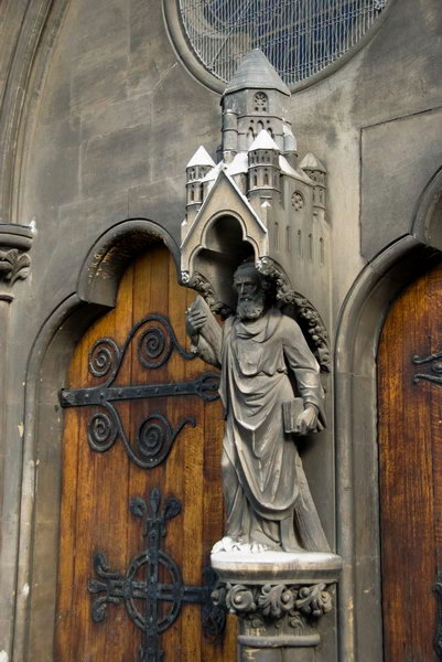
Collegiale Notre-Dame de la Crypte, Cassel, France
Though I have to say that some of those people see very different things in the pictures than what interested me and what I was trying to say when I made the picture.
D933, France
I don’t mind this. Sometimes they give me information about the scene which I was totally unaware of – and occasionally it adds something to my appreciation. Often I get comments which are very personal to the viewers who may have lived or worked in somewhere that I photographed and it perhaps adds another layer to my view of the image, as well as being pleasing that they found it of interest.
Notting Hill Carnival, 1999. Peter Marshall 99-823-11_2400
But there are some things I don’t like. People who share my images on social media without naming me as the photographer is perhaps the top of the list, and if anyone should dare to colorize one of my black and white images I might to moved to take out a contract on them. So far as I’m aware it hasn’t happened yet.
St Omer, France
But while my most viewed images have been seen over 20,000 times (one now 35,699 views) there are also a few which have apparently never been viewed at all.
St Omer, France
They aren’t any worse than most of my other pictures – and in any case how would anyone know without viewing them. I think it may actually reflect some small glitches in Flickr’s recording of views, as when I click on them in the Flickr report it actually states “No recent stats available for this photo” and I’m fairly sure some at least will have been seen by some people.
St Omer, France
But here, illustrating this post. are some of the fifteen images which had apparently never been seen when I wrote this post a few months ago. And after writing I discovered why – Flickr had changed their privacy settings to private. Not me – all of my images are uploaded as public. Somehow a stray bit or byte in their database had flipped. I’ve just checked again and found a different half-dozen images hidden in the same way.
Flickr has a reasonable search facility (though occasionally it goes haywire) and almost all of my images are keyworded. If you want to know if I have taken a picture of your street or town – or anything else – simply click this link to Flickr and type my name followed by what you want to find in the search box at the top of the page.
So to find if I have photographed Pegasus simply type:
Peter Marshall Pegasus
into the search box – and it should find all seven. Londoners in particular may find it useful to search on the names of London boroughs in this way.
1995 Colour – More from Dartford: The eighth part of my series showing colour images I made in 1995 continues with panoramic and normal images around Dartford. An earlier post 1995 Colour Part 4 – Around Dartford looked at some of the panoramas I made on a walk in March 1995 when I walked along the Darent and Thames Path to Littlebrook and Crossways. I returned to Dartford in April and May and made some more pictures.
Bow Arrow Lane Footbridge, Dartford Tunnel Approach, Dartford, 1995, 95p4-1072
Bow Arrow Lane Footbridge, Dartford Tunnel Approach, Dartford, 1995, 95p4-1073
Crossways, Dartford, 1995, 95p4-1062
I think this picture was taken on Cotton Lane. You can see the QEII bridge clearly and there are two lines of pylons. The storage tanks gleaming in the distance are on the north bank of the River Thames. There is no longer a rail siding here.
Philips Newman, Cash & Carry, Victoria Rd, Dartford, 1995, 95c5-764
1995 Colour – Kent Landscapes: Part 7 of my posts on my colour work in 1995. In the early months of 1995 I continued working in both Walthamstow, Chingford and other areas of North London but also made a number of visits south of the river to St Mary Cray, Belvedere and elsewhere. But most of my work was in black and white, though I’ve already posted a few colour images in this series.
River Darent, Dartford, 1995, 95p4-342
I took far fewer colour pictures and at the time kept few records of locations and dates of these, relying on the annotations I made on my black and white contact sheets.
Brooklands Lakes, River Darent, Dartford, 1995, 95p4-472
On April 1st 1995 I took the train to Dartford, a town I had previously photographed and visited occasionally to visit a friend. Dartford is just outside the east edge of London in Kent and at the west edge of an area beside the Thames which had for many years been the home of the cement industry with huge chalk quarries and riverside cement factories, the largest of which was still operation in the 1990s and which I’d photographed fairly extensively.
Farm, River Darent, Dartford, 1995, 95p4-473
I made a long walk around the area south of Dartford, beginning along the river that runs through the town, the Darent, but then through some of the countryside to the south.
As well as photographing traces of the cement industry – including a no longer working mineral conveyor which had carried chalk from a quarry to the factory I also photographed the two major roads which have impacted on the landscape south of Dartford, the A2 Dartford By-Pass and the M25 motorway.
Mineral Conveyor, M25, Hawley, Dartford, 1995, 95p4-433
You can see larger versions of the images by clicking on them which will take you to my Flickr album 1995 London Colour. More colour pictures from Dartford in a later post.
Bow Back Rivers, Plaistow & Upton Park: March 8th is of course International Women’s Day, and most years I’ve found events related to that to photograph, though often the main events take place not on the day itself but on the closest Saturday. In 2007 March 8th was a Thursday and I did something completely different, taking a stroll around the various rivers and channels to the south and west of the Olympic site.
Canning Rd from the Greenway
Many of the paths and roads I walked were soon to be closed for various works connected with the Olympics, including the building of a new lock. This was much heralded as being a part of making London 2012 green, with boasts that it would lead to a huge reduction in lorries taking spoil from the site out and bringing materials in to the area by barge. In fact I think it was only ever used for a few photo opportunities and the piece I wrote for My London Diary perhaps suggested the real driver behind its construction.
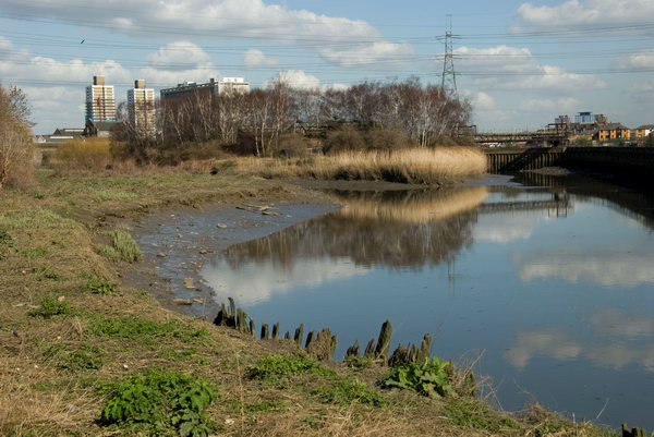
Channelsea River (now just a tidal creek)
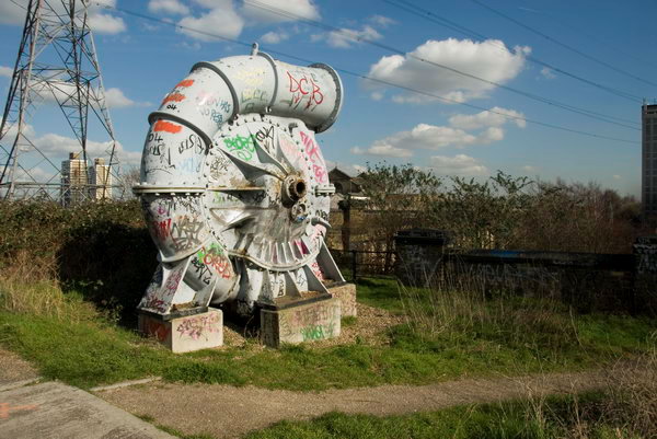
Another unnecessary aspect of the Olympic development was putting the power lines between Hackney and East Ham underground, perhaps also more driven by the desire by developers of the area, now with its many new tall blocks flats more attractive and profitable.
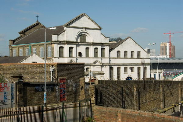
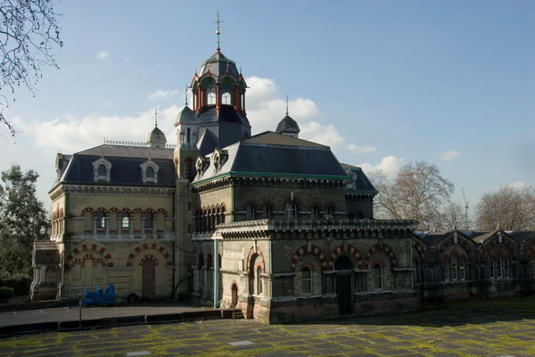
Abbey Mills pumping station (Charles Driver, 1865-8), the “cathedral of sewage”, viewed from the Greenway
There was also a very half-hearted attempt to use the rivers and navigation as a means of access to the games, with a river-boat service. It was said to be a part of opening up the area as a major leisure attraction, but didn’t ever work and was soon abandoned.
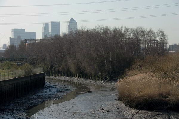
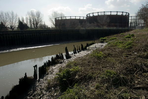
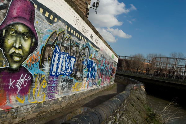
Longwall footpath, looking towards the gasholders over the Channelsea RIver.
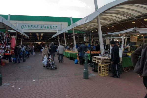
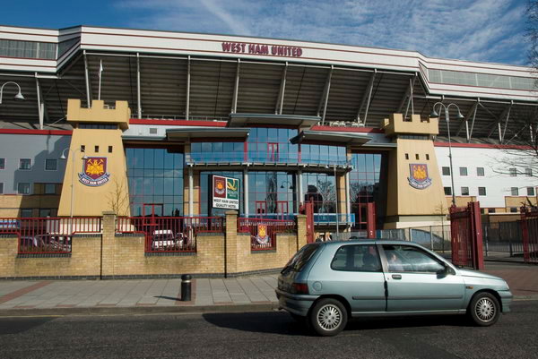
After walking around the area I walked east along the Greenway – the elevated walkway over the Northern Outfall Sewer – to Upton Park, also affected by the Olympics, with West Ham abandoning their Boleyn ground and moving to the Olympic Stadium after the games. Close to their ground is Queen’s Market, which Newham Council had being trying to demolish and redevelop since 2004. It is still currently under threat as it doesn’t fit with their dreams of gentrification but remains as an important community resource.
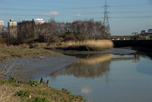
Channelsea Rvier and the island, with Abbey Creek to left
My post on My London Diary contains a lot of background but doesn’t really describe the walk I made – the pictures tell that story, along with their captions. It is rather more fanciful than most of my posts. As usual I’ve tidied it up slightly, changing to normal capitalisation and making a few minor amendments.
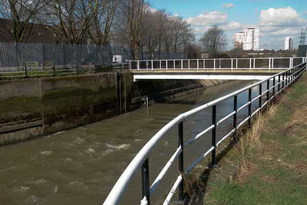
Bow Back Rivers – Prescott Lock Site
The tide flowing out fast from the Prescott Channel, officially opened in 1935
If you are a water molecule starting in the River Lea at Leagrave on the outskirts of Luton, your route to its mouth on the Thames can be rather convoluted – even assuming you don’t get diverted on the way for drinking by Londoners. Below Hertford the river runs in concert with the Lee Navigation, part river, part canal, and examining a map you would soon be confused.
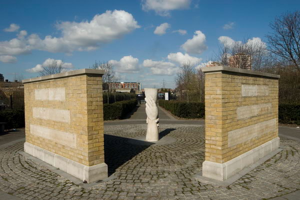
A memorial on Three Mills Green marked the heroism of distillery workers who died trying to rescue a workmate in 1901. The sculpture ‘Helping Hands’ by Alec Peevers replaced an earlier large cross
Since work by the Lee Conservancy Board and the West Ham Corporation started in 1931 and officially opened in 1935, the major flow of water in the southern area has been along the Flood Relief Channel (built in the 1970s following the 1947 floods) and the River Lea to Hackney Wick, and then along the Waterworks River, into the Three Mills Wall River and down the newly built Prescott Channel onward to Bow Creek and finally the Thames.
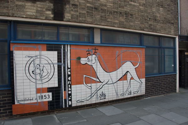
James Dane established Dane & Co. making news, letterpress and lithographic inks in Sugar House Lane in 1853. Recently much production had moved to Stalybridge.
All of these streams have been fully tidal since the Prescott Sluice was removed in the late 1950s (at the same time as most of the Channelsea River was culverted and filled in). Also tidal are the vestigial sections of the Channelsea River and Abbey Creek to the south of Stratford. So in your molecular progress, you might well spend some days being flushed north by tidal inflow from the Thames and then flowing south as the tide falls.
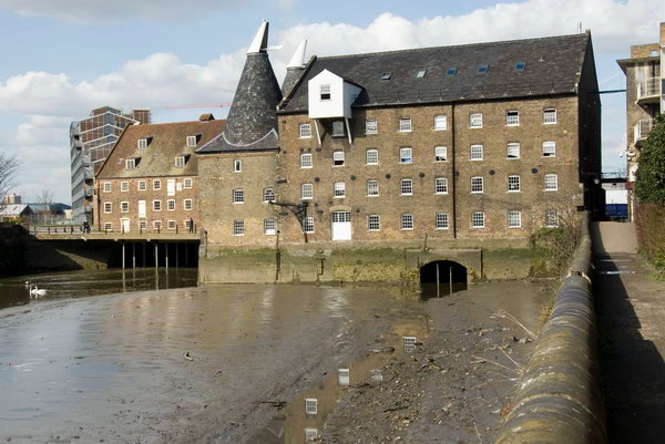
Three mills complex from the south
Flushed with you, at least on around 50 stormy days a year, might be some considerable sewage overflow from Abbey Mills sewage pumping station into Abbey Creek, lending its sweet smell to the banks of these streams in the Olympic area. Largely to avoid the delicate athletes (and spectators) being thus nasally assaulted a new lock and sluice is to be built on the Prescott Channel.
It remains to be seen whether the promises that the back rivers will actually carry the suggested 170,000 lorry loads in and out of the Olympic site will be met [of course it wasn’t], but it would certainly seem to be a useful development for the area longer term, opening up more of these waterways for leisure and possible commercial use. Currently there is a navigable loop on the Bow Back Rivers from the Lea Navigation, using St Thomas’s Creek, City Mill River and the Old River Lea, although this may well be restricted for the Olympics. [It was, for many years.]
The Long Wall path took me back to where I had begun taking pictures on the Greenway
The footpaths crossing the Prescott Channel bridge will be closed mid-March [2007] for around 18 months to allow the lock to be rebuilt, so I thought it a good time to take some pictures before the work begins.
Also in some of the pictures are a number of the sites which have been the subject of compulsory purchase to put the power lines between Hackney and East Ham underground for the Olympics. There are two lines, one going just north of the Greenway and curving down south through the Channelsea River.
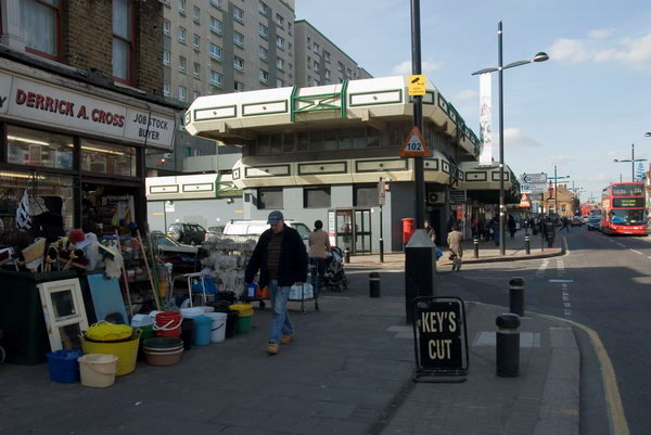
In October 2006 I photographed a march asking Newham Council to keep Queen’s Market in Upton Park. Although it is an exceedingly ugly ensemble, not helped by poor maintainence and an utterly depressing choice of colours, it is still a great local resource. The market is perhaps the most ethically diverse in London, and many rely on it as a great source of cheap fresh foods and other goods. As well as the market stalls there are many small shops around the side of the market.
[There was] then an online petition at the government web site urging the prime minister to “to ensure that strategic street markets such as queen’s market, upton park are given proper protection against the combined threat of negligent local authorities and predatory property developers. as part of this we seek an open and transparent consultation process.”
We go down to our local market a couple of times most weeks. The fruit and veg is much cheaper than in the supermarket, and it is fresh and not wrapped in 7 layers of plastic. We’d hate to see it go, and can see why the people who shop at don’t want their market replaced with yet another supermarket, and less small shops and stalls.
But Queen’s Market could do with doing up, perhaps replacing the roof, new stalls, a rethinking of some of the central space in the development which is a kind of wasteland where guys sit with cans to make it a more pleasant and family-friendly space. It could be a real centre for Upton Park, perhaps with more shops, cafés with outdoor seating and some kind of performance area and perhaps a playground. I’d get rid of the pub too, or at least give it a complete makeover.