Posts Tagged ‘bridge’

Thames Path – Pangbourne – Cholsey

Sunday, January 2nd, 2022

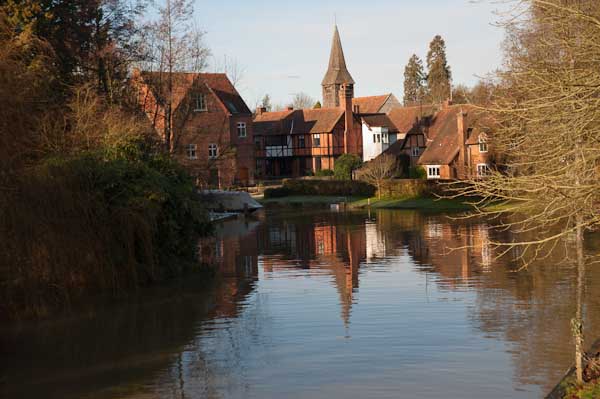
Whitchurch from the bridge from Pangbourne

Thames Path – Pangbourne – Cholsey: At the start of 2010 we were still walking sections of the Thames Path. On New Years Day we had walked from Reading to Pangbourne, and on the following day caught the train back to Pangbourne to begin our day’s journey there.
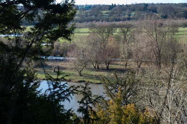
The Thames from the Thames Path along a hillside west of Whitchurch

We were heading to Cholsey, around 8 miles away, an easy distance suitable for a short day with over an hour’s rail travel at each end. Cholsey is a small village and has a railway station a little over a mile from the Thames Path with trains back to Reading from where trains run – if rather slowly – back to Staines.
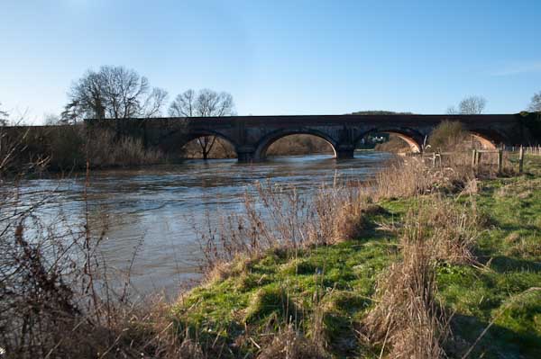
Gatehampton Bridge

Pangbourne is a much larger village, and its station is a short walk from where we joined the Thames Path, and there were a few shops where we could buy some crisps and sweets to supplement the sandwiches in our bags and even a public toilet, so a very useful place to start a walk.
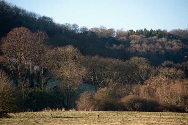
Before our walk really started we spent a little time in Pangbourne, visiting the parish church and photographing the Pang before rejoining the Thames Path at Whitchurch Bridge. Crossing the bridge takes you to Whitchurch, perhaps a prettier village than Pangbourne. Here the path takes quite a long detour away from the river bank and up on a hillside, with some extensive views through trees of the river and country to the south, before going back down to the riverside.
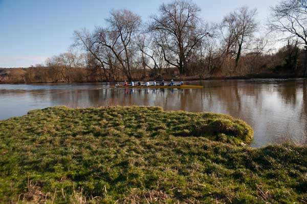
The railway line crosses the path and the river at Gatehampton Bridge, built by Brunel for the GWR main line in 1838 but the path stays on the north bank, passing between the tree-covered slopes of the Goring Gap, where the river cut through to seperate the Chilterns from the Berkshire Downs. Winter sun on the leafless bare branches was magical.
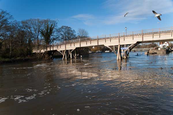
The bridge linking Goring on the north bank with Streatley on the south seems a rather primitive and temporary wooden structure, but has been here since 1923 when it replace the earlier bridge from 1837. Before then there had been both a ferry and a ford, though this was probably more often passable on horseback than on foot. It takes two bridges to reach Streatley from where the Thames Path proceeds westward on the south bank.
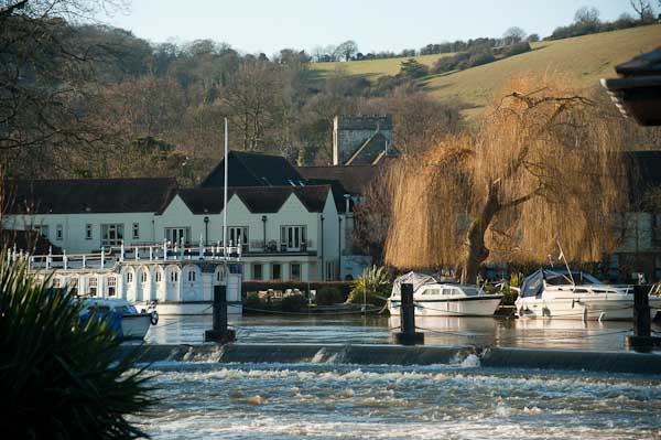
Streatley from Goring lock

At Streatley, a village until 1938 owned by the Oxfordshire brewers Morrell we visited the church and then set out on a partly underwater path by the river. December 2009 had been one of the wettest months on record and we began to doubt the wisdom of We thought about turning back and abandoning the walk, taking a train from Goring, but after seeing a walker paddle through towards us decided to continue.
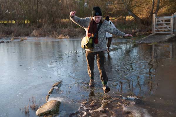
Fortunately it was only a few inches deep, but despite our boots I think we all got wet feet. The day was around freezing, but walking kept our feet warm, and many of the smaller puddles along the rest of our route were frozen over, as well as the mud, and it was much easier to walk than had it been warmer.
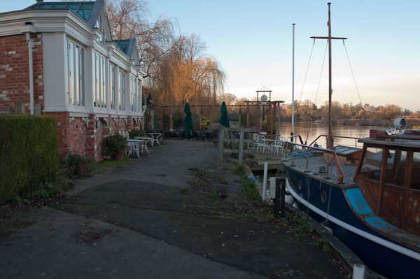
The Beetle and Wedge at Mouslford looked very closed

A little further on the tow path moves from the south to the north bank, not a great problem in the past for craft being towed who could pole over to the other side, but more so for walkers, who need to take a path away from the river and along a main road for a mile or so leaving the path were it went down towards the Moulsford railway bridge and continuing to a footpath beside the railway to Cholsey station.

More pictures from this walk at Pangbourne – Cholsey and more from the previous day’s walk at Reading – Pangbourne. You can read my original post at Thames Path.


West India – North Dock 1988

Sunday, November 21st, 2021

The Ledger Building,  Hertsmere Rd, West India Docks, Poplar, Tower Hamlets, 1988 88-6c-52-positive_2400
The Ledger Building, Hertsmere Rd, West India Docks, Poplar, Tower Hamlets, 1988 88-6c-52

The Offices of the West India Docks an Hertsmere Rd at the west corner of what was the Import Dock of the West India Docks and were Grade I listed in 1950 together with the adjoining warehouses. They were built in 1803 , architect George Gwilt and converted to hold the dock ledgers by John Rennie, who added the portico in 1827.

In 2000 it was converted into a Wetherspoon pub, the Ledger Office and can be visited during normal opening hours and displays some information about the history of the docks which can be read while drinking a cheap pint.

Warehouses, Hertsmere Rd, West India Docks, Poplar, Tower Hamlets, 1988 88-6c-53-positive_2400
Warehouses, Hertsmere Rd, West India Docks, Poplar, Tower Hamlets, 1988 88-6c-53

These listed warehouses are now converted for various uses including the Museum of London Docklands which has both permanent and temporary displays on the history of the River Thames, the growth of Port of London and the docks historical link to the Atlantic slave trade, in which this building, a sugar warehouse, played an important role. Temporary exhibitions there have included some of my pictures including in the show ‘Estuary‘ celebrating the museum’s 10th anniversary in 2013

Warehouses, Hertsmere Rd, West India Docks, Poplar, Tower Hamlets, 1988 88-6c-55-positive_2400
Warehouses, Hertsmere Rd, West India Docks, Poplar, Tower Hamlets, 1988 88-6c-55

The area has been opened up by the removal of the dockside sheds and is now a popular tourist venue, though it has lost most of its previous allure. But it’s still an interesting area, both for the old and the new buildings.

Crane, West India Quay, Poplar, Tower Hamlets, 1988 88-6c-44-positive_2400
Crane, West India Quay, Poplar, Tower Hamlets, 1988 88-6c-44

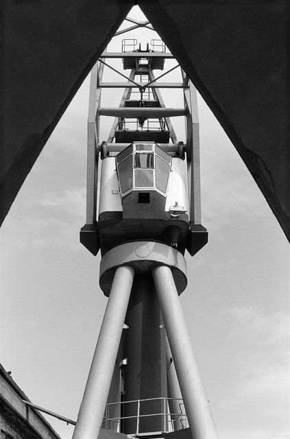
Two dockside cranes remain on the side of the dock, close to West India Quay DLR station, perhaps left there to divert attention from a rather hideous hotel building to their north.

Bridge, West India Quay, Poplar, Tower Hamlets, 1988 88-6c-45-positive_2400

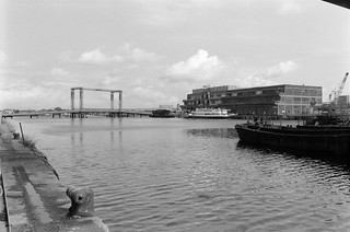
This picture taken I think from more or less underneath the DLR which goes across the North (Import) Dock gives some impression of the scale of the West India Docks , which I think when constructed in 1800-1806 were I think the largest enclosed high-security docks in the world – and a model for later docks elsewhere.

This dock now looks considerably smaller, with around half of its width taken up by a strange building on top of a new Crossrail station, looking to me rather like a woodlouse. Nothing in this picture remains except the listed dock wall at bottom left (and possibly the bollard on it.)

Bridge, West India Quay, Poplar, Tower Hamlets, 1988 88-6c-46-positive_2400

I think this bridge, built from what looks suspiciously like Meccano, was the Great Wharf Road Bridge, later replaced by what was intended as a more permanent structure as the Upper Bank Street Bridge. I can find no information about it on-line, but it appears to have a central lifting section with heavy counterweights in those four towers. That more permanent bridge was removed for the construction of the Crossrail station in 2012 and a new, much shorter bridge was built in five sections in Belgium by Hollandia and welded together in situ in, opening in 2020.

Docklands Light Railway, Poplar, Tower Hamlets, 1988 88-6c-32-positive_2400
Docklands Light Railway, Poplar, Tower Hamlets, 1988 88-6c-32

It was time to leave Docklands for home, and together with my two young assistants we got on the DLR, sitting right at the front of the train. This view from the front window as the train had just left Poplar Station and about to cross Aspen Way shows dockland cranes at left and St Anne’s Limehouse at right. Then DLR trains were single two-carriage units like the Stratford service in this picture.

This is the final part of posts here about my pictures from my walk around the docks on the Isle of Dogs in June 1988.

Click on any of the pictures to see a larger version in my album 1988 London Photos, from where you can browse the album. The pictures there are largely ordered by my negative reference numbers, which do not in detail reflect the order in which the pictures were taken used in the posts here.


Around Three Mills

Wednesday, January 27th, 2021

House Mill, Clock Mill, Three Mills Island, Bromley-by-Bow, Newham, 1981 29q-15_2400
Three Mills

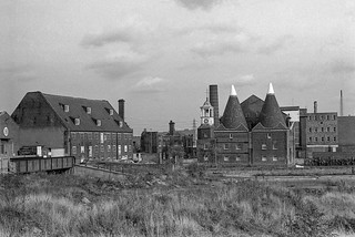
Three Mills Lane which runs from Hancock Road, a short walk from Bromley by Bow Underground station takes you across the Lea Navigation and Bow Creek to a remarkable ensemble of four of Newham’s listed buildings, including the Grade I listed House Mill from 1776, the early 19th century offices and the 1817 Clock Mill, with its 1753 Clock Tower. The fourth is easy to miss, as it is the stone setts and flagstones under your feet, dating back to the 19th century.

The Clock Mill, Three Mills Island, Bromley-by-Bow, Newham, 1981 29q-13_2400

Together they make a splendid early industrial landscape, though now a little hemmed in by rather more recent flats. When I photographed there in the 1980s and 1990s, the area around was full of largely 20th century industrial sites, mainly along the navigation, and a little still remains, particularly an impressive set of gas holders (seven Grade II listings) on the southern side of the Channelsea River at the former Bromley-by-Bow gas works (which also has listings for its bridge across the canal and Bow Creek as well as its war memorial and statue of Sir Corbet Woodhall.)

Three Mills Wall River, Stratford, Newham, 1981 29t-63p_2400
Three Mills Wall River

In more normal times the House Mill, which was saved from demolition in the 1970s and has been partially restored offers reasonably priced guided tours on Sundays from May to October and at some other times as well as hosting various events. The mill is a tide mill, and is on a site recorded in the Domesday Book, with foundations dating back to the end of the 14th century. It was able to generate power for 7-8 hours a day, though the output varied with the monthly changes in tides. Together with the Clock Mill it would grind an average of 125 tons of grain a week.

Works, Lea Navigation, Bromley-by-Bow, Tower Hamlets, 1981 29t-33_2400
Works, Lea Navigation, Bromley-by-Bow, Tower Hamlets, 1981

The towpath running south from Three Mills is on a narrow strip with the navigation on the west and Bow Creek to the west, and it leads down under railway bridges to Twelvetrees Crescent (where recent stairs now allow you to go on to the bridge and continue your walk beside Bow Creek) and under the bridge to Bow Locks where you can continue along the Limehouse Cut.

Railway bridge, Wharf, Lea Navigation, Bromley -by-Bow, Tower Hamlets, 1981 29t-61_2400
Railway bridge, Wharf, Lea Navigation, Bromley -by-Bow, Tower Hamlets, 1981
Bromley-By-Bow Gasworks, Imperial Gas Light and Coke Co, Bromley-By-Bow, Newham, 1981  29q-25-6_2400
Bromley-By-Bow Gasworks, Imperial Gas Light and Coke Co, Bromley-By-Bow, Newham, 1981
Lea Navigation, Twelvtrees Crescent, Bromley-by-Bow, Tower Hamlets, Newham, 1983 36v-02_2400 (2)
Lea Navigation, Twelvtrees Crescent, Bromley-by-Bow, Tower Hamlets, Newham, 1983

You won’t see the empty lighters on the navigation that were there when I walked along here in 1983, not long after commercial traffic ended. The large pipe across in front of the bridge would have carried gas from the Bromley gas works across to deliver gas to London west of the works. The listed bridge dates from 1872. Under it you can see the bridge which takes the path across Bow Locks and on to Gillender St or to the towpath beside the Limehouse Cut.

More on page 4 of River Lea – Lea Navigation. Click any of the images above to go to larger versions on my Flickr site.


All photographs on this and my other sites, unless otherwise stated, are taken by and copyright of Peter Marshall, and are available for reproduction or can be bought as prints.


Around Warton Road

Wednesday, January 13th, 2021

Robbialac, Warton Rd, Stratford, Newham, 1983 35p-15_2400
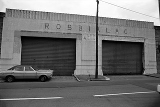
Jenson and Nicholson, Robbialac Works, Warton Road, Stratford, London E15.

Jensen and Nicholson were the makers of Robbialac paints and had premises here on Warton Road, offices on the Goswell Rd and a further works in Stratford on Carpenters Rd. The business was started in 1821 at the Barbican by William Kingham and John Jenson became a partner in 1840, taking over the business in 1848. He was joined in 1856 by Wilfred Nicholson.

Following a fire which destroyed the company’s factory, Nicholson decided to move to Stratford Marshes and a few years later Nicholson took over the company, which continued to trade under the name Jenson and Nicholson Ltd. As well as Robbialac enamel paints for cars and home decoration, the company also made Copal varnishes and distributed Cuprinol wood preservatives. In 1960 they merged with Berger Paints forming Berger, Jenson and Nicholson who after various takeovers became a part of Crown Paints and were then acquired by the Dutch company Akzo Nobel. (Information from Grace’s Guide https://www.gracesguide.co.uk/Jenson_and_Nicholson.)

The name Robbialac came from the 15th century Italian ceramicist Luca Della Robbia, famed for his brightly coloured enamels and the word lacquer. The major Portuguese paint manufacturer Tinta Robbialac, founded in 1928, also uses it as a brand name.

Bridgewater Rd, Stratford, Newham, 1983 35q-12_2400
Bridgewater Rd, Stratford, Newham, 1983

The concrete bridge here is an early use of ferro-concrete I think had a plaque on it stating it had been built using the Hennebique system and certainly deserves preservation. I photographed it on various occasions and it survived the Olympics and was still present when I last visited the area, but I’m unsure if it will be retained in the future.

Waterworks River, Bridgewater Rd, Stratford, 1983 36m-62-positive_2400
Waterworks River, Bridgewater Rd, Stratford, 1983

The view looking south from the Bridgewater Road bridge along the Waterworks River to the Warton House on Stratford High St, and blocks of flats on the opposite side of the street off Abbey Lane, Albert Bigg Point and Aubrey Moore Point. The footpath on the bank at right was extremely overgrown and the gates to it were locked. At right is one of the many pylons that were taken down for the Olympics.

Carpenters Rd, Stratford, Newham, 1983 35p-51_2400
Carpenters Estate, Stratford, Newham, 1983

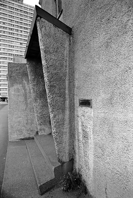
I am not sure of the exact location of this doorway with its interesting use of concrete. There were (and are) 3 point blocks on the Carpenters Estate and I think the one in the background here may be Dennison Point and this building may have been on the site now occupied by the Building Crafts College in Kennard Road which moved to a new building here in 2001.

Waterworks River, Railway Bridge, Stratford, Newham, 1983 35q-32_2400
Waterworks River, Railway Bridge, Stratford, Newham, 1983

I think this is from the footpath beside the Waterworks River looking north towards the bridge carrying the Eastern Region main line from Liverpool St across to Stratford. Possibly I had climbed down from Bridgewater Road as I think this path was closed at the time. The factory at right was on Warton Rd.

Waterworks River, Blaker Rd, Stratford, 1983 36m-52_2400
Waterworks River, view towards Blaker Rd from the Greenway, Stratford, 1983

The Waterworks River turns to the left in the distance to go under Stratford High St, with a channel going on under Blaker Rd to City Mill lock. The concrete pillar is part of the bridge carrying the Northern Outfall Sewer across the river and I wondered if the profuse fig tree growing here might be benefiting from some warmth from the sewage or possibly even be nourished by some leakage.

Kerry's, Greenway, Northern Outfall Sewer, Stratford, Newham, 1983 35v-23_2400
Kerry’s, Stratford 1983.

Kerry’s were a company that made and distributed a wide range of products, both those they made themselves and others branded with their name. In 1961 according to Grace’s Guide they were “Wholesale distributors to the motor, radio, electrical and cycle trades, also machine tool makers, specialising in centre lathes, boring mills, power saws, drills and special purpose machines” and even produced a light weight moped, the Capitano. Manufacturing moved to Basildon in the 1960s and the business was bought up and sold at the end of the decade.

Although Kerry’s address was Warton Road, I think the factory was actually rather closer to the Northern Outfall Sewer and reached over the bridge on Bridgewater Road.

More pictures on Flickr.


All photographs on this and my other sites, unless otherwise stated, are taken by and copyright of Peter Marshall, and are available for reproduction or can be bought as prints.


Regents Canal – Bethnal Green

Monday, July 22nd, 2019

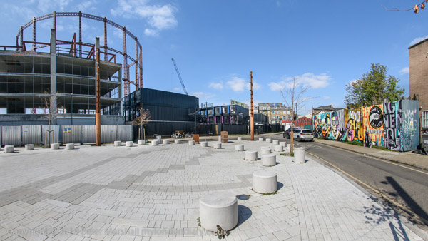
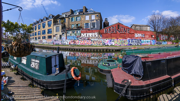
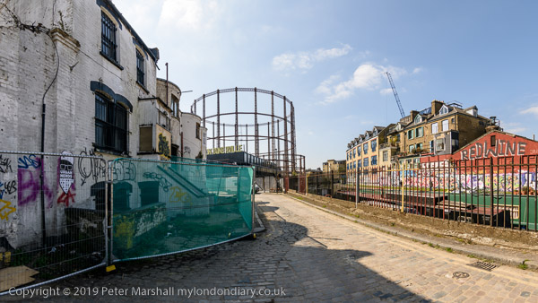
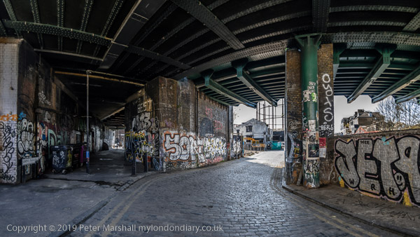
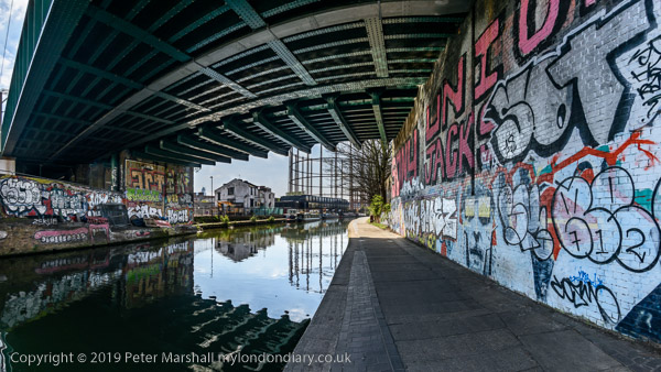
More panoramic images from the Regents Canal and nearby areas in Bethnal Green.

The Oval
From Corbridge Crescent
Corbridge Cresecent
Corbdige Crescent and Grove Passage

This is an area I photographed for the first time around 1980 and that I’ve returned to occasionally over the years. On My London Diary you can see more of these cylindrical perspective panoramic views – each around 147 degrees horizontal field of view, as well as some more normal rectilinear lens views at Regent’s Canal.

I’m hoping to use some pictures from the canal in a small show next year – more later.


There are no adverts on this site and it receives no sponsorship, and I like to keep it that way. But it does take a considerable amount of my time and thought, and if you enjoy reading it, please share on social media.
And small donations via Paypal – perhaps the cost of a beer – would be appreciated.

All photographs on this and my other sites, unless otherwise stated, are taken by and copyright of Peter Marshall, and are available for reproduction or can be bought as prints.

To order prints or reproduce images


Secret Rivers

Tuesday, May 28th, 2019

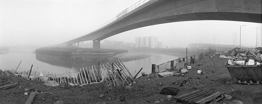
Just opened at the Museum of London Docklands is the exhibition Secret Rivers, which is worth going to see if you are around – and is free. Not all of the rivers featured are secret – they include the Thames and the Lea – but they are all of interest. As well as videos and maps and pictures including a few photographs there are also objects found in the rivers on display.

I’ll leave more general comments about the show to the reviews listed at the bottom of this post, but say a little more about my own minor contribution, the picture above of the DLR being built across the not very secret Bow Creek which I made in morning fog back in 1992. It was one of around a dozen images of the DLR extension shown as part of a group show on Transport at the Museum of London later that year.

I’d left home early on a Sunday morning in mid-January as a fine morning with clear sky was dawning, catching the first early morning train to Richmond then the North London Link to Canning Town. As we approached the destination I was disappointed to find everywhere was shrouded in mist; had I known I would have stayed in bed at home!

I’d recently bought what was then the most expensive camera I’d ever owned, a new Japanese Widelux 35mm model, a rotating swing lens camera, which had cost me around £2000 (equivalent to around £7000 today allowing for inflation) and had decided this was an ideal project to make use of its unique characteristics.

I was pretty fed up with the mist, as I wanted nice clear pictures, and it was also much colder than I’d anticipated in the mist, but as I’d spent a couple of hours travelling to the location I decided to take some pictures, and stuck at it for an hour or two, making around 40 exposures – roughly two films. The camera gave around 21 exposures on a normal 36x 35mm casette with negatives the same width as those made with a 6×6 camera but only 24mm tall.

It was a slow job, as the camera had to be carefully levelled on a tripod for each picture, otherwise the horizon would appear curved. The viewfinder was imprecise, and I soon learnt it was better to rely on the two arrows on the top plate which indicated the field of view to visualise the result.

The camera used no batteries, but was clockwork and entirely manual. Winding on the film also wound the shutter and rotated the lens, held in a vertical cylinder in front of the curved film behind, to its starting point. On pressing the shutter release, a slit behind the lens opened to epose the film as the lens rotated around a roughly 130 degree arc. I think the shutter speed was probably 1/125 s, based on the exposure of any point on the film, but it took perhaps 1/30th for the slit to travel across the film as the lens rotated.

I calculated the exposure using a separate hand-held meter, a Weston Master V, which could make relected light readings as in-camera meters do or, with the aid of a curiously shaped lump of translucent plastic, it could measure the light falling on your subject, almost certainly what I used for these pictures in the fog. The Weston meters used a selenium photo cell around two inches in diameter, which generated enough electricity to power the meter, and again needed no battery.

I’d walked from Canning Town down the Silvertown Way and over the Lower Lea Crossing to where the DLR crossed the creek. The mist I think was rather thicker than it looks in the picture, and I could hardly see Pura Foods. I took a few more pictures then my way back via the East India Dock Road to Canning Town cold and disappointed. It seemed to me to have been a wasted day – and I came back a week later to retake the images in clear daylight.

Once I’d developed and printed the films a couple of weeks later, I realised that although for most of what I’d taken the mist really spoiled the pictures, this image, with the viaduct disappearing into the distance was rather special. It remains one of my most widely published and exhibited works, but is the only one from that foggy day day that appears on my River Lea website.

More about the Secret Rivers show at:
Londonist
London Live (video)
The Guardian
Evening Standard
MuseumCrush

There are no adverts on this site and it receives no sponsorship, and I like to keep it that way. But it does take a considerable amount of my time and thought, and if you enjoy reading it, please share on social media.
And small donations via Paypal – perhaps the cost of a beer – would be appreciated.

All photographs on this and my other sites, unless otherwise stated, are taken by and copyright of Peter Marshall, and are available for reproduction or can be bought as prints.

To order prints or reproduce images