Brompton around Swanscombe 2015 – Late in 2002 I bought a Brompton folding bicycle, something I’d been considering for years, but the cost had put me off. I can’t remember exactly what it cost me then, but with a few essential bits and pieces it was around £700 – allowing for inflation now equivalent to around £1200. Bromptons (hereafter just B’s) now start at £850, even better value. In an interview a year or two later with a photographic magazine I was asked “What is your favourite photographic accessory?” and my answer, “My B” wasn’t what was expected.
I wasn’t new to cycling – I’d got my first two-wheeler back in 1951 and had owned and used bikes since then, but this was my first folding bike and was bought as a photographic accessory to enable me to explore areas in outer London and the outskirts where public transport was often in scarce supply.
I’d hoped also it would be a convenient way to get around when photographing various events in the centre of London, but soon gave up on that idea as finding safe places to leave it appeared impossible. Bs are idea for bike thieves. Relatively high value and much in demand, they can be stowed away in a car boot in seconds. And even the sturdiest bike lock can only hold up the well-equipped criminal for less than a minute.
Locking and leaving isn’t really an option unless you can keep it in sight or in a secure place. Office workers can keep them in cloakrooms or under their desks, but when your place of work is the street you have a problem.
For cycling close to home I still had the full-size Cinelli that my eldest brother had given me as a birthday present back in 1958, and despite being dirty, dilapidated and having suffered much downgraded with more robust and heavier wheels and tyres still rolling well. But the huge advantage of the B was that it could be folded and taken on trains, underground and even buses at any time, enabling me to make rides from places which were too far away for me to cycle to.
I made my first such journey back in January 2003, taking the train to Erith, a little over 30 miles away, and then spent a few hours cycling “around the town and along the Thames, Darent and Cray before braving the Dartford bypass and striking off along Joyce Green Lane before returning to catch the train home from Slade Green.” Much of that cycling was along footpaths and other poor surfaces and tiring enough – and at one point I almost collapsed trying to lift the B over a stile. I couldn’t understand why, as even with my photographic gear in the front bag it was probably less than 15kg. A week or two later I found out the reason, having a relatively mild heart attack at home which required some minor surgery to put a stent into a blocked artery.
As soon as I could walk, my doctor told me I had to exercise, and soon I was taking a series of rides from home on the B over much of the nearby country. It was much easier to mount and dismount than a normal men’s bike, having no crossbar. Scattered through My London Diary are pictures from a number of bike rides, mainly made on the B. On a bike you can stop almost anywhere and don’t need a place to park, and the ease of getting on and off makes a B ideal. At times I’ve also used it, parked against a wall to stand on, one foot on the saddle and the other on the handlebars, but it can roll away and leave you unsupported.
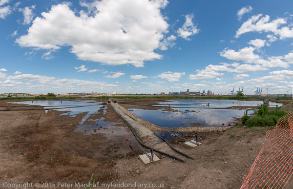
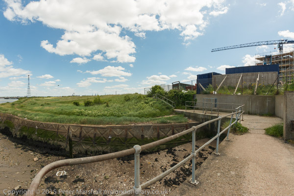
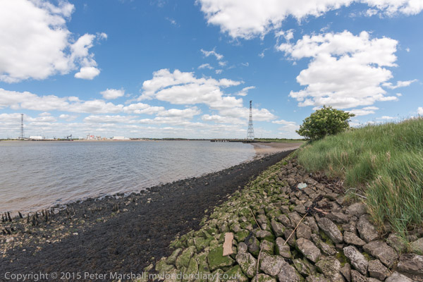
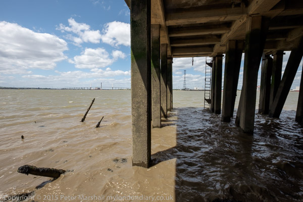
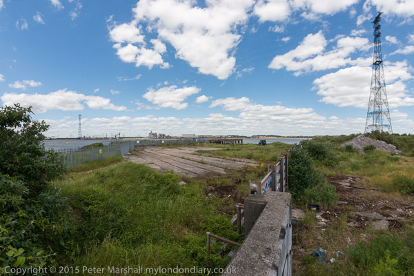
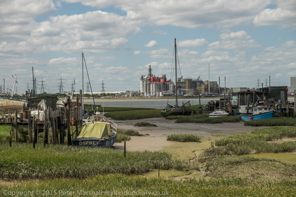
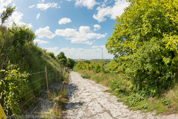
My trip around Swanscombe on Saturday 6th June was one such ride, taken while the area was under threat from development as the Paramount London theme park (and it still is though this now seems less likely.) It was an area I’d photographed on a number of occasions since the 1980s and knew reasonably well. In the 1970s, together with neighbouring Stone, Greenhithe, Swanscombe and Northfleet was the largest cement producing area in Europe, mainly run by Blue Circle. But by the time I first visited that production was centred at Northfleet, and the works at the other sites had largely disappeared or were very run down, and the Swanscombe works had ceased production although the site only finally closed in 1990. Northfleet continued for some years into this century, but nothing now remains – except of course the huge quarry areas with their chalk cliffs.
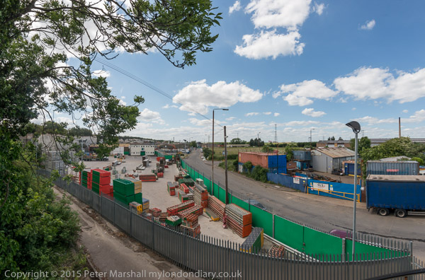
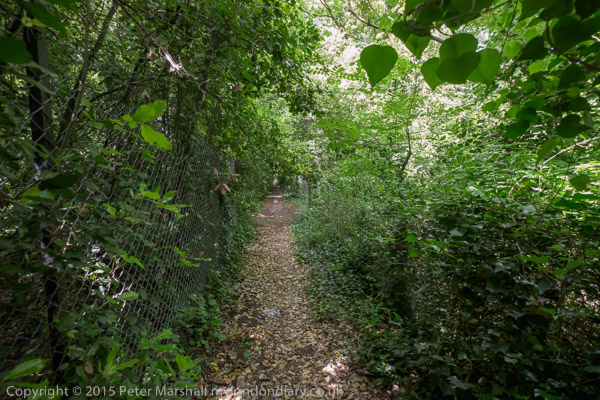
The post Swanscombe on My London Diary gives more of the history of the area, and also includes a fairly complete description of the route I took on Saturday 6th June 2015, so I won’t repeat that information here. The B isn’t a great off-road bike – and impossible in muddy conditions – but is fine on reasonable footpaths but I might had had to get off an push in some places. One of the paths I mention, Lovers Lane, is now a wide road beside a new housing estate but otherwise the area is much the same as it was in 2015 except there are now notices that some of the areas are private property.
The area is also well described in the many pictures, many of which were made with a very wide horizontal and vertical angle of view. Although not panoramic in format they are panoramic in their scope.


