Carnaval, Right To Protest & Tobin: On Sunday 7th August 2005 I began by photographing London’s Latin Americans getting ready for the Carnaval Del Pueblo procession, then went to Parliament Square for an illegal protest against the Serious Organised Crime and Police Act 2005 which had come into force on August 1st and among other things restricted the right to demonstrate within a large area around parliament without prior written notice to the police. Finally another illegal protest on Westminster Bridge expressed support for the Tobin Tax, a low rate of tax on currency conversions with the aim of discouraging short-term currency speculation and so stabilising currency markets. Here is what I wrote about the day in 2005 with some pictures and links to more on My London Diary
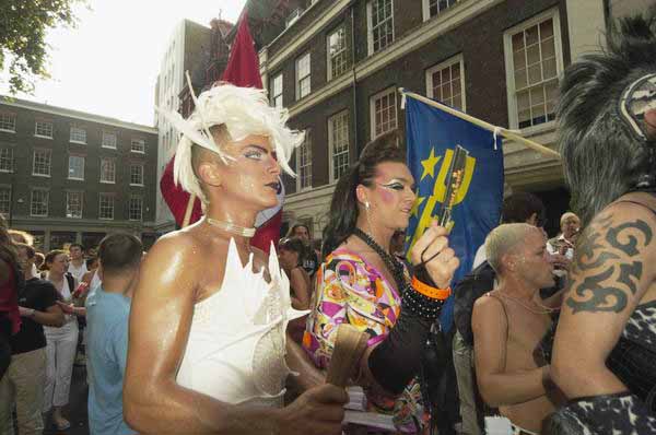
Carnaval del Pueblo – Southwark
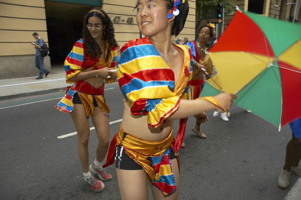
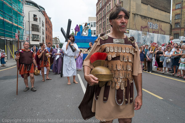
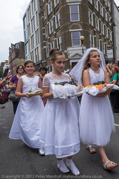
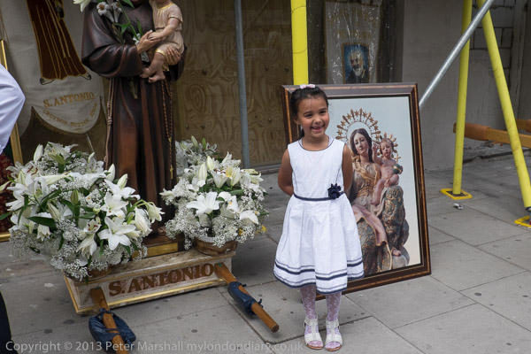
Sunday I started off photographing London’s Latin American communities getting ready for the start of their annual Carnaval Del Pueblo procession. This year it was starting from Potters Fields near the GLA headquarters, on an empty site awaiting development, rather than from a street, and this made photography a little more difficult.
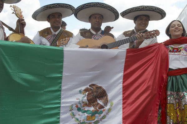
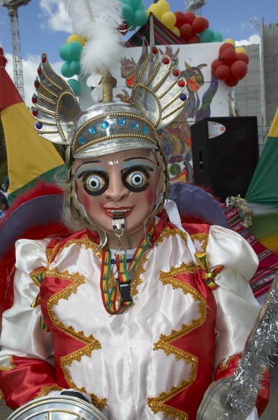
It was good to see so many groups taking part, although I found it very difficult to sort out the different nations, and found myself unable to recognise most of their national flags.
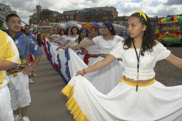
This procession, making it’s way to Burgess Park where there is a Latin-American Festival, is one of London’s most colourful events, with some costumes to rival those seen at the much larger annual Notting Hill event at the end of the month.
I was sorry not to be anle to go on to the festival, especially since there was to be a short period of silence to mark the tragic shooting by police of the innocent Brazilian electrician, Jean Charles de Menezes, on a tube train at Stockwell Station the day following the second round of bombings in London.

I followed the procession up to London Bridge Station where I needed to get on a train to get to Westminster.
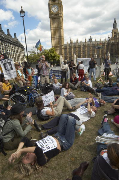
The Right to Protest – Parliament Square
Britain once had a deserved reputation as a haven for free speech and the rights of the citizen. A number of acts by our New Labour government have seriously curtailed these freedoms – including introducing a number of measures that they had opposed before they came to power.
Some of these measures have just been a part of the general trend to central control begun under Thatcher, but others have been brought on by the threat of terrorism and even more by the growth of opposition to government policies, and in particular to the war on Iran.
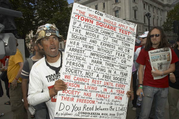
Formerly a life-long supporter of the party it saddens me, and angers me. One of the signs that Brian Haw holds in a picture is a quotation from a speech by Condoleeza Rice in January 2005, when she said “if a person cannot walk into the middle of the town square and express his or her views without fear of arrest, imprisonment, or physical harm, then that person is living in a fear society, not a free society. We cannot rest until every person living in a ”fear society” has finally won their freedom.”
New restrictions have been brought in that move Britain into that realm of a “fear society”.
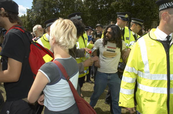
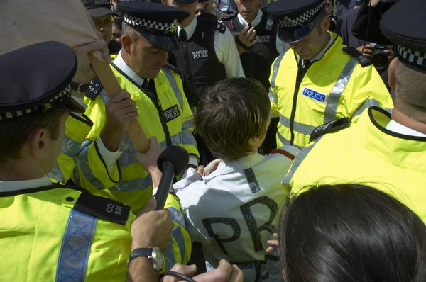
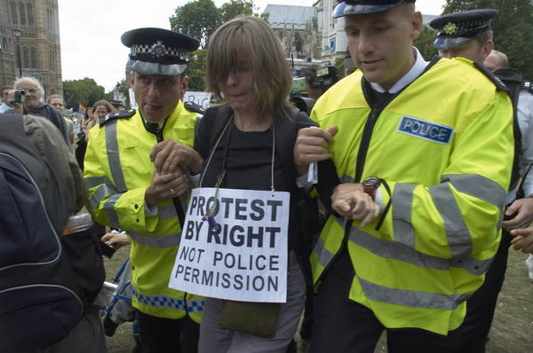
This afternoon I saw five people arrested for simply peacefully holding banners supporting the right to protest. It happened on the square opposite our Houses of Parliament, and it made me feel ashamed to be British.
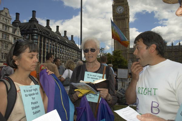
Although the law was passed largely to get rid of Brian Haw, it turns out not to alter his right to be there, as his protest started before the act became law and is thus not covered by it. Rather a lot of egg on government faces there.
[The High Court decision that agreed Haw was not covered by the Act was overturned by the Court of Appeal in an alarming decision in May 2006.]
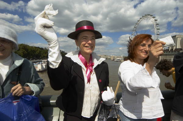
The Westminster Tea Party – Time for Tobin Tax
In 1978, Nobel Prize-winning economist James Tobin proposed a uniform world-wide tax at a very low level – perhaps only 0.2% – on all foreign currency exchange transactions. The aim was to deter speculation on currency movements, thus giving the elected governments greater control over their fiscal and monetary policies, and reducing the power of unelected speculators (who include some of the larger multinational companies) to affect the markets.
Exporters, importers and long-term investors would all benefit from less volatile exchange rates, and the revenue raised by the tax could make a significant contribution both to the revenue of national economies and also for international development projects.
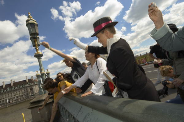
As a small gesture of support for the Tobin Tax, another illegal demonstration took place in Westminster this afternoon, unnoticed by police. A small group of demonstrators, again following an example from Boston – although this time from 1773 – chose tea as a way to symbolise their protest. Each threw a teabag, produced by one of the giant corporations, from the middle of Westminster Bridge into the River Thames below.
A couple more pictures at the bottom of this page on My London Diary.
Flickr – Facebook – My London Diary – Hull Photos – Lea Valley – Paris
London’s Industrial Heritage – London Photos
All photographs on this page are copyright © Peter Marshall.
Contact me to buy prints or licence to reproduce.