More Thamesmead Panoramas – 1994

More Thamesmead Panoramas: This final set of panoramic images came from my final visit to Thamesmead in November 1994.

Lesnes Abbey, Ruins, Abbey Wood, Bexley, 1994, 94-1104-42

I began and ended the day at Abbey Wood station and I no longer remember the route of the walk that I tookm but I think I began by going to the Lesnes Abbey Ruins. After the Norman conquest in 1066 land here was given to Bishop Odo, the half-brother of William the Conqueror and Bishop of Bayeux (and pictured on that tapestry he probably commissioned as a gift to his brother.)

Odo was the man who ran the country for his brother – until he was tried for fraud and disgraced. Odo was forgiven on William’s deathbed. But Lesnes Abbey was only founded in 1178 by the man then in charge of England for Henry II, Richard de Luci. He retired here then, possibly as a penance for his role earlier inspiring the 1170 murder of Thomas Beckett, and died three months after retiring.

The Abbey was always small and was closed by Cardinal Wolsey in 1525 as it had fewer than seven men living there. Much of the stones were taken away as building material with the abbot’s house becoming a part of a farmhouse. The London County Council bought the site and grounds in 1930 and opened it as a public park.

Abbey Way, Footpath, Footbridge, Abbey Rd, Thamesmead, Bexley, 1994, 94-1104-21

From the ruins I walked to the elevated footpath which leads into Thamesmead South.

Abbey Way, Footpath, Footbridge, Abbey Rd, Thamesmead, Bexley, 1994, 94-1104-12

The footbridge goes across Abbey Road and to the north gives a view of the tower blocks of Thamesmead across the horizon.

Clocktower, Deptford Dockyard, Joyce Dawson Way, Thamesmead, Greenwich, 1994, 94-1003-32

I don’t think I made many other panoramas as I walked towards the river, and this is one I made on an earlier visit. It isn’t a good picture of the clock tower as it doesn’t show the clock!

When Convoys took over the old Royal Naval Dockyard in 1960 to bring newsprint into London they had no interest in its history and despite many objections they demolished the large Great Storehouse and many other old buildings on the site. The clock tower which had been a later addition on the top of this ancient wooden building was saved by urgent pleas and left by the riverside at Convoys Wharf when the building was demolished in 1981.

But it was still just a nuisance to Convoys and they still were threatening to demolish it. The tower was saved by the GLC and taken by boat to Thamesmead and erected here in the middle of a commercial centre.

Tavy Bridge Centre, Thamesmead, Bexley, 1994, 94-1102-22

At some point in my visit I made another visit to the Tavy Btidge Centre and made a few more panoramas.

Tavy Bridge Centre, Thamesmead, Bexley, 1994, 94-1102-11
Tavy Bridge Centre, Thamesmead, Bexley, 1994, 94-1102-12
Riverside Path, River Thames, Thamesmead, Greenwich, 1994, 94-1103-22

The River Thames is around a mile and a half away. On a previous visit I had taken another panorama from an almost identical position, but I think this is a rather better composition with the rail lined up carefully with the opposite shore.

These two lines are in the vertical centre of the image and so remain straight. Standing up a little to the right of centre above them is the Barking Creek Barrier.

Goldfish Are Wankers, Graffiti, Riverside Path, River Thames, Thamesmead, Greenwich, 1994, 94-1103-23

I couldn’t decide which was the more interesting work of art, the strange yellow sculpture or the graffiti on the wall behind. The wall is the flood barrier to protect Thamesmead, much of which is low-lying.

Crossness Nature Reserve, Thamesmead East, Bexley, 1994, 94-1101-61

The Crossness Nature Reserve is to the east of Thamesmead, just past the large Crossness Sewage Treatment Works. When opened in 1865 the the sewage from London south of the Thames was simply pumped into the Thames when the tide was going out, but a large area of land was taken over to treat it before release around 1890.

Crossness Nature Reserve, Thamesmead East, Bexley, 1994, 94-1103-41

This is the end of my posts of colour pictures from around Thamesmead in 1994 though there are still a few more in my Flickr colour album for that year – as well as others in the 1994 black and white album.


Flickr – Facebook – My London Diary – Hull Photos – Lea Valley – Paris
London’s Industrial Heritage – London Photos

All photographs on this page are copyright © Peter Marshall.
Contact me to buy prints or licence to reproduce.

Thamesmead & The Thames – 1994

Thamesmead & The Thames: More pictures from my October and November 1994 visits to Thamesmead.

Tavy Bridge, Thamesmead, Bexley, 1994, 94-1003-61

I hope the captions which I wrote at the time are accurate, but I found parts of Thamesmead rather confusing to walk around. There are both streets and raised walkways and various footpaths, and I don’t think the map was always too helpful.

Tavy Bridge Centre, Thamesmead, Bexley, 1994, 94-1003-63

However these shops were certainly at the Tavy Bridge Centre. Thamesmead is built on the flood plain and the whole area had been badly flooded before the new estate was developed. The planners decided to build with garages at street level and the living areas of the housing at first floor and above so as not to be vulnerable to floods.

Tavy Bridge, Thamesmead, Bexley, 1994, 94-1003-52

Some of the areas liable to flooding have since been rebuilt with housing at ground level. I assume that the river walls are now thought to be an adequate defence, but would not myself buy a house there.

Footbridge, Yarnton Way, Thamesmead, Bexley, 1994, 94-116-41

Sea levels are slowly rising as the earth gets hotter because of increasing levels of greenhouse gases from burning fossil fuels means that ice melts. The Thames Barrier still protects most of London, but will need to be replaced. Thamesmead is downstream of the barrier and so will need its own extra protection. At some point with high spring tides and an easterly gale this will be overtopped.

River Thames, Beckton, Canary Wharf, Thamesmead, Bexley, Greenwich, 1994, 94-115-44

I walked on to the riverside promenade, Thameside Walk. Looking towards the west both the remains of the Beckton gas works and Canary Wharf were visible though there was considerable haze due to air pollution in London.

River Thames, Ford, Dagenham, Thamesmead, Bexley, Greenwich, 1994, 94-115-45

Across the Thames and a little to the east was the vast Ford complex at Dagenham, its logo visible on the water tower at left.

Promenade, River Thames, Thamesmead, Bexley, 1994, 94-115-35

The river is stretches away east towards the estuary, turning around towards the south in the distance. At the left of the picture is the Essex bank. The river is a little over 2000 feet wide here.

The panoramic images here were taken on a Russian Horizon swing-lens camera, its 28mm lens giving a horizontal angle of view of around 127 degrees (often stated as 120.) The negatives, on standard 35mm film are 58x24mm, a similar width as a ‘6×6’ medium format camera though only 2/5 the height. It was possible to use the camera handheld, but for these pictures I used a sturdy Manfrotto tripod, usually working from a normal eye height of a little over 5 foot.

More to come from Thamesmead.


Flickr – Facebook – My London Diary – Hull Photos – Lea Valley – Paris
London’s Industrial Heritage – London Photos

All photographs on this page are copyright © Peter Marshall.
Contact me to buy prints or licence to reproduce.


Tavy Bridge, Thamesmead 1994

Tavy Bridge, Thamesmead: In October and November 1994 I returned to Thamesmead, a New Town which I had first photographed nine years earlier and spent a few days wandering around the area, developed largely from the end of the 1960s by the GLC under architect Robert Rigg to house families from poor and overcrowded Victorian working-class terraces, particularly those in East London.

Pyramid Club, Tavy Bridge, Thamesmead, 1994, 94-101-26

The planners hoped to grow some of the community that had existed in those working class areas by giving the families of the initial residents priority for new housing, and had s strong belief that the water in lakes and canals as a calming influence of those who lived among them. Neither policies were as effective as had been hoped.

Tavy Bridge Centre, Thamesmead, Bexley, 1994, 94-115-52

Thamesmead is on low-lying land on the bank of the River Thames and had been flooded in 1953, so the living accommodation on much of the housing began at first floor level, with walkways there where people would meet and children play as they had done on the streets back in their old homes. The ground level was for cars, with roads and garages.

Pyramid Club, Tavy Bridge, Thamesmead, Bexley, 1994, 94-115-53

It didn’t work out too well in practice, partly because of a huge increase in car use, in part driven by the isolation of Thamesmead and poor public transport as well as increasing affluence. Shops, schools, pubs and more which might have been at the corner of the old streets were now much further away, and people increasingly got into cars, leaving the walkways deserted. And for those who did walk, there were almost always shorter routes at ground level across the streets and grassy areas than on the walkways.

Pyramid Club, Tavy Bridge, Thamesmead, Bexley, 1994, 94-115-31

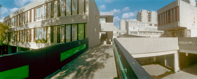
As I think my pictures show, at least in part the result was an empty and rather alienating landscape, much used in films, notably Stanley Kubrick’s dystopian 1973 ‘A Clockwork Orange’, based on Anthony Burgess’s 1962 novel. And in real life it seemed also to encourage high levels of drug-related crime and violence with often racist gangs.

Pyramid Club, Tavy Bridge, Thamesmead, Bexley, 1994, 94-115-32

Thamesmead lies across the boundary of two London boroughs, Greenwich and Bexley, and the abolition of the GLC in 1985-6 was also a disaster for the development of the town, with ownership first being transferred to a new body, Thamesmead Town Limited (TTL) and later in 2000 the housing to Gallions Housing Association with Tilfen Land taking over the undeveloped land.

Tavy Bridge, Thamesmead, Bexley, 1994, 94-115-33

The Tavy Bridge area where this first section of pictures was taken was redeveloped by Gallions together with Wates Group – and new homes were then built with living accommodation at ground level, so almost certain to flood.

Limestone Social Club, T.C.A., Limestone Walk, Thamesmead, Bexley, 1994, 94-116-56
Bus Stop, Tee Dee's, Hair & Beauty Salon, Thamesmead, Bexley, 1994, 94-116-55
Bus Stop, Tee Dee’s, Hair & Beauty Salon, Thamesmead, Bexley, 1994, 94-116-55

Along with these photographs (and more in black and white on Flickr) I also made a number of panoramic images around Tavy Bridge which will feature in a later post.


Flickr – Facebook – My London Diary – Hull Photos – Lea Valley – Paris
London’s Industrial Heritage – London Photos

All photographs on this page are copyright © Peter Marshall.
Contact me to buy prints or licence to reproduce.


Chariot Festival, Plumstead & Woolwich – 2009

Chariot Festival, Plumstead & Woolwich: Sunday 28th June 2009 I photographed the Hare Krishna Chariot Festival from Hyde Park to Trafalgar Square then travelled to Plumstead Common for short visit to the annual Mela there. But I didn’t find much to interest me and instead took a walk down to the Thames at Thamesmead West and then back alongside the river to Woolwich. On My London Diary I wrote at some length about the walk, which turned out to be surprisingly interesting and about how I thought the area could be improved.


Sri Jagannatha Rathayatra Festival – Hyde Park to Trafalgar Square

Chariot Festival, Plumstead & Woolwich - 2009
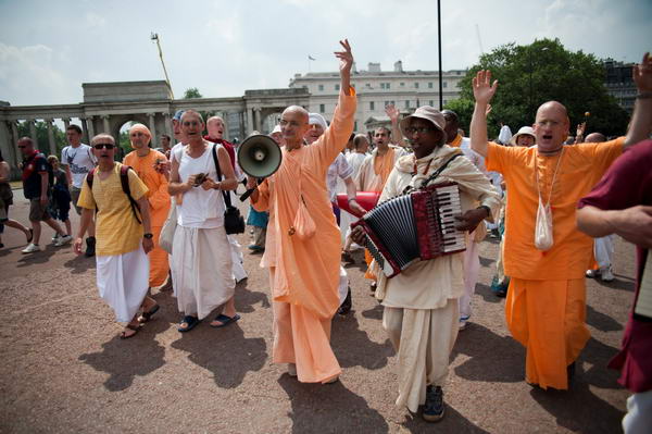
Musicians in the procession as it leaves Hyde Park

I didn’t write much about the chariot festival on My London Diary in 2009 as I had written at some length about it the previous year – and I won’t say much here either as I posted about the 2012 Rathayatra festival a few days ago.

Chariot Festival, Plumstead & Woolwich - 2009
The three giant chariots are pulled by people on large ropes

In 2009 I concentrated mainly on the people rather than the chariots.

More pictures at Sri Jagannatha Rathayatra.


Plumstead & Woolwich – Plumstead, Thamesmead West, River Thames

Chariot Festival, Plumstead & Woolwich - 2009

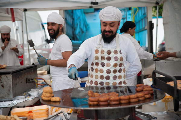
It was a long walk up the hill from Plumstead station to the common where the Mela is held and I arrived rather tired and was disappointed to find the the event seemed to be only just starting. But I’d stopped to take a few pictures on the way, and found several things of interest on the walk.

Chariot Festival, Plumstead & Woolwich - 2009

So after a short time at the Mela I decided it was too hot to wait around longer and to take a walk instead.

Chariot Festival, Plumstead & Woolwich - 2009

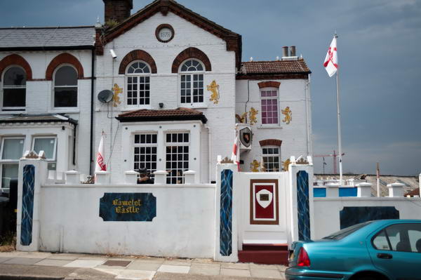
I walked down to Camelot Castle, home of self-proclaimed “celebrity gangster Dave Courtney“, who was made bankrupt in May 2009, owing £400,000 including an estimated £250,000 to HM Revenue & Customs.

Shouldn’t, I mused looking at the St Georges flags, patriots be pleased to pay taxes? I photographed the house and then onto the gates with a giant knuckleduster at their centre. Courtney also awarded himself a blue plaque with the text ‘Dave Courtney OBE lived here’ where the OBE stands for “One Big Ego”.

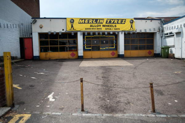
Soon after I came across Merlin Tyres. Is it coincidence that Merlin was one of the six main characters of Camelot?

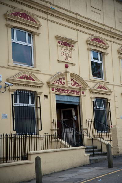
The Plumstead Radical Club is a working mens club formed by local Liberals who later became members of the Labour party, but most working mens clubs lost any real political connection, though they still sell cheap beer to members. From Plumstead I walked into Thamesmead.

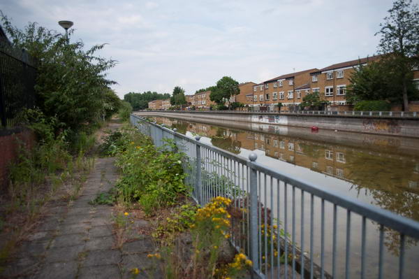
This part of Thamesmead West had failed to make good use of its location and what should have become a vibrant area at Broadwater was derelict and depressing.

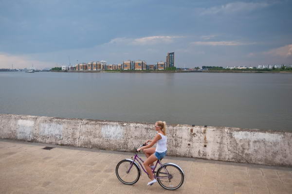
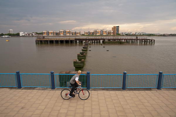
But soon I reached the Thames path and photographed this woman cycling along it with the recent flats of North Woolwich around a third of a mile away on the opposite bank of the wide river.

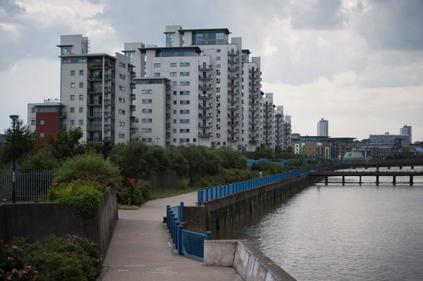
And there are plenty of new riverside flats on the south bank too, with residents enjoying riverside views. These flats are perhaps less of an eyesore than some.

Woolwich Arsenal had three piers – this was the one in the middle, known as the Iron Pier, and you can see why from my picture. To the east was the Coal Pier, the lower parts of which still remain – built in 1917-20 it was used to bring in around 1500 tons of coal a week and is fenced off as a dangerous structure, The largest of the three piers, the T Pier has I think gone completely though there is now a Uber Boat pier.

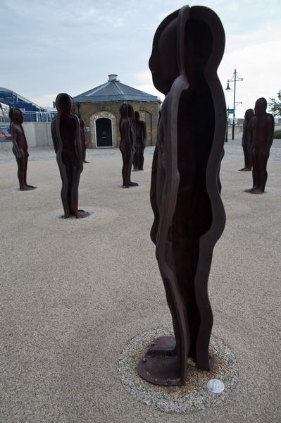
In the Woolwich Arsenal site I came across a group of aliens, ‘Assembly’ by Peter Burke (b1944) placed here in 2004. I stopped to photograph them before heading to Woolwich Arsenal station for a train.

More on My London Diary at Plumstead & Woolwich.


Flickr – Facebook – My London Diary – Hull Photos – Lea Valley – Paris
London’s Industrial Heritage – London Photos

All photographs on this page are copyright © Peter Marshall.
Contact me to buy prints or licence to reproduce.