Thamesmead & The Thames: More pictures from my October and November 1994 visits to Thamesmead.
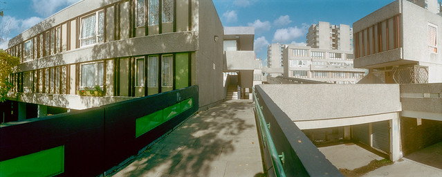
I hope the captions which I wrote at the time are accurate, but I found parts of Thamesmead rather confusing to walk around. There are both streets and raised walkways and various footpaths, and I don’t think the map was always too helpful.

However these shops were certainly at the Tavy Bridge Centre. Thamesmead is built on the flood plain and the whole area had been badly flooded before the new estate was developed. The planners decided to build with garages at street level and the living areas of the housing at first floor and above so as not to be vulnerable to floods.

Some of the areas liable to flooding have since been rebuilt with housing at ground level. I assume that the river walls are now thought to be an adequate defence, but would not myself buy a house there.

Sea levels are slowly rising as the earth gets hotter because of increasing levels of greenhouse gases from burning fossil fuels means that ice melts. The Thames Barrier still protects most of London, but will need to be replaced. Thamesmead is downstream of the barrier and so will need its own extra protection. At some point with high spring tides and an easterly gale this will be overtopped.

I walked on to the riverside promenade, Thameside Walk. Looking towards the west both the remains of the Beckton gas works and Canary Wharf were visible though there was considerable haze due to air pollution in London.

Across the Thames and a little to the east was the vast Ford complex at Dagenham, its logo visible on the water tower at left.

The river is stretches away east towards the estuary, turning around towards the south in the distance. At the left of the picture is the Essex bank. The river is a little over 2000 feet wide here.
The panoramic images here were taken on a Russian Horizon swing-lens camera, its 28mm lens giving a horizontal angle of view of around 127 degrees (often stated as 120.) The negatives, on standard 35mm film are 58x24mm, a similar width as a ‘6×6’ medium format camera though only 2/5 the height. It was possible to use the camera handheld, but for these pictures I used a sturdy Manfrotto tripod, usually working from a normal eye height of a little over 5 foot.
More to come from Thamesmead.
Flickr – Facebook – My London Diary – Hull Photos – Lea Valley – Paris
London’s Industrial Heritage – London Photos
All photographs on this page are copyright © Peter Marshall.
Contact me to buy prints or licence to reproduce.
